Showing 7 items matching "connectivity"
-
 Broadmeadows Historical Society & Museum
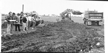
Photograph, Construction of Access Road, Banksia Gardens, c 1980s
... This item depicts the construction of the Access Road to Banksia Gardens, The photograph captures a significant moment in the development of the Banksia Gardens housing project, highlighting the infrastructure improvements aimed at enhancing accessibility and connectivity within the community. The construction of the access road was a crucial step in the urban planning process, facilitating easier movement for residents and contributing to the overall development and integration of the housing estate....The construction of the access road was a key component in the urban planning strategy, aimed at enhancing connectivity and facilitating the movement of residents. ...This item depicts the construction of the Access Road to Banksia Gardens, The photograph captures a significant moment in the development of the Banksia Gardens housing project, highlighting the infrastructure improvements aimed at enhancing accessibility and connectivity within the community. The construction of the access road was a crucial step in the urban planning process, facilitating easier movement for residents and contributing to the overall development and integration of the housing estate.This item, showing the construction of the Access Road to Banksia Gardens, holds significant historical value. It documents a pivotal moment in the development of the Banksia Gardens housing project, illustrating the efforts to improve infrastructure and accessibility within the community. The construction of the access road was a key component in the urban planning strategy, aimed at enhancing connectivity and facilitating the movement of residents. This development not only improved the practical aspects of daily life for the community but also symbolised progress and growth within the housing estate. The photograph serves as an important record of the planning and development processes that shaped the Banksia Gardens community.Poor quality black and white photograph on matte photographic paper.banksia gardens, broadmeadows, construction, access road, c 1980's -
 Ballarat Tramway Museum
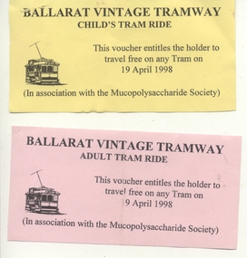
Ephemera - Ticket, Ballarat Tramway Museum (BTM), Mucopolysaccharide Society, Apr. 1998
... When carbohydrates build up in body tissues, this causes damage to the heart, bones, lungs, cornea, skin, connective tissue and the central nervous system (brain and spinal cord). ...When carbohydrates build up in body tissues, this causes damage to the heart, bones, lungs, cornea, skin, connective tissue and the central nervous system (brain and spinal cord). ...Yields information about the type of ticket provided to visitors, in this case the Mucopolysaccharide Society and that nature of its use.Set of two preprinted tickets for use on the BTM tramway, 19 April 1998 by the Mucopolysaccharide Society. .1 - printed on yellow paper. .2 - ditto printed on green Mucopolysaccharide diseases (MPS) are rare inherited disorders of the metabolism. They are caused by a problem with the enzymes that break down complex carbohydrates. When carbohydrates build up in body tissues, this causes damage to the heart, bones, lungs, cornea, skin, connective tissue and the central nervous system (brain and spinal cord). http://raisingchildren.net.au/articles/mucopolysaccharide_diseases_d.html - accessed 3/11/2012.trams, tramways, visitors, btm, tickets, special trams -
 Moorabbin Air Museum
Magazine - Airbus A380
... ...Connectivity...Airbus A380 Defining the A380 Fuselage & tail Wings Powering the A380 Cockpit Undercarriage Cabin creativity Connectivity Turnaround A380 maintenance / repair & overhaul Ground support Global presence A380 statistics Overview of the development of the Airbus A380 airliner Magazine format Airbus A380 Magazine Airbus A380 ...Overview of the development of the Airbus A380 airlinerMagazine formatnon-fictionOverview of the development of the Airbus A380 airliner defining the a380, fuselage & tail, wings, powering the a380, cockpit, undercarriage, cabin creativity, connectivity, turnaround, a380 maintenance / repair & overhaul, ground support, global presence, a380 statistics -
 Broadmeadows Historical Society & Museum
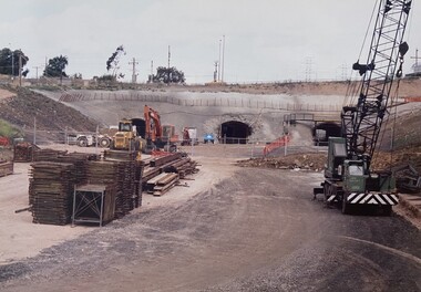
Photograph - Road - Ring Road, Construction of the Jacana Underpass, c. 1990s
... The Jacana Underpass Tunnel was constructed between 1992 and 1993 as part of Melbourne’s Western Ring Road project, a major infrastructure initiative aimed at improving traffic flow and connectivity across the city’s northern suburbs. ...The Jacana Underpass Tunnel was constructed between 1992 and 1993 as part of Melbourne’s Western Ring Road project, a major infrastructure initiative aimed at improving traffic flow and connectivity across the city’s northern suburbs. ...This photograph documents the construction of the Jacana Underpass Tunnel, a landmark infrastructure project undertaken to allow Melbourne’s Western Ring Road to pass beneath a complex transport corridor. The corridor included Pascoe Vale Road, Electric Street, and four active railway lines—two broad gauge, one standard gauge, and one commuter line—making traditional tunneling or bridging methods impractical. The tunnel was constructed using a pioneering hydraulic jacking technique, where precast concrete tunnel segments, each weighing approximately 1200 tonnes, were pushed into place through pilot tunnels. This method minimised disruption to the busy transport corridor above, which carried tens of thousands of vehicles and multiple rail services daily. The Jacana Underpass Tunnel was constructed between 1992 and 1993 as part of Melbourne’s Western Ring Road project, a major infrastructure initiative aimed at improving traffic flow and connectivity across the city’s northern suburbs. The underpass was designed to carry the freeway beneath a complex transport corridor that included Pascoe Vale Road, Electric Street, and four active railway lines—two broad gauge, one standard gauge, and one commuter line. Due to the shallow depth of cover—less than one metre in some areas—and the need to maintain uninterrupted road and rail services above, engineers employed an innovative hydraulic jacking technique. This involved pushing precast concrete tunnel segments, each weighing approximately 1200 tonnes, through pilot tunnels using hydraulic rams. The method was one of the largest of its kind in Australia at the time and allowed for the safe and efficient installation of the tunnel without open excavation. The photograph captures a key stage in the construction process, showing the dual tunnel portals, heavy machinery, and construction materials on site. It reflects the scale, complexity, and ingenuity of late 20th-century civil engineering in Victoria and provides valuable insight into the evolution of Melbourne’s transport infrastructure.This photograph documents a pivotal moment in the construction of the Jacana Underpass Tunnel, part of Melbourne’s Western Ring Road infrastructure project undertaken in the early 1990s. The image features two tunnel entrances under construction, surrounded by heavy machinery, construction materials, and temporary fencing, with a dirt access road leading into the site. The Jacana Underpass was constructed using a hydraulic jacking technique, a method that allowed large precast concrete tunnel segments—each weighing approximately 1200 tonnes—to be installed beneath a live transport corridor without disrupting traffic or rail services. This innovative approach was one of the largest of its kind in Australia and addressed significant engineering challenges, including shallow cover and complex geological conditions. The photograph is significant for its documentation of advanced civil engineering practices and the transformation of Melbourne’s northern suburbs through major infrastructure development. It provides insight into the construction techniques, site logistics, and material use typical of large-scale tunneling projects in the late 20th century. As part of an archival collection, this image contributes to the historical record of urban growth, transport planning, and engineering innovation in Victoria. It holds enduring value for researchers, historians, and infrastructure professionals studying the evolution of public works in the state.Colour photo. Construction Site. Jacana underpass tunnel.(Back - blue pen) 'Underpass/Jacana'underpass, jacana, construction, 1990's, jacana underpass tunnel, western ring road -
 Wycheproof & District Historical Society Inc.
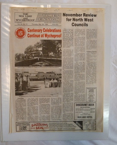
Events Book, Events of Interest, 2000
... This collection of local stories and facts of Wycheproof and District have a connectiveness and provide an opportunity to celebrate occasions, remember and learn of the past. ...These selections of printed articles and photos recaptures past local events, reflecting our culture and social life.This collection of local stories and facts of Wycheproof and District have a connectiveness and provide an opportunity to celebrate occasions, remember and learn of the past. Large white A3 book with 4 ring binder which allows plastic pockets to be added. Includes newspaper items, brochures and other printed matter on various local topics. Mrs Betty Denney's collection is followed by articles collected by other members of the Wycheproof Historical Society.Mrs Betty Denney's Collectionnewspaper- wycheproof, wycheproof - memories -
Broadmeadows Historical Society & Museum
Archive (collection) - Local Government, Mark Moore, City of Broadmeadows, 7 January 2025
... These items reflect the rich cultural heritage, diverse community, and crucial role in the development and connectivity of Melbourne's northern suburbs. City of Broadmeadows Photographs Annual Reports Flag A collection of various items associated with Broadmeadows City Council. ...To consolidate the collection of council items.The archive is brought together as a physical archive by the Curator (Broadmeadows Historical Society) to allow easier location of items.Contains Photographs; Annual Reports; Crockery; Glasses; Flags; Documentscity of broadmeadows, photographs, annual reports, flagcity of broadmeadows, photographs, annual reports, flag -
Broadmeadows Historical Society & Museum
Photograph - Aerial Photograph
... It provides insight into land use changes, transport connectivity (notably the Hume Highway and Craigieburn railway line), and the emergence of community hubs such as Craigieburn Central. ...Craigieburn is a rapidly growing suburb located approximately 25 km north of Melbourne’s CBD. Historically, it was a rural area with agricultural roots, but since the late 20th century, it has undergone significant urban development. The transformation accelerated in the 1990s and 2000s, with large-scale residential subdivisions, infrastructure projects, and commercial developments reshaping the landscape. Key historical milestones include: Early Settlement: Originally inhabited by the Wurundjeri people of the Kulin Nation. European Settlement: Began in the mid-1800s, primarily for farming and grazing. Urban Expansion: Post-1970s, Craigieburn saw increasing suburban development, especially after the extension of rail and road infrastructure. Recent Growth: From the 2000s onward, Craigieburn became one of Melbourne’s fastest-growing suburbs, with new estates, schools, and shopping centres.This large colour aerial photograph of Craigieburn holds significant value as a visual record of the suburb’s transformation from a semi-rural landscape to a dynamic urban centre in Melbourne’s northern growth corridor. Captured during a period of rapid development, the image documents the spatial evolution of Craigieburn, including residential expansion, infrastructure projects, and the integration of green spaces and commercial zones. The photograph is historically significant as it reflects the broader patterns of post-2000 suburban growth in Victoria, driven by population pressures, housing demand, and strategic planning initiatives. It provides insight into land use changes, transport connectivity (notably the Hume Highway and Craigieburn railway line), and the emergence of community hubs such as Craigieburn Central. From a cultural heritage perspective, the image contributes to understanding the lived environment of diverse communities who have settled in Craigieburn, including its role in accommodating Melbourne’s multicultural population. It also serves as a reference point for future urban planning, environmental monitoring, and historical comparison. The photograph is an important archival asset for researchers, planners, and local historians, offering a detailed snapshot of a pivotal moment in Craigieburn’s development trajectory.Colour aerial photograph of Craigieburnaerial photograph, craigieburn