
Showing 52 items matching "dandenong ranges - victoria"
-
 Victorian Railway History Library
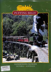
Book, Emerald Tourist Railway Board, Puffing Billy Dandenong Ranges Victoria Australia, 1998
... Puffing Billy Dandenong Ranges Victoria Australia...Puffing Billy Dandenong Ranges Victoria Australia Book Emerald Tourist Railway Board ...A brief illustrated history of the 2'6" Puffing Billy railway from Upper Fern Tree Gully to Gembrook in Victoriaill, maps, p.32.non-fictionA brief illustrated history of the 2'6" Puffing Billy railway from Upper Fern Tree Gully to Gembrook in Victoriavr narrow gauge railways - victoria - history, puffing billy - victoria - history -
 Mont De Lancey
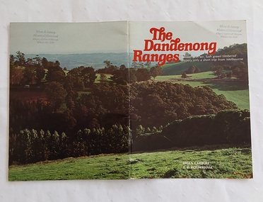
Book, Brian Carroll, The Dandenong Ranges, 1979
... Dandenong Ranges - Victoria...A book with a colourful double cover photograph of the Dandenong Ranges in Victoria. The title is printed in red lettering at the top of the front cover with 'Clean, fresh air, lush green timbered scenery only a short trip from Melbourne' printed in white underneath. ...Development saw the rise of village settlements like Mount Dandenong, Olinda, and Sassafras along the ridge. Dandenong Ranges - Victoria Dandenong Ranges - tourism and travel Dandenong Ranges - history This book offers an illustrated historical overview of the iconic Melbourne mountain range. ...This book offers an illustrated historical overview of the iconic Melbourne mountain range. It highlights the area's transition from indigenous hunting grounds to a popular tourist, residential, and forestry destination, featuring photographs by E.R. Rotherham.A book with a colourful double cover photograph of the Dandenong Ranges in Victoria. The title is printed in red lettering at the top of the front cover with 'Clean, fresh air, lush green timbered scenery only a short trip from Melbourne' printed in white underneath. The author and photographer are printed in white below. The book is filled with beautiful photographs of the many aspects of the Ranges and what can be seen and experienced there. Pp. 32non-fictionThis book offers an illustrated historical overview of the iconic Melbourne mountain range. It highlights the area's transition from indigenous hunting grounds to a popular tourist, residential, and forestry destination, featuring photographs by E.R. Rotherham. dandenong ranges - victoria, dandenong ranges - tourism and travel, dandenong ranges - history -
 City of Whittlesea
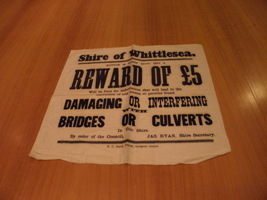
Poster - Banner, Shire of Whittlesea Notice
... Kangaroo Ground , Yarra-Dandenong Ranges , Victoria, Australia ...Banner, issued by the Shire of Whittlesea. Circa 1876 to 1938. White Cotton banner, black printShire/of/whittlesea/notice/is/hearby/given/that/a/reward/of/£5/will/be/paid/for/information/that/will/lead/to/the/conviction/of/any/person/or/persons/found/damaging/or/interfering/with/bridges/or/culverts/in/this/shire./By/order/of/the/council/Jas/Ryan/Shire/Secretary./shire of whittlesea, james ryan -
 Cockatoo History & Heritage Group
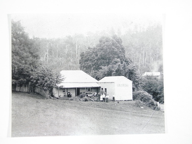
photograph, Desmond, home of O'Hara family
... Cockatoo, Dandenong Ranges, Victoria, 3781, Australia ..."Desmond", on the Cockatoo Creek, on land which now forms part of Alma Treloar Reserve, was the home of the O'Hara family ca. 1910. The poet John Bernard O'Hara, used to visit his mother there, and remembered many wonderful holidays with the "city folk" who travelled to Cockatoo on "Puffing Billy" and camped along the creek. The family in the foreground is most likely the O'Hara family.The photograph is significant because it shows a Cockatoo home of around 1910.Black and white photograph of "Desmond", home of the O'Hara family, with a family group in foreground. Situated on Cockatoo Creek, on land now known as Alma Treloar Reserve. Circa 1910.cockatoo homes, "desmond", o'hara family, cockatoo creek, john bernard o'hara. -
 Ithacan Historical Society
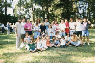
Photograph, Ithacan picnic, c2000s
... Ferny Creek, Dandenong Ranges, Victoria, Australia ...The Ithacan Philanthropic Society's annual picnic has been held at various locations over the years, including Mount Evelyn, Bacchus Marsh, and in latter years at the reserve at Ferny Creek at which this photo is taken. Running races have been a highlight of the picnics. Pictured on the left are Dennis Katsamas, Anthony Drakopoulos and Greg Varigos together with the place-getters displaying their medals. The annual Ithacan Picnic has always been an important and popular social event for members and friends of the Ithacan Society. The first picnic was held in 1918. A coloured photograph of a picnic scene. -
 Ithacan Historical Society
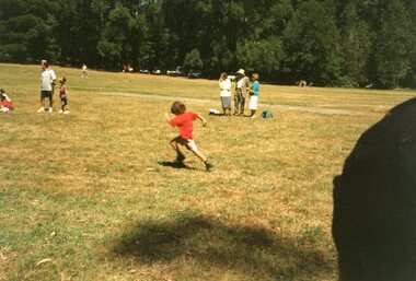
Photograph, Ithacan Picnic
... Ferny Creek, Dandenong Ranges, Victoria, Australia ...The photograph was taken at one of the picnics organized by the Ithacan Philanthropic Society. The picnics have been a popular annual event on the society's calendar for many years. Over the years the picnics were held at many different venues on the outskirts of Melbourne including Mt. Evelyn and Bacchus Marsh. Of recent years Ferny Creek has been the chosen venue. The annual family picnic organized by the Ithacan Philanthropic Society is an important event in the society's calendar and allows the members to relax with family and friends in the early months of each year. A coloured photograph of a little boy dressed in a red T-shirt and running in a race at a group picnic. -
 Emerald Museum & Nobelius Heritage Park
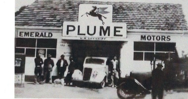
Photograph, Emerald Motors, Early 1950s?
... Main Street, Emerald, Yarra Valley and Dandenong Ranges, Victoria, 3782, Australia ...The site of H A ("Herbie") Sherriff's business, Emerald Motors, was a former blacksmith's shop on the corner of Main Road and Kilvington Road. The sign over the shop bears the word "PLUME": This was a "motor spirit" (fuel) produced by Standard Oils and sold in Australia 1916-1954.The signage and the two cars visible (one late model and one early) establish the time the photograph was taken. Black and white photograph of shopfront of H A Sherriff's Emerald Motors business. White car (Austin?) visible in workshop entrance, dark older car in profile on right. Sign over garage shows Mobil "Pegasus" logo and word "PLUME" . Five men and a dog standing around casually, a sixth man (Herbie Sherriff?) posing next to white car. emerald motors, herbie sherriff -
 Mont De Lancey
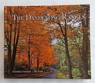
Book, Kornelia Freeman et al, The Dandenong Ranges, 2011
... Dandenong Ranges - Victoria...Dandenong Ranges approximately 40km from Melbourne. The title The Dandenong Ranges is printed in white lettering at the top with the two authors listed below. The spine has the title, authors and M symbol for Melbourne Publishers. The title page has the same information with Portraits of Victoria... Dandenong Ranges - History Tourism Victoria Tourists come from all over the world to enjoy the prized gardens of Victoria's Dandenong Ranges. ...Tourists come from all over the world to enjoy the prized gardens of Victoria's Dandenong Ranges. This beautifully produced book showcases the splendour of the public and private gardens of the Dandenongs as well as its unique villages and native animals and birds.A colourful covered book showing a road winding through the beautiful autumn trees in the Dandenong Ranges approximately 40km from Melbourne. The title The Dandenong Ranges is printed in white lettering at the top with the two authors listed below. The spine has the title, authors and M symbol for Melbourne Publishers. The title page has the same information with Portraits of Victoria added at the bottom right. There is a Contents, Introduction and then in alphabetical order, stunning photographs and detailed information about each place included. Mont De Lancey Historical Homestead is featured on p.144. At the back is an Acknowlegments list. Pp. 151.non-fictionTourists come from all over the world to enjoy the prized gardens of Victoria's Dandenong Ranges. This beautifully produced book showcases the splendour of the public and private gardens of the Dandenongs as well as its unique villages and native animals and birds.dandenong ranges - victoria, dandenong ranges - history, tourism victoria -
 Mont De Lancey
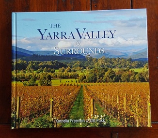
Book, Kornelia Freeman et al, The Yarra Valley & Surrounds, 2011
... Dandenong Ranges - Victoria...Their Dreamtime stories tell us that the river was etched into the landscape by the ancestral creator spirit Bunjil - the wedge-tailed eagle. Dandenong Ranges - Victoria Dandenong Ranges - History Tourism Victoria Just over an hour’s drive from central Melbourne, the Yarra Valley is Victoria’s premier cold-climate wine region. ...Just over an hour’s drive from central Melbourne, the Yarra Valley is Victoria’s premier cold-climate wine region. It offers a mix of world-class wineries, artisanal farm gates, and lush, mountainous hinterlands that stretch into the Dandenong Ranges and the foothills of the Victorian Alps. Outside of Melbourne, settlement in the Yarra Valley represented a very significant segment in the history and economic development of the state of Victoria. In the 1850s, the region was on the bustling route to the Warburton goldfields. The Yarra River was also the main traffic path for the timers industry during the 1890s, as such, it was developed as the primary food production region for Melbourne.A colourful covered book showing a scene of beautiful vineyards in autumn in the Yarra Valley and surrounds approximately 40km from Melbourne. The title is printed in blue and white lettering at the top with the two authors listed below. The spine has the title, authors and M symbol for Melbourne Publishers. The title page has the same information with Portraits of Victoria added at the bottom right. There is a Contents, Introduction and then in alphabetical order, stunning photographs and detailed information about each place. At the back is an Acknowlegments and Directory of places of interest. It provides a comprehensive guide to the region's top spots—such as Healesville Sanctuary, the giant Redwoods, and local wineries—through 173 pages of stunning photography and history.non-fictionJust over an hour’s drive from central Melbourne, the Yarra Valley is Victoria’s premier cold-climate wine region. It offers a mix of world-class wineries, artisanal farm gates, and lush, mountainous hinterlands that stretch into the Dandenong Ranges and the foothills of the Victorian Alps. Outside of Melbourne, settlement in the Yarra Valley represented a very significant segment in the history and economic development of the state of Victoria. In the 1850s, the region was on the bustling route to the Warburton goldfields. The Yarra River was also the main traffic path for the timers industry during the 1890s, as such, it was developed as the primary food production region for Melbourne.dandenong ranges - victoria, dandenong ranges - history, tourism victoria -
 Southern Sherbrooke Historical Society Inc.
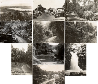
Postcard
... Set of ten small postcards showing scenes around the Dandenong Ranges, Victoria. See individual entries below....Set of ten small postcards showing scenes around the Dandenong Ranges, Victoria. See individual entries below. ...Set of ten small postcards showing scenes around the Dandenong Ranges, Victoria. See individual entries below. -
 Mont De Lancey
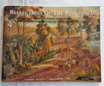
Book, Reflections of the Past (Vol. 2), 2001
... History of the Dandenong Ranges Victoria...Australian history History of the Dandenong Ranges Victoria History Victoria Following the success of Volume 1, this follow-up edition is slightly different to the first one by gathering photos together under some new headings More attention is given to some aspects of local history, the pioneer families and community organisations than previously. ...Following the success of Volume 1, this follow-up edition is slightly different to the first one by gathering photos together under some new headings More attention is given to some aspects of local history, the pioneer families and community organisations than previously. The historical society's main interest is the history of the Dandenong Ranges and the communities of Belgrave, Tecoma, Upper Ferntree Gully, Upwey and surrounds.A photographic history of Belgrave, Upwey, Tecoma and Upper Ferntree Gully. The front cover is of a painting 'Wintry Sunset Belgrave 1913' from a series of 36 paintings by Charlie Hammond between 1910 and 1953. It is of the country town, Belgrave, showing a dirt road with a bullock team, with trees surrounding the road. Inside, are black and white and coloured photographs of paintings, people in general life and historical information about the areas noted. Pp.104.non-fictionFollowing the success of Volume 1, this follow-up edition is slightly different to the first one by gathering photos together under some new headings More attention is given to some aspects of local history, the pioneer families and community organisations than previously. The historical society's main interest is the history of the Dandenong Ranges and the communities of Belgrave, Tecoma, Upper Ferntree Gully, Upwey and surrounds. australian history, history of the dandenong ranges victoria, history victoria -
 Mont De Lancey
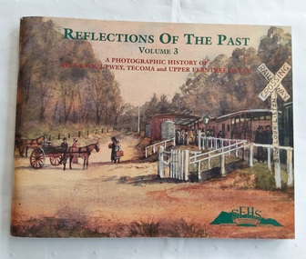
Book, Reflections of the Past (Vol. 3), 2005
... History of the Dandenong Ranges Victoria...Australian history History of the Dandenong Ranges Victoria History Victoria Following the success of Volumes 1 and 2, this third edition is slightly different to the first ones in that it has filled some of the gaps by gathering photos not previously covered. ...Following the success of Volumes 1 and 2, this third edition is slightly different to the first ones in that it has filled some of the gaps by gathering photos not previously covered. It has been expanded to having 128 pages with fewer historical errors. The historical society's main interest is the history of the Dandenong Ranges and the communities of Belgrave, Tecoma, Upper Ferntree Gully, Upwey and surrounds.A photographic history of Belgrave, Upwey, Tecoma and Upper Ferntree Gully. The front cover is of a painting of the Upwey Railway Station with Puffing Billy in 1912 by Charlie Hammond. The train is being met by the Tullidge sisters, Francis, Sarah and Emily. Inside, are black and white and coloured photographs of paintings, people in general life and historical information about the areas noted. Pp.128.non-fictionFollowing the success of Volumes 1 and 2, this third edition is slightly different to the first ones in that it has filled some of the gaps by gathering photos not previously covered. It has been expanded to having 128 pages with fewer historical errors. The historical society's main interest is the history of the Dandenong Ranges and the communities of Belgrave, Tecoma, Upper Ferntree Gully, Upwey and surrounds. australian history, history of the dandenong ranges victoria, history victoria -
 Mont De Lancey
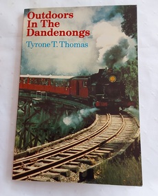
Book, Hill of Content Publishing Company Pty Ltd, Outdoors in the Dandenongs, 1981
... The Dandenong Ranges - Victoria...The book served as a practical guide for exploring the area, providing readers with insights into both the historical significance and the outdoor opportunities within the Dandenongs. The Dandenong Ranges - Victoria Dandenongs Tourism Victoria This book by Tyrone T. ...This book by Tyrone T. Thomas, published in 1981 by Hill of Content, is a 90-page guide covering the history and natural attractions of the Dandenong Ranges. It features 32 maps and explores the region's development, including timber felling, the Puffing Billy railway, and walking trails.This book has a colourful front and back full cover photograph of the tourist train, Puffing Billy. The title, Outdoors in the Dandenongs is printed in red with the author's name in blue underneath. The spine has the title, author and publisher printed in red. The title page has the title, author and publisher with a black outlined illustration of a lyrebird. On the back of the front end paper is a list of four more books by the same author. There is a Contents page, a List of Maps and Charts, an Introduction, Background Information, photographs of the area and more. 32 detailed maps are included with an Index to Places and features at the back. non-fictionThis book by Tyrone T. Thomas, published in 1981 by Hill of Content, is a 90-page guide covering the history and natural attractions of the Dandenong Ranges. It features 32 maps and explores the region's development, including timber felling, the Puffing Billy railway, and walking trails. the dandenong ranges - victoria, dandenongs, tourism victoria -
 Mont De Lancey
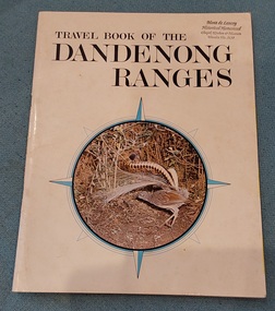
Book, Danpro Productions, Travel Book of the Dandenong Ranges, Unknown
... Dandenong Ranges - History...Dandenong Ranges - Victoria...The Director of Tourism Victoria at the time, M. J. Harkins states the Dandenong Ranges are an irreplaceable asset to Victoria. ...Victoria, a detailed map of the Ranges with a Legend, as well as listing Art Galleries, Restaurants and Nurseries at the time of publication. Full coloured photographs of suburbs and the area are throughout the book. The back cover states - The biggest spectacular in the business, with a photograph overlooking the area, taken from the Observatory at Mount Dandenong. ...Dandenong Ranges - History Dandenong Ranges - Victoria Dandenong Ranges - tourism and travel This is a vintage guidebook featuring a Superb Lyrebird on the cover. ...This is a vintage guidebook featuring a Superb Lyrebird on the cover. It contains coloured pictures with information of many of the local suburbs and area.A white covered book with a compass shaped circle with blue compass points around the edge; featured in the middle is a coloured photograph of a lyrebird. A Mont de Lancey stamp is at the top right of the cover. Inside is an Introduction by M.J. Harkins, Director of Tourism - Victoria, a detailed map of the Ranges with a Legend, as well as listing Art Galleries, Restaurants and Nurseries at the time of publication. Full coloured photographs of suburbs and the area are throughout the book. The back cover states - The biggest spectacular in the business, with a photograph overlooking the area, taken from the Observatory at Mount Dandenong. Pp.24non-fictionThis is a vintage guidebook featuring a Superb Lyrebird on the cover. It contains coloured pictures with information of many of the local suburbs and area.dandenong ranges - history, dandenong ranges - victoria, dandenong ranges - tourism and travel -
 City of Moorabbin Historical Society (Operating the Box Cottage Museum)
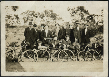
Photographs, 7 x B&W Circa 1918 Cheltenham Methodist Youth Group, Circa 1918 Photos of Cheltenham Methodist Youth Group, 1918
... Photo 4 shows 6 ladies and a man on holiday at Cockatoo in the Dandenong Ranges ,Victoria . Photos 5 to 7 show men, women and children in bushland surroundings of unrecorded locations....Photo 4 shows 6 ladies and a man on holiday at Cockatoo in the Dandenong Ranges ,Victoria . Photos 5 to 7 show men, women and children in bushland surroundings of unrecorded locations. ...Circa 1918: Various Photos of the Cheltenham Methodist Youth Group. Row 1 and 2: "At Flinders". Row 3: 1st Left, "Holidaying at Cockatoo". in 1852 Stephen Charman, who had arrived in Melbourne 1842 aged 21 years as one of Henry Dendy's emigrants, purchased 160 acres in Spring Grove ( now Cheltenham). Stephen and his family lived in a wattle and daub hut and worked hard to establish a market garden, poultry and pig farm. The first Methodist Church Services were held at their home. In 1855 Stephen gave 1 acre of his land on Balcombe Road to the Methodist Church for a School, Burial ground and a Chapel which was built in 1857.The Methodist Church, Balcombe Road was the 2nd religious building to be erected in Spring Grove now known as Cheltenham c 18577 small black and white photographs of the Cheltenham Methodist Youth Group at Flinders, Cockatoo and unkown locations, c 1918 . First 3 photos are of male cyclists on a trip to Flinders, Victoria. Photo 4 shows 6 ladies and a man on holiday at Cockatoo in the Dandenong Ranges ,Victoria . Photos 5 to 7 show men, women and children in bushland surroundings of unrecorded locations.Photo 1 - 3 on back : Flinders 1918 Photo 4 left on back : Holiday at Cockatoo right on back : Whitehead Photo 5-7 nilcheltenham, cheltenham methodist youth group, 1914, 1918, charman stephen, gettens mary, spring grove, methodist church, charman road, balcombe road, dendy henry, henry dendy's special survey 1841, youth groups, social groups, market gardners, early settlers, pioneers, dairy farmers, poultry farmers, pig farmers,moorabbin, brighton, -
 Bendigo Historical Society Inc.
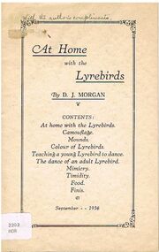
Book - ALEC H CHISHOLM COLLECTION: BOOK ''AT HOME WITH THE LYREBIRDS'' BY D.J.MORGAN
... ALEC H CHISHOLM COLLECTION. 12 page booklet on the habits, life etc of the lyrebird as witnessed by the author at Sherbrooke Forest, Dandenong Ranges, Victoria, between 1932 and 1935. List of contents on front cover. ...ALEC H CHISHOLM COLLECTION. 12 page booklet on the habits, life etc of the lyrebird as witnessed by the author at Sherbrooke Forest, Dandenong Ranges, Victoria, between 1932 and 1935. List of contents on front cover. ...Booklet. ALEC H CHISHOLM COLLECTION. 12 page booklet on the habits, life etc of the lyrebird as witnessed by the author at Sherbrooke Forest, Dandenong Ranges, Victoria, between 1932 and 1935. List of contents on front cover. Printed in 1936 by W. D. Vaughan, Kew, Victoria. Catalogue sticker ''2202 MOR'' on front cover. Handwritten in ink on front cover ''With the author's compliments''.D. J. Morganbooks, collections, ornithology, alec h chisholm collection, d.j.morgan, lyrebirds, sherbrooke forest, ornithology -
 Ballarat Heritage Services
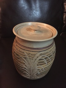
Ceramic - Domestic Ware, Lidded vessel by Wirilda, c1995
... Gembrook Pottery was based in Gembrook in the Dandenong Ranges of Victoria. The pottery, run by Ian and Robyn Burgher, was registered as a business from 1987 to 2007. ...Gembrook Pottery was based in Gembrook in the Dandenong Ranges of Victoria. The pottery, run by Ian and Robyn Burgher, was registered as a business from 1987 to 2007. ...Gembrook Pottery was based in Gembrook in the Dandenong Ranges of Victoria. The pottery, run by Ian and Robyn Burgher, was registered as a business from 1987 to 2007. Marks include Gembrook Pottery (impressed), Gembrook Pottery Wirilda (impressed) and Wirilda (painted). Lidded vessel with incised carvingceramics, australian studio pottery -
 Ballarat Heritage Services
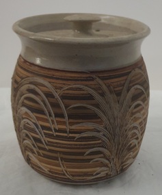
Ceramic - Domestic Ware, Lidded vessel by Wirilda, c1995
... Gembrook Pottery was based in Gembrook in the Dandenong Ranges of Victoria. The pottery, run by Ian and Robyn Burgher, was registered as a business from 1987 to 2007. ...Gembrook Pottery was based in Gembrook in the Dandenong Ranges of Victoria. The pottery, run by Ian and Robyn Burgher, was registered as a business from 1987 to 2007. ...Gembrook Pottery was based in Gembrook in the Dandenong Ranges of Victoria. The pottery, run by Ian and Robyn Burgher, was registered as a business from 1987 to 2007. Marks include Gembrook Pottery (impressed), Gembrook Pottery Wirilda (impressed) and Wirilda (painted). Lidded bowl with incised carving.ceramics, australian studio pottery, warilda, gembrook pottery -
 Young Christian Workers (YCW Australia) Archive and Research Centre
Bush Fire Working Party Registration Form (Blank), 1962
... In 1962, bushfires in the Dandenong Ranges (Melbourne, Victoria) took the lives of 32 people and saw the destruction of many homes. ...In 1962, bushfires in the Dandenong Ranges (Melbourne, Victoria) took the lives of 32 people and saw the destruction of many homes. ...In 1962, bushfires in the Dandenong Ranges (Melbourne, Victoria) took the lives of 32 people and saw the destruction of many homes. St Andrews was one of the places affected, and the Melbourne YCW (Boys) contributed to the re-building effort by providing skilled trades on a voluntary basis. In the days before online communication, this proforma was distributed to YCW members either by post or through the channel of the branch meeting to garner volunteers to the bushfire recovery effort. The document reveals the coordinating role of the diocesan team based at headquarters, and how the YCW (Boys) in Melbourne understood it's role as a service organisation. This document is part of a broader set of documents exploring this effort, including a subsequent report evaluating the effort and letters of thanks. Document printed on pink paperycw boys, ycw melbourne, bushfire recovery, st andrews bushfires, volunteering -
 Mont De Lancey
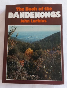
Book, John Larkins, The Book of the Dandenongs, 1978
... A brown hardcover book with a brown and colourful dust jacket featuring an autumn photograph of the countryside from the Dandenong Ranges in Victoria. The title is printed at the top of the front cover in orange and white lettering along with the author. ...History - Victoria History - The Dandenongs Tourism - Victoria The Book of the Dandenongs by John Larkins (1978) is a detailed, illustrated history and description of Victoria's Dandenong Ranges, exploring the area's transition from early timber-getting to a tourist destination. ...The Book of the Dandenongs by John Larkins (1978) is a detailed, illustrated history and description of Victoria's Dandenong Ranges, exploring the area's transition from early timber-getting to a tourist destination. It covers the region's unique culture, bushfires, and landmarks like Puffing Billy.A brown hardcover book with a brown and colourful dust jacket featuring an autumn photograph of the countryside from the Dandenong Ranges in Victoria. The title is printed at the top of the front cover in orange and white lettering along with the author. The front and back end papers have a photograph of a green illustration of Melbourne as seen from the Dandenongs. The front flap of the dust jacket gives an overview of the contents and the back one gives details of the author, John Larkin and his background. The title page notes the title, author and publisher information. Further titles written by this author are listed opposite the title page. Inside are Contents, Acknowledgements, Chapters on the history, photographs throughout and an Index at the back. P. 192.non-fictionThe Book of the Dandenongs by John Larkins (1978) is a detailed, illustrated history and description of Victoria's Dandenong Ranges, exploring the area's transition from early timber-getting to a tourist destination. It covers the region's unique culture, bushfires, and landmarks like Puffing Billy. history - victoria, history - the dandenongs, tourism - victoria -
 Marysville & District Historical Society
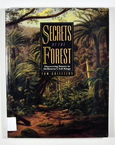
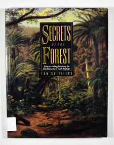
Book - Paperback book, Secrets of the Forest-Discovering history in Melbourne's Ash Range, 1992
... A history of Melbourne's Ash forests historic site victoria ash range history griffiths, tom Tom Griffiths with assistance from the Historic Places Branch,/ Department of Conservation and Environment, Victoria,/ and the Monash Public History Group Stamp of the Marysville & District Historical Society Inc / P.O. Box 22 / Marysville 3779 Paperback. Front cover has a painting on it. The painting is "Ferntree Gully in the Dandenong ...A history of Melbourne's Ash forestsPaperback. Front cover has a painting on it. The painting is "Ferntree Gully in the Dandenong Ranges, 1857", painted by Eugene von Guerard.Tom Griffiths with assistance from the Historic Places Branch,/ Department of Conservation and Environment, Victoria,/ and the Monash Public History Group Stamp of the Marysville & District Historical Society Inc / P.O. Box 22 / Marysville 3779historic site, victoria, ash range, history, griffiths, tom -
 Marysville & District Historical Society
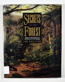
Book - Paperback book, Secrets of the Forest-Discovering history in Melbourne's Ash Range, 1992
... A history of Melbourne's Ash forests historic site victoria ash range history griffiths, tom Tom Griffiths with assistance from the Historic Places Branch,/ Department of Conservation and Environment, Victoria,/ and the Monash Public History Group Stamp of the Marysville & District Historical Society Inc / P.O. Box 22 / Marysville 3779 Paperback. Front cover has a painting on it. Painting is "Ferntree Gully in the Dandenong ...A history of Melbourne's Ash forestsPaperback. Front cover has a painting on it. Painting is "Ferntree Gully in the Dandenong Ranges, 1857", painted by Eugene von Guerard.Tom Griffiths with assistance from the Historic Places Branch,/ Department of Conservation and Environment, Victoria,/ and the Monash Public History Group Stamp of the Marysville & District Historical Society Inc / P.O. Box 22 / Marysville 3779historic site, victoria, ash range, history, griffiths, tom -
 Marysville & District Historical Society
Book, Secrets of the Forest-Discovering history in Melbourne's Ash Range, 1992
... A history of Melbourne's Ash forests historic site victoria ash range history griffiths, tom Stamp of the Marysville & District Historical Society Inc / P.O. Box 22 / Marysville 3779 Paperback. Front cover has a painting on it. Painting is "Ferntree Gully in the Dandenong ...A history of Melbourne's Ash forestsPaperback. Front cover has a painting on it. Painting is "Ferntree Gully in the Dandenong Ranges, 1857", painted by Eugene von Guerard.Stamp of the Marysville & District Historical Society Inc / P.O. Box 22 / Marysville 3779historic site, victoria, ash range, history, griffiths, tom -
 Marysville & District Historical Society
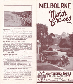
Ephemera (item) - Tourism brochure, Victorian Railways, MELBOURNE Motor Cruises, 12-1933
... Dandenong Ranges, Mount Donna Buang and Marysville. The brochure was produced by Victorian Railways Print in December 1933. A brochure outlining various sightseeing tours of Melbourne and the surrounding environments. marysville victoria australia melbourne motor cruises victorian government tourist bureau melbourne dandenong ranges warrandyte yarra river bayside highway frankston black spur narbethong mt donna buang ben cairn sorrento portsea the city motor service pty. ltd. victorian railways print A brochure outlining various sightseeing tours of Melbourne and the surrounding environments. ...A brochure outlining various sightseeing tours of Melbourne and the surrounding environments. The tours outlined include Melbourne's sights and suburbs, the Dandenong Ranges, Mount Donna Buang and Marysville. The brochure was produced by Victorian Railways Print in December 1933.A brochure outlining various sightseeing tours of Melbourne and the surrounding environments.marysville, victoria, australia, melbourne motor cruises, victorian government tourist bureau, melbourne, dandenong ranges, warrandyte, yarra river, bayside highway, frankston, black spur, narbethong, mt donna buang, ben cairn, sorrento, portsea, the city motor service pty. ltd., victorian railways print -
 Flagstaff Hill Maritime Museum and Village
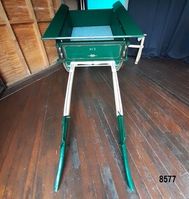
Vehicle - Tip Dray, Prior to 1930s
... range of "working class" occupations - road construction, railway construction, carting goods, rubbish collection etc. and would have been found in cities, country towns and on farms. Flagstaff Hill Maritime Museum and Village Warrnambool Shipwreck Coast tipping dray dray tip dray tip cart vehicles horse drawn vehicle Springvale Council Jack Bourke Muck Cart Scotch Cart Tumbrel Putt box body Oswald Bourke Sunbury Queen Victoria Market Melbourne No. 3 Front of dray - "No. 3" Side of dray - "A. & M. BOURKE / Contractors / LONGWARRY" Back of dray - "G.T. ANDREWS / QUEEN VICTORIA MARKET - Stand C23 / Phone DANDENONG ...A Dray is a type of dead axle wagon that was used to transport heavy loads or objects. They had a flat level floor and while some had no sides, others had box bodies and sides. Tip Drays (also known as Tip Carts, Muck Cart, Scotch Cart, Tumbrel or Putt in different parts of England) were smaller than other drays as their loads were heavy and usually only pulled by one horse. Their basic design included two wheels, a tipping body and shafts. The Tip Dray has a unique mechanism that allows the top to tip backwards to tip the load out of the back of the dray. The tipper was activated by a handle at the front allowing the driver to operate it while still having control over the horse. A Tip Dray was an indispensable piece of equipment in the days before tractors and mechanical trucks. They were used by farmers and carters to transport hay, rocks, bricks, gravel and rubbish etc. and because they were useful for dumping loads, they were favoured for use in road and railway construction. A photo in the collection of the Lorne Historical Society shows a tipping dray being used during the construction of the Great Ocean Road. They were part of the daily street traffic in towns and cities around Australia from the early days of settlement. In Australia in the early 1900's, carters began to join unions to protect their jobs and pay. N.S.W. had a "Trolley, Draymen and Carters Union", Queensland had a "Tip Dray Men's Association" and in W. A. the "Top Dray Driver's Union" had a "cessation of work" in 1911 when they were fighting for an increase in their day's wages. In 1910 a meeting of Tip Carters was held in Geelong at the Trades Hall to discuss the formation of a union (The Geelong Tip Dray Carters) which was a success and a schedule of rates for all carting, whether by contract or day labor, was fixed. By 1912 they had "labelled" more than 50 drays and had representatives on the "Trades Hall and Eight Hours Committee". By the mid 1930's and early 1940's, tip drays were being superseded by mechanical trucks and utes. However tip drays continued to be used in some circumstances. They were a practical solution to the problem of petrol rationing during W. W. 2. It was noted in a letter to the editor in the "Sunshine Advocate" in 1938 that a positive argument for continued use of Tip Drays for rubbish collection related to the idea that a horse drawn vehicle involved with lots of stops and starts at different houses (very like a milkman's delivery route) often involved the horse "driving itself" while the driver picked up the rubbish - something a motor truck was unable to do! Another article written in August 1935 and published in the Age in a parliamentary report into the rubber industry noted "tip drays had almost disappeared and in their place, metal was carted in 5 ton motor trucks" but the report went on to say that as a part of the Government relief work (during the Great Depression) the Government had "to some extent reintroduced the tip drays so that a greater number of men would be employed". This particular tip dray was owned by Mr. Oswald (Jack) Bourke. He used it to deliver dry goods from Sunbury to the Queen Victoria Market in Melbourne several times a week in the 1930's and then (between 1945 and 1962) Mr. Bourke used it on the garbage round in Springvale Victoria for the Springvale Council. The Council owned three drays and the "No. 3" painted on this dray is in recognition of its original number. After the death of Mr. Bourke in 1990, one of Mr. Bourke's sons (Andy) found the dray in a shed and restored it. The sign writing on the back and side panels were added during the restoration. This Tipping Dray is a significant example of a horse drawn vehicle that was used by workers from the early days of white settlement through to the 1940's and even into the early 1960's. It was used in a range of "working class" occupations - road construction, railway construction, carting goods, rubbish collection etc. and would have been found in cities, country towns and on farms.A wooden and metal tipping dray with a box body and four sides. It has two iron and wooden wheels (with 14 spokes), two wooden shafts and a metal tipping mechanism. The back panel folds down to allow loads to be dumped out. It is painted in green and cream with sign writing on one of the sides and on the front and back panels. It features decorative painted lines and designs in burgundy, cream and light blue on most of the wooden parts. The tipping mechanism is on the front of the dray's left side and consists of a metal pin secured with a metal ring, and a lever.Front of dray - "No. 3" Side of dray - "A. & M. BOURKE / Contractors / LONGWARRY" Back of dray - "G.T. ANDREWS / QUEEN VICTORIA MARKET - Stand C23 / Phone DANDENONG 225"flagstaff hill maritime museum and village, warrnambool, shipwreck coast, tipping dray, dray, tip dray, tip cart, vehicles, horse drawn vehicle, springvale council, jack bourke, muck cart, scotch cart, tumbrel, putt, box body, oswald bourke, sunbury, queen victoria market, melbourne, no. 3 -
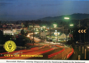 Ringwood and District Historical Society
Postcards, Colorscans (Publishing) Pty Ltd, Various postcards of Ringwood in the 1970s, c. 1968
... Postcards - pack of 6: 'Ringwood Victoria - tear off postcard folder - 6 views' (two identical folders); 1. Maroondah Highway, entering Ringwood with the Dandenong Ranges in the background (3303_001.jpg); 2. ...Postcards - pack of 6: 'Ringwood Victoria - tear off postcard folder - 6 views' (two identical folders); 1. Maroondah Highway, entering Ringwood with the Dandenong Ranges in the background (3303_001.jpg); 2. ...Postcards - pack of 6: 'Ringwood Victoria - tear off postcard folder - 6 views' (two identical folders); 1. Maroondah Highway, entering Ringwood with the Dandenong Ranges in the background (3303_001.jpg); 2. Aerial View of the City of Ringwood (3303_002.jpg); 3. Eastland Regional Shopping Centre at dusk (3303_003.jpg); 4. The Ringwood Memorial Clock Tower (3303_004.jpg); 5. The Civic Centre (3303_005.jpg); 6. The Ringwood Lake (3303_006.jpg) -
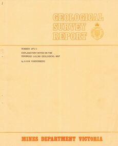 Ringwood and District Historical Society
Booklet - Geological Survey Report, Explanatory Notes on Ringwood, Victoria by A.H.M. Vandenberg, 1971
... Geological description of the eastern and southeastern suburbs of Melbourne, Dandenong Ranges, Harkaway Hills and the Silvan and Macclesfield districts. Explanatory Notes on Ringwood, Victoria by A.H.M. ...Geological description of the eastern and southeastern suburbs of Melbourne, Dandenong Ranges, Harkaway Hills and the Silvan and Macclesfield districts. -
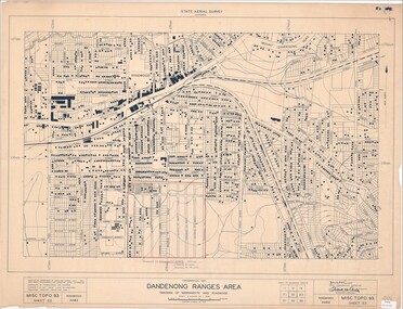 Ringwood and District Historical Society
Map - State Aerial Survey, Dandenong Ranges Area, Parishes of Warrandyte and Ringwood - 1956
... Ballyduffy Estate streets include City Road, West Prussia Road, Duffy Street, Ireland Street, Evans Street, Victoria Street, Regina Street, Short Road, Prussia Road, Duffy Street East, Ireland Street East, Evans Street East, Chapman Street. Dandenong Ranges ...Map of central and southern areas of Ringwood and part of Ringwood East and Heathmont compiled by Dept of Lands and Survey, July 1956, from aerial photographs and Cadastral Survey information. Subsequent hand-drawn addition of streets showing layout of "Township of Ballyduffy Estate 1858-60", an earlier proposed subdivision that did not eventuate. (See attached 5009b Ballyshanassy_ Melbourne’s lost suburb.pdf for Ballyduffy historical naming relevance). Ballyduffy Estate streets include City Road, West Prussia Road, Duffy Street, Ireland Street, Evans Street, Victoria Street, Regina Street, Short Road, Prussia Road, Duffy Street East, Ireland Street East, Evans Street East, Chapman Street. Misc Topo 93 Sheet 22, Ringwood A4B2. Scale: 4 chains to 1 inch. Contour interval 20 feet. -
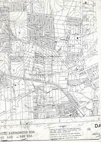 Ringwood and District Historical Society
Map, Heathmont/Bayswater Area Survey Map - 1956
... Cutaway section of black & white Dandenong Ranges Area survey map with countour lines centred over Bedford Road and Canterbury Road, Heathmont, and Bayswater Road and Wantirna-Sassafras Road (Mountrain Highway) Bayswater, Victoria. ...Cutaway section of black & white Dandenong Ranges Area survey map with countour lines centred over Bedford Road and Canterbury Road, Heathmont, and Bayswater Road and Wantirna-Sassafras Road (Mountrain Highway) Bayswater, Victoria. ...Cutaway section of black & white Dandenong Ranges Area survey map with countour lines centred over Bedford Road and Canterbury Road, Heathmont, and Bayswater Road and Wantirna-Sassafras Road (Mountrain Highway) Bayswater, Victoria. Chivers property marked on Armstrong Road, Heathmont.Caption: "Compiled by Department of Lands and Survey July 1956, from aerial photographs and cadastral survey informaton. Controlled by triangulation and traverse. Elevations in feet. Datum. L.W.M. Williamstown. Transverse , Mercator Projection. Zone 7." -
 Eltham District Historical Society Inc
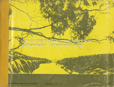
Book, Land Conservation Council, Report on the Melbourne Study Area, December 1973
... Range, Cerberean, Upper Goulburn, Kinglake, Donna Buang, Upper Yarra, Thomson, Dandenongs, Bunyip-Latrobe, Shady Creek, Tyers, Westernport and Strzelecki. The Land Conservation Act 1970 established the Land Conservation Council whose functions is to "carry out investigations and make recommendations to the Minister with respect to the use of public land in order to provide for the balanced use of land in Victoria. ...This report is one of a series describings the physical nature of the land and its environment, examines the likely forms of land use, and assesses the hazards associated with these uses. It is divided into four main sections: Introduction, Characteristics of environment, main forms of land use and description of 24 specific blocks in the study area which include Torquay, Brisbane Ranges, Werribee, Wombat, Loddon, Romsey, Puckapunyal, Strathbogie, Eildon, Disappointment, Break O'Day, Black Range, Cerberean, Upper Goulburn, Kinglake, Donna Buang, Upper Yarra, Thomson, Dandenongs, Bunyip-Latrobe, Shady Creek, Tyers, Westernport and Strzelecki. The Land Conservation Act 1970 established the Land Conservation Council whose functions is to "carry out investigations and make recommendations to the Minister with respect to the use of public land in order to provide for the balanced use of land in Victoria. This report sets out to describe and assess the natural resources of the public lands in the Melbourne area and provides a factual basis on which members of the community may base submissions to the [Land Conservation] Council of Victoria.444 pagesnon-fictionThis report is one of a series describings the physical nature of the land and its environment, examines the likely forms of land use, and assesses the hazards associated with these uses. It is divided into four main sections: Introduction, Characteristics of environment, main forms of land use and description of 24 specific blocks in the study area which include Torquay, Brisbane Ranges, Werribee, Wombat, Loddon, Romsey, Puckapunyal, Strathbogie, Eildon, Disappointment, Break O'Day, Black Range, Cerberean, Upper Goulburn, Kinglake, Donna Buang, Upper Yarra, Thomson, Dandenongs, Bunyip-Latrobe, Shady Creek, Tyers, Westernport and Strzelecki. The Land Conservation Act 1970 established the Land Conservation Council whose functions is to "carry out investigations and make recommendations to the Minister with respect to the use of public land in order to provide for the balanced use of land in Victoria. This report sets out to describe and assess the natural resources of the public lands in the Melbourne area and provides a factual basis on which members of the community may base submissions to the [Land Conservation] Council of Victoria.land use, kinglake, thomson valley, conservation, public lands
