Showing 490 items matching "department of land "
-
 Tatura Irrigation & Wartime Camps Museum
Map, Department of Land and Survey, County of Rodney
... Department of Land and Survey...County of Rodney Map Department of Land and Survey ...Early county maps.One original map of County of Rodney and 3 photo copies. Original and one copy in colour. 2 copies in black and white. county of rodney -
 Wodonga & District Historical Society Inc
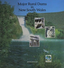
Book - Major Rural Dams In New South Wales, Department of Land and Water Conservation, NSW, 1996
... Department of Land and Water Conservation, NSW...Major Rural Dams In New South Wales Book Major Rural Dams In New South Wales Department of Land and Water Conservation, NSW ...A pictorial examination of key dams established throughout New South Wales as part of approaches to water management in the state.non-fictionA pictorial examination of key dams established throughout New South Wales as part of approaches to water management in the state.dams new south wales, water management, water conservation -
 Wodonga & District Historical Society Inc
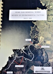
Booklet - Hume Dam Remedial Works - Review of Environmental Factors July 1995, Department of Land and Water Conservation, NSW Government, July 1995
... Department of Land and Water Conservation, NSW Government...Hume Dam Remedial Works - Review of Environmental Factors July 1995 Booklet Hume Dam Remedial Works - Review of Environmental Factors July 1995 Department of Land and Water Conservation, NSW Government ...The findings of a review into the environmental impact of remedial works being carried out on the Hume Dam.non-fictionThe findings of a review into the environmental impact of remedial works being carried out on the Hume Dam.hume dam, remedial works dams, environmental impact of dams -
 Wodonga & District Historical Society Inc
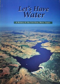
Book - Let's Have Water - A history of the Fish River Water Supply, Robin McLachlan, Denis Barrett, Jack Domis, Nick Welling, 1997
... ...Department of Land and Water Conservation, NSW...Let's Have Water - A history of the Fish River Water Supply Book Let's Have Water - A history of the Fish River Water Supply Robin McLachlan, Denis Barrett, Jack Domis, Nick Welling Department of Land and Water Conservation, NSW ...A history of the development of the management of the Fish River Water Supply Scheme in Central NSW. The scheme extends across the local government areas of the Shire of Oberon, the City of Lithgow and the City of the Blue Mountains.non-fictionA history of the development of the management of the Fish River Water Supply Scheme in Central NSW. The scheme extends across the local government areas of the Shire of Oberon, the City of Lithgow and the City of the Blue Mountains.water nsw, fish river region nsw, oberon dam, water resources development nsw australia -
 Orbost & District Historical Society
document, PULP MILL RELATED ARTICLES from "Snowy River Mail" Feb 1990 -Jan 1991, 1990 / 1991
... This folder of articles was compiled by the Department of Land & Water Conservation / Forestry....Department of Conservation and Land Management...Orbost & District Historical Society Ruskin Street Orbost gippsland This folder of articles was compiled by the Department of Land & Water Conservation / Forestry. ...This folder of articles was compiled by the Department of Land & Water Conservation / Forestry.This item is a useful reference tool on the pulp /paper mill proposed for East Gippsland.A small 8 pp folder of photocopied articles from the Snowy River Mail. They relate to the pulp/paper mill proposal in East Gippsland. pulp-mill-orbost -
 Orbost & District Historical Society
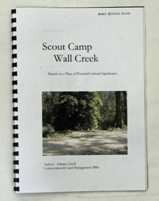
book, Scout Camp Wall Creek, 2006
... This report was written by Dianne Lavell for the Department of Conservation and Land Management. Dianne Lavell worked for the Department of Conservation and Land Management in Orbost. ...Department of Conservation and Land Management...Orbost & District Historical Society Ruskin Street Orbost gippsland This report was written by Dianne Lavell for the Department of Conservation and Land Management. Dianne Lavell worked for the Department of Conservation and Land Management in Orbost. ...This report was written by Dianne Lavell for the Department of Conservation and Land Management. Dianne Lavell worked for the Department of Conservation and Land Management in Orbost. She was a long time resident of Orbost. A spiral bound, plastic covered book titled Scout Camp Wall Creek. It is a report on Scout Camp at Wall Creek in Orbost. It contains description and history of the site deemed to be a place of potential cultural significance. on the front cover is a coloured photo of the site.scout-camp-wall-creek -
 Orbost & District Historical Society
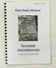
book, Close Family Allotment, 2006
... This report was compiled by Martin Healey for the Department of Conservation and Land Management, Victoria. ...Department of Conservation and Land Management...Close Family Allotment book Department of Conservation and Land Management ...This report was compiled by Martin Healey for the Department of Conservation and Land Management, Victoria. Martin Healey, a long time Orbost resident, worked for the Department of Conservation and Land Management in Orbost.This is a useful research tool.A small spiral bound book of 30 pp with a plastic cover. It is a report written by Martin Healey and details the close Family allotments at Murrangower, east of Orbost. -
 Greensborough Historical Society
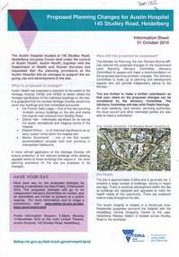
Document, Victoria. Department of Environment Land Water and Planning, Proposed planning changes for Austin Hospital, 28/10/2016
... Victoria. Department of Environment Land Water and Planning...Greensborough Historical Society 34A Glenauburn Road Lower Plenty Lower Plenty melbourne Information on proposed changes to heritage overlays on the Austin Hospital site on Studley Road Heidelberg austin hospital 4p. coloured information sheet, with one page covering letter from the Government Land Standing Advisory Committee Proposed planning changes for Austin Hospital Document Victoria. Department ...Information on proposed changes to heritage overlays on the Austin Hospital site on Studley Road Heidelberg4p. coloured information sheet, with one page covering letter from the Government Land Standing Advisory Committeeaustin hospital -
 The Beechworth Burke Museum
Photograph
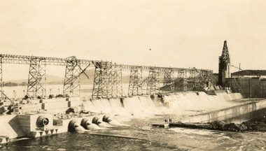
... ...Department of Land & Water Conservation...Archaeological surveys were completed by Austral Archaeology, which was done when the Department of Land & Water Conservation was doing work to improve Hume Dam. ...Archaeological surveys were completed by Austral Archaeology, which was done when the Department of Land & Water Conservation was doing work to improve Hume Dam. ...Taken on 25 October 1930, various houses with the Hume Dam under construction are depicted in the background. The construction of the Hume Dam took place from 1919 to 1936. At the time of construction, it was the second largest dam in the world. It was also one of the earliest civil projects developed after the Federation. Some of the Dam workers consisted of World War I veterans. Dam workers often settled their families in Mitta Junction Village and Wodonga. Archaeological surveys were completed by Austral Archaeology, which was done when the Department of Land & Water Conservation was doing work to improve Hume Dam. The archaeological report that came out of the survey recommended three sites of interest where archaeological excavation should be done: Camp Ganger’s Quarters, Stableman’s Quarters, and the Industrial Dump. The excavation uncovered artefacts. Mitta Mitta: Mitta Mitta is situated between Mount Welcome and Mount Misery. It is named after the river that explorers Hume and Hovell discovered in 1824. The town would eventually become a huge gold mining town. Mitta Mitta is called Midamodunga by the local Indigenous peoples Wodonga: Wodonga is situated on the Murray River and is part of North East Victoria. Hume and Hovell: Hamilton Hume (1979-1873) and William Hilton Hovell (1786-1875). W. H. Hovell was born in Norfolk England and Hume was born in Parramatta, New South Wales Hovell and Hume undertook an exploration journey in 1824 and thought they discovered a river, which turned out to be the Murray River. They returned home in 1825, but returned to the area in 1826 and discovered coal in the area. This photo is historically significant as it shows the Hume Dam under construction in 1930. The Dam was named after Hamilton Hume, who is an important historical figure for this area as he helped discover the area where resources were found.Sepia rectangular photograph printed unmountedReverse: 84-19-5 / 1997.3185/ Values & spillway. / When completed the wall / will be as high as the / scaffolding. [featuring trademark: kodak print]construction, houses, veterans, mitta junction village, hume dam, world war i, federation, wodonga, archaeological survey, excavation, austral archaeology, department of land & water conservation, camp ganger's quarter's, stableman's quarters, industrial dump, artefacts, mitta mitta, mount welcome, mount misery, murray river, hamilton hume, william hilton hovell, hume and hovell expedition -
 The Beechworth Burke Museum
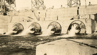
Photograph, c1930
... ...Department of Land & Water Conservation...Archaeological surveys were completed by Austral Archaeology, which was done when the Department of Land & Water Conservation was doing work to improve Hume Dam. ...Archaeological surveys were completed by Austral Archaeology, which was done when the Department of Land & Water Conservation was doing work to improve Hume Dam. ...Taken on 25 October 1930, various houses with the Hume Dam under construction are depicted in the background. The construction of the Hume Dam took place from 1919 to 1936. At the time of construction, it was the second largest dam in the world. It was also one of the earliest civil projects developed after the Federation. Some of the Dam workers consisted of World War I veterans. Dam workers often settled their families in Mitta Junction Village and Wodonga. Archaeological surveys were completed by Austral Archaeology, which was done when the Department of Land & Water Conservation was doing work to improve Hume Dam. The archaeological report that came out of the survey recommended three sites of interest where archaeological excavation should be done: Camp Ganger’s Quarters, Stableman’s Quarters, and the Industrial Dump. The excavation uncovered artefacts. Mitta Mitta: Mitta Mitta is situated between Mount Welcome and Mount Misery. It is named after the river that explorers Hume and Hovell discovered in 1824. The town would eventually become a huge gold mining town. Mitta Mitta is called Midamodunga by the local Indigenous peoples Wodonga: Wodonga is situated on the Murray River and is part of North East Victoria. Hume and Hovell: Hamilton Hume (1979-1873) and William Hilton Hovell (1786-1875). W. H. Hovell was born in Norfolk England and Hume was born in Parramatta, New South Wales Hovell and Hume undertook an exploration journey in 1824 and thought they discovered a river, which turned out to be the Murray River. They returned home in 1825, but returned to the area in 1826 and discovered coal in the area.This photo is historically significant as it shows the Hume Dam under construction in 1930. The Dam was named after Hamilton Hume, who is an important historical figure for this area as he helped discover the area where resources were found.Sepia rectangular photograph printed unmountedReverse: 84-19-2/ 1997.3188/ These are the four / release valves they are / not always open (illegible) this / when closed the water flows / over the spillway. [featuring trademark: kodak print] photograph number: 354construction, houses, veterans, mitta junction village, hume dam, world war i, federation, wodonga, archaeological survey, excavation, austral archaeology, department of land & water conservation, camp ganger's quarter's, stableman's quarters, industrial dump, artefacts, mitta mitta, mount welcome, mount misery, murray river, hamilton hume, william hilton hovell, hume and hovell expedition -
 The Beechworth Burke Museum
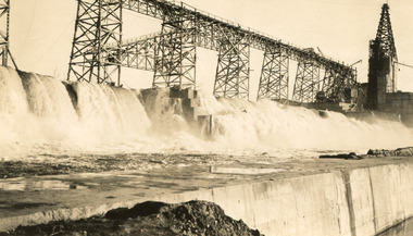
Photograph, 25 October 1930
... ...Department of Land & Water Conservation...Archaeological surveys were completed by Austral Archaeology, which was done when the Department of Land & Water Conservation was doing work to improve Hume Dam. ...Archaeological surveys were completed by Austral Archaeology, which was done when the Department of Land & Water Conservation was doing work to improve Hume Dam. ...Taken on 25 October 1930, various houses with the Hume Dam under construction are depicted in the background. The construction of the Hume Dam took place from 1919 to 1936. At the time of construction, it was the second largest dam in the world. It was also one of the earliest civil projects developed after the Federation. Some of the Dam workers consisted of World War I veterans. Dam workers often settled their families in Mitta Junction Village and Wodonga. Archaeological surveys were completed by Austral Archaeology, which was done when the Department of Land & Water Conservation was doing work to improve Hume Dam. The archaeological report that came out of the survey recommended three sites of interest where archaeological excavation should be done: Camp Ganger’s Quarters, Stableman’s Quarters, and the Industrial Dump. The excavation uncovered artefacts. Mitta Mitta: Mitta Mitta is situated between Mount Welcome and Mount Misery. It is named after the river that explorers Hume and Hovell discovered in 1824. The town would eventually become a huge gold mining town. Mitta Mitta is called Midamodunga by the local Indigenous peoples Wodonga: Wodonga is situated on the Murray River and is part of North East Victoria. Hume and Hovell: Hamilton Hume (1979-1873) and William Hilton Hovell (1786-1875). W. H. Hovell was born in Norfolk England and Hume was born in Parramatta, New South Wales Hovell and Hume undertook an exploration journey in 1824 and thought they discovered a river, which turned out to be the Murray River. They returned home in 1825, but returned to the area in 1826 and discovered coal in the area.This photo is historically significant as it shows the Hume Dam under construction in 1930. The Dam was named after Hamilton Hume, who is an important historical figure for this area as he helped discover the area where resources were found.Sepia rectangular photograph printed unmountedReverse: 84-19-6/ 1997.3187/ The spillway [featuring trademark: kodak print] construction, houses, veterans, mitta junction village, hume dam, world war i, federation, wodonga, archaeological survey, excavation, austral archaeology, department of land & water conservation, camp ganger's quarter's, stableman's quarters, industrial dump, artefacts, mitta mitta, mount welcome, mount misery, murray river, hamilton hume, william hilton hovell, hume and hovell expedition -
 The Beechworth Burke Museum
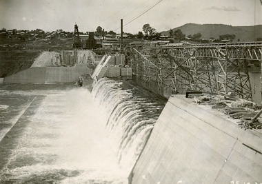
Photograph, 25 October 1930
... ...Department of Land & Water Conservation...Archaeological surveys were completed by Austral Archaeology, which was done when the Department of Land & Water Conservation was doing work to improve Hume Dam. ...Archaeological surveys were completed by Austral Archaeology, which was done when the Department of Land & Water Conservation was doing work to improve Hume Dam. ...Taken on 25 October 1930, various houses with the Hume Dam under construction are depicted in the background. The construction of the Hume Dam took place from 1919 to 1936. At the time of construction, it was the second largest dam in the world. It was also one of the earliest civil projects developed after the Federation. Some of the Dam workers consisted of World War I veterans. Dam workers often settled their families in Mitta Junction Village and Wodonga. Archaeological surveys were completed by Austral Archaeology, which was done when the Department of Land & Water Conservation was doing work to improve Hume Dam. The archaeological report that came out of the survey recommended three sites of interest where archaeological excavation should be done: Camp Ganger’s Quarters, Stableman’s Quarters, and the Industrial Dump. The excavation uncovered artefacts. Mitta Mitta: Mitta Mitta is situated between Mount Welcome and Mount Misery. It is named after the river that explorers Hume and Hovell discovered in 1824. The town would eventually become a huge gold mining town. Mitta Mitta is called Midamodunga by the local Indigenous peoples Wodonga: Wodonga is situated on the Murray River and is part of North East Victoria. Hume and Hovell: Hamilton Hume (1979-1873) and William Hilton Hovell (1786-1875). W. H. Hovell was born in Norfolk England and Hume was born in Parramatta, New South Wales Hovell and Hume undertook an exploration journey in 1824 and thought they discovered a river, which turned out to be the Murray River. They returned home in 1825, but returned to the area in 1826 and discovered coal in the area.This photo is historically significant as it shows the Hume Dam under construction in 1930. The Dam was named after Hamilton Hume, who is an important historical figure for this area as he helped discover the area where resources were found.Black and white rectangular photograph printer unmountedReverse: 84-20-1/ 1997.3147construction, houses, veterans, mitta junction village, hume dam, world war i, federation, wodonga, archaeological survey, excavation, austral archaeology, department of land & water conservation, camp ganger's quarter's, stableman's quarters, industrial dump, artefacts, mitta mitta, mount welcome, mount misery, murray river, hamilton hume, william hilton hovell, hume and hovell expedition -
 The Beechworth Burke Museum
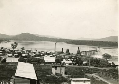
Photograph, 25 October 1930
... ...Department of Land & Water Conservation...Archaeological surveys were completed by Austral Archaeology, which was done when the Department of Land & Water Conservation was doing work to improve Hume Dam. ...Archaeological surveys were completed by Austral Archaeology, which was done when the Department of Land & Water Conservation was doing work to improve Hume Dam. ...Taken on 25 October 1930, various houses with the Hume Dam under construction are depicted in the background. The construction of the Hume Dam took place from 1919 to 1936. At the time of construction, it was the second largest dam in the world. It was also one of the earliest civil projects developed after the Federation. Some of the Dam workers consisted of World War I veterans. Dam workers often settled their families in Mitta Junction Village and Wodonga. Archaeological surveys were completed by Austral Archaeology, which was done when the Department of Land & Water Conservation was doing work to improve Hume Dam. The archaeological report that came out of the survey recommended three sites of interest where archaeological excavation should be done: Camp Ganger’s Quarters, Stableman’s Quarters, and the Industrial Dump. The excavation uncovered artefacts. Mitta Mitta: Mitta Mitta is situated between Mount Welcome and Mount Misery. It is named after the river that explorers Hume and Hovell discovered in 1824. The town would eventually become a huge gold mining town. Mitta Mitta is called Midamodunga by the local Indigenous peoples Wodonga: Wodonga is situated on the Murray River and is part of North East Victoria. Hume and Hovell: Hamilton Hume (1979-1873) and William Hilton Hovell (1786-1875). W. H. Hovell was born in Norfolk England and Hume was born in Parramatta, New South Wales Hovell and Hume undertook an exploration journey in 1824 and thought they discovered a river, which turned out to be the Murray River. They returned home in 1825, but returned to the area in 1826 and discovered coal in the area. This photo is historically significant as it shows the Hume Dam under construction in 1930. The Dam was named after Hamilton Hume, who is an important historical figure for this area as he helped discover the area where resources were found. Black and white rectangular photograph printer unmountedReverse: 1997.3145/ 84-20-2construction, houses, veterans, mitta junction village, hume dam, world war i, federation, wodonga, archaeological survey, excavation, austral archaeology, department of land & water conservation, camp ganger's quarter's, stableman's quarters, industrial dump, artefacts, mitta mitta, mount welcome, mount misery, murray river, hamilton hume, william hilton hovell, hume and hovell expedition -
 Federation University Historical Collection
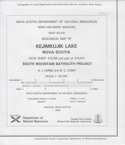
Map - Geological, Nova Scotia Department of Natural Resources, Kejimkujik Lake, Nova Scotia: Geological Map 94-05, 1994
... Nova Scotia Department of Natural Resources...Land...Kejimkujik Lake, Nova Scotia: Geological Map 94-05 Map - Geological Nova Scotia Department of Natural Resources Land Registration and Information Services ...Produced b Nova Scotia Department of Natural Resources, Mines and Energy Branches. The Minister of the Department was the Honourable Donald R Downe and the Deputy Minister was Darrell D HiltzLarge coloured map depicting different areas and deposits. Includes a legend, symbols used, mineral abbreviations and alteration abbreviations.Symbolsnova scotia, kejimkujik lake, geological survey, cartography, mine and energy branches, donald r downe, minister, darrell d hiltz, deputy mnister, south mountain batholith project, legend, symbols -
 Federation University Historical Collection
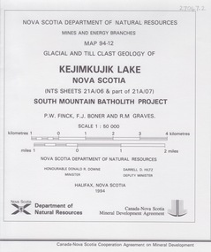
Map - Geological, Kejimkujik Lake, Nova Scotia: Glacial and Till Clast Geology: Map 94-12, 1994
... Nova Scotia Department of Natural Resources...Land...Kejimkujik Lake, Nova Scotia: Glacial and Till Clast Geology: Map 94-12 Map - Geological Nova Scotia Department of Natural Resources Land Registration and Information Services ...Produced b Nova Scotia Department of Natural Resources, Mines and Energy Branches. The Minister of the Department was the Honourable Donald R Downe and the Deputy Minister was Darrell D HiltzLarge coloured map depicting different areas and deposits. Includes a legend, symbols used, mineral abbreviations and alteration abbreviations.Symbols -
 Federation University Historical Collection
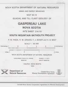
Map - Geological, Gaspereau Lake, Nova Scotia: Glacial and Till Clast Geology: Map 94-14, 1994
... Nova Scotia Department of Natural Resources...Land...Gaspereau Lake, Nova Scotia: Glacial and Till Clast Geology: Map 94-14 Map - Geological Nova Scotia Department of Natural Resources Land Registration and Information Services ...Produced by Nova Scotia Department of Natural Resources, Mines and Energy Branches. The Minister of the Department was the Honourable Donald R Downe and the Deputy Minister was Darrell D HiltzLarge coloured map depicting different areas and deposits. Includes a legend, symbols used, mineral abbreviations and alteration abbreviations.Symbolsnova scotia, department of natural resources, mines and energy branch, donald r downe, minister, darrel d hiltz, deputy minister, glacial and till clast, geo;logy, south mountain batholith project -
 Wodonga & District Historical Society Inc
Booklet - Total Catchment Management: Community and Government Working Together, Department of Conservation and Land Management, C. 1993
... Department of Conservation and Land Management...Wodonga & District Historical Society Inc Hut 97, Bonegilla Migrant Experience, 132 Bonegilla Road Bonegilla the-murray catchment management water resources australia Information sheets outlining the need for Total Catchment Management and what this approach means for management into the future, Total Catchment Management: Community and Government Working Together Booklet Total Catchment Management: Community and Government Working Together Department of Conservation and Land Management ...Information sheets outlining the need for Total Catchment Management and what this approach means for management into the future,non-fictionInformation sheets outlining the need for Total Catchment Management and what this approach means for management into the future,catchment management, water resources australia -
Clunes Museum
Document - TIMBER LICENCE
... ...DEPARTMENT OF LAND AND SURVEY...Clunes Museum 36 Fraser Street enter building through Collins Place Clunes goldfields TIMBER LICENCE DEPARTMENT OF LAND AND SURVEY .2 ON FRONT A WHITE ROUND STICKER WITH "16". ....2 TWO PAGES OUT OF LICENCE BOOK 12 8TH APRIL 1903 TO HARVEST WOOD IN STATE FOREST IN CAMPBELLTOWN LICENCE EXPIRES 7 JULY 1903 .2 BOOK 375 NO 1 TO NO 24 TIMBER LICENCE ORDINARY WOOD, DATED 23 OCTOBER 1901 TO 29/07/1903.2 ON FRONT A WHITE ROUND STICKER WITH "16". ON THE BACK HANDWRITTEN 8/9/04timber licence, department of land and survey -
 Bendigo Historical Society Inc.
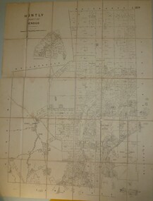
Map - JACK FLYNN COLLECTION: HUNTLY, 8/09/1921
... Photo Lithographed at the Department of Land and Survey Melbourne By W. J. Butson...Photo Lithographed at the Department of Land and Survey Melbourne By W. J. Butson Map: Parish of Huntly, County of Bendigo. ...Map: Parish of Huntly, County of Bendigo. Parish plan.By Authority, Govt., Printer. A. J. Mullett. Photo Lithographed at the Department of Land and Survey Melbourne By W. J. Butsonmap, bendigo, parish plan, huntly -
University of Melbourne, Burnley Campus Archives
Plan, Royal Botanic Gardens Melbourne, 1978
... ...Department of Crown Land and Survey Division of Survey and Mapping...University of Melbourne, Burnley Campus Archives 500 Yarra Boulevard Richmond melbourne jeremy j. wallace royal botanical gardens melbourne Department of Crown Land and Survey Division of Survey and Mapping ornamental lakes Plan of RBG with grid references. ...Plan of RBG with grid references. Produced by Dept. of Crown Lands and Survey, Victoria, Division of Survey and Mapping. Prepared in 1978 from surveys completed in 1976. (1) 2 copies plan. Main areas, buildings, etc., labelled, beds outlined. (2) Original coloured plan and reduced size photocopy. More labelling, particularly beds (handwritten). Labelled Jeremy J. Wallace with handwritten notes on reverse re a project. (3) Reduced size photocopy. Handwritten labelling of beds. (4 - 11) Enlarged photocopies of sections of (1) Handwritten notes and plant labelling. (1). Photgraphed copies by FRESCO 510131-TA. (12) Plan on a grid, coloured. "No Public Access," areas marked.jeremy j. wallace, royal botanical gardens melbourne, department of crown land and survey division of survey and mapping, ornamental lakes -
Port Melbourne Historical & Preservation Society
Book, Life on the bend, Jul 2017
... Department of Environment, Land, Water and Planning...Life on the bend Book Department of Environment, Land, Water and Planning ..."Life on the bend" Oblong book. Front cover photographs on blue background. Back cover blue with context logo.. Book explores 8 themes including industry, early settlement, identity ."Life on the bend" social history of Fishermans Bend Melbournebuilt environment - industrial, natural environment, fishermans bend -
 Ringwood and District Historical Society
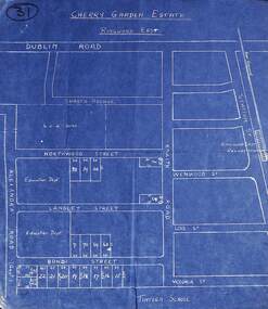
Map, Plan of Subdivision - Cherry Garden Estate, Ringwood East, Victoria. Circa 1950
... Map includes Dublin Road, Shasta Avenue, Education Department land in Alexandra Road, and numbered allotments in Knaith Road, Northwood Street, Langley Street and Bondi Street, Ringwood East, Victoria....Ringwood and District Historical Society 125A Warrandyte Road Ringwood North melbourne Map includes Dublin Road, Shasta Avenue, Education Department land in Alexandra Road, and numbered allotments in Knaith Road, Northwood Street, Langley Street and Bondi Street, Ringwood East, Victoria. ...Blue hand-drawn map of residential subdivision surrounding Tintern School.Map includes Dublin Road, Shasta Avenue, Education Department land in Alexandra Road, and numbered allotments in Knaith Road, Northwood Street, Langley Street and Bondi Street, Ringwood East, Victoria. -
 Eltham District Historical Society Inc
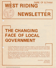
Newspaper - Folder, Shire of Eltham, West Riding Newsletter, 1978
... Newsletter produced by the Shire of Eltham including introduction titled: "The changing face of local government", signed by Ward councillors: Helen Wells, Neil Roberts and Allan Horsley, a brief financial statement: "where the money comes from", roads, shopping centres, council/education department projects, land purchase, senior citizens and recreation include list of new construction and upgrades. ...Eltham District Historical Society Inc 728 Main Rd Eltham melbourne Newsletter produced by the Shire of Eltham including introduction titled: "The changing face of local government", signed by Ward councillors: Helen Wells, Neil Roberts and Allan Horsley, a brief financial statement: "where the money comes from", roads, shopping centres, council/education department projects, land purchase, senior citizens and recreation include list of new construction and upgrades. ...Newsletter produced by the Shire of Eltham including introduction titled: "The changing face of local government", signed by Ward councillors: Helen Wells, Neil Roberts and Allan Horsley, a brief financial statement: "where the money comes from", roads, shopping centres, council/education department projects, land purchase, senior citizens and recreation include list of new construction and upgrades. Folder 71 from Harry Gilham Collection4 pages. Foldedallan horsley, community services, shire of eltham, budget, roads, shoppping centres, briar hill, montmorency, recreation, helen wells, neil roberts -
 St Kilda Historical Society
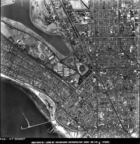
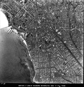
Photograph - Photo map, 28/01/1951
... For correlation with a current map, and access to other historical photo maps of Victoria, see the Historic Photo-Maps Index published by the Department of Environment, Land, Water and Planning at https://services.land.vic.gov.au/DELWPmaps/historical-photomaps/...For correlation with a current map, and access to other historical photo maps of Victoria, see the Historic Photo-Maps Index published by the Department of Environment, Land, Water and Planning at https://services.land.vic.gov.au/DELWPmaps/historical-photomaps/ Albert Park St Kilda Junction St Kilda Pier Catani Gardens St Kilda Prahran Albert Park Lake 1951 Middle Park St Kilda Beach Windsor 1424-45 SECRET 534 Run 18 Lens 12" Melbourne Metropolitan 12150 28.1.51 M639 Black and white aerial photograph Photograph Photo map ...One of a series of photo-maps produced for the Department of Crown Lands and Survey (1857-1983). For correlation with a current map, and access to other historical photo maps of Victoria, see the Historic Photo-Maps Index published by the Department of Environment, Land, Water and Planning at https://services.land.vic.gov.au/DELWPmaps/historical-photomaps/Black and white aerial photograph1424-45 SECRET 534 Run 18 Lens 12" Melbourne Metropolitan 12150 28.1.51 M639albert park, st kilda junction, st kilda pier, catani gardens, st kilda, prahran, albert park lake, 1951, middle park, st kilda beach, windsor -
 St Kilda Historical Society
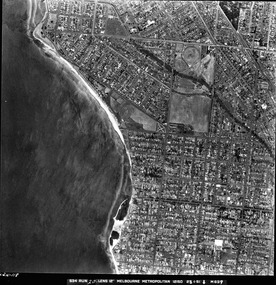
Photograph - Photo map, 17/01/1951
... For correlation with a current map, and access to other historical photo maps of Victoria, see the Historic Photo-Maps Index published by the Department of Environment, Land, Water and Planning at https://services.land.vic.gov.au/DELWPmaps/historical-photomaps/...For correlation with a current map, and access to other historical photo maps of Victoria, see the Historic Photo-Maps Index published by the Department of Environment, Land, Water and Planning at https://services.land.vic.gov.au/DELWPmaps/historical-photomaps/ St Kilda St Kilda botanical gardens Peanut farm Elwood 1951 Point Ormond Elwood canal St Kilda Beach 1414-21 538 Run 19 Lens 12" Melbourne Metropolitan 12150 17.1.51 M586 Black and white aerial photograph Photograph Photo map ...One of a series of photo-maps produced for the Department of Crown Lands and Survey (1857-1983). For correlation with a current map, and access to other historical photo maps of Victoria, see the Historic Photo-Maps Index published by the Department of Environment, Land, Water and Planning at https://services.land.vic.gov.au/DELWPmaps/historical-photomaps/Black and white aerial photograph1414-21 538 Run 19 Lens 12" Melbourne Metropolitan 12150 17.1.51 M586st kilda, st kilda botanical gardens, peanut farm, elwood, 1951, point ormond, elwood canal, st kilda beach -
 St Kilda Historical Society
Photograph - Photo map, 28/01/1951
... For correlation with a current map, and access to other historical photo maps of Victoria, see the Historic Photo-Maps Index published by the Department of Environment, Land, Water and Planning at https://services.land.vic.gov.au/DELWPmaps/historical-photomaps/...For correlation with a current map, and access to other historical photo maps of Victoria, see the Historic Photo-Maps Index published by the Department of Environment, Land, Water and Planning at https://services.land.vic.gov.au/DELWPmaps/historical-photomaps/ Elwood Point Ormond Elwood Park Elsternwick Park Elwood Beach 1951 1424-118 534 Run 20 Lens 12" Melbourne Metropolitan 12150 18.1.51M639 Black and white aerial photograph Photograph Photo map ...One of a series of photo-maps produced for the Department of Crown Lands and Survey (1857-1983). For correlation with a current map, and access to other historical photo maps of Victoria, see the Historic Photo-Maps Index published by the Department of Environment, Land, Water and Planning at https://services.land.vic.gov.au/DELWPmaps/historical-photomaps/Black and white aerial photograph1424-118 534 Run 20 Lens 12" Melbourne Metropolitan 12150 18.1.51M639elwood, point ormond, elwood park, elsternwick park, elwood beach, 1951 -
 St Kilda Historical Society
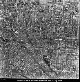
Photograph - Photo map, 17/01/1951
... For correlation with a current map, and access to other historical photo maps of Victoria, see the Historic Photo-Maps Index published by the Department of Environment, Land, Water and Planning at https://services.land.vic.gov.au/DELWPmaps/historical-photomaps/...For correlation with a current map, and access to other historical photo maps of Victoria, see the Historic Photo-Maps Index published by the Department of Environment, Land, Water and Planning at https://services.land.vic.gov.au/DELWPmaps/historical-photomaps/ Elwood Elsternwick St Kilda East Balaclava Ripponlea 1951 1414-20 538 Run 19 Lens 12" Melbourne Metropolitan 12150 17.1.51 M586 Black and white aerial photograph Photograph Photo map ...One of a series of photo-maps produced for the Department of Crown Lands and Survey (1857-1983). For correlation with a current map, and access to other historical photo maps of Victoria, see the Historic Photo-Maps Index published by the Department of Environment, Land, Water and Planning at https://services.land.vic.gov.au/DELWPmaps/historical-photomaps/Black and white aerial photograph1414-20 538 Run 19 Lens 12" Melbourne Metropolitan 12150 17.1.51 M586elwood, elsternwick, st kilda east, balaclava, ripponlea, 1951 -
 St Kilda Historical Society
Photograph - Photo map, 28/01/1951
... For correlation with a current map, and access to other historical photo maps of Victoria, see the Historic Photo-Maps Index published by the Department of Environment, Land, Water and Planning at https://services.land.vic.gov.au/DELWPmaps/historical-photomaps/...For correlation with a current map, and access to other historical photo maps of Victoria, see the Historic Photo-Maps Index published by the Department of Environment, Land, Water and Planning at https://services.land.vic.gov.au/DELWPmaps/historical-photomaps/ 1424-44 534 Run 18 Lens 12" Melbourne Metropolitan 12150 28.1.51 M639 Black and white aerial photograph Photograph Photo map ...One of a series of photo-maps produced for the Department of Crown Lands and Survey (1857-1983). For correlation with a current map, and access to other historical photo maps of Victoria, see the Historic Photo-Maps Index published by the Department of Environment, Land, Water and Planning at https://services.land.vic.gov.au/DELWPmaps/historical-photomaps/Black and white aerial photograph1424-44 534 Run 18 Lens 12" Melbourne Metropolitan 12150 28.1.51 M639 -
 St Kilda Historical Society
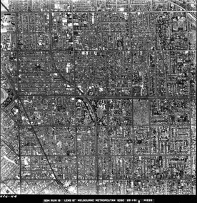
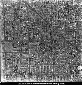
Photograph - Photo map, 28/01/1951
... For correlation with a current map, and access to other historical photo maps of Victoria, see the Historic Photo-Maps Index published by the Department of Environment, Land, Water and Planning at https://services.land.vic.gov.au/DELWPmaps/historical-photomaps/...For correlation with a current map, and access to other historical photo maps of Victoria, see the Historic Photo-Maps Index published by the Department of Environment, Land, Water and Planning at https://services.land.vic.gov.au/DELWPmaps/historical-photomaps/ Armadale Malvern St Kilda cemetery Caulfield North St Kilda East 1951 1424-43 534 Run 18 Lens 12" Melbourne Metropolitan 12150 28.1.51 M639 Black and white aerial photograph Photograph Photo map ...One of a series of photo-maps produced for the Department of Crown Lands and Survey (1857-1983). For correlation with a current map, and access to other historical photo maps of Victoria, see the Historic Photo-Maps Index published by the Department of Environment, Land, Water and Planning at https://services.land.vic.gov.au/DELWPmaps/historical-photomaps/Black and white aerial photograph1424-43 534 Run 18 Lens 12" Melbourne Metropolitan 12150 28.1.51 M639armadale, malvern, st kilda cemetery, caulfield north, st kilda east, 1951 -
 St Kilda Historical Society
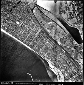
Photograph - Photo map, 30/01/1960
... For correlation with a current map, and access to other historical photo maps of Victoria, see the Historic Photo-Maps Index published by the Department of Environment, Land, Water and Planning at https://services.land.vic.gov.au/DELWPmaps/historical-photomaps/...For correlation with a current map, and access to other historical photo maps of Victoria, see the Historic Photo-Maps Index published by the Department of Environment, Land, Water and Planning at https://services.land.vic.gov.au/DELWPmaps/historical-photomaps/ Middle Park Albert Park Catani Gardens St Kilda West 1960 Vic 1093-62 Melbourne & Metropolitan Project Run 21 30.1.60 Lens 10" 8.200 Black and white aerial photograph Photograph Photo map ...One of a series of photo-maps produced for the Department of Crown Lands and Survey (1857-1983). For correlation with a current map, and access to other historical photo maps of Victoria, see the Historic Photo-Maps Index published by the Department of Environment, Land, Water and Planning at https://services.land.vic.gov.au/DELWPmaps/historical-photomaps/Black and white aerial photographVic 1093-62 Melbourne & Metropolitan Project Run 21 30.1.60 Lens 10" 8.200middle park, albert park, catani gardens, st kilda west, 1960