Showing 103 items matching "dividing range"
-
 Ringwood and District Historical Society
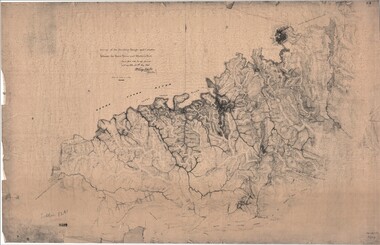
Map, Survey of Dividing Range between Yarra Yarra and Western Port - William Wedge Darke, 1843
... Survey of Dividing Range between Yarra Yarra and Western Port - William Wedge Darke, 1843...William's most important work was probably his survey of the Dividing Range and the country between the Yarra River and Western Port, completed in May 1843, and during which he made a traverse between the Mullum and Dandenong creeks along the higher ground that he labelled the "best line of road from Melbourne". ...Surveyor's relief map of features to the east of Melbourne including Yarra Yarra River, Mullum Mullum Creek, Anderson's Creek, Dandenong Creek. Survey of Dividing Range between Yarra Yarra and Western Port - William Wedge Darke, 1843 Map ...Extract - Ringwood, Place of Many Eagles - Hugh Anderson (1974): William Wedge Darke, from Hereford, England, was a nephew of John Helder Wedge of the Port Phillip Association, who was also a surveyor. William's most important work was probably his survey of the Dividing Range and the country between the Yarra River and Western Port, completed in May 1843, and during which he made a traverse between the Mullum and Dandenong creeks along the higher ground that he labelled the "best line of road from Melbourne". This road was for many years the major route to Gippsland and to the higher country about Alexandra and Mansfield, sometimes known as White Horse Road, and now Maroondah Highway.Surveyor's relief map of features to the east of Melbourne including Yarra Yarra River, Mullum Mullum Creek, Anderson's Creek, Dandenong Creek.Transmitted to the Surveyor General with my letter of 10th May 1843 (signed) Wm Wedge Drake, Assistant Surveyor. Scale: two inches to a mile. Descriptive remarks include upstream area of Yarra River - "impassable, appears to have been formerly a lake", and to the south - "barren and scrubby swamps of the Western Port Country". Marked tracks include "best line of road from Melbourne", "track to Dandenong", "Road to Port Albert may probably be found on this range", "Best line to Upper Yarra". Several huts also marked. -
 Wooragee Landcare Group
Photograph, circa April 2003
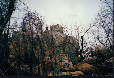
... ...great dividing range...The tiger quoll is found along the Great Dividing Range, which includes Victoria, New South Wales and also near the border of Queensland. ...The tiger quoll is found along the Great Dividing Range, which includes Victoria, New South Wales and also near the border of Queensland. ...This photograph was taken in the Mount Pilot Chiltern National Park. This park is located near Chiltern in Victoria. It's most notable landmarks include Mt Pilot and Woolshed Falls. It also has many mines from the Gold Rush in the late 1800s. It is home to much flora and fauna, including the tiger quoll. The tiger quoll, also known as the spotted-tail quoll, is a marsupial that gives in the Mount Pilot Chiltern National Park. It is also main land Australia's largest carnivorous marsupial. It can weigh up too four kilograms and looks similar to either a possum or a spotted cat. It has red and brown fur with distinct spots. The tiger quoll is found along the Great Dividing Range, which includes Victoria, New South Wales and also near the border of Queensland. It lives in forests, rainforests and coastal heathlands and woodlands. In 2004 a team of volunteers from the Wooragee Landcare group as well as some of the Department of Sustainability and Environment staff set out to find the tiger quoll following the 2003 bushfires. Since the bushfires, concern had arisen for it because it hadn't been seen since the bushfires. They attempted to find traces of the quoll through finding and identifying their droppings as well as DNA testing. This photograph was taken during this search. This photograph represents the work that goes into protecting a important species like the tiger quoll. The tiger quoll is a significant species because it is main land Australia's largest carnivorous marsupial. As a result of this, there has been much work done to preserve and protect it. This photograph was taken when the Wooragee Landcare group went to ensure the survival of this species, highlighting how the tiger quoll is being protected. This photograph also demonstrates the impacts of the 2003 bushfires in the Mount Pilot Chiltern National Park. This is seen through the burnt trees featured in the picture. Landscape coloured photograph printed on gloss paperReverse: WAN NA 0ANA0N0 NNN 0 1636 / [PRINTED] (No.7) / 921quoll, mount pilot chiltern national park, national park, 2003 bushfires, search, endangered, beechworth, wooragee landcare group, wooragee landcare, wooragee, possum, australia, victoria, department of sustainability and environment, photograph, 2004, spotted-tailed quoll, great dividing range, spots, fur, forests, rainforests, woodlands, coastal heathlands, spotted quoll, spotted quoll habitat -
 Marysville & District Historical Society
Magazine (Item) - Leisure guide, Michael Cheshire, LEISURE GUIDE THE MOUNTAINS OF MELBOURNE, 1984
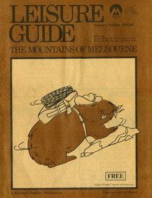
... A leisure guide to the mountains of Melbourne beginning in the eastern suburbs, going through the Yarra Valley and into the Great Dividing Range. This was produced by Michael Cheshire as a free publication to promote Melbourne tourism. ...A leisure guide to the mountains of Melbourne beginning in the eastern suburbs, going through the Yarra Valley and into the Great Dividing Range....A leisure guide to the mountains of Melbourne beginning in the eastern suburbs, going through the Yarra Valley and into the Great Dividing Range. LEISURE GUIDE THE MOUNTAINS OF MELBOURNE Magazine Leisure guide Michael Cheshire Waverley Offset Publishing Group BP Typesetting Pty. ...A leisure guide to the mountains of Melbourne beginning in the eastern suburbs, going through the Yarra Valley and into the Great Dividing Range. This was produced by Michael Cheshire as a free publication to promote Melbourne tourism. The magazine featured Healesville, Marysville, Warburton, Eildon, Alexandra, the Upper Yarra area, and includes information on wineries in the district. It was released in the summer of 1984-1985.A leisure guide to the mountains of Melbourne beginning in the eastern suburbs, going through the Yarra Valley and into the Great Dividing Range.Summer Edition 1984-85 Featuring:/ Healesville, Marysville, Warburton, Eildon,/ Alexandra, Wineries and Upper Yarra Area.healesville, warburton, eildon, alexandra, upper yarra, marysville, victoria, australia, leisure guide, michael cheshire, blackwood holiday flats, black spur motel and caravan park, tudor lodge road house, nanda binya lodge, marysville caravan park, marysville recreation and fun park, scenic motel, the tower motel, the cumberland, cathedral restaurant, cathedral restaurant gallery, taggerty golf course, taggerty holiday units, marylyn guest house -
 Federation University Historical Collection
Booklet, Thomas Stephen Hart, The Highlands and Main Divide of Western Victoria, 1907, 12/12/1907
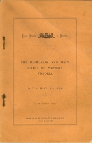
... ...great dividing range...Sketch of the Hills west and north-west from Mt Buninyong - - The divide in Ascot Gap from Mt Blowhard (Serra Range, Mt William, Mt Ararat, Larne Gerin, Ben Major, Mt Cole, Mt Misery, Mt Bolton) Fig. 5. ...Sketch of the Hills west and north-west from Mt Buninyong - - The divide in Ascot Gap from Mt Blowhard (Serra Range, Mt William, Mt Ararat, Larne Gerin, Ben Major, Mt Cole, Mt Misery, Mt Bolton) Fig. 5. ...Thomas S. Hart was a teacher at the Ballarat School of Mines, and a member of the Ballarat Field Naturalists ClubArticle with illustrations published by the Royal Society of Victoria by Thomas S. Hart. The following plates are included: Fig 1. The Main Divide and some of the transverse ridges Fig 2. Hills on and near the Divide at the Ercildoun and Ascot Gaps Fig. 3. Profile of the Divide at Ascot Gap. Fig. 4. Sketch of the Hills west and north-west from Mt Buninyong - - The divide in Ascot Gap from Mt Blowhard (Serra Range, Mt William, Mt Ararat, Larne Gerin, Ben Major, Mt Cole, Mt Misery, Mt Bolton) Fig. 5. Diagram to illustrate the possible courses of the leads south of the present Divide - Burrumbeet Basin (Smythesdale, Ballarat, Lal Lal , Mt Doran, egerton, Parwan Creet, Rowsley Fault, Eastern Plateau) Fig. 6. Diagramatic cross section of the grampians, south of Hall's Gap. Profile of the Pyranees, from maiden Hill - Diagramatic Section of the Grampians south of Hall's Gap. (Mt Cole, Mt Mitchell, Ben Major, Ben More, Avoca Hill, Hall's Gap.) Fig. 7. Profile of the Pyrenees as seen from Maiden Hill near Waubra.thomas hart, thomas s. hart, ballarat school of mines, ballarat field naturalists club, royal society of victoria, western victoria, ballarat, great dividing range, mt william, volcano, volcanic plains, waterways, lal lal basin, yarrowee creek, ballarat common, lava flow, wendouree, warrenheip, ballarat plateau, mt elephant, grampians, t.s. hart, mt buangor, mt beckworth, mt misery, mt bolton, lal lal iron ored, mt ararat, mt wiliam, mt cole, burrumbeet, mt warrenheip, daylesford, waubra, ercildoun gap, smythesdale, lal lal falls, parwan valley, burrumbeet creek, staffordshire reef, pyranees, bacchus marsh, rowsley fault, ben nevis, avoca hill, landsborough hill, mt blowhard, weatherboard, mclean's hill, fyan's creek, thomas stephen hart, lal lal -
 Marysville & District Historical Society
Article (item) - Museum Victoria Australia Article, Museum Victoria Australia, Aboriginal Land, Unknown
... ...great dividing range...A brief history of the Kulin clan in Victoria. kulin clan great dividing range yarra river goulburn river tonne-be-wong toole-be-wong donne-be-wong mount riddell ben cairn donna buang port phillip settlement john batman james dredge port phillip protectorate for aborigines duang wurrung king parrot creek acheron river mitchellstown william le souef murchison woi wurrung boon wurrung warrandyte mordialloc little river william thomas acheron station mohican run john green mohican station badger creek healesville coranderrk black's spur christmas bush prostanthera lasianothos geringdah A brief history of the Kulin clan in Victoria. ...A brief history of the Kulin clan in Victoria.A brief history of the Kulin clan in Victoria.kulin clan, great dividing range, yarra river, goulburn river, tonne-be-wong, toole-be-wong, donne-be-wong, mount riddell, ben cairn, donna buang, port phillip settlement, john batman, james dredge, port phillip protectorate for aborigines, duang wurrung, king parrot creek, acheron river, mitchellstown, william le souef, murchison, woi wurrung, boon wurrung, warrandyte, mordialloc, little river, william thomas, acheron station, mohican run, john green, mohican station, badger creek, healesville, coranderrk, black's spur, christmas bush, prostanthera lasianothos, geringdah -
Marysville & District Historical Society
Article (item) - Book Extract, Aboriginal History, Unknown
... ...dividing range...The extract also covers current (1991) status of Aboriginal affairs and European settlement of the area. kulin nation woiworung taungurong bunurong watherong jajowrong wurrundjeri-willam waring-ilam-balluk goulburn valley acheron valley upper goulburn district eildon-thornton eildon homestead o'rourke thornton assistant protector thomas yarra valley kilmore mount william jt gellibrand william buckley major mitchell port phillip murray river yorta yorta yowung-illam-balluk waring-illam-balluk ngurai-illam-wurrung kurnai nation protectorate system victoria george robinson chief protector willam thomas james dredge edward parker charles sievewright central board for the protection of aborigines presbyterian mission anglican mission moravian mission wonga munnarin beaning murrin murrin parugean baruppin koo-gurrin acheron river little river acheron run peter snodgrass stephen jones barak dividing range black spur watts river badger creek healesville coranderrk victorian christmas bush aboriginal and torres strait islander heritage protection act 1984 archaelological and aboriginal relics preservation act 1972 camp jungai rubicon warrawa college victorian archaeological survey hume and hovell molesworth broadford william hamilton alexandra mansfield avenel tallarook worrough john cotton trawool valley seymour pyalong gold mining central victoria strath creek reedy creek yea jamieson marysville jordan goldfields comet mine wandong melbourne-albury railway rabbit plague narbethong lord kitchener puckapunyal military camp 1944 decentralisation policy eildon weir hume freeway bypass timber industry australian paper manufacturers mill An extract from a book regarding a brief history of the Kulin nation of the North Central district of Victoria. ...An extract from a book regarding a brief history of the Kulin nation of the North Central district of Victoria.An extract from a book regarding a brief history of the Kulin nation of the North Central district of Victoria. This history covered is both prior to European history and post-European history. The extract also covers current (1991) status of Aboriginal affairs and European settlement of the area.kulin nation, woiworung, taungurong, bunurong, watherong, jajowrong, wurrundjeri-willam, waring-ilam-balluk, goulburn valley, acheron valley, upper goulburn district, eildon-thornton, eildon homestead, o'rourke, thornton, assistant protector thomas, yarra valley, kilmore, mount william, jt gellibrand, william buckley, major mitchell, port phillip, murray river, yorta yorta, yowung-illam-balluk, waring-illam-balluk, ngurai-illam-wurrung, kurnai nation, protectorate system, victoria, george robinson, chief protector, willam thomas, james dredge, edward parker, charles sievewright, central board for the protection of aborigines, presbyterian mission, anglican mission, moravian mission, wonga, munnarin, beaning, murrin murrin, parugean, baruppin, koo-gurrin, acheron river, little river, acheron run, peter snodgrass, stephen jones, barak, dividing range, black spur, watts river, badger creek, healesville, coranderrk, victorian christmas bush, aboriginal and torres strait islander heritage protection act 1984, archaelological and aboriginal relics preservation act 1972, camp jungai, rubicon, warrawa college, victorian archaeological survey, hume and hovell, molesworth, broadford, william hamilton, alexandra, mansfield, avenel, tallarook, worrough, john cotton, trawool valley, seymour, pyalong, gold mining, central victoria, strath creek, reedy creek, yea, jamieson, marysville, jordan goldfields, comet mine, wandong, melbourne-albury railway, rabbit plague, narbethong, lord kitchener, puckapunyal military camp, 1944 decentralisation policy, eildon weir, hume freeway bypass, timber industry, australian paper manufacturers mill -
Marysville & District Historical Society
Document (Item) - Report, John F. Waghorn, Yarra Track, Unknown
... ...great dividing range...If an ancestor was a postmaster in a Victorian town, he may have been able to reveal the person's occupation, income and working conditions. yarra track john waghorn victoria's postal services wood's point sydney road longwood merton mansfield postmasters bonnie doon melville merton mansfield eltham healesville marysville walhalla melbourne-warburton-wood's point line loose bags heidelberg post office eltham post office kangaroo ground post office yarra glen post office marysville post office healesville post office mansfield post office jamieson post office gaffney's creek post office wood's point post office postal department george rieck stockman jones beecher stockman's reward big river mary mcdonald upper yarra river donovan's creek cornelius donovan bridget buggy matlock alexandra william farrell jordan diggings new chum watts river black spur narbethong granton acheron river mount strickland paradise plains mount grant mount arnold jordan goldfields william robley robley's spur big river crossing great dividing range cumberland valley james mcguigan w elliot christopher harrison james marsh cobb and co box hill lilydale fehrings koehlers shaws bear creek cairnsville cumberland creek walkers golden bower mine collins' mountain home hotel walsh's creek post office rosa mcveigh frank barton hitchins matthew kennedy william morris e r nichols t woods tom burchell peter kerr henry kuyper william podlech george koehler henry brockmann henry petty thomas smith jacob butchart john perry slingsby davis royal mail hotel walter gray john summers travellers rest hotel lockington the oaks the springs st clair thomas crawford springvale hotel john sinclair saint clair hotel gould mathews willie we have missed you hotel germany johan fehring adelaide linton ballarat gunbower murray river anna katerina fehring 1890s depression land boom fehring place fred baker alf sparke fehring's hotel mcveigh's hotel wood's point mountaineer l cox victorian country directories letson cox coburg maria hayes setson fitzroy richmond john cox jordan river jericho e. norris le poidevin newell o'brien alhambra sinclair parker ellis tripp quin vernon thompson charsley james fahie george locke william chester chesterville kirwan cumberland reserve blue spruce e.s. and a bank selby joyce selby charles joy selby joseph joyce A report on the history of the Yarra Track by John Waghorn, a local amateur historian. ...A report on the history of the Yarra Track by John Waghorn, a local amateur historian.A report on the history of the Yarra Track by John Waghorn, a local amateur historian. John Waghorn was an amateur historian, an authority on the history of Victoria's postal services. He could tell you how mail was delivered in the high country in the 1880s, where the town of Gobur was, or when the overland Melbourne-Sydney mail service began. He admitted that his hobby has got a little out of hand. He had 30 filing cabinets, and indexes of more than 70,000 postal workers over the past 160 years crammed into three rooms at his home. If an ancestor was a postmaster in a Victorian town, he may have been able to reveal the person's occupation, income and working conditions.yarra track, john waghorn, victoria's postal services, wood's point, sydney road, longwood, merton, mansfield, postmasters, bonnie doon, melville merton mansfield, eltham, healesville, marysville, walhalla, melbourne-warburton-wood's point line, loose bags, heidelberg post office, eltham post office, kangaroo ground post office, yarra glen post office, marysville post office, healesville post office, mansfield post office, jamieson post office, gaffney's creek post office, wood's point post office, postal department, george rieck, stockman, jones, beecher, stockman's reward, big river, mary mcdonald, upper yarra river, donovan's creek, cornelius donovan, bridget buggy, matlock, alexandra, william farrell, jordan diggings, new chum, watts river, black spur, narbethong, granton, acheron river, mount strickland, paradise plains, mount grant, mount arnold, jordan goldfields, william robley, robley's spur, big river crossing, great dividing range, cumberland valley, james mcguigan, w elliot, christopher harrison, james marsh, cobb and co, box hill, lilydale, fehrings, koehlers, shaws, bear creek, cairnsville, cumberland creek, walkers, golden bower mine, collins' mountain home hotel, walsh's creek post office, rosa mcveigh, frank barton, hitchins, matthew kennedy, william morris, e r nichols, t woods, tom burchell, peter kerr, henry kuyper, william podlech, george koehler, henry brockmann, henry petty, thomas smith, jacob butchart, john perry, slingsby davis, royal mail hotel, walter gray, john summers, travellers rest hotel, lockington, the oaks, the springs, st clair, thomas crawford, springvale hotel, john sinclair, saint clair hotel, gould, mathews, willie we have missed you hotel, germany, johan fehring, adelaide, linton, ballarat, gunbower, murray river, anna katerina fehring, 1890s depression, land boom, fehring place, fred baker, alf sparke, fehring's hotel, mcveigh's hotel, wood's point mountaineer, l cox, victorian country directories, letson cox, coburg, maria hayes, setson, fitzroy, richmond, john cox, jordan river, jericho, e. norris, le poidevin, newell, o'brien, alhambra, sinclair, parker, ellis, tripp, quin, vernon, thompson, charsley, james fahie, george locke, william chester, chesterville, kirwan, cumberland reserve, blue spruce, e.s. and a bank, selby joyce, selby charles joy, selby joseph joyce -
 Marysville & District Historical Society
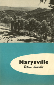
Ephemera (Item) - Tourist brochure, Victorian Railways, Marysville Victoria Australia, 11-1958
... ...great dividing range...A tourist brochure showing information for travel to Marysville from Melbourne and accommodation venues in Marysville. marysville victoria australia marysville hotel the cumberland kerami guest house kooringa guest house marylands guest house mary-lyn guest house marysville chalet guest house marysville house guest house mt kitchener guest house lake mountain mckenzie tourist services melbourne great dividing range cumberland valley white mountain ash eildon weir alexandra acheron way warburton victorian government tourist bureau victorian railways A tourist brochure showing information for travel to Marysville from Melbourne and accommodation venues in Marysville. ...A tourist brochure showing information for travel to Marysville from Melbourne and accommodation venues in Marysville. This brochure was published by the Victorian Railways Public Relations and Betterment Board in November, 1958.A tourist brochure showing information for travel to Marysville from Melbourne and accommodation venues in Marysville.marysville, victoria, australia, marysville hotel, the cumberland, kerami guest house, kooringa guest house, marylands guest house, mary-lyn guest house, marysville chalet guest house, marysville house guest house, mt kitchener guest house, lake mountain, mckenzie tourist services, melbourne, great dividing range, cumberland valley, white mountain ash, eildon weir, alexandra, acheron way, warburton, victorian government tourist bureau, victorian railways -
 Marysville & District Historical Society
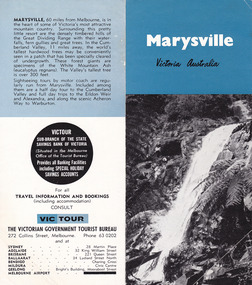
Ephemera (Item) - Tourist brochure, Victorian Government Tourist Bureau, Marysville Victoria Australia, Unknown
... ...great dividing range...A tourist brochure showing information for travel to Marysville from Melbourne and accommodation venues in Marysville. marysville victoria australia marysville hotel the cumberland kerami guest house kooringa guest house marylands guest house mary-lyn guest house marysville chalet guest house marysville house guest house mt kitchener guest house lake mountain mckenzie tourist services melbourne great dividing range cumberland valley white mountain ash eildon weir alexandra acheron way warburton victorian government tourist bureau A tourist brochure showing information for travel to Marysville from Melbourne and accommodation venues in Marysville. ...A tourist brochure showing showing information for travel to Marysville from Melbourne and accommodation venues in Marysville. This brochure was published by the Victorian Government Tourist Bureau.A tourist brochure showing information for travel to Marysville from Melbourne and accommodation venues in Marysville.marysville, victoria, australia, marysville hotel, the cumberland, kerami guest house, kooringa guest house, marylands guest house, mary-lyn guest house, marysville chalet guest house, marysville house guest house, mt kitchener guest house, lake mountain, mckenzie tourist services, melbourne, great dividing range, cumberland valley, white mountain ash, eildon weir, alexandra, acheron way, warburton, victorian government tourist bureau -
 Marysville & District Historical Society
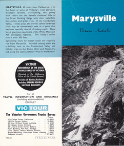
Ephemera (Item) - Tourist brochure, Victorian Government Tourist Bureau, Marysville Victoria Australia, Unknown
... ...great dividing range...A tourist brochure showing information for travel to Marysville from Melbourne and accommodation venues in Marysville. marysville victoria australia marysville hotel the cumberland kerami guest house kooringa guest house marylands guest house mary-lyn guest house marysville chalet guest house marysville house guest house mt kitchener guest house lake mountain mckenzie tourist services melbourne great dividing range cumberland valley white mountain ash eildon weir alexandra acheron way warburton victorian government tourist bureau A tourist brochure showing information for travel to Marysville from Melbourne and accommodation venues in Marysville. ...A tourist brochure showing showing information for travel to Marysville from Melbourne and accommodation venues in Marysville. This brochure was published by the Victorian Government Tourist Bureau.A tourist brochure showing information for travel to Marysville from Melbourne and accommodation venues in Marysville.marysville, victoria, australia, marysville hotel, the cumberland, kerami guest house, kooringa guest house, marylands guest house, mary-lyn guest house, marysville chalet guest house, marysville house guest house, mt kitchener guest house, lake mountain, mckenzie tourist services, melbourne, great dividing range, cumberland valley, white mountain ash, eildon weir, alexandra, acheron way, warburton, victorian government tourist bureau -
 Victorian Aboriginal Corporation for Languages
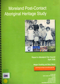
Book, Megan Goulding et al, Moreland post-contact Aboriginal heritage study, 2006
... ...Great Dividing Range...Victorian Aboriginal Corporation for Languages 33 Saxon Street Brunswick melbourne Woiworung Woi wurrung Wurundjeri Waa Bunjil Werribee River Port Phillip Mount Baw Baw Great Dividing Range Yarra River Eastern Kulin Gunung willam balluk William Barak John Batman William Thomas Moreland history moieties local history colonisation maps, colour photographs, b&w photographs, tables This study aims to identify Aboriginal heritage sites and landscape associations in the Moreland municipality that date from the pre-contact period through to the early contact period when Europeans settled in and around the area, to the present day. ...This study aims to identify Aboriginal heritage sites and landscape associations in the Moreland municipality that date from the pre-contact period through to the early contact period when Europeans settled in and around the area, to the present day.maps, colour photographs, b&w photographs, tableswoiworung, woi wurrung, wurundjeri, waa, bunjil, werribee river, port phillip, mount baw baw, great dividing range, yarra river, eastern kulin, gunung willam balluk, william barak, john batman, william thomas, moreland history, moieties, local history, colonisation -
 Rutherglen Historical Society
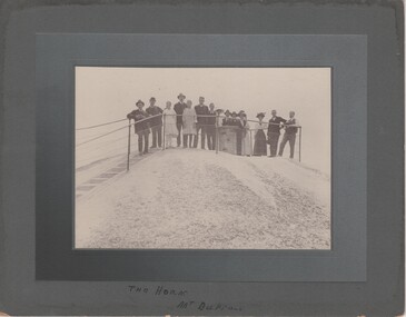
Image, c1915
... ...great dividing range...Rutherglen Historical Society Murray Street Rutherglen high-country the horn mt buffalo victorian alps great dividing range mount buffalo Written at bottom of mount: "The Horn, Mt Buffalo" Black and white photograph, mounted on cardboard, of a group of people posing at a lookout. ...Black and white photograph, mounted on cardboard, of a group of people posing at a lookout. Written at bottom of mount: "The Horn, Mt Buffalo"the horn, mt buffalo, victorian alps, great dividing range, mount buffalo -
 Federation University Historical Collection
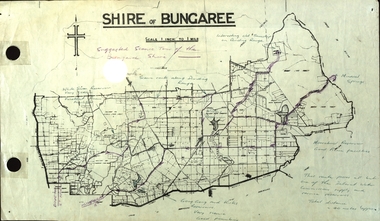
Plan, Shire of Bungaree
... ...great dividing range...The former Shire of Bungaree is now part of Moorabool Shire. bungaree water supply barkstead humffray street, ballarat doveton (north) stret, ballarat ballarat water commission great dividing range wombat state forest mineral water springs Gong Gon Reservoir kirks reservoir Purple line in purple pencil indictaes suggested scenic tour of the Bungaree Shire Plan of the Shire of Bungaree. ...The former Shire of Bungaree is now part of Moorabool Shire.Plan of the Shire of Bungaree. Scale is 1 inch to 1 mile with the total distance approximately 40 miles. Includes Gong Gong Reservoir, Kirks Reservoir, White Swan Reservoir, Wilson's Reservois and Moorabool Reservoir. Purple line in purple pencil indictaes suggested scenic tour of the Bungaree Shirebungaree, water supply, barkstead, humffray street, ballarat, doveton (north) stret, ballarat, ballarat water commission, great dividing range, wombat state forest, mineral water springs, gong gon reservoir, kirks reservoir -
Lakes Entrance Historical Society
Map - Alpine Study Area - Topography, Land Conservation Council
... Map shows Great Dividing Range...Lakes Entrance Historical Society 4 Marine Parade Lakes Entrance gippsland Topography study Conservation Map No. 3 Map shows Great Dividing Range Map Alpine Study Area - Topography Land Conservation Council ...Map shows Great Dividing RangeMap No. 3topography, study, conservation -
Lakes Entrance Historical Society
Map - Alpine Study Area - Land Systems, Land Conservation Council
... Map shows land systems, bounderies in the Great Dividing Range...Lakes Entrance Historical Society 4 Marine Parade Lakes Entrance gippsland Topography Land Systems Conservation Map No. 7 Map shows land systems, bounderies in the Great Dividing Range Map Alpine Study Area - Land Systems Land Conservation Council ...Map shows land systems, bounderies in the Great Dividing RangeMap No. 7topography, land systems, conservation -
![Scene from the Black Spur / [by] Nicholas Caire, circa 1876](/media/collectors/550653872162f11fb04854aa/items/577b5403d0cdd10948cd5b81/item-media/577b5470d0cdd10948cda270/item-fit-380x285.jpg?cb=6) Kew Historical Society Inc
Kew Historical Society IncPhotograph, Anglo-Australasian Photographic Company, Scene from the Black Spur, c. 1876
... On Reverse: ‘The scene which this illustration represents is taken from one of the slopes of the Black Spur Hill, on the Great Dividing Range of Mountains, and is characteristic of the scenery to be found in most parts of the beautiful and romantic districts of Fernshawe and Healesville.’...His vision of the Australian bush and pioneer life had a counterpart in the works of Henry Lawson and other nationalist poets, authors and painters. nicholas caire (1837-1918) australia - landscape photography On Reverse: ‘The scene which this illustration represents is taken from one of the slopes of the Black Spur Hill, on the Great Dividing Range of Mountains, and is characteristic of the scenery to be found in most parts of the beautiful and romantic districts of Fernshawe and Healesville.’ ...Nicholas Caire was born on Guernsey in the Channel Islands in 1837. He arrived in Adelaide with his parents in about 1860. In 1867, following photographic journeys in Gippsland, he opened a studio in Adelaide. From 1870 to 1876 he lived and worked in Talbot in Central Victoria. In 1876 he purchased T. F. Chuck's studios in the Royal Arcade Melbourne. In 1885, following the introduction of dry plate photography, he began a series of landscape series, which were commercially successful. As a photographer, he travelled extensively through Victoria, photographing places few of his contemporaries had previously seen. He died in 1918. Reference: Jack Cato, 'Caire, Nicholas John (1837–1918)', Australian Dictionary of Biography.An original, rare photograph from the series 'Views of Victoria: General Series' by the photographer, Nicholas Caire (1837-1918). The series of 60 photographs that comprise the series was issued c. 1876 and reinforced a neo-Romantic view of the Australian landscape to which a growing nationalist movement would respond. Nicholas Caire was active as a photographer in Australia from 1858 until his death in 1918. His vision of the Australian bush and pioneer life had a counterpart in the works of Henry Lawson and other nationalist poets, authors and painters.Views of Victoria (General Series) No.27 / ‘Scene from the Black Spur’ / Albumen silver photograph mounted on boardOn Reverse: ‘The scene which this illustration represents is taken from one of the slopes of the Black Spur Hill, on the Great Dividing Range of Mountains, and is characteristic of the scenery to be found in most parts of the beautiful and romantic districts of Fernshawe and Healesville.’nicholas caire (1837-1918), australia - landscape photography -
 Bendigo Historical Society Inc.
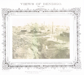
Photograph - VIEWS OF BENDIGO: NORTH OLD CHUM CLAIM, c. 1870's
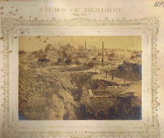
... 'New Chum and Victoria Company's Quartz Crushing Battery', 'the dividing range between Happy Valley, Victoria Hill and Iron Bark'. ...'New Chum and Victoria Company's Quartz Crushing Battery', 'the dividing range between Happy Valley, Victoria Hill and Iron Bark'. ...Photograph 10. Sepia photograph of View of North Old Chum Claim, showing surface Excavations. Printed below photograph: J.W. Forbes, Agent, Lansell's No. 180 Claim, Welch Expo. 'New Chum and Victoria Company's Quartz Crushing Battery', 'the dividing range between Happy Valley, Victoria Hill and Iron Bark'. Nicholas CaireN J Cairetopic, mining, old chum mine -
Greensborough Historical Society
Book, Melbourne Water, Plenty River Waterway Management Activity Plan 2000, 2000_
... This report covers the catchment of the Plenty River from its upper reaches in the Great Dividing Range to the confluence with the Yarra River at Viewbank. ...Greensborough Historical Society 34A Glenauburn Road Lower Plenty Lower Plenty melbourne This report covers the catchment of the Plenty River from its upper reaches in the Great Dividing Range to the confluence with the Yarra River at Viewbank. ...This report covers the catchment of the Plenty River from its upper reaches in the Great Dividing Range to the confluence with the Yarra River at Viewbank. It discusses ecological diversity and methods of improving water quality and significant areas of the catchment. Includes a brief history of settlement along the Plenty River.This is a significant plan for the improvement of the Plenty River.207 p., maps, folding maps. Printed on white paper with black spiral binding and clear plastic front cover.plenty river, melbourne water -
![View of Sailor’s Creek Bridge / [by] Nicholas Caire, circa 1876](/media/collectors/550653872162f11fb04854aa/items/577b5b7ed0cdd10948d14ae1/item-media/577b5be9d0cdd10948d196a2/item-fit-380x285.jpg?cb=6) Kew Historical Society Inc
Kew Historical Society IncPhotograph, Anglo-Australasian Photographic Company, View of Sailor’s Creek Bridge, c.1876
... On Reverse" ‘Sailor’s Creek as situated in the Jim Crow Ranges, which Range forms a portion of the Great Dividing Range of Mountains in Victoria. These hills contain many romantic spots. ...His vision of the Australian bush and pioneer life had a counterpart in the works of Henry Lawson and other nationalist poets, authors and painters. nicholas caire (1837-1918) sailor's creek (vic) gold mining (vic) On Reverse" ‘Sailor’s Creek as situated in the Jim Crow Ranges, which Range forms a portion of the Great Dividing Range of Mountains in Victoria. These hills contain many romantic spots. ...Nicholas Caire was born on Guernsey in the Channel Islands in 1837. He arrived in Adelaide with his parents in about 1860. In 1867, following photographic journeys in Gippsland, he opened a studio in Adelaide. From 1870 to 1876 he lived and worked in Talbot in Central Victoria. In 1876 he purchased T. F. Chuck's studios in the Royal Arcade Melbourne. In 1885, following the introduction of dry plate photography, he began a series of landscape series, which were commercially successful. As a photographer, he travelled extensively through Victoria, photographing places few of his contemporaries had previously seen. He died in 1918. Reference: Jack Cato, 'Caire, Nicholas John (1837–1918)', Australian Dictionary of Biography.An original, rare photograph from the series 'Views of Victoria: General Series' by the photographer, Nicholas Caire (1837-1918). The series of 60 photographs that comprise the series was issued c. 1876 and reinforced a neo-Romantic view of the Australian landscape to which a growing nationalist movement would respond. Nicholas Caire was active as a photographer in Australia from 1858 until his death in 1918. His vision of the Australian bush and pioneer life had a counterpart in the works of Henry Lawson and other nationalist poets, authors and painters.Views of Victoria (General Series) No.31 / ‘View of Sailor’s Creek Bridge’ / Albumen silver photograph mounted on boardOn Reverse" ‘Sailor’s Creek as situated in the Jim Crow Ranges, which Range forms a portion of the Great Dividing Range of Mountains in Victoria. These hills contain many romantic spots. The one which forms the subject of the present illustration is a view of the Bridge which spans the Creek. Gold has been found throughout the course of the bed of this Creek in payable quantities. The diggers, as may be seen in the photograph, have constructed sluices in the side of the embankment for the purpose of washing the fine gold contained in the wash-dirt.’nicholas caire (1837-1918), sailor's creek (vic), gold mining (vic) -
 Hume City Civic Collection
Photograph, c 1974
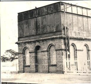
... Steam trains needed sufficient steam power to climb the steep gradients over the Great Dividing Range and the water tower at Sunbury was used to replenish the trains' water supply for the remainder of the journey....Steam trains needed sufficient steam power to climb the steep gradients over the Great Dividing Range and the water tower at Sunbury was used to replenish the trains' water supply for the remainder of the journey. sunbury railway station water towers victorian railways bett j. george evans collection A black and white photograph of the water tower at Sunbury Railway Station. ...The mounted photograph is one of a series used for display purposes. The water tower at Sunbury Station was built in 1861 by J. Bett. it is of state significance and is an indicator of the importance of the railway to Sunbury's expansion in the Nineteenth Century. Steam trains needed sufficient steam power to climb the steep gradients over the Great Dividing Range and the water tower at Sunbury was used to replenish the trains' water supply for the remainder of the journey.A black and white photograph of the water tower at Sunbury Railway Station. The base of the tower is a brick construction with an arched doorway and two bricked in arched windows at either side of the doorway and a further two bricked in arched windows on the side. Above the base is a large square iron water storage tank with two downpipes at the side. There is a picket fence either side of the building. Mounted on board.sunbury railway station, water towers, victorian railways, bett, j., george evans collection -
 Bendigo Historical Society Inc.
Photograph - LONG GULLY HISTORY GROUP COLLECTION: VIEWS OF BENDIGO NO 10
... Printed at the bottom is: The dividing range between Happy Valley, Victoria Hill and Iron Bark, Lansell's No 180 Claim and New Chum and Victoria Company's Quartz Crushing Battery, J W Forbes, Agend and another name beginning with a W. ...Printed at the bottom is: The dividing range between Happy Valley, Victoria Hill and Iron Bark, Lansell's No 180 Claim and New Chum and Victoria Company's Quartz Crushing Battery, J W Forbes, Agend and another name beginning with a W. ...BHS CollectionSepia copy of a photograph titled Views of Bendigo No. 10. Photo has a printed decorated edge. Under the photo is View of North Old Chum Claim, showing surface Excavations. N J Caire was the Sandhurst photographer. Printed at the bottom is: The dividing range between Happy Valley, Victoria Hill and Iron Bark, Lansell's No 180 Claim and New Chum and Victoria Company's Quartz Crushing Battery, J W Forbes, Agend and another name beginning with a W. In the photo are three tall chimneys, poppet legs, buildings, stacks of wood, fences and in the foreground a large excavation with a heap of rubble beside it.bendigo, history, long gully history group, the long gully history group - views of bendigo no 10, north old chum claim, n j caire, j w forbes, lansell's no 180 claim, new chum and victoria company's quartz crushing battery -
 Marysville & District Historical Society
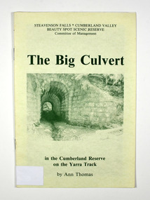
Booklet - Paperback booklet, Ann Thomas, The Big Culvert, 1992
... ./ Some levels of elevation top the 4000 ft. mark, as it is part of the Great Dividing/Range in Victoria. I have collected just a few aspects of early times and would like/ to say thanks for the encouragement I have received, to write about one of my/ favourite subjects./ Ann Thomas..../ Some levels of elevation top the 4000 ft. mark, as it is part of the Great Dividing/Range in Victoria. I have collected just a few aspects of early times and would like/ to say thanks for the encouragement I have received, to write about one of my/ favourite subjects./ Ann Thomas Paperback. ...A history of the Big Culvert in the Cumberland Reserve and its link to the Yarra Track.Paperback. Front cover has an old photograph of the big culvert.non-fictionA history of the Big Culvert in the Cumberland Reserve and its link to the Yarra Track.big culvert, cumberland reserve, yarra track, victoria, history -
 Old Colonists' Association of Ballarat Inc.
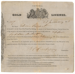
Document - Gold License, Gold License issued to Edwin Smart, 28/01/1853
... The headwaters of the Loddon River rise on the northern slopes of the Great Dividing Range east of Daylesford. The river rises below Musk near Trentham and Lyonville from where it heads northward to Glenlyon and on to Loddon Falls. ...The headwaters of the Loddon River rise on the northern slopes of the Great Dividing Range east of Daylesford. The river rises below Musk near Trentham and Lyonville from where it heads northward to Glenlyon and on to Loddon Falls. ...The Old Colonists Association Minute Book records: 'James Smart presented the Association with a Gold Diggers License dated 28th January 1853, it being resolved a vote of thanks be recorded.' The headwaters of the Loddon River rise on the northern slopes of the Great Dividing Range east of Daylesford. The river rises below Musk near Trentham and Lyonville from where it heads northward to Glenlyon and on to Loddon Falls. It then flows generally northward through Guildford and Newstead, 40 kilometres (25 mi) west of Bendigo, then towards the Murray River. The Upper Loddon Plains is within the traditional lands of the Dja Dja Wurrung people.Gold License issued to Edwin Smart on 28 January 1853 at the Upper Loddon.gold license, edwin smart, gold mining, james smart, upper loddon -
 Marysville & District Historical Society
Book, Steavenson Falls-Cumberland Valley Beauty Spot Scenic Reserve Committee of Management, The Big Culvert, 1992
... ./ Some levels of elevation top the 4000 ft. mark, as it is part of the Great Dividing/Range in Victoria. I have collected just a few aspects of early times and would like/ to say thanks for the encouragement I have received, to write about one of my/ favourite subjects./ Ann Thomas With Best Wishes / Ann Thomas / 12.7.92 Stamp of Marysville & District / Historical Society Inc / P.O. ..../ Some levels of elevation top the 4000 ft. mark, as it is part of the Great Dividing/Range in Victoria. I have collected just a few aspects of early times and would like/ to say thanks for the encouragement I have received, to write about one of my/ favourite subjects./ Ann Thomas With Best Wishes / Ann Thomas / 12.7.92 Stamp of Marysville & District / Historical Society Inc / P.O. ...A history of the Big Culvert in the Cumberland Reserve and its link to the Yarra TrackPaperback. Front cover has an old photograph of the big culvert.Marysville, Vic. 3779./ January, 1992. Dear Reader,/ I hope you'll enjoy sharing with me an account of some of the excitement and/ drama of events through history on the old Yarra Track. This Reserve is, of course,/ in the heart of one of the world's great hardwood forests, where generations of my/ family have lived and worked./ Some levels of elevation top the 4000 ft. mark, as it is part of the Great Dividing/Range in Victoria. I have collected just a few aspects of early times and would like/ to say thanks for the encouragement I have received, to write about one of my/ favourite subjects./ Ann Thomas With Best Wishes / Ann Thomas / 12.7.92 Stamp of Marysville & District / Historical Society Inc / P.O. Box 22 / Marysville 3779big culvert, cumberland reserve, yarra track, victoria, history -
 Marysville & District Historical Society
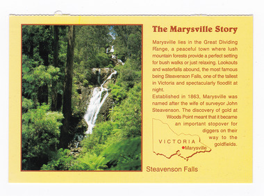
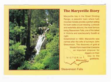
Postcard (item) - Colour postcard, Neil Cutts, The Marysville Story-Steavenson Falls, Pre 2009
... The Marysville Story/ Marysville lies in the Great Dividing/ Range, a peaceful town where lush/ mountain forests provide a perfect setting/ for bush walks or just relaxing. ...Rose Series Postcard No. 3530. marysville steavenson falls victoria postcard souvenir rose stereograph co 3530 john steavenson The Marysville Story/ Marysville lies in the Great Dividing/ Range, a peaceful town where lush/ mountain forests provide a perfect setting/ for bush walks or just relaxing. ...A postcard in a series produced by the Rose Stereograph Company in Victoria, Australia as a souvenir of Marysville.A colour photograph of Steavenson Falls in Marysville, Victoria. The Steavenson Falls is named after the Victorian Assistant Commissioner of Roads and Bridges, John Steavenson, who arrived in Victoria in the early 1860s. At 84 metres high, Steavenson Falls is Victoria's tallest cascading waterfall. The falls are split into roughly five cascades, with the last of these plunging into a small, picturesque rock pool. Rose Series Postcard No. 3530. The Marysville Story/ Marysville lies in the Great Dividing/ Range, a peaceful town where lush/ mountain forests provide a perfect setting/ for bush walks or just relaxing. Lookouts/ and waterfalls abound, the most famous/ being Steavenson Falls, one of the tallest/ in Victoria and spectacularly floodlit at/ night./ Established in 1863, Marysville was/ named after the wife of surveyor John/ Steavenson. The discovery of gold at/ Woods Point meant that it became/ an important stopover for/ diggers on their/ way to the/ goldfields. Steavenson Falls POST CARD The "Rose" Series/ De Luxe Proudly Printed in/ Australia Since 1880 AFFIX/ STAMP/HERE/ Rose Series/ Post Card No./ 3530 ADDRESS/ POSTCODE the MARYSVILLE STORY & Steavenson Falls/ MARYSVILLE, VICTORIA, AUSTRALIA/ Photo Neil Cutts Copyright Rose Stereograph Co., Glen Waverley, Victoria (03) 9560 7772marysville, steavenson falls, victoria, postcard, souvenir, rose stereograph co, 3530, john steavenson -
 Marysville & District Historical Society
Postcard (item) - Colour postcard, Neil Cutts, The Marysville Story-Steavenson Falls, Pre 2009
... The Marysville Story/ Marysville lies in the Great Dividing/ Range, a peaceful town where lush/ mountain forests provide a perfect setting/ for bush walks or just relaxing. ...The Rose Series postcard No. 3530. marysville steavenson falls victoria postcard souvenir rose stereograph co 3530 john steavenson The Marysville Story/ Marysville lies in the Great Dividing/ Range, a peaceful town where lush/ mountain forests provide a perfect setting/ for bush walks or just relaxing. ...A postcard in a series produced by the Rose Stereograph Company in Victoria, Australia as a souvenir of Marysville.A colour photograph of Steavenson Falls in Marysville, Victoria. The Steavenson Falls is named after the Victorian Assistant Commissioner of Roads and Bridges, John Steavenson, who arrived in Victoria in the early 1860s. At 84 metres high, Steavenson Falls is Victoria's tallest cascading waterfall. The falls are split into roughly five cascades, with the last of these plunging into a small, picturesque rock pool. The Rose Series postcard No. 3530. The Marysville Story/ Marysville lies in the Great Dividing/ Range, a peaceful town where lush/ mountain forests provide a perfect setting/ for bush walks or just relaxing. Lookouts/ and waterfalls abound, the most famous/ being Steavenson Falls, one of the tallest/ in Victoria and spectacularly floodlit at/ night./ Established in 1863, Marysville was/ named after the wife of surveyor John/ Steavenson. The discovery of gold at/ Woods Point meant that it became/ an important stopover for/ diggers on their/ way to the/ goldfields. Steavenson Falls POST CARD The "Rose" Series/ De Luxe Proudly Printed in/ Australia Since 1880 AFFIX/ STAMP/HERE/ Rose Series/ Post Card No./ 3530 ADDRESS/ POSTCODE the MARYSVILLE STORY & Steavenson Falls/ MARYSVILLE, VICTORIA, AUSTRALIA/ Photo Neil Cutts Copyright Rose Stereograph Co., Glen Waverley, Victoria (03) 9560 7772marysville, steavenson falls, victoria, postcard, souvenir, rose stereograph co, 3530, john steavenson -
 Wooragee Landcare Group
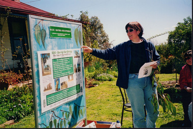
Photograph, 5 September 2004
... The Tatong Tavern is an old English style pub situated in the foothills of the Great Dividing Range the small community of Tatong 23km south-east of Benalla. ...The Tatong Tavern is an old English style pub situated in the foothills of the Great Dividing Range the small community of Tatong 23km south-east of Benalla. ...Wooragee Landcare Group took a bus trip Sunday 5th September to Samaria, Tatong area (near Benalla) to look at land use on small farms. Around this time, Wooragee Landcare were looking into how small land holders could run some enterprises. This photo was taken at Tatong Tavern where the group had lunch. The Tatong Tavern is an old English style pub situated in the foothills of the Great Dividing Range the small community of Tatong 23km south-east of Benalla. The original weatherboard hotel was originally built in the 1880s by William Worrall who was listed as Hotel Keeper from 1886 to 1910. It was destroyed by fire in 1923 and replaced by the current building, which has undergone many changes over the past 100 years. The name has also changed from the Tatong Hotel or ‘Pub’ to the current name of Tatong Tavern.Tatong is a rural village in north-east Victoria, set in undulating country that rises southwards to the Tolmie ranges. The name is thought to derive from an Aboriginal expression, possibly referring to something unseen. The Tatong pastoral run was taken up in 1847 and farm selections began in the 1870s. A school opened in 1890 (closed in 2006). Dairy herds were grazed on the Tatong flats and a cooperative creamery operated from 1892 until 1918. In 1914 a branch railway line was opened from Benalla to Tatong that carried farm produce and timber to Tatong, which had two sawmills in the 1920s. There was also a general store, a police station, and a livestock trucking yard. St Albans Church of England was built in 1921. Most of those buildings have now disappeared. The Tatong Tavern along with the Hall built in 1904 are the only remaining buildings. The Tatong Tavern is a significant tangible and visual representation of the area’s cultural and social history over the past 100 years. Coloured rectangular photograph printed on paperReverse: WAN NA E0NA2N2. NNN- 14240/ (No. 20) 373/ tatong, tatong pub, tatong tavern, tolmie ranges, tatong flats, benalla, wooragee landcare, wooragee landcare group, bus trip, samaria, land use, william worrall, 1800s, 2004, mount samaria -
 Ringwood and District Historical Society
Map, Partially Trimmed Copy of Ringwood Heights Estate, Ringwood, Vic. - circa 1923
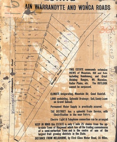
... Captions - This Estate commands extensive views of mountain, hill and dale including Dandenong and Great Dividing Ranges, Mt. Macedon, Keilor Plains, etc. ...Captions - This Estate commands extensive views of mountain, hill and dale including Dandenong and Great Dividing Ranges, Mt. Macedon, Keilor Plains, etc. ...Clipped copy of a subdivision advertisement on cardboard backing. Sales notations on numbered allotments in Andersons's Creek Road (later Warrandyte Road) and Wonga Road, Ringwood. Handwritten title reference - LP7305. Captions - This Estate commands extensive views of mountain, hill and dale including Dandenong and Great Dividing Ranges, Mt. Macedon, Keilor Plains, etc. The outlook cannot be surpassed. Climate invigorating, mountain air, good rainfall. Land undulating, splendid drainage; soil, sandy loam on gravel subsoil. Permanent water supply is practically assured. The district has a splendid train service, with electrification in the near future. Electric light & telephone connection can be arranged. Keep in mind this estate is only 1 mile 25 chains from the up-to-date town of Ringwood which has all the trading conveniences of a semi-suburban town and is the centre of one of the largest fruit growing districts in the state. Distance from Melbourne by first class motor road, 16 miles. -
![Junction of the River Watt and Contentment Creek / [by] Nicholas Caire, circa 1876](/media/collectors/550653872162f11fb04854aa/items/57760437d0cdd10a5c49fc3e/item-media/57760510d0cdd10a5c4a8f9c/item-fit-380x285.jpg?cb=6) Kew Historical Society Inc
Kew Historical Society IncPhotograph, Anglo-Australasian Photographic Company, Junction of the River Watt and Contentment Creek, c. 1876
... Munda (3,500 feet high), 4 miles distant, from which place / visitors can see the Australian Alps, in all their mighty grandeur, stretching for hundreds of miles on either side, / and, as far as the eye can reach, impressing a beholder with the appropriateness of their title, being that of the Great Dividing Range. printed in ink on support reverse l.c.l.: J.W. ...Munda (3,500 feet high), 4 miles distant, from which place / visitors can see the Australian Alps, in all their mighty grandeur, stretching for hundreds of miles on either side, / and, as far as the eye can reach, impressing a beholder with the appropriateness of their title, being that of the Great Dividing Range. printed in ink on support reverse l.c.l.: J.W. ...Nicholas Caire was born on Guernsey in the Channel Islands in 1837. He arrived in Adelaide with his parents in about 1860. In 1867, following photographic journeys in Gippsland, he opened a studio in Adelaide. From 1870 to 1876 he lived and worked in Talbot in Central Victoria. In 1876 he purchased T. F. Chuck's studios in the Royal Arcade Melbourne. In 1885, following the introduction of dry plate photography, he began a series of landscape series, which were commercially successful. As a photographer, he travelled extensively through Victoria, photographing places few of his contemporaries had previously seen. He died in 1918. Reference: Jack Cato, 'Caire, Nicholas John (1837–1918)', Australian Dictionary of Biography.An original, rare photograph from the series 'Views of Victoria: General Series' by the photographer, Nicholas Caire (1837-1918). The series of 60 photographs that comprise the series was issued c. 1876 and reinforced a neo-Romantic view of the Australian landscape to which a growing nationalist movement would respond. Nicholas Caire was active as a photographer in Australia from 1858 until his death in 1918. His vision of the Australian bush and pioneer life had a counterpart in the works of Henry Lawson and other nationalist poets, authors and painters.Albumen Silver Photograph, mounted on Board. printed in ink on support l.c.: JUNCTION OF THE RIVER WATT AND CONTENTMENT CREEK. / COPYRIGHT REGISTERED. printed in ink on support reverse c.: VIEWS OF VICTORIA. / (GENERAL SERIES.) / No. 1. / JUNCTION OF THE RIVER WATT AND CONTENTMENT CREEK. / This scene is situated about two miles to the westward of Fernshawe, a small but extremely romantic township. / The river, at this juncture, is crossed by a fallen tree, as may be seen in the illustration. The track which is seen on / the opposite side of the river leads to the summit of Mt. Munda (3,500 feet high), 4 miles distant, from which place / visitors can see the Australian Alps, in all their mighty grandeur, stretching for hundreds of miles on either side, / and, as far as the eye can reach, impressing a beholder with the appropriateness of their title, being that of the Great Dividing Range. printed in ink on support reverse l.c.l.: J.W. FORBES, Agent, printed in ink on support reverse l.c.: ANGLO-AUSTRALASIAN PHOTOGRAPHIC COMPANY, MELBOURNE. printed in ink on support reverse l.c.r.: 10 Temple Court, Collins Street West.nicholas caire, views of victoria - general series, landscape photography -
 Bendigo Historical Society Inc.
Newspaper - Fortuna Article - "Historic Building has Varied Past", Jul 25 2008
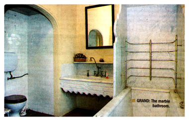
... By 1938, the property was in disrepair but avoided demolition.In 1942, the Australian military sought a secure location for map printing and storage north of the Great Dividing Range. The Commonwealth acquired a lease on Fortuna, and Army tradesmen made alterations. ...By 1938, the property was in disrepair but avoided demolition.In 1942, the Australian military sought a secure location for map printing and storage north of the Great Dividing Range. The Commonwealth acquired a lease on Fortuna, and Army tradesmen made alterations. ...Built in 1856 by J.T.C. Balderstedt as an eight-room, two-storey red brick house near the New Chum gold reef. Extended in 1869 with a three-room gabled wing. Surrounded by ornate gardens and a masonry wall, overlooking gold mining operations. Purchased by George Lansell in 1871 for 20,000 pounds. Lansell made significant additions and modifications; he died in 1906. By 1938, the property was in disrepair but avoided demolition.In 1942, the Australian military sought a secure location for map printing and storage north of the Great Dividing Range. The Commonwealth acquired a lease on Fortuna, and Army tradesmen made alterations. Major Sari and 150 men arrived in June 1942. The Australian Survey Corps and Women's Army Corps produced classified mapping documents during World War II. Purchased by the Commonwealth Government in 1951. The Royal Australian Survey Corps was disbanded in 1996.D efence Imagery and Geospatial Organisation (DIGO) was established in 2000 in Canberra and Bendigo to provide geospatial intelligence for defence.In 2004, it was announced that DIGO operations would remain in Bendigo but move from Fortuna. The Department of Defence plans to vacate Fortuna, with its future use undecided.History Lives Article - "Historic Building has Varied Past" - The Bendigo Weekly Friday Jul 25 2008 This item contains the following: 11217.15a Colour Photo of Fortuna Long Room 11217.15b Colour Photo of Fortuna Staircase 11217.15c Colour Photo of Fortuna Steps and Entrance 11217.15d Part of page 7 - Fortuna Refit Not an Easy Option 11217.15e Colour Photo of Fortuna Bathroom 11217.15f Colour Photo of Fortuna Entrance Pathnon-fictionbendigo, fortuna, george lansell, australian army survey corps