
Showing 91 items matching "first land sales"
-
 Ringwood and District Historical Society
Envelope, First land sales in Ringwood 1858
... First land sales in Ringwood 1858...First land sales in Ringwood 1858...First land sales in Ringwood 1858 First land sales in Ringwood 1858 Envelope ...First land sales in Ringwood 1858 -
 Whitehorse Historical Society Inc.
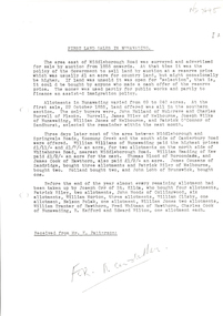
Document, First Land Sales in Nunawading, 1855
... First Land Sales in Nunawading...First land sales and prices in Nunawading....First land sales and prices in Nunawading. First Land Sales in Nunawading Document Document ...First land sales and prices in Nunawading.First land sales and prices in Nunawading.First land sales and prices in Nunawading.land sales, land subdivision, middleborough road, nunawading, koonung creek, canterbury road, whitehorse road, holland john, burrell charles, riley james, wilks joseph, springvale road, o'connor patrick, williams william, heading william, blood thomas, cook james, whitman fred, cook charles, kefford r, wilton edward, cousens james, riley patrick, lobb john, orr joseph, woods john, morton william, clisby william, polak nelson, tranter william -
 St Kilda Historical Society
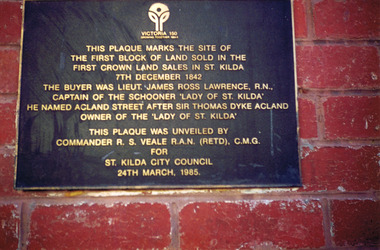
Photograph, Plaque marking the site of the first block of land sold in the first Crown Land Sales in St Kilda 7 Dec 1842, c. 1980s?
... Plaque marking the site of the first block of land sold in the first Crown Land Sales in St Kilda 7 Dec 1842...This plaque marks the site of the first block of land sold in the first Crown Land Sales in St Kilda 7 Dec 1842. ...This plaque marks the site of the first block of land sold in the first Crown Land Sales in St Kilda 7 Dec 1842. ...colour photograph unmounted (2 identical photographs)This plaque marks the site of the first block of land sold in the first Crown Land Sales in St Kilda 7 Dec 1842. The buyer was Lieut. James Ross Lawrence, R N, Captain of the Schooner 'Lady of St Kilda'. He named Acland st after Sir Thomas Dyke Acland, owner of "The Lady of St Kilda". This plaque was unveiled by Commander RS Veale RAN (retd) CMG for St Kilda City Council. 24 March 1985. -
 St Kilda Historical Society
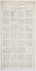
Plan - Melbourne, Plan of Town of Melbourne 1837 A.D, 1837 (original)
... Shows the outcome of the first land sales held in Melbourne, on 1 June and 1 November 1837. ...Photocopy of "Plan of Town of Melbourne 1837 A.D." showing first land sales....Shows the outcome of the first land sales held in Melbourne, on 1 June and 1 November 1837. ...Shows the outcome of the first land sales held in Melbourne, on 1 June and 1 November 1837. All the names and prices for each lot are displayed.Photocopy of "Plan of Town of Melbourne 1837 A.D." showing first land sales.All lots printed with name of buyer and price paid.melbourne - history, town of melbourne- 1837 -
Koorie Heritage Trust
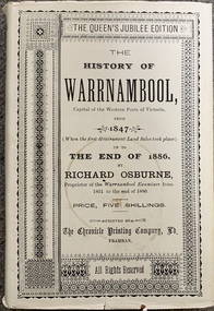
Book, Osburne, Richard, The history of Warrnambool, Capital of the Western Ports of Victoria, from 1847 (when the first Government Land Sales took place) up to the end of 1886, 1887
... The history of Warrnambool, Capital of the Western Ports of Victoria, from 1847 (when the first Government Land Sales took place) up to the end of 1886,...The history of Warrnambool, Capital of the Western Ports of Victoria, from 1847 (when the first Government Land Sales took place) up to the end of 1886, Book Osburne, Richard Chronicle Printing and Publishing Company ...A well documented account of many aspects of Warrnambool area from settlement to 1886. Chapter xii deals with the Framlingham Aboriginal Station. Including [1] folded leaf of plates containing a table.vii, 284 pages ; 19 cm.A well documented account of many aspects of Warrnambool area from settlement to 1886. Chapter xii deals with the Framlingham Aboriginal Station. Including [1] folded leaf of plates containing a table.warrnambool-history - 1847 - 1886., western district - victoria - history., aboriginals, victoria - history (1847-1886), framlingham - aboriginal station - history., massacres-history-warrnambool p.193-94 -
 Port Fairy Historical Society Museum and Archives
Book, Richard Osburne, The history of Warrnambool, capital of the western ports of Victoria, from 1847 (when the first government land sales took place) up to the end of 1886, 1980
... The history of Warrnambool, capital of the western ports of Victoria, from 1847 (when the first government land sales took place) up to the end of 1886 ...The history of Warrnambool, capital of the western ports of Victoria, from 1847 (when the first government land sales took place) up to the end of 1886 / by Richard Osburne /Fraser, Malcolm, 1930-2015, (author of introduction, etc.) ...The history of Warrnambool, capital of the western ports of Victoria, from 1847 (when the first government land sales took place) up to the end of 1886 / by Richard Osburne Other Authors, Fraser, Malcolm, 1930-2015, (author of introduction, etc.) Tylee Memorial Collection368 pages, unnumbered and folded leaves of plates : illustrations (some colour), maps, portraits, plans ; 19 cmnon-fictionThe history of Warrnambool, capital of the western ports of Victoria, from 1847 (when the first government land sales took place) up to the end of 1886 / by Richard Osburne Other Authors, Fraser, Malcolm, 1930-2015, (author of introduction, etc.) Tylee Memorial Collectionvictoria. warrnambool, 1847-1886. facsimiles, government policy - initial period and protectionism., settlement and contacts - 19th century., mining industry - gold., race relations - violent - massacres, religions - christianity - missions., warrnambool (vic.) -- history., framlingham / purnim (w vic sj54-11), demography - census data, book -
 Flagstaff Hill Maritime Museum and Village
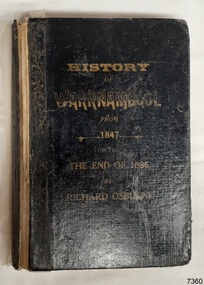
Book - Historical, Warrnambool, Richard Osburne, The History of Warrnambool, 1887
... ...First Government Land Sales...It spans fifty years of the history of Warrnambool from the time that the first Government Land Sales commenced. It also deliberately coincides with the 1887 celebrations of Queen Victoria's Jubilee Year of her ascension to the British Throne. ...The History of Warrnambool: Capital of the Western Ports of Victoria, From1847 up to the end of 1886 (when the first Government Land Sales took place) Author: Richard Osburne, "Proprietor of the Warrnambool Examiner from 1851 to the close of 1880" Publisher: The Chronicle Printing and Publishing Company Limited Date: 1887 (MDCCCLXXXVII) (Roman numerals are covered in tape) Edition: Original: Queen's Jubilee Edition Black fabric covered hardcover book with embossed gold titles on spine and front cover. ...It spans fifty years of the history of Warrnambool from the time that the first Government Land Sales commenced. It also deliberately coincides with the 1887 celebrations of Queen Victoria's Jubilee Year of her ascension to the British Throne. ...This copy of the book is personally signed and dated by the Curator of the first Warrnambool Museum, which was also the Warrnambool Public Library. This copy also has many hand written notes in the margins. This little book is one of only 1000 books published of the original Queen's Jubilee Edition. It spans fifty years of the history of Warrnambool from the time that the first Government Land Sales commenced. It also deliberately coincides with the 1887 celebrations of Queen Victoria's Jubilee Year of her ascension to the British Throne. The book is an invaluable reference for researchers of local Warrnambool history and has been used as a textbook and reference book for local students. After the closure of the Warrnambool Museum, the book was held by the Warrnambool City Council until, in 1974, it was transferred to the newly established Flagstaff Hill Maritime Museum and Village. The author, Richard Osburne, (1825-1895) was born in Australia. He moved to Warrnambool in 1847 as the first local Journalist. In 1851 he founded the Warrnambool Examiner newspaper which he operated until the end of 1880. Osburne was much involved in civic and community affairs of the town, and he set himself the task of recording the history of the city's early pioneers. In the introductory pages of the book the author refers to himself as "The Father of the Warrnambool Press". Only 1,000 copies of this edition of the book were printed. In September 1980 a facsimile edition was printed with the addition of illustrations from the period, an index and relevant annotations by local historian T.A. Wicking (Tom Wicking). This later book was named the Premier Town Edition, due to Warrnambool being awarded the title of Premier Town in Victoria in 1979-82 by the Premier of Victoria; it also received the inaugural award in 1959 and a later award in 1988-91.This book has strong significance for being signed in 1887 by Joseph Archibald, the Curator of the first museum and library in Warrnambool, the Warrnambool Museum. It is also significant for the annotations added to many of the pages, perhaps for the Facsimile edition that followed many years later. This book is rare. It is one of only 1000 copies printed, and one of three in the Collection of Flagstaff Hill Maritime Museum and Village. The book was dedicated to the early colonists as well as to the new arrivals by the writer, Richard Osburne, who entitles himself as "The father of the Warrnambool Press". The content of the book is invaluable as a reference for Warrnambool and District's local history in its early colonial and pioneering days. It provides the information that helps in an understanding the foundation that the city was built on, connecting the people of today to the pioneers of the past.The History of Warrnambool: Capital of the Western Ports of Victoria, From1847 up to the end of 1886 (when the first Government Land Sales took place) Author: Richard Osburne, "Proprietor of the Warrnambool Examiner from 1851 to the close of 1880" Publisher: The Chronicle Printing and Publishing Company Limited Date: 1887 (MDCCCLXXXVII) (Roman numerals are covered in tape) Edition: Original: Queen's Jubilee Edition Black fabric covered hardcover book with embossed gold titles on spine and front cover. Inscriptions include stamps and handwriting. It once belonged to the Warrnambool Public Museum and is signed by the first Curator, Joseph Archibald, in 1887. The first fly page has a message to the readers, as shown in the Inscriptions of this record. Many of the pages in this book have handwritten notes in the margins and within the text and some of the lines are crossed out.Handwritten: "Warrnambool Museum" Signed: "J Archibald / 1887" Stamped: "WARRNAMBOOL PUBLIC MUSEUM" Printed on fly page: "PRICE, FIVE SHILLINGS" First fly page: "THE QUEEN'S JUBILEE EDITION. TO OLD COLONISTS AND YOUNG AUSTRALIANS, OR NEW ARRIVALS, THIS HISTORY OF THE RISE AND PROGRESS OF THE CAPITAL OF WESTERN VICTORIA, IS DEDICATED AS INTERESTING AND USEFUL, BY "THE FATHER OF THE WARRNAMBOOL PRESS" RICHARD OSBURNE."warrnambool, shipwreck coast, flagstaff hill, maritime museum, maritime village, the history of warrnambool, richard osburne, osturne's history of warrnambool, queen's jubilee edition, 1847-1887, warrnambool history, the chronicle printing and publishing company, capital of the western ports of victoria, first government land sales, warrnambool examiner, five shillings, warrnambool's first reporter, warrnambool public library, 1887, 1979, premier town, premier edition, queen's jubliee, queen victoria's jubilee, western ports of victoria, 1847, government land sales, chronicle publishing and printing co., 1000 copies, t a wicking, old colonists, young australians, new arrivals, rise and progress, capital of western victoria, interesting and useful, the father of the warrnambool press -
 Flagstaff Hill Maritime Museum and Village
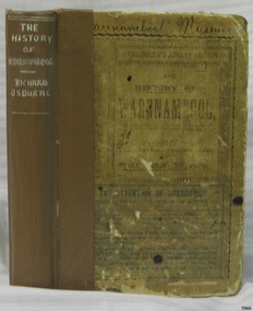
Book - Historical, Warrnambool, Richard Osburne, The History of Warrnambool, 1887
... ...First Government Land Sales...It spans fifty years of the history of Warrnambool from the time that the first Government Land Sales commenced. It also deliberately coincides with the 1887 celebrations of Queen Victoria's Jubilee Year of her ascension to the British Throne. ...The History of Warrnambool: Capital of the Western Ports of Victoria, From1847 up to the end of 1886 (when the first Government Land Sales took place) Author: Richard Osburne, "Proprietor of the Warrnambool Examiner from 1851 to the close of 1880" Publisher: The Chronicle Printing and Publishing Company Limited Date: 1887 (MDCCCLXXXVII) (Roman numerals are covered in tape) Edition: Original: Queen's Jubilee Edition Hardcover book with titles on the spine and front cover. ...It spans fifty years of the history of Warrnambool from the time that the first Government Land Sales commenced. It also deliberately coincides with the 1887 celebrations of Queen Victoria's Jubilee Year of her ascension to the British Throne. ...This little book is one of only 1000 books published of the original Queen's Jubilee Edition. It spans fifty years of the history of Warrnambool from the time that the first Government Land Sales commenced. It also deliberately coincides with the 1887 celebrations of Queen Victoria's Jubilee Year of her ascension to the British Throne. The book is an invaluable reference for researchers of local Warrnambool history and has been used as a textbook and reference book for local students. The book became part of the Warrnambool Public Library, and when the library closed down, the book was held by the Warrnambool City Council until, in 1974, it was transferred to the newly established Flagstaff Hill Maritime Museum and Village. The author, Richard Osburne, (1825-1895) was born in Australia. He moved to Warrnambool in 1847 as the first local Journalist. In 1851 he founded the Warrnambool Examiner newspaper which he operated until the end of 1880. Osburne was much involved in civic and community affairs of the town, and he set himself the task of recording the history of the city's early pioneers. In the introductory pages of the book the author refers to himself as "The Father of the Warrnambool Press". Only 1,000 copies of this edition of the book were printed. In September 1980 a facsimile edition was printed with the addition of illustrations from the period, an index and relevant annotations by local historian T.A. Wicking (Tom Wicking). This later book was named the Premier Town Edition, due to Warrnambool being awarded the title of Premier Town in Victoria in 1979-82 by the Premier of Victoria; it also received the inaugural award in 1959 and a later award in 1988-91.This book is rare. It is one of only 1000 copies printed, and one of three in the Collection of Flagstaff Hill Maritime Museum and Village. The book was dedicated to the early colonists as well as to the new arrivals by the writer, Richard Osburne, who entitles himself as "The father of the Warrnambool Press". The content of the book is invaluable as a reference for Warrnambool and District's local history in its early colonial and pioneering days. It provides the information that helps in an understanding the foundation that the city was built on, connecting the people of today to the pioneers of the past.The History of Warrnambool: Capital of the Western Ports of Victoria, From1847 up to the end of 1886 (when the first Government Land Sales took place) Author: Richard Osburne, "Proprietor of the Warrnambool Examiner from 1851 to the close of 1880" Publisher: The Chronicle Printing and Publishing Company Limited Date: 1887 (MDCCCLXXXVII) (Roman numerals are covered in tape) Edition: Original: Queen's Jubilee Edition Hardcover book with titles on the spine and front cover. The front and back covers have been coated in a clear substance, the spine has fabric reinforcing with titles handwritten in white. Inscriptions include stamps and handwriting. A library label has been pasted onto the front cover, then the cover has been lacquered. The first fly page has a message to the readers, as shown in the Inscriptions of this record. Many of the pages in this book have handwritten notes in the margins and within the text and some of the lines are crossed out.The Pastedown front endpaper has a sticker from Warrnambool Mechanics Institute and Free Library Front loose endpaper has a stamp from "Warrnambool Mechanics Institute" Handwritten Iin black pen on from cover are the words "Warrnambool Museum" Label on the front cover: "THE ATTENTION OF SUBSCRIBERS ..."warrnambool, shipwreck coast, flagstaff hill, maritime museum, maritime village, the history of warrnambool, richard osburne, osturne's history of warrnambool, queen's jubilee edition, 1847-1887, warrnambool history, the chronicle printing and publishing company, capital of the western ports of victoria, first government land sales, warrnambool examiner, five shillings, warrnambool's first reporter, warrnambool public library, 1887, 1979, premier town, premier edition, queen's jubliee, queen victoria's jubilee, western ports of victoria, 1847, government land sales, chronicle publishing and printing co., 1000 copies, old colonists, young australians, new arrivals, rise and progress, capital of western victoria, interesting and useful, the father of the warrnambool press -
 Flagstaff Hill Maritime Museum and Village
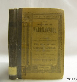
Book - Historical, Warrnambool, Richard Osburne, The History of Warrnambool, 1887
... ...First Government Land Sales...It spans fifty years of the history of Warrnambool from the time that the first Government Land Sales commenced. It also deliberately coincides with the 1887 celebrations of Queen Victoria's Jubilee Year of her ascension to the British Throne. ...The History of Warrnambool: Capital of the Western Ports of Victoria From1847 (when the first Government Land Sales took place) up to the end of 1886, By Richard Osburne, Proprietor of the Warrnambool Examiner from 1851 to the close of 1880. ...It spans fifty years of the history of Warrnambool from the time that the first Government Land Sales commenced. It also deliberately coincides with the 1887 celebrations of Queen Victoria's Jubilee Year of her ascension to the British Throne. ...This little book is one of only 1000 books published of the original Queen's Jubilee Edition. It spans fifty years of the history of Warrnambool from the time that the first Government Land Sales commenced. It also deliberately coincides with the 1887 celebrations of Queen Victoria's Jubilee Year of her ascension to the British Throne. The book is an invaluable reference for researchers of local Warrnambool history and has been used as a text book and reference book for local students. The book had two owners before it became part of the Warrnambool Public Library, and when the library closed down, the book was held by the Warrnambool City Council until, in 1974, it was transferred to the newly established Flagstaff Hill Maritime Museum and Village. The author, Richard Osburne, (1825-1895) was born in Australia. He moved to Warrnambool in 1847 as the first local Journalist. In 1851 he founded the Warrnambool Examiner newspaper which he operated until the end of 1880. Osburne was much involved in civic and community affairs of the town, and he set himself the task of recording the history of the city's early pioneers. In the introductory pages of the book the author refers to himself as "The Father of the Warrnambool Press". Only 1,000 copies of this edition of the book were printed. In September 1980 a facsimile edition was printed with the addition of illustrations from the period, an index and relevant annotations by local historian T.A. Wicking (Tom Wicking). This later book was named the Premier Town Edition, due to Warrnambool being awarded the title of Premier Town in Victoria in 1979-82 by the Premier of Victoria; it also received the inaugural award in 1959 and a later award in 1988-91. This book is rare. It is one of only 1000 copies printed, and one of three in the Collection of Flagstaff Hill Maritime Museum and Village. The book was dedicated to the early colonists as well as to the new arrivals by the writer, Richard Osburne, who entitles himself as "The father of the Warrnambool Press". The content of the book is invaluable as a reference for Warrnambool and District's local history in its early colonial and pioneering days. It provides the information that helps in an understanding the foundation that the city was built on, connecting the people of today to the pioneers of the past. The inscriptions of two previous owners of the book, at least one of whom was a local resident, gives additional significance to this copy. The History of Warrnambool: Capital of the Western Ports of Victoria From1847 (when the first Government Land Sales took place) up to the end of 1886, By Richard Osburne, Proprietor of the Warrnambool Examiner from 1851 to the close of 1880. Author: Richard Osburne Publisher: Prahran: The Chronicle Printing & Publishing Company Limited Date: 1887 (MDCCCLXXXVII) Edition: Original: Queen's Jubilee Edition Small book with hard cover and reinforced spine. Dust jacket front has been pasted over front hard cover. The hardcovers are covered with clear adhesive plastic covering. Inscriptions include a typed label on the spine, a stamp at base of the fly page, on the loose page inside front cover, on inside back cover, and two hand written names on the second fly page; Jackson Giblett and G. M. Potter. The first fly page has a message to the readers, as shown in the Inscriptions of this record.Label on spine "R.A. 994.57 OSB" Inscriptions on second fly page: "Jackson Giblett / 1886" and "G.M. Potter, 70 Japan Street" Printed on fly page: "PRICE, FIVE SHILLINGS" Stamp of front end paper: WARRNAMBOOL / PUBLIC LIBRARY", "000336" and in a rectangular border " - - - - - - / WARRNAMBOOL / PUBLIC LIBRARY" First fly page: "THE QUEEN'S JUBILEE EDITION. TO OLD COLONISTS AND YOUNG AUSTRALIANS, OR NEW ARRIVALS, THIS HISTORY OF THE RISE AND PROGRESS OF THE CAPITAL OF WESTERN VICTORIA, IS DEDICATED AS INTERESTING AND USEFUL, BY "THE FATHER OF THE WARRNAMBOOL PRESS" RICHARD OSBURNE." Stamp inside back cover: "WARRNAMBOOL LIBRARY/ Liebig Street / Warrnambool 3280 / (055) 6- 2258"warrnambool, shipwreck coast, flagstaff hill, maritime museum, maritime village, the history of warrnambool, richard osburne, osturne's history of warrnambool, queen's jubilee edition, 1847-1887, warrnambool history, the chronicle printing and publishing company, capital of the western ports of victoria, first government land sales, warrnambool examiner, five shillings, warrnambool's first reporter, warrnambool public library, 1887, 1979, premier town, premier edition, queen's jubliee, queen victoria's jubilee, western ports of victoria, 1847, government land sales, chronicle publishing and printing co., g m potter, 1000 copies, t a wicking, jackson giblett, 1886, japan street, old colonists, young australians, new arrivals, rise and progress, capital of western victoria, interesting and useful, the father of the warrnambool press -
 Surrey Hills Historical Society Collection
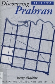
Book, Discovery Prahran - Area Two, 1999
... This booklet provides a general picture of Prahran as it developed from the first Crown land sales of 1840 to its amalgamation with the City of Malvern in 1994...This booklet provides a general picture of Prahran as it developed from the first Crown land sales of 1840 to its amalgamation with the City of Malvern in 1994...This booklet provides a general picture of Prahran as it developed from the first Crown land sales of 1840 to its amalgamation with the City of Malvern in 1994 prahran (vic) - history toorak (vic) - history armadale (vic) - history (Ms) Betty Malone This booklet provides a general picture of Prahran as it developed from the first Crown land sales of 1840 to its amalgamation with the City of Malvern in 1994 Discovery Prahran - Area Two Book Prahran Historical & Arts Society Inc. ...This booklet provides a general picture of Prahran as it developed from the first Crown land sales of 1840 to its amalgamation with the City of Malvern in 1994This booklet provides a general picture of Prahran as it developed from the first Crown land sales of 1840 to its amalgamation with the City of Malvern in 1994prahran (vic) - history, toorak (vic) - history, armadale (vic) - history, (ms) betty malone -
Dandenong & District Historical Society
Book - Berwick Nostalgia, Berwick Nostalgia- The Berwick-Pakenham Historical Society, 19 August 2026
... ...First Land sales...Berwick - 157 years of History including Shire Premises, Post Office, Shire Halls, Farming in the area, Berwick campus of Monash University, Nostalgic Look & Pictorial History of Berwick Education Farming First Land sales First building of homes Book Title front Cover & Ayrshire Cattle Adverst on back cover 4 Colour Process front Cover - Black Printed back cover Adverts for 1915 Berwick Nostalgia- The Berwick-Pakenham Historical Society Book Berwick Nostalgia ...4 Colour Process front Cover - Black Printed back cover Adverts for 1915non-fictioneducation, farming, first land sales, first building of homes -
Port Melbourne Historical & Preservation Society
Document, "Plan of Town of Melbourne 1837 A.D.", 1937
... Also showing first land sales, historical memoranda, and an alphabetical list of purchases....Also showing first land sales, historical memoranda, and an alphabetical list of purchases. ...Photocopy of "Plan of Town of Melbourne 1837 A.D." Also showing first land sales, historical memoranda, and an alphabetical list of purchases.town planning, town of melbourne -
 Kew Historical Society Inc
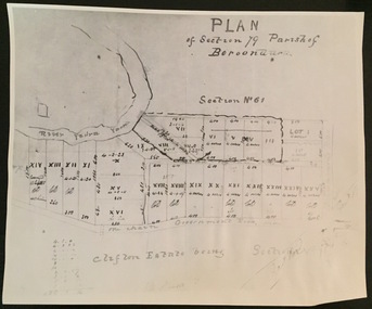
Print - Subdivision Plan (copy), Plan of Section 79 Parish of Boroondara (Clifton Estate), Nineteenth Century
... The numbered lots represent the first land sales in Kew in the area north of Studley Park Road....The numbered lots represent the first land sales in Kew in the area north of Studley Park Road. ...This work forms part of the collection assembled by the historian Dorothy Rogers, that was donated to the Kew Historical Society by her son John Rogers in 2015. The manuscripts, photographs, maps, and documents were sourced by her from both family and local collections or produced as references for her print publications. Many were directly used by Rogers in writing ‘Lovely Old Homes of Kew’ (1961) and 'A History of Kew' (1973), or the numerous articles on local history that she produced for suburban newspapers. Most of the photographs in the collection include detailed annotations in her hand. The Rogers Collection provides a comprehensive insight into the working habits of a historian in the 1960s and 1970s. Together it forms the largest privately-donated collection within the archives of the Kew Historical Society.A photographic reproduction of a plan in the Vale Collection of the State Library of Victoria. The numbered lots represent the first land sales in Kew in the area north of Studley Park Road.maps (kew), plan of section 79 parish of boroondara -
 Bendigo Historical Society Inc.
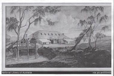
Photograph - BENDIGO POST OFFICE 1854
... Photo: copy of photo of first Bendigo Post Office and Survey Office, located corner of Mitchell and Pall Mall. Building constructed by John Pyke, land purchased for 1800 pounds in first land sales. ...BENDIGO Buildings post office and survey office Photo: copy of photo of first Bendigo Post Office and Survey Office, located corner of Mitchell and Pall Mall. Building constructed by John Pyke, land purchased for 1800 pounds in first land sales. ...Photo: copy of photo of first Bendigo Post Office and Survey Office, located corner of Mitchell and Pall Mall. Building constructed by John Pyke, land purchased for 1800 pounds in first land sales. Source of information: Dr. Ralph Birrell. This reproduction is the property of the National Library of Australia, and is not for reproduction in any form apart from for research.bendigo, buildings, post office and survey office -
 Surrey Hills Historical Society Collection
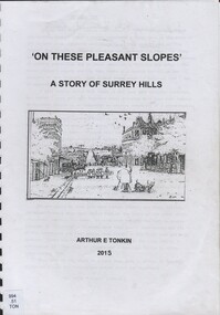
Book, On these pleasant slope's: a story of Surrey Hills, 2015
... Includes: First settlers, location, early land sales, commerce and trade....Includes: First settlers, location, early land sales, commerce and trade....Includes: First settlers, location, early land sales, commerce and trade. ...Sourced via conversations with those interested in Surrey Hills History. Including Alan Holt, Jack McLean, Frank Bamford, Jocelyn Hall. Includes: Topographical maps, first Elgar Survey. First Wesleyan Church in Surrey Hills. Bibliography on P.50 (last numbered page) Provides a chronological history of Surrey Hills. Includes: First settlers, location, early land sales, commerce and trade.Provides a chronological history of Surrey Hills. Includes: First settlers, location, early land sales, commerce and trade.Back of Title page: To the Surrey Hills Historical / Arthur E. Tonkinfreehold investment and banking company, windsor park estate, (mr) dennis delany, mont albert village, surrey hills - history, royal hotel, surrey hills, humberstone's hotel, chatham state school, holy trinity church, lydswood, lugano, (mr) john butler maling, (mr) john hanlon knipe, mont albert primary school, (mr) james sneddon, (mr) arthur tonkin -
 Bendigo Historical Society Inc.
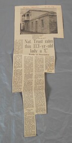
Newspaper - Lydia Chancellor collection: Specimen cottage
... He purchased the land at the first land sales in 1854. It is possibly the earliest building still standing in Bendigo. ...He purchased the land at the first land sales in 1854. It is possibly the earliest building still standing in Bendigo. ...Specimen Cottage in Hargreaves Street Bendigo was built by stonemason James Brierley in 1856. He purchased the land at the first land sales in 1854. It is possibly the earliest building still standing in Bendigo. Further information "Written in Stone - The Story of pioneer Bendigo Stonemason James Brierley and his family" Written by Barbara Poustie. Published in 2017. Printed by Bendigo Historical Society.Bendigo advertiser from 04/10/1969. Article titled: Nat. Trust rates this 113 years old lady a "C" details the history of Specimen cottage. In red pen Bendigo Advertiser 4-10-69bendigo building, specimen cottage, james brierly, national trust -
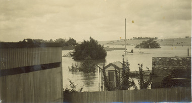 Kew Historical Society Inc
Photograph - Flooding of the Yarra River in North Kew, 1934
... Prior to urban development, the area since European settlement and the first land sales in the district in the 1840s, had been used for dairy farming. ...Prior to urban development, the area since European settlement and the first land sales in the district in the 1840s, had been used for dairy farming. yarra river -- north kew floods -- yarra valley floods -- north kew floods -- 1929 floods -- 1934 natural disasters -- kew Verso: 2/12/34 / TAKEN FROM OUR RAMP Small sepia snapshot taken from the river ramp of a house at 8 Kellett Grove, in what was then known as North Kew. ...North Kew, now divided between Kew and Kew East, bordered the Yarra River. As such, it was a region subject to flooding in the Yarra Valley. Development beyond this point (ie Kellett Grove) was limited by the City of Kew's planning regulations. Prior to urban development, the area since European settlement and the first land sales in the district in the 1840s, had been used for dairy farming. Small sepia snapshot taken from the river ramp of a house at 8 Kellett Grove, in what was then known as North Kew. The point of view is from a backyard looking towards Fairfield. Beyond the fence line are two almost submerged houses. A number of people are in a motor driven boat midstream. Fairfield at this period, (ie 1934) was noted for its limited river side development. Verso: 2/12/34 / TAKEN FROM OUR RAMPyarra river -- north kew, floods -- yarra valley, floods -- north kew, floods -- 1929, floods -- 1934, natural disasters -- kew -
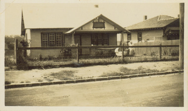 Kew Historical Society Inc
Photograph - 8 Kellett Grove, North Kew, 1929
... Prior to urban development, the area since European settlement and the first land sales in the district in the 1840s, had been used for dairy farming. ...Prior to urban development, the area since European settlement and the first land sales in the district in the 1840s, had been used for dairy farming. 8 Kellett Gove -- North Kew Californian bungalows Houses -- Kellett Grove -- Kew (Vic.) ...North Kew, now divided between Kew and Kew East, bordered the Yarra River. As such, it was a region subject to flooding in the Yarra Valley. Development beyond this point (ie Kellett Grove) was limited by the City of Kew's planning regulations. Prior to urban development, the area since European settlement and the first land sales in the district in the 1840s, had been used for dairy farming. Small sepia snapshot taken of the front of 8 Kellett Grove, in what was then known as North Kew. Verso: 8 KELLETT GROVE / NORTH KEW / 1929 / 418 kellett gove -- north kew, californian bungalows, houses -- kellett grove -- kew (vic.) -
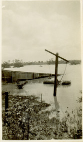 Kew Historical Society Inc
Photograph - Flooding of the Yarra River in North Kew, 1934
... Prior to urban development, the area since European settlement and the first land sales in the district in the 1840s, had been used for dairy farming. ...Prior to urban development, the area since European settlement and the first land sales in the district in the 1840s, had been used for dairy farming. yarra river -- north kew floods -- yarra valley floods -- north kew floods -- 1934 natural disasters -- kew Verso: BACKYARD NTH. ...North Kew, now divided between Kew and Kew East, bordered the Yarra River. As such, it was a region subject to flooding in the Yarra Valley. Development beyond this point (ie Kellett Grove) was limited by the City of Kew's planning regulations. Prior to urban development, the area since European settlement and the first land sales in the district in the 1840s, had been used for dairy farming. Small sepia snapshot taken from the back yard of a house at 8 Kellett Grove, in what was then known as North Kew. The point of view is from a backyard looking towards Fairfield. Floodwaters have submerged the fence and a clothes line. Verso: BACKYARD NTH. KEWyarra river -- north kew, floods -- yarra valley, floods -- north kew, floods -- 1934, natural disasters -- kew -
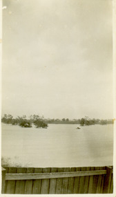 Kew Historical Society Inc
Photograph - Flooding of the Yarra River in North Kew, 1934
... Prior to urban development, the area since European settlement and the first land sales in the district in the 1840s, had been used for dairy farming. ...Prior to urban development, the area since European settlement and the first land sales in the district in the 1840s, had been used for dairy farming. yarra river -- north kew floods -- yarra valley floods -- north kew floods -- 1934 natural disasters -- kew Verso: 8 KELLETT GROVE Small sepia snapshot taken from the back yard of a house at 8 Kellett Grove, in what was then known as North Kew. ...North Kew, now divided between Kew and Kew East, bordered the Yarra River. As such, it was a region subject to flooding in the Yarra Valley. Development beyond this point (ie Kellett Grove) was limited by the City of Kew's planning regulations. Prior to urban development, the area since European settlement and the first land sales in the district in the 1840s, had been used for dairy farming. Small sepia snapshot taken from the back yard of a house at 8 Kellett Grove, in what was then known as North Kew. The point of view is from a backyard looking towards Fairfield. Verso: 8 KELLETT GROVEyarra river -- north kew, floods -- yarra valley, floods -- north kew, floods -- 1934, natural disasters -- kew -
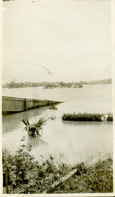 Kew Historical Society Inc
Photograph - Flooding of the Yarra River in North Kew, 1934
... Prior to urban development, the area since European settlement and the first land sales in the district in the 1840s, had been used for dairy farming. ...Prior to urban development, the area since European settlement and the first land sales in the district in the 1840s, had been used for dairy farming. yarra river -- north kew floods -- yarra valley floods -- north kew floods -- 1934 natural disasters -- kew Verso: OUR BACKYARD 8 KELLETT GROVE Small sepia snapshot taken from the back yard of a house at 8 Kellett Grove, in what was then known as North Kew. ...North Kew, now divided between Kew and Kew East, bordered the Yarra River. As such, it was a region subject to flooding in the Yarra Valley. Development beyond this point (ie Kellett Grove) was limited by the City of Kew's planning regulations. Prior to urban development, the area since European settlement and the first land sales in the district in the 1840s, had been used for dairy farming. Small sepia snapshot taken from the back yard of a house at 8 Kellett Grove, in what was then known as North Kew. The point of view is from a backyard looking towards Fairfield. Verso: OUR BACKYARD 8 KELLETT GROVEyarra river -- north kew, floods -- yarra valley, floods -- north kew, floods -- 1934, natural disasters -- kew -
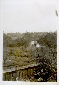 Kew Historical Society Inc
Photograph - View of the Yarra River from 8 Kellett Grove, North Kew, 1948
... Prior to urban development, the area since European settlement and the first land sales in the district in the 1840s, had been used for dairy farming. ...Prior to urban development, the area since European settlement and the first land sales in the district in the 1840s, had been used for dairy farming. ...North Kew, now divided between Kew and Kew East, bordered the Yarra River. As such, it was a region subject to flooding in the Yarra Valley. Development beyond this point (ie Kellett Grove) was limited by the City of Kew's planning regulations. Prior to urban development, the area since European settlement and the first land sales in the district in the 1840s, had been used for dairy farming. The view from the rear of 8 Kellett Grove predates the construction of the Eastern Freeway so provides a rare view of the area before it was built.Small sepia snapshot taken from the back yard of a house at 8 Kellett Grove, in what was then known as North Kew. A tower of the Kew Asylum on the top left of the horizon assist the viewer to recognise that the land to the left of the river is in Kew and Studley Park.Verso: NORTH KEW 1948 / Stamped 51019yarra river -- north kew, kellett grove -- north kew -
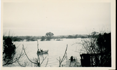 Kew Historical Society Inc
Photograph - Flooding of the Yarra River in North Kew, 1934
... Prior to urban development, the area since European settlement and the first land sales in the district in the 1840s, had been used for dairy farming. ...Prior to urban development, the area since European settlement and the first land sales in the district in the 1840s, had been used for dairy farming. yarra river -- north kew floods -- yarra valley floods -- north kew floods -- 1934 natural disasters -- kew Verso: OUR BACKYARD / Stamped 3 163 Small sepia snapshot of floodwaters taken from near Kellett Grove, in what was then known as North Kew. ...North Kew, now divided between Kew and Kew East, bordered the Yarra River. As such, it was a region subject to flooding in the Yarra Valley. Development beyond this point (ie Kellett Grove) was limited by the City of Kew's planning regulations. Prior to urban development, the area since European settlement and the first land sales in the district in the 1840s, had been used for dairy farming. Small sepia snapshot of floodwaters taken from near Kellett Grove, in what was then known as North Kew. The point of view is from a backyard looking towards Fairfield. In the foreground ar two men in a rowboat.Verso: OUR BACKYARD / Stamped 3 163yarra river -- north kew, floods -- yarra valley, floods -- north kew, floods -- 1934, natural disasters -- kew -
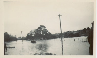 Kew Historical Society Inc
Photograph - Flooding of the Yarra River in North Kew, 1934
... Prior to urban development, the area since European settlement and the first land sales in the district in the 1840s, had been used for dairy farming. ...Prior to urban development, the area since European settlement and the first land sales in the district in the 1840s, had been used for dairy farming. yarra river -- north kew floods -- yarra valley floods -- north kew floods -- 1934 natural disasters -- kew willsmere road Verso: WILLSMERE ROAD NORTH KEW / Stamped 3 163 Small sepia snapshot of floodwaters taken from near Willsmere Road, in what was then known as North Kew. ...North Kew, now divided between Kew and Kew East, bordered the Yarra River. As such, it was a region subject to flooding in the Yarra Valley. Development beyond this point (ie Kellett Grove) was limited by the City of Kew's planning regulations. Prior to urban development, the area since European settlement and the first land sales in the district in the 1840s, had been used for dairy farming. Small sepia snapshot of floodwaters taken from near Willsmere Road, in what was then known as North Kew. The point of view is looking towards Fairfield. In the foreground are two figures viewing a group in a rowboat in the middle of the flooded river. Semi-submerged street lighting indicates that entire streets had been. overwhelmed by the flood waters. Verso: WILLSMERE ROAD NORTH KEW / Stamped 3 163yarra river -- north kew, floods -- yarra valley, floods -- north kew, floods -- 1934, natural disasters -- kew, willsmere road -
 Kew Historical Society Inc
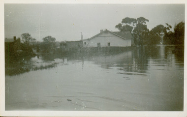
Photograph - Flooding of the Yarra River in North Kew, 1934
... Prior to urban development, the area since European settlement and the first land sales in the district in the 1840s, had been used for dairy farming. ...Prior to urban development, the area since European settlement and the first land sales in the district in the 1840s, had been used for dairy farming. yarra river -- north kew floods -- yarra valley floods -- north kew floods -- 1934 natural disasters -- kew willsmere road Verso: HYATTS HOUSE / WILLSMERE ROAD / Stamped 3 163 Small sepia snapshot of floodwaters in North Kew. ...North Kew, now divided between Kew and Kew East, bordered the Yarra River. As such, it was a region subject to flooding in the Yarra Valley. Development beyond this point (ie Kellett Grove) was limited by the City of Kew's planning regulations. Prior to urban development, the area since European settlement and the first land sales in the district in the 1840s, had been used for dairy farming. Small sepia snapshot of floodwaters in North Kew. The point of view is of two houses belonging to local families that were surrounded by floodwater. Verso: HYATTS HOUSE / WILLSMERE ROAD / Stamped 3 163yarra river -- north kew, floods -- yarra valley, floods -- north kew, floods -- 1934, natural disasters -- kew, willsmere road -
 Kew Historical Society Inc
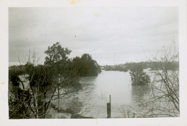
Photograph - Flooding of the Yarra River in North Kew, 1934
... Prior to urban development, the area since European settlement and the first land sales in the district in the 1840s, had been used for dairy farming. ...Prior to urban development, the area since European settlement and the first land sales in the district in the 1840s, had been used for dairy farming. yarra river -- north kew floods -- yarra valley floods -- north kew floods -- 1934 natural disasters -- kew willsmere road Verso: OUR BACKYARD / Stamped 52 Small sepia snapshot of floodwaters in North Kew, from the rear of 8 Kellett Grove. ...North Kew, now divided between Kew and Kew East, bordered the Yarra River. As such, it was a region subject to flooding in the Yarra Valley. Development beyond this point (ie Kellett Grove) was limited by the City of Kew's planning regulations. Prior to urban development, the area since European settlement and the first land sales in the district in the 1840s, had been used for dairy farming. Small sepia snapshot of floodwaters in North Kew, from the rear of 8 Kellett Grove. Verso: OUR BACKYARD / Stamped 52yarra river -- north kew, floods -- yarra valley, floods -- north kew, floods -- 1934, natural disasters -- kew, willsmere road -
 Kew Historical Society Inc
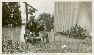
Photograph - Grandfather and granddaughter in the yard of 8 Kellett Grove, Kew, 1934
... Prior to urban development, the area since European settlement and the first land sales in the district in the 1840s, had been used for dairy farming. ...Prior to urban development, the area since European settlement and the first land sales in the district in the 1840s, had been used for dairy farming. ...North Kew, now divided between Kew and Kew East, bordered the Yarra River. As such, it was a region subject to flooding in the Yarra Valley. Development beyond this point (ie Kellett Grove) was limited by the City of Kew's planning regulations. Prior to urban development, the area since European settlement and the first land sales in the district in the 1840s, had been used for dairy farming. Vivid photograph contrasting domestic life and relationships with natural disasters such as the flood of 1934.Small sepia snapshot of a grandfather and granddaughter sitting in the backyard of 8 Kellett Grove, North Kew, with the floodwaters stretching behind them.Verso: GRANDDAD AND I IN BACKYARDyarra river -- north kew, floods -- yarra valley, floods -- north kew, floods -- 1934, natural disasters -- kew, willsmere road -
 Kew Historical Society Inc
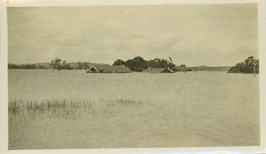
Photograph - Submerged houses in River Avenue, North Kew, 1934
... Prior to urban development, the area since European settlement and the first land sales in the district in the 1840s, had been used for dairy farming. ...Prior to urban development, the area since European settlement and the first land sales in the district in the 1840s, had been used for dairy farming. ...North Kew, now divided between Kew and Kew East, bordered the Yarra River. As such, it was a region subject to flooding in the Yarra Valley. Development beyond this point (ie Kellett Grove) was limited by the City of Kew's planning regulations. Prior to urban development, the area since European settlement and the first land sales in the district in the 1840s, had been used for dairy farming. Vivid photograph contrasting domestic life and relationships with natural disasters such as the flood of 1934.Small sepia snapshot of two submerged houses belonging to local families in River Avenue, North Kew, during the 1934 floods. The view is presumably from near Kellett Grove looking north towards Fairfield.Verso: COES & HYATTS ROOF / RIVER AVENUE / Stamped: 6414yarra river -- north kew, floods -- yarra valley, floods -- north kew, floods -- 1934, natural disasters -- kew -
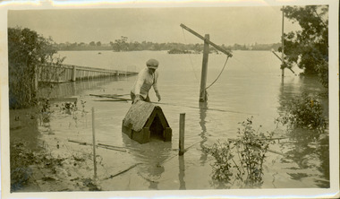 Kew Historical Society Inc
Photograph - Flooding of the Yarra River in North Kew, 1934
... Prior to urban development, the area since European settlement and the first land sales in the district in the 1840s, had been used for dairy farming. ...Prior to urban development, the area since European settlement and the first land sales in the district in the 1840s, had been used for dairy farming. ...North Kew, now divided between Kew and Kew East, bordered the Yarra River. As such, it was a region subject to flooding in the Yarra Valley. Development beyond this point (ie Kellett Grove) was limited by the City of Kew's planning regulations. Prior to urban development, the area since European settlement and the first land sales in the district in the 1840s, had been used for dairy farming. Vivid photograph contrasting domestic life and relationships with natural disasters such as the flood of 1934.Small sepia snapshot of the donors grandfather rescuing the family dog's kennel from rising floodwaters at the rear of 8 Kellett Grove, North Kew, .Verso: DAD SECURING NIPPY'S DOG KENNEL / Stamped 6414yarra river -- north kew, floods -- yarra valley, floods -- north kew, floods -- 1934, natural disasters -- kew -
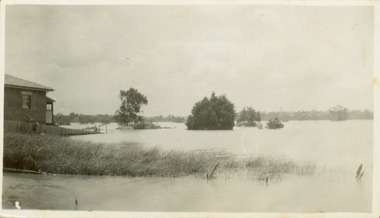 Kew Historical Society Inc
Photograph - Flooding of the Yarra River in North Kew, 1934
... Prior to urban development, the area since European settlement and the first land sales in the district in the 1840s, had been used for dairy farming. ...Prior to urban development, the area since European settlement and the first land sales in the district in the 1840s, had been used for dairy farming. . yarra river -- north kew floods -- yarra valley floods -- north kew floods -- 1934 natural disasters -- kew Verso: THE SIDE OF RYANS Small sepia snapshot of a local family's house in what was then River Avenue, North Kew being surrounded by floodwaters. ...North Kew, now divided between Kew and Kew East, bordered the Yarra River. As such, it was a region subject to flooding in the Yarra Valley. Development beyond this point (ie Kellett Grove) was limited by the City of Kew's planning regulations. Prior to urban development, the area since European settlement and the first land sales in the district in the 1840s, had been used for dairy farming. .Small sepia snapshot of a local family's house in what was then River Avenue, North Kew being surrounded by floodwaters.Verso: THE SIDE OF RYANSyarra river -- north kew, floods -- yarra valley, floods -- north kew, floods -- 1934, natural disasters -- kew
