
Showing 5 items matching "flood mitigation"
-
 Sunshine and District Historical Society Incorporated
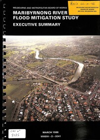
Document - Maribyrnong River Flood Mitigation Study Executive Summary March 1996, Melbourne And Metropolitan Board of Works (MMBW)
... Maribyrnong River Flood Mitigation Study Executive Summary March 1996...Melbourne And Metropolitan Board of Works Maribyrnong River Flood Mitigation Study Executive Summary March 1986...Part of the gwen Goedecke Collection Maribyrnong River Floood Melbourne And Metropolitan Board of Works Maribyrnong River Flood Mitigation Study Executive Summary March 1986 Ring bound document with coloured photo of the Maribyrnong River Document Maribyrnong River Flood Mitigation Study Executive Summary March 1996 Melbourne And Metropolitan Board of Works (MMBW) ...Part of the gwen Goedecke CollectionMelbourne And Metropolitan Board of Works Maribyrnong River Flood Mitigation Study Executive Summary March 1986maribyrnong river, floood -
 Clunes Museum
Plan - PLANS, Harry E Sando, Borough of Clunes Contract 96.6 of 1893/4, c1894
... ...Flood mitigation...(Borough Enginee) as at 10th March 1894, this plan also signed by the contactor and witness, both signatures are illegible Creswick Creek Flood mitigation Weir System Headings on plans; "Ground Plan No.1, Ground Plan No.2, Sections of weirs Coloured drawings on tracing/architects papers, pinned with dress makers pins to stiff paper. ...Harry E Sando C.E. (Borough Enginee) as at 10th March 1894, this plan also signed by the contactor and witness, both signatures are illegibleColoured drawings on tracing/architects papers, pinned with dress makers pins to stiff paper. Scale 2 feet to 1 inchHeadings on plans; "Ground Plan No.1, Ground Plan No.2, Sections of weirscreswick creek, flood mitigation, weir system -
 Orbost & District Historical Society
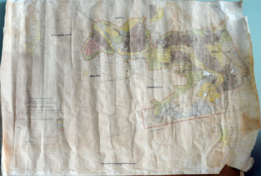
plan, before 1948
... (ref. 4 East Gippsland CMA Submission to Inquiry into Flood Mitigation Infrastructure in Victoria) ...(ref. 4 East Gippsland CMA Submission to Inquiry into Flood Mitigation Infrastructure in Victoria) This plan is significant as a historical document. ...Drainage infrastructure was developed and maintained in this region by the Snowy River Improvement Trust. The Trust was administered by a local committee and its activities funded by a local rate charged on the farmers and land owners in the Trust’s designated district. The level of the rate charged by the Trust was designed to be proportionate to the benefit derived from the works undertaken. Financial assistance was provided by the State Government from time to time for specific projects such as post flood repairs but not for new capital works. The Trust undertook new drainage and river management works including tree planting, rock beach construction and servicing of the drains and flood gates. The Trust also provided a personal flood warning service to the farmers in its district. The Trust ceased to operate in 1997 with the advent of the East Gippsland Catchment Management Authority. The infrastructure developed by the Trust continues to provide a service to the farmers in the region. (ref. 4 East Gippsland CMA Submission to Inquiry into Flood Mitigation Infrastructure in Victoria) This plan is significant as a historical document. The Snowy River Improvement Trust was vital to the Orbost district because of its ability to apply local knowledge and to engage the local farming community.A large plan of divisions of land for the purpose of levying the Snowy River Improvement District - Bete Bolong, Orbost, Waygara, Newmerella and Orbost East. The properties are coloured according to levy amount. The scale is 1" - 20 chains. snowy-river-improvement-trust -
 Sunshine and District Historical Society Incorporated
Document - Maribyrnong River The 2022 Flood Event In Victoria Reports, Parliament of Victoria, 2024
... This event reshaped early flood‑mitigation thinking across Melbourne. 1974 – Widespread metropolitan flooding - Heavy rainfall across Melbourne caused significant rises in the Maribyrnong. ...This event reshaped early flood‑mitigation thinking across Melbourne. 1974 – Widespread metropolitan flooding - Heavy rainfall across Melbourne caused significant rises in the Maribyrnong. ...The Maribyrnong River flows through the former Shire of Keilor, Shire of Braybrook and the City of Sunshine and now the City of Brimbank. The river has a long history of flooding including the following events; 1906 – The largest flood on record - Highest recorded flood level: 4.50 m at the Chifley Drive gauge. This remains the benchmark flood for the Maribyrnong catchment. This flood washed away the Arundel Road Keilor timber bridge during its construction. 1916 – Early 20th‑century flood - Less documented than 1906 but included in the official count of major events. Occurred during a period of widespread Victorian flooding. 1934 – The Great Melbourne Flood - Part of the catastrophic 1934 state‑wide floods. Maribyrnong catchment experienced severe riverine overflow. This event reshaped early flood‑mitigation thinking across Melbourne. 1974 – Widespread metropolitan flooding - Heavy rainfall across Melbourne caused significant rises in the Maribyrnong. Often referenced in Melbourne Water’s long‑term flood modelling. 1983 – Ash Wednesday period flooding - Occurred during the same climatic cycle as the Ash Wednesday bushfires. Intense rainfall caused rapid rises in the Maribyrnong River. 2011 – La Niña flood cycle - Part of the broader 2010–2011 La Niña flooding across Victoria. Maribyrnong experienced moderate–major riverine flooding. 2022 – The most significant modern flood - One of the worst urban floods in Melbourne in decades. Hundreds of homes inundated; major damage in Maribyrnong, Kensington, Ascot Vale. Triggered a parliamentary inquiry, major insurance issues, and debate over the Flemington Racecourse floodwall. Officially counted as the seventh major flood since 1906.The Maribyrnong River 2022 flood was one of the most significant urban flood events in Melbourne in decades. On 14 October 2022, after days of record‑breaking rain across Victoria, the Maribyrnong River breached its banks, inundating large parts of Keilor, Braybrook, Maribyrnong, Kensington, Ascot Vale, and surrounding suburbs. Many houses and streets in Maribyrnong were flooded by the river including the Angler’s Tavern, Anglers Way, Maribyrnong which was inundated up to the second floor. The flood also damaged many upstream locations including the flat lands of the Maribyrnong Valley, Brimbank Park and washing away part of the historical Arundel Road timber bridge in Keilor, the second time in its 116 year old history.maribyrnong river, flood, angler’s tavern, anglers way, maribyrnong, arundel road bridge, keilor -
 Wodonga & District Historical Society Inc
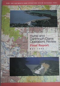
Book - Hume and Dartmouth Dams : Operations Review Final Report and Recommendations, Hume and Dartmouth Dams Operations Review Reference Panel, May 1999
... The Panel’s terms of reference were essentially to consider how the operating rules might be amended to better address the competing objectives of water supply, environmental enhancement and flood mitigation. This report includes summaries of feedback considered by the reference panel as well as its final recommendations. ...During 1997 and 1998, the Hume and Dartmouth Dams Operations Review Reference Panel has undertaken a broadly based review of the way in which these two major water storages were operated. The Panel’s terms of reference were essentially to consider how the operating rules might be amended to better address the competing objectives of water supply, environmental enhancement and flood mitigation. This report includes summaries of feedback considered by the reference panel as well as its final recommendations.non-fictionDuring 1997 and 1998, the Hume and Dartmouth Dams Operations Review Reference Panel has undertaken a broadly based review of the way in which these two major water storages were operated. The Panel’s terms of reference were essentially to consider how the operating rules might be amended to better address the competing objectives of water supply, environmental enhancement and flood mitigation. This report includes summaries of feedback considered by the reference panel as well as its final recommendations.hume reservoir nsw, dartmouth dam victoria, water management
