Showing 5 items matching "fortuna army mapping division"
-
 Bendigo Historical Society Inc.
Photograph - 1.25,000 BENDIGO AERIAL PHOTOGRAPHS
... ...fortuna army mapping division...History House 11 Mackenzie Street Bendigo goldfields BENDIGO Utilities fortuna army mapping division Eighteen undated coloured 1.25,000 army aerial photographs covering Bendigo city and district. ...Eighteen undated coloured 1.25,000 army aerial photographs covering Bendigo city and district. [a] -( Similar to A vintage Abrams map reader -Adjustable Stereoscope) -Casella London viewing eye frame with Irving scratched into frame. Another name scratched out also. [b] WW2 Leather pouch stamped Casella London made to hold eye frame.bendigo, utilities, fortuna army mapping division -
 Bendigo Military Museum
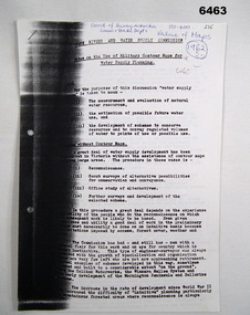
Administrative record - Use of Military maps for water supply planning, 1962
... Mapping containing accurate relief information that can then be used for water supply planning. Royal Australian Survey Corps RASvy Fortuna Army Survey Regiment Army Svy Regt ASR State Rivers and Water Supply Commission 5 x A4 pages of typed notes, poorly photocopied Use of Military maps for water supply planning Administrative record Use of Military maps for water supply planning State Rivers and water supply Commision, Division of National Mapping ...These are typed notes on the use of Military maps for water supply planning. This demonstrates the value of Military Mapping containing accurate relief information that can then be used for water supply planning.5 x A4 pages of typed notes, poorly photocopiedroyal australian survey corps, rasvy, fortuna, army survey regiment, army svy regt, asr, state rivers and water supply commission -
 Bendigo Military Museum
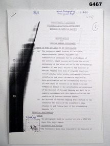
Administrative record - Division of National Mapping - Specification for Vertical Aerial Photography, Division of National Mapping, 1963
... Division of National Mapping Specification. This is a Specification for Aerial Photography acquisition and is written for civilian contract work. Royal Australian Survey Corps RASvy Fortuna Army ...Commonwealth of Australia, Department of Defence of National Development, Division of National Mapping Specification. This is a Specification for Aerial Photography acquisition and is written for civilian contract work.8 x A4 poor photocopies of typed pagesroyal australian survey corps, rasvy, fortuna, army survey regiment, army svy regt, asr -
 Bendigo Military Museum
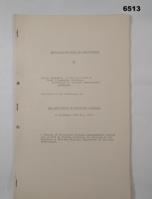
Administrative record - Trilateration with the Tellurometer - GRL Rimington 1958, Department of National Development , ACT, 26 May 1958
... Fortuna...Army Survey Regiment...Army Svy Regt...ASR...Division of National Mapping...division of National Mapping, Department of National Development. Trilateration is a surveying Technique that uses measurements of the sides of triangles to determine relative position. Royal Australian Survey Corps RASvy Fortuna Army ...trilateration with the tellurometer by GRL Rimington L.S MIS (Aust) Chief Topographic Surveyor, Department of National Development, Australia. This paper was delivered to the Institute of Surveyors Conference, Brisbane 26 May 1958. This paper is a summary of Electronic distance measurements carried out in 1957 in Central Australia by officers of the division of National Mapping, Department of National Development. Trilateration is a surveying Technique that uses measurements of the sides of triangles to determine relative position.A 11 page foolscap size stapled paper report. Two holed punched with dis-coloured pages due to age.royal australian survey corps, rasvy, fortuna, army survey regiment, army svy regt, asr, division of national mapping, surveying -
 Bendigo Military Museum
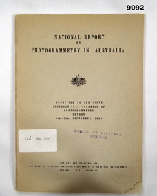
Administrative record - Report on Photogrammetry in Australia 1960 - Division of National Mapping, Division of National Mapping, Department of National Development, September 1960
... Fortuna...Army Survey Regiment...Army Svy Regt...ASR...Division of National Mapping...This comprehensive report details the status of mapping and aerial photography in Australia in 1960 including 14 Annexes. Royal Australian Survey Corps RASvy Fortuna Army Survey Regiment Army Svy Regt ASR Division of National Mapping Stamped "SCHOOL OF MILITARY SURVEY" on the front cover and first page. ...This National Report on Photogrammetry in Australia was prepared and submitted to the Ninth International Congress of Photogrammetry held in London during September 1960. Chapters deal with Mapping activities by various Australian Organisations including the Royal Australian Survey Corps. This comprehensive report details the status of mapping and aerial photography in Australia in 1960 including 14 Annexes. An A4 sized buff coloured card covered paper report of 68 pages and stapled. There is a property Card inside the front cover titled "Historical Property Record". Stamped "SCHOOL OF MILITARY SURVEY" on the front cover and first page. Sticker has hand written "526 982 DIV"royal australian survey corps, rasvy, fortuna, army survey regiment, army svy regt, asr, division of national mapping