Showing 105 items matching "geological heritage"
-
 The Beechworth Burke Museum
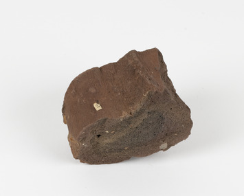
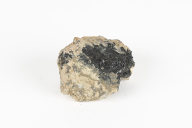
Geological specimen - Ropy Lava
... ...geological heritage...Victoria Talbot lava ropy ropy lava mineral Geological Specimen geological geological heritage natural stone natural history 42 / Hand sized specimen in brown/red hues Geological specimen Ropy Lava ...‘Ropy lava’ is known for its sculptural and layered qualities. It occurs in specific lava flows that are slow moving and slow cooling, allowing for unique formations to be created out of the motion. Ropy Lava is a flow that has a hardened crust with molten material underneath, the tension between these states is what creates its characteristic form. The brown/red hue of the stone is an indication of age, as it is oxidised iron deposits. This rock deposit is thought to be sourced from the area by Talbot, in western Victoria. This area has a rich mineral history and experienced the gold rush in the 1850's. The traditional owners of this area are the Dja Dja Wurrung people.This geological specimen shows the conditions in which the Australian landscape was created as well as provides an indication as to how these events occurred. It is representative of a common natural process that contextualises the formation of Australia with the formation of other landmasses. This specimen is part of a larger collection of geological and mineral specimens collected from around Australia (and some parts of the world) and donated to the Burke Museum between 1868-1880. A large percentage of these specimens were collected in Victoria as part of the Geological Survey of Victoria that begun in 1852 (in response to the Gold Rush) to study and map the geology of Victoria. Collecting geological specimens was an important part of mapping and understanding the scientific makeup of the earth. Many of these specimens were sent to research and collecting organisations across Australia, including the Burke Museum, to educate and encourage further study.Hand sized specimen in brown/red hues42 / victoria, talbot, lava, ropy, ropy lava, mineral, geological specimen, geological, geological heritage, natural stone, natural history -
 Sunshine and District Historical Society Incorporated
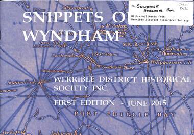
Book - Snippets of Wyndham - Werribee District Historical Society Inc. First Edition - June 2015 June 2015|Hume & Howell, Werribee District Historical Society, 2015
... Heritage...Geological history...Hume & Hovell Aboriginal occupation Heritage Geological history Wyndham's development Snippets of Wyndham's History A soft blue covered book - 35 pages Book Snippets of Wyndham - Werribee District Historical Society Inc. ...A brief guide to the history and historical sites of Wyndham.Snippets of Wyndham's History hume & hovell, aboriginal occupation, heritage, geological history, wyndham's development -
 Bendigo Historical Society Inc.
Document - LONG GULLY HISTORY GROUP COLLECTION: BANKNOTES AND JAMES BEVERAGE
... Enhancing the significance of the place are relics from the Victoria Quartz Company operations, including, at 4,870 feet, the world's deepest nineteenth-century gold mining shaft. (Heritage Victoria) Geology of Victoria Hill: https://aigjournal.aig.org.au/wp-content/uploads/2019/12/AIG-Victoria-Hill-Mining-Reserve_FinalWeb.pdf...Enhancing the significance of the place are relics from the Victoria Quartz Company operations, including, at 4,870 feet, the world's deepest nineteenth-century gold mining shaft. (Heritage Victoria) Geology of Victoria Hill: https://aigjournal.aig.org.au/wp-content/uploads/2019/12/AIG-Victoria-Hill-Mining-Reserve_FinalWeb.pdf BENDIGO History long gully history group The Long Gully History Group - Banknotes and James Beverage Victoria Quartz Mine Vincent Kelly Shepard's Bush Mr Rickards Mr Abraham Mr W Healy Mr J Smith Mr James Beverage South Iron Bark Mine Rae's Hill Sandhurst No 1 Fire Brigade Christie's Hotel Mrs Christie Royal Humane Society's Medal Bendigo Fire Station Long Gully History Group Mr Steve Gibbons Department of Environment Water Heritage Arts Commnmoration of Historic Events and Famous Persons Typed copy of what appears to be a speech. ...Victoria Quartz Gold Mine was on Victoria Hill, Ironbark, Bendigo. The Victoria Hill Quartz Gold Mines are scientifically important, as they contain relics span nearly sixty years of mining (1854 to 1913), documenting the richest and most significant years of Bendigo's world-famous quartz mining industry. Enhancing the significance of the place are relics from the Victoria Quartz Company operations, including, at 4,870 feet, the world's deepest nineteenth-century gold mining shaft. (Heritage Victoria) Geology of Victoria Hill: https://aigjournal.aig.org.au/wp-content/uploads/2019/12/AIG-Victoria-Hill-Mining-Reserve_FinalWeb.pdfTyped copy of what appears to be a speech. Mentioned is that after 1910 the Commonwealth took over the minting it's own money. Gold mining was chosen for the one pound note and a Bendigo scene was chosen. The scene chosen shows boring operations in the Victoria Quartz Mine. The picture was taken by Vincent Kelly of the five figures but for engraving only three were shown. They were Mr W Healy, Mr J Smith and Mr James Beverage. James Beverage was a member of Bendigo's first fire brigade. He went to Beechworth for a demonstration and on the way home stopped at Christie's Hotel in Swanston Street. There was a fire at the hotel and Mr Beverage rescued Mrs Christie, her baby and a servant. At a later date Mr Beverage saved a woman from a burning building in Moore Street in Bendigo. He received the Royal Humane Society's Medal which is now housed at the Bendigo Fire Station in Hargreaves Street. In the City's formative years the area that deposited its rain water into the Long Gully Creek was considered to be in Long Gully and for many years the Victoria Quartz Mine deposited many thousands of gallons of water into the Long Gully Creek. Mr Steve Gibbons unveiled the plaque.bendigo, history, long gully history group, the long gully history group - banknotes and james beverage, victoria quartz mine, vincent kelly, shepard's bush, mr rickards, mr abraham, mr w healy, mr j smith, mr james beverage, south iron bark mine, rae's hill, sandhurst no 1 fire brigade, christie's hotel, mrs christie, royal humane society's medal, bendigo fire station, long gully history group, mr steve gibbons, department of environment water heritage, arts commnmoration of historic events and famous persons -
 Kiewa Valley Historical Society
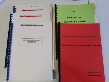
Collection of Papers and Books re - Mt Beauty Heritage Centre
... Heritage Centre - Matt Viney & Associates - white spiral folders 6. Landscape Consultants - Susan Campbell & son - red spiral folder 7. Plant List - Upper Kiewa Valley Water Supply Catchment 8. Geological...Mt Beauty Heritage Centre Mt Beauty Discovery Centre Geological Surveys 1. Bogong - The Alpine Discovery Centre 2. ...In the early 1990s the KVHS applied for a grant to create the Mt Beauty Heritage Centre / Discovery Centre. This involved employing consultants and further research.This collection includes a lot of detail of the Kiewa Valley area.1. Bogong - The Alpine Discovery Centre 2. Heritage Centre - black folder 3. Heritage Centre - manila folder 4. High Country Heritage Centre - 1991 - green spiral folder 5. Six Heritage Centre - Matt Viney & Associates - white spiral folders 6. Landscape Consultants - Susan Campbell & son - red spiral folder 7. Plant List - Upper Kiewa Valley Water Supply Catchment 8. Geological Survey of Vic., Plates, Bulletin No. 44 - in battered paper 'bag' with front cover list of contents - 15 plates 9. Geological Survey - A3 photo copies of pages 106-117 10. Geological Survey of Vic. - Report of Progress No VII 1884 - bound book 11. Geological Survey of Vic. Bulletin 56 - includes nth east Vic. 1958 - bound book with green cloth spine 12. Department of Mines Report Vic. 1906 - booklet held with two staples 13. Royal Society of Vic book - The Geology of the Kiewa Area 1961 14. Miscellaneous papers - Geological Survey, Reports of Fossil Specimens and maps of local area 15. Gold - Appendix K and Appendix 111, Part C - photocopied pages from Vic Mining Registrars Report 1888 - manila foldermt beauty heritage centre, mt beauty discovery centre, geological surveys -
 Emerald Museum & Nobelius Heritage Park
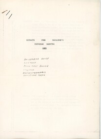
Booklet - Extracts from Bailliere's Victorian Gazetter 1865, Robert Whitworth, 1865
... Emerald Museum & Nobelius Heritage Park 5 Crichton Rd Emerald yarra-valley-and-the-dandenong-ranges Robert Whitworth (1831 -1901), an England-born journalist and author worked with the government printer Ferdinand François Balliere in producing gazetteers of the Australian colonies. The first was a gazetteer of Victoria printed in 1865. This copied extract from that gazetter provides information about the fauna and flora and geology ...Robert Whitworth (1831 -1901), an England-born journalist and author worked with the government printer Ferdinand François Balliere in producing gazetteers of the Australian colonies. The first was a gazetteer of Victoria printed in 1865. This copied extract from that gazetter provides information about the fauna and flora and geology of Emerald and environs at an early period of European settlement in Victoria.This gazetter extract provides a picture of Emerald and environs as described by a settler in the mid-19th century.Four foolscap pages of information photocopied regarding the Dandenong Ranges and environs. Pages attached with a staple.On first page: ' EXTRACTS FROM BAILLIERE'S / VICTORIAN GAZETTER / 1865 / DANDENONG RANGE / EMERALD / FERN TREE GULLIES / LILYDALE / CORRANWARRABUL / DANDENONG CREEK'robert whitworth, balliere, gazetter, emerald, 1865 -
 Federation University Historical Collection
Booklet, Wendy Morris, A Guide to Maldon, 1983, 1983
... heritage...tourism...maldon...mining...streetscape...townscape...gardens...quartz reef mining...geology...Barker Library (top floor) Mount Helen goldfields heritage tourism maldon mining streetscape townscape gardens quartz reef mining geology maldon goldmines Maldon hospital kangaroo hotel architecture conservation and planning cast iron forests mount tarrangower nuggetty ranges beehive Soft covered booklet featuring an aerial view of the town of Maldon on the cover. ...Soft covered booklet featuring an aerial view of the town of Maldon on the cover. heritage, tourism, maldon, mining, streetscape, townscape, gardens, quartz reef mining, geology, maldon goldmines, maldon hospital, kangaroo hotel, architecture, conservation and planning, cast iron, forests, mount tarrangower, nuggetty ranges, beehive -
 Eltham District Historical Society Inc
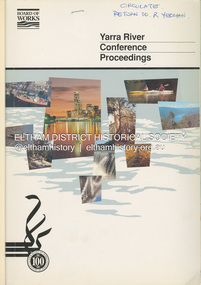
Book, Melbourne Metropolitan Board of Works, Yarra River Conference Proceedings, 1991
... Session 1 Heritage and Environment: Flora and fauna / Paul Gullan. -- Geology and topography / Brian Finlayson. -- Aboriginal culture / Margaret Gardiner. ...Conference staged by the Board of Works to present a range of papers examining the river's environment, recreational uses, natural resources, development, commerce and land use. Conference delegates included representatives from Eltham Shire Council and was held in April 1991. Session 1 Heritage and Environment: Flora and fauna / Paul Gullan. -- Geology and topography / Brian Finlayson. -- Aboriginal culture / Margaret Gardiner. Session 2 History. Session 3: Management plans and policies : overview of responsibilities / Dr Colin Leigh. --Role of the media / Peter Cole-Adams. -- Urban development / Paul Jerome. -- Port of Melbourne area / Leigh McKay. -- Recreation / Ken Marriott. Session 4: Perspectives - the current view. Session 5: Issues, challenges, potential solutions.non-fictionConference staged by the Board of Works to present a range of papers examining the river's environment, recreational uses, natural resources, development, commerce and land use. Conference delegates included representatives from Eltham Shire Council and was held in April 1991. Session 1 Heritage and Environment: Flora and fauna / Paul Gullan. -- Geology and topography / Brian Finlayson. -- Aboriginal culture / Margaret Gardiner. Session 2 History. Session 3: Management plans and policies : overview of responsibilities / Dr Colin Leigh. --Role of the media / Peter Cole-Adams. -- Urban development / Paul Jerome. -- Port of Melbourne area / Leigh McKay. -- Recreation / Ken Marriott. Session 4: Perspectives - the current view. Session 5: Issues, challenges, potential solutions.yarra river, melbourne -
 The Beechworth Burke Museum
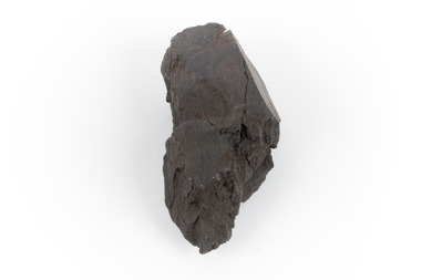
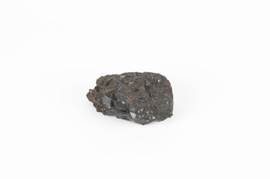
Geological specimen - Brown coal
... The Victorian Heritage Database has listed the Lal Lal Coal Mine with local significance, with their Statement of Significance stating: "The Lal Lal coal mine is historically significant as the site of the first discovery of lignite (brown coal) in Victoria, and one that promised important benefits to regional and state industries that were reliant on coal imports at the time. The significance of the stie is reduced by the poor state of preservation of the coal mining and processing fabric". This specimen is part of a larger collection of geological ...This particular specimen was recovered from the Lal Lal Coal and Iron Mine in Victoria, 19km from Ballarat. Brown Coal was discovered here in 1857, just alongside the Geelong to Ballarat Railway line. This discovery of lignite (brown coal) was the first in Victoria, which would bring important benefits to the region and state, both of which had previously been reliant on coal imports. In the 1860s, iron ore was found just 5km from Lal Lal, and the area was converted into an Iron Ore Mine. The Lal Lal Iron Mining Company took over operations in 1874, who then peaked iron production in 1884. This mine continued operations until June 1884, when the blast furnace was extinguished and never recommenced. The blast furnace at Lal Lal is considered one of the most important and highly significant sites ion early industrial history in Australia, as it is the only remaining best furnace from the nineteenth century in the Southern Hemisphere. The furnace ruins are 17 metres high, and are clearly visible today on Iron Mine Road, Lal Lal, near the Bungal Dam. This specimen of Lignite (brown coal) is significant, as it was mined from the area where brown coal was first discovered in Victoria, leading to an important and controversial future of the mining and use of brown coal in this State. The Victorian Heritage Database has listed the Lal Lal Coal Mine with local significance, with their Statement of Significance stating: "The Lal Lal coal mine is historically significant as the site of the first discovery of lignite (brown coal) in Victoria, and one that promised important benefits to regional and state industries that were reliant on coal imports at the time. The significance of the stie is reduced by the poor state of preservation of the coal mining and processing fabric". This specimen is part of a larger collection of geological and mineral specimens collected from around Australia (and some parts of the world) and donated to the Burke Museum between 1868-1880. A large percentage of these specimens were collected in Victoria as part of the Geological Survey of Victoria that begun in 1852 (in response to the Gold Rush) to study and map the geology of Victoria. Collecting geological specimens was an important part of mapping and understanding the scientific makeup of the earth. Many of these specimens were sent to research and collecting organisations across Australia, including the Burke Museum, to educate and encourage further study.A hand-sized light-weight, soft and combustable sedimentary rock specimen, that is dark brown in colour. The specimen has jagged edges, as though parts of the rock have crumbled away. Brown coal, or Lignite, is formed naturally from compressed peat, and is typically found in natural basins. The stages to the formation of coal ('coalification') begin with plant material and wood, which will decay if it is not subjected to deep burial or heating, and turn into Peat. Peat, when sufficiently compressed naturally, will turn into Brown Coal (Lignite), and finally into Black Coal (sub-bituminous, bituminous and anthracite). Each successive stage has a higher energy content and lower water content. It is brownish-black in colour. Brown Coal has a high moisture content, between 50 and 75 percent, and a low carbon content. Some Brown Coals may be stratified, with layers of plant matter, which means little coalification has occurred beyond the peat natural processing stage. When Brown Coal is submerged in dilute nitric acid or boiling potassium hydroxide solution, it reacts to produce a reddish solution, of which higher-ranked coals do not. When brown coal is pulverised and burned in boilers, the steam is used to drive turbines, which generates electricity. It is the lowest rank of coal, as when burned, it creates a relatively low heat content, which in turn does not create a great output of steam. burke museum, beechworth, indigo shire, beechworth museum, geological, geological specimen, mineralogy, brown coal, brown coal specimen, lignite, lal lal, lal lal coal mine, lal lal iron mine, ballarat, blast furnace -
 The Beechworth Burke Museum
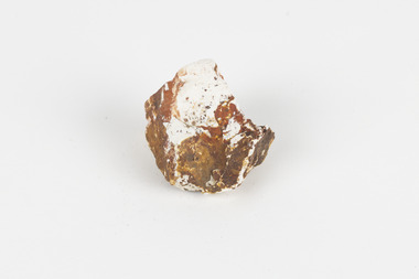
Geological specimen - Montmorillonite
... heritage. This specimen is part of a larger collection of geological and mineral specimens collected from around Australia (and some parts of the world) and donated to the Burke Museum between 1868-1880. ...Montmorillonite is a type of clay composed of aluminium silicate that forms very small particles that are not well-bonded to one another. This is why it is so soft. When in the presence of water, all types of clay swell. Montmorillonite swells even more than most types of clay, which is why it is often chosen over other types of clay in its practical uses. Montmorillonite has many different practical uses, including in the mining industry, as a soil additive, as a sealant, as a desiccant to draw water out of the air, to clean ponds, to make kitty litter and in cosmetics. Montmorillonite is a common mineral and, despite being named after Montmorillon, France, can be found all over the world, including many deposits in Australia. It is not known where this particular specimen originates from. Montmorillonite is an economically and socially significant material with a wide variety of uses. Having samples of common and important minerals allows collections, like the Burke Museum, to have a more complete view of the land on which they are located, and therefore a more complete view of heritage. This specimen is part of a larger collection of geological and mineral specimens collected from around Australia (and some parts of the world) and donated to the Burke Museum between 1868-1880. A large percentage of these specimens were collected in Victoria as part of the Geological Survey of Victoria that begun in 1852 (in response to the Gold Rush) to study and map the geology of Victoria. Collecting geological specimens was an important part of mapping and understanding the scientific makeup of the earth. Many of these specimens were sent to research and collecting organisations across Australia, including the Burke Museum, to educate and encourage further study.A solid tennis-ball sized chunk of aluminium silicate clay. It is primarily white, accented with orange and brown.burke museum, beechworth, geological, geological specimen, clay, montmorillonite -
 The Beechworth Burke Museum
Geological specimen - Tourmaline (schorl), Unknown
... Its occurrence is closely linked to the geological processes that shaped the region during the Gold Rush era. The discovery of tourmaline in Beechworth adds to the rich mineral heritage of the area, which was historically known for gold mining. ...Tourmaline is a group of minerals belonging to the complex borosilicate mineral class. These minerals are known for their striking and varied colours, making them prized gemstones. Tourmaline crystals can come in various shades, including pink, green, blue, brown, black, and colourless. They are often transparent or translucent. Tourmaline's chemical composition is complex, but it typically includes elements such as aluminium, iron, magnesium, sodium, lithium, and potassium. The specific arrangement of these elements in the crystal lattice gives rise to the different colours and properties of tourmaline specimens. Tourmaline specimens from Beechworth, Victoria, Australia, are a notable part of the region's mineral heritage. These tourmalines are of interest to mineral collectors and enthusiasts. While the tourmaline found in Beechworth is not as well-known as some other tourmaline varieties, it has unique characteristics and a historical context associated with the gold mining areas in Beechworth.The significance of tourmaline in Beechworth, Victoria, Australia, lies in its unique geological and historical context, contributing to both scientific and cultural aspects. The tourmaline mined in Beechworth is a rare and unique variety of tourmaline that is primarily found in the historic gold mining areas surrounding Beechworth. Its occurrence is closely linked to the geological processes that shaped the region during the Gold Rush era. The discovery of tourmaline in Beechworth adds to the rich mineral heritage of the area, which was historically known for gold mining. The specimens serve as a tangible connection to the region's mining history and contribute to preserving its geological legacy. The presence of tourmaline in Beechworth showcases the mineralogical diversity of the area. Tourmaline is known for its wide range of colours and unique properties, making it a valuable subject of study for mineralogists and geologists. Tourmaline specimens from Beechworth have educational significance, providing opportunities for research and study. They offer insights into the geological processes and mineral formation in the region, contributing to a better understanding of Earth's geological history.A hand-sized solid mineral specimen in shades of brown, green, light grey and dark greyTOURMALINE (schorl) / (Silicate of boron and aluminum) burke museum, beechworth, indigo shire, geological, geological specimen, mineralogy, tourmaline -
 The Beechworth Burke Museum
Geological specimen - Garnet crystals in galena, Unknown
... It represents heritage value through the systematic collecting of the geological surveyers in Victoria and Australia during the early to late 19th Century. ...Majority of Galena in Australia is found in hydrothermal deposits emplaced around 1680 million years ago which have been heavily metamorphosed. Galena is the natural mineral form of lead sulfaide. It occurs generally as fine to large crystals due to syntectonic remobilization at low temperatures and moves to a suitable location. The colour is a shining lead and silvery gray with high specific gravity between 7.2 and 7.6 gms/cm3 and contains 86.6 lead sulfaide in its purest form. Its cyrstal system is cubic with perfect cleavages, and contract penetration and lamellar twinning. This particular specimen is from the Broken Hill mine, it is one of the largest lead mines located in Western New South Wales and still has ore reserves amounting to 20.9 million tonnes of ore grading of 7.4% lead, 9.4% zinc, and 61.5 million oz of Silver. Throughout its history, it has produced over 200 million tonnes of ore throughout its 127 years of mining history dating back to 1885. Galena mineral ore found in Australia is considered rare, as it is only currently found in the Broken Hill Mine of Western New South Wales. It represents heritage value through the systematic collecting of the geological surveyers in Victoria and Australia during the early to late 19th Century. The fact that it is only found in one mining area of Australia, shows that this specimen is rare for examples of Australian Galena. This mineral specimen is one part to a larger collection, aquistion, and distribution of Garnet in Galena around Australia and parts of the world and donated to the Burke Museum between 1860-1880. While this specimen was not found by the Victorian Geological Survey, it shows the historical need for mapping geological areas around the Gold Rush region to further identify areas of precious metal and gem aquisition. Additionally, collecting these specimens was an important part of mapping the scientific make up of the earth's surface. Many were sent to institutions for further contribution to research and scientific knowledge of the specimens. A solid coin-sized lead and zinc sulphaide and zinc silicate ore mineral in shades of black and red with shiny black points. GARNET CRYSTALS in / GALENA (lead sulphide), / SPALERITE (zinc sulphide), / WILLEMITE (zinc silicate) ore. / Locality: Broken Hill, NSWburke museum, #beechworth, indigo shire, beechworth museum, geological, geological specimen, mineral, galena, galena quartz, broken hill mine, broken hill, nsw -
 Eltham District Historical Society Inc
Folder, Victorian Goldfields Project: Historic gold mining sites in St Andrews mining division, 1999
... Heritage site report and gazetteer by David Bannear, head consultant for archealogy for the Department of Natural Resources and Environment. Includes information on the Warrandyte Goldfield and the Caledonia Goldfield, Queenstown (now known as St Andrews), One Tree Hill, Kingston (now known as Panton Hill), Kangaroo Grounds, You You Hill, Kingstown, South Morang, Nillumbik, (now known as Diamond Creek), Steele's Creek, Yarrambet and Kinglake. Photocopy of map headed: Location of mines and reefs from Geological...Heritage site report and gazetteer by David Bannear, head consultant for archealogy for the Department of Natural Resources and Environment. Includes information on the Warrandyte Goldfield and the Caledonia Goldfield, Queenstown (now known as St Andrews), One Tree Hill, Kingston (now known as Panton Hill), Kangaroo Grounds, You You Hill, Kingstown, South Morang, Nillumbik, (now known as Diamond Creek), Steele's Creek, Yarrambet and Kinglake. Photocopy of map headed: Location of mines and reefs from Geological ...Heritage site report and gazetteer by David Bannear, head consultant for archealogy for the Department of Natural Resources and Environment. Includes information on the Warrandyte Goldfield and the Caledonia Goldfield, Queenstown (now known as St Andrews), One Tree Hill, Kingston (now known as Panton Hill), Kangaroo Grounds, You You Hill, Kingstown, South Morang, Nillumbik, (now known as Diamond Creek), Steele's Creek, Yarrambet and Kinglake. Photocopy of map headed: Location of mines and reefs from Geological survey of Victoria, Yan Yean with the Diamond Creek prominant on the map. no date35 page report with map and print out of cover letter (email form) from donorcaledonian gold fields, caledonina gold field, david bannear, gold mining, harry gilham collection, queenstown, st andrews, warrandyte goldfield -
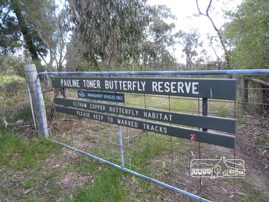
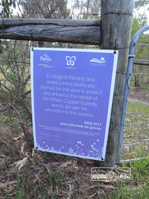
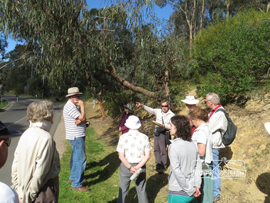
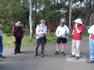
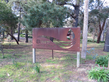
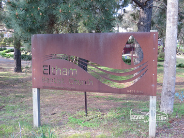
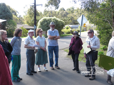
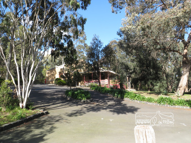
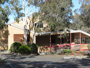
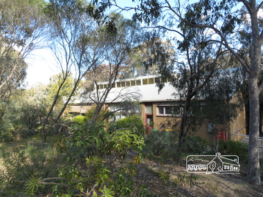
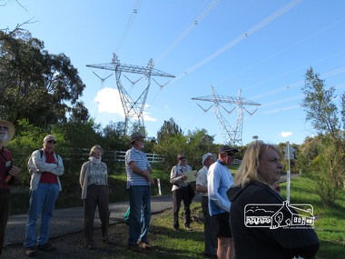
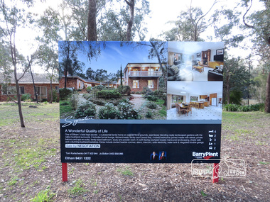
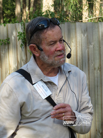
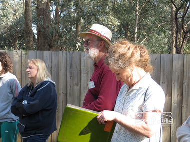
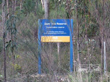
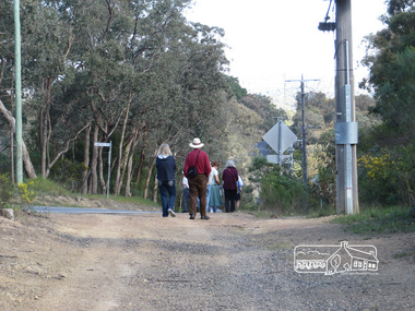
 Eltham District Historical Society Inc
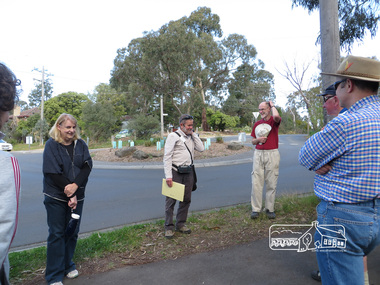
Photograph, Liz Pidgeon, Heritage Excursion; East of Eltham, 6 Sep 2014, 20 May 2017
... geology. This walk is about 3.5 km in length and will take 2 to 2.5 hours. It will start at 2pm at the corner of Eucalyptus Road, Pitt Street and Nyora Road. eltham east eltham district historical society heritage excursion activities nyora road reynolds road gum tree road reserve diosma road stokes orchard eucalyptus road Born Digital Heritage Excursion; East of Eltham, 6 Sep 2014 Photograph Liz Pidgeon ...Newsletter No. 218, September 2014 September Excursion - East of Eltham Walk In Newsletter No. 197, March 2011, there was a brief history of Crown Allotment 15 Section 5 Parish of Nillumbik (CA 15) a parcel of land of a quarter of a square mile extending from Eucalyptus Road to Reynolds Road at the eastern extremity of Eltham. From the 1940s it was known as Stokes orchard. In later years it has been subdivided for residential purposes but leaving significant areas as power line and water supply reserves and bushland reserves that are habitat for the threatened For our excursion on 6th September we intend to walk through CA 15 to a bushland reserve east of Reynolds Road. The walk will traverse the boundary between suburban Eltham and the non-urban areas to the south and east. This is a pleasant walk through residential areas and bushland. Along the way we will discuss the early and more recent history of CA 15 as well as local natural history and geology. This walk is about 3.5 km in length and will take 2 to 2.5 hours. It will start at 2pm at the corner of Eucalyptus Road, Pitt Street and Nyora Road.Born Digitaleltham east, eltham district historical society, heritage excursion, activities, nyora road, reynolds road, gum tree road reserve, diosma road, stokes orchard, eucalyptus road -
 Eltham District Historical Society Inc
Photograph, Liz Pidgeon, Heritage Excursion; East of Eltham, 6 Sep 2014, 20 May 2017
... geology. This walk is about 3.5 km in length and will take 2 to 2.5 hours. It will start at 2pm at the corner of Eucalyptus Road, Pitt Street and Nyora Road. eltham east eltham district historical society heritage excursion activities nyora road reynolds road gum tree road reserve diosma road stokes orchard eucalyptus road Born Digital Heritage Excursion; East of Eltham, 6 Sep 2014 Photograph Liz Pidgeon ...Newsletter No. 218, September 2014 September Excursion - East of Eltham Walk In Newsletter No. 197, March 2011, there was a brief history of Crown Allotment 15 Section 5 Parish of Nillumbik (CA 15) a parcel of land of a quarter of a square mile extending from Eucalyptus Road to Reynolds Road at the eastern extremity of Eltham. From the 1940s it was known as Stokes orchard. In later years it has been subdivided for residential purposes but leaving significant areas as power line and water supply reserves and bushland reserves that are habitat for the threatened For our excursion on 6th September we intend to walk through CA 15 to a bushland reserve east of Reynolds Road. The walk will traverse the boundary between suburban Eltham and the non-urban areas to the south and east. This is a pleasant walk through residential areas and bushland. Along the way we will discuss the early and more recent history of CA 15 as well as local natural history and geology. This walk is about 3.5 km in length and will take 2 to 2.5 hours. It will start at 2pm at the corner of Eucalyptus Road, Pitt Street and Nyora Road.Born Digitaleltham east, eltham district historical society, heritage excursion, activities, nyora road, reynolds road, gum tree road reserve, diosma road, stokes orchard, eucalyptus road