Showing 7 items matching "geology of dandenong ranges"
-
 Southern Sherbrooke Historical Society Inc.
Information Folder - geology of Dandenong Ranges
... Information Folder - geology of Dandenong Ranges......geology of dandenong ranges...Information folder containing items pertaining to the geology of the Dandenong Ranges, including material prepared by Betty Hotchin for a talk to the Kallista Tourism course. ...Southern Sherbrooke Historical Society Inc. 127 Colby Drive Belgrave Heights 3160 yarra-valley-and-the-dandenong-ranges dandenong ranges geology of dandenong ranges Information folder containing items pertaining to the geology of the Dandenong Ranges, including material prepared by Betty Hotchin for a talk to the Kallista Tourism course. ...Information folder containing items pertaining to the geology of the Dandenong Ranges, including material prepared by Betty Hotchin for a talk to the Kallista Tourism course. Contents:-/typescript, re. basic features/photocopy, "The Dandenongs volcano and settlement in its great forest" by John Lundy-Clarke, published by Lilydale and District Historical Society/2 maps, Dandenong Ranges/List of reference materialdandenong ranges, geology of dandenong ranges -
 Emerald Museum & Nobelius Heritage Park
Booklet - Extracts from Bailliere's Victorian Gazetter 1865, Robert Whitworth, 1865
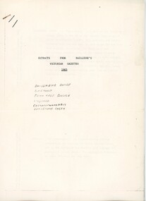
... Emerald Museum & Nobelius Heritage Park 5 Crichton Rd Emerald yarra-valley-and-the-dandenong-ranges Robert Whitworth (1831 -1901), an England-born journalist and author worked with the government printer Ferdinand François Balliere in producing gazetteers of the Australian colonies. The first was a gazetteer of Victoria printed in 1865. This copied extract from that gazetter provides information about the fauna and flora and geology ...Robert Whitworth (1831 -1901), an England-born journalist and author worked with the government printer Ferdinand François Balliere in producing gazetteers of the Australian colonies. The first was a gazetteer of Victoria printed in 1865. This copied extract from that gazetter provides information about the fauna and flora and geology of Emerald and environs at an early period of European settlement in Victoria.This gazetter extract provides a picture of Emerald and environs as described by a settler in the mid-19th century.Four foolscap pages of information photocopied regarding the Dandenong Ranges and environs. Pages attached with a staple.On first page: ' EXTRACTS FROM BAILLIERE'S / VICTORIAN GAZETTER / 1865 / DANDENONG RANGE / EMERALD / FERN TREE GULLIES / LILYDALE / CORRANWARRABUL / DANDENONG CREEK'robert whitworth, balliere, gazetter, emerald, 1865 -
 Monbulk RSL Sub Branch
Book, Harper Collins, The fracture zone : a return to the Balkans, 1999
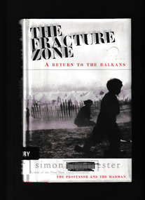
... Monbulk RSL Sub Branch 48 Main Road Monbulk yarra-valley-and-the-dandenong-ranges Balkan peninsula - History Balkan peninsula - Travel Winchester travels in a scimitar-shaped journey through Croatia, Bosnia, Montenegreo, Macedonia, Bulgaria and Greece to Turkey. He names his route the Fracture Zone, because this locale marks not only the meeting of two vast continental tectonic plates, perpetrators of geological chaos, but also the uneasy boundary between two great historical empires, the Hapsburg and the Ottoman." ...Winchester travels in a scimitar-shaped journey through Croatia, Bosnia, Montenegreo, Macedonia, Bulgaria and Greece to Turkey. He names his route the Fracture Zone, because this locale marks not only the meeting of two vast continental tectonic plates, perpetrators of geological chaos, but also the uneasy boundary between two great historical empires, the Hapsburg and the Ottoman." "The Fracture Zone weaves together history, travel and political perspective with the personal testaments of ordinary and extraordinary people. In this record of history, hatred and ruin, Simon Winchester details the conditions under which the area's refuges now live against a background of ancient political and spiritual struggleGlossary, maps, p.236.non-fictionWinchester travels in a scimitar-shaped journey through Croatia, Bosnia, Montenegreo, Macedonia, Bulgaria and Greece to Turkey. He names his route the Fracture Zone, because this locale marks not only the meeting of two vast continental tectonic plates, perpetrators of geological chaos, but also the uneasy boundary between two great historical empires, the Hapsburg and the Ottoman." "The Fracture Zone weaves together history, travel and political perspective with the personal testaments of ordinary and extraordinary people. In this record of history, hatred and ruin, Simon Winchester details the conditions under which the area's refuges now live against a background of ancient political and spiritual strugglebalkan peninsula - history, balkan peninsula - travel -
 Ringwood and District Historical Society
Booklet - Geological Survey Report, Explanatory Notes on Ringwood, Victoria by A.H.M. Vandenberg, 1971
... Geological description of the eastern and southeastern suburbs of Melbourne, Dandenong Ranges, Harkaway Hills and the Silvan and Macclesfield districts....Ringwood and District Historical Society 125A Warrandyte Road Ringwood North melbourne Geological description of the eastern and southeastern suburbs of Melbourne, Dandenong Ranges, Harkaway Hills and the Silvan and Macclesfield districts. ...Geological description of the eastern and southeastern suburbs of Melbourne, Dandenong Ranges, Harkaway Hills and the Silvan and Macclesfield districts. -
 Marysville & District Historical Society
Photograph (Item) - Black and white photograph, 08-1927
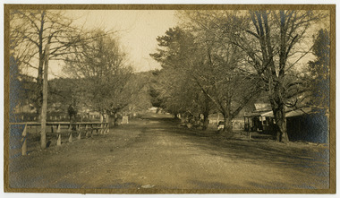
... dandenong-ranges A black and white photograph of Murchison Street in Marysville in Victoria. A black and white photograph of Murchison Street in Marysville in Victoria. Murchison Street was named for Roderick Impey Murchison who was one of the most distinguished geologists of the 19th century. His liberality and social position plus the pride he took in his science were of immense value in furthering the cause of learning in Britain. murchison street marysville victoria roderick impey murchison geology ...A black and white photograph of Murchison Street in Marysville in Victoria.A black and white photograph of Murchison Street in Marysville in Victoria. Murchison Street was named for Roderick Impey Murchison who was one of the most distinguished geologists of the 19th century. His liberality and social position plus the pride he took in his science were of immense value in furthering the cause of learning in Britain.murchison street, marysville, victoria, roderick impey murchison, geology, geologist -
Marysville & District Historical Society
Document (Item) - Research Document, Rene de Koning, Sedgwick Street Named After Adam Sedgwick (1785 - 1873), 13-08-2022
... dandenong-ranges An account of the life of Adam Sedgwick whom Sedgwick Street in Marysville in Victoria is named for. An account of the life of Adam Sedgwick whom Sedgwick Street in Marysville in Victoria is named for. Adam Sedgwick was a British geologist and Anglican priest, one of the founders of modern geology ...An account of the life of Adam Sedgwick whom Sedgwick Street in Marysville in Victoria is named for.An account of the life of Adam Sedgwick whom Sedgwick Street in Marysville in Victoria is named for. Adam Sedgwick was a British geologist and Anglican priest, one of the founders of modern geology. He proposed the Cambrian and Devonian period of the geological timescale. Based on work which he did on Welsh rock strata, he proposed the Cambrian period in 1835, in a joint publication in which Roderick Murchison also proposed the Silurian period. Later in 1840, to resolve what later became known as the Great Devonian Controversy about rocks near the boundary between the Silurian and Carboniferous periods, he and Murchison proposed the Devonian period. adam sedgwick, sedgwick street, marysville, victoria -
 Marysville & District Historical Society
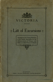
Booklet (Item) - Information booklet, Albert J. Mullett, Victoria-List of Excursions, 1914
... Marysville & District Historical Society 39 Darwin Street Marysville yarra-valley-and-the-dandenong-ranges A booklet of a list of excursions that was arranged for the visiting members of the British Association for Advancement of Science which included Marysville. These excursions were conducted in August 1914. They included geological ...A booklet of a list of excursions that was arranged for the visiting members of the British Association for Advancement of Science which included Marysville. These excursions were conducted in August 1914. They included geological excursions as well as excursions to local attractions to observe the flora and fauna found in and around the various destinations. The excursions were to Bacchus Marsh, Marysville, Warburton and Cement Creek, the Macedon District, Emerald, Ballarat and the local district, Bendigo and surrounds, Wilson's Promontory, and the Central Research Farm at Werribee. There is also a chapter on other places of interest in Victoria which includes Mount Buffalo, the Gippsland Lakes, the Buchan Caves, Daylesford, Lorne and Sorrento.A booklet of a list of excursions that was arranged for the visiting members of the British Association for Advancement of Science which included Marysville.victoria, british association for the advancement of science, bacchus marsh, marysville, warburton, cement creek, macedon, emerald, ballarat, bendigo, wilson's promontory, central research farm werribee, werribee, mount buffalo, gippsland lakes, buchan caves, daylesford, lorne, sorrento