Showing 181 items matching "gold estates"
-
 Tarnagulla History Archive
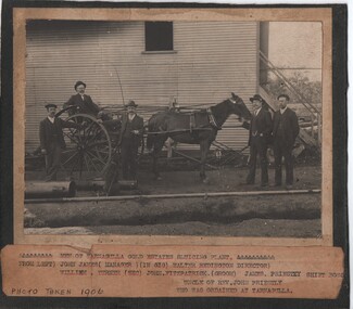
Photograph - Photograph: Workers at Tarnagulla Gold Estates N.L, c.1905
... Photograph: Workers at Tarnagulla Gold Estates N.L....Monochrome photograph of workers at Tarnagulla Gold Estates N.L. An original photograph, mounted on card. ...Photograph Photograph: Workers at Tarnagulla Gold Estates N.L. ...Williams Family Collection. Monochrome photograph of workers at Tarnagulla Gold Estates N.L. An original photograph, mounted on card. Handwritten on from: "Tarnagulla Dredge".tarnagulla, people -
Tarnagulla History Archive
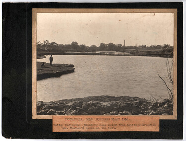
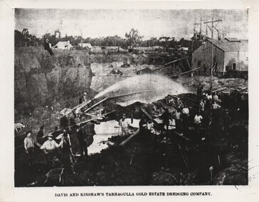
Photograph - Photograph: Tarnagulla Gold Estates Sluicing Dredge, 1911
... Photograph: Tarnagulla Gold Estates Sluicing Dredge...Photograph depicting the site of the Tarnagulla Gold Estates Sluicing Dredge, then owned by Davis and Kershaw. ...Photograph Photograph: Tarnagulla Gold Estates Sluicing Dredge ...Williams Family Collection. Photograph depicting the site of the Tarnagulla Gold Estates Sluicing Dredge, then owned by Davis and Kershaw. Original photographic print. Above information handwritten on reverse.tarnagulla -
 Tarnagulla History Archive
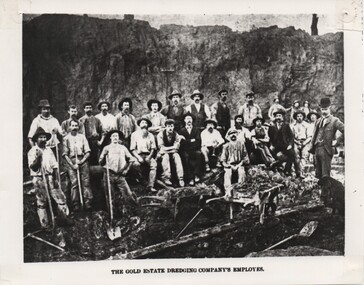
Photograph of Men of the Tarnagulla Gold Estates Sluicing Plant, 1906
... Photograph of Men of the Tarnagulla Gold Estates Sluicing Plant, 1906....Tarnagulla History Archive Tarnagulla Public Hall 69-71 Commercial Rd Tarnagulla goldfields Photograph of Men of the Tarnagulla Gold Estates Sluicing Plant, 1906. ... -
 Tarnagulla History Archive
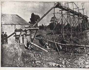
Photograph of Tarnagulla Gold Estates plant, 1906
... Photograph of Tarnagulla Gold Estates plant, 1906....Tarnagulla History Archive Tarnagulla Public Hall 69-71 Commercial Rd Tarnagulla goldfields Photograph of Tarnagulla Gold Estates plant, 1906. ... -
 Tarnagulla History Archive
Photograph of men at the Tarnagulla Gold Estates Dredging Plant, Tarnagulla, c.1905
... Photograph of men at the Tarnagulla Gold Estates Dredging Plant, Tarnagulla, c.1905....Tarnagulla History Archive Tarnagulla Public Hall 69-71 Commercial Rd Tarnagulla goldfields Photograph of men at the Tarnagulla Gold Estates Dredging Plant, Tarnagulla, c.1905. ... -
 Tarnagulla History Archive
Photograph of the Tarnagulla Gold Estates Dredging Plant, c.1906
... Photograph of the Tarnagulla Gold Estates Dredging Plant, c.1906....Tarnagulla History Archive Tarnagulla Public Hall 69-71 Commercial Rd Tarnagulla goldfields Photograph of the Tarnagulla Gold Estates Dredging Plant, c.1906. ... -
 Federation University Historical Collection
Letter, Letters from Richard Squire to his son Tom 1934
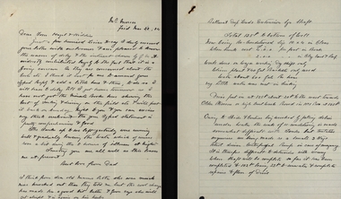
... ...Gold Estates...Hayes Illness Poppet Carburetor Mum Ned Shaft Balance Weight Hazel Squire Pearson Pulleys Syndicate Goon Len Hopkins Suction Dunstown Lease Jim Squire Bannockburn Nina Albert Mrs Trenery Connie Jay Judy Squire Cohuna Bladder Attack Reports Estimates Dunstan & Coy Jelbarts Barrett Flat Fields Brown Gold Estates Berry Leads Parsley Roots Share Book Meredith Reef Pay Sheet Colin Mr Gibbs L.R.G Plan Banagwanth McNaughton Bores Glenfine Allan William Thomas John Lynch Crawford Shelford Liz the Car Trucks Chandlers Ballarat Trustees Cameron Elaine Mrs Read Clark J. ...In 1905 Richard Squire was manager of the West Berry Consols at Allendale, and developed an improved system of mine ventilation, which was supported in "The Age."[4] He was successful in combating and remedying the gas and ventilation troubles of the Deep Mines of Creswick and Allendale Districts after all had failed.[5] MINE MANAGERS’ ASSOCIATION. Ballarat Branch. ... Mr R. B. Squire, manager of the West Berry Consols, at Allendale, submitted a paper detailing what he had done tor the betterment of ventilation in the alluvial mines of Smeaton and Mary borough districts- Members gave Mr Squire every credit for the results that he claimed to have effected; the adoption of his ideas had testified to their value to mine-owners. It was painted out, however, that for want of a thorough debate of the subject with experienced men the author had unwittingly included some general statements that required modifying in some points and extending in others, in justice to other workers among the earlier and the present day managers of mines. It was decided to invite the author to meet a sub-committee on this subject![6]Handwritten letters from Richard Squire to his son Tom and Family reporting happening at the mine richard squire, tom squire, engine trouble, basil, f.l. smythe broker, trembath, w. ryall, mt mercer, flu, plant, skids, pump, c. hayes, illness, poppet, carburetor, mum, ned, shaft, balance weight, hazel squire, pearson, pulleys, syndicate, goon, len hopkins, suction, dunstown, lease, jim squire, bannockburn, nina, albert, mrs trenery, connie, jay, judy squire, cohuna, bladder attack, reports, estimates, dunstan & coy, jelbarts, barrett, flat fields, brown, gold estates, berry leads, parsley roots, share book, meredith, reef, pay sheet, colin, mr gibbs, l.r.g plan, banagwanth, mcnaughton bores, glenfine, allan, william thomas, john lynch, crawford, shelford, liz the car, trucks, chandlers, ballarat trustees, cameron, elaine, mrs read, clark, j. hayes, dunlop, dr lawrence, eye specialist, reid, mullock bank, jack squire, herman, peter's legal inc. ballarat, freddie reid, j.r. whipp, a.b. reid, grenville, leigh river plan, johnstone's, premier petrol coy, chandler's, ballarat deep leads extension, harwood & pincott, a. rice, lillas, l. e. walker, secretary for mines, pipeclay, sandstone, mr saville, weymouth & carroll, suction pipe, valves, financiers, gold mines of australia, mr hanley hunter, sadowa coy, kerang shareholder, buninyong, stanley hunter, len, fran, max, dr jones, honeycomb rock, booth, sandy mcnab, emily shaw, john cock, ross creek, mitchell, rowe, neil cameron, walker, kidney disease, holst, nellie, ronaldson's, ronaldson & tippett, brokers, investors, lockett, miller & co, wellesly, john sharpe, elizabeht ellen, old lawaluk, mining -
Tarnagulla History Archive
Photograph: Sluicing Dredge, Tarnagulla, 1911
... Monochrome photograph. Tarnagulla Gold Estates, Sluicing Dredge, 1911. (Davis & Kershaw). ...Tarnagulla History Archive Tarnagulla Public Hall 69-71 Commercial Rd Tarnagulla goldfields Monochrome photograph. Tarnagulla Gold Estates, Sluicing Dredge, 1911. (Davis & Kershaw). ...Monochrome photograph. Tarnagulla Gold Estates, Sluicing Dredge, 1911. (Davis & Kershaw). -
 Tarnagulla History Archive
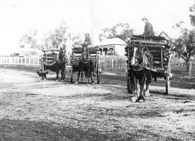
Photograph of three wagons loaded with logs, Three wagons loaded with logs, early 20th Century (original image)
... The wagons are carting five-foot firewood billets to the Tarnagulla Gold Estates hydraulic dredge operation.. This photograph is a fair copy of an older original, probably made in the late 1960s. ...The wagons are carting five-foot firewood billets to the Tarnagulla Gold Estates hydraulic dredge operation.. This photograph is a fair copy of an older original, probably made in the late 1960s. ...Murray Comrie Collection. Monochrome photograph depicting three wagons loaded with logs, being driven by three unidentified men. The photograph appears to be taken in Gladstone Street, Tarnagulla. The wagons are carting five-foot firewood billets to the Tarnagulla Gold Estates hydraulic dredge operation.. This photograph is a fair copy of an older original, probably made in the late 1960s. tarnagulla, timber, haulage, transport, horses, wagons, industry, people -
 Federation University Historical Collection
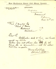
Letter, Douglas Scott, New Rietfontontein Estate Gold Mines Limited Correspondence and Letterhead, 1910, 20/06/1910
... New Rietfontontein Estate Gold Mines Limited Correspondence and Letterhead, 1910...new rietfontontein estate gold mines limited...Correspondence on New Rietfontontein Estate Gold Mines Limited letterhead to the Ballarat School of Mines....New Rietfontontein Estate Gold Mines Limited Correspondence and Letterhead, 1910 Letter Douglas Scott ...Letter from Douglas Scott to the Ballarat School of Mines concerning safe delivery of certificates. Correspondence on New Rietfontontein Estate Gold Mines Limited letterhead to the Ballarat School of Mines.new rietfontontein estate gold mines limited, letterhead, douglas scott, frederick martell, the rand, alumni, transvaal, south africa, rietfontein -
 The Beechworth Burke Museum
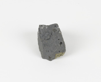
Geological specimen - Basalt (igneous-volcanic) containing Olivine, unknown
... Deep lead mining was initially unsuccessful, and it was not until the late 1870s that the Franklinford Gold Mining Company mined at Mount Franklin on a significant scale. A few years later the Mount Franklin Estate Gold Mining Company also struck gold, followed by the Shakespeare and Great Western companies in the mid-1880s. ...Deep lead mining was initially unsuccessful, and it was not until the late 1870s that the Franklinford Gold Mining Company mined at Mount Franklin on a significant scale. A few years later the Mount Franklin Estate Gold Mining Company also struck gold, followed by the Shakespeare and Great Western companies in the mid-1880s. ...This particular geological specimen was found in Mount Franklin or Lalgambook in Djadjawurrung, located between Daylesford and Newstead, approximately ninety minutes drive from Melbourne. The mountain is an example of a breached scoria cone (a steep conical hill of loose pyroclastic fragments) which was created by a volcanic eruption about 470,000 years ago, a date which may indicate the age of this geological specimen. The volcanic eruptions of Mount Franklin were most likely witnessed by members of the Dja Dja Wurrung Aboriginal tribe, who referred to this country as the 'smoking grounds'. Mount Franklin and the surrounding area appears to have been a place of considerable religious significance to Aboriginal people, there is evidence which indicates that frequent large ceremonial gatherings took place in the area. Basalt is the most common rock on Earth’s surface, more than 90% of all volcanic rock on Earth is basalt. Basalt is an aphanitic extrusive igneous rock formed from the rapid cooling of low-viscosity lava exposed at or very near the surface of a rocky planet or moon. Specimens are black in colour and weather to dark green or brown. Basalt is rich in iron and magnesium and is mainly composed of olivine, pyroxene, and plagioclase. Olivine is the name of a group of rock-forming silicate minerals with compositions ranging between Mg2SiO4 and Fe2SiO4. Unlike other minerals, Olivine has a very high crystallisation temperature which makes it the first of the minerals to crystallise from magma. As magma cools, the crystals begin to form and settle on the bottom of the lava and form basalts that are abnormally enriched in olivine in the lower part of lava flows. According to H. M. King (on geology.com) "Olivine is thought to be an important mineral in Earth's mantle. Its presence as a mantle mineral has been inferred by a change in the behaviour of seismic waves as they cross the boundary between Earth's crust and mantle". Lava from Mount Franklin and other volcanoes in the area filled valleys and buried the gold bearing streams that became the renowned ‘deep leads’ of the gold mining era. In 1852, as part of the Victorian gold rush, gold was discovered in the immediate area, this gold was created by lava flows during the Newer Volcanic period, which were mined intensively during the nineteenth century. Around 1865 the presence of a deep lead in Mount Franklin was established. Deep lead mining was initially unsuccessful, and it was not until the late 1870s that the Franklinford Gold Mining Company mined at Mount Franklin on a significant scale. A few years later the Mount Franklin Estate Gold Mining Company also struck gold, followed by the Shakespeare and Great Western companies in the mid-1880s. By the late 1880s, however, deep lead mining had ceased in the area. Soon after gold was discovered in 1851, Victoria’s Governor La Trobe wrote to the Colonial Office in London, urging ‘the propriety of selecting and appointing as Mineral Surveyor for this Colony a gentleman possessed of the requisite qualifications and acquaintance with geological science and phenomena’. Alfred Selwyn was appointed geological surveyor in Australia in 1852 which began the Geological Survey of Victoria. In 1853-69 the Geological Survey issued under Selwyn's direction sixty-one geological maps and numerous reports; they were of such high standard that a writer in the Quarterly Journal of the Geological Society of London bracketed the survey with that of the United States of America as the best in the world. During his years spent in Australia, Selwyn collected numerous significant geological specimens, examples of which are held in collections such as the Burke Museum.This geological specimen is an example of basalt and olivine which shows the volcanic lava activity and geographical specific nature of Mt Franklin as a significant volcanic site. According to Agriculture Victoria 'The crater is one of the deepest in the Central Highlands area. It is a major megacryst site with some of the largest known Victorian examples of megacrysts of augite and an orthoclase. The small parasitic mound of Lady Franklin on the western flanks adds to the geological interest of the site'. This specimen also highlights the locality as a significant place for both indigenous activity and Victorian gold rush era mining practices. This specimen is part of a larger collection of geological and mineral specimens collected from around Australia (and some parts of the world) and donated to the Burke Museum between 1868-1880. A large percentage of these specimens were collected in Victoria as part of the Geological Survey of Victoria that begun in 1852 (in response to the Gold Rush) to study and map the geology of Victoria. Collecting geological specimens was an important part of mapping and understanding the scientific makeup of the earth. Many of these specimens were sent to research and collecting organisations across Australia, including the Burke Museum, to educate and encourage further study.An angular, solid hand-sized piece of grey volcanic Basalt with green/brown Olivine phenocrysts along one flat edge.Olivine in basalt / - label is probably / correct. / C. Willman / 15/4/21burke museum, beechworth, indigo shire, beechworth museum, geological, geological specimen, mineralogy, basalt, igneous rock, igneous-volcanic, volcanic geology, volcanic, olivine, olivine specimen, basaltoid -
 Warrnambool and District Historical Society Inc.
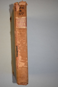
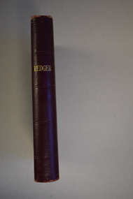
Ledger, Chadwick Copying Book Co, Letter book 1905, 1902
... estate. This letter book is of considerable importance as it contains the letters, maps and plans produced by John William Crawley Junior, a Shire of Warrnambool engineer for 40 years. It will be useful to researchers. john william crawley, junior, warrnambool rolf crawley, warrnambool shire of warrnambool history of warrnambool ‘1’ ‘Invoice’ ‘Chadwick Copying Book Co. Springfield Mass.’ This is a black hard cover letter book of 505 pages, plus an alphabetical index at the back of the book. The letter book contains handwritten letters, sketch maps and plans. There is gold ...This letter book has maps, letters and plans dating from 1902 to 1905. It came from the office of John William Crawley, Junior, an engineer, architect and surveyor in private practice in Warrnambool and also the engineer for the Shire of Warrnambool from 1895 to 1935. His father, brother and son were all engineers and worked in that capacity or as Shire Secretary for the Shire of Warrnambool, with the Crawley family recording a total of 132 years of service to the Shire of Warrnambool. The Shire of Warrnambool existed from 1863 to 1994. This letter book was passed on to John Crawley’s son, Rolf, engineer for the Shire of Warrnambool from 1935 to 1968. The letter book then came into the possession of Michael Hand who took over the private surveying business of Rolf Crawley in Warrnambool. The Warrnambool and District Historical Society acquired the letter book, along with several other Crawley ledgers, from the Michael Hand estate. This letter book is of considerable importance as it contains the letters, maps and plans produced by John William Crawley Junior, a Shire of Warrnambool engineer for 40 years. It will be useful to researchers. This is a black hard cover letter book of 505 pages, plus an alphabetical index at the back of the book. The letter book contains handwritten letters, sketch maps and plans. There is gold lettering on the spine.‘1’ ‘Invoice’ ‘Chadwick Copying Book Co. Springfield Mass.’ john william crawley, junior, warrnambool, rolf crawley, warrnambool, shire of warrnambool, history of warrnambool -
 Warrnambool and District Historical Society Inc.
Letter book 6, Jan 1914 - 1917, 1914
... estate. This letter book is of considerable significance as it contains letters, maps and plans drawn up by John William Crawley, Junior, the engineer for the Shire of Warrnambool for 40 years. It will be very useful for researchers. John William Crawley Junior, Warrnambool Rolf Crawley, Warrnambool Shire of Warrnambool ‘6’ ‘Letter Book 1914 to 1917’ This is a brown hard cover letter book with leather binding on the edges of the cover and on the spine. The leather is worn away in several places. There is gold ...This letter book contains letters, plans and sketch maps dating from 1914 to 1917. It came from the office of John William Crawley Junior, an engineer, architect and surveyor in private practice in Warrnambool and also the engineer for the Shire of Warrnambool from 1895 to 1935. His father, brother and son were also engineers and worked in that capacity or as the Shire Secretary for the Shire of Warrnambool, with the Crawley family recording a total of 132 years of service to the Shire of Warrnambool. This Shire existed from 1863 to 1994. The letter book was passed on the John Crawley’s son, Rolf, engineer for the Shire of Warrnambool from 1935 to 1968. It then came into the possession of Michael Hand who took over the private surveying practice of Rolf Crawley in Warrnambool. The Warrnambool and District Historical Society has acquired the letter book, along with several other Crawley ledgers, from the Michael Hand estate. This letter book is of considerable significance as it contains letters, maps and plans drawn up by John William Crawley, Junior, the engineer for the Shire of Warrnambool for 40 years. It will be very useful for researchers. This is a brown hard cover letter book with leather binding on the edges of the cover and on the spine. The leather is worn away in several places. There is gold lettering on the spine. The book has 750 pages of handwritten letters, maps and plans. The inside cover is of a mottled blue colour. There is an alphabetical index at the beginning of the book. ‘6’ ‘Letter Book 1914 to 1917’ john william crawley junior, warrnambool, rolf crawley, warrnambool, shire of warrnambool -
 Warrnambool and District Historical Society Inc.
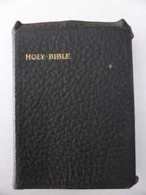
Book, The Holy Bible: Rogers, 1914
... estate item). This item has a particular poignancy as it was given to a Warrnambool World War One soldier who was killed in action. Perhaps he carried the Bible with him and it was returned to his family after his death. Henry Rogers Rogers Families of South Warrnambool World War One and Warrnambool ‘To Dear Harry Wishing Him God Speed & Safe Return From His Loving Uncle, Aunt And Cousins, Rita, Alfie & Charlie’. This is a black leather-covered book of 822 pages. The cover extends over the edges of the pages and has gold ...This Bible was given in March 1916 to Private Henry Havelock Rogers (1895-1917), the son of Joseph and Ellen Rogers of Warrnambool. He left Australia in April 1916 as a member of the 14th Battalion (17 Reinforcement Group) and died in France in April 1917 as a result of wounds. The cousins named on the card were the three older children of Arthur and Agnes Rogers, also of Warrnambool. Joseph and Arthur Rogers were brothers. The Bible was found in the MacDonald Street, South Warrnambool home of Bill Rogers, another son of Arthur and Agnes Rogers not born until the 1920s (deceased estate item). This item has a particular poignancy as it was given to a Warrnambool World War One soldier who was killed in action. Perhaps he carried the Bible with him and it was returned to his family after his death. This is a black leather-covered book of 822 pages. The cover extends over the edges of the pages and has gold lettering on the front cover and spine. The pages are gilt-edged and there are several colour maps at the end of the book. There is a blue ribbon marker encased in the binding. The inscription is on a loose card and is handwritten in black ink. ‘To Dear Harry Wishing Him God Speed & Safe Return From His Loving Uncle, Aunt And Cousins, Rita, Alfie & Charlie’. henry rogers, rogers families of south warrnambool, world war one and warrnambool -
 Warrnambool and District Historical Society Inc.
Letter book 7, 1917-1920, 1917
... estate. This letter book is of considerable significance as it contains letters, plans and maps drawn up John William Crawley Junior, the engineer for the Shire of Warrnambool for 40 years. It will be very useful for research. John William Crawley Junior, Warrnambool Rolf Crawley, Warrnambool Shire of Warrnambool ‘7 Private’ ‘Letter Book 1917 to 1920’ This is a hard cover book of 745 pages. It has leather trim on the cover edges and the spine with gold ...This letter book contains handwritten letters, sketch maps and plans and dates from 1917 to 1920. It comes from the office of John William Crawley Junior, an engineer, architect and surveyor in private practice in Warrnambool and also the engineer for the Shire of Warrnambool from 1895 to 1935. His father, brother and son were also engineers and worked in that capacity or as Shire Secretary for the Shire of Warrnambool, with the Crawley family recording 132 years of service with the Shire of Warrnambool. The Shire existed from 1863 to 1994. The letter book was passed on to John Crawley’s son, Rolf, the engineer for the Shire of Warrnambool from 1935 to 1968. The letter book then came into the possession of Michael Hand who took over the private surveying business of Rolf Crawley in Warrnambool. The Warrnambool and District Historical Society then acquired this letter book, along with other Crawley ledgers, from the Michael Hand estate. This letter book is of considerable significance as it contains letters, plans and maps drawn up John William Crawley Junior, the engineer for the Shire of Warrnambool for 40 years. It will be very useful for research. This is a hard cover book of 745 pages. It has leather trim on the cover edges and the spine with gold lettering on the spine. The leather covering is scuffed and torn. The inside covers have a mottled blue lining. The book contains maps, plans and handwritten letters and has an alphabetical index at the beginning of the book. Most of the pages have been water-stained. ‘7 Private’ ‘Letter Book 1917 to 1920’john william crawley junior, warrnambool, rolf crawley, warrnambool, shire of warrnambool -
 Warrnambool and District Historical Society Inc.
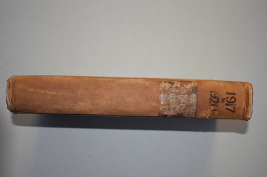
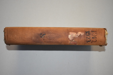
Ledger 10, Letters 1912 1923, 1912
... estate of Michael Hand. This letter book is of considerable interest as it contains letters and maps drawn up by John William Crawley, a Shire of Warrnambool engineer for 40 years. It will be helpful to researchers. John William Crawley Junior, Warrnambool Rolf Crawley, Warrnambool Shire of Warrnambool ‘Letter Book 1912, 1923’ This is a black hard cover letter book with brown binding on the cover edges and the spine. Parts of the cover have been worn away. The spine once had gold ...This letter book contains letters and maps and dates from 1912 to 1923. It came from the office of John William Crawley Junior, an engineer, architect and surveyor in private practice in Warrnambool and also the engineer for the Shire of Warrnambool from 1895 to 1935. Hs father, brother and son were also engineers and worked in that capacity or as the Shire Secretary in the Shire of Warrnambool, with the Crawley family recording a total of 132 years of service to the Shire. The Shire of Warrnambool existed from 1863 to 1994. The letter book was passed on to John Crawley’s son, Rolf who was the engineer for the Shire of Warrnambool from 1935 to 1968. It then passed into the possession of Michael Hand who took over the private surveying practice of Rolf Crawley in Warrnambool. The Warrnambool and District Historical Society acquired the letter book, along with several other Crawley ledgers, from the estate of Michael Hand. This letter book is of considerable interest as it contains letters and maps drawn up by John William Crawley, a Shire of Warrnambool engineer for 40 years. It will be helpful to researchers. This is a black hard cover letter book with brown binding on the cover edges and the spine. Parts of the cover have been worn away. The spine once had gold lettering but this is mostly worn away. The book has 743 pages of handwritten letters and maps and an alphabetical index at the front. The pages are water stained.‘Letter Book 1912, 1923’john william crawley junior, warrnambool, rolf crawley, warrnambool, shire of warrnambool -
 Warrnambool and District Historical Society Inc.
Ledger, Crawley, 1919
... estate of Michael Hand. This book is of considerable interest as it contains details of the 1920s accounts and payments recorded by John William Crawley Junior, the engineer for the Shire of Warrnambool for 40 years. It will be useful for researchers. John William Crawley Junior, Warrnambool Rolf Crawley, Warrnambool Shire of Warrnambool ‘Shire Office Warrnambool’ ‘J.Wm. Crawley & Son Warrnambool’ This is a black hard cover book of 132 pages. It has red binding on the corners of the cover and on the spine. There is gold ...This ledger contains accounts and payment details and dates from 1919 to 1925. It came from the office of John William Crawley Junior, an engineer, surveyor and architect in private practice in Warrnambool and also the engineer for the Shire of Warrnambool from 1895 to 1935. His father, brother and son were all engineers and worked in that capacity or as the Shire Secretary of the Shire of Warrnambool, with the Crawley family recording a total of 132 years of service to the Shire. The Shire of Warrnambool existed from 1863 to 1994. This accounts book was passed on to John Crawley’s son, Rolf who was the engineer for the Shire of Warrnambool from 1935 to 1968. It then came into the possession of Michael Hand who took over the private surveying business of Rolf Crawley in Warrnambool. The Warrnambool and District Historical Society acquired the accounts book, together with several other Crawley ledgers, from the estate of Michael Hand. This book is of considerable interest as it contains details of the 1920s accounts and payments recorded by John William Crawley Junior, the engineer for the Shire of Warrnambool for 40 years. It will be useful for researchers.This is a black hard cover book of 132 pages. It has red binding on the corners of the cover and on the spine. There is gold lettering on the spine. The book has a brown mottled pattern inside the cover. The pages are ruled with red and blue lines and contain invoices and payment statements.‘Shire Office Warrnambool’ ‘J.Wm. Crawley & Son Warrnambool’ john william crawley junior, warrnambool, rolf crawley, warrnambool, shire of warrnambool -
 Warrnambool and District Historical Society Inc.
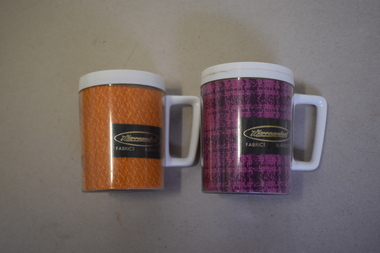
Mugs, Newlyne Mfg. Co Pty Ltd, Warrnambool Fabric Blankets, Mid 20th century
... estate in 2009. These mugs are of interest as mementoes of the Warrnambool Woollen Mill, a key industry in the development of Warrnambool and one that operated for 90 years. Warrnambool Woollen Mill .1 & .2 Warrnambool Fabrics Blankets Steditemp Insulated Ware Made in Australia by Newlyne MFG Co Pty Ltd Division of J. Glaser & Co Melbourne .1 This is an insulated plastic mug with a mottled orange-coloured body and a white rim on the top opening and a white handle. On the side of the mug is a printed name with gold ...These mugs are souvenirs of the Warrnambool Woollen Mill. They were either sold as souvenirs or given to clients of the mill. The Warrnambool Woollen Mill in South Warrnambool was opened in 1910 with the first manager being John Bennett, an Englishman who recruited skilled weavers and bought mill equipment from his home country. At the height of production the mill was employing up to 700 people. In 1958 the mill became the first in Australia to manufacture electric blankets. In 1968 the mill was sold to the Dunlop company and in the ensuing years various companies owned the plant. In the year 2000 the mill was closed and the equipment was sold. The buildings were sold to a private developer and the first residents moved into the new housing estate in 2009. These mugs are of interest as mementoes of the Warrnambool Woollen Mill, a key industry in the development of Warrnambool and one that operated for 90 years. .1 This is an insulated plastic mug with a mottled orange-coloured body and a white rim on the top opening and a white handle. On the side of the mug is a printed name with gold lettering on a brown background. The maker’s name is etched into the base of the mug. .2 This is an insulated plastic mug with a purple and black mottled body and a white rim on the top opening and a white handle. On the side of the mug is a printed name on a brown background with gold lettering. The maker’s name is etched into the base of the mug. .1 & .2 Warrnambool Fabrics Blankets Steditemp Insulated Ware Made in Australia by Newlyne MFG Co Pty Ltd Division of J. Glaser & Co Melbourne warrnambool woollen mill -
 Warrnambool and District Historical Society Inc.
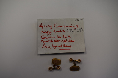
Accessory - Cuff Links
... These cuff links are of considerable interest as they are mementoes of the life and work of the prominent Warrnambool auctioneer and real estate agent, Harry Greening Harry Greening Warrnambool H G These are two identical gold cuff links in a rectangular shape cut across the edges. ...These cuff links belonged to Harry Greening (1888-1979). He was a Warrnambool auctioneer and real estate agent, operating in the city for over 60 years. He was brought up, and later resided for some time at 230 Liebig Street. At one time his business was known as Greening and Cain Pty Ltd and operated in Koroit Street but he was also in Kepler Street and Lava Street. Over the years his real estate business was involved in the selling of many well-known Warrnambool properties, including the Lyndoch estate. These cuff links are of considerable interest as they are mementoes of the life and work of the prominent Warrnambool auctioneer and real estate agent, Harry GreeningThese are two identical gold cuff links in a rectangular shape cut across the edges. The centre of the cuff links is an oval shape with ornamentation around the outside and two inscribed letters in the middle. The cuff links have a gold attachment and a gold chain to enable the links to pass through the button holes of the shirt cuff.H Gharry greening, warrnambool -
 Warrnambool and District Historical Society Inc.
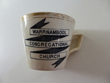
souvenir cup, Warrnambool Congregational Church
... It remained on this site until the site was sold to the T & G Assurance in 1939 and land known as Kianga Estate was purchased on the corner of Lava and Henna Streets.It became part of the amalgamation with other churches to form the Uniting Church in 1977.This cup is possibly a souvenir from the 50th anniversary celebrations held in 1912. A common object which is linked to one of warrnambool's longest running churches. warrnambool warrnambool congregational church Warrnambool Congregational Church on front of cup . 338 written on bottom and 4 on paper label Cream china cup with thick gold rim and black test in banner style on one side of the cup. ...The Warrnambool Congregational Church was established with a meeting called in April 1862 and over the ensuing months a congregation with first pastor Rev W Pentland was established. After initially meeting at the small Temperence Hall in Liebig St, land was purchased at the corner of Liebig and lava St and the first church opened in March 1864. It remained on this site until the site was sold to the T & G Assurance in 1939 and land known as Kianga Estate was purchased on the corner of Lava and Henna Streets.It became part of the amalgamation with other churches to form the Uniting Church in 1977.This cup is possibly a souvenir from the 50th anniversary celebrations held in 1912. A common object which is linked to one of warrnambool's longest running churches.Cream china cup with thick gold rim and black test in banner style on one side of the cup. Warrnambool Congregational Church on front of cup . 338 written on bottom and 4 on paper labelwarrnambool, warrnambool congregational church -
 Warrnambool and District Historical Society Inc.
Book, A course of harmony, 1899
... Estate Agent and in the 1940s and 50s she took an active part in the musical life of Warrnambool as a violinist and accompanying pianist. Her son Frank was also a businessman in Warrnambool. This book is of moderate interest as a text book used by Edith Jacobs. She was prominent in the 1940s and 50s in the Warrnambool musical scene. Edith Jacobs (nee Larwill) History of Warrnambool ‘Edith Larwill’ This is a hard cover book of 210 pages. It has a dark green cover with gold ...The owner of this book was Edith Larwill. She was a violinist who played in the Brisbane Symphony Orchestra early in the 20th century. She married Henry Jacobs, a Warrnambool Real Estate Agent and in the 1940s and 50s she took an active part in the musical life of Warrnambool as a violinist and accompanying pianist. Her son Frank was also a businessman in Warrnambool. This book is of moderate interest as a text book used by Edith Jacobs. She was prominent in the 1940s and 50s in the Warrnambool musical scene. This is a hard cover book of 210 pages. It has a dark green cover with gold lettering on the spine. The book has a Preface, 24 chapters of text and an Appendix. The text includes many musical notations. The signature of the owner is handwritten in black ink. There is some damage to the bottom edge of the spine. The stamp of a Brisbane music shop on the first page is indecipherable. ‘Edith Larwill’ edith jacobs (nee larwill), history of warrnambool -
 Warrnambool and District Historical Society Inc.
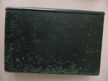
Album, Warrnambool and District 1886 Western Hotel, 1886
... estate and 2342 pounds personality to relatives. Large hard covered album. Dark green cover with title in red rectangle on front cover. Text in gold ...This album contains a number of local coastal and seascapes including Thunder Point, views of local streets such as Liebig and Fairy streets, panorama views of the town from Manse Hill and Booval Hill and the Botanic Gardens. Buildings included are Cramond and Dickson, St Joseph’s Church, the saleyards. The book itself would have been used by patrons of the Western Hotel when J Fox was licensee, from 1880 until 1887. The hotel had been operating since 1870 when William O’Brien applied for a publican’s license for the house on the corner of Timor and Kepler Streets with five sitting rooms and eight bedrooms. The stone building was designed by Andrew Kerr and built by Williams & Co. The Western Hotel was also the booking office for Cobb and Co Coaches which operated until the railway came to town in 1890. This album has historical significance on different levels. Firstly the photographs provide a view of Warrnambool in the late 19th century. The photos are aesthetically and artistically significant. Many of the buildings in the streetscapes are still recognizable. Secondly the Western Hotel has occupied a prominent site within the CBD for nearly 150 years. It has links to Cobb & Co, an important part of early Australian transport. Large hard covered album. Dark green cover with title in red rectangle on front cover. Text in gold lettering. A variety of photographs mounted on card.Chuck Photo Ballarat on front cover. Small cutting pasted inside front cover, reads as follows,” Will and Estates. Joseph Fox, late of Grosvenor Street, Balaclava who died on 29th July by his will of 11th August 1915 left 3737pounds real estate and 2342 pounds personality to relatives. warrnambool, warrnambool history, warrnambool photographs of the past, western hotel photographs -
 Bendigo Military Museum
Financial record - ACCOUNT BOOKS BRSL, Bendigo RSL Sub Branch, 1987 - 2003
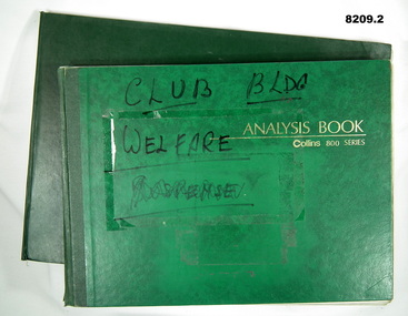
... Estate Bissett, 2000 - 2003. Refer Cat No's 8020 & 8073P for the formation of the Bendigo District RSL Sub Branch Inc. brsl smirsl accounts .1) On front cover in black texta, "Club Bldg, Welfare ..............". In gold ...Account books Income/Expenditure for the Bendigo RSL Sub Branch which flows on into the early days of Bendigo District RSL Sub Branch Inc. .1) Three Acc's listed, Club Building Fund 1983 - 1999, Welfare Patriotic Fund 1987 - 1999, Bissett Acc 1994 - 1999. .2) Three Acc's listed, Building Patriotic Fund 2000 - 2003, Welfare Patriotic Fun 2000 - 2003, Estate Bissett, 2000 - 2003. Refer Cat No's 8020 & 8073P for the formation of the Bendigo District RSL Sub Branch Inc..1) Book, green covers, blue ruled lines with red and blue vertical lines, entries are in blue pen and black pencil. .2) Book, dark green covers, blue ruled lines with blue and black vertical lines, entries are in blue pen and black pencil..1) On front cover in black texta, "Club Bldg, Welfare ..............". In gold print "Analysis book Collins 800 series". .2) On front cover in gold print, "Collins 800 Analysis book 27 money columns - 13245"brsl, smirsl, accounts -
 Bendigo Military Museum
Book, The Seventeenth Brigade Magazine, 'THE SEVENTEENTH AUSTRALIAN INFANTRY BRIGADE
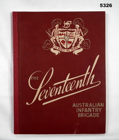
... Estate/Mrs J. Crosbie" - Owner's stamp, black ink BENDIGO DISTRICT/ RSL SUB BRANCH INC/ PO BOX 449/ BENDIGO VIC 3552. Soft cover book. Soft cover, cardboard. Gold ...Book - "Issued to mark the fourth Anniversary of the departure from Australia of the 17th Australia Infantry Brigade for Active Service".Soft cover book. Soft cover, cardboard. Gold and cream print on front cover. Burgundy coloured background. Front cover illustration -0 military coat of arms with the words 'IN WHICH WE SERVE" . 144 pages, paper, cut, plain, off white. Illustrated black & white photographs, maps and illustrations. Book binding cloth tape on spine and stapled. Inscriptions - two on title page.Title page - handwritten, black ink " Estate/Mrs J. Crosbie" - Owner's stamp, black ink BENDIGO DISTRICT/ RSL SUB BRANCH INC/ PO BOX 449/ BENDIGO VIC 3552.books, history, ww2, 1939-1944 -
 Kiewa Valley Historical Society
Book - Reference Melbourne Directory, Melbourne and Suburban Directory for 1889, Circa 1889
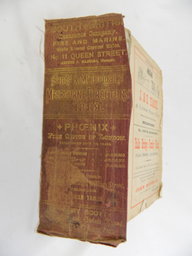
... gold colour "South * British insurance Company Fire and Marine. Risks Lowest Current Rates No. 11 Queen Street, Arthur J Masters, Manager" and half way down " *Phoenix* Fire Office of London established over 100 years Annual Income exceeds (pound sign) 1,000,000" underneath "Losses Paid Over (pound sign) 16,000,000" underneath "Reserve Fund Exceeds (pound sign) 1,000,000" underneath "9 Market Buildings William Street, Melbourne " underneath " R. Manfield Taylor, Agent" and at the bottom section" Henry Scott Auctioneer and Estate...gold colour "South * British insurance Company Fire and Marine. Risks Lowest Current Rates No. 11 Queen Street, Arthur J Masters, Manager" and half way down " *Phoenix* Fire Office of London established over 100 years Annual Income exceeds (pound sign) 1,000,000" underneath "Losses Paid Over (pound sign) 16,000,000" underneath "Reserve Fund Exceeds (pound sign) 1,000,000" underneath "9 Market Buildings William Street, Melbourne " underneath " R. Manfield Taylor, Agent" and at the bottom section" Henry Scott Auctioneer and Estate ...This Directory of 1889 covers the location of Melbourne based trade and professional offices by street and in Alphabetical order. It covers all of Melbourne and its suburbs. It also covers government and official, ecclesiastic, legal, municipal and miscellaneous information. The directory details a cross section of a developing city with a splattering of advertisements opening up an in depth look of all aspects of living in the late 1800s. It is interesting to see that all the advertisements do not have any telecommunication numbers listed (personal shoppers or mail orders only). This was a period of high moral standing within the community and hotels advertised rooms " suites of rooms for families and single rooms for Ladies and Gentlemen" also "electric bells throughout the house. Telephone, night porter and hot and cold baths."This directory would be used by the majority of families and businesses working and living within the Kiewa Valley and the surrounding area. Melbourne was the only place where every aspect of living requirement was catered for. Although the delivery of services and goods were not at a high rate, certain items or transactions would require a visit to "the big smoke". Business information are listed both by suburb and alphabetically. There is also a section for British and Foreign Trade. This directory covered nearly everything to do with commerce, an example pay days for principle firms. Greater evolution of trade locations started to balloon out after the mid 1950's. Increased populations and greater levels of communication and safe fast transport facilities permitted greater devolution of commercial enterprises into rural communities, such as the Kiewa Valley.This directory has no front or back cover and is held together by its cloth spine. It contains over 1300 pages, however there may be some pages missing front and back of the directory which would have contained advertisements of some unknown shops. All the sides of this directory (except the spine) have advertisements and content information stamped on. The spine cover has been placed in the directory until further conservation work is carried out. It has gold coloured printing and in the central section, a gold coloured background with the words "Sands & McDougall's Melbourne Directory 1889." The spine has three adverts on the spine.On the spine in gold colour "South * British insurance Company Fire and Marine. Risks Lowest Current Rates No. 11 Queen Street, Arthur J Masters, Manager" and half way down " *Phoenix* Fire Office of London established over 100 years Annual Income exceeds (pound sign) 1,000,000" underneath "Losses Paid Over (pound sign) 16,000,000" underneath "Reserve Fund Exceeds (pound sign) 1,000,000" underneath "9 Market Buildings William Street, Melbourne " underneath " R. Manfield Taylor, Agent" and at the bottom section" Henry Scott Auctioneer and Estate Agent 49 Bridport St., Albert Park" stamped on the bottom side across the page endings "The Wonderful Wertheim Sewing Machines Swanston Street opposite Town Hall", stamped on the top side across the page endings " The Sweet Hapsburg Pianos & Organs Swanston Street Opposite Town Hall"state government listings, names and location of early melbourne population business names, 1889 members of the victorian executive council -
 Kiewa Valley Historical Society
Bowl Covered, circa mid to late 1900's
... estates. This period was part of the early 1900's, when large rural acreage was family owned and the economical return to rural produce was very high. It was a time when the Australian economy "rode on the back of sheep" This item has relative significance to the Kiewa Valley as part of the rural and mining(gold) era when the strong return from local gold mining and grazing was demonstrated by the "landed gentry" and significant household cutlery, crockery, etiquette and old English mores, influenced by "Mother Britain" glass bowls kitchen crockery serving etiquette meal presentation Barely visible "VALLERYSTHAL" This green opalescent covered bowl is similar to the French PV cabbage form. ...This covered glass bowl with lid was made in a period when there was a strict discipline in the use a various dishes and accompaniments with respect to the type of crockery used. This was in the English style, especially in well to do rural family estates. This period was part of the early 1900's, when large rural acreage was family owned and the economical return to rural produce was very high. It was a time when the Australian economy "rode on the back of sheep"This item has relative significance to the Kiewa Valley as part of the rural and mining(gold) era when the strong return from local gold mining and grazing was demonstrated by the "landed gentry" and significant household cutlery, crockery, etiquette and old English mores, influenced by "Mother Britain"This green opalescent covered bowl is similar to the French PV cabbage form. When the lid is on the bowl appears as a small cabage with three sets of half peeled leaves. There are five outer leaves, next row are five inner leaves and finally three core leaves. The main bowl has a lip encircling the inside of the bowl for the lid to rest upon with closed. The glass has been pressed to show the leaves with their web like stalks. The inside area of the bowl and lid are smooth. This is to allow the mashed up contents to be easily scraped into a serving ladle.Barely visible "VALLERYSTHAL"glass bowls, kitchen crockery, serving etiquette, meal presentation -
 Orbost & District Historical Society
Clothing - belt, 1890-1910
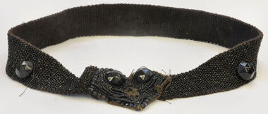
... estate. George Temple (1832-1916) started Temple's store opposite Post Office. Packed stores to Bendoc area gold fields....estate. George Temple (1832-1916) started Temple's store opposite Post Office. Packed stores to Bendoc area gold fields. ...This item is from the Temple estate. George Temple (1832-1916) started Temple's store opposite Post Office. Packed stores to Bendoc area gold fields.This item is significant because it represents part of a woman's costume worn c. late 19th Century to 1910. It is highly decorative.Jet beaded belt . Large and small beads. Large jet bead fastener (Paris Jet).belt beads costume-accessories jewelry jet-beads temple-george -
 Orbost & District Historical Society
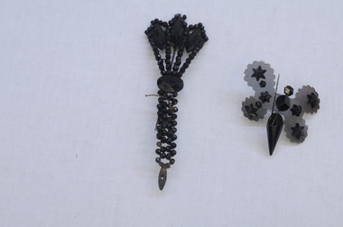
Decorative object - Brooch
... estate. George Temple (1832-1916) started Temple's store opposite Orbost Post Office. Packed stores to Bendoc area gold fields, also had a store in Cann River. ...estate. George Temple (1832-1916) started Temple's store opposite Orbost Post Office. Packed stores to Bendoc area gold fields, also had a store in Cann River. ...These items are from the Temple estate. George Temple (1832-1916) started Temple's store opposite Orbost Post Office. Packed stores to Bendoc area gold fields, also had a store in Cann River. This item is an example of a popular piece of jewelry worn by women in the early 20th century. These brooches were sold in a local store and could have been purchased for a local funeral.Black, bakelite brooch - three small sections form centre of brooch, one is a hexagonal cone-shape with hexagonal dome attached by link to smaller circular polygon attached by link to a smaller flat pentagon. Black mesh in the shape of wings form the backing featuring eight bakelite stars of varying sizes (two smaller stars missing from the assembly). A metal pin is attached to the rear in the form of a clasp.1900s jewellery, bakelite, mourning brooch, george temple, orbost store -
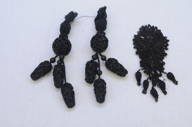 Orbost & District Historical Society
beading
... estate. George Temple (1832-1918) started Temple's store opposite Post Office. Packed stores to Bendoc area gold fields....estate. George Temple (1832-1918) started Temple's store opposite Post Office. Packed stores to Bendoc area gold fields. ...These items are from the Temple estate. George Temple (1832-1918) started Temple's store opposite Post Office. Packed stores to Bendoc area gold fields.Items worn by women early 20th Century and possibly available in an Orbost store.One long rope of jet beads and a pair of bobble jet beads. One jet bead applique piece.beading jet-beads costume-accessories haberdashery