Showing 847 items matching "gold mining - victoria"
-
 Lakes Entrance Historical Society
Photograph - gold mining town of Grant Victoria, 1900 c
... gold mining town of Grant Victoria ...gold mining town of Grant Victoria ...Black and white photograph of a vegetable patch and flower garden beside a rustic dwelling surrounded by split paling fence near the gold mining town of Grant Victoria...Lakes Entrance Historical Society 4 Marine Parade Lakes Entrance gippsland Mines and Mining Settlement Topography Gold Black and white photograph of a vegetable patch and flower garden beside a rustic dwelling surrounded by split paling fence near the gold mining town of Grant Victoria gold mining town of Grant Victoria Photograph gold mining town of Grant Victoria ...Black and white photograph of a vegetable patch and flower garden beside a rustic dwelling surrounded by split paling fence near the gold mining town of Grant Victoriamines and mining, settlement, topography, gold -
 Stawell Historical Society Inc
Book, R.B. Watchorn, A Pictorial History of Gold Mining at Stawell Victoria - Previously Cat No 3632, 06 April 1986
... A Pictorial History of Gold Mining at Stawell Victoria - Previously Cat No 3632...A Pictorial History of Gold Mining at Stawell, Victoria By R.B. Watchorn R Watchorn (Signature) Stawell, Vic 6 April, 1986...gold mining in Stawell. PLEASE NOTE: This book is not very accurate, lots of mistakes. stawell A Pictorial History of Gold Mining at Stawell, Victoria By R.B. ...Photos and extracts from the proposed new pictorial history of gold mining in Stawell. PLEASE NOTE: This book is not very accurate, lots of mistakes.White Paper cover with map of Victoria inside two oval rings.A Pictorial History of Gold Mining at Stawell, Victoria By R.B. Watchorn R Watchorn (Signature) Stawell, Vic 6 April, 1986stawell -
 Lakes Entrance Historical Society
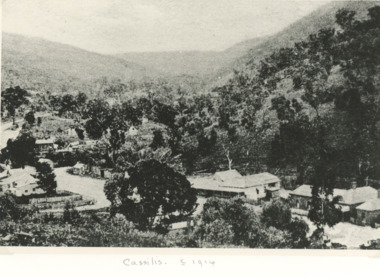
Photograph - gold mining at Cassilis Victoria c1914
... gold mining at Cassilis Victoria c1914...Black and white photograph of old gold mining town between Swifts Creek and Omeo, Cassilis Victoria...Lakes Entrance Historical Society 4 Marine Parade Lakes Entrance gippsland Houses Settlement Mines and Mining Black and white photograph of old gold mining town between Swifts Creek and Omeo, Cassilis Victoria Photograph gold mining at Cassilis Victoria c1914 ...Black and white photograph of old gold mining town between Swifts Creek and Omeo, Cassilis Victoriahouses, settlement, mines and mining -
 Bendigo Historical Society Inc.
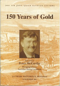
Book - 150 YEARS OF GOLD, 2001
... GOLD...Goldfields...victoria...Gold Mining...History House 11 Mackenzie Street Bendigo goldfields GOLD Goldfields victoria Gold Mining - Victoria Discovery of gold - Victoria Sir John Quick. ...150 Years of Gold, 2001 Sir John Quick Bendigo Lecture delivered by Peter McCarthy Managing Director Australian Mining Consultants at La Trobe University Bendigo. Published by La Trobe University, 17 pages with photographs. With IndexPeter.McCarthy.gold, goldfields, victoria, gold mining - victoria, discovery of gold - victoria, sir john quick. -
 Bendigo Historical Society Inc.
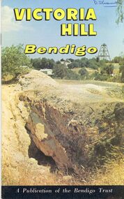
Book - STRAUCH COLLECTION: VICTORIA HILL BENDIGO
... ...Gold mining...victoria...History House 11 Mackenzie Street Bendigo goldfields BHS Collection BENDIGO Gold mining victoria hill Bendigo-History-Mining Victoria Hill Bendigo a publication of the Bendigo Trust with maps, black and white & colour photographs. ...BHS CollectionVictoria Hill Bendigo a publication of the Bendigo Trust with maps, black and white & colour photographs.bendigo, gold mining, victoria hill, bendigo-history-mining -
 Bendigo Historical Society Inc.
Map - PLAN OF VICTORIA HILL AREA, 1971
... ...Gold mining...victoria...History House 11 Mackenzie Street Bendigo goldfields BHS Collection BENDIGO Gold mining victoria hill Bendigo Historical Society feature Plan of the Victoria Hill area. ...BHS CollectionBendigo Historical Society feature Plan of the Victoria Hill area. Printed on Paper and laminated. B & W. Compiled by AHG Survey Regiment.CMF Increment May 1971bendigo, gold mining, victoria hill -
Bendigo Historical Society Inc.
Map - PLAN OF VICTORIA HILL AREA, 1971
... ...Gold mining...victoria...History House 11 Mackenzie Street Bendigo goldfields BHS Collection BENDIGO Gold mining victoria hill Bendigo Historical Society feature Plan of the Victoria Hill area. ...BHS CollectionBendigo Historical Society feature Plan of the Victoria Hill area. Printed on Paper. B & W. Compiled by AHG Survey Regiment.CMF Increment May 1971bendigo, gold mining, victoria hill -
Bendigo Historical Society Inc.
Map - PLAN OF VICTORIA HILL AREA, 1971
... ...Gold mining...victoria...History House 11 Mackenzie Street Bendigo goldfields BHS Collection BENDIGO Gold mining victoria hill Bendigo Historical Society feature Plan of the Victoria Hill area. ...BHS CollectionBendigo Historical Society feature Plan of the Victoria Hill area. Printed on Acetate. B & W. Compiled by AHG Survey Regiment.CMF Increment May 1971bendigo, gold mining, victoria hill -
 Bendigo Historical Society Inc.
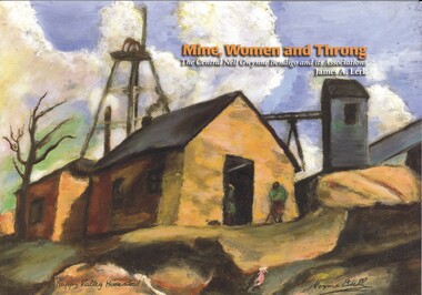
Book - MINE, WOMEN AND THRONG
... Gold mining...central nell gwynne...Gold mines-gold mining Victoria...History House 11 Mackenzie Street Bendigo goldfields BENDIGO Gold mining central nell gwynne Gold mines-gold mining Victoria-Bendigo-history James Lerk Mine, Women and Throng, The Central Nell Gwynne Bendigo and its Associations, soft cover 116 pages with colour & black and white photographs, maps & graphs. ...Mine, Women and Throng, The Central Nell Gwynne Bendigo and its Associations, soft cover 116 pages with colour & black and white photographs, maps & graphs. Signed inside cover by author, printed by BartnPrint.James Lerkbendigo, gold mining, central nell gwynne, gold mines-gold mining victoria-bendigo-history -
 Marysville & District Historical Society
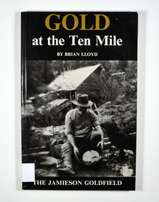
Book, Gold at the Ten Mile-The Jamieson Goldfield, 1995
... ...gold mining...victoria...Marysville & District Historical Society 39 Darwin Street Marysville yarra-valley-and-the-dandenong-ranges A history of the Jamieson gold field gold mines gold mining victoria jamieson district australia history To the memory of my great grandfather Tom Allen,/ my grandfather Jim, Wray, my father Ben Lloyd and/ his uncle, Charlie Lloyd - all seekers of gold at the/ Ten Mile. ...A history of the Jamieson gold fieldPaperback. Black cover. Front cover has a photograph of a man gold panning with his dog in a river. In the background is an old wooden house.To the memory of my great grandfather Tom Allen,/ my grandfather Jim, Wray, my father Ben Lloyd and/ his uncle, Charlie Lloyd - all seekers of gold at the/ Ten Mile. Stamp of the Marysville & District Historical Society Inc / P.O. Box 22 / Marysville 3779 Stamp of the Marysville & District / Historical Society Inc.gold mines, gold mining, victoria, jamieson district, australia, history -
 Wodonga & District Historical Society Inc
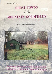
Book - Secrets of Ghost Towns of the Mountain Goldfields, Luke Steenhuis, 1999
... ...gold mining victoria...Wodonga & District Historical Society Inc Hut 97, Bonegilla Migrant Experience, 132 Bonegilla Road Bonegilla the-murray ghost towns victoria gold mining victoria Stories from 50 former towns in and around Melbourne's North-east mountain region. ...Stories from 50 former towns in and around Melbourne's North-east mountain region. These old towns include: Aberfeldy, Aberfeldy Crossing, BB Township, Blue Jacket, Clarke's Flat, Concord Gully, Edwards Reef, Fultons Creek, Jericho, Loch Fyne, Red Jacket, Store Point, The Springs, Toombon, Toombon Upper, Tullamore, Upper Thomson, Victors Quartz, Violet Town & White Star.non-fictionStories from 50 former towns in and around Melbourne's North-east mountain region. These old towns include: Aberfeldy, Aberfeldy Crossing, BB Township, Blue Jacket, Clarke's Flat, Concord Gully, Edwards Reef, Fultons Creek, Jericho, Loch Fyne, Red Jacket, Store Point, The Springs, Toombon, Toombon Upper, Tullamore, Upper Thomson, Victors Quartz, Violet Town & White Star.ghost towns victoria, gold mining victoria -
 Bendigo Historical Society Inc.
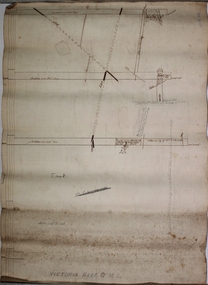
Plan - Victoria Reef Gold Mine Trans Section
... gold mining...gold...Victoria...Victoria Reef Gold Mine was situated near the intersection of Hercules and Syncline Court, Long Gully. gold mining gold Victoria Reef trans section Bendigo Quartz mining J. ...Victoria Reef Gold Mine was situated near the intersection of Hercules and Syncline Court, Long Gully.Hand drawn plan of Victoria Reef Gold Mine, trans section. Written on bottom of plan: Victoria Reef G.M.C. Handwritten annotations on section of plan. Plan forms part of the Margaret Roberts Collection.J. Sheard, 189 View Street, Bendigo' written on plangold mining, gold, victoria reef, trans section, bendigo, quartz mining -
Bendigo Historical Society Inc.
Plan - Victoria Proprietary Co
... gold mining...gold...Bendigo...Victoria...Victoria Pty Ltd. Mine was located near Wattle Drive, Spring Gully, inside the Spring Gully Reservoir reserve. gold mining gold Bendigo Victoria Pty Ltd. ...Victoria Pty Ltd. Mine was located near Wattle Drive, Spring Gully, inside the Spring Gully Reservoir reserve.Victoria Proprietary Company Plan forms part of the Margaret Roberts Collection.gold mining, gold, bendigo, victoria pty ltd., spring gully, wattle drive -
 Marysville & District Historical Society
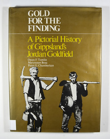
Book - Hardcover book, Gold for the Finding-A Pictorial History of Gippsland's Jordan Goldfield, 1979
... gold mining...gold mines...victoria...Marysville & District Historical Society 39 Darwin Street Marysville yarra-valley-and-the-dandenong-ranges A pictorial history of Gippsland's Jordan goldfield gold gold mining gold mines victoria gippsland history bosa, marysusan tomlin, owen f. chamberlain, peter g. ...A pictorial history of Gippsland's Jordan goldfieldHardcover. Gold dust cover. Front cover has a photograph of two miners carrying mining equipment.This work is dedicated to the people of the Jordan Goldfields,/ the Pioneers who worked, lived, loved and died in the moun-/ tains of Gippsland, giving us a rich and varied heritage. It is especially dedicated to Mr William Rae, Gentleman, Late of/ Jericho, without whose assistance this work would have/ remained a dream. Stamp of the Marysville & District Historical Society Inc / P.O. Box 22 / Marysville 3779gold, gold mining, gold mines, victoria, gippsland, history, bosa, marysusan, tomlin, owen f., chamberlain, peter g. -
 Marysville & District Historical Society
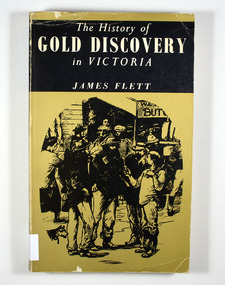
Book - Paperback book, The History of Gold Discovery in Victoria, 1979
... gold mining...gold town...victoria...Marysville & District Historical Society 39 Darwin Street Marysville yarra-valley-and-the-dandenong-ranges A history of gold discovery in Victoria gold gold field gold miner gold mining gold town victoria australia history Stamp of the Marysville & District Historical Society Inc / P.O. ...A history of gold discovery in VictoriaPaperback. Gold front cover. Front cover has a drawing of a group of miners outside a shop. Back cover has a drawing of a group of mounted police riding roughshod through a group of people and dogs.Stamp of the Marysville & District Historical Society Inc / P.O. Box 22 / Marysville 3779gold, gold field, gold miner, gold mining, gold town, victoria, australia, history -
 Bendigo Historical Society Inc.
Plan - Victoria Quartz Gold Mine, Unknown
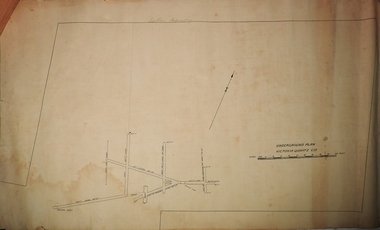
... gold mining...gold...Bendigo...Victoria...Gold Mines Hotel. Victoria Hill was one of the richest areas on the Bendigo Goldfield. It had many successful mines, including Lansell's '180' and the Victoria Quartz, once the deepest gold mine in the world. At the turn of the century, this was the site of one of the premier mines on the Bendigo goldfield. In 1908, it boasted the world's deepest shaft - 4,478 feet (1,365 metres). The shaft reached a depth of 4,613 feet (1,406 metres) in 1910. In 1857 eight small claims in this area had been merged to form the Victoria Reef Quartz Mining...Victoria Quartz Co. For the next three decades, the mine produced consistent profits. In 1910, water burst into the claim, flooding the shaft and halting operations. The company baled water for six months then handed the mine over to the tributers who worked the upper levels for the share of the profits. The mine closed in 1913, having produced over 48,000 ounces of gold and paid dividends of £99,600. gold mining ...Victoria Quartz Gold Mine was situated on Victoria Hill, Bendigo. Victoria Hill is situated on the Marong Road, opposite the Gold Mines Hotel. Victoria Hill was one of the richest areas on the Bendigo Goldfield. It had many successful mines, including Lansell's '180' and the Victoria Quartz, once the deepest gold mine in the world. At the turn of the century, this was the site of one of the premier mines on the Bendigo goldfield. In 1908, it boasted the world's deepest shaft - 4,478 feet (1,365 metres). The shaft reached a depth of 4,613 feet (1,406 metres) in 1910. In 1857 eight small claims in this area had been merged to form the Victoria Reef Quartz Mining Co. Another merger in 1877 led to the formation of the Victoria Quartz Co. For the next three decades, the mine produced consistent profits. In 1910, water burst into the claim, flooding the shaft and halting operations. The company baled water for six months then handed the mine over to the tributers who worked the upper levels for the share of the profits. The mine closed in 1913, having produced over 48,000 ounces of gold and paid dividends of £99,600.Printed in black text on light tan paper: 'Underground workings, Victoria Quartz Co''. Written on accompanying label: "Victoria Reef, underground plan'. Plan shows shaft, drives and geological features. Plan forms part of the Margaret Roberts Collection.gold mining, gold, bendigo, victoria quartz gold mine, victoria reef -
 Bendigo Historical Society Inc.
Album - FORTUNA COLLECTION: ALBUM - PHOTOGRAPHS OF FORTUNA, BENDIGO
... Gold mining...Ballerstedt...Victoria...Victoria Hill for £30,000. The purchase included a two-story villa. Lansell extended the building in the following years with the last major additions in 1904 - 1905. Architects included Vahland and Getzschmann, W.C. Vahland and William Beebe. Contractors include J.K. McLean and W.H.Johns. PLACE Fortuna photo album George Lansell Gold mining ...Fortuna Villa George Lansell purchased Ballerstadt's claim on Victoria Hill for £30,000. The purchase included a two-story villa. Lansell extended the building in the following years with the last major additions in 1904 - 1905. Architects included Vahland and Getzschmann, W.C. Vahland and William Beebe. Contractors include J.K. McLean and W.H.Johns.Album, covered in blue fabric. Printed in gold lettering on front 'Photographs of 'Fortuna' Bendigo". Album contains 48 black and white photos of George Lansell's home, Fortuna, taken in late 1800s, ranging from photos of the interior of the house, the garden and the lake.place, fortuna, photo album, george lansell, gold mining, ballerstedt, victoria hill, historic building -
 Bendigo Historical Society Inc.
Book - DEPARTMENT OF MINES VICTORIA, PROSPECTOR'S GUIDE 1958 FOURTH EDITION, 1958
... gold mining... prospecting... Victoria...History House 11 Mackenzie Street Bendigo goldfields GOLD prospecting guide gold gold mining prospecting Victoria. Dept. of Mines PROSPECTOR'S GUIDE 1958 FOURTH EDITION. ...PROSPECTOR'S GUIDE 1958 FOURTH EDITION. Produced by Department of Mines, Victoria. Hard cloth covered bookDept. of Minesgold, prospecting guide, gold, gold mining, prospecting, victoria. -
 Bendigo Historical Society Inc.
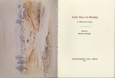
Book - VI CATTANACH COLLECTION: EARLY DAYS ON BENDIGO, 1979
... ...Gold mines & mining-Victoria-Bendigo district...History House 11 Mackenzie Street Bendigo goldfields BENDIGO History early recollections Gold mines & mining-Victoria-Bendigo district F. McKenzie Clark Early days on Bendigo Author F.McKenzie Clarke Edited by Frank Cusack. ...Early days on Bendigo Author F.McKenzie Clarke Edited by Frank Cusack. The recollections of life on early Bendigo first appeared in the pages of the Bendigo Advertiser under the title 'The first discovery of gold at Bendigo' published by Queensberry Hill Press 86 pages. Cream colour soft cover.F. McKenzie Clarkbendigo, history, early recollections, gold mines & mining-victoria-bendigo district -
Marysville & District Historical Society
Article (item) - Book Extract, Aboriginal History, Unknown
... gold mining...central victoria...The extract also covers current (1991) status of Aboriginal affairs and European settlement of the area. kulin nation woiworung taungurong bunurong watherong jajowrong wurrundjeri-willam waring-ilam-balluk goulburn valley acheron valley upper goulburn district eildon-thornton eildon homestead o'rourke thornton assistant protector thomas yarra valley kilmore mount william jt gellibrand william buckley major mitchell port phillip murray river yorta yorta yowung-illam-balluk waring-illam-balluk ngurai-illam-wurrung kurnai nation protectorate system victoria george robinson chief protector willam thomas james dredge edward parker charles sievewright central board for the protection of aborigines presbyterian mission anglican mission moravian mission wonga munnarin beaning murrin murrin parugean baruppin koo-gurrin acheron river little river acheron run peter snodgrass stephen jones barak dividing range black spur watts river badger creek healesville coranderrk victorian christmas bush aboriginal and torres strait islander heritage protection act 1984 archaelological and aboriginal relics preservation act 1972 camp jungai rubicon warrawa college victorian archaeological survey hume and hovell molesworth broadford william hamilton alexandra mansfield avenel tallarook worrough john cotton trawool valley seymour pyalong gold mining central victoria strath creek reedy creek yea jamieson marysville jordan goldfields comet mine wandong melbourne-albury railway rabbit plague narbethong lord kitchener puckapunyal military camp 1944 decentralisation policy eildon weir hume freeway bypass timber industry australian paper manufacturers mill An extract from a book regarding a brief history of the Kulin nation of the North Central district of Victoria. ...An extract from a book regarding a brief history of the Kulin nation of the North Central district of Victoria.An extract from a book regarding a brief history of the Kulin nation of the North Central district of Victoria. This history covered is both prior to European history and post-European history. The extract also covers current (1991) status of Aboriginal affairs and European settlement of the area.kulin nation, woiworung, taungurong, bunurong, watherong, jajowrong, wurrundjeri-willam, waring-ilam-balluk, goulburn valley, acheron valley, upper goulburn district, eildon-thornton, eildon homestead, o'rourke, thornton, assistant protector thomas, yarra valley, kilmore, mount william, jt gellibrand, william buckley, major mitchell, port phillip, murray river, yorta yorta, yowung-illam-balluk, waring-illam-balluk, ngurai-illam-wurrung, kurnai nation, protectorate system, victoria, george robinson, chief protector, willam thomas, james dredge, edward parker, charles sievewright, central board for the protection of aborigines, presbyterian mission, anglican mission, moravian mission, wonga, munnarin, beaning, murrin murrin, parugean, baruppin, koo-gurrin, acheron river, little river, acheron run, peter snodgrass, stephen jones, barak, dividing range, black spur, watts river, badger creek, healesville, coranderrk, victorian christmas bush, aboriginal and torres strait islander heritage protection act 1984, archaelological and aboriginal relics preservation act 1972, camp jungai, rubicon, warrawa college, victorian archaeological survey, hume and hovell, molesworth, broadford, william hamilton, alexandra, mansfield, avenel, tallarook, worrough, john cotton, trawool valley, seymour, pyalong, gold mining, central victoria, strath creek, reedy creek, yea, jamieson, marysville, jordan goldfields, comet mine, wandong, melbourne-albury railway, rabbit plague, narbethong, lord kitchener, puckapunyal military camp, 1944 decentralisation policy, eildon weir, hume freeway bypass, timber industry, australian paper manufacturers mill -
 Bendigo Historical Society Inc.
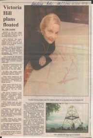
Newspaper - Kangaroo Flat Gold Mine Collection: Victoria Hill
... Gold mining...Bendigo...Victoria...Gold mining Bendigo Victoria Hill Ironbark tourism Sandhurst Town Sovereign Hill Ballarat Bendigo Advertiser article, 26th July,1995, titled 'Victoria Hill plans floated'. ...Bendigo Advertiser article, 26th July,1995, titled 'Victoria Hill plans floated'. Plans to relocate Sandhurst Town to Victoria Hill, Bendigo, were drawn up by Professor Brian Lewis, head of Melbourne University's School of Architecture, prior to Sovereign Hill being established as a tourist destination in Ballarat. Article includes colour photo of Cecilia Conroy looking at the plans, and Victoria Hill 'diggings' in Ironbark, Bendigo. gold mining, bendigo, victoria hill, ironbark, tourism, sandhurst town, sovereign hill, ballarat -
 Wodonga & District Historical Society Inc
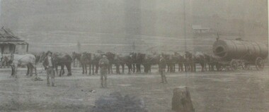
Photograph - North-Eastern Gold Days, 1900
... ...Gold mining Northeast Victoria...Bethanga Gold mining Northeast Victoria Gold mining Bethanga Bethanga History On label beneath image: "North-eastern "Gold Days"/ Combined teams hauling a boiler to Bethanga Mines, 1900. ...Bethanga was established as a result of the discovery of gold. Gold was first reported in the Bethanga area in 1852. Before 1876 gold mining in the Bethanga district occurred to the north of the town and was known as the 'Talgarno diggings'. Reports of alluvial gold date back to 1852. Early gold fields were worked at Ruby Creek, Gold Creek and Jarvis Creek. The opening of the Bethanga goldfields began with the discovery of a gold-bearing quartz reef on New Year’s Day 1876. The 'Gift' mine site is located southeast of Kurrajong Gap lookout to the west of Bethanga township. The Great Eastern Copper Smelting Works was opened in 1878. Due to the nature of the gold-bearing quartz reef, the gold was difficult to extract, and the discovery of copper led to a change in focus. It was not until the early 1890s that an efficient technique for extracting the gold from the ore was discovered, and once again gold became the focus, with copper as a by-product. Bethanga was removed from the official list of goldfields in 1912, however some mining activity has taken place since.This image reflects an important time in the development of Bethanga and Northeast Victoria.A large mounted and framed image of horse teams and their owners hauling a large boiler to the gold mine near Bethanga, Victoria. On label beneath image: "North-eastern "Gold Days"/ Combined teams hauling a boiler to Bethanga Mines, 1900. Teamsters - Mr. G. Pearce, W. Chapple, G, Bannon." Donated by Ron Saunders and Barbara Cadman"bethanga, gold mining northeast victoria, gold mining bethanga, bethanga history -
 Bendigo Historical Society Inc.
Document - LONG GULLY HISTORY GROUP COLLECTION: GOLD MINING
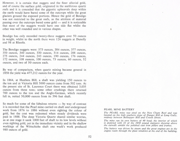
... Gold Mining... Hustlers Hill... Victoria...gold. Some large Bendigo nuggets and their weight in ounces are mentioned, but no names of the nuggets. Some yields from shaft mining are also mentioned. The Pearl Mine and the Victoria...History House 11 Mackenzie Street Bendigo goldfields BENDIGO History long gully history group The Long Gully History Group - Gold Mining Hustlers Hill Victoria Hill St Laurence Court Anglo-German Pearl Mine Victoria Quartz Wittschiebe Shaft New Chum Reef Danger Hill Belltopper Hill Copy of page 52 from a book. ...Copy of page 52 from a book. Mentioned are nuggets of gold. Some large Bendigo nuggets and their weight in ounces are mentioned, but no names of the nuggets. Some yields from shaft mining are also mentioned. The Pearl Mine and the Victoria Quartz did a lot of work without sighting any gold, while nearby at the Wittschiebe shaft there was a good find. There is also a short piece about the Pearl Mine Battery. It belongs to photo that was on the next page.bendigo, history, long gully history group, the long gully history group - gold mining, hustlers hill, victoria hill, st laurence court, anglo-german, pearl mine, victoria quartz, wittschiebe shaft, new chum reef, danger hill, belltopper hill -
 Bendigo Historical Society Inc.
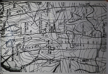
Map - MINING PLAN ,VICTORIA HILL AREA, No date visible
... Mining... Gold Mines... Victoria...History House 11 Mackenzie Street Bendigo goldfields MAP Bendigo mining plan Mining Gold Mines Victoria Hill Lines of Reef Map: Large scale plan of an area of the Goldfield, Northward from Barnard Street, covering the Victoria Hill area. ...Map: Large scale plan of an area of the Goldfield, Northward from Barnard Street, covering the Victoria Hill area. Black printing on polycarbonate film. Transparent.map, bendigo, mining plan, mining, gold mines, victoria hill, lines of reef -
Bendigo Historical Society Inc.
Map - BIG 180 SHAFT POSITION, No date visible
... Mining ... Gold Mines. Victoria Hill...History House 11 Mackenzie Street Bendigo goldfields MAP Bendigo mining plan Mining Gold Mines. Victoria Hill Big 180 Map: Plan showing the location of various shafts in the Victoria Hill area, hand draughted in pencil. ...Map: Plan showing the location of various shafts in the Victoria Hill area, hand draughted in pencil. Scale 2 Chains to 1 inchmap, bendigo, mining plan, mining , gold mines. victoria hill, big 180 -
 The Beechworth Burke Museum
Photograph, c. 1870
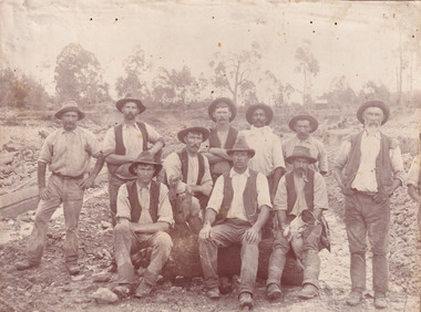
... mining...goldfields...beechworth...1870...australia...australian goldfields...diggers...victoria...sluicing...gold...mining for gold on both society and the Australian landscape. The Burke Museum is home to a substantial collection of Australian mining photographs which can be used to gain a deeper understanding into life on the gold fields, technology used in mining, the miners themselves and the impact of the gold digging on the environment. mining goldfields beechworth 1870 australia australian goldfields diggers victoria sluicing gold mining miners diggers victoria Reverse: 1997.2518 Sepia toned rectangular photograph printed on matte photographic paper mounted on board. ...This photograph was captured at an undisclosed location and at an unidentified time but likely dates to approximately 1870. The photographer's details are not recorded and the identities of the men in the image are also not known. This image depicts a group of 10 men in typical miners fashion. Four of them are sat on a large log with one holding a small dog. Six miners stand behind those sitting. All these men are wearing a white button-up shirt and tan coloured work trousers. They wear heavy boots and seven have included a dark vest over their shirt. The man holding the dog has a pipe in his mouth. Two of these men are clean shaven with the remainder sporting a moustache and two with a beard. The ages of these men vary from late 20s to middle age. This group of men are located in a mining location with what appears to be an open cut mine in the background of the image. The ground is muddy and has elements which can help identify it as a mining location based on the condition of the landscape. The bottom of the men's trousers are muddy which provides the assurance that these men were working in this location when their photograph was captured. In the background there is one structure, possibly a dwelling, and bush which identifies the location as Australia. Open cut sluicing is a method used to extract gold and other precious metals from beneath the surface of the earth. This technique involved the use of high-powered hoses which broke down the soil enabling miners to come along and search this soil for gold. After the gold rush of the early 1850s, diggers had to enlist the assistance of heavy machinery and techniques like hydraulic sluicing in order to reach gold because the surface alluvial gold had already been discovered and removed. This heavy machinery was not used until after 1853. The search for gold is ingrained into the history of Victoria and therefore, images like this one which portray an open cut sluicing site can reveal important information for society and technology for the date when the photograph was taken. This image is of important historical significance for its ability to convey information about sluicing and the methods used to find gold in the late 1800s and early 1900s. It also shows a location where sluicing was undertook which provides insight into the impact of sluicing on the environment at a time when it was done. Images, like this one, of Australian gold rush history can reveal important information about the social and environmental impact of this period. This image depicts diggers standing in a mining location and therefore, this image has the capacity to reveal or support significant information for researchers studying the fashion and social status of diggers in Australia in approximately 1870. It can also provide information on the landscape of Australia in this period and the impact of mining for gold on both society and the Australian landscape. The Burke Museum is home to a substantial collection of Australian mining photographs which can be used to gain a deeper understanding into life on the gold fields, technology used in mining, the miners themselves and the impact of the gold digging on the environment.Sepia toned rectangular photograph printed on matte photographic paper mounted on board.Reverse: 1997.2518mining, goldfields, beechworth, 1870, australia, australian goldfields, diggers, victoria, sluicing, gold mining, miners, diggers victoria -
 The Beechworth Burke Museum
Photograph - Lantern Slide, c1900
... gold mining...north-east victoria...Victoria in the time period. Burke Museum Beechworth Lantern Slide Slide Glass Slide Plate Burke Museum Collection Photograph Monochrome beechworth gorge indigo shire landscapes mill sluicing gold mining north-east victoria Spring Creek Louis Chevalier cascades Thin translucent sheet of glass with a square image printed on the front and framed in a black backing. ...This image shows the gorge adjacent to Beechworth in approximately 1900. Although the exact location of the photograph is yet to be determined, the present-day Beechworth Gorge Walk includes views of the Cascades at the point at which Spring Creek flows into the valley on the level below. Gold-sluicing techniques in use in the town during periods of active gold extraction may have altered the landscape since the photograph was taken, however. In the 1850s a mill was built at the top of the Spring Creek falls by Russian-born Louis Chevalier, brother of artist Nicholas Chevalier. The mill supplied the town with lumber that supported the town's initial construction boom. Lantern slides, sometimes called 'magic lantern' slides, are glass plates on which an image has been secured for the purpose of projection. Glass slides were etched or hand-painted for this purpose from the Eighteenth Century but the process became more popular and accessible to the public with the development of photographic-emulsion slides used with a 'Magic Lantern' device in the mid-Nineteenth Century. Photographic lantern slides comprise a double-negative emulsion layer (forming a positive image) between thin glass plates that are bound together. A number of processes existed to form and bind the emulsion layer to the base plate, including the albumen, wet plate collodion, gelatine dry plate and woodburytype techniques. Lantern slides and magic lantern technologies are seen as foundational precursors to the development of modern photography and film-making techniques.This glass slide is significant because it provides insight into Beechworth's built environment and natural landscape in the early Twentieth Century, around the time of Australia's Federation. It is also an example of an early photographic and film-making technology in use in regional Victoria in the time period.Thin translucent sheet of glass with a square image printed on the front and framed in a black backing. It is held together by metals strips to secure the edges of the slide.burke museum, beechworth, lantern slide, slide, glass slide, plate, burke museum collection, photograph, monochrome, beechworth gorge, indigo shire, landscapes, mill, sluicing, gold mining, north-east victoria, spring creek, louis chevalier, cascades -
 The Beechworth Burke Museum
Photograph, unknown
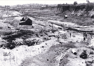
... gold mine...open cut mining...mining...gold mining...north-east victoria...Rocky Mountain Extended Gold Sluicing Company gold sluicing gold sluicing hydraulic sluicing gold mine open cut mining mining gold mining north-east victoria beechworth burke museum Obverse: Reverse: 84.222.5/ digital print/ Black and white rectangular reproduced photograph printed on glossy photographic paper Photograph Photograph ...This reproduced photograph is of Pennyweight Flat near Beechworth, a notable area of the 1850's gold rush in Victoria. Donald Fletcher, migrating to Beechworth from Scotland in 1855, had substantial claims at Pennyweight Flat and was amongst the first in the district to utilise hydraulic sluicing and water diverting methods.The flat is said to have seen a flurry of 200 miners to the area around 1857, and by 1861 when work commenced on extending Fletcher's tail race the census recorded 644 people residing there (European males, females and Chinese).The search for gold is ingrained into the history of Victoria and therefore, images like this one which portray an open cut sluicing site can reveal important information for society and technology for the date when the photograph was taken. This image is of important historical significance for its ability to convey information about sluicing and the methods used to find gold in 1910. It also shows a location where sluicing was undertaken which provides insight into the impact of sluicing on the environment at a time when it was done. This image is important for current research into the history of Beechworth and surrounding area including Victoria's North East. The Rocky Mountain Extended Gold Sluicing Company was a long running and very active mine that was one of the most successful and largest in the district. Therefore, this image has the capacity to be beneficial for research into society and the motivations of those living and working in this region during this period and therefore, has social significance. The Beechworth Burke Museum has additional images relating to gold sluicing which can be analysed and studied alongside images like this one. When the mine closed in 1921, in a liquidation sale, Zwar purchased the tunnel and clear water supply that ran under the town of Beechworth. He directed the water to his tannery and over time built a major industry in leather works that was a major employer in Beechworth. In growing his leather business, Zwar installed crude oil engines for electricity in his factory. He oversaw working with local council to introduce electricity to Beechworth via a sub-station on Albert Street. In 1927 Electric street lamps replaced gas lamps in the streets of Beechworth. Black and white rectangular reproduced photograph printed on glossy photographic paperObverse: Reverse: 84.222.5/ digital print/ rocky mountain extended gold sluicing company, gold, sluicing, gold sluicing, hydraulic sluicing, gold mine, open cut mining, mining, gold mining, north-east victoria, beechworth, burke museum -
 The Beechworth Burke Museum
Photograph
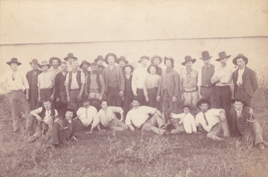
... gold sluicing...hydraulic sluicing...mining...gold mining...north-east victoria...This image is of important historical significance for its ability to convey information about society at the time, regarding fashion (which can potentially reveal social status) and mining in Beechworth in 1900. quartz north east gold sluicing gold sluicing hydraulic sluicing mining gold mining north-east victoria beechworth burke museum 1900 group miners hats vests ties wild shrubs tin quartz mining Reverse: BMM 8032/ Group(?) ...The photograph, captured around 1900, depicts a large group of minors located in Beechworth. Importantly, this photograph can provide information into the clothing and fashion of minors during this period of history. These men wear loose fitting shirts which are mostly a pale white colour, several wear vests and/or jackets and loose fitting trousers with boots. The majority of men wear wide brimmed hats to protect their skin and eyes from the sunlight. One man has a wooden pipe in his mouth and a few have ties/neckerchief's tied around their necks. The outfits of these miners has the potential to provide insight into their social status, these men are all dressed equally which provides the notion that they are of equal societal standing. The outfits of these miners dating to the 1900s is not dissimilar to photographs of those captured in the 1880s. The location of this photograph is not easy to interpret, but the photograph is recorded to have been taken in the Beechworth region. Displayed in this image is some wild shrubbery and grass where the men are standing/sitting and behind the group is a tin wall or even tin building. At the end of 1899, companies were continuing to search for gold in Beechworth and the surrounds but these attempts were not overly successful. In the early 1900's Quartz mining was occurring but this was done by individuals or smaller parties. It is unclear if these men are mining for gold or for quartz.The search for gold is ingrained into the history of Victoria and therefore, the study of images like this one which portrays some of the miners who worked behind-the-scenes for these discoveries has the potential to reveal important information regarding society, fashion etc. The date when the photograph was taken is vague but it allows us to form a timeline of mining activities in the North East. This image is of important historical significance for its ability to convey information about society at the time, regarding fashion (which can potentially reveal social status) and mining in Beechworth in 1900. Black and white rectangular photograph printed on matte photographic paper mounted on board.Reverse: BMM 8032/ Group(?) Beechworth Mines about 1900/ 80quartz, north east gold, sluicing, gold sluicing, hydraulic sluicing, mining, gold mining, north-east victoria, beechworth, burke museum, 1900, group, miners, hats, vests, ties, wild shrubs, tin, quartz mining -
 The Beechworth Burke Museum
Photograph, 1910
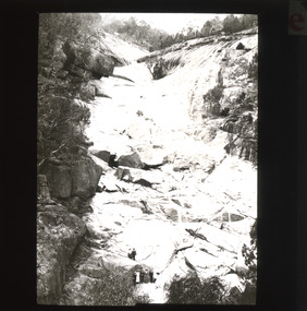
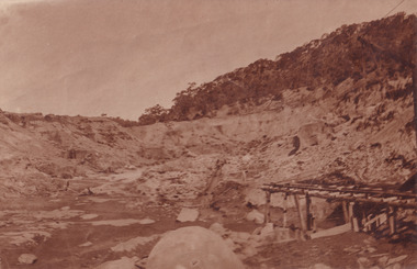
... gold and tin mine...open cut mining...mining...gold mining...north-east victoria...Gold and Tin Mines NL (previously it was known as Cocks Pioneer Sluicing Co) and undertook large scale sluicing operations until 1929 and then 1934-1941. El Dorado is located on Reedy Creek and is surrounded by forested country to the north and east. It is 20 km east of Wangaratta in Victoria's regional north-east. John Cock was the son of a Cornish minor who arrived in El Dorado in 1858. Cock founded his gold and tin mining...Victoria's North East. Therefore, this image has the capacity to be beneficial for research into society and the motivations of those living and working in this region during this period and therefore, has social significance. The Beechworth Burke Museum has additional images relating to gold sluicing and El Dorado which can be analysed and studied alongside images like this one. el dorado north east gold sluicing gold sluicing hydraulic sluicing 1910 gold and tin mine open cut mining mining gold mining north-east victoria beechworth burke museum Obverse: COCKS PIONEER Q + T SL CO, N.L. / 1910 / LOOKING EAST UP OPEN CUT / FROM NO3 BARGE SITE / Reverse: 1997 . 2611 / A02611 Sepia coloured rectangular photograph printed on gloss photographic paper mounted on board. ...This photograph dating to 1910 depicts an open cut sluicing site located in El Dorado captured looking east up the open cut from the number 3 Barge site. Sluicing was undertaken in the area from 1900 to 1942 with some short breaks between these periods. The image depicts a location mined by Cocks Pioneer Gold and Tin Sluicing Company (as recorded on the annotation on the card mount). It portrays open cut rocks with a crevice in the center of the image where the sluicing was being undertaken. There is a small timber structure on the right of the image which could be an entrance to a mine or supports made of wood to prevent a cave in at the open cut site and above the cut rock there is bush. The timber structure has rail tracks on top of the bridge which could suggest the identification of this structure as a mine entrance. The rail tracks were used for little carts which hauled soil from the mine. The Cocks Pioneer Gold and Tin Mines N.L was one of El Dorado's two largest open cut sluicing mines of the 20th Century. The other was named the Cocks El Dorado Gold Dredging Company. The Cocks Pioneer Mines operated from 1901 until 1941 and found a total of 117,378 ounces of Gold and 1,673 tones of tin concentrates over these years. The Cocks company was formed in 1898 and operated until 1941. Open cut sluicing involved the use of high-powered hoses which used the centrifugal sand pump system (known as hydraulic sluicing) which broke down the soil which was then processed for gold and other precious metals. From 1914 , four years after this image was captured, the company reformed to Cocks Pioneer Gold and Tin Mines NL (previously it was known as Cocks Pioneer Sluicing Co) and undertook large scale sluicing operations until 1929 and then 1934-1941. El Dorado is located on Reedy Creek and is surrounded by forested country to the north and east. It is 20 km east of Wangaratta in Victoria's regional north-east. John Cock was the son of a Cornish minor who arrived in El Dorado in 1858. Cock founded his gold and tin mining company which ran successfully for many years in the El Dorado region. It was an open cut sluicing company because of the abandonment of underground mining after this was deemed too dangerous. In 1935 Cock's El Dorado Company commissioned the floating dredge which is still visible in El Dorado today. The dredge was built by the Thompson engineering works, Castlemaine, and weighed over 2,000 tones and today has a place on the Victorian Registers of historic buildings. Interestingly, the name El Dorado does not derive from the gold in the region, but from the Barambogie pastoral run completed by William Baker in 1840-1841. Gold was discovered in El Dorado 1854 but the gold was too deep for individual prospectors to find, it required the use of heavy machinery.The search for gold is ingrained into the history of Victoria and therefore, images like this one which portray an open cut sluicing site can reveal important information for society and technology for the date when the photograph was taken. This image is of important historical significance for its ability to convey information about sluicing and the methods used to find gold in 1910. It also shows a location where sluicing was undertook which provides insight into the impact of sluicing on the environment at a time when it was done. This image is important for current research into the history of El Dorado, a small regional location near Wangaratta in Victoria's North East. Therefore, this image has the capacity to be beneficial for research into society and the motivations of those living and working in this region during this period and therefore, has social significance. The Beechworth Burke Museum has additional images relating to gold sluicing and El Dorado which can be analysed and studied alongside images like this one.Sepia coloured rectangular photograph printed on gloss photographic paper mounted on board.Obverse: COCKS PIONEER Q + T SL CO, N.L. / 1910 / LOOKING EAST UP OPEN CUT / FROM NO3 BARGE SITE / Reverse: 1997 . 2611 / A02611el dorado, north east gold, sluicing, gold sluicing, hydraulic sluicing, 1910, gold and tin mine, open cut mining, mining, gold mining, north-east victoria, beechworth, burke museum