Showing 648 items matching "gold mining in australia"
-
 Bendigo Historical Society Inc.
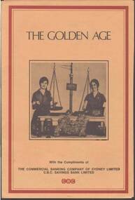
Document - THE GOLDEN AGE: A HISTORY OF GOLD MINING IN AUSTRALIA
... THE GOLDEN AGE: A HISTORY OF GOLD MINING IN AUSTRALIA...AUSTRALIA...History...gold mining...The Golden Age - booklet produced by The Commonwealth banking Company of Sydney Ltd --A history of Gold mining in Australia - photo of two teen age girls with a set of scales and a huge gold nugget...History House 11 Mackenzie Street Bendigo goldfields AUSTRALIA History gold mining The Golden Age -a booklet produced by The Commonwealth banking Company of Sydney Ltd The Golden Age - booklet produced by The Commonwealth banking Company of Sydney Ltd --A history of Gold mining in Australia - photo of two teen age girls with a set of scales and a huge gold nugget Document THE GOLDEN AGE: A HISTORY OF GOLD MINING IN AUSTRALIA ...The Golden Age - booklet produced by The Commonwealth banking Company of Sydney Ltd --A history of Gold mining in Australia - photo of two teen age girls with a set of scales and a huge gold nuggetaustralia, history, gold mining, the golden age -a booklet produced by the commonwealth banking company of sydney ltd -
 Marysville & District Historical Society
Booklet (item) - Information booklet, Artworkz Tourism, Gold & Mining, Unknown
... A booklet that was produced of information regarding gold and gold mining in Australia....A booklet that was produced of information regarding gold and gold mining in Australia....Marysville & District Historical Society 39 Darwin Street Marysville yarra-valley-and-the-dandenong-ranges A booklet that was produced of information regarding gold and gold mining in Australia. A booklet that was produced of information regarding gold and gold mining in Australia. gold gold mining californian gold rush australian gold rush new south wales gold rush victorian gold rush eureka stockade redgate diggings eglington mine redgate alexandra alluvial mining quartz reef mining walhalla quartz reef mine mount pleasant diggings artworks tourism A booklet that was produced of information regarding gold and gold mining in Australia. ...A booklet that was produced of information regarding gold and gold mining in Australia.A booklet that was produced of information regarding gold and gold mining in Australia.gold, gold mining, californian gold rush, australian gold rush, new south wales gold rush, victorian gold rush, eureka stockade, redgate diggings, eglington mine, redgate, alexandra, alluvial mining, quartz reef mining, walhalla quartz reef mine, mount pleasant diggings, artworks tourism -
 Bendigo Historical Society Inc.
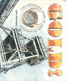
Book - GOLD!, 1994
... gold mining...Gold mining in Australia...History House 11 Mackenzie Street Bendigo goldfields Gold gold mining Gold mining in Australia John Nicholson 32 page hard cover book entitled 'GOLD ! ...32 page hard cover book entitled 'GOLD ! The fascinating story of gold in Australia' by John Nicholson. Published 1994 by Allen & Unwin. Printed in Hong Kong. Illustrated with coloured sketches.John Nicholsongold, gold mining, gold mining in australia -
 Marysville & District Historical Society
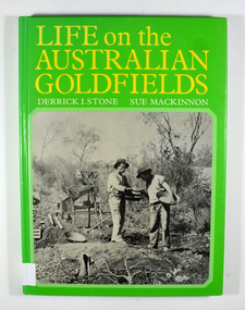
Book - Hardcover book, Life on the Australian Goldfields, 1984
... gold mines...gold mining...australia...A history of gold mining in Australia...Marysville & District Historical Society 39 Darwin Street Marysville yarra-valley-and-the-dandenong-ranges A history of gold mining in Australia gold gold mines gold mining australia history social life customs stone, derrick i mackinnon, sue Front cover has a price sticker that is discolored. ...A history of gold mining in AustraliaHardcover. Front cover has a photograph of two miners from West Australia using the dry-blowing technique. In the background are two 'Wood's dry placer-miners'. Back cover has a photograph of the interior of a steam-operated quartz crushing battery at the Mount Boppy Mine.Front cover has a price sticker that is discolored. Inside there is the stamp of the Marysville & District Historical Society / P.O. Box 22 / Marysville 3779 gold, gold mines, gold mining, australia, history, social life, customs, stone, derrick i, mackinnon, sue -
Clunes Museum
Functional object - CANDLESTICK HOLDER
... gold mining in clunes, victoria, australia...Clunes Museum 36 Fraser Street enter building through Collins Place Clunes goldfields clunes township and mining mining gold mining in clunes, victoria, australia illumination in underground gold mines Metal candle holder on a spike to drive into wall to hold candle during mining operation Functional object CANDLESTICK HOLDER ...Metal candle holder on a spike to drive into wall to hold candle during mining operationclunes township and mining, mining, gold mining in clunes, victoria, australia, illumination in underground gold mines -
Clunes Museum
Book, John Woodland, Company mining in the Australian gold rush: "what should have been a great mercantile adventure", 2009
... gold mining in clunes, victoria, australia...Company mining in the Australian gold rush...Clunes Museum 36 Fraser Street enter building through Collins Place Clunes goldfields Company mining in the Australian gold rush A thesis submitted in total fulfillment of the requirements for the Degree, Doctor of Philosophy using Clunes Museum resources. bland gold mining in clunes, victoria, australia thesis A Thesis by John George Woodland, Latrobe University, Victoria, Australia December 2009 HARD COVER BOOK WITH RED COVER, GOLD EMBOSSING ON THE FRONT COVER AND THE SPINE. 269 PAGES (VOLUME 1) APPENDICES IN VOLUME 2 Company mining in the Australian gold rush: "what should have been a great mercantile adventure" Book BOOK John Woodland ...A Thesis by John George Woodland, Latrobe University, Victoria, Australia December 2009non-fiction A Thesis by John George Woodland, Latrobe University, Victoria, Australia December 2009bland, gold mining in clunes, victoria, australia, thesis -
Clunes Museum
Container
... gold mining in clunes, victoria, australia...gold mining in clunes, victoria, australia chemicals in mining mining methods Nil Mercury container, made of iron with metal cork missing. ...Mercury container, made of iron with metal cork missing. Dolly pot.Nilgold mining in clunes, victoria, australia, chemicals in mining, mining methods -
 Clunes Museum
Photograph, ca1861
... Black and white reproduction of Port Phillip Colonial & Gold Mining Co., Clunes, Victoria, Australia in a light wood timber frame...The glass plates attributed to him by the State Library of Victoria show four images of the mines in Clunes, Victoria, Australia in the 1860's port phillip and colonial gold mining co. richard daintree On Reverse: Handwritten in pencil Port Phillip Co. 1860's Nettleton Photography glass plate Latrobe Library Black and white reproduction of Port Phillip Colonial & Gold Mining Co., Clunes, Victoria, Australia in a light wood timber frame Photograph PHOTOGRAPH RICHARD DAINTREE ...When Richard Daintree rejoined the Victorian Geological Survey as a field surveyor in January 1859, he pioneered the use of photography in field-work. The glass plates attributed to him by the State Library of Victoria show four images of the mines in Clunes, Victoria, Australia in the 1860'sBlack and white reproduction of Port Phillip Colonial & Gold Mining Co., Clunes, Victoria, Australia in a light wood timber frameOn Reverse: Handwritten in pencil Port Phillip Co. 1860's Nettleton Photography glass plate Latrobe Libraryport phillip and colonial gold mining co., richard daintree -
 Bendigo Historical Society Inc.
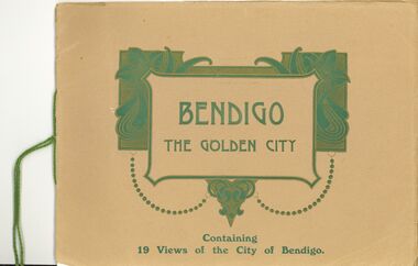
Book - BENDIGO - THE GOLDEN CITY
... Containing 19 views of the City of Bendigo -- population of Bendigo and district 40,000 -- The principal Gold-Mining Centre of Australia -- Noted for its Glorious and Health-Giving Climate...Containing 19 views of the City of Bendigo -- population of Bendigo and district 40,000 -- The principal Gold-Mining Centre of Australia -- Noted for its Glorious and Health-Giving Climate Book BENDIGO - THE GOLDEN CITY ...Bendigo the Golden City. (no date) Printed by Cambridge Press, Printers and publishers, Bendigo. 16 pages. Containing 19 views of the City of Bendigo -- population of Bendigo and district 40,000 -- The principal Gold-Mining Centre of Australia -- Noted for its Glorious and Health-Giving Climatebendigo, streetscape -
 Bendigo Historical Society Inc.
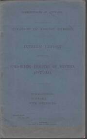
Document - MCCOLL, RANKIN AND STANISTREET COLLECTION: GOLD MINING INDUSTRY OF WESTERN AUSTRALIA, KALGOORLIE, 11th. May 1927
... MCCOLL, RANKIN AND STANISTREET COLLECTION: GOLD MINING INDUSTRY OF WESTERN AUSTRALIA, KALGOORLIE...gold mining... Western Australia....Document: McColl, Rankin & Stanistreet, book 'Interim Report relating to the Gold Mining Industry of Western Australia., Kalgoorlie, Gwalia. ...History House 11 Mackenzie Street Bendigo goldfields ORGANIZATION Mining McColl Rankin & Stanistreet gold mining Western Australia. Commonwealth of Australia Document: McColl, Rankin & Stanistreet, book 'Interim Report relating to the Gold Mining Industry of Western Australia., Kalgoorlie, Gwalia. ...Document: McColl, Rankin & Stanistreet, book 'Interim Report relating to the Gold Mining Industry of Western Australia., Kalgoorlie, Gwalia. Blue cover, 39 pages with maps, graphs.Commonwealth of Australiaorganization, mining, mccoll, rankin & stanistreet, gold mining, western australia. -
 Bendigo Historical Society Inc.
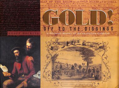
Book - "Gold! Off to the Diggings", 2010
... In 1851 Australia's gold rush had begun, and the focus of the world suddenly turned to the hills, gullies and creeks of New South Wales and Victoria as people from all over the world rushed to the diggings. Gold mining...gold mining scenes on front and back. Title written on gold and black on front cover and spine. Printed in Castlemaine, Australia. 320 pp. ...In 1851 Australia's gold rush had begun, and the focus of the world suddenly turned to the hills, gullies and creeks of New South Wales and Victoria as people from all over the world rushed to the diggings. Gold mining ...A pictorial history of the Australian goldrush. In 1851 Australia's gold rush had begun, and the focus of the world suddenly turned to the hills, gullies and creeks of New South Wales and Victoria as people from all over the world rushed to the diggings. Gold mining in Australia has a rich history that began in the early 19th century, leading to significant economic growth and population influx during the gold rushes of the 1850s. The first documented discovery of gold in Australia occurred in 1823 near Bathurst, New South Wales. However, it wasn't until 1851 that significant gold deposits were found at Ophir, which triggered the first major gold rush. The discovery of payable gold led to a massive influx of prospectors and miners from around the world, particularly during the Victorian Gold Rush. By the mid-1850s, Australia was producing nearly 40% of the world's gold. The gold rushes significantly increased Australia's population, with estimates suggesting that the population tripled from 1851 to 1860 due to the influx of miners and their families. Economic Contributions: Gold mining became a cornerstone of the Australian economy, contributing to export income and the development of infrastructure. The wealth generated from gold mining helped finance the young colonies and led to the establishment of new towns and services."Gold! Off to the Diggings" by Geoff Hocking. Published by New Chum Press in 2010. Hard cover book which is black fabric. Title and author's name in gold on spine. Dust jacket is multi-colored, with different gold mining scenes on front and back. Title written on gold and black on front cover and spine. Printed in Castlemaine, Australia. 320 pp. Glossy pages. Contains both text and black and white images. Has index. ISBN 9780957897236. gold, mining, miners -
 Bendigo Historical Society Inc.
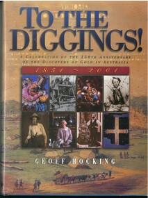
Book - TO THE DIGGINGS, 2000
... Gold in Australia'. Illustrated with colour and B&W photos First published 2000. Printed in Singapore by Tat Wei Printing Packaging Pte Ltd. 14 Chapters tracing the history of gold discovery and mining in Australia....Gold in Australia'. Illustrated with colour and B&W photos First published 2000. Printed in Singapore by Tat Wei Printing Packaging Pte Ltd. 14 Chapters tracing the history of gold discovery and mining in Australia. ...256 page hard cover book 'To the Diggings, A Celebration of the 150th Anniversary of the Discovery of Gold in Australia'. Illustrated with colour and B&W photos First published 2000. Printed in Singapore by Tat Wei Printing Packaging Pte Ltd. 14 Chapters tracing the history of gold discovery and mining in Australia.Geoff Hocking -
 Bendigo Historical Society Inc.
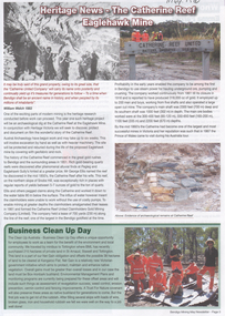
Document - Kangaroo Flat Gold Mine Collection: Bendigo Mining, History of Catherine Reef United Mine site, Bendigo Mining NL, Undated
... Catherine Reef United Claimholders Gold Mine The Catherine Reef United Claimholders Gold Mine was a significant site in the history of gold mining in Victoria, Australia. It operated from 1861 to 1913 and was considered the second most important gold mine in Victoria, behind the Port Phillip Company at Clunes. ...Catherine Reef United Claimholders Gold Mine The Catherine Reef United Claimholders Gold Mine was a significant site in the history of gold mining in Victoria, Australia. It operated from 1861 to 1913 and was considered the second most important gold mine in Victoria, behind the Port Phillip Company at Clunes. ...Catherine Reef United Claimholders Gold Mine The Catherine Reef United Claimholders Gold Mine was a significant site in the history of gold mining in Victoria, Australia. It operated from 1861 to 1913 and was considered the second most important gold mine in Victoria, behind the Port Phillip Company at Clunes. The mine utilized steam power for quartz mining, which required pounding the quartz to sand to extract gold. The mine's engine and battery foundations are remnants of this historical activity and are of great archaeological and scientific importance to the State of Victoria. The mine played a crucial role in the development of Victorian manufacturing industry and is a characteristic example of an important form of gold miningThree documents relating to the Catherine Reef United Claimholders Gold Mine, Eaglehawk. 1. Bendigo Mining, one page Information Sheet regarding the history of the Catherine Reef United mine site. Text is an extract from 'Bendigo's Deborah Gold Mine and its Era' by James Lerk. 2. Bendigo Mining Heritage News, - The Catherine Reef Eaglehawk Mine. Double sided one page information sheet. Images of archaelogical remains at Catherin Reef are featured on the front page. Emma Farrell and Mark Andrews question/answers featured on back page. 3. A3 photocopy of map of Catherine Reef United mine site and a list of archaeological remains found. bendigo mining n.l., bendigo, mining, gold, kangaroo flat, james lerk, catherine reef united claimholders gold mine, eaglehawk, archaeological dig, mining heritage, bendigo amalgamated goldfields, poppet head -
 Bendigo Historical Society Inc.
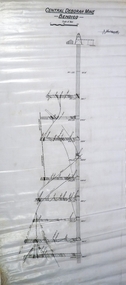
Plan - Central Deborah Gold Mine, 22.10.45
... mining. The physical evidence at the site has excellent interpretative value and the ability to answer archaeological research questions. (Criterion C) The Central Deborah Gold Mine is significant as a notable and fine example of the class of twentieth century quartz mine. The working machinery—including a Cornish boiler, winding engine and two compressors—comprise one of the few publicly accessible and in situ collections in the State. Central Deborah Company Gold Mine is now a popular tourist mine and a living part of the story of gold mining in Australia...mining. The physical evidence at the site has excellent interpretative value and the ability to answer archaeological research questions. (Criterion C) The Central Deborah Gold Mine is significant as a notable and fine example of the class of twentieth century quartz mine. The working machinery—including a Cornish boiler, winding engine and two compressors—comprise one of the few publicly accessible and in situ collections in the State. Central Deborah Company Gold Mine is now a popular tourist mine and a living part of the story of gold mining in Australia ...CENTRAL DEBORAH GOLD MINE 76 VIOLET STREET BENDIGO, GREATER BENDIGO CITY: The Central Deborah Gold Mine was developed from 1939 and operated as a working mine until 1954. The mine was one of a minority that continued to function during the Second World War. In 1939 the mine boasted a small timber poppet head, boiler steam winch, compressor, blacksmith shop, store, change rooms, and offices. Between 1945-46 the company upgraded the mine with extensions to sheds and the installation of new steam machinery, electric air compressor, steel poppet head, and ore bins. The Central Deborah Gold Mine is historically significant for its ability to demonstrate the tangible and important links to twentieth century quartz mining. It is of outstanding historical significance as the last intact and working example of the 5,500 quartz mines that won Bendigo widespread fame as a gold mining centre. At one time Bendigo had the world’s deepest shafts. Of particular importance are original buildings, fittings and mining machinery that document the mine’s character from 1939 to 1954. (Criterion A) The Central Deborah Gold Mine is archaeologically significant for its ability and potential to illustrate important aspects of early twentieth century mining. The physical evidence at the site has excellent interpretative value and the ability to answer archaeological research questions. (Criterion C) The Central Deborah Gold Mine is significant as a notable and fine example of the class of twentieth century quartz mine. The working machinery—including a Cornish boiler, winding engine and two compressors—comprise one of the few publicly accessible and in situ collections in the State. Central Deborah Company Gold Mine is now a popular tourist mine and a living part of the story of gold mining in Australia. Its historic mining equipment is still functional, and several levels underground are accessible to visitors. (Victorian Heritage Database: https://vhd.heritagecouncil.vic.gov.au/places/5996) Transverse section of Central Deborah Gold Mine, Bendigo. Printed on top in bold black text: ' Central Deborah Mine Bendigo'. Handwritten on plan: J.Caldwell 12.10.45 Plan forms part of the Margaret Roberts Collection.gold mining, gold, bendigo, central deborah gold mine, transverse -
 Bendigo Historical Society Inc.
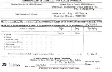
Document - MCCOLL, RANKIN AND STANISTREET COLLECTION: DEBORAH EXTENDED GOLD MINING CO. NL, 1942
... Deborah Extended Gold Mining Co. NL Commonwealth of Australia - War Damage Commission...McColl Rankin & Stanistreet, Deborah Extended Gold Mining Co. NL. Commonwealth of Australia - War Damage Commission. ...History House 11 Mackenzie Street Bendigo goldfields ORGANIZATION Business deborah extended mine McColl Rankin & Stanistreet Deborah Extended Gold Mining Co. NL Commonwealth of Australia - War Damage Commission McColl Rankin & Stanistreet, Deborah Extended Gold Mining Co. ...McColl Rankin & Stanistreet, Deborah Extended Gold Mining Co. NL. Commonwealth of Australia - War Damage Commission. Plant valued at 2,000 pounds Rate 8 shillings which was the contribution to be paid. Authorized agent: Commercial Union Assurance Co. Ltd., Manager: A V Le Page. Dated 31/3/42 (1942). Receipt No 393055.organization, business, deborah extended mine, mccoll rankin & stanistreet, deborah extended gold mining co. nl commonwealth of australia - war damage commission -
 Kiewa Valley Historical Society
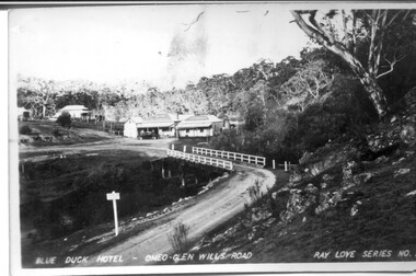
Four photographs of the Blue Duck Hotel and two Photos of the Glen Wills area, c1920 Post cards, c1949/50 small photographs
... gold mining days. Blue Duck Hotel; Anglers Rest; Omeo Highway; fishing; mining Post Card No. 1 - "Blue Duck Hotel- Omeo-Glen wills road Ray Love Series No.2"(written on lower front) Post Card No. 2- "Looking towards Bogong High Plains. Omeo-Glen Wills road"(front, bottom, L hand) Ray Love Series No. 18 (front, lower R hand corner) On both of above photos, centre back, is stamped POST CARD and underneath this is printed "A GENUINE PHOTOGRAPH'/ Post Card No. 3 - Bottom L hand corner "Mystic Sea Australian Alps". ...The Blue Duck Hotel stands at the confluence of 3 trout rivers - Cobungra, Bundarra and Mitta Mitta, called Angler's Rest. The original 1900's building was of slab construction and operated as a butcher shop, servicing miners on the track from Omeo to Mt. Wills. In 1912 it was purchased by a miner, Billy O'Connell, and he obtained a hotel license. In the early 1920's he transported 2 houses from Omeo on Horse drays. One is the main building of the Blue Duck and the other was a residence where Billy and his wife raised their nine children. The small log structure behind the pub is State School No.4286 where the children attended school. A teacher was shared with Glen Wills. By the late 1920's the hotel was discovered and patronized by keen anglers. Sir Harold Clapp (head of the railways) was one and he had the bronze blue duck cast and presented to the owners in the 1930's. This stands at the entrance to the premises.These photographs are of a building, in a remote area, that has provided a service to miners, anglers and travellers for over 100 years and continues to do so today. It also played a vital role in the history of the Mt. Wills/Omeo gold mining days.3 Post cards, Black and White photographs. 3 small black and white photographsPost Card No. 1 - "Blue Duck Hotel- Omeo-Glen wills road Ray Love Series No.2"(written on lower front) Post Card No. 2- "Looking towards Bogong High Plains. Omeo-Glen Wills road"(front, bottom, L hand) Ray Love Series No. 18 (front, lower R hand corner) On both of above photos, centre back, is stamped POST CARD and underneath this is printed "A GENUINE PHOTOGRAPH'/ Post Card No. 3 - Bottom L hand corner "Mystic Sea Australian Alps". R hand corner "(Bulmer Copyright)". Each small photograph, handwritten on back "Blue duck Hotel". All have circular stamp with "Print by Wilson White Albury" blue duck hotel; anglers rest; omeo highway; fishing; mining -
 Kiewa Valley Historical Society
Scales Balance Pocket, Circa 1900
... Australian outback rule of thumb. The significance of this item in the Kiewa Valley during this period demonstrates the slower acceptance of accurate trading measure using the country side principle "my hand shake is my bond". In the Kiewa Valley small quantity commercial undertakings e.g. gold mining ...Historically this item would have been used by gold miners, rabbit shooters, mobile "Rag and Bone" traders and other mobile(in caravans and/or horse drawn cart) traders of various small goods and haberdashery. Although marked as not to be used as trade, the isolation and sometimes difficult terrain rules out using larger and more delicate scales. In the early 1900s rough roads and severe weather conditions forced traders to be more flexible in trading with weights and measures. The "close enough is good enough" doctrine was the Australian outback rule of thumb. The significance of this item in the Kiewa Valley during this period demonstrates the slower acceptance of accurate trading measure using the country side principle "my hand shake is my bond". In the Kiewa Valley small quantity commercial undertakings e.g. gold mining, fur pelts and rabbit meat trade did not require bulk weight type scales. Commerce in rural production e.g. fruit and vegetables involved more farmers and their staff in a barter and/or "in kind" payments. This was more so in the depression years 1929 to late 1930s. Self sufficiency was to a large extent more attainable in this region than in the city/ large country town environment. The Australian "fair go" ethical approach to life and commerce was very much ingrained in those living in country regions, like Kiewa Valley as is demonstrated by the not so accurate hand balance, spring loaded scales. Portable Pocket Balance with front plate made from brass. Spring mechanism enclosed by black painted medium gauge steel cover( three quarters cylindrical). Front scale face and rear spring casing fastened by three rivets. Spring loaded marker blade is located in the centre of the front plate. See item KVHS 0224 for a similar scales.Front plate marked: at top "Not legal for use in trade", below this in larger print "Pocket Balance", under and to the right in smaller print "lbs" under this graded marks, first marked with a Zero, then every second mark in ascending order up to 25. At the bottom of the front plate is marked "Made in Germany"antique pocket balance, scales, mobile weights, vintage appliances -
 Kiewa Valley Historical Society
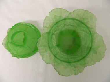
Bowl Covered, circa mid to late 1900's
... It was a time when the Australian economy "rode on the back of sheep" This item has relative significance to the Kiewa Valley as part of the rural and mining(gold) era when the strong return from local gold mining and grazing was demonstrated by the "landed gentry" and significant household cutlery, crockery, etiquette and old English mores, influenced by "Mother Britain" glass bowls kitchen crockery serving etiquette meal presentation Barely visible "VALLERYSTHAL" This green opalescent covered bowl is similar to the French PV cabbage form. ...This covered glass bowl with lid was made in a period when there was a strict discipline in the use a various dishes and accompaniments with respect to the type of crockery used. This was in the English style, especially in well to do rural family estates. This period was part of the early 1900's, when large rural acreage was family owned and the economical return to rural produce was very high. It was a time when the Australian economy "rode on the back of sheep"This item has relative significance to the Kiewa Valley as part of the rural and mining(gold) era when the strong return from local gold mining and grazing was demonstrated by the "landed gentry" and significant household cutlery, crockery, etiquette and old English mores, influenced by "Mother Britain"This green opalescent covered bowl is similar to the French PV cabbage form. When the lid is on the bowl appears as a small cabage with three sets of half peeled leaves. There are five outer leaves, next row are five inner leaves and finally three core leaves. The main bowl has a lip encircling the inside of the bowl for the lid to rest upon with closed. The glass has been pressed to show the leaves with their web like stalks. The inside area of the bowl and lid are smooth. This is to allow the mashed up contents to be easily scraped into a serving ladle.Barely visible "VALLERYSTHAL"glass bowls, kitchen crockery, serving etiquette, meal presentation -
 Kiewa Valley Historical Society
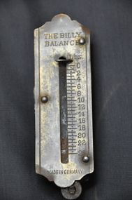
Scales Weighing Pocket, circa early 1900s
... Australian outback rule of thumb. The significance of this item in the Kiewa Valley during this period demonstrates the slower acceptance of accurate trading measure using the country side principle "my hand shake is my bond". In the Kiewa Valley small quantity commercial undertakings e.g. gold mining ...Historically this item would have been used by gold miners, rabbit shooters, mobile "Rag and Bone" traders and other mobile(in caravans and/or horse drawn cart) traders of various small goods and haberdashery. Although marked as not to be used as trade, the isolation and sometimes difficult terrain rules out using larger and more delicate scales. In the early 1900s rough roads and severe weather conditions forced traders to be more flexible in trading with weights and measures. The "close enough is good enough" doctrine was the Australian outback rule of thumb.The significance of this item in the Kiewa Valley during this period demonstrates the slower acceptance of accurate trading measure using the country side principle "my hand shake is my bond". In the Kiewa Valley small quantity commercial undertakings e.g. gold mining, fur pelts and rabbit meat trade did not require bulk weight type scales. Commerce in rural production e.g. fruit and vegetables involved more farmers and their staff in a barter and/or "in kind" payments. This was more so in the depression years 1929 to late 1930s. Self sufficiency was to a large extent more attainable in this region than in the city/ large country town environment. The Australian "fair go" ethical approach to life and commerce was very much ingrained in those living in country regions, like Kiewa Valley as is demonstrated by the not so accurate hand balance, spring loaded scales.This brass "faced" portable Pocket Balance ( Fish Scales) has front plate made from thin pressed brass. The mild steel spring mechanism enclosed by black painted medium gauge steel cover( three quarters cylindrical). Front scale face and rear spring casing fastened by three rivets. Spring loaded marker blade is located in the centre of the front plate. A steel " finger holder" ring is attached at the top of the scale unit from one of two pre drilled holes. The top is for holding the scale upright and the bottom for a hook to dangle the item to be weighed from the bottom. See item KVHS 0223 for similar scales"THE BILLY BALANCE" and at the bottom "MADE IN GERMANY"antique pocket balance, scales, mobile weights, vintage appliances -
Federation University Historical Collection
Document, Zelda Martin, Central Victorian Goldmining towns - Boom Towns or Ghost Towns?, c1996
... Australian mining History Association - A.M.H.A. Bibliography *Australia's Mining History * Bibliography - Land Surveys Victoria - *1853 Administration (Statistics and Other) includes: schools / ministers of religion / police / military / local administration / licences for sale of spirits / distances between various Victorian gold fields. * Victoria Government Gazette (Copy) - N0. 116, 12/12/1854 includes: Gold Felds Commission of Enquiry & No. 85, 15/09/1854 - Addresses presented to the Lieutenant Governor (Sir Charles Hotham) during his tour through the Gold Fields of Victoria,1854. ...Australian mining History Association - A.M.H.A. Bibliography *Australia's Mining History * Bibliography - Land Surveys Victoria - *1853 Administration (Statistics and Other) includes: schools / ministers of religion / police / military / local administration / licences for sale of spirits / distances between various Victorian gold fields. * Victoria Government Gazette (Copy) - N0. 116, 12/12/1854 includes: Gold Felds Commission of Enquiry & No. 85, 15/09/1854 - Addresses presented to the Lieutenant Governor (Sir Charles Hotham) during his tour through the Gold Fields of Victoria,1854. ...Zelda Martin was a PhD candidate at the University of Melbourne.[.1] 4th item in light blue display book titled Research Approach/Overview of Chapters/Confirmation of Canditure/Chapters1,2,3&4 of proposed thesis. *Twenty-seven page article on Victorian goldfields towns titled: Central Victorian Goldmining Towns - Boom Towns or Ghost Towns. The article was written during the author's PhD study. It outlines the context methodology, and resources and the chapters of the proposed thesis: (1) Central Victorian Goldmining Towns - The Context (2) Contemporary Views of the Factors Necessary for Town Growth (3) Outward Manifestations of Town Growth (4) The Trappings of Government (5-9) The Main Towns and Their Hinterland. [.2] 5th item in Light Blue display book as above item. *Chapter 1 of proposed thesis titled 'Pick, Shovel and Tin Dish Mining.' Covers in Section A: Central Victoria - Pre 1851: Aborigines in Central Victoria, Squatters, and Government. Section B: The years 1851-1854: The Early Gold Rushes, Government Reaction, Township Surveys, Legislation, Town Development, Local Government and Early Settlement. [.3] 6th item in Light Blue display book as above item. *2A of proposed thesis titled 'Contemporary Views of the Factors Necessary for Town Growth'. Similar information to Chapter 1 plus extra re towns and maps. Sections: Introduction, Context of Place - Geographical Towns Listed, The Context of Time - Pre1851 Aborigines, Governance of Port Phillip, The Squatters, The Villages of Central Victorian Highlands, Conclusion, Condensed Version of Chapter2B. [.4] 7th item in Light Blue display book as above item. *Chapter2B of proposed thesis. Sections: Area of Research, Schools, Banks, Newspapers, Progress Association, Town Development - Sandhurst (Bendigo), Ballarat, Castlemaine,, Maryborough, Ararat and Stawell. [.5] 8th item in Light Blue display book as above item. *Chapter 3 of proposed thesis titled 'Outward Manifestations of Town Growth'. Sections: Introduction, Contemporary Writing, Educationalists, The Bankers, The Townsfolk, Current Theory, General Theories of Urban Development, and Conclusion. [.6] 9th item in Light Blue display book as above item. *Chapter 4 of proposed thesis titled 'Trappings of Government' Sections: Introduction, Early Government Attitudes to Mining and Town Development, Law and Order, Township Surveys, Legislation, Local Government, Transport and Communication, The People and Lobbyists. [.7] 10th item in Light Blue display book as above item. *'The Rise and Fall of Central Victorian Goldmining Towns'. Includes a map showing main Goldfields, a table showing towns and villages at two points in time - 1857 and 1871; a Bibliography of Primary and Secondary Sources. [.8] Resource No1. Black display book titled Local Towns 1 : Alma: *Brief history *Directory *Maps Amphitheatre / Mountain Hut: *Brief History Post Office Directory Ararat: *Brief History *Post Office Directory 1869 - Alphabetical Listing by Occupation *Ararat - Prominent Citizens of 1858 *Langi-Morgala Museum Avoca: *Brief History *Excerpts from 'Avoca The Early Years', Margery and Betty Beavis; pg1 - Beginnings; pg11 - The Midas Touch; pg25 - Local Gold Escorts; pg27 - A Town is Born; pg51- The Administration of Justice; pg53 - The Ways of the Law; pg61 - News of the Day; pg65 - A Time to Play; pg72 - Land Ownership *Post Office Directory (Bailliere's) 1869 *Tourism Map and Information of area *Historic Avoca - A 5.5km Tour *Avoca & the Pyrenees Region - information pamphlet Ballarat: *Early History of Ballarat - Ballarat Historical Society, Publication No.1: origin of the name; Ballaarat - the Beginning; Fabulous Yields from the Ballaarat Goldfield; *Streetscape Lydiard Street. *Hand drawn map showing Leigh River, Old Portland Bay Road, plaque on road to Colac; etc. *Newspaper article re 'The Theatre Royal' ( which stood in the vicinity of the current Owen Williams store) - 'The News'15/04/1998 *Article - 'Ballarat's Mechanics' Institute Lives On' Ballarat Courier, 14/09/1985 *Article - Standing the Test of Time' The News 17/11/1993 re The Mechanics Institute & picture of the Reading Room *'Ballarat a Study of a City, Phyllis Reichl, pub. Nelson, 1968; no.3 place, time and people field studies series *Investigator Vol.33 No.2, 1998 Geelong Historical Society. Article on pg75 describes Ballarat in 1861 *Folded poster - 'Ballarat 100' a history of telegraph communication, pub. Telecom. Beaufort (Fiery Creek): *Brief history *Post Office Directory [.9] Resource No.2 Black Folder Titled Towns cont.No2 Bendigo (Sandhurst): *'Family & Local History at the Bendigo Library - 1851-2001 150 years of gold'. *Bendigo Government Camp in 1853 illustration; key to sketch and names of Government officers stationed there *Excerpts from 'Bendigo and Vicinity' Adolph Haman *The Bendigo Goldfield Registry - pgs 1-7 Introduction *Excerpt: 'Breaking the Grip' *Excerpt: The Most Go-Ahead Place *Excerpts from 'History of Bendigo' - anti license agitation; laying out of town; proposed railway; gold calls and dividends; the Sandhurst Municipality; journalism *Bibliography Blackwood: *Excerpts from 'Aspects of Early Blackwood - The Goldfield, the Landmarks, the Pioneers' Alan J Buckingham and Margaret F Hitchcock, JG Publishing,1980 Buninyong: *A Brief History *Investigator Vol1 No.2 Feb 1966 Geelong Historical Society. Pg3 - Article re gold escort route - Mt Alexander to Adelaide - (see a simple monument on the Western Highway a few miles out of Horsham. Pg 15 - Ballarat Excursion - re the finding of gold. *Three articles published by Buninyong and District Historical Society Inc: (Magpie Exploration; Finding Gold In The Green Hills; Magpie Exploration; Burnt Bridge to Cargarie to Mt Mercer) *Copies of newspaper articles/items *Buninyong Street Directory Carisbrook: *In the Beginning There Was Carisbrook *The History of the Carisbrook Racecourse Carngham / Snake Valley: *Brief History *Directory Castlemaine: *Directory 1865-1866 - Alphabetical and Street *Poster - Castlemaine A Contemporary Guide "The Great Centre" 1866 - A Contemporary Guide to the Fascinating Past *Pamphlet - Castlemaine District Community Hospital *Map - Castlemaine, Maldon & Surrounding Districts *Map and Information - The Dry Diggings Track - a 55kl walk among historic goldfields relics ( Castlemaine Fryerstown Vaughan Mt Franklin Hepburn Daylesford) *Postcard - Former Court House *Directory 1867 - Alphabetical, Trade [.10] Resource No.3 Grey folder Titled Towns 3 Creswick to Maryborough Creswick: *Brief History *Booklet - "Creswick Cemetery Walk" *Booklet - The Buried Rivers of Gold Heritage Trail Creswick *Creswick Historical Museum Information Sheet *Chronological History of Creswick *Alphabetical Directory of the Borough of Creswick *Creswick's Creek Directory 1856 *Historic Creswick Walking Tour *A Brief Account of the Schools of Creswick - Past and Present *100 Years of Railway Travel in Creswick *The Berry Deep Leads *The Spence Home at Jackass Gully in the Creswick State Forest ( William Guthrie Spence - Pioneer) *The New Australian Mine and the 1882 Disaster *Creswick District News, Issue 7, July August 1999 *The Creswick Miners Walk - Information and Map *Maps Chewton: *Brief History *Directory Clunes: *Brief History *Clunes Street Directory Daylesford: *Brief History *Notable Bushfires in Daylesford District Over More Than a Century - "Black Thursday" 1851; 1862; 1899; the Disastrous Hepburn Fire of 1906; 1939; 1944; 1969. *Post Office Directory -Daylesford and Hepburn Dunolly / Inkerman: *Brief History *Directory *Pamphlet - Goldfields Historical Museum *Pamphlet - Historic Dunolly - Victoria's Best Kept Secret *Map of Gold Workings at Dunolly Area - showing where the main gold rushes occurred *Brief History - Inglewood *Directory - Inglewood - Name Occupation, Dwelling Kingower: *Brief History *Directory - Name / Ocupation / Dwelling Linton / Happy Valley / Piggoreet: *Brief History *Directory - Lintons McIvor: *"A History of the Shire and the Township of Heathcote" by J.O. Randell Majorca: *Brief History *Official Post Office Directory 1869 - Name / Occupation/ Address Maldon (Tarrangower): *Brief History Part 1 *Brief History Part 2 *Post Office Directory *List - Alphabetical Order by Names plus Business and Trade (Tarrangower Times Oct/1858) *List - Alphabetical Order by Trade plus Name and Business *Directory - Name / Occupation / Dwelling Maryborough: *Worsley Cottage - built by Arthur Worsley, a contractor in stonework in 1894 [.11] Resource No. 4 Blue Display Book titled Towns 4 Moliagul to Stawell Moliagul: *Brief History *Moligul Legislative Assembly (Voting?) List - Names and Occupations *Moliagul Victorian Post Office Directory 1868 - Name / Ocupation / Address / Comments *"The Welcome Stranger" gold nugget *The Sunday School *The Welcome Stranger Discovery Walk - information and map Moonambel (Mountain Creek) Redbank *Brief History *List of names extracted from advertisments of the Pioneer and Mountain Creek Advertiser 16/02/1861. *Bailliere's Directory 1869 - Alphabetical List of Name / Occupation / Place St Arnaud: *Brief History Sebastapol: *Brief History *Directory 1869 - Alphabetical by Name; plus occupation and address. Browns and Scarsdale: *Brief History *Browns Street Directory - Name and Occupation Smythesdale: *Brief Description *Smythesdale Street Directory -Name and Occupation Stawell (Pleasant Creek) *Brief History *Victorian Official Post Office Directory - Name /Occupation / Dwelling *Chronology - 1841-1920 *Production of gold statistics - 1879 - 1900 *Big Hill *Extracts from "The Golden Years of Stawell". Chapt 1 - Stawell's Coming Out. Capt. 2 - The Gold Rush. Caapt.3 - Cradle of Democracy. Chapt.4 - The Reefs Becomes Stawell. Chapt. 5 - Rushing In. Chapt.6 - The Pioneers. Chapt 7 - The Decade of Optimism. [.12] Resource No. 5: Blue Display Book titled 'Towns Steiglitz to the The Golden Triangle. Steiglitz: Brief History Victorian Post Office Directory 1869 *Map of Steiglitz *List of maps relevant to Steiglitz history *Information 6 tables of data from "Reports of Mining Surveyors Talbot (Back Creek) Brief History Taradale: Post office Directory 1869 - Name/Occupation/Street. Also list in alphabetical order by Occupation Taradale *Chronological Reference to Taradale Mines *Water - The Coliban System of Waterworks *Joseph Brady *The Syphon Tarnagulla (Sandy Creek) *Brief History *Tarnagulla Businessmen Cameos to give depth to advertisments in 'The Tarnagulla Courier' various issues 1864-1871 *Directory - Name/Occupation /Address *List - Name/Business/Trade Wedderburn (Koorong) *Brief History *List - Name/Occupation The Golden Triangle: *The Early Rushes - Wedderburn / Moliagul / Sandy Creek - Tarnagulla / Jones Creek - Waanyarra / Kingower / Dunolly - Goldsborough / Inglweood *Census of 1857 - Population / Occupations *1858-1871 - A Time of Consolidation- Wedderburn / Moliagul / Sandy Creek- Tarnagulla / Arnold *Census 1871 - Population *Information gleaned from the census data - Demographics / Population / Occupations / marital / Birthplace / Religion / Literacy/ Occupation and Housing Cameos *Graphs - Birthplace of settlers /Male-Female Ratio / Married males / Children under 15 as Percentage of Population / Religion *Census 1857 - Statistical data *Maps *Bibliography [.13] Resource No. 6 - Black Display Book Information and Research in Central Victoria including: *Banking - Research from ANZ Bank Archives *Institutions - also includes articles listed from the Ballarat Times Newspaper *Australian mining History Association - A.M.H.A. Bibliography *Australia's Mining History * Bibliography - Land Surveys Victoria - *1853 Administration (Statistics and Other) includes: schools / ministers of religion / police / military / local administration / licences for sale of spirits / distances between various Victorian gold fields. * Victoria Government Gazette (Copy) - N0. 116, 12/12/1854 includes: Gold Felds Commission of Enquiry & No. 85, 15/09/1854 - Addresses presented to the Lieutenant Governor (Sir Charles Hotham) during his tour through the Gold Fields of Victoria,1854. Addresses on behalf of : the people of Bendigo; Members of the Church of England, Bendigo; Members of the Wesleyan Church on the Bendigo Gold Fields; Bendigo Gold District General Hospital; the Bendigo Prospecting Association; Committee of the Bendigo Local Exhibition; Bendigo District Medical Association; Coloured Americans Resident at Bendigo; German Inhabitants of Bendigo; Landowners, Inhabitants, and Miners of Castlemaine; Inhabitants of Forest Creek; Inhabitants of Heathcote and Gold Miners of McIvor; Residents and landholders of the District of Bacchus Marsh; Inhabitants of Kilmore and Vicinity. *Gold Fields Correspondence 1853: letter from Lieutenant Colonel Valiant, (Officer commanding the Troops in Victoria) to the Lieutenant Governor re threatened disturbance at Sandhurst (Bendigo) regarding the Gold License Fee. * Extracts from a book "Victoria" re Gold Fields Commission of Enquiry involving mainly Ballarat and Castlemaine and a chapter titled 'A Tour to the Victorian Gold-Fields' *Lists of central Victorian newspapers - listed by date published 1851to 1874; by first date available to State Library. *A list of cities and towns showing County, population in 1861 &1871, and municipal status. [.14] Resource no.7. Black display book. *Reference: Papers presented to Parliament Victoria - 1859-1860 4 volumes - relevant sections copied. Contains information on Branches of Government. General / Finance / Gold / Gazette / Commission and Warrant / Statistic. *Gold Fields Act. In accordance with the Act the gold fields are divided into six districts - Ballaarat, Castlemaine , Sandhurst, Avoca, Ararat, and Beechworth.. Official staff in each gold district consists of a Resident Warden, Wardens, Wardens' Clerks, Bailiffs, Chinese Protectors, Chinese Interpreters, and Mining Surveyors. *Gold Receiver *Gaols *Police magistrates and Clerks of Petty Sessions, etc. *Field Branch *Immigration and Emigration Overland - Chinese - 1859 *Population on the Goldfields *The Geological Survey - The Government Geologist is assisited by staff from four branches - the office Branch; the Publishing Branch; the Field Branch and the Museum Branch. *Commission to Enquire Into Sludge dated 10/02/1859 (Some sections copied) - Report to the Honorable Chief Commissioner of Public Works, Melbourne re the mode of carrying the sludge from the puddling mills in Sandhurst without interfering with the drainage of the town and the roads in the neighbourhood. [.15] Resource No.8: Camel display book titled Resource No. 8. Aborigines *Lists of book titles - +"Readings in Victorian prehistory" +"The Aborigines of Port Phillip" +Aboriginal languages and clans" +"A History of the Port Phillip District" +"Langi Ghiran 1: Aboriginal Rock...." +"Koorie History: sources for aboriginal studies in the State Library of Victoria", ed. Tom Griffiths, Melb. Friends of the State Library, 1989 +"The Public Lands of Australia Felix"; settlement and land appraisal in Victoria1834-91 with special reference to the Western Plains", J.M.Powell, Melb. Oxford University Press 1970 +*Bibliography of the Victorian Aborigines' from the earliest manuscripts to 31st December 1970, Massoa, Aldo, Melb. Hawthorn Press, 1971 +"Aborigines in Colonial Victoria, 1836-1886", M.F. Christie, Sydney University Press, 1979 +"Urban and Industrial Australia: readings in Human Geography" ed J.M. Powell, Melb. Sorrett Pub. 1974 *Extracts: -Processes of Pioneer Settlement - The Squatting Occupation of Victoria, 1834-60. J.M. Powell -Areal Variations in the Class Structure of the Central-Place Hierarchy. P. Scott - Volume1 and Volume 2: Notes Relating to the Habits of the Natives of Other Parts of Australia and Tasmania. Compiled from various sources for the Government of Victoria by R Brough Smyth. John Curry, O'Neil, Melb. 1st pub. Melb. 1876. p31-45 - Numbers and Distribution of the Aborigines in Victoria -Victorian Aborigines 1835-1901 - A Resource Guide to the Holdings of the Public Record Office, Victoria; published by the Government Information Centre 1984. *History of the Aboriginal Artefacts Displayed in the Daylesford Museum. F. G. Powell (4 page pamphlet) *Letter to Zelda Martin from Peter Lovett, Cultural Officer, Ballarat & District Aboriginal Co- Operative, 05/02/1997 *Map: Ian Clarke Victorian Tribunal Boundary Map - Clans of Central Victoria. *Victorian Rock Art and Mythology - Article about Mount Langhi Ghiran and myths of the Tjapwarong people. *Two Aboriginal myths relating to the Grampians - 'The Monster Emu' / 'The Aquisition of Fire', by the Aborigines in the Grampians Areas *Article titled (chapter 8) Ballarat - information re camping sites in the region. Lake Wendouree / Lake Burrumbeet (includes a myth) / Mt Bunninyong / Lal Lal / Pitfield / Mount Elephant / Mount Egerton / Meredith / Lake Goldsmith / Lake Learmonth / Ercildoune *Notes on the Aborigines of the Wider Ballarat Region plus European names=Aboriginal names. John Morris 26/07/1995 *Role of Aborigines in Town Development in Central Victoria. Mentions Native Police Force est. in Port Phillip 1842 and Central Board for Aborigines est. 1860 *The Grave of King Billy. (Frank Wilson) Pamphlet. *Camping Places in Central and Northern Victoria. Article re Lake Burrumbeet site. *Programme for the Unveiling of Memorial Cairn for Edward Stone Parker 1802-1865. Note portrait not accurate. Accurate portrait is available in the book "A Successful Failure A Trilogy The Aborigines and Early Settlers", Edgar Morrison, Graffiti Publications, 2002. * Large envelope addressed to Mr G Netherway containing newspaper cuttings regarding the life of Edward Stone Parker, the unveiling of the Memorial Cairn as mentioned above, articles titled 'Episodes from Our Early Days' (Edgar Morrison, Yandoit)- The Black's School, A School At Last and The Final years. Also a typed page titled 'Historical Background to E.S.Parker's Career. Includes an interesting tale titled 'When the cat lay doggo' re laying power leads for the unveiling ceremony at the memorial site. [.16] green display folder titled 'Research Aids' *List of references to Commissioners' & W'ardens' Reports (formerly held at La Trobe Library Archives, now at Public Records Office [PRO]). Indicates town referred to / date of report / name of camp if different to town. * Archive information re Anglican Records *Movement around the Goldfields - Miners and Storekeepers - usefulness of newspapers in providing information - areas covered - Castlemaine, Maldon, Ararat, Stawell, Tarnagulla, Dunolly. *Port Phillip /Victoria Directories 1839/1867 - Chronological list of Directories included in this series. *"Notes on the History of Local Government in Victoria" A.W. Greig Melb. University Press 1925 - Photo-copied extract p5-p40. (Source - Deakin University Library) - Introduction by W.Harrison Moore. Section 1 - Development in New South Wales Before Separation. Section 2 - Development in Victoria After Its Separation from New South Wales. Hand written notations: 'roads, markets, and local government 1855 on' ;'opportunity of squatters in parliament' and 'opportunities of matters in parliament p33' * Notes on the Establishment of Surveyor General's Department 1851and Commissioner of Crown Lands and Survey. * Newspaper articles from The Argus, 1849, re the discovery of gold in the Pyrenees region. * Excerpt - a report on schools - A.B.Orlebar, Inspector; re the need for permanent school buildings rather than tents. *Excerpt from - 'Approaches to Urban History', Sean Glynn: The Case for Caution * Except from - 'The Urban Sprinkle', Weston Bate: Country Towns and Australian Regional History *Reference- 'The History of Land Tenure in the Colony of Victoria', John Quick. References the Haines Land Bill, land tenure and Land Leagues. [.17] Light blue envelope folder titled 'Birtchnell's Ballarat, etc. Directory 1862 *Contains various directories for Smythesdale, Buninyong, Clunes, Brown's and Creswick. [.18] Red envelope folder no.2 titled Victorian Gazetteer *Selected pages from 1869 Victorian Gazetteer on A4 paper (with a handwritten note questioning if some pages are from 1868 Victorian Gazetteer as appears to be different sizes - A3 pages.) Information includes locations and descriptions of towns, hotels, banks, communications and populations. (Does not include names, residences and occupations) [.19] Red Envelope folder titled Bailliere's Official Post Office Directory 1868 (or1869 or a mixture of both?) *Preface *Contains a selection of pages of towns highlighted in yellow in the the index *Work on this directory was commenced in 1867. *Information includes: Municipalities - mayors and councilors; lists of towns naming male inhabitants and their occupations. [.20]Yellow manila folder titled Post Grad Seminar Presentation 1996 *Gives some background to Zelda Martin's proposed thesis and why she chose the topic Gold Mining Towns Boom or Bust [.21] A3 display book - No. 1A * A list of 'Relevant Newspapers collected: The Tarrangower Times and Maldon Advertiser (first published 1858) Includes dates 1858-1867. The Mount Alexander Mail. Includes dates 1854-1866 The Tarnagulla Courier. Includes dates from1864-1871 Dunolly and Burnt Creek Express. Includes dates from 1862-1871 * Selection of newspaper pages from The Mount Alexander Mail 1854 to 1856, mostly showing advertisements for businesses and services provided to that community. [.22] A3 display book - No. 1B * Selection of newspaper pages from The Mount Alexander Mail 1857 to 1866, mostly showing advertisements for businesses and services provided to that community. [.23] A3 display book -No. 2 * Selection of newspaper pages from The Tarnagulla Courier 1864 to 1871, mostly showing advertisements for businesses and services provided to that community. [.24] A3 display book - No. 3 *Selection of newspaper pages from The Tarrangower Times (and Maldon and Newstead) Advertiser 1858 to1867, mostly showing advertisements for businesses and services provided to that community. [.25] A3 display book - No.4 * Selection of newspaper pages from The Dunolly and Burnt Creek Express; and The Dunolly and Betbetshire Express 1862 to 1871, mostly showing advertisements for businesses and services provided for that community. [.26] A3 display book - No.5 Includes: * Bryce Ross's Diggings Directory. Includes instructions for using this directory. This directory was used by "all persons having connexion or desiring to communicate with 'working parties, private friends, or Stores at the Diggings." As a directory for each area wwas completed it was published in each month's issue of Bonwick's "Digger's Magazine." Years c1852/1853. This Directory commences first at the head of Forest Creek. Includes a directory for Bendigo and Ballarat. Of interest at the end of the Bendigo and Ballarat directory is a list of the number of storekeepers, butchers, doctors, smiths, eating houses, lemonade sellers and chapels. * The Castlemaine Directory and Book of General Information Comprehending Glass's Model Calendar for the Two Years 1862 and1863. "zelda martin, victorian goldfield towns, bendigo, castlemaine, ballarat, maldon, stawell, ararat, maryborough, creswick, avoca, heathcote, banks, bank of australasia, union bank of australia, government camp, sandhurst, water supply, tarnagulla, talbot, back creek, mountain creek, police court, carisbrook, dunolly, thompson's foundry, charles clacy, anthony trollope, robert cecil, mount alexander, urbanisation, national schools, education, govenrment, industry, railway, transport, settlement, land settlement in central victoria, steiglitz, joseph brady, the new australian mine, berry deep leads, william guthrie spence, creswick state forest, arthur worsley, worsley cottage, the welcome stranger, moliagul, moonambel, redbank, st arnaud, sebastapol, brown's, scarsdale, clunes, chewton, daylesford, bushfires, inkerman, inglewood, kingower, lintons, happy valley, piggoreet, mcivor, majorca, tarrangower, taradale, the coliban system, the syphon, sandy creek, wedderburn, koorong, arnold, jones creek, waanyarra, the golden triangle, census 1857, blackwood, buninyong, durham lead, magpie, carngham, snake valley, alma, amherst, daisy hill, amphitheatre, mountain hut, beaufort, fiery creek, counties, population, gold fields commission of enquiry1854, william westgarth, gold license fee, lieutenant colonel valiant, administration of the victorian gold fields, commission to enquire into sludge 1859, e.s. parker, edward stone parker, edgar morrison, mount franklin protectorate, dja dja wurrung, memorial cairn, franklinford, mt franklin memorial cairn, jajowurrong, dja dja wurung, tjaowarong, wothowurong, assistant protectors, daylesford museum, buluk, rock art - grampians, aboriginal mythology - grampians, aborigines, first nations people, mount franklin, aboriginal artifacts, lake burrumbeet, native police force, central board of aborigines, yandoit, commissioners' reports, wardens' reports, port phillip/victoria directories 1839-1867, local government - victoria 1853/1854, surveyor general's department - 1850's, victorian schools 1850's, a.b.orlebar, haines land bill, william charles haines, wilson gray, land tenure, land leagues, victorian gazetteer, the tarrangower times and maldon advertiser - 1858-1867, the mount alexander mail 1854-1866, the tarnagulla courier 1864, dunolly and burnt creek express 1862-1871, bryce rose's diggings directory, the castlemaine directory 1862-1863 -
Federation University Historical Collection
Document - Folder, Henry J. Armstrong, A Treatise on The Law of Gold Mining and the Procedure and Practice of the Mining Courts, 1891
... Australia E.J. Barker Library (top floor) Mount Helen goldfields This copy wa sused by Dianne Campbell during her research on the legal profession on Victoria's goldfields Di Campbell Goldfields Lawyers Collection goldmining law mining courts Henry J. Armstrong mining claims miner's right mining board marking out abandonment gold ...This copy wa sused by Dianne Campbell during her research on the legal profession on Victoria's goldfieldsCopy of a book by solicitor Henry J. Armstrongdi campbell goldfields lawyers collection, goldmining law, mining courts, henry j. armstrong, mining claims, miner's right, mining board, marking out, abandonment, gold mining leases, wardens on goldfields -
Federation University Historical Collection
Letter, Inward Correspondence to the Ballarat School of Mines, 1910, 08/1910
... Australia E.J. Barker Library (top floor) Mount Helen goldfields letterhead Education Department Roland Graham Coleraine M. Carew Row Brothers Mount Gambier Joseph Row R. Blackburn Max Kohl Wilfred P. Avery Jubilee Hall Broken Hill Frederick E. Barclay Pharmacy BOard Victoria Harry Shinningham Hobson's Gold Mining ...Inward Correspondence to the Ballarat School of Mines, August 1910letterhead, education department, roland graham, coleraine, m. carew, row brothers, mount gambier, joseph row, r. blackburn, max kohl, wilfred p. avery, jubilee hall, broken hill, frederick e. barclay, pharmacy board victoria, harry shinningham, hobson's gold mining company, macquarie steam brick yards, james dewar, henrey sotheran & co, piccadilly, london, salop, thomas parker, frank tate, dressmaking, steiglitz, telegram, postcard, lahasa fiji, r. palmerf, church of england grammar school of girls, f. abrams, radium hill, welcome gold mine, stanley b. white, new golden gate gold mining company, n.j. wise, h.g. taylor, kout morrien harrow, l.f. fairthorne & sons, h.b. silberberg & co, skipton, henry f. hull, birthday tunnel company, l. hansen, victorian railways, edmund c. earles, lawrence, r. welesteo, wellington cyanide works, clunes, octavius williams, h.j. thwaites, tolarno station, gilbert pa, gilbert palmer, wool sorting, r.j. webster, w.a.t. davies, henry markwald, e. rolland -
Federation University Historical Collection
Letter, Inward Correspondence to the Ballarat School of Mines, 1910, 08/1910
... Mining Company...Ballarat City BOard of Advice...Metallurgical Laboratory...S. Radcliff...F.W. Hall...Ararat...Gordon Technical School...D.C. Newham...Staffordshire Reef...John Wilesmith...Sandstone Western Australia...J. Worthington...Elaine...J. Loughman...Gold...Australia E.J. Barker Library (top floor) Mount Helen goldfields letterhead Education Department Telegram Yarraville Chlorination And Ore Reduction Works A. Anderson H.B. Silberberg & Co A.H. Walsh J.M. Edgar Charles W. Frost Gordon Technical College G. King Jennings Deep Lead Tingha Tin Mining Company Ballarat City BOard of Advice Metallurgical Laboratory S. Radcliff F.W. Hall Ararat Gordon Technical School D.C. Newham Staffordshire Reef John Wilesmith Sandstone Western Australia J. Worthington Elaine J. Loughman Gold ...Inward Correspondence to the Ballarat School of Mines, November 1910letterhead, education department, telegram, yarraville chlorination and ore reduction works, a. anderson, h.b. silberberg & co, a.h. walsh, j.m. edgar, charles w. frost, gordon technical college, g. king, jennings deep lead tingha tin mining company, ballarat city board of advice, metallurgical laboratory, s. radcliff, f.w. hall, ararat, gordon technical school, d.c. newham, staffordshire reef, john wilesmith, sandstone western australia, j. worthington, elaine, j. loughman, gold buyers act, h.h. smith, incorporated institute of accountants, james stapp, electric supply companyof victoria, h.j. spencer, tasmanis mines department, david melvin, caulter f. ingpen, hobson's gold mining company, canadian finance and securities, scott hotel steiglitz, g. straight, jubilee mine italians, elsie alcock, dressmaking, w.a. t. davies, legislative assembly, state forests department, myles b. webster, photography, albury, commercial banking company sydney -
 Federation University Historical Collection
Letter, F.W. Calaby, Letters from F.W. Calaby to School of Mines Ballarat, 18/07/1910
... Australia E.J. Barker Library (top floor) Mount Helen goldfields Clementston is a small gold town to the north of Creswick, Victoria. Formerly known as Beaconsfield, the Beaconsfield gold mining mullock heap is probably the sole remaining remnant of the village. ...Clementston is a small gold town to the north of Creswick, Victoria. Formerly known as Beaconsfield, the Beaconsfield gold mining mullock heap is probably the sole remaining remnant of the village.Hand written noteClemontston 11/7/1910 Mr F.W. Martell Ser Sir, I am sending in a parcel of gold for smeling and sale with Mr Tolliday. Yours Faithfully F.W. Calaby. Clemontston, July, 18th 1910 Mr F.J. Martell Dear Sir I received your letter with cheque for 10 poinds 3 shillings 7 pence, also receipt for 5 shillings charges and I am very much obliged to you. Yours faithfully F.W. Calabyf.w. calaby, frederick martell, clementston, beacsonfield -
Federation University Historical Collection
Book - Course Guide, University of Ballarat Program Guide 2012/13, 2012
... Australia in 2014. Applications. Deferring. VTAC fees financial assistance scholarships TAFE Campuses Exchange Universities Stawell Campus Camp Street Campus Arts Academy SMB Campus Mt Helen Campus Ararat Campus Horsham Campus UB Tec Student Experience office Student Living Skills Aboriginal Education Centre Student Learning Skills Conselling UB PASS UB Ready SMB Fitness Centre Disability Helat Services Alumni Gold Key Chapter Student Res idences apprenticeships traineeships unisports ceramics acting teaching nursing human movement Nick Driden engineering geology mining equine Courses handbook Couloured cover, predominantly in ochre, with a young man's face featuring. ...Couloured cover, predominantly in ochre, with a young man's face featuring. Contents include: Applications. Deferring. VTAC, fees, financial assistance, scholarships, TAFE, Campuses, Exchange Universities, Stawell Campus, Camp Street Campus, Arts Academy, SMB Campus, Mt Helen Campus, Ararat Campus, Horsham Campus, UB Tec, Student Experience office, Student Living Skills, Aboriginal Education Centre, Student Learning Skills, Conselling, UB PASS, UB Ready, SMB Fitness Centre, Disability, Helat Services, Alumni, Gold Key Chapter, Student Res, idences, apprenticeships, traineeships, unisports, ceramics, acting, teaching, nursing, human movement, Nick Driden, engineering, geology, mining, equineapplications. deferring. vtac, fees, financial assistance, scholarships, tafe, campuses, exchange universities, stawell campus, camp street campus, arts academy, smb campus, mt helen campus, ararat campus, horsham campus, ub tec, student experience office, student living skills, aboriginal education centre, student learning skills, conselling, ub pass, ub ready, smb fitness centre, disability, helat services, alumni, gold key chapter, student res, idences, apprenticeships, traineeships, unisports, ceramics, acting, teaching, nursing, human movement, nick driden, engineering, geology, mining, equine, courses, handbook -
Federation University Historical Collection
Booklet, The Ballarat School of Mines and Industries 1870-1920 Jubilee Booklet, 1920 (estimated)
... Australia than its fame as a gold field is the reputation won for it by its school of Mines, ... Ballarat was still quite a new place when the School was founded, but a very propserous and popular place all the same, with a go-ahead lot of citizens brim full of the spirit of enterprise which seemsto animate mining populations generally. ...gold mining mining laboratory plaster cast R.W. Richards anniversary jubilee White stapled booklet - landscape format - 20pp + soft covers with blue writing. Includes an historical sketch of the Ballarat School of Mines. Contains images of the school from around 1920. The history outlined in the booklet follows: 'Ballarat has helped to influence the life and destinies of Australia ...The first school of Mines in Australia was established at Ballarat in 1870. At the time of its jubilee (1930) the following people were members of the School Council: W.H. Middleton (President), W.T. Humphreys (VP), J.S. Vickery (VP), F. Barrow, Col. W.K. Bolton, William Baragwanath, A.E. Cutter, J.N. Dunn, G. Fitches, W.H. Fleay, F. Herman. W.D. Hill, T. Hurley, K. Kean. J. Kelly, L. Lederman, Mayor of Ballarat, Mayour of Ballarat East, D. Maxwell, M. Martin, R. Maddern, D. Ronaldson, F. Saunders, R. Stephenson, A.O. Stubbs, R.E. Tunbridge. The School Staff in 1920 comprised: Herbert H. Smith, Walter Rowbotham, Reginald L. Cutter, M.C. Young, Hilda Wardle, M. Wiliamson, P.S. Richards, L.H. Archibald, J. Woods, Ken Moss, W. Kenneth, Mrs McIlvena. B. Robinson, S. Rowe, E. Hope-Jones, Miss Abrams, L.St.G.P. Austin, Alfred Mica Smith, J.R. Pound, Herbert R. Murphy, N.H. Junner, Maurice Copland, L.H. Archibald, E.J.A. McConnon, Newton King, D.m. Hull, T.R. Gordon, John M. Sutherland, T.K. Jebb, Dick Richards, C. Tonkin, A.W. Steane, J. Paterson, H.W. Malin, R.V. Maddison, S.M. Mayo, F.A. King, W.H. Steane, T.R. Gordon, T.A. Williams, H. Waldron, G. Black, E.J. McConnon, R.V. Duncan. R. Cutter, E.G. Vawdrey, Hilda WardleWhite stapled booklet - landscape format - 20pp + soft covers with blue writing. Includes an historical sketch of the Ballarat School of Mines. Contains images of the school from around 1920. The history outlined in the booklet follows: 'Ballarat has helped to influence the life and destinies of Australia in many ways, the recital of which would perhaps prove tedious to the citizens of less favoured localities! However, it can be said, without much fear of contradiction, that only less known thought Australia than its fame as a gold field is the reputation won for it by its school of Mines, ... Ballarat was still quite a new place when the School was founded, but a very propserous and popular place all the same, with a go-ahead lot of citizens brim full of the spirit of enterprise which seemsto animate mining populations generally. Money was plentiful, and they launched out into ventures, which later, were to develop and take the place of the gold mines, while what is more to the point, they understood the value of education. the old digging days were passing away. So far as Ballarat itself was concerned the day of the cradle and tin dish had already passed into an antiquity "as dead and distant as the age of the Tubal Caon," said dir redmond Barry on declaring the School open. Mining had become a serious business, and the mining engineer, the metallurgist, and the geologist had become a power in the land. In these circumstances the suggestions to found a School of Mines met with ready acceptance. The late Mr James M. Bickett had the honor of bringing forward the proposition at a meeting of the Ballarat Mining Board in October, 1869. it was agreed to, and the Government, having been approached for assistance, granted a lease of the old Supreme Court buildings at a nominal reantal. A modest sum, including 100 pounds from the Borough Council of Ballarat West, was subscribed by a number of sympathisers, and on the 26th October, 1870, the inaugural address was delivered by Sir Redmond Barry, the first President of the School. Classes were commenced on the 23rd January, 1871. The students at first were mostly adults. They were chiefly men emloyed at the mines, who had the wisdom and energy to devote their spare time to study, and, though their attendance was somewhat irregular, they made very good progress. Old prints which have been preserved show them at work at furnaces, big bearded men of the old-fashioned type of miner. It is interesting to note that among those who gave evidence and encouragement was Sir Roderick Murchison, who many years before had advised Cornish miners to emigrate to Australia to search for gold, and who in 1848 was in possession of gold ore sent from this country. Sir Roderick sent a parcel of books for the library, and gave useful advice as to the curriculum which should be adopted. The Museum, which now contains a most valuable collection of minerals, was one of the first things attended to, and the reports presented to the Council from time to time speak of additions being made from all parts of the world. New equipment was constantly being added to the School, a good deal of assay work was done, and some specimens were sent from the East Indies for examination as far back as 1873. By this time there was a difficulty in providing accomodation for the students who wished to enrol, and the number of instructors had grown from two to four. In 1882 the first building was being erected on what was then part of the gaol reserve. A little more than ten years afterwards a buildnig formerly serving as a Methodist Church was absorbed, while later on, the demand for accomodation increasing, the attack upon the gaol was renewed. The School continued to grow in reputation and size, and became the science centre of the district, and in 1889 a learge new building was opened by Sir Alexander Peacock. Students came from over seas as well as from all the States of Australia, and after going through their courses they took with them the name and fame of the old School to all parts of the globe. School of Mines boys have played a great part in developing the mining fields of Western Australia, South Australia, and africa, while old students who have made a name in their profession are constantly dropping in to see how the old place is getting along. It was not to be expected, however, that the Ballarat School would be left without rivals, its very success inspiring competition. Mining Schools were started in other parts of Australia, and, at the same time, Victoria ceased to hold first place as a mining state. On the other hand there was a great advance in manufacturing, and the demand for technicaly trained men became a great and as insistent as ever it had been for trained mining men. The Council was quick to adapt the school to the new conditions, and the result is seen in the institution, which is one of Ballarat's proudest possession. Instruction is given in all branches of technical work, and the classes are filled with students who are building up for Ballarat a reputation as an industrial centre, which promises to equal that which it formerly held as a mining town. Owing to its bracing climate, its abundant opportunities for recreations, and its accessibilty, Ballarat as a city is an ideal place for educational purposed, and is yearly becoming more and more appreciated throughout the State. The chairman of one of Ballarat's biggests industries claims that the workman can do twice the day's work here that he can do in Melbourne. he was a little enthusiastic over it, perhaps, but it is a well-known fact that the healthy and invigourating Ballarat climate is conducive to both physical and mental activity, and the records of the School provide ample proof of it. One of the most interesting and successful branches of the School of Mines and Industries - if the name be enlarged with the enlargement of its scope - is the Technical Art School. "The City of Statues" has from its earliest days been a stronghold of art. Art schools have flourised here, and in 1905 the Education Department came to the conclusion that the best thing to do with them was to place them under the management of the School of Mines Council. A magnificent new Technical Art School was built at a cost of some 12,000 pounds on the site of the old Supreme Court building, and was formally opened on the 23rd July, 1915. The results have not only been justified but surpassed all anticipations. The most comprehensive list of subjects is taught, and this list is constantly added to. Students have flocked to the art School, which may be said to occupy a unique position in Australia, and its record of success is really astonishing. Its students supply art teachers for the newer schools that are being built, and many occupy leading positinos in important business houses. So well is its reputation known that orders are constantly being received, not only from Victoria, but from other States, for honor boards and challenge shields to be designed and made. The most recent addition to the School of Mines and Industries is the Junior Technical School, for which a new building is now being erected on a portion of the gaol site, transferred to the School of Mines Counci by the Government. At the present moment temporary quarters are being occupied. Some students after passing through the Junior School go straight to employment, continuing perhaps to attend the evening trade classes, while others move on to the senior School. In a review of the work of the School of Mines mention must be made of a series of industrial research carried out under supervision of the Principal. One in particular, regarding the suitability of the local ores for the manufacture of pigments attracted much attention, while the experiemtns on the manufacture of white potery from Victorian clayes were considered of sufficient importance by the Federal Advisory Council of Science and Industry to warrant the appointment of a special investigator. The results of these have been most encouraging, and may have far-reaching consequences. The vocational training of returned soldiers also should not be overlooked. The work was taken in hand from the first, before the Repatriation Department gave assistance, and now with the help of the department of the School has become one of the largest vocational training centres in Victoria outside of Melbourne. The soldiers, trained in a variety of occupations, have made remarkable progress, and already considerable numbers have found employment in local workshops and factories. To sum up, the School is divided into the following departments, each well staffed and equipped: - The School of Mines, science, and Engineering; the Techncial Art School, the Boys' Junior Technical School, the Girl's Preparatory Technical Classes, Trade Classes, and the Commercial School. The school of Mines, science and Engineering, comprises the following branches: - Mining, Metallurgy, Geology, Electrical Engineering, Civil Engineering, Mechanical Engineering, Applied Chemistry, and Pharmacy. Battery treatments, Cyanide Testing, Smelting, Assays, and Clay Testing from a regular part of the School's work. Students gaining qualifications obtain concession in their courses at the university, should they proceed there to continue their studies. The technical Art school curriculum includes training in all branches of pictorial and applied art, an Architectural Diploma Course, a Draughtman's Course, technical Art teachers' Course, Photography,Ticket Writing, Art Metal Work, Woodcarving, Needlework, and Leather work. The Trade Classes give instruction in Telephone Mechanics, telegraphy, Carpentry, Cabinet Making, Plumbing, Blacksmithing, Fitting, Electric Wiring, and Printing. Numerous Scholarships are offered every year, and altogether students will find few places to equal the Ballarat School of Mines and Industries as a training place for their life's work. One of the first in the continent to be established, its Jubilee finds it still in the front rank, keeping pace with the times, and offering to the youths of this country the means of taking advantage of Australia's teeming opportunities. william, battery, smith, herbert, drawing from the antique, ballarat school of mines botanical gardens, ballarat school of mines, redmond barry, alfred mica smith, james bickett, museum, dick richards, ballarat junior technical school, s m b, ballarat school of mines and industries, ballarat technical art school, model mine, james m bickett, j m bickett, roderick murchison, vocational training rooms, wesley church, methodist church, alexander peacock, lathes, repatriation, repatriatin department, war service, school council, baragwanath, gold mining, mining laboratory, plaster cast, r.w. richards, anniversary, jubilee -
Federation University Historical Collection
Newspaper, Our Heroes (The Courier Special Edition, 25 April 2015)
... Barker Library (top floor) Mount Helen goldfields ANZAC Courier Gallipoli Ballarat Arch of Victory Albert Lambert Frank Lambert Henry Lambert William Lambert Ballarat Ranger Barracks Australian Mining Corps Frank Golding Abert Coates Pompey Elliott Alick White Alexander Henry White Thomas Ellefsen Catherine McWilliam Albert Green A special edition of the Courier newspaper to commemorate the cententary of the ANZAC landing at Gallipoli. ...A special edition of the Courier newspaper to commemorate the cententary of the ANZAC landing at Gallipoli.non-fictionanzac, courier, gallipoli, ballarat arch of victory, albert lambert, frank lambert, henry lambert, william lambert, ballarat ranger barracks, australian mining corps, frank golding, abert coates, pompey elliott, alick white, alexander henry white, thomas ellefsen, catherine mcwilliam, albert green -
Federation University Historical Collection
Book, Digging for Gold: A guide to researching family and local history in Victoria's Central Goldfields, 1988
... Australia E.J. Barker Library (top floor) Mount Helen goldfields Gold mining genealogy family history local history localities historical societies Yellow covered book of 121 pages Digging for Gold: A guide to researching family and local history in Victoria's Central Goldfields Book ...Yellow covered book of 121 pagesnon-fictiongold, mining, genealogy, family history, local history, localities, historical societies -
Federation University Historical Collection
Letter, Specifications for taking down , carting and re-erecting engine gear puddlers
... Australia E.J. Barker Library (top floor) Mount Helen goldfields Taking down of equipment of the Berry Consols Gold Mining Company No.1 Mine. engine gear air pipes surface horizontal gear machine horses sluice deck tram roads step ladders engine house balance weights sludge vat Handwritten specifications. ...Taking down of equipment of the Berry Consols Gold Mining Company No.1 Mine. Handwritten specifications.engine, gear, air pipes, surface horizontal gear, machine horses, sluice deck, tram roads, step ladders, engine house, balance weights, sludge vat -
 Orbost & District Historical Society
plaque
... Australia. Local government authorities exist to provide services and amenities to local communities, and are also responsible for regulating and providing services for land and property in their district. This item is representative of a time when Orbost had its own Shire Council. government orbost-shire-council coat-of-arms plaque SHIRE OF ORBOST 1892 A large round metal plaque with the words SHIRE OF ORBOST1892 in gold letters around a crown and shield divided into four sections to represent four industries : Shipping ; farming - maize ; dairy and mining. plaque ...The Coat of Arms of the Shire of Orbost has been designed in the form of a cross in which five stars are set on a shield. This was typical of those used by many shires and cities throughout Victoria and the Commonwealth. A small crown above the cross indicates the loyalty of the President, Councillors and Ratepayers to the reigning King or Queen. The inner circle of the shield contains four figures, a sheaf of wheat, a factory, a cow, and a ship, which represents the activities of agriculture, fishing, industry and dairying undertaken in the district. Originally part of the Bairnsdale district, Orbost split away as part of the Shire of Tambo in 1882, and became a Shire in its own right as the Shire of Croajingolong on the 30th may 1892. The name changed to the Shire of Orbost on 17 February 1893. Orbost was divided into four ridings on 31st May 1895, they were the North, South, East and Central riding, which was represented by three elected councillors. The Shire coat of arms was on the wall on the right of the front entrance to the building and was removed from the current building when Orbost Shire Council was amalgamated into East Gippsland Shire in 1994.The current building was opened on Friday 28th February 1969 by the Premier of Victoria, The Hon. Sir Henry E. Bolte, K.C.M.G., M.P. Local governments play an important role in the lives of citizens in Australia. Local government authorities exist to provide services and amenities to local communities, and are also responsible for regulating and providing services for land and property in their district. This item is representative of a time when Orbost had its own Shire Council. A large round metal plaque with the words SHIRE OF ORBOST1892 in gold letters around a crown and shield divided into four sections to represent four industries : Shipping ; farming - maize ; dairy and mining.SHIRE OF ORBOST 1892government orbost-shire-council coat-of-arms plaque