Showing 980 items matching "heidelberg golf club"
-
 Heidelberg Golf Club
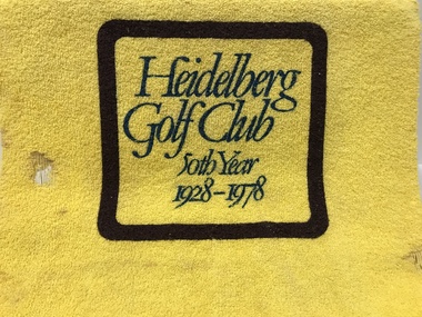
Memorabilia - Handtowel, Heidelberg Golf Club, Heidelberg Golf Club 50th Year 1928-1978, 1978
... Heidelberg Golf Club 50th Year 1928-1978...Heidelberg Golf Club... the Heidelberg Golf Club's 50th Year 1928-1978..."Heidelberg Golf Club 50th Year 1928-1978"...Heidelberg Golf Club...Heidelberg Golf Club 8 Main Road Lower Plenty 3093 Hand ...Hand towel produced as part of the memorabilia to celebrate the Heidelberg Golf Club's 50th Year 1928-1978Yellow cotton hand towel; green printed text in brown frame."Heidelberg Golf Club 50th Year 1928-1978"heidelberg golf club, 50th year, memorabilia, towels, vic mcgavin -
 Heidelberg Golf Club
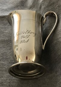
Functional object - Jug, Lewbury, Heidelberg Golf Club water jug, 1950s
... Heidelberg Golf Club water jug...Heidelberg Golf Club water jug ..."Heidelberg Golf Club" ...Heidelberg Golf Club...Heidelberg Golf Club 8 Main Road Lower Plenty 3093 ...Heidelberg Golf Club water jug Engraved metal jug"Heidelberg Golf Club" tableware, jugs -
 Heidelberg Golf Club
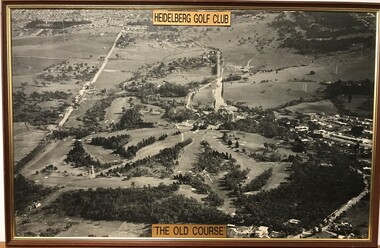
Photograph - Framed Photograph, Heidelberg Golf Club: The old course, 1966c
... Heidelberg Golf Club: The old course...Heidelberg Golf Club..."Heidelberg Golf Club" "The old course"...Heidelberg Golf Club...Heidelberg Golf Club 8 Main Road Lower Plenty 3093 ...An aerial photograph of the Heidelberg Golf Course, around 1966 (this date is taken from the road work to build the new bridge over the Plenty River). Known as the 'old course' it was designed by Harry Alexander and was in play until a redesign of the course in 1968. The clubhouse is in top centre of photograph.One of several aerial photogrphs showing the layout of the Heidelberg Golf CourseLarge Black and white aerial photograph, timber frame. Brass plaque top and bottom."Heidelberg Golf Club" "The old course"heidelberg golf club, old course -
 Heidelberg Golf Club
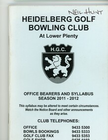
Booklet - Program, Heidelberg Golf Club Bowling Club, Heidelberg Golf Club Bowling Club: Office bearers and syllabus: Season 2011-2012, 2011
... Heidelberg Golf Club Bowling Club: Office bearers and...Heidelberg Golf Club...Contains Heidelberg Golf Club Bowling Club office bearers...Heidelberg Golf Club Bowling Club...Contains Heidelberg Golf Club Bowling Club office bearers ...Contains Heidelberg Golf Club Bowling Club office bearers, club information, a members list, some sponsor advertising and a calendar of events. Note change of title: "Heidelberg Golf Club Bowling Club at Lower Plenty."80 p., stapled, blue cover with black text and logo. heidelberg golf club, members handbooks, program of events, heidelberg golf club bowling club, syllabus -
 Heidelberg Golf Club
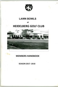
Booklet - Program, Heidelberg Golf Club Bowling Club, Heidelberg Golf Club Bowling Club: Office bearers and syllabus: Season 2017-2018, 2017
... Heidelberg Golf Club Bowling Club: Office bearers and...Heidelberg Golf Club...Contains Heidelberg Golf Club Bowling Club office bearers...Heidelberg Golf Club Bowling Club...Contains Heidelberg Golf Club Bowling Club office bearers ...Contains Heidelberg Golf Club Bowling Club office bearers, club information, some sponsor advertising and a calendar of events. Note change of title: "Lawn Bowls at Heidelberg Golf Club: Members Handbook."68 p., stapled, white cover with black text and black and white photo. heidelberg golf club, members handbooks, program of events, heidelberg golf club bowling club, syllabus -
 Heidelberg Golf Club
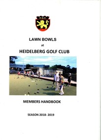
Booklet - Program, Heidelberg Golf Club Bowling Club, Heidelberg Golf Club Bowling Club: Office bearers and syllabus: Season 2018-2019, 2018
... Heidelberg Golf Club Bowling Club: Office bearers and...Heidelberg Golf Club...Contains Heidelberg Golf Club Bowling Club office bearers...Heidelberg Golf Club Bowling Club...Contains Heidelberg Golf Club Bowling Club office bearers ...Contains Heidelberg Golf Club Bowling Club office bearers, club information, some sponsor advertising and a calendar of events. Note change of title: "Lawn Bowls at Heidelberg Golf Club: Members Handbook."68 p., stapled, white cover with black text and colour photo. heidelberg golf club, members handbooks, program of events, heidelberg golf club bowling club, syllabus -
 Heidelberg Golf Club
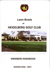
Booklet - Program, Heidelberg Golf Club Bowling Club, Heidelberg Golf Club Bowling Club: Office bearers and syllabus: Season 2016-2017, 2016
... Heidelberg Golf Club Bowling Club: Office bearers and...Heidelberg Golf Club...Contains Heidelberg Golf Club Bowling Club office bearers...Heidelberg Golf Club Bowling Club...Contains Heidelberg Golf Club Bowling Club office bearers ...Contains Heidelberg Golf Club Bowling Club office bearers, club information, some sponsor advertising and a calendar of events. Note change of title: "Lawn Bowls at Heidelberg Golf Club: Members Handbook."68 p., stapled, white cover with black text and colour photo. heidelberg golf club, members handbooks, program of events, heidelberg golf club bowling club, syllabus -
![Photograph - Framed Team Photograph, Heidelberg Golf Club Bowling Club, Heidelberg Golf Club Bowling Club: [Team to be identified, no date]](/media/collectors/62fc2e8d3b4c83fe7f279a1c/items/67848cf97361eb691d563279/item-media/67848d237361eb691d563494/item-fit-380x285.jpg) Heidelberg Golf Club
Heidelberg Golf ClubPhotograph - Framed Team Photograph, Heidelberg Golf Club Bowling Club, Heidelberg Golf Club Bowling Club: [Team to be identified, no date]
... Heidelberg Golf Club Bowling Club: [Team to be identified...Heidelberg Golf Club...Heidelberg Golf Club Bowling Club members taken...Heidelberg Golf Club Bowling Club...Heidelberg Golf Club Bowling Club members taken ...Heidelberg Golf Club Bowling Club members taken on the Bowling Green.Colour team photograph in timber frame, under glass.heidelberg golf club, heidelberg golf club bowling club -
 Heidelberg Golf Club
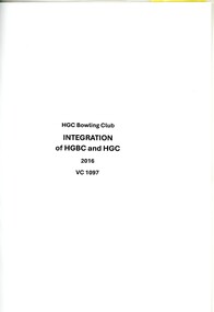
Document, Heidelberg Golf Club Bowling Club, Heidelberg Golf Club Bowling Club. Integration 2016, 2016
... Heidelberg Golf Club Bowling Club. Integration 2016...Heidelberg Golf Club Bowling Club...Heidelberg Golf Club Bowling Club. Integration 2016...Heidelberg Golf Club Bowling Club...Heidelberg Golf Club Bowling Club. Integration 2016 ...Heidelberg Golf Club Bowling Club. Integration 2016. A collection of documents relating to the merge (integration) of Bowling Club into the management of Heidelberg Golf Club. The Bowling Club was formed in 1958 to enable members no longer able to walk the hills of the golf course to have a sporting involvement with the club. A collection of documentsheidelberg golf club bowling club, integration, heidelberg golf club -
 Heidelberg Golf Club
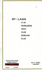
Booklet - Program, Heidelberg Golf Club, By-laws of the Heidelberg Golf Club Bowling Club, Before 1966
... By-laws of the Heidelberg Golf Club Bowling Club...Heidelberg Golf Club...Contains By-laws of the Heidelberg Golf Club Bowling Club...Heidelberg Golf Club...Heidelberg Golf Club 8 Main Road Lower Plenty 3093 Contains ...Contains By-laws of the Heidelberg Golf Club Bowling Club. Includes sponsor advertisements.8 p., stapled, cream cover with brown writing. 4 copies.heidelberg golf club, members handbooks, heidelberg golf club bowling club -
 Heidelberg Golf Club
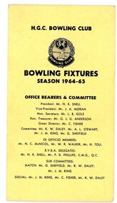
Card - Program, Heidelberg Golf Club Bowling Club, Heidelberg Golf Club Bowling Club: Bowling Fixtures: Season 1964-65, 1964
... Heidelberg Golf Club Bowling Club: Bowling Fixtures: Season...Heidelberg Golf Club...Contains Heidelberg Golf Club Bowling Club office bearers...Heidelberg Golf Club Bowling Club...Contains Heidelberg Golf Club Bowling Club office bearers ...Contains Heidelberg Golf Club Bowling Club office bearers and a calendar of events. 4 p., stapled, cream cover with black text and logo.heidelberg golf club, members handbooks, program of events, heidelberg golf club bowling club, syllabus -
 Heidelberg Golf Club
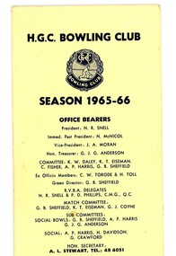
Card - Program, Heidelberg Golf Club Bowling Club, Heidelberg Golf Club Bowling Club: Season 1965-66, 1965
... Heidelberg Golf Club Bowling Club: Season 1965-66...Heidelberg Golf Club...Contains Heidelberg Golf Club Bowling Club office bearers...Heidelberg Golf Club Bowling Club...Contains Heidelberg Golf Club Bowling Club office bearers ...Contains Heidelberg Golf Club Bowling Club office bearers and a calendar of events. 4 p., folded, cream cover with black text and logo.heidelberg golf club, members handbooks, program of events, heidelberg golf club bowling club, syllabus -
 Heidelberg Golf Club
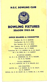
Card - Program, Heidelberg Golf Club Bowling Club, Heidelberg Golf Club Bowling Club: Bowling Fixtures: Season 1963-64, 1963
... Heidelberg Golf Club Bowling Club: Bowling Fixtures: Season...Heidelberg Golf Club...Contains Heidelberg Golf Club Bowling Club office bearers...Heidelberg Golf Club Bowling Club...Contains Heidelberg Golf Club Bowling Club office bearers ...Contains Heidelberg Golf Club Bowling Club office bearers and a calendar of events. 4 p., stapled, cream cover with black text and logo.heidelberg golf club, members handbooks, program of events, heidelberg golf club bowling club, syllabus -
![Photograph - Framed Team Photograph, Heidelberg Golf Club Bowling Club, Heidelberg Golf Club Bowling Club: [Team to be identified, no date]](/media/collectors/62fc2e8d3b4c83fe7f279a1c/items/678486d57361eb691d55d649/item-media/6784873d7361eb691d55dea6/item-fit-380x285.jpg) Heidelberg Golf Club
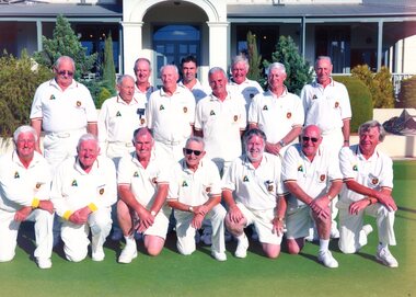
Heidelberg Golf ClubPhotograph - Framed Team Photograph, Heidelberg Golf Club Bowling Club, Heidelberg Golf Club Bowling Club: [Team to be identified, no date]
... Heidelberg Golf Club Bowling Club: [Team to be identified...Heidelberg Golf Club...Heidelberg Golf Club Bowling Club members taken...Heidelberg Golf Club Bowling Club...Heidelberg Golf Club Bowling Club members taken ...Heidelberg Golf Club Bowling Club members taken on the Bowling Green in front of the HGC clubhouse.Colour team photograph in timber frame, under glass.heidelberg golf club, heidelberg golf club bowling club, bryn teg -
![Photograph - Framed Team Photograph, Heidelberg Golf Club Bowling Club, Heidelberg Golf Club Bowling Club: [Team to be identified, no date]](/media/collectors/62fc2e8d3b4c83fe7f279a1c/items/67848dd87361eb691d5639d8/item-media/67848e0a7361eb691d563bcd/item-fit-380x285.jpg) Heidelberg Golf Club
Heidelberg Golf ClubPhotograph - Framed Team Photograph, Heidelberg Golf Club Bowling Club, Heidelberg Golf Club Bowling Club: [Team to be identified, no date]
... Heidelberg Golf Club Bowling Club: [Team to be identified...Heidelberg Golf Club...Heidelberg Golf Club Bowling Club: Officials in the HGC...Heidelberg Golf Club Bowling Club...Heidelberg Golf Club Bowling Club: Officials in the HGC ...Heidelberg Golf Club Bowling Club: Officials in the HGC clubhouse and two men on the Bowling Green.2 Colour photographs in timber frame, under glass.heidelberg golf club, heidelberg golf club bowling club -
 Heidelberg Golf Club
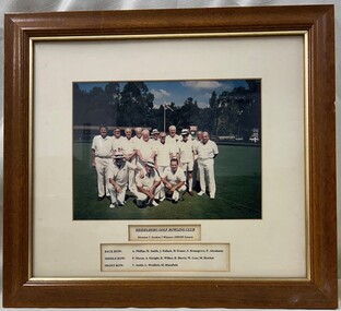
Photograph - Framed Team Photograph, Heidelberg Golf Club Bowling Club, Heidelberg Golf Club Bowling Club: Division 7, Section 5 winners 1988-1989, 1989
... Heidelberg Golf Club Bowling Club: Division 7, Section 5...Heidelberg Golf Club...Heidelberg Golf Club Bowling Club: Division 7, Section 5...Heidelberg Golf Club Bowling Club...Heidelberg Golf Club Bowling Club: Division 7, Section 5 ...Heidelberg Golf Club Bowling Club: Division 7, Section 5 winners 1988-1989. Colour team photograph with caption in timber frame under glass. heidelberg golf club, heidelberg golf club bowling club, pennant (bowls) -
 Heidelberg Golf Club
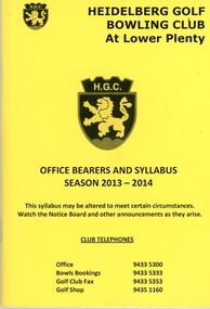
Booklet - Program, Heidelberg Golf Club Bowling Club, Heidelberg Golf Club Bowling Club: Office bearers and syllabus: Season 2013-2014, 2013
... Heidelberg Golf Club Bowling Club: Office bearers and...Heidelberg Golf Club...Contains Heidelberg Golf Club Bowling Club office bearers...Heidelberg Golf Club Bowling Club...Contains Heidelberg Golf Club Bowling Club office bearers ...Contains Heidelberg Golf Club Bowling Club office bearers, club information, a members list, some sponsor advertising and a calendar of events. Note change of title: "Heidelberg Golf Bowling Club at Lower Plenty."68 p., stapled, yellow cover with black text and logo. Copy 2 is an A4 printed copy of this booklet.heidelberg golf club, members handbooks, program of events, heidelberg golf club bowling club, syllabus -
 Heidelberg Golf Club
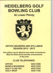
Booklet - Program, Heidelberg Golf Club Bowling Club, Heidelberg Golf Club Bowling Club: Office bearers and syllabus: Season 2012-2013, 2012
... Heidelberg Golf Club Bowling Club: Office bearers and...Heidelberg Golf Club...Contains Heidelberg Golf Club Bowling Club office bearers...Heidelberg Golf Club Bowling Club...Contains Heidelberg Golf Club Bowling Club office bearers ...Contains Heidelberg Golf Club Bowling Club office bearers, club information, a members list, some sponsor advertising and a calendar of events. Note change of title: "Heidelberg Golf Bowling Club at Lower Plenty."68 p., stapled, manilla cover with black text and logo. heidelberg golf club, members handbooks, program of events, heidelberg golf club bowling club, syllabus -
 Heidelberg Golf Club
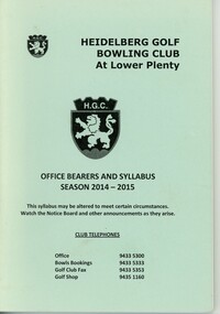
Booklet - Program, Heidelberg Golf Club Bowling Club, Heidelberg Golf Club Bowling Club: Office bearers and syllabus: Season 2014-2015, 2014
... Heidelberg Golf Club Bowling Club: Office bearers and...Heidelberg Golf Club...Contains Heidelberg Golf Club Bowling Club office bearers...Heidelberg Golf Club Bowling Club...Contains Heidelberg Golf Club Bowling Club office bearers ...Contains Heidelberg Golf Club Bowling Club office bearers, club information, a members list, some sponsor advertising and a calendar of events. Note change of title: "Heidelberg Golf Bowling Club at Lower Plenty."68 p., stapled, blue cover with black text and logo. heidelberg golf club, members handbooks, program of events, heidelberg golf club bowling club, syllabus -
 Heidelberg Golf Club
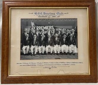
Photograph - Framed Team Photograph, Heidelberg Golf Club Bowling Club, Heidelberg Golf Club Bowling Club: Premiers "C1" 1964-1965, 1965
... Heidelberg Golf Club Bowling Club: Premiers "C1" 1964-1965...Heidelberg Golf Club...Heidelberg Golf Club Bowling Club: Premiers "C1" 1964-1965...Heidelberg Golf Club Bowling Club...Heidelberg Golf Club Bowling Club: Premiers "C1" 1964-1965 ...Heidelberg Golf Club Bowling Club: Premiers "C1" 1964-1965. Team photograph with Pennant flag in background.Black and white team photograph with caption in timber frame under glass. heidelberg golf club, heidelberg golf club bowling club, pennant (bowls) -
 Heidelberg Golf Club
Photograph - Team Photograph, Heidelberg Golf Club Bowling Club, Heidelberg Golf Club Bowling Club: Team 2 2009 final, 2009
... Heidelberg Golf Club Bowling Club: Team 2 2009 final...Heidelberg Golf Club...Heidelberg Golf Club Bowling Club Pennant Team taken...Heidelberg Golf Club Bowling Club...Heidelberg Golf Club Bowling Club Pennant Team taken ...Heidelberg Golf Club Bowling Club Pennant Team taken on the Bowling Green, Team 2, final, 2009.Colour team photograph.heidelberg golf club, heidelberg golf club bowling club, pennant (bowls) -
 Heidelberg Golf Club
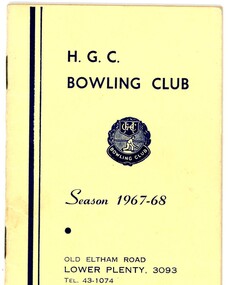
Booklet - Program, Heidelberg Golf Club Bowling Club, Heidelberg Golf Club Bowling Club: Season 1967-68, 1967
... Heidelberg Golf Club Bowling Club: Season 1967-68...Heidelberg Golf Club...Contains Heidelberg Golf Club Bowling Club office bearers...Heidelberg Golf Club Bowling Club...Contains Heidelberg Golf Club Bowling Club office bearers ...Contains Heidelberg Golf Club Bowling Club office bearers, club information, members' contact details and a calendar of events. 20 p., stapled, cream cover with brown writing and logo. Logo on front and back coversheidelberg golf club, members handbooks, program of events, heidelberg golf club bowling club, syllabus -
 Heidelberg Golf Club
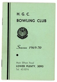
Booklet - Program, Heidelberg Golf Club Bowling Club, Heidelberg Golf Club Bowling Club: Season 1969-70, 1969
... Heidelberg Golf Club Bowling Club: Season 1969-70...Heidelberg Golf Club...Contains Heidelberg Golf Club Bowling Club office bearers...Heidelberg Golf Club Bowling Club...Contains Heidelberg Golf Club Bowling Club office bearers ...Contains Heidelberg Golf Club Bowling Club office bearers, club information, members' contact details and a calendar of events. 20 p., stapled, green cover with black writing and logo. Logo on front and back coversheidelberg golf club, members handbooks, program of events, heidelberg golf club bowling club, syllabus -
 Heidelberg Golf Club
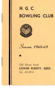
Booklet - Program, Heidelberg Golf Club Bowling Club, Heidelberg Golf Club Bowling Club: Season 1968-69, 1968
... Heidelberg Golf Club Bowling Club: Season 1968-69...Heidelberg Golf Club...Contains Heidelberg Golf Club Bowling Club office bearers...Heidelberg Golf Club Bowling Club...Contains Heidelberg Golf Club Bowling Club office bearers ...Contains Heidelberg Golf Club Bowling Club office bearers, club information, members' contact details and a calendar of events. 20 p., stapled, cream cover with brown writing and logo. Logo on front and back coversheidelberg golf club, members handbooks, program of events, heidelberg golf club bowling club, syllabus -
 Heidelberg Golf Club
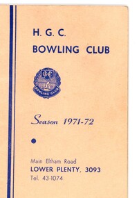
Booklet - Program, Heidelberg Golf Club Bowling Club, Heidelberg Golf Club Bowling Club: Season 1971-72, 1971
... Heidelberg Golf Club Bowling Club: Season 1971-72...Heidelberg Golf Club...Contains Heidelberg Golf Club Bowling Club office bearers...Heidelberg Golf Club Bowling Club...Contains Heidelberg Golf Club Bowling Club office bearers ...Contains Heidelberg Golf Club Bowling Club office bearers, club information, members' contact details and a calendar of events. 20 p., stapled, pink cover with dark blue writing and logo. Logo on front and back coversNotations throughoutheidelberg golf club, members handbooks, program of events, heidelberg golf club bowling club, syllabus -
 Heidelberg Golf Club
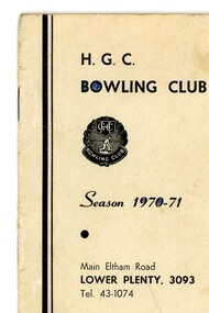
Booklet - Program, Heidelberg Golf Club Bowling Club, Heidelberg Golf Club Bowling Club: Season 1970-71, 1970
... Heidelberg Golf Club Bowling Club: Season 1970-71...Heidelberg Golf Club...Contains Heidelberg Golf Club Bowling Club office bearers...Heidelberg Golf Club Bowling Club...Contains Heidelberg Golf Club Bowling Club office bearers ...Contains Heidelberg Golf Club Bowling Club office bearers, club information, members' contact details and a calendar of events. 20 p., stapled, grey cover with black writing and logo. Logo on front and back coversNotations throughoutheidelberg golf club, members handbooks, program of events, heidelberg golf club bowling club, syllabus -
 Heidelberg Golf Club
Booklet - Program, Heidelberg Golf Club Bowling Club, Heidelberg Golf Club Bowling Club: Season 1972-73, 1972
... Heidelberg Golf Club Bowling Club: Season 1972-73...Heidelberg Golf Club...Contains Heidelberg Golf Club Bowling Club office bearers...Heidelberg Golf Club Bowling Club...Contains Heidelberg Golf Club Bowling Club office bearers ...Contains Heidelberg Golf Club Bowling Club office bearers, club information, members' contact details and a calendar of events. 20 p., stapled, cream cover with dark black writing and logo. Notations throughoutheidelberg golf club, members handbooks, program of events, heidelberg golf club bowling club, syllabus -
 Heidelberg Golf Club
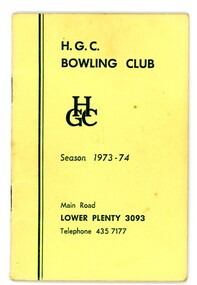
Booklet - Program, Heidelberg Golf Club Bowling Club, Heidelberg Golf Club Bowling Club: Season 1973-74, 1973
... Heidelberg Golf Club Bowling Club: Season 1973-74...Heidelberg Golf Club...Contains Heidelberg Golf Club Bowling Club office bearers...Heidelberg Golf Club Bowling Club...Contains Heidelberg Golf Club Bowling Club office bearers ...Contains Heidelberg Golf Club Bowling Club office bearers, club information, members' contact details and a calendar of events. 20 p., stapled, cream cover with dark green writing and logo. Notations throughoutheidelberg golf club, members handbooks, program of events, heidelberg golf club bowling club, syllabus -
 Heidelberg Golf Club
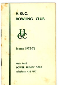
Booklet - Program, Heidelberg Golf Club Bowling Club, Heidelberg Golf Club Bowling Club: Season 1975-76, 1975
... Heidelberg Golf Club Bowling Club: Season 1975-76...Heidelberg Golf Club...Contains Heidelberg Golf Club Bowling Club office bearers...Heidelberg Golf Club Bowling Club...Contains Heidelberg Golf Club Bowling Club office bearers ...Contains Heidelberg Golf Club Bowling Club office bearers, club information, members' contact details and a calendar of events. 20 p., stapled, cream cover with green text and logo. heidelberg golf club, members handbooks, program of events, heidelberg golf club bowling club, syllabus -
 Heidelberg Golf Club
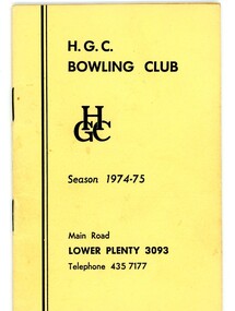
Booklet - Program, Heidelberg Golf Club Bowling Club, Heidelberg Golf Club Bowling Club: Season 1974-75, 1974
... Heidelberg Golf Club Bowling Club: Season 1974-75...Heidelberg Golf Club...Contains Heidelberg Golf Club Bowling Club office bearers...Heidelberg Golf Club Bowling Club...Contains Heidelberg Golf Club Bowling Club office bearers ...Contains Heidelberg Golf Club Bowling Club office bearers, club information, members' contact details and a calendar of events. 20 p., stapled, cream cover with black text and logo. heidelberg golf club, members handbooks, program of events, heidelberg golf club bowling club, syllabus