Showing 128168 items matching "heidelberg-kinglake-road"
-
 Eltham District Historical Society Inc
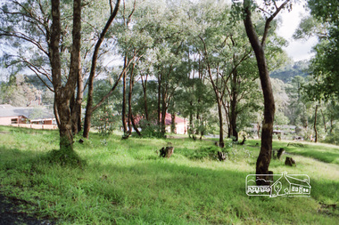
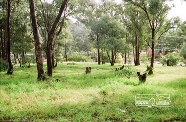
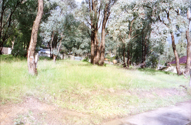
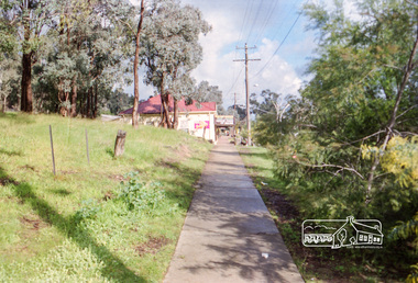
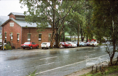
Photograph, Vacant land at 816 Heidelberg-Kinglake Road, Hurstbridge, c.1980, 1980c
... Vacant land at 816 Heidelberg-Kinglake Road, Hurstbridge, c.1980...Heidelberg-Kinglake Road, Hurstbridge, Victoria...Eltham District Historical Society Inc 728 Main Rd Eltham melbourne Streetscape evolution; prior to development of reserve for housing units and redevelopment of shops opposite Hurstbridge Railway Station streets heidelberg-kinglake road hurstbridge railway station Kodak GB 200 5096 Roll of 35mm colour negative film, 4 strips Vacant land at 816 Heidelberg-Kinglake Road, Hurstbridge, c.1980 Photograph ...Streetscape evolution; prior to development of reserve for housing units and redevelopment of shops opposite Hurstbridge Railway StationRoll of 35mm colour negative film, 4 stripsKodak GB 200 5096streets, heidelberg-kinglake road, hurstbridge, railway station -
 Eltham District Historical Society Inc
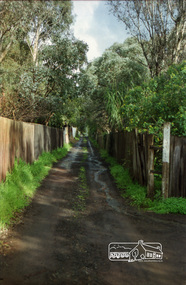
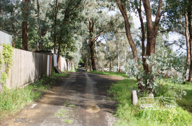
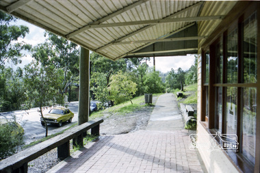
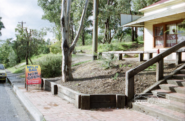
Photograph, Milk Bar at 808 and vacant land at 816 Heidelberg-Kinglake Road, Hurstbridge, c.1980, 1980c
... Milk Bar at 808 and vacant land at 816 Heidelberg-Kinglake Road, Hurstbridge, c.1980...Heidelberg-Kinglake Road, Hurstbridge, Victoria...Eltham District Historical Society Inc 728 Main Rd Eltham melbourne Streetscape evolution; prior to development of reserve for housing units and redevelopment of shops opposite Hurstbridge Railway Station streets heidelberg-kinglake road hurstbridge milk bar bendigo bank railway station Kodak GB 200 5096 Roll of 35mm colour negative film, 4 strips Milk Bar at 808 and vacant land at 816 Heidelberg-Kinglake Road, Hurstbridge, c.1980 Photograph ...Streetscape evolution; prior to development of reserve for housing units and redevelopment of shops opposite Hurstbridge Railway StationRoll of 35mm colour negative film, 4 stripsKodak GB 200 5096streets, heidelberg-kinglake road, hurstbridge, milk bar, bendigo bank, railway station -
 Eltham District Historical Society Inc
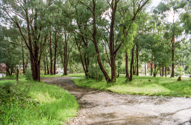
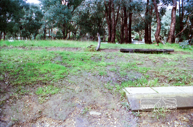
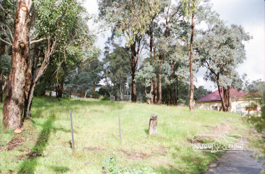
Photograph, Vacant land at 816 Heidelberg-Kinglake Road, Hurstbridge, c.1980, 1980c
... Vacant land at 816 Heidelberg-Kinglake Road, Hurstbridge, c.1980...Heidelberg-Kinglake Road, Hurstbridge, Victoria...Eltham District Historical Society Inc 728 Main Rd Eltham melbourne Now fully developed as multiple units Streetscape evolution; prior to development of reserve for housing units and redevelopment of shops opposite Hurstbridge Railway Station streets heidelberg-kinglake road hurstbridge railway station Kodak GB 200 5096 Roll of 35mm colour negative film, 4 strips Vacant land at 816 Heidelberg-Kinglake Road, Hurstbridge, c.1980 Photograph ...Now fully developed as multiple unitsStreetscape evolution; prior to development of reserve for housing units and redevelopment of shops opposite Hurstbridge Railway StationRoll of 35mm colour negative film, 4 stripsKodak GB 200 5096streets, heidelberg-kinglake road, hurstbridge, railway station -
 Eltham District Historical Society Inc
Photograph, Vacant land at 816 Heidelberg-Kinglake Road, Hurstbridge, c.1980, 1980c
... Vacant land at 816 Heidelberg-Kinglake Road, Hurstbridge, c.1980...Heidelberg-Kinglake Road, Hurstbridge, Victoria...Eltham District Historical Society Inc 728 Main Rd Eltham melbourne Streetscape evolution; prior to development of reserve for housing units and redevelopment of shops opposite Hurstbridge Railway Station streets heidelberg-kinglake road hurstbridge railway station Kodak GB 200 5096 Roll of 35mm colour negative film, 4 strips Vacant land at 816 Heidelberg-Kinglake Road, Hurstbridge, c.1980 Photograph ...Streetscape evolution; prior to development of reserve for housing units and redevelopment of shops opposite Hurstbridge Railway StationRoll of 35mm colour negative film, 4 stripsKodak GB 200 5096streets, heidelberg-kinglake road, hurstbridge, railway station -
 Eltham District Historical Society Inc
Photograph, Milk Bar at 808 and vacant land at 816 Heidelberg-Kinglake Road, Hurstbridge, c.1980, 1980c
... Milk Bar at 808 and vacant land at 816 Heidelberg-Kinglake Road, Hurstbridge, c.1980...Heidelberg-Kinglake Road, Hurstbridge, Victoria...Eltham District Historical Society Inc 728 Main Rd Eltham melbourne Streetscape evolution; prior to development of reserve for housing units and redevelopment of shops opposite Hurstbridge Railway Station streets heidelberg-kinglake road hurstbridge milk bar bendigo bank railway station Kodak GB 200 5096 Roll of 35mm colour negative film, 4 strips Milk Bar at 808 and vacant land at 816 Heidelberg-Kinglake Road, Hurstbridge, c.1980 Photograph ...Streetscape evolution; prior to development of reserve for housing units and redevelopment of shops opposite Hurstbridge Railway StationRoll of 35mm colour negative film, 4 stripsKodak GB 200 5096streets, heidelberg-kinglake road, hurstbridge, milk bar, bendigo bank, railway station -
 Eltham District Historical Society Inc
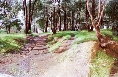
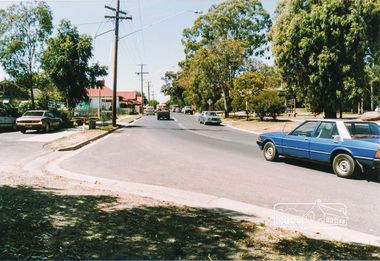
Photograph, Heidelberg-Kinglake Road, Hurstbridge; looking north east towards Kinglake
... Heidelberg-Kinglake Road, Hurstbridge; looking north east towards Kinglake...Two colour photographs taken near the location of the present roundabout intersection of Anzac Road (on right) and Arthurs Creek Road (on left) with the Heidelberg-Kinglake Road at Hurstbridge. [37�38'14.8"S 145�11'39.6"E -37.637459, 145.194322]...Eltham District Historical Society Inc 728 Main Rd Eltham melbourne main street kinglake road heidelberg/kinglake road hurstbridge Two colour photographs taken near the location of the present roundabout intersection of Anzac Road (on right) and Arthurs Creek Road (on left) with the Heidelberg-Kinglake Road at Hurstbridge. [37�38'14.8"S 145�11'39.6"E -37.637459, 145.194322] Heidelberg-Kinglake Road, Hurstbridge; looking north east towards Kinglake Photograph ...Two colour photographs taken near the location of the present roundabout intersection of Anzac Road (on right) and Arthurs Creek Road (on left) with the Heidelberg-Kinglake Road at Hurstbridge. [37�38'14.8"S 145�11'39.6"E -37.637459, 145.194322]main street, kinglake road, heidelberg/kinglake road, hurstbridge -
 Eltham District Historical Society Inc
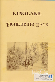
Book, Deidre G. Hawkins, Kinglake pioneering days / Deidre G. Hawkins, Editor, 1991c
... Kinglake pioneering days / Deidre G. Hawkins, Editor....kinglake......Kinglake Historical Society...Kinglake, v, Australia...Kinglake pioneering days / Deidre G. Hawkins, Editor. ...Paperback; 72 pages : illustrations, plans, portraits ; 30 cm.kinglake, early settlers -
 Eltham District Historical Society Inc
Photograph, Bridge over Smiths Gully Creek, Heidelberg-Kinglake Road, St Andrews, c.1968, 1968c
... Bridge over Smiths Gully Creek, Heidelberg-Kinglake Road, St Andrews, c.1968...Looking northwest from Smiths Gully creek at the bridge on Scott Street (Heidelberg-Kinglake Road) just east of the intersection with Burns Street (Kangaroo Ground-St Andrews Road), and the St Andrews Market...Eltham District Historical Society Inc 728 Main Rd Eltham melbourne Looking northwest from Smiths Gully creek at the bridge on Scott Street (Heidelberg-Kinglake Road) just east of the intersection with Burns Street (Kangaroo Ground-St Andrews Road), and the St Andrews Market Bridge, Burns Street, Heidelberg-Kinglake Road, Infrastructure, Kangaroo Ground-St Andrews Road, Scott Street, shire of eltham, Shire of Eltham Infrastructure, Smiths Gully Creek, St Andrews, St Andrews Market H-KL at KG SA Black and white photograph (x 2) Bridge over Smiths Gully Creek, Heidelberg-Kinglake Road, St Andrews, c.1968 Photograph ...Looking northwest from Smiths Gully creek at the bridge on Scott Street (Heidelberg-Kinglake Road) just east of the intersection with Burns Street (Kangaroo Ground-St Andrews Road), and the St Andrews MarketBlack and white photograph (x 2)H-KL at KG SAbridge, burns street, heidelberg-kinglake road, infrastructure, kangaroo ground-st andrews road, scott street, shire of eltham, shire of eltham infrastructure, smiths gully creek, st andrews, st andrews market -
 Greensborough Historical Society
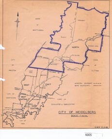
Map, City of Heidelberg, City of Heidelberg, 1962, 02/02/1962
... City of Heidelberg, 1962...Map of City of Heidelberg showing boundaries of its six wards; North Ward is highlighted, covering Watsonia, Greensborough, part Bundoora, St Helena, Plenty, Yarrambat and Diamond Creek....City of Heidelberg Scale: 1" to 1 ml. G.M.H. 2.2.62...City of Heidelberg...Heidelberg...Greensborough Historical Society 34A Glenauburn Road Lower Plenty Lower Plenty melbourne Map of City of Heidelberg showing boundaries of its six wards; North Ward is highlighted, covering Watsonia, Greensborough, part Bundoora, St Helena, Plenty, Yarrambat and Diamond Creek. city of heidelberg heidelberg - maps City of Heidelberg Scale: 1" to 1 ml. ...Map of City of Heidelberg showing boundaries of its six wards; North Ward is highlighted, covering Watsonia, Greensborough, part Bundoora, St Helena, Plenty, Yarrambat and Diamond Creek.Blue print mapCity of Heidelberg Scale: 1" to 1 ml. G.M.H. 2.2.62city of heidelberg, heidelberg - maps -
 Greensborough Historical Society
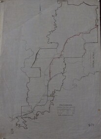
Maps, Shire of Heidelberg, 1920s
... Shire of Heidelberg......heidelberg...Map of main roads within Shire of Heidelberg, probably those for which the Shire was responsible for maintaining...Map of main roads within Shire of Heidelberg, hand coloured, and Hurstbridge rail line. 40 chains: 1 inch...Shire of Heidelberg...Greensborough Historical Society 34A Glenauburn Road Lower Plenty Lower Plenty melbourne Map of main roads within Shire of Heidelberg, probably those for which the Shire was responsible for maintaining shire of heidelberg heidelberg 971 Map of main roads within Shire of Heidelberg, hand coloured, and Hurstbridge rail line. 40 chains: 1 inch Shire of Heidelberg Maps Shire of Heidelberg ...Map of main roads within Shire of Heidelberg, probably those for which the Shire was responsible for maintainingMap of main roads within Shire of Heidelberg, hand coloured, and Hurstbridge rail line. 40 chains: 1 inch971shire of heidelberg, heidelberg -
 Victorian Interpretive Projects Inc.
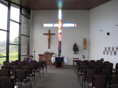
Photograph - Digital, Clare Kathleen Gervasoni, St Mary's Kinglake, 2012, 15/12/2012
... St Mary's Kinglake, 2012...kinglake...The park was established in 1928 to protect native flora and fauna. Kinglake takes its name from Alexander Kinglake who travelled through the area in 1870. ...Photographs showing the newly built St Mary's Catholic Church at Kinglake. .1) Interior of Church .2) Painting of the Four Churches of Kinglake by Judy Racz .3-5) Views from the Church windows to the adjoining landscape .6) St Mary's Church grounds...Kinglake, Victoria, Victoria, Australia...The park was established in 1928 to protect native flora and fauna. Kinglake takes its name from Alexander Kinglake who travelled through the area in 1870. kinglake bushfire black saturday church catholic racz St Mary's Catholic Church Kinglake Photographs showing the newly built St Mary's Catholic Church at Kinglake. .1) Interior of Church .2) Painting of the Four Churches of Kinglake by Judy Racz .3-5) Views from the Church windows to the adjoining landscape .6) St Mary's Church grounds St Mary's Kinglake, 2012 Photograph - Digital Clare Kathleen Gervasoni ...The images depict the newly completed fourth Catholic Church at Kinglake. The previous three churches having been destroyed by 'Black Saturday' bushfire. The painting is oil on canvas. The historical continuity is expressed by the continuity of the skyline and the disconnectedness of the colours. it is not a literal depiction of each church, but a recognizable and symbolic image conveying resilience of faith of the local community. The first church was burnt down in a bushfire, the second burnt down by vandals, and the three burnt down in the 2009 bushfires known as 'Black Saturday'.The white cross and black fence at the lower left commemorated the remarkable fact that these remained intact after the 2009 bushfires. The red-orange can be the colour of the kinglake soil or the fires. The return of new life is indicated by the green growth on the burnt gumtrees. The presence of the Holy Trinity is shown above the entrance to the church. The return of new life is indicated by the green growth on the burnt gumtrees. The presence of the Holy Trinity is shown above the entrance to the church. The Holy Sprit is symbolized by the sulphur crested cockatoo, an Australian bird instead of the white dove. The symbol for the father is above the church in the triangle which has God's Holy Name (I AM) as given to Moses from the Burning Bush, written in Hebrew. Christ is represented by the cross above the entrance. The previous church was destroyed in the 2009 bushfires. The area is surrounded by 22,000 hectares of Kinglake National Park, the largest National Park close to Melbourne. The park was established in 1928 to protect native flora and fauna. Kinglake takes its name from Alexander Kinglake who travelled through the area in 1870. Photographs showing the newly built St Mary's Catholic Church at Kinglake. .1) Interior of Church .2) Painting of the Four Churches of Kinglake by Judy Racz .3-5) Views from the Church windows to the adjoining landscape .6) St Mary's Church groundskinglake, bushfire, black saturday, church, catholic, racz, st mary's catholic church kinglake -
 Eltham District Historical Society Inc
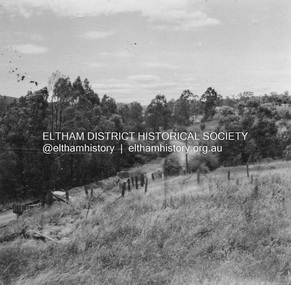
Album - Photograph, J.A. McDonald, Heidelberg-Kinglake Road, c. 1956
... Heidelberg-Kinglake Road...Hurstbridge-Kinglake Road at Cottlesbridge from Pills House to north c. 1956...The negatives have been catalogued separately and relevant relationships to pages highlighted in catalogue record. Heidelberg-Kinglake Road Album Photograph J.A. ...Hurstbridge-Kinglake Road at Cottlesbridge from Pills House to north c. 1956Record of various Shire of Eltham infrastructure works undertaken during the period of 1952-1962 involving bridge and road reconstruction projects, sometimes with Eltham Shire Council Project Reference numbers quoted. It was during this period that a number of significant improvements were made to roads and new bridges constructed within the shire that remain in place as of present day (2022). In many situations, the photos provide a tangible visible record of infrastructure that existed throughout the early days of the Shire. The album was put together by or under the direction of the Shire Engineer, J.A. McDonald.infrastructure, shire of eltham, 1956, bridge construction, heidelberg-kinglake road, road construction, cottlesbridge -
 Eltham District Historical Society Inc
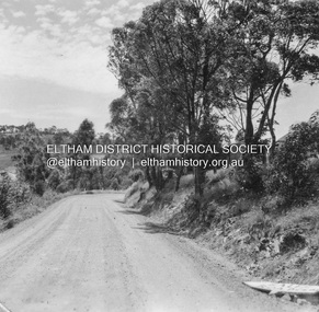
Album - Photograph, J.A. McDonald, Heidelberg-Kinglake Road, Jan. 1956
... Heidelberg-Kinglake Road...Hurstbridge-Kinglake Road at Cottlesbridge south Pill’s Corner before reconstruction January 1956...The negatives have been catalogued separately and relevant relationships to pages highlighted in catalogue record. Heidelberg-Kinglake Road Album Photograph J.A. ...Hurstbridge-Kinglake Road at Cottlesbridge south Pill’s Corner before reconstruction January 1956Record of various Shire of Eltham infrastructure works undertaken during the period of 1952-1962 involving bridge and road reconstruction projects, sometimes with Eltham Shire Council Project Reference numbers quoted. It was during this period that a number of significant improvements were made to roads and new bridges constructed within the shire that remain in place as of present day (2022). In many situations, the photos provide a tangible visible record of infrastructure that existed throughout the early days of the Shire. The album was put together by or under the direction of the Shire Engineer, J.A. McDonald.infrastructure, shire of eltham, bridge construction, heidelberg-kinglake road, road construction, cottlesbridge, 1956-01 -
 Greensborough Historical Society
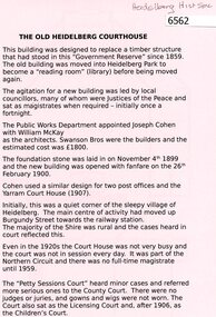
Document, The Old Heidelberg Courthouse, 2018_
... The Old Heidelberg Courthouse...The Courthouse is now the location of the Heidelberg Historical Society....Heidelberg Historical Society...Heidelberg Historical Society...Heidelberg...Greensborough Historical Society 34A Glenauburn Road Lower Plenty Lower Plenty melbourne The Courthouse is now the location of the Heidelberg Historical Society. heidelberg historical society old heidelberg court house 2 p. black print on pink paper, building plan The Old Heidelberg Courthouse Document Heidelberg Historical Society Heidelberg Historical Society ...The Courthouse is now the location of the Heidelberg Historical Society.2 p. black print on pink paper, building planheidelberg historical society, old heidelberg court house -
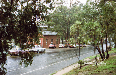
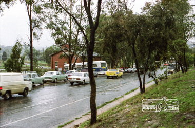
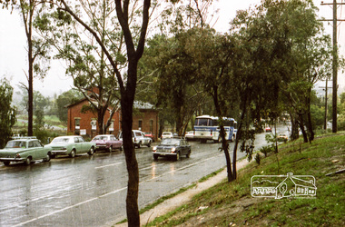
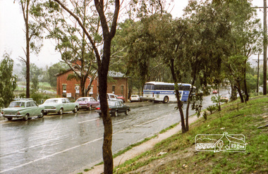
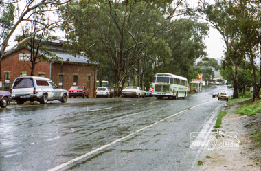
 Eltham District Historical Society Inc
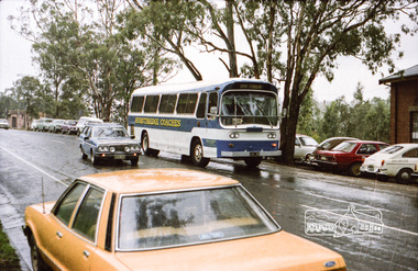
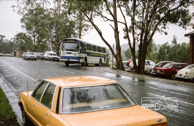
Photograph, Hurstbridge Coaches depot and Hurstbridge rail station, Heidelberg-Kinglake Road, Hurstbridge, c.1980
... Hurstbridge Coaches depot and Hurstbridge rail station, Heidelberg-Kinglake Road, Hurstbridge, c.1980......heidelberg-kinglake-road...Eltham District Historical Society Inc 728 Main Rd Eltham melbourne streetscape heidelberg-kinglake-road hurstbridge hurstbridge coaches railway station Kodak Safety 5035 Roll of 35mm colour negative film, 7 strips Hurstbridge Coaches depot and Hurstbridge rail station, Heidelberg-Kinglake Road, Hurstbridge, c.1980 Photograph ...Roll of 35mm colour negative film, 7 stripsKodak Safety 5035streetscape, heidelberg-kinglake-road, hurstbridge, hurstbridge coaches, railway station -
 Eltham District Historical Society Inc
Photograph, Hurstbridge Coaches depot and Hurstbridge rail station, Heidelberg-Kinglake Road, Hurstbridge, c.1980
... Hurstbridge Coaches depot and Hurstbridge rail station, Heidelberg-Kinglake Road, Hurstbridge, c.1980......heidelberg-kinglake-road...Eltham District Historical Society Inc 728 Main Rd Eltham melbourne streetscape heidelberg-kinglake-road hurstbridge hurstbridge coaches railway station Kodak Safety 5035 Roll of 35mm colour negative film, 7 strips Hurstbridge Coaches depot and Hurstbridge rail station, Heidelberg-Kinglake Road, Hurstbridge, c.1980 Photograph ...Roll of 35mm colour negative film, 7 stripsKodak Safety 5035streetscape, heidelberg-kinglake-road, hurstbridge, hurstbridge coaches, railway station