Showing 4201 items matching "history victoria goldfields"
-
 Bendigo Historical Society Inc.
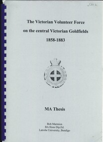
Book - THE VICTORIAN VOLUTEER FORCE ON THE CENTRAL VICTORIAN GOLDFIELDS 1858-1883
... ...history Victoria Goldfields...History House 11 Mackenzie Street Bendigo goldfields GOLD Goldfields volunteer force victoria history Victoria Goldfields Victorian volunteer force Victorian defence forces Bendigo and District history Bob Marmion The Victorian Volunteer Force on the central Victorian Goldfields 1858-1883, MA Thesis. ...The Victorian Volunteer Force on the central Victorian Goldfields 1858-1883, MA Thesis. Publisher: Latrobe University, Bendigo. Produced post 2003. Imperial and Colonial defence, Volunteers of Victoria's defences, British army's role, social structure, changing of the guard on the goldfields. Photographs, illustrations & graphs. 144 pages.Bob Marmiongold, goldfields, volunteer force, victoria, history victoria goldfields, victorian volunteer force, victorian defence forces, bendigo and district history -
 Bendigo Historical Society Inc.
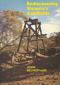
Book - REDISCOVERING VICTORIAS GOLDFIELDS
... history...Goldfields...Victoria...History House 11 Mackenzie Street Bendigo goldfields BOOKS Natural history Goldfields Victoria-history-goldfields John Bechervaise Hard covered book with dust jacket titled Rediscovering Victoria's Goldfields contains 117 pages with black and white & coloured photographs and prints. ...Hard covered book with dust jacket titled Rediscovering Victoria's Goldfields contains 117 pages with black and white & coloured photographs and prints.John Bechervaisebooks, natural history, goldfields, victoria-history-goldfields -
 Stawell Historical Society Inc
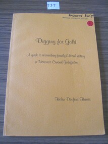
Book, Helen Doxford Harris, Digging for Gold - A Guide to researching family & local history in Victorias Central Goldfields by Helen Doxford Harris, 1988
... Digging For Gold A guide to researching family & local history in Victoria's Central Goldfields Helen Doxford Harris...Stawell Historical Society Inc 46 Longfield St Stawell grampians stawell Digging For Gold A guide to researching family & local history in Victoria's Central Goldfields Helen Doxford Harris Orange Card Cover with Black Print Digging for Gold - A Guide to researching family & local history in Victorias Central Goldfields by Helen Doxford Harris Book Helen Doxford Harris Aristoc Press Pty Ltd ...Orange Card Cover with Black PrintDigging For Gold A guide to researching family & local history in Victoria's Central Goldfields Helen Doxford Harrisstawell -
 Bendigo Historical Society Inc.
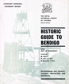
Book - HISTORIC GUIDE TO BENDIGO
... history... Victoria... Victorian history... goldfields...History House 11 Mackenzie Street Bendigo goldfields BENDIGO History gold mining book books Bendigo Bendigo history history Australian history Victoria Victorian history goldfields gold The Royal Historical Society of Victoria A copy of a book titled 'The Royal Historical Society of Victoria Bendigo Branch Historic Guide to Bendigo with map of goldfields showing streets, lines of reef, principal shafts. ...A copy of a book titled 'The Royal Historical Society of Victoria Bendigo Branch Historic Guide to Bendigo with map of goldfields showing streets, lines of reef, principal shafts. Recommended for tourists, students, prospectors and historians.' Sandhurst Municipal Centenary Edition. 4th edition. Maps, photos, illustrations.bendigo, history, gold mining, book, books, bendigo, bendigo history, history, australian history, victoria, victorian history, goldfields, gold, the royal historical society of victoria -
 Bendigo Historical Society Inc.
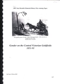
Book - GENDER ON THE CENTRAL VICTORIAN GOLDFIELDS 1851 - 91, 2001
... VICTORIA...History...goldfields...History House 11 Mackenzie Street Bendigo goldfields VICTORIA History goldfields Peter O'Brien Gender on the Central Victorian Goldfields 1851-91. 2001 Amy Huxtable Memorial History Prize Winning Paper by Peter O'Brien. 17 pages with black and white illustrations & colour photographs. ...Gender on the Central Victorian Goldfields 1851-91. 2001 Amy Huxtable Memorial History Prize Winning Paper by Peter O'Brien. 17 pages with black and white illustrations & colour photographs.Peter O'Brienvictoria, history, goldfields -
 Bendigo Historical Society Inc.
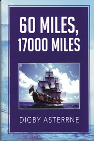
Book - 60 MILES, 17000 MILES
... VICTORIA...History...goldfields...History House 11 Mackenzie Street Bendigo goldfields VICTORIA History goldfields Great Britain-Victoria-Gold Discovery Digby Asterrne 60 Miles, 17000 Miles a hard cover book with dust jacket 93 pages with black and white illustrations. ...60 Miles, 17000 Miles a hard cover book with dust jacket 93 pages with black and white illustrations. The book covers the history of mainly Great Britain from 1700 through to the 1850 period & the transportation of the general public to America and Australia.Digby Asterrnevictoria, history, goldfields, great britain-victoria-gold discovery -
 Warrnambool and District Historical Society Inc.
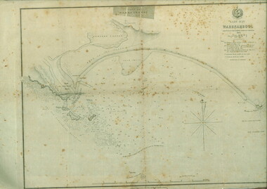
Document, Map: Lady Bay 1853, 1853
... Victoria. This map is of high historical and comparitive significance as it shows the Lady Bay area prior to the changes that have occurred in the last 160 years with the building of the breakwater. The issue regarding access to Lady Bay remains a current one. The engraver D Tulloch engraved some of the earliest scenes of the goldfields in Ballarat and as such has left a record of a very early and important era in Australian history ...This is one of the earliest surveys and maps of Warrnambool harbor, Lady Bay. Being done in 1853, it shows the depths of the bay area marked in fathoms, currents and directions and areas of rocks around mouth of the Merri and the Western side of the bay as well as a large sand spit to the middle right of the beach region.. It also marks the large areas of seaweed and fuci in the outer bay area. It has the area of Pertobe Lagoon marked and shows the early tracks to the town. The engraving work was done by Tulloch and Brown, with Tulloch being one of the earliest engravers and lithographers in the state of Victoria. He arrived in Melbourne in 1849 and set up business with James Davie Brown in 1853 with Brown being a map engraver. They were awarded bronze and silver medals for their work at the Victorian Industrial Exhibition. He also worked in the vignettes on the Proeschel Map of Victoria.This map is of high historical and comparitive significance as it shows the Lady Bay area prior to the changes that have occurred in the last 160 years with the building of the breakwater. The issue regarding access to Lady Bay remains a current one. The engraver D Tulloch engraved some of the earliest scenes of the goldfields in Ballarat and as such has left a record of a very early and important era in Australian history. Rectangular cream paper with black text. Map area is outlined by fine black lined border. Key in top right hand corner and scale at bottom middle of map.Map is labelled Town of Warrnambool printed at top of map. Small logo at top right corner which has “Hydrographic Department” in circle around an anchor. Lady Bay Warrnambool Surveyed by John Barrow assistant surveyor Engraved by Tulloch & Brown in bottom right corner. Melbourne engraved by order of the legislative Council of Victoria in middle bottom.map, warrnambool, town of warrnambool map 1853, tulloch & brown map 1853, lady bay warrnambool,, warrnambool harbour, warrnambool breakwater, warrnambool beach -
 Bendigo Military Museum
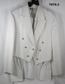
Uniform - MESS DRESS, RAAF, 1993
... goldfields Uniform, Sqd Leader Shane Wright. For his Service History Refer Cat No. 7877.6 Uniform RAAF Mess Dress Summer Manufacturers information - black ink print. 1. "ADI/ VICTORIA ...Uniform, Sqd Leader Shane Wright. For his Service History Refer Cat No. 7877.61. Jacket - white colour polyester viscose fabric, mess dress style - Summer. Collar and long lapels. Shoulder tapes for epaulettes. Gold colour plastic buttons with shank and metal pin. Raised emlem, crown and wings - RAAF. Lining - white colour polyester fabric. White cotton manufacturers label inside right side of jacket. 2. Shirt - white colour polyester/cotton fabric, dress shirt, collar, stiff front with buttonholes for studs and long sleeves with double cuff and buttonholes for cufflinks. White colour plastic buttons. White colour polyester manufacturers label, below collar inside. 3. Bowtie - black colour polyester/cotton fabric. Bowtie is prefolded and stitches on ribbon with black metal hook and ring closer.Manufacturers information - black ink print. 1. "ADI/ VICTORIA/ 1993^/ 8405-66-131. 8010/ SIZE 110R/ TO FIT CHEST 110/ SERVICE NO/ NAME/ 65% Poly 35% Visc/ Dry Clean Only". 2. "RA/ PHILIPPE ANTON/ MADE IN AUSTRALIA/ 44".uniform, raaf, mess dress, summer -
 Bendigo Military Museum
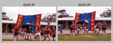
Photograph - Army Survey Regiment’s Fortuna Lions Football Club Grand Finals, Seymour, Victoria, 1983
... Bendigo Military Museum 37 - 39 Pall Mall Bendigo goldfields This is a set of 25 colour photographs of Army Survey Regiment’s Australian Rules football team – the Fortuna Lions aka “Fortuna Fumblers”, taken at Seymour Victoria in 1983. The 26th item is a A4 paper document detailing the history ...This is a set of 25 colour photographs of Army Survey Regiment’s Australian Rules football team – the Fortuna Lions aka “Fortuna Fumblers”, taken at Seymour Victoria in 1983. The 26th item is a A4 paper document detailing the history of Fortuna Football Club from 1978 to 1993. The Fortuna Lions competed in the Puckapunyal Area Football Association for several years from 1978 to 1984 and in 1983, fielded a great team it managed to reach the Grand Final. Held at the neutral ground at Kings Park, Seymour, the match was an incredibly exciting and bruising contest played in damp conditions and ended in a draw. Dave Lawler’s spectacular mark was a highlight. Due to heavy rain during the following week, the Grand Final replay was held the following week in even heavier conditions. The Fortuna Lions prevailed in the replay with an emphatic victory. The team’s leaders were Eddie Jacobs (coach), Rhys De Laine (captain), Greg Else (vice-captain), and Ken Slater (manager). See items 6244.27P and 6274.7P for more photographs taken at the two grand finals. Although not part of the photo collection, the team photo with names .24P and a photo of the premiership banner .25P are included. The team changed its name to the Fortuna Falcons and its guernsey to gold with a blue ‘V’ in 1988 and continued to compete in the competition up to 1995.This is a set of 25 photographs of Army Survey Regiment’s Australian Rules football team – the Fortuna Lions aka “Fortuna Fumblers”, taken at Seymour Victoria in 1983. The 26th item is a A4 paper document detailing the history of Fortuna Football Club from 1978 to 1993. The photographs were printed on photographic paper They are part of the Army Survey Regiment’s Collection. The photographs were scanned at 300 dpi and the document at 200 dpi. Fortuna’s footballers named below are in Fitzroy jumpers. .1) - Photo, colour. 1983. L to R: Nick Van Dalen, Jim Ash, Dennis Learmonth, Greg Higgins, Dave Lawler. .2) - Photo, colour. 1983. L to R: Terry McIntyre, Andy Godden, Rod Skidmore, Alan Staley, Carmel Butler, Gayle Humphrey. .3) - Photo, colour. 1983. L to R: Greg Else, Doug Home, Wendy Leitinger, Leah Hoffman, Carmel Butler, Ken Talbot-Smith. .4) - Photo, colour. 1983. L to R: Leah Hoffman, Carmel Butler, Kristin Skidmore, Neville Carr, Brian Fauth on right of banner. .5) - Photo, colour. 1983. L to R: Dave Lawler, Larry Thompson, Rod Skidmore, Greg Higgins, Gayle Humphrey. .6) and .7) - Photo, colour. 1983. Army Survey Regiment, 1st Armoured Regiment and officials line up before game. .8) - Photo, colour. 1983. L to R: unidentified (x2), Kristin Skidmore, Carmel Fauth, Leah Hoffman, Wendy Leitinger, Gayle Humphrey, Di Weston, unidentified, Rob Straube. .9) and .10) - Photo, colour. 1983. Competition’s individual award recipients. Eddie Jacobs in white shorts. .11) and .12) - Photo, colour. 1983. Fortuna’s supporters on boundary. .13) to .15) - Photo, colour. 1983. All players unidentified. .16) - Photo, colour. 1983. Dave Lawler launches to take a spectacular mark. .17) - Photo, colour. 1983. L to R: Stu Ridge (No.2) Eddie Jacobs (No.16), and (No.9). .18) - Photo, colour. 1983. L to R: unidentified (No.9), unidentified, Alan Staley (No.7). .19) - Photo, colour. 1983. L to R: Alan Staley (No.7), unidentified (No.17), unidentified, unidentified (No.9), Greg Higgins (No.20). .20) - Photo, colour. 1983. All players unidentified. .21) - Photo, colour. 1983. Peter Jones (No.5) .22) - Photo, colour. 1983. L to R: Greg Higgins (No.20), unidentified, Alan Staley (No.7). .23) - Photo, colour. 1983. L to R: Unidentified, Greg Byers (No.19). .24) - Photo, colour. 1983. Fortuna Football Club Team Photo. .25) - Banner, colour. 1983. Fortuna Football Club Premiership Banner. .26) - Document, black & white. 1993. History of Fortuna Football Club from 1978 to 1993..1P to .23P – no annotations .24P – Members of team named on bottom .26 - A4 size paper document of the team’s history.royal australian survey corps, rasvy, army survey regiment, army svy regt, fortuna, asr -
 Bendigo Military Museum
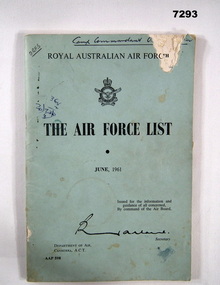
Manual - THE AIR FORCE LIST - RAAF, RAAF, 1961
... goldfields From booklet front cover "ROYAL AUSTRALIAN AIR FORCE - THE AIR FORCE LIST - JUNE 1961 Issued for the information and guidance of all concerned By Command of the Air Board, Secretary. DEPARTMENT OF AIR, CANBERRA, A.C.T. AAP 598" Item in the collection re R.W McGilvery RAAF, refer Cat No 2787P for his service details. History Booklet RAAF Front cover - handwritten black ink - top left - "ORFS". top right - "Camp Commandant O..." Back cover - stamp - purple ink HEADQUARTERS SUPPORT COMMAND UNIT RAAF/ VICTORIA ...From booklet front cover "ROYAL AUSTRALIAN AIR FORCE - THE AIR FORCE LIST - JUNE 1961 Issued for the information and guidance of all concerned By Command of the Air Board, Secretary. DEPARTMENT OF AIR, CANBERRA, A.C.T. AAP 598" Item in the collection re R.W McGilvery RAAF, refer Cat No 2787P for his service details.SOFT COVER BOOKLET. Cover - lightweight cardboard, pale blue colour with black print on front. 108 pages, cut, plain, off-white paper. Information manual for RAAF. Front cover - handwritten black ink - top left - "ORFS". top right - "Camp Commandant O..." Back cover - stamp - purple ink HEADQUARTERS SUPPORT COMMAND UNIT RAAF/ VICTORIA BARRACKS/ MELBOURNE S.C.I. VIC.history, booklet, raaf -
 Bendigo Military Museum
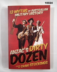
Book - ANTHYOLOGY, MILITARY MYTHS, Craig Stockings, 'ANZAC'S DIRTY DOZEN", 2012
... goldfields From Title Page, "ANZAC'S DIRTY/ DOZEN/ 12 MYTHS OF AUSTRALIAN MILITARY HISTORY" Publications Books Military History Anthology Soft cover book. Cover - cardboard, red colour background with white, yellow and black print on front, spine and back. Illustrated - sepia drawings from Military posters. Front - three persons, two holding rifles, one in uniform. Back - two persons, one in uniform, second holding a rifle. 335 pages - cut, plain, white colour paper. No illustrations. 'ANZAC'S DIRTY DOZEN" Book ANTHYOLOGY, MILITARY MYTHS Craig Stockings New South Publishing with State Library of Victoria ...From Title Page, "ANZAC'S DIRTY/ DOZEN/ 12 MYTHS OF AUSTRALIAN MILITARY HISTORY"Soft cover book. Cover - cardboard, red colour background with white, yellow and black print on front, spine and back. Illustrated - sepia drawings from Military posters. Front - three persons, two holding rifles, one in uniform. Back - two persons, one in uniform, second holding a rifle. 335 pages - cut, plain, white colour paper. No illustrations. publications, books, military history, anthology -
 Bendigo Military Museum
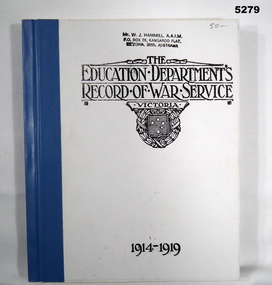
Book - BOOK, BIOGRAPHY - Facsimile, The Education Department, Victoria, "The Education Department's Record of War Service Victoria 1914-1919", c1921
... Bendigo Military Museum 37 - 39 Pall Mall Bendigo goldfields Books History War Service WW1 Biography Front cover - top, handwritten, grey lead pencil "50-" Front cover - Owners stamp, black ink. "Mr. W.J. HAMMILL, A.A.I.M./PO Box 76, Kangaroo Flat/ Victoria ...Book - Facsimile - Hard cover, cloth tape binding. Cover - cardboard, front black print on white background. Blue cloth tape binding. 304 pages - paper, cut, plain, white. Illustrated - black and white copies of photographs and illustrations. Handwritten marking top front cover> Owners stamp top front cover.Front cover - top, handwritten, grey lead pencil "50-" Front cover - Owners stamp, black ink. "Mr. W.J. HAMMILL, A.A.I.M./PO Box 76, Kangaroo Flat/ Victoria, 3555, Australia"books, history, war service, ww1, biography -
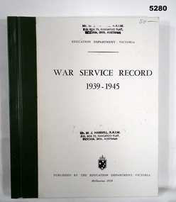 Bendigo Military Museum
Book - BOOK, BIOGRAPHY - Facsimile, The Education Department, Victoria, "War Service Record 1939 - 1945", 1959
... Bendigo Military Museum 37 - 39 Pall Mall Bendigo goldfields Books History War Service WW2 Biography Front cover top - handwritten, grey lead pencil "50--" Owners stamp, black ink. "Mr W.J. HAMMILL, A.A.I.M./PO Box 76, Kangaroo Flat/Victoria ...Facsimile - hard cover, cloth tape binding. Cover - cardboard, front - black print on white background. Green cloth tape binding. 313 pages, paper, cut, plain, white. Illustrated - black and white copies of photographs and illustrations. Handwritten marking, top front cover. Owners stamp top front cover.Front cover top - handwritten, grey lead pencil "50--" Owners stamp, black ink. "Mr W.J. HAMMILL, A.A.I.M./PO Box 76, Kangaroo Flat/Victoria, 3555, Australia"books, history, war service, ww2, biography -
 Bendigo Military Museum
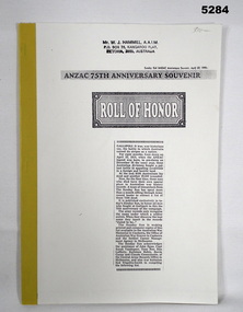
Book - BOOK - facsimile, Sunday Sun Newspaper - ANZAC Anniversary Souvenir April 22, 1990, "ANZAC 75th ANNIVERSARY SOUVENIR ROLL OF HONOR", 1990
... goldfields ANZAC Roll of Honor. Published in Sunday Sun - 75th Anniversary of one Gallipoli campaign - Lists 7594 dead. Books History ANZAC WW1 Front cover top - owner's stamp, black ink - "MR. W. J. HAMMILL, A.A.I.M./P.O. BOX 76, KANGAROO FLAT/VICTORIA ...ANZAC Roll of Honor. Published in Sunday Sun - 75th Anniversary of one Gallipoli campaign - Lists 7594 dead.Soft cover book - facsimile. Front cover - light cardboard, front cover black print on white background includes copy of newspaper article. Back cover - beige colour, yellow cloth tape binding. Pages - paper, cut, plain, white. One illustration - black print. Front cover top - owner's stamp.Front cover top - owner's stamp, black ink - "MR. W. J. HAMMILL, A.A.I.M./P.O. BOX 76, KANGAROO FLAT/VICTORIA, 3555, AUSTRALIA"books, history, anzac, ww1 -
 Bendigo Military Museum
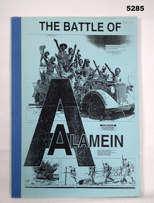
Book - BOOK - facsimile, The Australian Newspaper - with Assistance of the "Staff of Central Army Records", "THE BATTLE OF ALAMEIN.", c1992
... goldfields The Battle of Alamein - The Australian Casualties. The Australian`, The Weekend Australian - 50th Anniversary Special Edition. Honour Roll and Newspaper Articles. Books History WW2 Inside front cover - owner's stamp black ink "Mr W.J. HAMMILL, A.A.I.M./ PO Box 76, KANGAROO FLAT/ VICTORIA ...The Battle of Alamein - The Australian Casualties. The Australian`, The Weekend Australian - 50th Anniversary Special Edition. Honour Roll and Newspaper Articles.SOFT COVER BOOK - FOLIO FACSIMILE - Cloth tape binding. Cover - thin cardboard, front cover - black print on blue background, illustrated in black print three photographs - top/troops in a vehicle, bottom/ tanks and soldiers advamcing. Pages - paper, cut, plain white. Illustrated black and white copies of photographs. Owners stamp - inside front cover.Inside front cover - owner's stamp black ink "Mr W.J. HAMMILL, A.A.I.M./ PO Box 76, KANGAROO FLAT/ VICTORIA, 3505, AUSTRALIA"books, history, ww2 -
 Bendigo Military Museum
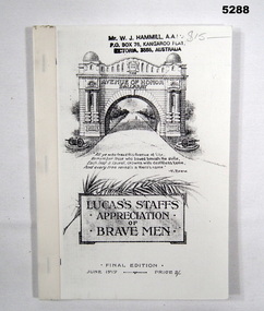
Book - BOOK - facsimile, Facsimile of book - final edition of original book created June 1919, "Lucas's Staffs Appreciation of Brave Men", June 1919
... Bendigo Military Museum 37 - 39 Pall Mall Bendigo goldfields From Title Page - "The/Avenue of Honour/ Ballarat/ A Living Monument to all Loyal Citizens/ of Ballarat who volunteered for Active Service/ Abroad.". Books History WW1 Front cover top - owner's stamp, black ink "MR W. J. HAMMILL, A.A.I.M./ P.O. Box 76, Kangaroo Flat/ VICTORIA ...From Title Page - "The/Avenue of Honour/ Ballarat/ A Living Monument to all Loyal Citizens/ of Ballarat who volunteered for Active Service/ Abroad.".Soft cover book - facsimile. Cover - light cardboard, black print front and back. Illustrated - front -. Memorial Arch Illustration, back soldier. Cloth tape binding. 108 pages - paper, cut, plain, white. Facsimile. Illustrated - black print copy on white paper, photograph and illustrations. Front cover top - owner's stamp and handwritten mark.Front cover top - owner's stamp, black ink "MR W. J. HAMMILL, A.A.I.M./ P.O. Box 76, Kangaroo Flat/ VICTORIA, 3555, AUSTRALIA" Handwritten in gray lead pencil "$15-".books, history, ww1 -
 Bendigo Military Museum
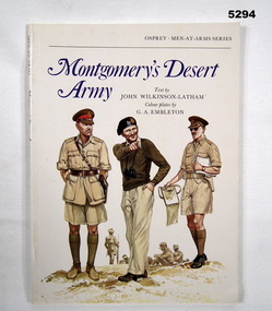
Book - BOOK, WW2, NORTH AFRICA, JOHN WILKINSON- LATHAM, Montgomery's Desert Army, 1977
... goldfields Colour Plates by 'G.A. EMELETON'. OSPREY MEN AT ARMS SERIES. Books History WW2 Title page - owner's stamp, black ink, "MR. W.J. HAMMILL, A.A.I.M./ PO BOX 76, KANGAROO FLAT/ VICTORIA ...Colour Plates by 'G.A. EMELETON'. OSPREY MEN AT ARMS SERIES.Soft cover book. Soft cover - cardboard, blue and black colour print on front, spine and back. Front cover illustration of three army personnel on white background. 40 pages, paper, cut, plain, white. Illustrated - black and white photographs, maps and colour plates. Title page - two owner's stamps.Title page - owner's stamp, black ink, "MR. W.J. HAMMILL, A.A.I.M./ PO BOX 76, KANGAROO FLAT/ VICTORIA, 3555, AUSTRALIA,"books, history, ww2 -
 Bendigo Military Museum
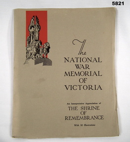
Book, W.D. JOYNT, COLARTS STUDIOS PTY LTD, "THE NATIONAL WAR MEMORIAL OF VICTORIA", 1934 Second Edition
... goldfields See Cat No. 5820. "The National War Memorial of Victoria". An interpretative Appreciation of/ The Shrine/of/ Remembrance/with 50 Illustrations. Books Military History ...See Cat No. 5820. "The National War Memorial of Victoria". An interpretative Appreciation of/ The Shrine/of/ Remembrance/with 50 Illustrations.SOFT COVER BOOK Cover - Light weight cardboard, black print on front cover, with one illustration depicting buttress group, lions and women with wings. 40 pages - cut, plain, paper - print sections - heavy paper, black and white photographs - glossy off white paper. Spine stapled.books, military history, war memorials -
 Bendigo Military Museum
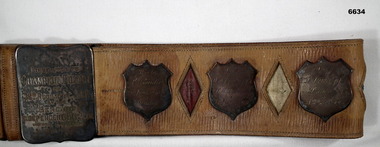
Award - BELT, BOXING CHAMPIONSHIP 1st AIF, Bendigo Independent Newspaper 1916, 1916
... goldfields Refer to Cat 6631P J.A. Fleming for his service history. Pte Condic. This would be Pte James Andrew Condick No 15, enlisted 26.2.1916 age 30 years 7 months in D Coy 38th Bn, embark for England 20.6.1916, hospital in England he rejoins 38th Bn in the field on 15.1.1917, transfers to 3rd Div Salvage Coy 21.1.1917, WIA 30.4.1918 Gassed, he returns to Australia late 1919. Boxing Belt AIF Passchendaele barracks trust 38th The buckle is engraved: - "Presented to Champion Boxer of 38th Regiment A.I.F. by the Bendigo Independent Pty Ltd. Victoria ...Refer to Cat 6631P J.A. Fleming for his service history. Pte Condic. This would be Pte James Andrew Condick No 15, enlisted 26.2.1916 age 30 years 7 months in D Coy 38th Bn, embark for England 20.6.1916, hospital in England he rejoins 38th Bn in the field on 15.1.1917, transfers to 3rd Div Salvage Coy 21.1.1917, WIA 30.4.1918 Gassed, he returns to Australia late 1919.This is a broad leather belt, made in 2 pieces, hemmed at top and bottom edge. It has a large rectangular buckle which is engraved. The belt has three tarnished silver shields which are engraved. Between the shields are diamond shaped "holes", red, white and blue alternatively. The buckle is engraved. There are blank spaces of 5 missing winner's or other shields.The buckle is engraved: - "Presented to Champion Boxer of 38th Regiment A.I.F. by the Bendigo Independent Pty Ltd. Victoria Australia." On three shields:- 1.”Won by Pte Condic, June 1916, Bendigo” 2. “Won by WO Fleming J.A. HMAT Ronic August 1916” (“Ronic” This should be "Runic"'). 3. “Won by 2 LT Fleming J.A. Salisbury November 1916”boxing belt, aif, passchendaele barracks trust, 38th -
 Bendigo Military Museum
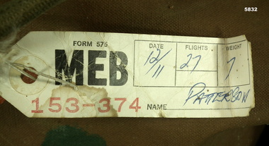
Document - TICKET, BAGGAGE, ANSETT AIRLINES, Ansett Airline, c 1968 - 1971
... goldfields Refer to Cat 5825. Memorabilia Military History Baggage ticket On side 2 written in ink is Date: 12/11 Flight 27, Weight 7, name Patterson. Small cardboard ticket that is attached to baggage at the airport. Side 1 has black printing - Ansett Airlines of Victoria ...Refer to Cat 5825.Small cardboard ticket that is attached to baggage at the airport. Side 1 has black printing - Ansett Airlines of Victoria. Side 2 Has Meb - printed in ink are numbers 153 - 374. There is a hole at one end with a reinforced hole.On side 2 written in ink is Date: 12/11 Flight 27, Weight 7, name Patterson.memorabilia, military history, baggage ticket -
 Bendigo Military Museum
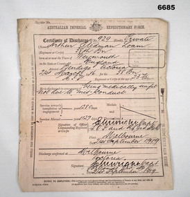
Administrative record - CERTIFICATE OF DISCHARGE, 1914-1919
... goldfields Refer Cat No 2698.2 for A.S.Loams service history. Passchendaele Barracks Trust Certificate of Discharge A.S. Loam 38th Battalion Australian Imperial Expeditionary Force. CERTIFICATE OF DISCHARGE of No. 929 rank PRIVATE ARTHUR STEDMAN LOAM, Regimental Corps 38th Bn. 1280 days service. Service abroad 1127. Medially unfit, not due to mis-conduct. Signature of Officer Commanding Regiment or Corps. E. W. Wright Capt. SOI and RS 3rd MD Melbourne. 21 September 1919 Discharge confirmed Melbourne, Victoria ...Refer Cat No 2698.2 for A.S.Loams service history.Certificate - cream coloured, heavy paper, black print handwriting.Australian Imperial Expeditionary Force. CERTIFICATE OF DISCHARGE of No. 929 rank PRIVATE ARTHUR STEDMAN LOAM, Regimental Corps 38th Bn. 1280 days service. Service abroad 1127. Medially unfit, not due to mis-conduct. Signature of Officer Commanding Regiment or Corps. E. W. Wright Capt. SOI and RS 3rd MD Melbourne. 21 September 1919 Discharge confirmed Melbourne, Victoria E.W. Wright Capt. 3MD 21 September 1919. passchendaele barracks trust, certificate of discharge, a.s. loam, 38th battalion -
 Bendigo Military Museum
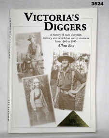
Booklet - BOOKLET, VICTORIA, The Press Gallery Printers, Victoria's Diggers, 1999
... Bendigo Military Museum 37 - 39 Pall Mall Bendigo goldfields Booklet Victoria’s diggers Front cover: “VICTORIA'S DIGGERS. A history of each Victorian military unit which has served overseas from 1860 to 1945. ...Soft cardboard cover, black print on front & spine, white background. Illustrated, 3 full portrait sepia photos of soldiers in uniform. 56 pages, cut, plain, white. Illustrated black & white photos. Stapled.Front cover: “VICTORIA'S DIGGERS. A history of each Victorian military unit which has served overseas from 1860 to 1945. Allan Box” Handwritten in blue ink title page: “from Mr Allan Box Leongatha” Inside back cover: “RSL stamp” booklet, victoria’s diggers -
 Bendigo Military Museum
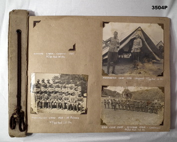
Album - ALBUM, PHOTOGRAPHS WW2, C.1940 - 45
... goldfields See Cat No 3505.23 a connection with Warick JOHANSON. See also Cat No 3506. books-albums photography-photographs military history “Printed in white by hand: Captions under each photo” Photo album consisting of heavy cardboard sheets tied together with brown cord. Photos appear to be of training camps in Victoria ...See Cat No 3505.23 a connection with Warick JOHANSON. See also Cat No 3506.Photo album consisting of heavy cardboard sheets tied together with brown cord. Photos appear to be of training camps in Victoria & Northern Territory & on deployment in New Guinea. All captioned. Several missing. “Printed in white by hand: Captions under each photo”books-albums, photography-photographs, military history -
 Bendigo Military Museum
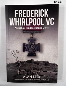
Book - BOOK, BIOGRAPHY, LEEK Alan, "Frederick Whirlpool, VC" Australia's Hidden Victoria Cross, 2018
... goldfields Books Military History Biography Soft cover book. Soft cover - cardboard, white print on front, spine and back. Background illustrated in grey monochrome front.- Walled city and fort, with image of Victoria Cross and Ribbon in colour. ...Soft cover book. Soft cover - cardboard, white print on front, spine and back. Background illustrated in grey monochrome front.- Walled city and fort, with image of Victoria Cross and Ribbon in colour. Back - on parade personnel with gun carriages. 311 pages, cut, plain white.books, military history, biography -
 Bendigo Military Museum
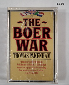
Book - BOOK, BOER WAR, Thomas Pakenham, The Boer War, 1982
... Bendigo Military Museum 37 - 39 Pall Mall Bendigo goldfields " The Boer War" Thomas Pakenham has written the first full scale history of the war since 1910. Books History The Boer War Front end paper - printed owner's label " W & E R van der Eynden/ 6 Elvey Drive/ Kangaroo Flat 3555/ Victoria, Australia". ..." The Boer War" Thomas Pakenham has written the first full scale history of the war since 1910.Soft cover book with soft plastic dust cover. Soft cover - cardboard, black and red coloured print on front, spine and back. Yellow colour background. Top front page in colour, 3 flags illustration. 659 pages, paper, cut, plain, white. Illustrated black and white photographs, maps and illustrations. Owner's label on front end paper. Soft plastic dust cover.Front end paper - printed owner's label " W & E R van der Eynden/ 6 Elvey Drive/ Kangaroo Flat 3555/ Victoria, Australia". Lower edge of pages - felt tipped pen, black ink - line drawn.books, history, the boer war -
 Bendigo Military Museum
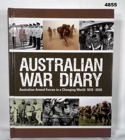
Book - BOOK, AUSTRALIAN ARMED FORCES, FISHER VICTORIA for Random House Australia, Australian War Diary, 2010
... goldfields "Australian War Diary" Australian Armed Force4s in a Changing World: 1870 - 2010. Books Military History Australia Hard cover book Hardcover cardboard with Glossy paper finish. White print on front, spine and back. Cover black and white and colour illustrations - montage of photographs in strips top and bottom, front to back of various Armed Forces scene. 303 pages, cut, plain white paper. Illustrated black and white and colour photographs, posters and paintings. Australian War Diary Book BOOK, AUSTRALIAN ARMED FORCES FISHER VICTORIA ..."Australian War Diary" Australian Armed Force4s in a Changing World: 1870 - 2010.Hard cover book Hardcover cardboard with Glossy paper finish. White print on front, spine and back. Cover black and white and colour illustrations - montage of photographs in strips top and bottom, front to back of various Armed Forces scene. 303 pages, cut, plain white paper. Illustrated black and white and colour photographs, posters and paintings.books, military history, australia -
 Bendigo Military Museum
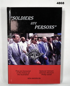
Book - BOOK, VIETNAM VETERANS MUSEUM, ANDERSON Ken, "Soldiers are Persons", 2011
... Bendigo Military Museum 37 - 39 Pall Mall Bendigo goldfields "Soldiers are Persons: A short history of the National Vietnam Veterans Museum 1994 - 2011" Phillip Island, Victoria Books Vietnam War Veterans Museums Hard cover book Hardcover - cardboard with glossy cover, white and black print on front, spine and back. ..."Soldiers are Persons: A short history of the National Vietnam Veterans Museum 1994 - 2011" Phillip Island, VictoriaHard cover book Hardcover - cardboard with glossy cover, white and black print on front, spine and back. Front cover illustrated with photograph in colour of a group of men marching, with copy of badge over photograph. Background colour - black and red. 204 pages, cut, plain, white. Illustrated black and white and colour photographs.books, vietnam war, veterans, museums -
 Bendigo Military Museum
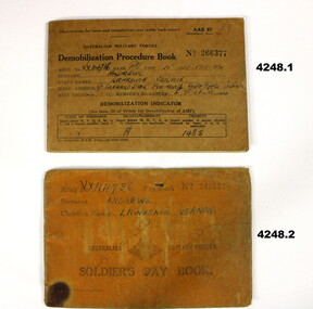
Financial record - PAY BOOK ARMY & DEMOBILIZATION, 1939 - 45
... goldfields Items issued to Lawrence Vernon Andrews VX 114736 2nd AIF. Refer Catalogue No4228 for his service history. Demobilization Pay books 2nd AIF .1) Front cover, “VX114736 Pte Andrews, Lawrence Vernon, C/- Ireland Bros , Poowong South Gipps Victoria”, “1485”. .2) Front cover, “VX114736 ANDREWS LAWRENCE VERNON”, Stamped, “CANCELLED” twice .1) Demoiblization Procedure booklet AAB. 87 No 266377, brown coloured covers, paper pages, black printing with entries in black pen. .2) Soldiers Pay Book No 242572, brownish coloured covers, paper pages, Black printing entries in black pen. ...Items issued to Lawrence Vernon Andrews VX 114736 2nd AIF. Refer Catalogue No4228 for his service history..1) Demoiblization Procedure booklet AAB. 87 No 266377, brown coloured covers, paper pages, black printing with entries in black pen. .2) Soldiers Pay Book No 242572, brownish coloured covers, paper pages, Black printing entries in black pen..1) Front cover, “VX114736 Pte Andrews, Lawrence Vernon, C/- Ireland Bros , Poowong South Gipps Victoria”, “1485”. .2) Front cover, “VX114736 ANDREWS LAWRENCE VERNON”, Stamped, “CANCELLED” twicedemobilization, pay books, 2nd aif -
 Bendigo Military Museum
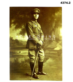
Book - BOOK, WORLD WAR 1, Michael GRANT (Artist and Curator), Homecoming, August 2018
... Bendigo Military Museum 37 - 39 Pall Mall Bendigo goldfields Book dedication, “Dedicated to the men and women of Victoria’s central Gold Fields who served and made the supreme sacrifice in our name” Books military History WW1 biography On title page adhesive sticker printed in red ink, “Central Goldfields/Art gallery”, hand written in black, “With Compliments” .1) .2) Books, soft cover, cardboard, white print on front and spine, front cover illustrated sepia tone photo of a soldier in uniform, back cover illustrated sepia tone photo of Soldiers marching with crowd of spectators, 73 pages, plain white, illustrated B & W and sepia photographs. ...Book dedication, “Dedicated to the men and women of Victoria’s central Gold Fields who served and made the supreme sacrifice in our name”.1) .2) Books, soft cover, cardboard, white print on front and spine, front cover illustrated sepia tone photo of a soldier in uniform, back cover illustrated sepia tone photo of Soldiers marching with crowd of spectators, 73 pages, plain white, illustrated B & W and sepia photographs.On title page adhesive sticker printed in red ink, “Central Goldfields/Art gallery”, hand written in black, “With Compliments”books military, history, ww1 biography -
 Bendigo Military Museum
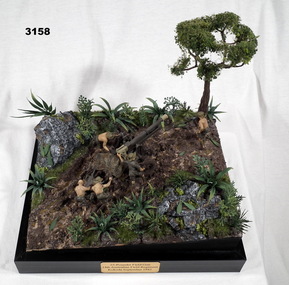
Memorabilia - DIORAMA, KOKODA, Post WW2
... Bendigo Military Museum 37 - 39 Pall Mall Bendigo goldfields Diorama inspired by image from State Library of Victoria image No H98 104 / 2102. military history-army arms-ordnance handcrafts Kokoda In black print on gold name plate attached to front of black base:: “25 Pounder Field Gun 14th Australian Field Regiment, Kokoda, September 1942” Diorama mounted on black base. 1/35 scale model of 25 pounder field gun with 5 man crew maneuvering a gun into position around a tree with a pulley system. ...Diorama inspired by image from State Library of Victoria image No H98 104 / 2102.Diorama mounted on black base. 1/35 scale model of 25 pounder field gun with 5 man crew maneuvering a gun into position around a tree with a pulley system. In black print on gold name plate attached to front of black base:: “25 Pounder Field Gun 14th Australian Field Regiment, Kokoda, September 1942”military history-army, arms-ordnance, handcrafts, kokoda