Showing 3 items matching "jurassic"
-
 Federation University Historical Collection
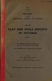
Book, Memoirs of the Geological Survey of Victoria; No 18, Clay and Shale Deposits of Victoria, 1952
... The 76 pages clay deposits, composition of Victorian clays, clay localities, granitic clays, Residual Clays, Clay-Shales, Jurassic clay shales....The 76 pages clay deposits, composition of Victorian clays, clay localities, granitic clays, Residual Clays, Clay-Shales, Jurassic clay shales. Memoirs of the Geological Survey of Victoria; No 18, Clay and Shale Deposits of Victoria Book ...Grey soft covered book with red tape spine. The 76 pages clay deposits, composition of Victorian clays, clay localities, granitic clays, Residual Clays, Clay-Shales, Jurassic clay shales.r a keble, senior field geologist, j c watson, chief chemist, d e watson, chief government geologist, g c moss, minister of mines, mallee plains, avoca valley, loddon valley, campaspe valley, goulburn valley, kiewa, mitta, glenelg valley, pitfield valley, otway area, moorabool valley, darley fireclay, campbellfield clay, latrobe river valley, hendley, ball clays, felspars, pegmatities, quartz, pakenham fireclay, bulla china clay, kaolin, terracotta, stoneware, ballan dyke-belt, egerton, gordon, ballan, llandeilo, colbrook, elaine, lal lal, maryborough, ballarat, ringwood, siliceous clay, stawell, dromana, ptways, bulla, pyalong china clay, linton china clay, wedderburn clays, lal lal china clays, ballan dyke belt, reginald callister, knight's koalin pottery, china clay, ferdinand krause, clarendon, bittern, frichot, hunt's dam, vaughan, rosenow, hickey, malone, claypits, ballarat dyke belt, stawell dyke belt, maryborough dyke belt, guildford, daylesford, ovens valley -
 Federation University Historical Collection
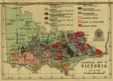
Photograph - colour, William Baragwanath, Department of Mines: Geological map of Victoria, c1935
... ...jurassic...Barker Library (top floor) Mount Helen goldfields Photograph included in book "Victoria: Gold and Minerals" issued by Mines Department Victoria, 1935 map department of mines victoria key to land formations time periods jurassic geological map Photograph Department of Mines: Geological map of Victoria Photograph - colour William Baragwanath Victorian Mines Department ...Photograph included in book "Victoria: Gold and Minerals" issued by Mines Department Victoria, 1935Photographmap, department of mines, victoria, key to land formations, time periods, jurassic, geological map -
 Phillip Island and District Historical Society Inc.
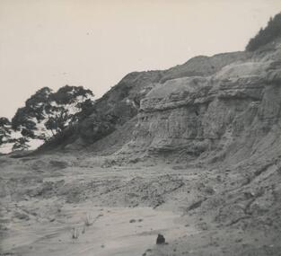
Photograph, Dr G Baker
... Phillip Island and District Historical Society Inc. phillip-island-and-the-bass-coast One of a collection of over 400 photographs in an album commenced in 1960 and presented to the Phillip Island & Westernport Historical Society by the Shire of Phillip Island local history photography jurassic rock quarry black & white photograph coastline rock formations rhyll Dr G Baker John Jenner Bryant West Photograph of a Quarry in jurassie rock near Rhyll Photograph Bryant West Dr G Baker ...One of a collection of over 400 photographs in an album commenced in 1960 and presented to the Phillip Island & Westernport Historical Society by the Shire of Phillip IslandPhotograph of a Quarry in jurassie rock near Rhylllocal history, photography, jurassic rock quarry, black & white photograph, coastline, rock formations, rhyll, dr g baker, john jenner, bryant west