Showing 31 items matching "kiowa"
-
 National Vietnam Veterans Museum (NVVM)
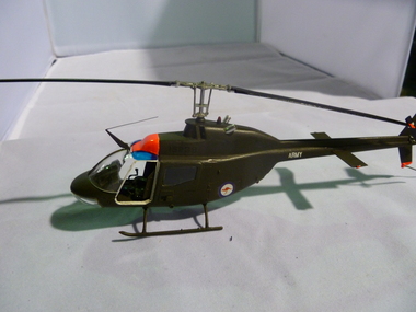
Model, Bell 206 Kiowa
... Bell 206 Kiowa......Kiowa...Model of a Bell 206 Kiowa helicopter painted olive green...National Vietnam Veterans Museum (NVVM) 25 Veterans Drive Newhaven phillip-island-and-the-bass-coast Model Helicopter Kiowa Army, Red kangaroo on white circle Model of a Bell 206 Kiowa helicopter painted olive green Bell 206 Kiowa Model Model ...Model of a Bell 206 Kiowa helicopter painted olive greenArmy, Red kangaroo on white circlemodel, helicopter, kiowa -
 National Vietnam Veterans Museum (NVVM)
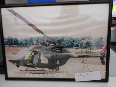
Photograph, Kiowa OH58A
... Kiowa OH58A...Framed coloured Photograph in a black frame of Australian Army Kiowa Helicopter parked at an unknown Airstrip....Kiowa OH58A Photograph Photograph ...Framed coloured Photograph in a black frame of Australian Army Kiowa Helicopter parked at an unknown Airstrip.Australian Rondel, S/N 15236photograph, oh58a, helicopter -
 Moorabbin Air Museum
Manual (Item) - Bell Kiowa Operator's Manual and Aviation Unit and Intermediate Maintenance Manual, Oh-58A/C Kiowa
... Oh-58A/C Kiowa...Also contains a certificate permitting Osborne Aviation Services Pty Ltd in North Hobart, Tasmania, to fly the Kiowa as a civilian organisation...Also contains a certificate permitting Osborne Aviation Services Pty Ltd in North Hobart, Tasmania, to fly the Kiowa as a civilian organisation Black lever-arch folder Oh-58A/C Kiowa Manual Bell Kiowa Operator's Manual and Aviation Unit and Intermediate Maintenance Manual ...Marked as "Approved for public release; distribution is unlimited." Also contains a certificate permitting Osborne Aviation Services Pty Ltd in North Hobart, Tasmania, to fly the Kiowa as a civilian organisation -
 National Vietnam Veterans Museum (NVVM)
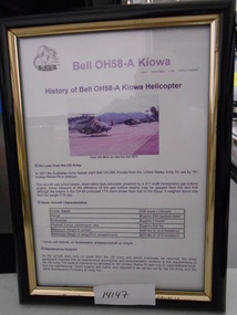
Document, Bell OH58-A Kiowa
... Bell OH58-A Kiowa......Kiowa...Document outline History and Specifications of Bell OH58-A Helicopter with 161 RECCE SQN. Bell OH58-A Kiowa Document Document ...Black Framed Document. Document outline History and Specifications of Bell OH58-A Helicopter with 161 RECCE SQN.framed document, oh58a, kiowa, 161 reconnaissance squadron, nui dat -
 National Vietnam Veterans Museum (NVVM)
Vehicle - Kiowa Helicopter
... Kiowa...Former ADF - Army Bell 206 B-1 Kiowa helicopter (incomplete)....Kiowa helicopter Navy Bell Company transport A17-007 Former ADF - Army Bell 206 B-1 Kiowa helicopter (incomplete). ...Former ADF - Army Bell 206 B-1 Kiowa helicopter (incomplete).A17-007kiowa, helicopter, navy, bell company, transport -
Moorabbin Air Museum
Photograph (Item) - Bell Kiowa 206B photos & modification - low skids for HMAS Morseby specs & Drawings
... Bell Kiowa 206B photos & modification - low skids for HMAS Morseby specs & Drawings -...Moorabbin Air Museum Moorabbin Airport 12 First Street Moorabbin melbourne Bell Kiowa 206B photos & modification - low skids for HMAS Morseby specs & Drawings - Photograph Bell Kiowa 206B photos & modification - low skids for HMAS Morseby specs & Drawings - ... -
Moorabbin Air Museum
Model (Item) - Bell Kiowa A12-44 scale 1:72
... Bell Kiowa A12-44 scale 1:72...Moorabbin Air Museum Moorabbin Airport 12 First Street Moorabbin melbourne Bell Kiowa A12-44 scale 1:72 Model Bell Kiowa A12-44 scale 1:72 ... -
Moorabbin Air Museum
Photograph (Item) - Includes photos of Commonwealth aircraft Corp aerial photos, CAC photos of Macchi MB326H trainer Bell 206 Kiowa
... CAC photos of Macchi MB326H trainer Bell 206 Kiowa ...Moorabbin Air Museum Moorabbin Airport 12 First Street Moorabbin melbourne CAC photos of Macchi MB326H trainer Bell 206 Kiowa Photograph Includes photos of Commonwealth aircraft Corp aerial photos ... -
Moorabbin Air Museum
Booklet (item) - CAC Collection - OH-58A Kiowa Helicopter
... CAC Collection - OH-58A Kiowa Helicopter...Moorabbin Air Museum Moorabbin Airport 12 First Street Moorabbin melbourne CAC Collection - OH-58A Kiowa Helicopter Booklet CAC Collection - OH-58A Kiowa Helicopter ... -
 Bendigo Military Museum
Photograph - 4th Field Survey Squadron – Operation ARIGHT 93, Queensland, 1993
... Hand-held Trimble and Magellan GPS receivers were used to assist with navigation and to position remote isolated features. Three Bell Kiowa LOH helicopters provided by 162 Recce Sqn supported field checking operations. ...Unidentified surveyor in Bell Kiowa LOH helicopter. .16) - Photo, colour, 1993. ...Ground below a Bell Kiowa LOH helicopter .27) - Photo, colour, 1993. ...This is a set of 42 photographs taken during 4th Field Survey Squadron’s deployment on Operation ARIGHT 93 in North Queensland from the 30th of August to the 8th of October 1993. The Survey Field Completion area of operations was Weipa near the top end of the Cape York Peninsula. Survey parties conducted field checking of topographic maps covering Bamaga, Heathlands, Weipa, Lockhart River and Strathgordon in Perentie 110 Series Survey variant FFR Land Rovers. Hand-held Trimble and Magellan GPS receivers were used to assist with navigation and to position remote isolated features. Three Bell Kiowa LOH helicopters provided by 162 Recce Sqn supported field checking operations. Supplementary and Vital Asset Protection photography was taken by air camera operators in AAAvn Nomad aircraft from 173 Survl Sqn fitted with an RC10 aerial camera.This is a set of 42 photographs taken in 1993 durin8g 4th Field Survey Squadron’s deployment on Operation ARIGHT in North Queensland. The colour photographs are on 35mm negative film and are part of the Army Survey Regiment’s Collection. The photographs were scanned at 96 dpi. .1) - Photo, colour, 1993. Survey party in Perentie 110 Series Land Rover navigates through Cape York Peninsula sand hills. .2) - Photo, colour, 1993. Cape York Peninsula sand hills. .3) - Photo, colour, 1993. Cape York Peninsula Island. .4) - Photo, colour, 1993. Survey party in Perentie 110 Series Land Rover enters a Cape York Peninsula beach. .5) - Photo, colour, 1993. SPR Kim Baker takes a break on a Cape York Peninsula beach. .6) - Photo, colour, 1993. L to R: MAJ Andy Cordova (USA Exchange) from the Army Survey Regiment and unidentified civilians. .7) to .14) - Photo, colour, 1993. Cape York Peninsula topography. .15) - Photo, colour, 1993. Unidentified surveyor in Bell Kiowa LOH helicopter. .16) - Photo, colour, 1993. Bell Kiowa LOH helicopter circles base camp. .17) to .18) - Photo, colour, 1993. Cape York Peninsula topography. .19) - Photo, colour, 1993. Vehicle convoy taking a break. L to R: LT John Bath (Detachment OC), unidentified (x2), SPR Chris Pearse. .20) - Photo, colour, 1993. Vehicle convoy taking a break. .21) - Photo, colour, 1993. Vehicle convoy ready to go. SPR Chris Pearse. .22) - Photo, colour, 1993. Vehicle convoy on the move. .23) - Photo, colour, 1993. Cape York Peninsula topography. .24) - Photo, colour, 1993. Unidentified personnel. .25) - Photo, colour, 1993. SGT Neale ‘Tex’ Houston. .26) - Photo, colour, 1993. Ground below a Bell Kiowa LOH helicopter .27) - Photo, colour, 1993. L to R: SPR Mark Sinderberry and CPL Stuart Adrain in a Bell Kiowa LOH helicopter. .28) & .29) - Photo, colour, 1993. Ground below a Bell Kiowa LOH helicopter. .30) - Photo, colour, 1993. Base camp viewed from a Bell Kiowa LOH helicopter. .31) - Photo, colour, 1993. Cape York Peninsula topography in recovery after burn-off. .32) & .33) - Photo, colour, 1993. SPR Kim Baker contemplates crossing this bridge in his Land Rover. .34) - Photo, colour, 1993. SPR Kim Baker takes a break next to a billabong. .35) - Photo, colour, 1993. Survey party in Perentie 110 Series Land Rover crosses a creek. .36) - Photo, colour, 1993. Cape York Peninsula bush fire in distance. .37) - Photo, colour, 1993. Survey party in Perentie 110 Series Land Rover traverses a sand hill. .38) - Photo, colour, 1993. SPR Kim Baker. .39) - Photo, colour, 1993. Cape York Peninsula bush fire. .40) - Photo, colour, 1993. Cape York Peninsula topography. .41) & .42) - Photo, colour, 1993. Cape York Peninsula sand hills..1P to .42P – There are no personnel identified. ‘1993 OP ARIGHT’ annotated on negative sleeve.royal australian survey corps, rasvy, 4 fd svy sqn, op aright 93 -
 Bendigo Military Museum
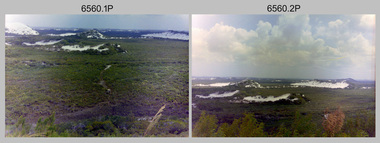
Photograph - Royal Australian Survey Corps Aerial Surveys, c1980
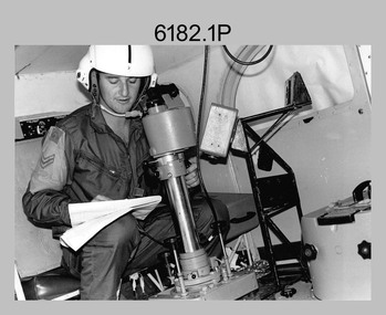
... Therefore Aerodist operations (pre-dating satellite receiver operations) were fully supported by Army’s Kiowa LOH aircraft. ...An Australian Army Kiowa helicopter supporting a field survey party undertaking Magnavox AN/PRR-14 portable Doppler satellite observations. ...An Australian Army Kiowa helicopter supporting a field survey party undertaking Magnavox AN/PRR-14 portable Doppler satellite observations. ...This is a set of nine photographs of technicians from the Royal Australian Survey Corps operating aerial surveys equipment c1980s. In photo .1P, CPL Steve Gloster was operating a RC10 air survey camera mounted in an Australian Army Pilatus Porter aircraft. The Wild RC10 super wide-angle air survey cameras were first introduced in 1971, were equipped with virtual distortion free lenses for supplementary, spot and special photography. In photo .2P, Roger Rees was operating Air Profile Recorder (APR) equipment. it was possibly taken during OP NERVOSE 84, sometime between June – August 1984 when based in Ngukurr, Northern Territory. The APR was operated at this time in unison with an RC10 camera. In 1963 the Royal Australian Survey Corps introduced the radar airborne profile recorder (Canadian Applied Research Ltd, Mark V, Airborne Profiler Recorder) was introduced for 1:100,000 mapping to replace terrain heighting by aneroid barometry. Later in 1974-1975, the Australian developed WREMAPS II airborne laser terrain profile recorder was introduced. In photo .3P, Neil Jones appears at the door of Airsearch Beechcraft Queen Air aircraft, Registration / Serial VH-MWX. This aircraft was typically used by RA Svy on air survey operations flying mission with Aerodist, APR and RC10 camera equipment. The Australian Army’s Pilatus Porter (short take-off and landing turbo propeller) was also equipped with a Wild RC10 aerial mapping camera for identification photography. The Pilatus Porter was also used on RA Svy’s map field checking operations. Photo .9P was taken at a survey station at an unknown location. In this photo an Australian Army Kiowa Light Observation Helicopter (LOH) is supporting a field survey party undertaking Magnavox AN/PRR-14 portable Doppler satellite observations. The satellite receiver’s antenna is plumbed over the survey ground mark surrounded by white plastic panels. The panels were used to identify the survey station on aerial photography. Introduced in 1974–1975, the Magnavox AN/PRR-14 portable Doppler satellite (US Navy Navigation Satellite System – TRANSIT) receivers and computing system provided independent three-dimensional point positions anywhere in the world, anytime, in any weather accurate to about 1.5metres with precise satellite ephemerides. The Bell OH-58 Kiowa LOH was a family of military helicopters used for observation, utility, and direct fire support. It was identified by RA Svy in the mid-1970s that considerable time was lost in replacing unserviceable remote equipment by road. Therefore Aerodist operations (pre-dating satellite receiver operations) were fully supported by Army’s Kiowa LOH aircraft. This is a set of nine photographs of technicians from the Royal Australian Survey Corps operating aerial surveys equipment c1980s. .1P to .3P, .5P to .9P - Colour and black and white photos on photographic paper and scanned at 300 dpi. .4P - Colour photo on 35mm slide film and scanned at 96 dpi. .1) & .2) - Photo, black & white, c1980s, CPL Steve Gloster operating an RC10 air camera. .3) - Photo, colour, 1984, Roger Rees operating Air Profile Recorder (APR) equipment. .4) - Photo, colour, c1980s, Neil Jones at the door of an Airsearch Beechcraft Queen Air aircraft, typically used by RA Svy on air survey operations. .5) - Photo, colour, c1980s. A Beechcraft King Air aircraft, also used by RA Svy on air survey operations. .6) - Photo, colour, c1980s. An Australian Army Pilatus Porter, used by RA Svy on air survey and map field checking operations. SGT Peter Mustart is possibly in the foreground. .7) to .8) - Photo, colour, c1980s. An Australian Army Pilatus Porter and unidentified personnel, used by RA Svy on air survey and map field checking operations. .9) - Photo, colour, c1980s. An Australian Army Kiowa helicopter supporting a field survey party undertaking Magnavox AN/PRR-14 portable Doppler satellite observations. There are biro marks on photos .4P to .9Proyal australian survey corps, rasvy, army survey regiment, asr, fortuna, aerial surveys -
 Bendigo Military Museum
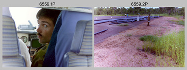
Photograph - 4th Field Survey Squadron – Operation MIZMAZE 92, Kimberley region, Western Australia, 1992
... Survey parties conducted field checking of topographic maps and GPS control acquisition in Perentie 110 Series Survey variant FFR Land Rovers. Three Bell Kiowa LOH helicopters provided by 162 Recce Sqn supported field checking and limited deployment of GPS surveys parties. ...Unidentified surveyor field checking a preliminary map in a Bell Kiowa LOH helicopter....Kimberley region topography viewed from Bell Kiowa LOH helicopter. .39) & .40) - Photo, colour, 1992. ...This is a set of 40 photographs taken in 1992 during 4th Field Survey Squadron’s deployment on Operation MIZMAZE 92 in the Kimberley region of Western Australia from the 13th of May to the 14th of July 1992. The area of operations was Wyndham, Halls Creek and Sandfire Flat. It was a two-part operation involving the field completion of topographic maps and the acquisition of mapping control by GPS field parties utilising Texas Instruments TI4100 Global Positioning System receivers. Survey parties conducted field checking of topographic maps and GPS control acquisition in Perentie 110 Series Survey variant FFR Land Rovers. Three Bell Kiowa LOH helicopters provided by 162 Recce Sqn supported field checking and limited deployment of GPS surveys parties. C-l30 Hercules from 36 Sqn supported deployment and extraction of personnel and equipment to and from from the AO. A Cessna 404 Titan Ambassador from Vee-H Aviation was used as the Wild RC10 camera platform for aerial photography acquisition.This is a set of 40 photographs taken in 1992 during 4th Field Survey Squadron’s deployment on Operation MIZMAZE 92 in the Kimberley region of Western Australia. The colour photographs are on 35mm negative film and are part of the Army Survey Regiment’s Collection. The photographs were scanned at 96 dpi. .1) - Photo, colour, 1992. CAPT Craig Hersant. .2) - Photo, colour, 1992. Unidentified officer/soldier. .3) & .4) - Photo, colour, 1992. Aboriginal rock art - Wandjina Gunduran, Donkey Creek. .5) - Photo, colour, 1992. Aboriginal rock art - Track Wandjinas, Donkey Creek. .6) & .7) - Photo, colour, 1992. CAPT Craig Hersant. .8) - Photo, colour, 1992. Kimberley region topography. CPL Glen Weatherell. .9) - Photo, colour, 1992. Unidentified personnel .10) - Photo, colour, 1992. Supermarket at unknown location. .11) to .13) - Photo, colour, 1992. Caravan park at unknown location. .14) - Photo, colour, 1992. Old bridge at Fitzroy Crosssing. .15) & .16) - Photo, colour, 1992. Survey party in Perentie 110 Series Land Rover. .17) & .18) - Photo, colour, 1992. Kimberley region topography. .19) - Photo, colour, 1992. Kimberley region topography. CPL Glen Weatherell. .20) - Photo, colour, 1992. Kimberley region topography, possibly the Bungle Bungles. .21) - Photo, colour, 1992. Kimberley region topography. SGT Frank Downie. .22) - Photo, colour, 1992. Kimberley region topography: the Bungle Bungles. .23) - Photo, colour, 1992. Kimberley region topography: the Bungle Bungles. .24) - Photo, colour, 1992. Kimberley region topography: the Bungle Bungles. SPR Neil Pedler. .25) & .26) - Photo, colour, 1992. Kimberley region topography: the Bungle Bungles. .27) - Photo, colour, 1992. Kimberley region topography. .28) - Photo, colour, 1992. Survey party with Perentie 110 Series Land Rover. .29) - Photo, colour, 1992. Kimberley region topography. .30) - Photo, colour, 1992. Survey party outside Perentie 110 Series Land Rover. .31) & .32) - Photo, colour, 1992. Survey party operating TI4100 GPS Receiver next to Perentie 110 Series Land Rover. SGT Eddie Jacobs. .33) & .34) - Photo, colour, 1992. Survey party operating TI4100 GPS Receiver next to Perentie 110 Series Land Rover. Unidentified surveyor. .35) - Photo, colour, 1992. Kimberley region topography. Hand water pump at well. .36) - Photo, colour, 1992. Survey party in Perentie 110 Series Land Rover. .37) - Photo, colour, 1992. Kimberley region topography. CPL Glen Weatherell. .38) - Photo, colour, 1992. Kimberley region topography viewed from Bell Kiowa LOH helicopter. .39) & .40) - Photo, colour, 1992. Unidentified surveyor field checking a preliminary map in a Bell Kiowa LOH helicopter..1P to .40P – There are no personnel identified. ‘1992 OP MIZMAZE annotated on negative sleeve.royal australian survey corps, rasvy, 4 fd svy sqn, op mizmaze 92 -
Moorabbin Air Museum
Document (item) - Various aircraft photos and drawings see description, CAC Misc documents and design drawings of various aircraft
... Various aircraft ,Kiowa, Bennet Airtruck, Fishermans Bend aerial view 1946, Hornet, Macchi, Mustang, Winjeel, Wamira, Sabre, Canberra instrument panel, early years of CAC operation, Wackett, Gloster, Gannet, Hector, Battle, Lysander, Magister, Beaufreighter, Canberra, Mirage, GAF Beaufighter fuel system instrument panel, 20mm gun feed, Turana, XP64, Allison gas turbine, Centaurus engine, Aspin, Esams, Tom Keeble, Kurt Lessing glider, Rover, Wasp, CA 15, Vampire, drop tanks,...xyz Various aircraft ,Kiowa, Bennet Airtruck, Fishermans Bend aerial view 1946, Hornet, Macchi, Mustang, Winjeel, Wamira, Sabre, Canberra instrument panel, early years of CAC operation, Wackett, Gloster, Gannet, Hector, Battle, Lysander, Magister, Beaufreighter, Canberra, Mirage, GAF Beaufighter fuel system instrument panel, 20mm gun feed, Turana, XP64, Allison gas turbine, Centaurus engine, Aspin, Esams, Tom Keeble, Kurt Lessing glider, Rover, Wasp, CA 15, Vampire, drop tanks, CAC Misc documents and design drawings of various aircraft Document Various aircraft photos and drawings see description ...xyz -
 Bendigo Military Museum
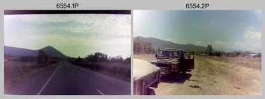
Photograph - 4th Field Survey Squadron deployed on Operation NERIGHT, Queensland & Northern Territory, 1989
... Part 1 was the field completion of topographic maps conducted near Camooweal QLD, along the Barkley Highway on the border between NT and QLD, from the 12th of September to the 20th of October 1989. A Bell Kiowa LOH helicopter from 162 Recce Sqn supported topographic field completion. ...Part 1 was the field completion of topographic maps conducted near Camooweal QLD, along the Barkley Highway on the border between NT and QLD, from the 12th of September to the 20th of October 1989. A Bell Kiowa LOH helicopter from 162 Recce Sqn supported topographic field completion. ...This is a set of 19 photographs taken in 1989 during 4th Field Survey Squadron’s deployment on Operation NERIGHT 89 in Queensland and the Northern Territory. It was a two-part operation in 1989 with work conducted in the areas of Camooweal and Weipa. Part 1 was the field completion of topographic maps conducted near Camooweal QLD, along the Barkley Highway on the border between NT and QLD, from the 12th of September to the 20th of October 1989. A Bell Kiowa LOH helicopter from 162 Recce Sqn supported topographic field completion. Operation NERIGHT 89 Part 2 was the acquisition of mapping control by GPS field parties utilising Texas Instruments TI4100 Global Positioning System receivers around Weipa on Cape York Peninsula from the 22nd of September to the 22nd of October 1989. Part 2 Two Bell UH-1H Iroquois helicopters from RAAF’s 35 Squadron were principally used to deploy GPS field parties. Identification photography of control points was taken by air camera operators in AAAvn Pilatus Porter aircraft from 173 Gen Spt Sqn fitted with an RC10 aerial camera. The two parts of the operation were conducted concurrently. This is a set of 19 photographs taken in 1989 during 4th Field Survey Squadron’s deployment on Operation Neright in Queensland & the Northern Territory. The colour photographs are on 35mm negative film and are part of the Army Survey Regiment’s Collection. The photographs were scanned at 96 dpi. .1) to .3) - Photo, colour, 1989. En-route to areas of survey operations. .4) to .5) - Photo, colour, 1989. Unidentified personnel relax next to river/waterhole. .6) - Photo, colour, 1989. Two Bell UH-1H Iroquois helicopters from RAAF’s 35 SQN utilised in the movement of GPS parties. .7) to .9) - Photo, colour, 1989. Unidentified soldier practices repelling from a UH1H Iroquois helicopter. .10) - Photo, colour, 1989. Inside the cockpit of a UH1H Iroquois helicopter. .11) - Photo, colour, 1989. Field Party camp with GPS equipment in foreground. Unidentified soldier prepares a meal. .12) - Photo, colour, 1989. GPS antenna plumbed over a survey ground mark. Witness post on left. .13) & .14) - Photo, colour, 1989. Unknown Cape York Peninsula beaches. .15) & .16) - Photo, colour, 1989. Dramatic fire next to base camp. .17) - Photo, colour, 1989. Aboriginal rock art at unknown location. .18) - Photo, colour, 1989. Aboriginal rock art at unknown location. L to R: unidentified, SPR Andrew Quin. .19) - Photo, colour, 1989. Aboriginal rock art at unknown location. LT Chris Topovsek..1P to .19P – There are no personnel identified. ‘1989 OP NERIGHT’ annotated on negative sleeve.royal australian survey corps, rasvy, 4 fd svy sqn, op neright 89 -
Moorabbin Air Museum
Book - CAC Commonwealth Aircraft Corporation, Australian -built Aircraft and the Industry
... ...Kiowa...CAC Commonwealth Aircraft Corporation The company Wirraway Wackett trainer Woomera Projects Radial engines Boomerang CA-14 & Lancer Mustang Winjeel & Cicada Nene/Tay & Avon Ceres Avon Sabre Mirage Atar & Viper Macchi MB326H Kiowa Wamira Hornet History of Australian built aircraft & the industry, circa 2020. ...History of Australian built aircraft & the industry, circa 2020.Boxed set of Volume 2, books 1 & 2. Donation by John McCullochnon-fictionHistory of Australian built aircraft & the industry, circa 2020.the company, wirraway, wackett trainer, woomera, projects, radial engines, boomerang, ca-14 & lancer, mustang, winjeel & cicada, nene/tay & avon, ceres, avon sabre, mirage, atar & viper, macchi mb326h, kiowa, wamira, hornet -
Moorabbin Air Museum
Photograph (Item) - Planes include Vickers Vimy RAAF Emblem Williamtown Amberley Parachutists East Sale fly over Ryan ST M Sunderland Westland Wapiti Mirage De Havilland DH 89 Dragon Rapide Dassault Falcon 20C BAC 111 Hawker Siddeley Kiowa CT-4 trainer Avro Cadet Learmouth aerodrome Macchi Tiger Moth Avro York De Havilland GLAS glider DHA G1, Packet 37 RAAF aircraft and Aerodrome Photographs
... Moorabbin Air Museum Moorabbin Airport 12 First Street Moorabbin melbourne Packet 37 RAAF aircraft and Aerodrome Photographs Photograph Planes include Vickers Vimy RAAF Emblem Williamtown Amberley Parachutists East Sale fly over Ryan ST M Sunderland Westland Wapiti Mirage De Havilland DH 89 Dragon Rapide Dassault Falcon 20C BAC 111 Hawker Siddeley Kiowa CT-4 trainer Avro Cadet Learmouth aerodrome Macchi Tiger Moth Avro York De Havilland GLAS glider DHA G1 ... -
Moorabbin Air Museum
Manual (Item) - Bell OH-58A Kiowa Depot Maintenance, Repair Parts and Special Tools List, DS, GS, and Depot Maintenance Repart Parts and Special Tools List: Helicopter, Observation, OH-58A (Bell)
... Moorabbin Air Museum Moorabbin Airport 12 First Street Moorabbin melbourne Soft-cover manual DS, GS, and Depot Maintenance Repart Parts and Special Tools List: Helicopter, Observation, OH-58A (Bell) Manual Bell OH-58A Kiowa Depot Maintenance, Repair Parts and Special Tools List ... -
Moorabbin Air Museum
Manual (Item) - Bell Kiowa Repair Manual, Bell 206B-1 Repair Manual
... Moorabbin Air Museum Moorabbin Airport 12 First Street Moorabbin melbourne AAP 7210.010-3 Yellow lever-arch folder Bell 206B-1 Repair Manual Manual Bell Kiowa Repair Manual ...AAP 7210.010-3 -
Moorabbin Air Museum
Manual (Item) - Bell Kiowa Illustrated Parts Breakdown, Bell 206B-1 Illustrated Parts Breakdown
... Moorabbin Air Museum Moorabbin Airport 12 First Street Moorabbin melbourne AAP 7210.010-4 Yellow lever-arch folder Bell 206B-1 Illustrated Parts Breakdown Manual Bell Kiowa Illustrated Parts Breakdown ...AAP 7210.010-4 -
Moorabbin Air Museum
Manual (Item) - Bell Kiowa Illustrated Airframe Maintenance Manual, Bell Helicopter Maintenance Manual Airframe
... Moorabbin Air Museum Moorabbin Airport 12 First Street Moorabbin melbourne AAP 7210.010-2-2 Yellow lever-arch folder Bell Helicopter Maintenance Manual Airframe Manual Bell Kiowa Illustrated Airframe Maintenance Manual ...AAP 7210.010-2-2 -
Moorabbin Air Museum
Manual (Item) - Bell Kiowa Component Repair & Overhaul Manual, Bell 206 Component Repair & Overhaul Manual
... Moorabbin Air Museum Moorabbin Airport 12 First Street Moorabbin melbourne Red hard-cover folder Bell 206 Component Repair & Overhaul Manual Manual Bell Kiowa Component Repair & Overhaul Manual ... -
 Moorabbin Air Museum
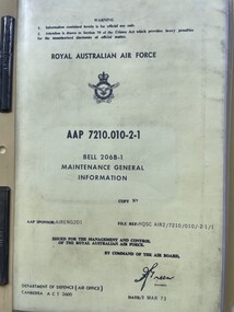
Manual (Item) - (SP) AAP 7210.010-2-1 Bell Kiowa 206B-1 Maintenance General Information
... Moorabbin Air Museum Moorabbin Airport 12 First Street Moorabbin melbourne RAAF Manual (SP) AAP 7210.010-2-1 Bell Kiowa 206B-1 Maintenance General Information ...RAAF -
 Moorabbin Air Museum
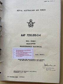
Manual (Item) - (SP) AAP 7210.010-2-4 Bell Kiowa Helicopter - maintenance
... Moorabbin Air Museum Moorabbin Airport 12 First Street Moorabbin melbourne RAAF Manual (SP) AAP 7210.010-2-4 Bell Kiowa Helicopter - maintenance ...RAAF -
 Moorabbin Air Museum
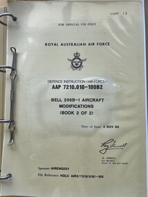
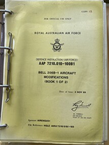
Manual (Item) - (SP) AAP 7210.010-100B2 Bell Kiowa 206B-1 Aircraft Modifications (Book 2 of 2)
... Moorabbin Air Museum Moorabbin Airport 12 First Street Moorabbin melbourne RAAF Manual (SP) AAP 7210.010-100B2 Bell Kiowa 206B-1 Aircraft Modifications (Book 2 of 2) ...RAAF -
 Moorabbin Air Museum
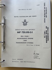
Manual (Item) - (SP) AAP 7210.010-2-3 Bell Kiowa 206B-1 Maintenance Engine and Transmission Systems
... Moorabbin Air Museum Moorabbin Airport 12 First Street Moorabbin melbourne RAAF Manual (SP) AAP 7210.010-2-3 Bell Kiowa 206B-1 Maintenance Engine and Transmission Systems ...RAAF -
 Moorabbin Air Museum
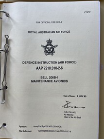
Manual (Item) - (SP) AAP 7210.010-2-6 Bell Kiowa 206B-1 Maintenance Avionics
... Moorabbin Air Museum Moorabbin Airport 12 First Street Moorabbin melbourne RAAF Manual (SP) AAP 7210.010-2-6 Bell Kiowa 206B-1 Maintenance Avionics ...RAAF -
 Moorabbin Air Museum
Manual (Item) - (SP) AAP 7210.010-100B1 Bell Kiowa 206B-1 Aircraft Modifications (Book 1 of 2)
... Moorabbin Air Museum Moorabbin Airport 12 First Street Moorabbin melbourne RAAF Manual (SP) AAP 7210.010-100B1 Bell Kiowa 206B-1 Aircraft Modifications (Book 1 of 2) ...RAAF -
 Moorabbin Air Museum
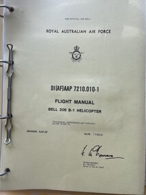
Manual (Item) - (SP) AAP 7210.010-1 Flight Manual Bell Kiowa 206B-1 Helicopter
... Moorabbin Air Museum Moorabbin Airport 12 First Street Moorabbin melbourne RAAF Manual (SP) AAP 7210.010-1 Flight Manual Bell Kiowa 206B-1 Helicopter ...RAAF -
 Moorabbin Air Museum
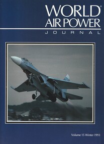
Book (item) - (SP) World Air Power Journal 15 Winter 1993
... Moorabbin Air Museum Moorabbin Airport 12 First Street Moorabbin melbourne Briefings: Mitsubishi F-4EJ Kai Seychelles Coast Guard Harrer GR.Mk 7 Lockheed C-130E(CL) ‘Comfy Levi’ EC-130E(RR) ‘Rivet Rider’ Bell 406/OH-58D Kiowa Warrior feature Marine Corps Assault photo feature Focus Aircraft: Sukhoi Su-27 ‘Flanker’ (54 pages) Variant Briefing: Dassault Mirage III/5/50 part 2 Austrian Air Force photo feature Shin Meiwa PS-1 and US-1 amphibians Air Power Analysis: Canada Book (SP) World Air Power Journal 15 Winter 1993 ...briefings: mitsubishi f-4ej kai, seychelles coast guard, harrer gr.mk 7, lockheed c-130e(cl) ‘comfy levi’, ec-130e(rr) ‘rivet rider’, bell 406/oh-58d kiowa warrior feature, marine corps assault photo feature, focus aircraft: sukhoi su-27 ‘flanker’ (54 pages), variant briefing: dassault mirage iii/5/50 part 2, austrian air force photo feature, shin meiwa ps-1 and us-1 amphibians, air power analysis: canada -
Moorabbin Air Museum
Drawing (Item) - RAAF Kiowa Colour and Markings
... Moorabbin Air Museum Moorabbin Airport 12 First Street Moorabbin melbourne Drawing RAAF Kiowa Colour and Markings ...