Showing 1517 items matching "land use"
-
 Bendigo Historical Society Inc.
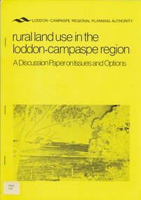
Book - RURAL LAND USE IN THE LODDON-CAMPASPE REGION, 1976
... RURAL LAND USE IN THE LODDON-CAMPASPE REGION...land use...RURAL LAND USE IN THE LODDON-CAMPASPE REGION - a discussion... Rural land use loddon campaspe rural land use agriculture Loddon ...RURAL LAND USE IN THE LODDON-CAMPASPE REGION - a discussion paper on issues and options. 30 pages, with maps.Loddon-Campaspe regional planning authoritybook, rural, land use, loddon campaspe, rural, land use, agriculture -
 Whitehorse Historical Society Inc.
Pamphlet, City of Nunawading land use statement, 1994
... City of Nunawading land use statement...Land Use...A draft statement from City of Nunawading on land use... Mitcham melbourne 4p Land Use City of Nunawading A draft statement ...A draft statement from City of Nunawading on land use strategy to establish directions & priorities for land use change and development within the municipality for the remainder of this decade and into the next. Council seeking comments.land use, city of nunawading -
 Churchill Island Heritage Precinct
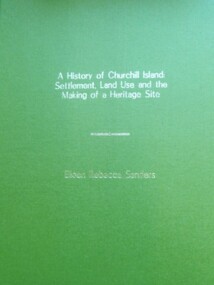
Book - Thesis, Dr E. Rebecca Saunders, A History of Churchill Island: Settlement, Land Use and the Making of a Heritage Site, 2015
... A History of Churchill Island: Settlement, Land Use and the...Land Use...A History of Churchill Island:/ Settlement, Land Use... Land Use Heritage Site Thesis 2015 An exploration ...An exploration of the intersections between the practices of community engagement, academia and history, the thesis responds to the challenges thrown up by the History Wars and the Churchill Island Project by making a history of settlement that is both academically critical and publicly accepted.A4 format bound text, with green front and back covers and gold writing on front page.non-fictionAn exploration of the intersections between the practices of community engagement, academia and history, the thesis responds to the challenges thrown up by the History Wars and the Churchill Island Project by making a history of settlement that is both academically critical and publicly accepted.saunders, churchill island, settlement, land use, heritage site, thesis 2015 -
Tatura Irrigation & Wartime Camps Museum
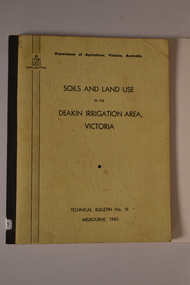
Book, Soils and Land Use, 1963
... Soils and Land Use...soils and land use...Advice to land holders on how to use the Soil Survey Report... Tatura the-murray Advice to land holders on how to use the Soil ...Advice to land holders on how to use the Soil Survey Report. Soils and land use in the deakin Irrigation area, Vict, Technical Bulletin No. 16, Melb. Includes maps for Deakin Irrigation AreaCream cover, black writing, Techical Bulletin No. 16soils and land use, tatura, irrigation, books, technical, rural, industry -
 Tatura Irrigation & Wartime Camps Museum
Book, Soils and Land Use. Deakin Irrigation Area Technical Bulletin No 16, 1963
... Soils and Land Use. Deakin Irrigation Area Technical...land use...Information in regard to land and soil use in Deakin... Tatura the-murray Information in regard to land and soil use ...Mid sized soft cover book, black spine, off white front and back, black writing on back and frontnon-fictionland use, soil use, deakin irrigation area -
Port Melbourne Historical & Preservation Society
Document - Port Melbourne Council re non-residential land use in residential zones, 1974 - 1978
... Port Melbourne Council re non-residential land use in... Schedule of non-residential land uses in residential zones...-residential land uses in residential zones Document Port Melbourne ...Retained by donor from his service on Port Melbourne Council 1973-78Miscellaneous Port Melbourne Council documents 1974-78 Schedule of non-residential land uses in residential zoneslocal government - city of port melbourne, town planning, glen cosham -
 Bendigo Historical Society Inc.
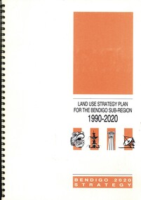
Book - LAND USE STRATEGY PLAN FOR THE BENDIGO SUV-REGION 1990-2020, 1991
... LAND USE STRATEGY PLAN FOR THE BENDIGO SUV-REGION 1990-2020...Land Use Strategy Plan for the Bendigo Sub-Region, 1990... Authority Land Use Strategy Plan for the Bendigo Sub-Region, 1990 ...Land Use Strategy Plan for the Bendigo Sub-Region, 1990 - 2020. Bendigo 2020 Strategy. Prepared by three consulting firms for the Loddon-Campaspe Regional Planning Authority Inside front cover are: 1 Cover sheet, 3 stapled reports covering Bendigo 2020 land use strategy plan, Issues Report, Environment, also a 5 page booklet planning for the future with information and maps.Loddon-Campaspe Regional Planning Authoritybendigo, planning, 2020 strategy. -
Lakes Entrance Historical Society
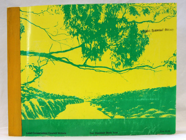
Book, Land Conservation Council Victoria, The Gippsland Lakes Land Use Strategy Plan 1978, 1985
... The Gippsland Lakes Land Use Strategy Plan 1978...A review of public land use in the East Gippsland area... of public land use in the East Gippsland area, including natural ...A review of public land use in the East Gippsland area, including natural resources, flora and fauna, recreation. Contains photographs, maps statistics.conservation, aboriginals, primary industry -
Clunes Museum
Education kit - DOCUMENT, SOIL CONSERVATION AUTHORITY, MCHUGH'S GULLY - A LAND USE AND MANAGEMENT TEACHING RESOURCE KIT, 1982
... MCHUGH'S GULLY - A LAND USE AND MANAGEMENT TEACHING... AND TOWN SHIP PRINTED ON IT. Section A contains documents of land... slides and transparencies MCHUGH'S GULLY - A LAND USE ...ENVIRONMENTAL STUDY OF MCHUGH'S GULLY RECORDED IN THE EARLY 1980'SBUFF COLOURED LEVER ARCH FILE CONTAINING SECTIONS A TO I WITH A CARDBOARD INSERT OF FRONT COVER WITH SEPIA IMAGES OF RURAL SCENES AND TOWN SHIP PRINTED ON IT. Section A contains documents of land use and management teaching resource kit. Section I contains slides and transparenciesnon-fictionENVIRONMENTAL STUDY OF MCHUGH'S GULLY RECORDED IN THE EARLY 1980'Smchughs gully, land management, environmental impact report -
Whitehorse Historical Society Inc.
Document, Community participation with land use
... Community participation with land use...Community participation with land use - a Nunawading... use - a Nunawading example. Community participation with land ...Community participation with land use - a Nunawading example.Community participation with land use - a Nunawading example. Edited version of a paper presented at 'Land for Leisure', annual conference of the Royal Australian Institute of Parks and Recreation, Burnie, 1978. Includes introduction and colour thumbnail prints of slides which were part of the presentation. 3 Cds contain images NP2904-2906.Community participation with land use - a Nunawading example. community gardens, city of nunawading. parks and recreation -
 Greensborough Historical Society
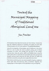
Booklet, Toward the municipal mapping of traditional aboriginal land use, by Jim Poulter, 2017c
... Toward the municipal mapping of traditional aboriginal land...Using Manningham as an example, aboriginal land use..., aboriginal land use patterns are shown, together with interconnecting ...Using Manningham as an example, aboriginal land use patterns are shown, together with interconnecting songlines.10 p., typescriptmanningham, songlines, aborigines -
 Tatura Irrigation & Wartime Camps Museum
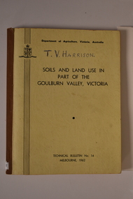
Book, Department of Agriculture Victori, Soil and Land Use in Part of the Goulburn Valley Victoria Technical Bulletin No 14, 1962
... Soil and Land Use in Part of the Goulburn Valley Victoria... Bulletin No 14. Soil and Land Use in Part of the Goulburn Valley ...Mid sized book with soft cover, brown spine with off white cover. Black writing on back and front. Contains maps. Tech Bulletin No 14.non-fictiongoulburn valley, soil studies victoria, victorian maps -
Lakes Entrance Historical Society
Book, Town and Country Planning Board Melbourne, Gippsland Lakes Land Use Strategy Plan, 1978
... Gippsland Lakes Land Use Strategy Plan... Land Use Strategy Plan Book Town and Country Planning Board ...Background report to the strategy plan to guide future development of the Gippsland Lakeswaterways, recreation -
 Orbost & District Historical Society
book, Report on the East Gippsland Study Area, June 1974
... East-Gippsland-Study-Area conservation public-land-use... and Environment with respect to the use of public land, in order... maps and information on public land use in East Gippsland.... and Environment with respect to the use of public land, in order ...In 1961 Bruce Evans was elected to the Victorian Legislative Assembly as the member for Gippsland East. He was the party's deputy leader from 1964 to 1970 and its whip from 1970 until his retirement in 1992. "The Land Conservation Council was established by the Land Conservation Act 1970. As one of its three functions, it makes recommendations to the Minister for Planning and Environment with respect to the use of public land, in order to provide for the balanced use of land in Victoria. This report contains the Council’s final recommendations concerning the use of public land in the East Gippsland study area, the boundaries of which correspond to those of the Shire of Orbost. The recommendations in the text are grouped under major headings, such as Parks, State Forest, and so on. " The Council met on seven occasions during the year, and also made visits of inspection to each study area. The Chairman visited Shire Councils in study areas to explain the role and the functions of the Land Conservation Council and to invite submissions on the use of public land in these areas. This is the fourth annual report by the council. This is a useful research tool.A large book 236 pp book with a yellow / gold cover with a green bush scene . The binding is orange. It contains folded maps and information on public land use in East Gippsland.inside - "With Compliments - Bruce Evans, M.P."east-gippsland-study-area conservation public-land-use -
 Whitehorse Historical Society Inc.
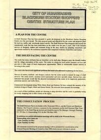
Pamphlet, City of Nunawading Blackburn Station Shopping Centre structure plan, 1990
... Land use...Map of land use precincts, draft structure plan including... Mitcham melbourne blackburn station shopping centre Land use Map ...Map of land use precincts, draft structure plan including overall strategic goals of Blackburn Station Shopping Centre. Also traffic managementMap of land use precincts, draft structure plan including overall strategic goals of Blackburn Station Shopping Centre. Also traffic management.Map of land use precincts, draft structure plan including overall strategic goals of Blackburn Station Shopping Centre. Also traffic managementblackburn station shopping centre, land use -
Whitehorse Historical Society Inc.
Document, Lee Parade, 1/11/1960
... Land Use...Lee Parade/Barkly Terrace area land use study, City... Mitcham melbourne Land Use Hassell Planning Consultants Lee Parade ...Lee Parade/Barkly Terrace area land use study, City of Nunawading. Review and recommendations by Hassell Planning Consultants Pty. Ltd., November 1960. In the folder correspondence, petitions and submissions from residents.land use, hassell planning consultants, lee parade, mitcham, barkly terrace, mitcham, whitehorse road, mitcham, church street, mitcham -
Port Melbourne Historical & Preservation Society
Letter - Lands & Survey Office re permission to use land for football ground, 13 May 1880
... Lands & Survey Office re permission to use land for... for use of land as per tracing sheet for football ground, 1880... & Survey Office granting permission for use of land as per tracing ...Letter from Lands & Survey Office granting permission for use of land as per tracing sheet for football ground, 1880sport - australian rules football, sport - recreational grounds, peter gallienne grut, port melbourne football club, pmfc -
 Greensborough Historical Society
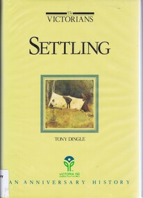
Book, Settling: The Victorians. By Tony Dingle, 1984_
... victoria land use...Part 2 of a 3-part series deals with land use from...Part 2 of a 3-part series deals with land use from ...Part 2 of a 3-part series deals with land use from Aboriginal land use to European settlement.Published to commemorate the 150th anniversary of European settlement in Victoria.Hard cover. 274 pages, illus., maps, end maps.victoria land use, victoria history, victoria social conditions, tony dingle -
 Eltham District Historical Society Inc
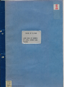
Document - Folder, Shire of Eltham, Land uses by number of lots, street and riding, 1984
... land use... other land uses. At the end of each Riding is given a summary... other land uses. At the end of each Riding is given a summary ...In work undertaken by the Shire of Eltham in revising its residential multi-unit development policy, information was collated by street and number of units. The exercise was expanded to include other land uses. At the end of each Riding is given a summary of the number of the various major land uses and index to abbreviations used on the last page11 pages inside blue coverharry gilham collection, land use, streets, ridings, dwellings, units -
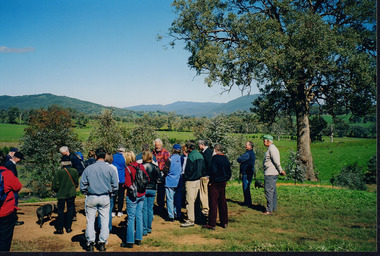
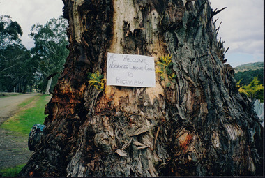 Wooragee Landcare Group
Photograph, 5 September 2004
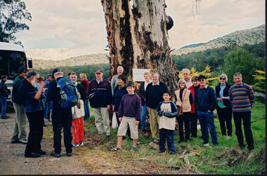
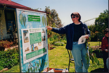
... land use... conservation and land-use practices in the North-East region... conservation and land-use practices in the North-East region ...Wooragee Landcare was formed in 1989 to promote sustainable conservation and land-use practices in the North-East region of Victoria. The organisation's work has included public awareness and education campaigns to control invasive, introduced species and protect native wildlife, such as campaigns to replant native plant species to improve soil integrity and restore habitat for flora and fauna. The organisation has drawn on the work of a variety of Government and academic experts to ensure best practice approaches are utilised. This photograph was taken at Riverview Farm, Victoria on Sunday the 5th of September as part of a day trip by the Wooragee Landcare Group. The event was about looking at land use on small farms and as a social get-together for the Group. Wooragee was also researching how small landholders could run some enterprises around the time of the trip. This photograph is a great example of the type of events that Wooragee Landcare Group has organized, while educating the public about the importance of land use management.Landscape colour photograph printed on gloss paper. Reverse: WAN NA E0NA2N2. NNN+ 4 4240/ [PRINTED] (No. 24) / 377wooragee, wooragee landcare group, wooragee landcare's collection, land use, social, riverview farm, animals, pests, indigo shire, tatong, samaria, north-east victoria -
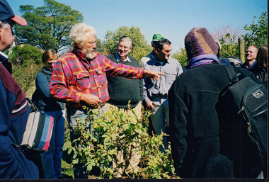 Wooragee Landcare Group
Photograph, 5 September 2004
... land use... in September 2004. The purpose of the excursion was to look at land use... in September 2004. The purpose of the excursion was to look at land use ...This photograph was taken during a bus excursion to Tatong in North East Victoria, held by the Wooragee Landcare Group in September 2004. The purpose of the excursion was to look at land use on small farms. As part of this, the excursion included a visit to Samaria Farm, run by Sue and Don Matheson. In this photo, taken at Samaria Farm, Don Matheson is discussing the management of his commercial rose garden. Events like this meet Wooragee Landcare's organisational goals of promoting best land management practices, cooperating and engaging with landowners, and providing information on plant management and care. This object is significant as a record of Wooragee Landcare's activities and community involvement. Landscape colour photograph printed on gloss photographic material. Reverse: "WAN NA E0NA2N2 NNN+ 1 4240/ don matheson, sue matheson, matheson, tatong, excursion, bus trip, wooragee landcare, wooragee, landcare, wooragee landcare group, samaria farm, roses, commercial rose garden, rose growing, education, activity, 2004, rose, farm, small farms, land use -
 Wooragee Landcare Group
Photograph, 5 Sepember 2004
... land use... Landcare Group. The event was about looking at land use on small... Landcare Group. The event was about looking at land use on small ...This photograph was taken at Riverview Farm, Victoria on Sunday the 5th of September as part of a day trip by the Wooragee Landcare Group. The event was about looking at land use on small farms and as a social get-together for the Group. Wooragee was also researching how small landholders could run some enterprises around the time of the trip. This photograph includes Julius Holt, Graeme Missen, Peter and Lesley Finedon, Sue Brunskill, Jacky Luisi, Bonnie Payne, Bob and Christine Stewart, Oliver Payne, and Gerri Boland. Wooragee Landcare Group was created in 1988. Its core mission is to work towards eradicating animals and pests from the land to protect the natural vegetation and promote revegetation projects.This photograph is a great example of the type of events that Wooragee Landcare Group has organized, while educating the public about the importance of land use management.Reverse: WAN NA E0NA2N2. NN1- 3 4556 / [PRINTED] (No. 9) / 188wooragee, wooragee landcare group, wooragee landcare's collection, land use, social, riverview farm, animals, pests -
 Wooragee Landcare Group
Photograph, 5 September 2004
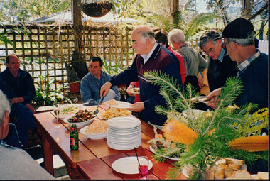
... land use... September to Samaria, Tatong area (near Benalla) to look at land use... September to Samaria, Tatong area (near Benalla) to look at land use ...Wooragee Landcare Group took a bus trip Sunday 5th September to Samaria, Tatong area (near Benalla) to look at land use on small farms. Around this time, Wooragee Landcare were looking into how small land holders could run some enterprises. This photo was taken at Tatong Tavern where the group had lunch. The Tatong Tavern is an old English style pub situated in the foothills of the Great Dividing Range the small community of Tatong 23km south-east of Benalla. The original weatherboard hotel was originally built in the 1880s by William Worrall who was listed as Hotel Keeper from 1886 to 1910. It was destroyed by fire in 1923 and replaced by the current building, which has undergone many changes over the past 100 years. The name has also changed from the Tatong Hotel or ‘Pub’ to the current name of Tatong Tavern.Tatong is a rural village in north-east Victoria, set in undulating country that rises southwards to the Tolmie ranges. The name is thought to derive from an Aboriginal expression, possibly referring to something unseen. The Tatong pastoral run was taken up in 1847 and farm selections began in the 1870s. A school opened in 1890 (closed in 2006). Dairy herds were grazed on the Tatong flats and a cooperative creamery operated from 1892 until 1918. In 1914 a branch railway line was opened from Benalla to Tatong that carried farm produce and timber to Tatong, which had two sawmills in the 1920s. There was also a general store, a police station, and a livestock trucking yard. St Albans Church of England was built in 1921. Most of those buildings have now disappeared. The Tatong Tavern along with the Hall built in 1904 are the only remaining buildings. The Tatong Tavern is a significant tangible and visual representation of the area’s cultural and social history over the past 100 years. Coloured rectangular photograph printed on paperReverse: WAN NA E0NA2N2. NNN- 14240/ (No. 20) 373/ tatong, tatong pub, tatong tavern, tolmie ranges, tatong flats, benalla, wooragee landcare, wooragee landcare group, bus trip, samaria, land use, william worrall, 1800s, 2004, mount samaria -
 Wooragee Landcare Group
Photograph, 5 September 2004
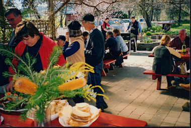
... land use... Landcare Group. The event was about looking at land use on small... Landcare Group. The event was about looking at land use on small ...This photograph was taken at Tatong Tavern, Victoria on Sunday the 5th of September as part of a day trip by the Wooragee Landcare Group. The event was about looking at land use on small farms and as a social get-together for the Group. Wooragee was also researching how small landholders could run some enterprises around the time of the trip. This photograph includes Jo Luisi, Bob Bennet, Christine Stewart, and Julius Holt. Tatong Tavern was built in the 1880's as Tatong Hotel or 'Pub' hotel for Mr. William Worrall. The original hotel was destroyed in 1923 by a fire, but was rebuilt for Mr. M. C. Clarke. The building is a representation of the changing society, as it changes as its uses and visitors change. The photograph shows the beer garden, which has been added more recently. The Tavern has a bar, restaurant, and accommodation area. Wooragee Landcare Group was created in 1988. Its core mission is to work towards eradicating animals and pests from the land to protect the natural vegetation and promote revegetation projects.This photograph is a great example of the type of events that Wooragee Landcare Group has organized, while educating the public about the importance of land use management. It showcases the social aspect of the Group, as well as the historic Tatong Tavern. Landscape colored photograph printed on gloss paper. Reverse: WAN NA E0NA2N2. NNN+ 1 4240/ [PRINTED] (No. 22) / 375wooragee, wooragee landcare group, wooragee landcare's collection, land use, social, tatong tavern, tatong hotel, tatong pub -
 Wooragee Landcare Group
Photograph, 5 September 2004
... land use... Landcare Group. The event was about looking at land use on small... Landcare Group. The event was about looking at land use on small ...This photograph was taken at Tatong Tavern, Victoria on Sunday the 5th of September as part of a day trip by the Wooragee Landcare Group. The event was about looking at land use on small farms and as a social get-together for the Group. Wooragee was also researching how small landholders could run some enterprises around the time of the trip. This photograph includes Christine Stewart, Julius Holt, Graeme Missen, Peter Finedon, and Sue Brunskill. Tatong Tavern was built in the 1880's as Tatong Hotel or 'Pub' hotel for Mr. William Worrall. The original hotel was destroyed in 1923 by a fire, but was rebuilt for Mr. M. C. Clarke. The building is a representation of the changing society, as it changes as its uses and visitors change. The photograph shows the beer garden, which has been added more recently. The Tavern has a bar, restaurant, and accommodation area. Wooragee Landcare Group was created in 1988. Its core mission is to work towards eradicating animals and pests from the land to protect the natural vegetation and promote revegetation projects.This photograph is a great example of the type of events that Wooragee Landcare Group has organized, while educating the public about the importance of land use management. It showcases the social aspect of the Group, as well as the historic Tatong Tavern.Landscape colored photograph printed on gloss paper. Reverse: WAN NA E0NA2N2. NNN+ 2 4240 / [PRINTED] (No. 23) / 376wooragee, wooragee landcare group, wooragee landcare's collection, land use, social, tatong tavern, tatong hotel, tatong pub -
 Wooragee Landcare Group
Photograph, 5 September 2004
... land use.... The event was about looking at land use on small farms.... The event was about looking at land use on small farms ...This photograph was taken at Samaria Farm on Sunday the 5th of September as part of a day trip by the Wooragee Landcare Group. The event was about looking at land use on small farms and as a social get-together for the Group. Wooragee Landcare was also researching how small landholders could run some enterprises around the time of this trip. Samaria Farm is located in northeast Victoria, near Mount Samaria, which is located 130 km northeast of Melbourne. Samaria Farm was owned by Sue and Due Matheson at the time of the trip and had a renowned rose garden, pigs, poultry, alpacas, and goats on their nine-hectare farm. The rose garden consists of 3000 damask roses. Samaria Farm distils the oil from these roses and is the only farm in Australia to do this. Rose oil has historically been used for religious and medical use. 20 kg of rose buds are picked by hand every day, which is then distilled and produced 5 to 8 ml of oil. The entire four-week season produces 80 to 100 ml of oil. Rose water is also created during this process and produces about 300 litres per season. Along with the oil, the Farm also harvests lemons, lime, olives, and oranges. The Farm is currently owned by Utako and Anthony since 2022, with Vicki and Allan Wight being the previous owners. Wooragee Landcare Group was created in 1988. Its core mission is to work towards eradicating animals and pests from the land to protect the natural vegetation and promote revegetation projects. This photograph is a great example of the type of events that Wooragee Landcare Group has organized, while educating the public about the importance of land use management. The group is important to the community and for the environment.Landscape coloured photograph printed on gloss paperReverse: WAN NA E0NA2N2. NNN+ 2 4240/ [PRINTED] (No. 18) / 371samaria farm, wooragee, wooragee landcare group, wooragee landcare's collection, samaria, small farm, land use, social, rose oil, damask roses, pests -
 Eltham District Historical Society Inc
Book, Land Conservation Council, Report on the Melbourne Study Area, December 1973
... land use... of public land in order to provide for the balanced use of land... of public land in order to provide for the balanced use of land ...This report is one of a series describings the physical nature of the land and its environment, examines the likely forms of land use, and assesses the hazards associated with these uses. It is divided into four main sections: Introduction, Characteristics of environment, main forms of land use and description of 24 specific blocks in the study area which include Torquay, Brisbane Ranges, Werribee, Wombat, Loddon, Romsey, Puckapunyal, Strathbogie, Eildon, Disappointment, Break O'Day, Black Range, Cerberean, Upper Goulburn, Kinglake, Donna Buang, Upper Yarra, Thomson, Dandenongs, Bunyip-Latrobe, Shady Creek, Tyers, Westernport and Strzelecki. The Land Conservation Act 1970 established the Land Conservation Council whose functions is to "carry out investigations and make recommendations to the Minister with respect to the use of public land in order to provide for the balanced use of land in Victoria. This report sets out to describe and assess the natural resources of the public lands in the Melbourne area and provides a factual basis on which members of the community may base submissions to the [Land Conservation] Council of Victoria.444 pagesnon-fictionThis report is one of a series describings the physical nature of the land and its environment, examines the likely forms of land use, and assesses the hazards associated with these uses. It is divided into four main sections: Introduction, Characteristics of environment, main forms of land use and description of 24 specific blocks in the study area which include Torquay, Brisbane Ranges, Werribee, Wombat, Loddon, Romsey, Puckapunyal, Strathbogie, Eildon, Disappointment, Break O'Day, Black Range, Cerberean, Upper Goulburn, Kinglake, Donna Buang, Upper Yarra, Thomson, Dandenongs, Bunyip-Latrobe, Shady Creek, Tyers, Westernport and Strzelecki. The Land Conservation Act 1970 established the Land Conservation Council whose functions is to "carry out investigations and make recommendations to the Minister with respect to the use of public land in order to provide for the balanced use of land in Victoria. This report sets out to describe and assess the natural resources of the public lands in the Melbourne area and provides a factual basis on which members of the community may base submissions to the [Land Conservation] Council of Victoria.land use, kinglake, thomson valley, conservation, public lands -
 Bacchus Marsh & District Historical Society
Map, Maddingley Township, Parish of Parwan, 1880s
... Land Use... discontinued use of land such as the showgrounds and police paddock... discontinued use of land such as the showgrounds and police paddock ...This map is dated Sept. 6th 1856. However places in the township of Maddingley which did not appear until the late 1880s such as the Bacchus Marsh Railway Station and line are shown on this map in their correct locations. This suggests the map has been derived from an earlier map. An earlier date of 1843 with a surveyor's name preceding it can also be seen on the map. The map is important because it indicates the location and dimensions of early but now discontinued use of land such as the showgrounds and police paddock and a site reserved for the Church of England which was not ultimately used for a permanent church. A single page paper map showing land allotments, streets, rivers, creeks, park lands, the railway line and Bacchus Marsh railway station in the township of Maddingley. The map is pasted into a bound volume containing 76 maps or plans in total. Bottom of Map: Surveyor-General's Office, Melbourne, Sept 6th, 1856bacchus marsh victoria maps, maddingley victoria maps, land use, maddingley victoria history -
Glen Eira Historical Society
Plan - Jasper Road, 236-246, McKinnon
... Land use... Petrol stations Factories Land use Land values Anderson's Garage ...Three items relating to the valuation of this property: 1/A typed copy of a three page valuation of 236-246 Jasper Road, McKinnon, by valuator W V Scott for Atlantic Union Oil Co Pty Ltd, dated 11/08/1961. Accompanying this are a hand-drawn plan of the property and handwritten working notes for the valuation. 2/One additional page of correspondence from W V Scott to Atlantic Union Oil, dated 11/08/1961, informing them that the occupier of the property, L A Atkinson’s Garage and Panel Beating Works, was aware of the valuation taking place. 3/Field Purchase Order for the valuation of the property from Atlantic Union Oil Company Pty. Limited dated 19/07/1961.jasper road, mckinnon road, mckinnon, atkinson l.a, webb d mr, l.a atkinson’s garage and panel beating works, moorabbin council, atkinson mr, atlantic oil co pty ltd, morris g h, scott w v, motor vehicle repair shops, garages, petrol stations, factories, land use, land values, anderson's garage & panel beating works -
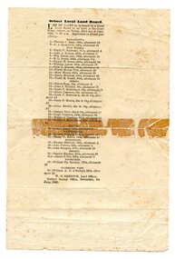 Orbost & District Historical Society
programe, 1888
... document land-use land-board gregson... issues in the late 19th century. document land-use land-board ...Local land boards were community based "tribunals" consisting of a chairman appointed by the the state government and two(?) local members who were there or their knowledge of local land management practices. These boards were establishe in the mid-late 19th century and generally dealt with disputes about fencing, water rights, general land enquiries and the opening or closing of local roads.This document is a record of local land issues in the late 19th century. A sheet of paper, held together with sticky tape, stating the names of cases to be read by court regarding land. document land-use land-board gregson