Showing 3 items matching "macedon regional park"
-
 Greensborough Historical Society
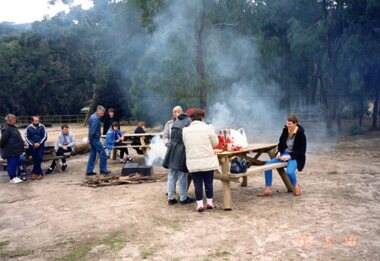
Photograph, Carolyn Haas, Janefield excursion to 'Barringo' Mt Macedon 1998, 1998
... ...macedon regional park...Colour photograph of a Janefield Special School excursion to the Barringo picnic area in Macedon Regional Park...Greensborough Historical Society 34A Glenauburn Road Lower Plenty Lower Plenty melbourne Colour photograph of a Janefield Special School excursion to the Barringo picnic area in Macedon Regional Park janefield janefield special school macedon regional park barringo 1 colour photographs. ...Colour photograph of a Janefield Special School excursion to the Barringo picnic area in Macedon Regional Park1 colour photographs.janefield, janefield special school, macedon regional park, barringo -
 Sunshine and District Historical Society Incorporated
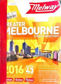
Book - Melway Greater Melbourne Street Directory 2016, Melway Publishing Pty Ltd, 2016
... Park 3023. Brimbank Library, 301 Hampshire Road, Sunshine 3020. melbourne The series of Melway Directories provides the most comprehensive maps of Great Melbourne area. In this Melway the coverage extends from Wallan, Whittlesea and Kinglake in the North to Mornington Peninsula in the South, Warburton and Tynong in the East to Bacchus Marsh and Geelong in the West. Regional areas of Kilmore, Macedon ...The series of Melway Directories provides the most comprehensive maps of Great Melbourne area. In this Melway the coverage extends from Wallan, Whittlesea and Kinglake in the North to Mornington Peninsula in the South, Warburton and Tynong in the East to Bacchus Marsh and Geelong in the West. Regional areas of Kilmore, Macedon, Gisborne, Riddells Creek, Bannockburn, Torquay, Anglesea, Lorne, Phillip Island and Koo Wee Rup are also included. Past editions can provide invaluable material for researchers and historians.Paper back booknon-fictionThe series of Melway Directories provides the most comprehensive maps of Great Melbourne area. In this Melway the coverage extends from Wallan, Whittlesea and Kinglake in the North to Mornington Peninsula in the South, Warburton and Tynong in the East to Bacchus Marsh and Geelong in the West. Regional areas of Kilmore, Macedon, Gisborne, Riddells Creek, Bannockburn, Torquay, Anglesea, Lorne, Phillip Island and Koo Wee Rup are also included. Past editions can provide invaluable material for researchers and historians. -
 Sunshine and District Historical Society Incorporated
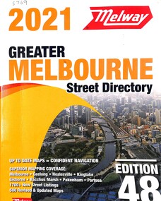
Book - Melway Greater Melbourne Street Directory 2021, Melway Publishing Pty Ltd, 2021
... Park 3023. Brimbank Library, 301 Hampshire Road, Sunshine 3020. melbourne The series of Melway Directories provides the most comprehensive maps of Great Melbourne area. In this Melway the coverage extends from Wallan, Whittlesea and Kinglake in the North to Mornington Peninsula in the South, Warburton and Tynong in the East to Bacchus Marsh and Geelong in the West. Regional areas of Kilmore, Macedon ...The series of Melway Directories provides the most comprehensive maps of Great Melbourne area. In this Melway the coverage extends from Wallan, Whittlesea and Kinglake in the North to Mornington Peninsula in the South, Warburton and Tynong in the East to Bacchus Marsh and Geelong in the West. Regional areas of Kilmore, Macedon, Gisborne, Riddells Creek, Bannockburn, Torquay, Anglesea, Lorne, Phillip Island and Koo Wee Rup are also included. Past editions of the Melway can provide invaluable material for researchers and historians.Paper back booknon-fictionThe series of Melway Directories provides the most comprehensive maps of Great Melbourne area. In this Melway the coverage extends from Wallan, Whittlesea and Kinglake in the North to Mornington Peninsula in the South, Warburton and Tynong in the East to Bacchus Marsh and Geelong in the West. Regional areas of Kilmore, Macedon, Gisborne, Riddells Creek, Bannockburn, Torquay, Anglesea, Lorne, Phillip Island and Koo Wee Rup are also included. Past editions of the Melway can provide invaluable material for researchers and historians.