Showing 111 items matching "main road eltham roundabout"
-
 Eltham District Historical Society Inc
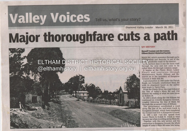
Document - Property Binder, 1045 Main Road, Eltham
... Main Road...Eltham...Property...Shops...Businesses...Russell Yeoman...Jim Connor...Eltham District Historical Society...Plenty River...Old Eltham Road...Kangaroo Ground...Nillumbik Council...Barry Rochford...Main Road Eltham...Luck Street Eltham...Aladdin Antiques Montmorency...Main Road Eltham roundabout...Eltham District Historical Society Inc 728 Main Rd Eltham melbourne Businesses, Eltham, Eltham Physiotherapy & Sports Injuries, Main Road Main Road Eltham Property Shops Businesses Russell Yeoman Jim Connor Eltham District Historical Society Plenty River Old Eltham Road Kangaroo Ground Nillumbik Council Barry Rochford Main Road Eltham Luck Street Eltham Aladdin Antiques Montmorency Main Road Eltham roundabout Steven White Geoff Glynn Michael Murray Harold Herd Enver Camdal Helen Bodycomb Rhonda Noble Jeph Neale Chris Marks John Brumby Andrew Haermeyer Sherryl Garbutt Eltham shopping centre Eltham Chamber of Commerce and Industry Norman Williams Pat Power John Graves Wattletree Road Eltham Bolton Street Eltham Miscellaneous clippings, notes, photocopies, etc held on the subject property. 1045 Main Road, Eltham Document Property Binder ...Businesses, Eltham, Eltham Physiotherapy & Sports Injuries, Main Roadmain road, eltham, property, shops, businesses, russell yeoman, jim connor, eltham district historical society, plenty river, old eltham road, kangaroo ground, nillumbik council, barry rochford, main road eltham, luck street eltham, aladdin antiques montmorency, main road eltham roundabout, steven white, geoff glynn, michael murray, harold herd, enver camdal, helen bodycomb, rhonda noble, jeph neale, chris marks, john brumby, andrew haermeyer, sherryl garbutt, eltham shopping centre, eltham chamber of commerce and industry, norman williams, pat power, john graves, wattletree road eltham, bolton street eltham -
 Eltham District Historical Society Inc
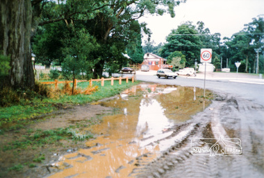
Photograph, M. North, Main Road, Eltham near Fitzsimons Lane Roundabout, Dec 1985, 1/12/85
... Main Road, Eltham near Fitzsimons Lane Roundabout, Dec 1985...Two colour photographs of Main Road, ElthamSouth between Falkiner Street and Bolton Street at the roundabout of Fitzsimons Lane, Eltham, Dec 1985...Main Rd Eltham melbourne main road eltham eltham south fitzsimons lane round about falkiner street Noted on 463B 'See 1934 small black and white snap of flooded bridge and the same two shops. This snap taken from same location, Dec 1985. Old Eltham Park on right of photo The two shops at left (Ansel and Muir) Road ahead crosses new bridge over the Diamond Creek, Eltham Main Road now dual highway, through Lower Plenty to this bridge' Two colour photographs of Main Road, ElthamSouth between Falkiner Street and Bolton Street at the roundabout of Fitzsimons Lane, Eltham, Dec 1985 Main Road, Eltham near Fitzsimons Lane Roundabout, Dec 1985 Photograph M. ...Two colour photographs of Main Road, ElthamSouth between Falkiner Street and Bolton Street at the roundabout of Fitzsimons Lane, Eltham, Dec 1985Noted on 463B 'See 1934 small black and white snap of flooded bridge and the same two shops. This snap taken from same location, Dec 1985. Old Eltham Park on right of photo The two shops at left (Ansel and Muir) Road ahead crosses new bridge over the Diamond Creek, Eltham Main Road now dual highway, through Lower Plenty to this bridge'main road, eltham, eltham south, fitzsimons lane, round about, falkiner street -
 Eltham District Historical Society Inc
Document - Folder, Jim Connor et al, Eltham Gateway, 1987
... The Eltham Gateway Group (EGG) was established about 1987 by some Eltham residents concerned for the development of the Eltham Gateway, defined as that historically and environmentally sensitive region of land along Main Road, Eltham extending from the roundabout at Fitzsimons Lane to Dudley Street, Eltham. ...Eltham District Historical Society Inc 728 Main Rd Eltham melbourne The Eltham Gateway Group (EGG) was established about 1987 by some Eltham residents concerned for the development of the Eltham Gateway, defined as that historically and environmentally sensitive region of land along Main Road, Eltham extending from the roundabout at Fitzsimons Lane to Dudley Street, Eltham. ...The Eltham Gateway Group (EGG) was established about 1987 by some Eltham residents concerned for the development of the Eltham Gateway, defined as that historically and environmentally sensitive region of land along Main Road, Eltham extending from the roundabout at Fitzsimons Lane to Dudley Street, Eltham. The gateway was a unique urban area with a strong sense of character that provided a distinctive entrance to the Eltham Town Centre. The intention of this group was to support development that preserved both the natural and historic features of the gateway region. It encouraged development sympathetic to Eltham’s traditional association with the arts and natural environment. The group was initiated in response to a planning application in December 1986 to redevelop the then Mobil service station site at 729 Main Road, Eltham on the corner of Brougham Street. This group worked with and encouraged the Eltham Shire Council to consider rezoning to protect the gateway area. A detailed Eltham Gateway Study undertaken by Tract Consultants assisted with the establishment of the Eltham Gateway Zone, the Eltham Gateway Policy and the Eltham Gateway Design and Siting Guidelines. The State Government subsequently agreed to a planning amendment to rezone the land from a Residential Zone C to an Eltham Gateway Zone under the Eltham Planning Scheme. While zoning changes over the years have altered the mix of permitted uses within this area the Eltham Gateway still looks and feels like a predominately residential style precinct, even where non-residential type uses operate. EGG was followed by the establishment of the Eltham Protection Society in about 1989 to respond to community planning issues beyond the area of the Eltham Gateway and in effect took over the role from the EGG. Jim Connor President Eltham District Historical Society 4 July 2022 During 1986/87 I was a community member on the Shire of Eltham’s Community Consultative Committee involved with the Eltham Gateway Study, which led to the establishment of the original Eltham Gateway Zone, under the then Eltham Planning Scheme The Eltham Gateway Group was the pioneer community action group dedicated to protecting the character of the Eltham Gateway. It was succeeded by the Eltham Protection Society. When the Shire of Eltham Offices were demolished by the unelected Commissioners of Nillumbik Shire Council in July/August 1996, significant community upset and protest led to the establishement of the Eltham Gateway Action Group (EGAG) which in present day form has evolved into the Eltham Community Action Group (ECAG) focussing on issues throughout Eltham and not just the Eltham Gatewayeltham community action group, eltham gateway, eltham gateway action group, eltham gateway design and siting guidelines, eltham gateway group (egg), eltham gateway policy, eltham gateway study, eltham gateway zone, eltham planning scheme, eltham protection society, jim connor, michael wilson, rodger dalling, tony mcmanus -
 Eltham District Historical Society Inc
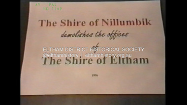
Film - Video (VHS), Jenni Mitchell, Demolition of the Shire of Eltham Offices, 1996
... main road...alistair knox park...artworks...auction...barn gallery...barry rochford...community health centre...dallas howgate...delta demolitions...demolition...don cordell...eltham...eltham library...eltham shire office...eltham war memorial...eltham war memorial gate...eltham war memorial hall...great hall...harry gilham...jenni mitchell...john graves...library place...main road...memorial gardens...mervyn hannan...montsalvat...pitt street...protest...robert marshall...roundabout...Eltham” and more music and singing “Put up a parking lot”. The crowd then proceeds to walk along the footpath of Main Road. Scene (15 Sep 1996) meeting at Montsalvat in Great Hall addressed by Sigmund Jorgensen discussing a recently published list of the Commissioner’s to senior Council Officers of banned Nillumbik people, others encouraging people to view proposed plans for the site and lodge objections. Specific issues regarding asbestos claims are also addressed. Harry Gilham addresses the meeting on the subject of the Eltham War Memorial and Memorial Gardens and how Council believe a roundabout...Eltham” and more music and singing “Put up a parking lot”. The crowd then proceeds to walk along the footpath of Main Road. Scene (15 Sep 1996) meeting at Montsalvat in Great Hall addressed by Sigmund Jorgensen discussing a recently published list of the Commissioner’s to senior Council Officers of banned Nillumbik people, others encouraging people to view proposed plans for the site and lodge objections. Specific issues regarding asbestos claims are also addressed. Harry Gilham addresses the meeting on the subject of the Eltham War Memorial and Memorial Gardens and how Council believe a roundabout ...Poor video quality (noise and interference), edited raw footage with music and some commentary by Merv Hanna. A video documenting the demolition of the Shire of Eltham offices at 895 Main Road Eltham under the direction of the Commissioners appointed for the new Shire of Nillumbik and some of the communities activities surrounding the event. The building was demolished exactly 25 years after the southern wing housing Engineering and Planning on the upper level and the Eltham Library on the ground level was opened in celebration of the Shire of Eltham's centenary. Video has lots of distortion and noise, and sections of clips dubbed over. Immediate initial footage of Jenni Mitchell talking about asbestos claims in the Shire Offices (Sigmund Jorgensen standing behind her) advising Council did a review of the building several years previously and had been cleared of health problems. Cuts to group of people standing outside front door of offices but possibly voice dub over not related ? Then the date 27 Jul 1996 on a scene flashes on screen immediately followed by an edited clip intro of title and credits with classical music track. It then opens with Jenni Mitchell driving to the Shire Offices on Saturday 27 July 1996 at 11.00am. Footage of Main Road past Pitt Street, Alistair Knox Park then entering Shire Office driveway which is fenced off and contractor signs hanging up. Scenes at rear of building showing some internal demolition has commenced. View of the Administration wing. More clips of road driving, Alistair Knox Park, Eltham Library and visitor car park for Shire Offices. Cuts to a group of people standing in access to visitor carpark with new Eltham Library in background, one being immediate former Shire of Eltham President, John Graves. Scenes of people looking through chain link fence and security guard checking front door. John Graves being filmed that someone informed him the Shire was offering the building to the Community Health Centre for $2.3 million and that if they had been offered a price of $1.1 for what it apparently was sold for they would have snapped it up. View of truck loaded with brick rubble literally struggling to ascend the hill of Library Place to exit into Main Road. Cuts to a scene looking at Eltham War memorial Hall through the Memorial Gate, then the Shillinglaw trees and large banner sign ‘Delta Demolitions’ hanging on office façade. Views of front door, old library and bluestone wall. Scene (31 Jul 1996) filmed at night of several white crosses with “RIP Community” and “RIP Democracy”. Scene (1 August 1996) again driving along Main Road towards the Shire Offices then scenes of the offices showing substantially more demolition to exterior, groups of people standing on footpath outside watching, Delta heavy demolition machines, woman holding sign “Democracy where have you gone …”, the odd person in full protection gear and breathing apparatus hand carrying materials out to place on rubbish pile in front of people standing on footpath watching (with no protection) and then stamping on it to break it creating dust, security person in hard hat (no other protection) wandering around, many groups standing around watching, news film crew, person standing on roadside edge holding signs facing traffic stating “Pirate Planning” and “ Grant us your ears” also sign on back of parked car “Elthams High Jacks”, another sign “Community Democracy”, views of crosses in Main Road median strip “RIP Community”, groups of people on footpaths and reporters conducting interviews, footage of unknown person standing with Jenni Mitchell and Sigmund Jorgensen advising people have the right to protest, Jenni Mitchell urging people to ask questions of local MP and Council and Sigmund Jorgensen referring to the three historic Shillinglaw trees with demolition machinery operating in background, Jenni Mitchell and others installing more crosses in median strip; demolition machines operating inside and outside the building, more views of onlookers including Sigmund Jorgensen then Police approaching on footpath, workers and machinery continuing to operate, views of the old library being demolished, the former Community Services department, security personnel. Scene (2 August 1996) more heavy demolition machinery in operation smashing building up, people standing around southern wing watching, view overlooking Eltham Library of train pulling in to Eltham station. Scene (7 August 1996) more heavy demolition and people wandering around with only hard hat protection, no dust protection, comments from one operator dumping a bin of material stating “wait till there’s a Hungry Jack’s here, you’ll be laughing, fuel, videos, hamburgers. You’ll be up with the rest of the world soon, you’ll have electricity and everything here, ha ha ha ha”, more heavy machinery demolition and breaking up of materials, view of Hitachi train going by and Administration wing, view inside the front door opening of the staircase leading to upper level, person walking around operating heavy machinery with a hose spraying rubble (no protective gear other than hard hat interspersed with edit cuts of meeting of Commissioners and independent observers on panel as well as members of the community in public gallery. Nillumbik Shire CEO Barry Rochford addressing the meeting., Chief Commissioner Don Cordell directly addressing Jenni Mitchell with respect to permission to take photographs, Barry Rochford continues to address the question asked of Council about the valuation of the former Shire of Eltham Office building/site, public gallery calling out asking why was building demolished, what was the urgency. Scene (14 August 1996) views of southern wing, previous single demolition operator again mocking people filming, operators working in and around building, Shillinglaw trees and largely demolished front, heavy demolition equipment at work, piles of building rubble, hose spraying water over rubble, large trucks arriving for rubble removal and loading of truck. Scene (21 August) more of the same, building virtually down, Shillinglaw trees standing tall and alone, water spraying on rubble and wattle in bloom. Cuts to Council meeting with public onlookers. Barry Rochford walks out, Wayne Phillips addresses meeting explaining one or two people shouting, members of the community challenging Council (Commissioners) about why due process appear to have been subverted. Former Shire President Robert Marshall in public audience, cuts back to Shire office carpark entrance site and sign hung on fence in front of library “Think Again!” and people standing around observing awaiting a protest demonstration erecting a large sign on stilts stating “Shell No!”, people singing a revised version of God Save the Queen (God Save Us All), Sigmund Jorgensen in attendance, Jenni Mitchell, Sigmund Jorgenson and others address the protest crowd, followed by people mingling, music being played then people standing around the cleared site circumference all with arms linked (video very broken up with noise) then chants “Save the Gateway” and “No Shell for Eltham” and more music and singing “Put up a parking lot”. The crowd then proceeds to walk along the footpath of Main Road. Scene (15 Sep 1996) meeting at Montsalvat in Great Hall addressed by Sigmund Jorgensen discussing a recently published list of the Commissioner’s to senior Council Officers of banned Nillumbik people, others encouraging people to view proposed plans for the site and lodge objections. Specific issues regarding asbestos claims are also addressed. Harry Gilham addresses the meeting on the subject of the Eltham War Memorial and Memorial Gardens and how Council believe a roundabout in the vicinity is of greater importance. Views of various artworks on display (for auction) and music performance in the Barn Gallery. Meeting addressed by Sigmund Jorgensen discussing an appeal against Council granting a permit to Dallas Howgate to develop the site and that the Minister has called the matter in to be decided by the governing council. This is followed by an auction of paintings.Hi-Tech Ultra High Grade Video Cassette E-180 VHS dubbing of (poor quality) edited raw footage with some music from Star Wars and commentary by Merv Hannan Converted to MP4 file format 0:30:26, 2.6GBOn label " Merv's Demolition tape No. 2 Copy"video recording, 895 main road, alistair knox park, artworks, auction, barn gallery, barry rochford, community health centre, dallas howgate, delta demolitions, demolition, don cordell, eltham, eltham library, eltham shire office, eltham war memorial, eltham war memorial gate, eltham war memorial hall, great hall, harry gilham, jenni mitchell, john graves, library place, main road, memorial gardens, mervyn hannan, montsalvat, pitt street, protest, robert marshall, roundabout, shell oil, shillinglaw trees, sigmund jorgensen, sign, wayne phillips -
 Eltham District Historical Society Inc
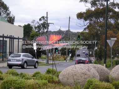
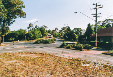
Photograph, Fay Bridge, Welcome Butterfly, Roundabout, Main Road and Luck Street, Eltham, 7 November 2016
... Welcome Butterfly, Roundabout, Main Road and Luck Street, Eltham...Eltham Copper) butterfly. The planned demonstartion by the far right was deflated by over 200 locals turning up and peacefully supporting the refugees with butterflies placed throughout parks, paths and roadways. This butterfly was created by Tim Read and Linda MacAulay was later relocated to the Judge Book Village Fay Bridge Collection 2016-11-07 Diamond Street Judge Book Village Luck Street Main Road Protests Syrian Refugees Welcome to Eltham Tim Read Linda MacAulay 1 image - born digital Welcome Butterfly, Roundabout, Main Road and Luck Street, Eltham Photograph Photograph Fay Bridge ...Plans by the Federal Government to temporarily settle 120 Christian Syrian refugees at the St Vincents facility in Diamond Street (Judge Book Village) brought out national protest by far right groups, many travelling intersate to demonstarte in Eltham against the settlement. Many locals stood up against these protesters, forming Welcome to Eltham, symbolised by the (Eltham Copper) butterfly. The planned demonstartion by the far right was deflated by over 200 locals turning up and peacefully supporting the refugees with butterflies placed throughout parks, paths and roadways. This butterfly was created by Tim Read and Linda MacAulay was later relocated to the Judge Book Village fay bridge collection, 2016-11-07, diamond street, judge book village, luck street, main road, protests, syrian refugees, welcome to eltham, tim read, linda macaulay -
 Eltham District Historical Society Inc
Photograph - Black and White Print, Intersection of Cherry Tree Road and Heidelberg-Kinglake Road, Hurstbridge, c.1988
... Eltham District Historical Society Inc 728 Main Rd Eltham melbourne Newly constructed roundabout https://maps.app.goo.gl/C6F5mbUnU8XpfSZHA 1988 Cherry Tree Road Heidelberg-Kinglake Road Hurstbridge Infrastructure Road construction Roundabout Marked "G 80%" Black and White print approx. 10 x 15 cm Originally housed in a 34.5 x 36 x 2.5 cm expandable album with padded cream covers and gold accents; 18 page inserts with clear pocket inserts holding 6 photos per side, total capacity 216 10 x 15 cm photo prints; showing yellowing with age Intersection of Cherry Tree Road and Heidelberg-Kinglake Road, Hurstbridge Photograph Black and White Print ...Newly constructed roundabout https://maps.app.goo.gl/C6F5mbUnU8XpfSZHAMarked "G 80%"1988, cherry tree road, heidelberg-kinglake road, hurstbridge, infrastructure, road construction, roundabout -
 Eltham District Historical Society Inc
Photograph - Black and White Print, Construction of roundabout at intersection of Merritts Road and Kangaroo Ground-St Andrews Road, Panton Hill, c.1988
... Eltham District Historical Society Inc 728 Main Rd Eltham melbourne Panton Hill Memorial Park in background on right 1988 Infrastructure Road construction Roundabout Kangaroo Ground-St Andrews Road Merritts Road Panton Hill Panton Hill Memorial Park Black and White print approx. 10 x 15 cm Originally housed in a 34.5 x 36 x 2.5 cm expandable album with padded cream covers and gold accents; 18 page inserts with clear pocket inserts holding 6 photos per side, total capacity 216 10 x 15 cm photo prints; showing yellowing with age Construction of roundabout at intersection of Merritts Road and Kangaroo Ground-St Andrews Road, Panton Hill Photograph Black and White Print ...Panton Hill Memorial Park in background on right1988, infrastructure, road construction, roundabout, kangaroo ground-st andrews road, merritts road, panton hill, panton hill memorial park -
 Eltham District Historical Society Inc
Photograph, Heidelberg-Kinglake Road, Hurstbridge; looking north east towards Kinglake
... Eltham District Historical Society Inc 728 Main Rd Eltham melbourne main street kinglake road heidelberg/kinglake road hurstbridge Two colour photographs taken near the location of the present roundabout intersection of Anzac Road (on right) and Arthurs Creek Road (on left) with the Heidelberg-Kinglake Road at Hurstbridge. [37�38'14.8"S 145�11'39.6"E -37.637459, 145.194322] Heidelberg-Kinglake Road, Hurstbridge; looking north east towards Kinglake Photograph ...Two colour photographs taken near the location of the present roundabout intersection of Anzac Road (on right) and Arthurs Creek Road (on left) with the Heidelberg-Kinglake Road at Hurstbridge. [37�38'14.8"S 145�11'39.6"E -37.637459, 145.194322]main street, kinglake road, heidelberg/kinglake road, hurstbridge -
 Eltham District Historical Society Inc
Photograph, Main Road, Panton Hill
... Eltham District Historical Society Inc 728 Main Rd Eltham melbourne main road st andrews road kangaroo ground/st andrews road bishops road roundabouts panton hill Colour photograph of Main Road Panton Hill showing roundabout at Bishops Road. ...Colour photograph of Main Road Panton Hill showing roundabout at Bishops Road.main road, st andrews road, kangaroo ground/st andrews road, bishops road, roundabouts, panton hill -
 Eltham District Historical Society Inc
Photograph, Main Road, Panton Hill
... Eltham District Historical Society Inc 728 Main Rd Eltham melbourne main road st andrews road kangaroo ground/st andrews road bishops road roundabouts panton hill Six colour photographs of Main Road Panton Hill showing Bishops Road roundabout Main Road, Panton Hill Photograph ...Six colour photographs of Main Road Panton Hill showing Bishops Road roundaboutmain road, st andrews road, kangaroo ground/st andrews road, bishops road, roundabouts, panton hill -
 Eltham District Historical Society Inc
Photograph, Main Road, Panton Hill
... Eltham District Historical Society Inc 728 Main Rd Eltham melbourne main road st andrews road kangaroo ground/st andrews road bishops road roundabouts panton hill Two colour photographs of Main Road Panton Hill showing Bishops Road roundabout Main Road, Panton Hill Photograph ...Two colour photographs of Main Road Panton Hill showing Bishops Road roundaboutmain road, st andrews road, kangaroo ground/st andrews road, bishops road, roundabouts, panton hill -
 Eltham District Historical Society Inc
Photograph, Main Road, Panton Hill
... Eltham District Historical Society Inc 728 Main Rd Eltham melbourne main road st andrews road kangaroo ground/st andrews road church road roger road roundabouts panton hill Two colour photographs of Main Road Panton Hill showing roundabout at Church Road/Roger Road intersection Main Road, Panton Hill Photograph ...Two colour photographs of Main Road Panton Hill showing roundabout at Church Road/Roger Road intersectionmain road, st andrews road, kangaroo ground/st andrews road, church road, roger road, roundabouts, panton hill -
 Eltham District Historical Society Inc
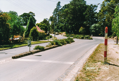
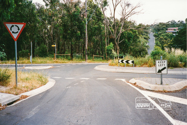
Photograph, Eucalyptus Road and Pitt Street/Nyora Road roundabout, Eltham
... Eltham District Historical Society Inc 728 Main Rd Eltham melbourne Looking north along Eucalyptus Road, showing roundabout at intersection of Pitt Street and Nyora Road, Eltham. ...Looking north along Eucalyptus Road, showing roundabout at intersection of Pitt Street and Nyora Road, Eltham. Parks Victoria owns and manages the Pauline Toner Eltham Copper Butterfly Reserve on the left of the image. Colour photographeucalyptus road, pitt street, nyora road, roundabouts, eltham, pauline toner eltham copper butterfly reserve, pauline toner butterfly nature conservation reserve -
 Eltham District Historical Society Inc
Photograph, Main Road, Research
... Three colour photographs of Main Road between Research and Eltham East; two showing the bike path looking tworads Eltham and one viewed from Warrandyte Road near the roundabout...Eltham District Historical Society Inc 728 Main Rd Eltham melbourne eltham east research main road research warrandyte road warrandyte road paths bike paths Three colour photographs of Main Road between Research and Eltham East; two showing the bike path looking tworads Eltham and one viewed from Warrandyte Road near the roundabout Main Road, Research Photograph ...Three colour photographs of Main Road between Research and Eltham East; two showing the bike path looking tworads Eltham and one viewed from Warrandyte Road near the roundabouteltham east, research, main road, research warrandyte road, warrandyte road, paths, bike paths -
 Eltham District Historical Society Inc
Photograph, Research-Warrandyte Road, Research
... Eltham District Historical Society Inc 728 Main Rd Eltham melbourne research research warrandyte road warrandyte road main road roundabouts Three colour photographs of Research-Warrandyte Road, Research including roundabout at Main Road Research-Warrandyte Road, Research Photograph ...Three colour photographs of Research-Warrandyte Road, Research including roundabout at Main Roadresearch, research warrandyte road, warrandyte road, main road, roundabouts -
 Eltham District Historical Society Inc
Photograph, Research Shops, Feb 1990, 1/2/90
... Eltham District Historical Society Inc 728 Main Rd Eltham melbourne main road research shops roundabouts Six colour photographs of Research Shopping Centre and precinct including roundabout at Ingrams Road Research Shops, Feb 1990 Photograph ...Six colour photographs of Research Shopping Centre and precinct including roundabout at Ingrams Roadmain road, research, shops, roundabouts -
 Eltham District Historical Society Inc
Photograph, Research Shops precinct
... Eltham District Historical Society Inc 728 Main Rd Eltham melbourne main road research ingrams road shops roundabouts Two colour photographs in the vicinity of Research Shops: 1. ...Two colour photographs in the vicinity of Research Shops: 1. At Main Road and Warrandyte Road roundabout looking south east towards the shops 2. At the north end of the shops at intersection of Raglan Road and Main Road looking north eastmain road, research, ingrams road, shops, roundabouts -
 Eltham District Historical Society Inc
Photograph, Kinglake near shops
... Eltham District Historical Society Inc 728 Main Rd Eltham melbourne kinglake kinglake whittlesea road hurstbridge road kinglake healesville road Three colour photographs showing the various road junctions near Kinglake shops. 1. St Andrews Road, Kinglake on left; Toolangi Road to left before roundabout ...Three colour photographs showing the various road junctions near Kinglake shops. 1. St Andrews Road, Kinglake on left; Toolangi Road to left before roundabout 2. Whittlesea Road on left with Kinglake Hotel 3.kinglake, kinglake whittlesea road, hurstbridge road, kinglake healesville road -
 Eltham District Historical Society Inc
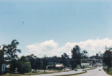
Document - Property Binder, Intersection of Main Road and Fitzsimons Lane, Eltham
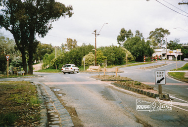
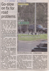
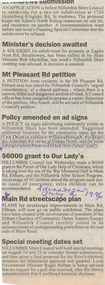
... Main Road...Eltham...Property...Fitzsimons Lane...Traffic...Edendale Community Farm...Eltham High School...Landscape...Major Road Projects Victoria...Porter Street...Roundabout...Main Road intersection. Main Road Eltham Property Fitzsimons Lane Traffic Edendale Community Farm Eltham High School Landscape Major Road Projects Victoria Porter Street Roundabout Yellow Box Gum Miscellaneous clippings, notes, photocopies, etc held on the subject property.. ...Newspaper article: Go-slow on fix for road problems, Diamond Valley Leader, 21 September 2005, covering delay re traffic problems Ironbark Road ,Yan Yean Road, Fitzsimons Lane, Main Road roundabout. Fitzsimons Lane Upgrade, Community Update, June 2022, Major Road Projects Victoria, includes detail on landscaping at Main Road intersection.main road, eltham, property, fitzsimons lane, traffic, edendale community farm, eltham high school, landscape, major road projects victoria, porter street, roundabout, yellow box gum -
 Eltham District Historical Society Inc
Document - Property Binder, 907 Main Road, Eltham
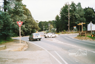
... (Other items include: St Andrews Submission Re application to subdivide 1726 Heidelberg-Kinglake Road; Minister's decision awaited - A six-eight lot subdivision at Eagles Nest Road, Strathewen; Mt Pleasant Rd petition - Need for a shared pathway; Policy on ad signs - Amended policy on advertising signs for community events; Main Rd streetscape plan - Plans for streetscape improvement in Main Road to go on display; Special meeting dates set - Special meetings to consider formal submissions and then adopt a final proposal for Shire's electoral structure for Ministerial approval and gazettal. Letter Eltham District Historical Society to Nillumbik Shire Council, 16 September 1996: Proposed roundabouts...Main Road Eltham at Dudley Street and Panther Place. Newspaper article: Diamond Valley News 16 October 1996, Pre-school welcomes plan for traffic lights. Main Road Eltham Property Roundabouts ...Newspaper article: $6000 grant to Our Lady's, The Advertiser, July 2, 1996 - Grant given to Parish of Our LadyHelp of Christians which is taking over the use of the Eltham War Memorial Hall in Main Road and the Nillumbik After School Program. (Other items include: St Andrews Submission Re application to subdivide 1726 Heidelberg-Kinglake Road; Minister's decision awaited - A six-eight lot subdivision at Eagles Nest Road, Strathewen; Mt Pleasant Rd petition - Need for a shared pathway; Policy on ad signs - Amended policy on advertising signs for community events; Main Rd streetscape plan - Plans for streetscape improvement in Main Road to go on display; Special meeting dates set - Special meetings to consider formal submissions and then adopt a final proposal for Shire's electoral structure for Ministerial approval and gazettal. Letter Eltham District Historical Society to Nillumbik Shire Council, 16 September 1996: Proposed roundabouts Main Road Eltham at Dudley Street and Panther Place. Newspaper article: Diamond Valley News 16 October 1996, Pre-school welcomes plan for traffic lights.main road, eltham, property, roundabouts, dudley street, panther place, eltham pre-school, eltham war memorial -
 Eltham District Historical Society Inc
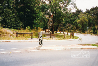
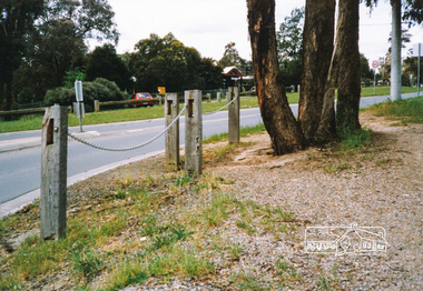
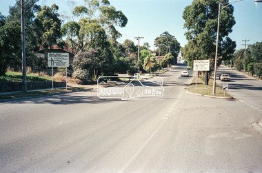
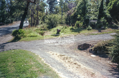
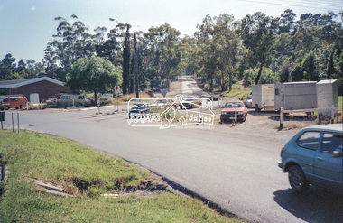
Negative - Photograph, Main Road, Eltham, c.Dec. 1983
... Eltham District Historical Society Inc 728 Main Rd Eltham melbourne Road sign advising of proposed reconstruction works of Main Road to install a roundabout at Mount Pleasant Road. ...Road sign advising of proposed reconstruction works of Main Road to install a roundabout at Mount Pleasant Road. Traffic to Lower Plenty and Templestowe to be diverted down Bridge Street (and Bolton Street) effective January 1984. The proposed roundabout did not proceed. Instead traffic islands on Mount Pleasant Road were installed in place of temporary blocked out islands.Film - Kodak CM 400 5079 7 strips, 26 framesinfrastructure, roads, road construction, roundabout, road sign, main road, mount pleasant road -
 Eltham District Historical Society Inc
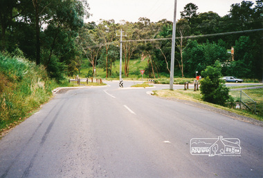
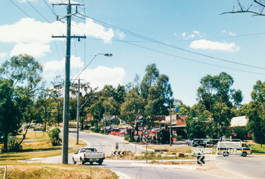
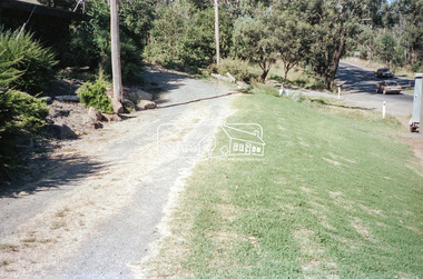
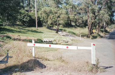
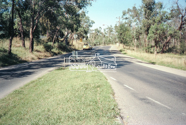
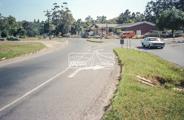
Negative - Photograph, Intersection of Mt Pleasant Road at Main Road, Eltham, c.Dec. 1983
... road construction...roundabout...road sign...main road...mount pleasant road...eltham...Eltham District Historical Society Inc 728 Main Rd Eltham melbourne Reconstruction work was planned for Main Road to install a roundabout at Mount Pleasant Road. ...Reconstruction work was planned for Main Road to install a roundabout at Mount Pleasant Road. Traffic to Lower Plenty and Templestowe to be diverted down Bridge Street (and Bolton Street) effective January 1984. The proposed roundabout did not proceed. Instead traffic islands on Mount Pleasant Road were installed in place of temporary blocked out islands and revised extended driveway to properties 622-642 Main Road with access off Mount Pleasant Road instead.Film - Kodak CM 400 5079 7 strips, 26 framesinfrastructure, roads, road construction, roundabout, road sign, main road, mount pleasant road, eltham -
 Eltham District Historical Society Inc
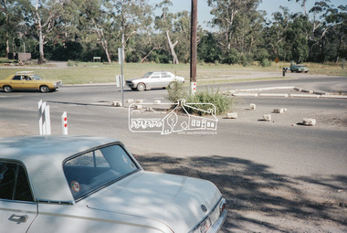
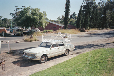
Negative - Photograph, Intersection of Mt Pleasant Road at Main Road, Eltham, c.Dec. 1983
... road construction...roundabout...road sign...main road...mount pleasant road...eltham...Eltham District Historical Society Inc 728 Main Rd Eltham melbourne Reconstruction work was planned for Main Road to install a roundabout at Mount Pleasant Road. ...Reconstruction work was planned for Main Road to install a roundabout at Mount Pleasant Road. Traffic to Lower Plenty and Templestowe to be diverted down Bridge Street (and Bolton Street) effective January 1984. The proposed roundabout did not proceed. Instead traffic islands on Mount Pleasant Road were installed in place of temporary blocked out islands and revised extended driveway to properties 622-642 Main Road with access off Mount Pleasant Road instead.Film - Kodak CM 400 5079 7 strips, 26 framesinfrastructure, roads, road construction, roundabout, road sign, main road, mount pleasant road, eltham, service station -
 Eltham District Historical Society Inc
Negative - Photograph, Intersection of Mt Pleasant Road at Main Road, Eltham, c.Dec. 1983
... road construction...roundabout...road sign...main road...mount pleasant road...eltham...Eltham District Historical Society Inc 728 Main Rd Eltham melbourne Reconstruction work was planned for Main Road to install a roundabout at Mount Pleasant Road. ...Reconstruction work was planned for Main Road to install a roundabout at Mount Pleasant Road. Traffic to Lower Plenty and Templestowe to be diverted down Bridge Street (and Bolton Street) effective January 1984. The proposed roundabout did not proceed. Instead traffic islands on Mount Pleasant Road were installed in place of temporary blocked out islands and revised extended driveway to properties 622-642 Main Road with access off Mount Pleasant Road instead.Film - Kodak CM 400 5079 7 strips, 26 framesinfrastructure, roads, road construction, roundabout, road sign, main road, mount pleasant road, eltham