
Showing 293 items matching "map box"
-
 Whitehorse Historical Society Inc.
Map, Map of Mont Albert, Box Hill, Surrey Hills and Blackburn, c 1933
... Map of Mont Albert, Box Hill, Surrey Hills and Blackburn...Map of Box Hill and Surrounds, showing location of Box Hill Grammar School....Maps Box Hill Grammar School Map of Box Hill and Surrounds, showing location of Box Hill Grammar School. ...Map of Box Hill and Surrounds, showing location of Box Hill Grammar School.Map of Box Hill and Surrounds, showing location of Box Hill Grammar School.Map of Box Hill and Surrounds, showing location of Box Hill Grammar School.maps, box hill grammar school -
 Flagstaff Hill Maritime Museum and Village
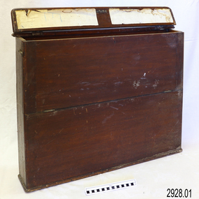
Container - Chart Case, Late 19th to early 20th centuries
... ...map box...box is built to keep the charts in order and easily accessible on board a vessel. The chart case is a rare example of a container used on board a vessel for the storage and protection of navigational charts. It represents the type of equipment used by the navigator of a seafaring vessel. The charts within the case represent the places to which the vessel travelled. flagstaff hill warrnambool shipwrecked coast flagstaff hill maritime museum maritime museum shipwreck coast flagstaff hill maritime village great ocean road map case chart case map box chart box british admiralty charts navigational charts hydrographer charts navigation ship equipment There is a hand written name on the back of the case. ...This case was donated along with the contents of over 60 navigational charts for locations all over the world. The narrow box is built to keep the charts in order and easily accessible on board a vessel. The chart case is a rare example of a container used on board a vessel for the storage and protection of navigational charts. It represents the type of equipment used by the navigator of a seafaring vessel. The charts within the case represent the places to which the vessel travelled.Chart case (or map case), wooden, has hinged opening at top. Front of case folds down and has a hook closure. It contained 65 British Admiralty navigational charts, which are listed and stored separately. (See separate items 2928.2 to 2928.66)There is a hand written name on the back of the case.flagstaff hill, warrnambool, shipwrecked coast, flagstaff hill maritime museum, maritime museum, shipwreck coast, flagstaff hill maritime village, great ocean road, map case, chart case, map box, chart box, british admiralty charts, navigational charts, hydrographer charts, navigation, ship equipment -
Whitehorse Historical Society Inc.
Document, Box Hill History Kit
... Contents include Brochures, First Box Hill Railway Time Table, copies of Box Hill & Doncaster Tramway Tram and old photos taken around Box Hill, Tom Roberts Artists' Camp, 1905 Map of Box Hill etc....Contents include Brochures, First Box Hill Railway Time Table, copies of Box Hill & Doncaster Tramway Tram and old photos taken around Box Hill, Tom Roberts Artists' Camp, 1905 Map of Box Hill etc....Contents include Brochures, First Box Hill Railway Time Table, copies of Box Hill & Doncaster Tramway Tram and old photos taken around Box Hill, Tom Roberts Artists' Camp, 1905 Map of Box Hill etc. ...Box Hill History Kit published by Box Hill Historical Society and Box Hill City Council.Box Hill History Kit published by Box Hill Historical Society and Box Hill City Council. Contents include Brochures, First Box Hill Railway Time Table, copies of Box Hill & Doncaster Tramway Tram and old photos taken around Box Hill, Tom Roberts Artists' Camp, 1905 Map of Box Hill etc.Box Hill History Kit published by Box Hill Historical Society and Box Hill City Council. box hill historical society, box hill city council -
Creswick Campus Historical Collection - University of Melbourne
Education kit - Booklet and set of maps, Forests Commission Victoria, A list of rare, very localised and endangered indigenous plants of Victoria, c.1982
... 1 Booklet and 29 maps in boxed set....1 Booklet and 29 maps in boxed set. Maps and Booklet A list of rare, very localised and endangered indigenous plants of Victoria Education kit Booklet and set of maps Forests Commission Victoria J.H. ...1 Booklet and 29 maps in boxed set.Maps and Booklet -
 Department of Energy, Environment and Climate Action
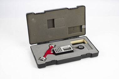
Planimeter (roller digital)
... Planimeter used to measure areas from scale maps. Includes box but no charger ...Knowing the scale of the mapsheet the figure was converted to areas or hectares Generally at least three measurements were taken to ensure accuracy and precision Forests Commission Victoria (FCV) Forest measurement Surveying Plancom KP90 Planimeter used to measure areas from scale maps. Includes box but no charger Planimeter (roller digital) ...The rollers move over the map as the tracing arm is used to follow the boundary to be measured. The wheels allow unlimited horizontal travel and vertical travel within the limits of the arm movement. They measure in the X and Y directions Reading from the digital scale the area in square centimetres could be measured. Knowing the scale of the mapsheet the figure was converted to areas or hectares Generally at least three measurements were taken to ensure accuracy and precisionPlanimeter used to measure areas from scale maps. Includes box but no charger Plancom KP90forests commission victoria (fcv), forest measurement, surveying -
Whitehorse Historical Society Inc.
Map, Box Hill in 1883, c1933
... Map of Box Hill in 1883 showing churches, hotels, etc, linked to ND4231 '1933 map'...Maps Box Hill Map of Box Hill in 1883 showing churches, hotels, etc, linked to ND 4231 '1933 map' Map of Box Hill in 1883 showing churches, hotels, etc, linked to ND4231 '1933 map' Box Hill in 1883 Map Map ...Map of Box Hill in 1883 showing churches, hotels, etc, linked to ND 4231 '1933 map'Map of Box Hill in 1883 showing churches, hotels, etc, linked to ND4231 '1933 map'Map of Box Hill in 1883 showing churches, hotels, etc, linked to ND 4231 '1933 map'maps, box hill -
Whitehorse Historical Society Inc.
Map, State Savings Bank of Victoria, 1921
... Map of Box Hill, Blackburn and Tunstall, 1921 from Australian Guide and Business Directory showing site of Box Hill branch of State Savings Bank of Victoria....Maps Box Hill Blackburn State Savings Bank of Victoria Map of Box Hill, Blackburn and Tunstall, 1921 from Australian Guide and Business Directory showing site of Box Hill branch of State Savings Bank of Victoria. ...Map of Box Hill, Blackburn and Tunstall, 1921 from Australian Guide and Business Directory showing site of Box Hill branch of State Savings Bank of Victoria.Map of Box Hill, Blackburn and Tunstall, 1921 from Australian Guide and Business Directory showing site of Box Hill branch of State Savings Bank of Victoria.Map of Box Hill, Blackburn and Tunstall, 1921 from Australian Guide and Business Directory showing site of Box Hill branch of State Savings Bank of Victoria.maps, box hill, blackburn, state savings bank of victoria -
City of Moorabbin Historical Society (Operating the Box Cottage Museum)
Document, leaflet Box Cottage Museum, Bambra Press Ltd, 2019
... Topics Box Cottage Museum, City of Moorabbin Historical Society, 1918 Chinese silk wedding dress, contact details, map, Box Family, Rietman Family, Land tenure records, Henry Dendy Special Survey 1841...Topics Box Cottage Museum, City of Moorabbin Historical Society, 1918 Chinese silk wedding dress, contact details, map, Box Family, Rietman Family, Land tenure records, Henry Dendy Special Survey 1841 Reprint 2019, Original print 2016 Leaflet/Brochure compiled by CMHS members for distribution to visitors, schools, local community to promote knowledge of Box Cottage Museum and early settlement in the Moorabbin area city of moorabbin, brighton, dendy henry, box william, box elizabeth, rietman august, rietman frieda, box cottage museum ormond, box alonzo, glen eira city council, city of moorabbin historical society, ormond, bentleigh, cheltenham bambra press Ltd port melbourne, Page 1 BOX COTTAGE MUSEUM Page 2 William & Elizabeth Box, Land, August Rietman & Family 1 x A4 glossy, colour, printed on both sides with photographs Document, leaflet Box Cottage Museum Bambra Press Ltd MKR Printing Ltd ...Reprint 2019 by Bambra Press Ltd; Original Print 2016 This Leaflet / Brochure was compiled by City of Moorabbin Historical Society members Carol Poole, Joan Moore, Fran Bader for distribution to visitors, schools, libraries and local community to promote knowledge of Box Cottage Museum and the early settlement in the Moorabbin area. Glen Eira City Council Community Grant 2016 was obtained to finance printing by MKR Printing Ltd. Carnegie. Topics Box Cottage Museum, City of Moorabbin Historical Society, 1918 Chinese silk wedding dress, contact details, map, Box Family, Rietman Family, Land tenure records, Henry Dendy Special Survey 1841Reprint 2019, Original print 2016 Leaflet/Brochure compiled by CMHS members for distribution to visitors, schools, local community to promote knowledge of Box Cottage Museum and early settlement in the Moorabbin area1 x A4 glossy, colour, printed on both sides with photographsPage 1 BOX COTTAGE MUSEUM Page 2 William & Elizabeth Box, Land, August Rietman & Familycity of moorabbin, brighton, dendy henry, box william, box elizabeth, rietman august, rietman frieda, box cottage museum ormond, box alonzo, glen eira city council, city of moorabbin historical society, ormond, bentleigh, cheltenham, bambra press ltd port melbourne, -
Creswick Campus Historical Collection - University of Melbourne
Equipment, Curvimeter
... For measuring distance of irregular line on maps. Cased in blue box with clear lid...For measuring distance of irregular line on maps. Cased in blue box with clear lid Equipment Curvimeter Equipment ...Steel tool with moving wheel attached to measurement dial. For measuring distance of irregular line on maps. Cased in blue box with clear lidEquipment -
 Department of Energy, Environment and Climate Action
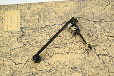
Planimeter (fixed arm)
... Planimeter used to measure areas from scale maps. Includes wooden box One revolution of the main wheel equaled 10 square inches. ...Knowing the scale of the mapsheet the figure was converted to areas or hectares Generally at least three measurements were taken to ensure accuracy and precision Forests Commission Victoria (FCV) Forest measurement Surveying Benalla Planimeter used to measure areas from scale maps. Includes wooden box One revolution of the main wheel equaled 10 square inches. ...The heavy weight is pinned onto the map and the tracing arm is used to follow the boundary to be measured Reading the number of revolutions from the two the scale wheels the area in square inches could be measured. Knowing the scale of the mapsheet the figure was converted to areas or hectares Generally at least three measurements were taken to ensure accuracy and precisionPlanimeter used to measure areas from scale maps. Includes wooden box One revolution of the main wheel equaled 10 square inches. A smaller rotating scale on the side was used to subdivide the area.Benallaforests commission victoria (fcv), forest measurement, surveying -
 Department of Energy, Environment and Climate Action
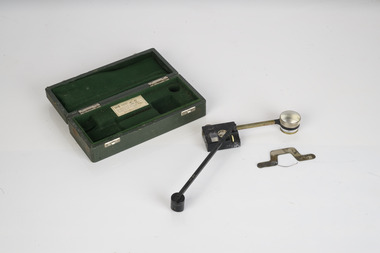
Planimeter (fixed arm)
... Planimeter used to measure areas from scale maps. Includes wooden box One revolution of the main wheel equaled 10 square inches. ...Knowing the scale of the mapsheet the figure was converted to areas or hectares Generally at least three measurements were taken to ensure accuracy and precision Forests Commission Victoria (FCV) Forest measurement Surveying Benalla Planimeter used to measure areas from scale maps. Includes wooden box One revolution of the main wheel equaled 10 square inches. ...The heavy weight is pinned onto the map and the tracing arm is used to follow the boundary to be measured Reading the number of revolutions from the two the scale wheels the area in square inches could be measured. Knowing the scale of the mapsheet the figure was converted to areas or hectares Generally at least three measurements were taken to ensure accuracy and precisionPlanimeter used to measure areas from scale maps. Includes wooden box One revolution of the main wheel equaled 10 square inches. A smaller rotating scale on the side was used to subdivide the area.Benallaforests commission victoria (fcv), forest measurement, surveying -
Tatura Irrigation & Wartime Camps Museum
Box of Maps, early 20th century
... Box containing maps of individual parishes in the county of Rodney, showing early selections. ...Also one of early Tatura townships with owners of many house blocks. 17 maps. Box of Maps Government Printers ...Maps are of the following: Toolamba (2), Toolamba West (2), Undera (2), North Murchison, Coomboona (2), Mooroopna, Waranga, Kyabram East, Girgarree East, Mooroopna West (2), Tatura and Goulburn irrigation district (pre 1956).Box containing maps of individual parishes in the county of Rodney, showing early selections. Also one of early Tatura townships with owners of many house blocks. 17 maps.each one is labelled with the parish (Toolamba, Tatura, , etc.) -
Whitehorse Historical Society Inc.
Map, Waverley, c1985
... Map of Waverley, including Box Hill Soiuth, Blackburn South, Vermont, Vermont South, Burwood East, Burwood, Ashburton, Mount Waverley, Glen Waverley, Oakleigh South, Clayton North and Mulgrave. ...Map of Waverley, including Box Hill Soiuth, Blackburn South, Vermont, Vermont South, Burwood East, Burwood, Ashburton, Mount Waverley, Glen Waverley, Oakleigh South, Clayton North and Mulgrave. ...Map of Waverley, including Box Hill Soiuth, Blackburn South, Vermont, Vermont South, Burwood East, Burwood, Ashburton, Mount Waverley, Glen Waverley, Oakleigh South, Clayton North and Mulgrave.Map of Waverley, including Box Hill Soiuth, Blackburn South, Vermont, Vermont South, Burwood East, Burwood, Ashburton, Mount Waverley, Glen Waverley, Oakleigh South, Clayton North and Mulgrave. UBD map issued by Nicholls Gledhill Real Estate Agents. Scale 1:50,000.Map of Waverley, including Box Hill Soiuth, Blackburn South, Vermont, Vermont South, Burwood East, Burwood, Ashburton, Mount Waverley, Glen Waverley, Oakleigh South, Clayton North and Mulgrave. blackburn south, burwood east, vermont, vermont south, forest hill -
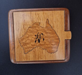 Tatura Irrigation & Wartime Camps Museum
Functional object - cigarette box
... Wooden cigarette box with map of Australia cut out of lid and inlayed with map of Australia in different wood. ...Karl Muffler cigarette case Tatura camp 1 K M Wooden cigarette box with map of Australia cut out of lid and inlayed with map of Australia in different wood. ...Made in Tatura internment camp 1 by Karl Muffler during WW2. Wooden cigarette box with map of Australia cut out of lid and inlayed with map of Australia in different wood. Base of case has rounded sides and a piece trimmed out for a catch on the lid. Lid, map of Australia and rest of cigarette case are made from 3 different types of wood. Map of Australia has a "K M" written on it. K Mkarl muffler, cigarette case, tatura camp 1 -
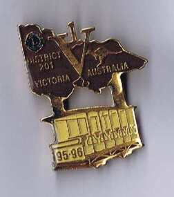 Melbourne Tram Museum
Ephemera - Badge, Douglas badges for Lions club District No. 201, 1995
... Badge - issued by the Lions District No. 201, Vic, featuring a map of Victoria with the letter V and number 1 included in the map, featuring a Box Hill toastrack style tramcar under the badge with the numbers 95-96 on the front of the tram. ...Trams tramways Box Hill Badges Lions club Badge - issued by the Lions District No. 201, Vic, featuring a map of Victoria with the letter V and number 1 included in the map, featuring a Box Hill toastrack style tramcar under the badge with the numbers 95-96 on the front of the tram. ...Badge - issued by the Lions District No. 201, Vic, featuring a map of Victoria with the letter V and number 1 included in the map, featuring a Box Hill toastrack style tramcar under the badge with the numbers 95-96 on the front of the tram. Gold badge with brown paint infill in the map of Victoria and a yellow paint infill on the tram finished with a gloss varnish. Has a pin clip on the rear with a locking mechanism. Made by Douglas batches of Melbourne - has their phone number on the rear.trams, tramways, box hill, badges, lions club -
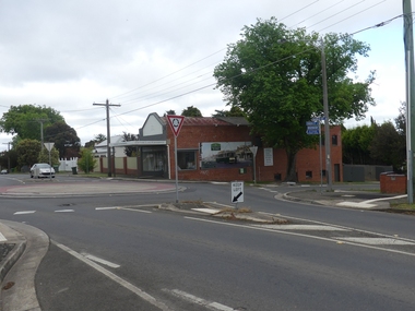 Ballarat Tramway Museum
Photograph - digital Images, Warren Doubleday
... Taken 12/11/2020 .1 - general view .2 - view of the main panel with interpretative panels. .3 and .4 - view of the interpretative panels with credits - includes photo turned into a mural by Bob Wilson. .5 - map panel .6 - pamphlet box....Taken 12/11/2020 .1 - general view .2 - view of the main panel with interpretative panels. .3 and .4 - view of the interpretative panels with credits - includes photo turned into a mural by Bob Wilson. .5 - map panel .6 - pamphlet box. Photograph digital Images Warren Doubleday ...Set of 6 digital images featured on the building on the south west corner of Barkly and Cobden Sts, the Mount Pleasant tram terminus. Taken 12/11/2020 .1 - general view .2 - view of the main panel with interpretative panels. .3 and .4 - view of the interpretative panels with credits - includes photo turned into a mural by Bob Wilson. .5 - map panel .6 - pamphlet box.trams, tramways, mount pleasant terminus, barkly st, history, heritage, interpretation -
Kew Historical Society Inc
Archive (Series) - Subject File, Kew Historical Society, Hawthorn (Vic) - History, 1958
... Some of the files were subsequently moved to other files or archive boxes including ‘Maps of Kew’ (archive file) and the newspaper collection (boxed newspapers). ...Some of the files were subsequently moved to other files or archive boxes including ‘Maps of Kew’ (archive file) and the newspaper collection (boxed newspapers). ...Various partiesReference, Research, InformationSecondary Values (KHS Imposed Order)Subject file containing typescripts relating to the early history of Hawthorn. The files were donated to the Society from the Preshil School archives. Some of the files were subsequently moved to other files or archive boxes including ‘Maps of Kew’ (archive file) and the newspaper collection (boxed newspapers). The files currently stored in this archive file include: Allen, J Alex, ‘The Red Lion Inn and Early Hawthorn’ (RHSV 1946), Serpell, TE, ‘Early History of Hawthorn’ (5pp), and Bonwick, J, ‘A Sketch of Boroondara’ (1858).hawthorn - history - 19th century, red lion inn, james bonwickhawthorn - history - 19th century, red lion inn, james bonwick -
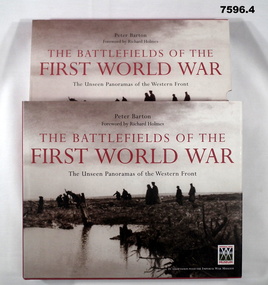 Bendigo Military Museum
Book - BOOK, WW1, PICTORIAL, Peter BARTON, "THE BATTLEFIELDS OF THE FIRST WORLD WAR", 2005
... Box with hard cover book, dust cover and two CD's. 1. Cover - cardboard, with adhered buckram, red colour, white print on spine. Dust cover - paper, with red, black and white print, front, spine and back. Illustrated, black and white photographs. Front cover - "German prisoners and wounded Canadians crossing the battlefield, Passchendaele 1917". Back cover - "Canadian soldiers carrying trench mats. Passchendaele". 376 pages, cut plain, white paper. Illustrated black and white, sepia and colour photographs, maps...Box with hard cover book, dust cover and two CD's. 1. Cover - cardboard, with adhered buckram, red colour, white print on spine. Dust cover - paper, with red, black and white print, front, spine and back. Illustrated, black and white photographs. Front cover - "German prisoners and wounded Canadians crossing the battlefield, Passchendaele 1917". Back cover - "Canadian soldiers carrying trench mats. Passchendaele". 376 pages, cut plain, white paper. Illustrated black and white, sepia and colour photographs, maps ...From front cover- "THE BATTLEFIELDS OF THE FIRST WORLD WAR". "The Unseen Panoramas of the Western front".Box with hard cover book, dust cover and two CD's. 1. Cover - cardboard, with adhered buckram, red colour, white print on spine. Dust cover - paper, with red, black and white print, front, spine and back. Illustrated, black and white photographs. Front cover - "German prisoners and wounded Canadians crossing the battlefield, Passchendaele 1917". Back cover - "Canadian soldiers carrying trench mats. Passchendaele". 376 pages, cut plain, white paper. Illustrated black and white, sepia and colour photographs, maps and diagrams. 2. Box for book - Cardboard, duplicate of print and photographs as per dust cover. Box is open one end. 3. & 4. CD's. - two, plastic CD's in clear plastic storage envelopes adhered to back and paper cardboard cover.books, ww1, pictorial -
 Ballarat Tramway Museum
Document - Report, Melbourne and Metropolitan Tramways Board (MMTB), MMTB Annual Reports 1977 to 1979, 1977 to 1979
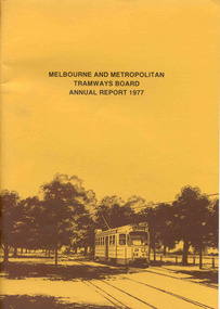
... Brennan, map of Bundoora extension, Box Hill tram, V214, vintage trams day 1979, MAN Bus, Swanston St at dusk and montage of painted W2's. ...Brennan, map of Bundoora extension, Box Hill tram, V214, vintage trams day 1979, MAN Bus, Swanston St at dusk and montage of painted W2's. ...Three copies of the Annual report of the MMTB for the years end 1977 to 1979. 3952.1 - "MMTB Annual Report 1977", brown card cover with a drawing of Z24 on the front cover, 24 pages, white paper, giving details of the MMTB Board, Officers, Introduction, Financial, Engineering, Industrial, Balance sheet, Summary of Income and Expenditure, Schedule of Debentures and Inscribed stock, auditors report, Schedule of tram and bus routes, and record of annual traffic receipts, passengers etc.. Photos include Z's in Bourke ST, after a heavy storm, new Volvo bus, display/advertising tram, Dandenong Rd, Route map board and Cathy Pacific advertisement. Printed by McCarron Bird. 3952.2 - "MMTB Annual Report 1978", gloss cover with a photo of Z18 in Wellington Parade on the front cover, 24 pages, white paper, giving details of the MMTB Board, Officers, Introduction, Financial, Engineering, Industrial, historical highlights, Balance sheet, Summary of Income and Expenditure, Schedule of Debentures and Inscribed stock, auditors report, Service Statistics, Schedule of tram and bus routes, and on inside back cover, route map. On back cover is a photo of Z20 in Wellington Parade. Photos include bus lane on Eastern Freeway, construction of Burwood Extension, first tram to Warragul Road, opening of Burwood tramway (1916), Volvo bus Bell St, upgraded computer installation, Volvo bus chassis, Z class bogie. Printed by McCarron Bird. 3952.3 - "MMTB Annual Report 1978-79", gloss card cover with a photo of Z 116 on the front cover, 24 pages, white paper, giving details of the MMTB Board, Officers, Introduction, Financial, Engineering, Industrial, historical highlights, Balance sheet, Summary of Income and Expenditure, Schedule of Debentures and Inscribed stock, auditors report, Service Statistics, Schedule of tram and bus routes, and on inside back cover, route map. On back cover is a photo of Z73, Nicholson St, Fitzroy. Photos include first tram on Burwood Extension, Volvo bus Westgate freeway, K. J. Brennan, map of Bundoora extension, Box Hill tram, V214, vintage trams day 1979, MAN Bus, Swanston St at dusk and montage of painted W2's. Printed by McCarron Bird.trams, tramways, mmtb, melbourne, annual reports, operations, trackwork -
 Flagstaff Hill Maritime Museum and Village
Functional object - Ditty Bag, Late 19th century
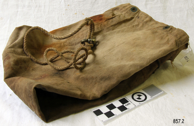
... box or bag in which a sailor kept his valuables such as letters, small souvenirs and sewing supplies. An item that is socially significant as it gives insight into a sailors life aboard ship and is another part of marine history. Items such as these although they were regarded at the time as everyday objects help us now to map ...A Ditty Bag (or box) was originally called “ditto bag” because it contained at least two of everything, two needles, two spools of thread, two buttons, etc. With the passing of years, the “ditto” was dropped in favour of "ditty" and remains so today. Before World War I, the Navy issued ditty boxes made of wood and styled after footlockers. These carried the personal gear and some clothes of the sailor. Today, the ditty bag is still issued to recruits and contains a sewing kit, toiletry articles and personal items such as writing paper and pens. Another source says a Ditty Box or Ditty Bag is possibly from the Saxon word “dite”, meaning tidy or from the English word “dittis”, a type of canvas material. A small box or bag in which a sailor kept his valuables such as letters, small souvenirs and sewing supplies.An item that is socially significant as it gives insight into a sailors life aboard ship and is another part of marine history. Items such as these although they were regarded at the time as everyday objects help us now to map various aspects of marine archaeology thorough the ages.Sailors Ditty Bag, canvas bag for holding all the sail making and roping tools, with tie and brass clasp. Holed.Noneflagstaff hill, warrnambool, shipwrecked-coast, flagstaff-hill, flagstaff-hill-maritime-museum, maritime-museum, shipwreck-coast, flagstaff-hill-maritime-village -
 Flagstaff Hill Maritime Museum and Village
Parallel Rule, 1947-1950
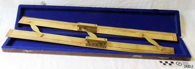
... It can therefor be assumed that this ruler was made during the company's transitional period to Kelvin & Hughes from Smith Industries Ltd. flagstaff hill warrnambool shipwrecked-coast flagstaff-hill flagstaff-hill-maritime-museum maritime-museum shipwreck-coast flagstaff-hill-maritime-village parallel rule kelvin & hughes ltd map ruler plot direction navigation maps echo sounder kelvin & james white lord kelvin baron kelvin of largs scientific instrument Rule inscribed on front "Kelvin & Hughes Ltd" " Made in Great Britain" Brass parallel rule in wooden box with blue felt lining. ...Navigators use parallel rule with maps and charts for plotting a specific course on a chart. One long edge is used with the compass rose on the chart, aligning the centre of the rose with the desired direction around the edge of the rose. The compass bars are then ‘walked’ in and out across the map to the desired location so that lines can be plotted to represent the direction to be travelled. Kelvin Company History: The origins of the company lie in the highly successful and strictly informal relationship between William Thomson (1824-1907), Professor of Natural Philosophy at Glasgow University from 1846-1899 and James White, a Glasgow optical maker. James White (1824-1884) founded the firm of James White, an optical instrument maker in Glasgow in 1850 and was involved in supplying and mending apparatus for Thomson university laboratory and working with him on experimental constructions. White was declared bankrupt in August 1861 and released several months later. In 1870, White was largely responsible for equipping William Thomson laboratory in the new University premises at Gilmore hill. From 1876, he was producing accurate compasses for metal ships to Thomson design during this period and this became an important part of his business in the last years of his life. He was also involved in the production of sophisticated sounding machinery that Thomson had designed to address problems encountered laying cables at sea, helping to make possible the first transatlantic cable connection. At the same time, he continued to make a whole range of more conventional instruments such as telescopes, microscopes and surveying equipment. White's association with Thomson continued until he died. After his death, his business continued under the same name, being administered by Matthew Edwards until 1891 when he left to set up his own company. Thomson who became Sir William Thomson and then Baron Kelvin of Largs in 1892, continued to maintain his interest in the business after James White's death in 1884, raising most of the capital needed to construct and equip new workshops in Cambridge Street, Glasgow. At these premises, the company continued to make the compass Thomson had designed during the 1870s and to supply it in some quantity, especially to the Admiralty. At the same time, the firm became increasingly involved in the design, production and sale of electrical apparatus. In 1899, Lord Kelvin resigned from his University chair and became, in 1900, a director in the newly formed limited liability company Kelvin & James White Ltd which had acquired the business of James White. At the same time Kelvin's nephew, James Thomson Bottomley (1845-1926), joined the firm. In 1904, a London branch office was opened which by 1915 had become known as Kelvin, White & Hutton Ltd. Kelvin & James White Ltd underwent a further change of name in 1913, becoming Kelvin Bottomley & Baird Ltd. Hughes Company History: Henry Hughes & Sons were founded in 1838 in London as a maker of chronographic and scientific instruments. The firm was incorporated as “Henry Hughes & Sons Ltd” in 1903. In 1923, the company produced its first recording echo sounder and in 1935 a controlling interest in the company was acquired by S Smith & Son Ltd resulting in the development and production of marine and aircraft instruments. Following the London office's destruction in the Blitz of 1941, a collaboration was entered into with Kelvin, Bottomley & Baird Ltd resulting in the establishing “Marine Instruments Ltd”. Following the formal amalgamation of Kelvin, Bottomley & Baird Ltd and Henry Hughes & Sons Ltd in 1947 to form Kelvin & Hughes Ltd. Marine Instruments Ltd then acted as regional agents in the UK for Kelvin & Hughes Ltd who were essentially now a part of Smith's Industries Ltd founded in 1944 and the successors of S Smith & Son Ltd. Kelvin & Hughes Ltd went on to develop various marine radar and echo sounders supplying the Ministry of Transport, and later the Ministry of Defence. The firm was liquidated in 1966 but the name was continued as Kelvin Hughes, a division of the Smiths Group. In 2002, Kelvin Hughes continues to produce and develop marine instruments for commercial and military. This model parallel map ruler is a good example of the commercial diversity of navigational instruments made by Kelvin & Hughes after World War II. It was made in numbers for use by shipping after the second world war and is not particularly rare or significant for it's type. Also it was made no earlier than 1947 as the firms of Kelvin, Bottomley & Baird Ltd and Henry Hughes & Sons Ltd who took over from Smith & Sons were not amalgamated until 1947. It can therefor be assumed that this ruler was made during the company's transitional period to Kelvin & Hughes from Smith Industries Ltd.Brass parallel rule in wooden box with blue felt lining.Rule inscribed on front "Kelvin & Hughes Ltd" " Made in Great Britain"flagstaff hill, warrnambool, shipwrecked-coast, flagstaff-hill, flagstaff-hill-maritime-museum, maritime-museum, shipwreck-coast, flagstaff-hill-maritime-village, parallel rule, kelvin & hughes ltd, map ruler, plot direction, navigation, maps, echo sounder, kelvin & james white, lord kelvin, baron kelvin of largs, scientific instrument -
 Federation University Historical Collection
Book, Guide for Prospectors in Victoria, 1931, 1931
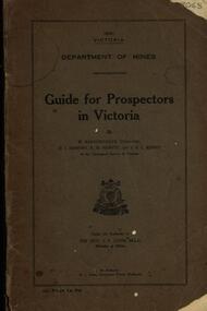
... The handbook was intended for those with little experience who wanted to prospect of fossick. mining baragwanath gold prospector geology quartz reefs alluvial deposits indicators victorian goldfields miners rights mining leases forest regulations sluicing sluice box puddling machine miner's cradle whim whip california pump gold nuggets saddle reef ballarat indicators state batteries Grey soft covered book of 90 pages. Includes fold out map ...The handbook was intended for those with little experience who wanted to prospect of fossick.Grey soft covered book of 90 pages. Includes fold out map of a portion of Victoria showing auriferous areas and mineral localities. Also show Counties of Victoria and localities of minerals such as tin, antimony, copper, silver lead, Malybdenite, tungsten ores, manganese, platinum, osmiridium and iron. Chapter heading s include: working alluvial deposits, equipment, geology of Victoria, gold deposits, quartz reefs, indicators, economic minerals, assistance to prospectors, Miners' Right, mining bye-law, mining leases, forest regulations and glossary. Descriptions are given of a god dish, puddling tub, cradle, puddling machine, ground sluicing, boring, windlass, whim, hand dollying, sweeping, California pump, and wing dam.mining, baragwanath, gold, prospector, geology, quartz reefs, alluvial deposits, indicators, victorian goldfields, miners rights, mining leases, forest regulations, sluicing, sluice box, puddling machine, miner's cradle, whim, whip, california pump, gold nuggets, saddle reef, ballarat indicators, state batteries -
 Ringwood and District Historical Society
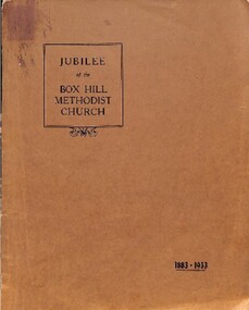
Book, Jubilee of the Box Hill Methodist Church 1883-1933
... Box Hill, 1937. CONTENTS. The Beginning - Trustees and Church Debts and Buildings The Depression and Church Union - The Curch Leads the Way Temperance The Sunday School The Ministers Local Preachers Organ and Choir Cheer-Up Brigade Progress and Change Foreign Missions Hospital Sunday Pew Rents Making Records Class Meeting and Endeavour Sport The Ladies Conclusion Tables Index Maps ...Box Hill, 1937. CONTENTS. The Beginning - Trustees and Church Debts and Buildings The Depression and Church Union - The Curch Leads the Way Temperance The Sunday School The Ministers Local Preachers Organ and Choir Cheer-Up Brigade Progress and Change Foreign Missions Hospital Sunday Pew Rents Making Records Class Meeting and Endeavour Sport The Ladies Conclusion Tables Index Maps Brown soft covered book with diagrams maps and photographs compiling information supplied or made available to the editors of the "Spectator", "Reporter" and "Woman's World" by Ministers and Officers of the churches at Richmond, Hawthorn and Auburn, Mr. ...Brown soft covered book with diagrams maps and photographs compiling information supplied or made available to the editors of the "Spectator", "Reporter" and "Woman's World" by Ministers and Officers of the churches at Richmond, Hawthorn and Auburn, Mr. R.A. Sutton, Mrs. A. Edgoose and Mr. J.R. Ellingworth and others who have helped with their memories of the past.Wholly set up and printeed in Australia by Reporter Print, Box Hill, 1937. CONTENTS. The Beginning - Trustees and Church Debts and Buildings The Depression and Church Union - The Curch Leads the Way Temperance The Sunday School The Ministers Local Preachers Organ and Choir Cheer-Up Brigade Progress and Change Foreign Missions Hospital Sunday Pew Rents Making Records Class Meeting and Endeavour Sport The Ladies Conclusion Tables Index Maps -
 Mission to Seafarers Victoria
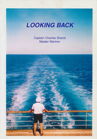
Book - Autobiography, Charles Shand, Looking Back, 2000
... . : ill. , 4 maps A small newspaper clipping about the death of Charles Shand was glued by the book donor and friend (Keith Oliver). The order of service from the Box.... : ill. , 4 maps A small newspaper clipping about the death of Charles Shand was glued by the book donor and friend (Keith Oliver). The order of service from the Box ...197 p. : ill. , 4 maps A small newspaper clipping about the death of Charles Shand was glued by the book donor and friend (Keith Oliver). The order of service from the Box Hill RSL was also found in the book.non-fictionww2, merchant navy, master mariner, captain charles shand (1915-2007), malta, patrick edward murphy, ned murphy -
 Bright & District Historical Society operating the Bright Museum
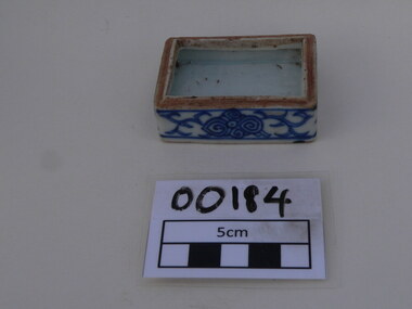
Box
... maps drawn by Aldo Gios also give more detail. This detail is rare, as most pieces of broken crockery were discarded and complete items were usually collected with no thought to recording the location they came from. Part of one of the largest collections of Chinese ware found in the Upper Ovens area and the only one recording the location where found. chinese box goldfields gios tableware glaze porcelain buckland Chinese porcelain square box, glazed, blue and white, tableware. ...Brought to the Ovens Goldfields by Chinese men working in the area in the 19th century. Most likely made in China.Aldo Gios recorded the location of where most of the pieces in this collection were found. Some maps drawn by Aldo Gios also give more detail. This detail is rare, as most pieces of broken crockery were discarded and complete items were usually collected with no thought to recording the location they came from. Part of one of the largest collections of Chinese ware found in the Upper Ovens area and the only one recording the location where found.Chinese porcelain square box, glazed, blue and white, tableware.chinese, box, goldfields, gios, tableware, glaze, porcelain, buckland -
 Marysville & District Historical Society
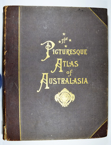
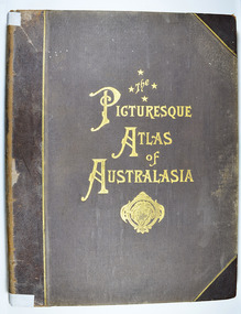
Book - Hardcover book, Picturesque Atlas Publishing Company Limited, The Picturesque Atlas of Australasia-Volume 2, 1886
... Box 22/ Marysville 3779 Hardcover. Cover is brown with the title in gold lettering. Underneath the title is a symbol of a solid wreath surrounding the head of a ram. Three fold-out maps ...The Picturesque Atlas of Australasia-Volume 2Hardcover. Cover is brown with the title in gold lettering. Underneath the title is a symbol of a solid wreath surrounding the head of a ram. Three fold-out maps are included; Railway Postal and Telegraph Map of South Australia, 1888; Railway Postal & Telegraph Map of Queensland, 1888; Railway, Postal, Telegraph and Rainfall Map of Tasmania 1889. non-fictionThe Picturesque Atlas of Australasia-Volume 2atlas, australasia, history -
 Marysville & District Historical Society
Book - Hardcover book, Picturesque Atlas Publishing Company Limited, The Picturesque Atlas of Australasia-Volume 3, 1886
... Box 22/ Marysville 3779 Hardcover. Cover is brown with the title in gold lettering. Underneath the title is a symbol of a solid wreath surrounding the head of a ram. A fold-out map ...The Picturesque Atlas of Australasia-Volume 3Hardcover. Cover is brown with the title in gold lettering. Underneath the title is a symbol of a solid wreath surrounding the head of a ram. A fold-out map is included; Railway Postal and Telegraph Map of the North Island of New Zealand, 1889. non-fictionThe Picturesque Atlas of Australasia-Volume 3atlas, australasia, history -
 Marysville & District Historical Society
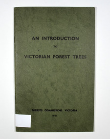
Book - Paperback book, An Introduction to Victorian Forest Trees, 1961
... Box 22 / Marysville 3779 Paperback. Cover is green with only the title on the front cover. On the inside back cover is a map of Victoria with the state forests indicated. ...A history of forestry in Victoria Paperback. Cover is green with only the title on the front cover. On the inside back cover is a map of Victoria with the state forests indicated.Stamp of Marysville & District / Historical Society Inc / P.O. Box 22 / Marysville 3779victoria, forestry, forest, trees -
 Marysville & District Historical Society
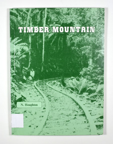
Book - Paperback book, Timber Mountain, 1986
... Box 22 / Marysville 3779 Paperback. Front cover has an old photograph of a timber railway leading into a forest. There is also a man standing at the side of the railway. In the inside back cover is a fold out map ...Paperback. Front cover has an old photograph of a timber railway leading into a forest. There is also a man standing at the side of the railway. In the inside back cover is a fold out map titled "Sawmills & Tramways of the Murrindindi Forest 1885-1950.Stamp of Marysville & District / Historical Society Inc / P.O. Box 22 / Marysville 3779history, sawmilling, murrindindi forest, victoria, north east victoria, houghton, n -
 Marysville & District Historical Society
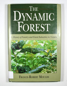
Book - Hardback book, The Dynamic Forest-A History of Forestry and Forest Industries in Victoria, 1991
... Box 22 / Marysville 3779 Hardback. Green dust cover with photograph of forest undergrowth. Front end paper shows a map of Victoria detailing forested and non-forested areas in the State of Victoria in the year 1869. ...A history of forestry and forest industries in VictoriaHardback. Green dust cover with photograph of forest undergrowth. Front end paper shows a map of Victoria detailing forested and non-forested areas in the State of Victoria in the year 1869. Back end paper shows a map of Victoria detailing forested and non-forested areas in the State of Victoria in the year 1987. To Jean, who bore the/ brunt of it all - and to/ Jan, Rob, Sue and Andy Stamp of the Marysville & District Historical Society Inc / P.O. Box 22 / Marysville 3779forests, forestry, forest products industry, victoria, history, moulds, francis robert
