Showing 3 items matching "mount stringy"
-
 Victorian Aboriginal Corporation for Languages
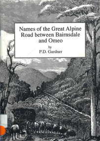
Book, P D Gardner, Names of the Great Alpine Road between Bairnsdale and Omeo : their origins, meanings and history, 1997
... ...Mount Stringy...Victorian Aboriginal Corporation for Languages 33 Saxon Street Brunswick melbourne Gunnai Kurnai Ngarigo Jaitmathang Brabiralung Tongiomunjie Tambo Tongio Bruthen Tambo Mount Stringy Swifts Creek Maps, b&w illustrations, b&w photographs Lists the place names along the Victorian Alps, with descriptions and meanings. ...Lists the place names along the Victorian Alps, with descriptions and meanings.Maps, b&w illustrations, b&w photographsgunnai, kurnai, ngarigo, jaitmathang, brabiralung, tongiomunjie, tambo, tongio, bruthen, tambo, mount stringy, swifts creek -
 Victorian Aboriginal Corporation for Languages
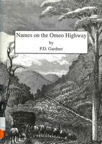
Book, P D Gardner, Names on the Omeo Highway between Bairnsdale and Omeo : their origins, meanings and history, 1992
... ...Mount Stringy...Victorian Aboriginal Corporation for Languages 33 Saxon Street Brunswick melbourne Gunnai Kurnai Brabiralung Jaitmathang Ngarigo Yuin Tongiomunjie Tongio Gap Bruthen Tambo Hells Gate Mount Stringy Doctors Flat Maps, b&w illustrations, b&w photographs An account of the origins and histories of local names between Bairnsdale and Omeo. ...An account of the origins and histories of local names between Bairnsdale and Omeo.Maps, b&w illustrations, b&w photographsgunnai, kurnai, brabiralung, jaitmathang, ngarigo, yuin, tongiomunjie, tongio gap, bruthen, tambo, hells gate, mount stringy, doctors flat -
 Ringwood and District Historical Society
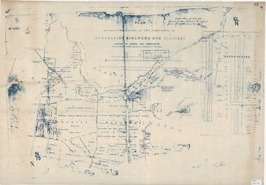
Map, Plan of Country Lands in the Parishes of Nunawading Ringwood and Scoresby - circa 1855
... Mount Dandenong Road. (*Cemetery did not eventuate.) Blueprint copy of Survey Map detailing original Selectors' names and property locations. List of Parish map references including property bearings, distances in Links, and markings on trees. Descriptive remarks include areas marked "Farmer's Common", "Poor soil thickly/moderately timbered with stringy ...Blueprint copy of Survey Map detailing original Selectors' names and property locations. List of Parish map references including property bearings, distances in Links, and markings on trees. Descriptive remarks include areas marked "Farmer's Common", "Poor soil thickly/moderately timbered with stringy bark", and location of water and firewood reserves."Surveyed and plotted by N.M. Bickford, Superintendant of Mr. Hodgkinson's Field Party". "The land comprised in this survey is of inferior quality, moderately undulating, and thickly wooded. It is watered by Dandenong Creek and Deep Creek." Inset map showing location of (*proposed) cemetery on southern corner of Lillydale Road from Melbourne and Sawmill Road, later Mount Dandenong Road. (*Cemetery did not eventuate.)