Showing 70 items matching "mountain trail"
-
 Eltham District Historical Society Inc
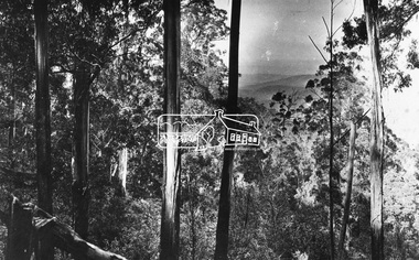
Negative - Photograph, Kinglake National Park; view from the Mountain Trail
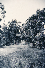
... Kinglake National Park; view from the Mountain Trail......mountain trail...It is significant in being the first community sourced collection representing the places and people of the Shire's first one hundred years. sepp shire of eltham pioneers photograph collection kinglake kinglake national park mountain trail Digital image 4 x 5 inch B&W Neg Kinglake National Park; view from the Mountain Trail Negative Photograph ...The Kinglake National Park was established on 11,300 acres in the Shire of Eltham in 1928.This photo forms part of a collection of photographs gathered by the Shire of Eltham for their centenary project book,"Pioneers and Painters: 100 years of the Shire of Eltham" by Alan Marshall (1971). The collection of over 500 images is held in partnership between Eltham District Historical Society and Yarra Plenty Regional Library (Eltham Library) and is now formally known as 'The Shire of Eltham Pioneers Photograph Collection.' It is significant in being the first community sourced collection representing the places and people of the Shire's first one hundred years.Digital image 4 x 5 inch B&W Negsepp, shire of eltham pioneers photograph collection, kinglake, kinglake national park, mountain trail -
 Eltham District Historical Society Inc
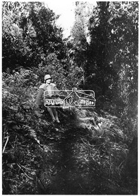
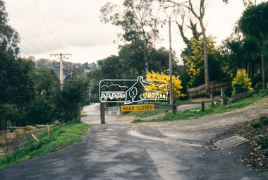
Photograph, Kinglake National Park; the Mountain Trail
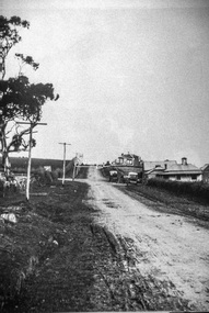
... Kinglake National Park; the Mountain Trail.......mountain trail...It is significant in being the first community sourced collection representing the places and people of the Shire's first one hundred years. sepp shire of eltham pioneers photograph collection kinglake kinglake national park mountain trail Digital image Kinglake National Park; the Mountain Trail. ...Source: Mrs. McMinn, Kinglake.This photo forms part of a collection of photographs gathered by the Shire of Eltham for their centenary project book,"Pioneers and Painters: 100 years of the Shire of Eltham" by Alan Marshall (1971). The collection of over 500 images is held in partnership between Eltham District Historical Society and Yarra Plenty Regional Library (Eltham Library) and is now formally known as the 'The Shire of Eltham Pioneers Photograph Collection.' It is significant in being the first community sourced collection representing the places and people of the Shire's first one hundred years.Digital imagesepp, shire of eltham pioneers photograph collection, kinglake, kinglake national park, mountain trail -
 Eltham District Historical Society Inc
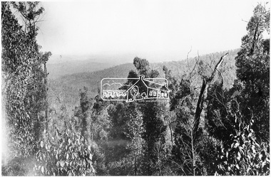
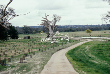
Photograph, View from the Mountain Trail, Kinglake
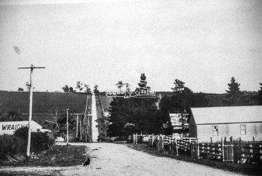
... View from the Mountain Trail, Kinglake.......mountain trail...It is significant in being the first community sourced collection representing the places and people of the Shire's first one hundred years. sepp shire of eltham pioneers photograph collection kinglake mountain trail Digital image View from the Mountain Trail, Kinglake. ...Source: Mrs. McMinn, KinglakeThis photo forms part of a collection of photographs gathered by the Shire of Eltham for their centenary project book,"Pioneers and Painters: 100 years of the Shire of Eltham" by Alan Marshall (1971). The collection of over 500 images is held in partnership between Eltham District Historical Society and Yarra Plenty Regional Library (Eltham Library) and is now formally known as the 'The Shire of Eltham Pioneers Photograph Collection.' It is significant in being the first community sourced collection representing the places and people of the Shire's first one hundred years.Digital imagesepp, shire of eltham pioneers photograph collection, kinglake, mountain trail -
 Eltham District Historical Society Inc
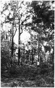
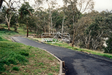
Photograph, Parking Avenue, The Mountain Trail, Kinglake
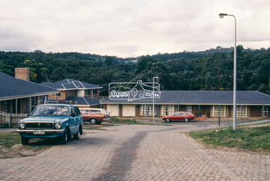
... Parking Avenue, The Mountain Trail, Kinglake.......mountain trail...It is significant in being the first community sourced collection representing the places and people of the Shire's first one hundred years. sepp shire of eltham pioneers photograph collection kinglake mountain trail parking avenue Digital image Parking Avenue, The Mountain Trail, Kinglake. ...Source: Mrs. McMinn, KinglakeThis photo forms part of a collection of photographs gathered by the Shire of Eltham for their centenary project book,"Pioneers and Painters: 100 years of the Shire of Eltham" by Alan Marshall (1971). The collection of over 500 images is held in partnership between Eltham District Historical Society and Yarra Plenty Regional Library (Eltham Library) and is now formally known as the 'The Shire of Eltham Pioneers Photograph Collection.' It is significant in being the first community sourced collection representing the places and people of the Shire's first one hundred years.Digital imagesepp, shire of eltham pioneers photograph collection, kinglake, mountain trail, parking avenue -
 Eltham District Historical Society Inc
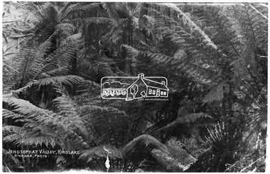
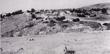
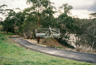
Photograph, Kinglake National Park; view from the Mountain Trail
... Kinglake National Park; view from the Mountain Trail...It is significant in being the first community sourced collection representing the places and people of the Shire's first one hundred years. sepp shire of eltham pioneers photograph collection kinglake kinglake national park view bush ferns Jehosophat Digital image Kinglake National Park; view from the Mountain Trail Photograph Photograph ...Kinglake National Park was established in 1928 on 11,300 acres in the Shire of Eltham. Jehosophat Valley was named by the Hotelier Frank Thomson's father, who was so struck with the grandeur of the valley in all its pristine beauty that he 'ejaculated the word Jehosophat.'This photo forms part of a collection of photographs gathered by the Shire of Eltham for their centenary project book,"Pioneers and Painters: 100 years of the Shire of Eltham" by Alan Marshall (1971). The collection of over 500 images is held in partnership between Eltham District Historical Society and Yarra Plenty Regional Library (Eltham Library) and is now formally known as 'The Shire of Eltham Pioneers Photograph Collection.' It is significant in being the first community sourced collection representing the places and people of the Shire's first one hundred years.Digital imagesepp, shire of eltham pioneers photograph collection, kinglake, kinglake national park, view, bush, ferns, jehosophat -
 Falls Creek Historical Society
Clothing - Cycling Shirt - McKayos Mountain Bike Ride, 2016
... During Jo's tenure, the resort made significant investments in mountain bike trails, aiming to activate the village during the summer months and support local businesses. ...During Jo's tenure, the resort made significant investments in mountain bike trails, aiming to activate the village during the summer months and support local businesses. ...In 2015, the Marketing, Events, and Operations teams at Falls Creek launched McKayos—a bold, one-of-a-kind race designed to showcase the resort's trails to winter visitors. Inspired by the legendary Megavalanche in the French Alps, McKayos was a mass-start descent from the summit of Mt McKay (1,850m) to the edge of Lake Bogong, over 1,200m below. Riders tackled snow, village roads, fire trails, and singletrack across an 18km course. With the support of the Lift Company, competitors and bikes were transported up the Falls Express chairlift before climbing to the summit start line. In later years, the race began at the Ski Patrol base. Held for five consecutive years, McKayos grew to attract up to 450 participants, cementing itself as a legendary event in Australian mountain biking history. This shirt is from the 2016 event when the winners were:- Open Men: Paul van der Ploeg (1st), Sebastian Jayne (2nd). Women: Lisa Brydon (1st), Julia Clark (2nd) Junior Men: Ben McIlroy (1st) Casey Griska (2nd) Jo Prothero, Director of Marketing for Falls Creek Resort Management from 2012 to 2019, generously donated two mountain bike jerseys that capture a pivotal era in the resort's history. During Jo's tenure, the resort made significant investments in mountain bike trails, aiming to activate the village during the summer months and support local businesses. This development included appointing Blue Dirt as the resort's first shuttle operator, transporting riders from Howman's Gap to the Summit.This shirt is significant because it represents an important and innovative event held at Falls Creek Victoria.A green and gold cyclist shirt featuring the logo of the McKayos Mountain Bike Ride. It also has a mountain bike on the front in black. The Mckayos logo in on the upper left. The back features the words SNOW, DIRT, ROAD as well as sponsors' logos and "Falls Creek Victoria and the manufacturer, Sacul Sportswear of Mount Beauty, Victoria. McKayos is on the right sleeve and 2016 is on the left sleeve.mckayos mountain bike ride, falls creek activities, falls creek victoria -
 Falls Creek Historical Society
Clothing - Shirt Falls Creek Mountain Bike Park Crew
... During Jo's tenure, the resort made significant investments in mountain bike trails, aiming to activate the village during the summer months and support local businesses. ...During Jo's tenure, the resort made significant investments in mountain bike trails, aiming to activate the village during the summer months and support local businesses. ...The Falls Creek Mountain Bike Park opened in 2013 with 40 kilometres of trails in the Victorian Alpine National Park. Designed and built by World Trail, the bike trails provide access to beautiful alpine terrain. The rides now extend over more than 50 kilometres, catering for a range of abilities and providing activities in the summer season. All trails start and finish in the resort. The high-altitude trails of Falls Creek include a range of wide gravel roads to winding single trails. The graded trails include rides to the Rocky Valley Lake, historic cattlemen’s huts such as Cope Hut and Wallaces Hut, the top of Mt McKay, Pretty Valley Lake and for the experts the ride to Mt Nelse and the Spion Kopje summit. MTB Bike Patrol Top To ensure rider safety, Falls Creek Resort introduced a Bike Patrol service during shuttle operating hours. Many Ski Patrol members transitioned into these roles, offering riders peace of mind that medical care was available quickly if needed. The program highlighted the resort's commitment to duty of care and to growing mountain biking responsibly. This shirt was designed by Australian Company Dharco as a highly visible uniform for crew at the Falls Creek Mountain Bike Park. Jo Prothero, Director of Marketing for Falls Creek Resort Management from 2012 to 2019, generously donated two mountain bike jerseys that capture a pivotal era in the resort's history. During Jo's tenure, the resort made significant investments in mountain bike trails, aiming to activate the village during the summer months and support local businesses. This development included appointing Blue Dirt as the resort's first shuttle operator, transporting riders from Howman's Gap to the Summit.This shirt is significant as it is representative of the Falls Creek Mountain Bike Park development.A uni-sex style shirt designed to be worn by mountain bike crews in Falls Creek, Victoria. It has multi-coloured panels of black, orange, yellow and grey. It features an image of a mountain biker descending a slope on the front along with the manufacturer's name. Sponsors' logos also feature across the lower backOn front: PARK CREW/ DHARCO On back: Falls Creek Mountain Bike Park On both sleeves: PARK CREWfalls creek mountain bike park, falls creek staff uniform -
 Kiewa Valley Historical Society
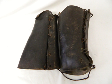
Gaiters Riding, Late 19th Century
... mountain slopes. Small settlements such as Mount Beauty, Bogong village and Falls Creek provided a secure backdrop for short term horse back adventures. The increasing pressure of city life provided a greater flow of stressed out city dweller to find the peace and quiet that city life does not have. Horse riding preceded the modern trail ...These gaiters where used circa 1800's to mid 1900's, by horse riders "cattle men" to protect their shins and long trousers against wear and tear. They were used rather than having expensive boots damaged. Gaiters were a lot easier to fasten and clean than boots. They were used in the Kiewa Valley and the High Plains grazing areas.These gaiters were part of a cattleman's "out fit". The Gaiters were easily cleaned and did away with expensive riding boots. They were used throughout the valley and high plains areas both by horse riders herding cattle and the recreational rider of both sexes. After the 1950s more recreational riders from Melbourne ventured onto the high plains and not so rugged mountain slopes. Small settlements such as Mount Beauty, Bogong village and Falls Creek provided a secure backdrop for short term horse back adventures. The increasing pressure of city life provided a greater flow of stressed out city dweller to find the peace and quiet that city life does not have. Horse riding preceded the modern trail bikes and other recreational vehicles of the late 1900s. Thick leather tapered gaiters with six metal Hooks and Leather lacing through metal eyelets. All bar two eyelets have a metal reinforced punch holes. Left gaiter missing most of lacing.horse, country, leather, gaiters, high, grazing, cattlemen, laces, studs -
 Marysville & District Historical Society... trail under review...grand opening labour day weekend...maryton park b & b...madrats...lake mountain...Marysville & District Historical Society 39 Darwin Street Marysville yarra-valley-and-the-dandenong-ranges marysville victoria australia murrindindi shire heritage study adopted marysville tree works what's on when in march the committee of management of the gallipoli park precinct triangle garden club marysville primary school parents club agm town meeting narbethong community hall narbethong progress assocn villains player registration day preparing for easter 2012 church notices mops agm marysville preschool duck race el kanah's open weekend advertisements adventurous cooks kim's kitchen closed marysville pharmacy the 3 tenors show breast screening mobile service mayor's chair historic bridge saved murrindindi shire council breakaway bridge marysville & district sesquicentenary celebrations villains 2012 season launch services review community information sessions marysville golf report marysville real estate long lunch undercover taggerty trail under review grand opening labour day weekend maryton park b & b madrats lake mountain music festival ...marysville, victoria, australia, murrindindi shire heritage study adopted, marysville tree works, what's on when in march, the committee of management of the gallipoli park precinct, triangle garden club, marysville primary school parents club agm, town meeting narbethong community hall, narbethong progress assocn, villains player registration day, preparing for easter 2012, church notices, mops agm, marysville preschool duck race, el kanah's open weekend, advertisements, adventurous cooks, kim's kitchen closed, marysville pharmacy, the 3 tenors show, breast screening mobile service, mayor's chair, historic bridge saved, murrindindi shire council, breakaway bridge, marysville & district sesquicentenary celebrations, villains 2012 season launch, services review community information sessions, marysville golf report, marysville real estate, long lunch undercover, taggerty trail under review, grand opening labour day weekend, maryton park b & b, madrats, lake mountain music festival
 -
Marysville & District Historical Society
THE TRIANGLE NEWS-VOL 39 NO 26-JULY 13 2012
... trail...rising power and gas bills...marysville pharmacy...marysville medical clinic...mayor's chair...adventurous cooks...marysville community golf & bowls club...trivia and pasta...intrepid triangle bushwalkers...sample wines...alexandra library...midnight express dance...taggerty hall...alexandra cinema...real estate...council's rating review strategy...yea council chambers...lake mountain...Marysville & District Historical Society 39 Darwin Street Marysville yarra-valley-and-the-dandenong-ranges marysville victoria australia loan subsidies still on offer for marysville & triangle marysville & triangle investment subsidary for affected bushfire areas regional arts fund steel pan bands receiving funding for international festivals what's on when in july the committee of management of the gallipoli park precinct marysville community market creative triangle murrindindi shire council shire tennis club growth support alexandra junior soccer club advertisements vale stephen franzi-ford church notices parkinsons victoria ambassadors of hope marysville golf report goulburn river high country rail trail rising power and gas bills marysville pharmacy marysville medical clinic mayor's chair adventurous cooks marysville community golf & bowls club trivia and pasta intrepid triangle bushwalkers sample wines alexandra library midnight express dance taggerty hall alexandra cinema real estate council's rating review strategy yea council chambers lake mountain alpine resort ann thoma 1995 reflections on history marysville & district historical society national emergency medal nominations marysviile steel band festival 2013 THE TRIANGLE NEWS-VOL 39 NO 26-JULY 13 2012 ...marysville, victoria, australia, loan subsidies still on offer for marysville & triangle, marysville & triangle investment subsidary for affected bushfire areas, regional arts fund, steel pan bands receiving funding for international festivals, what's on when in july, the committee of management of the gallipoli park precinct, marysville community market, creative triangle, murrindindi shire council, shire tennis club growth support, alexandra junior soccer club, advertisements, vale stephen franzi-ford, church notices, parkinsons victoria ambassadors of hope, marysville golf report, goulburn river high country rail trail, rising power and gas bills, marysville pharmacy, marysville medical clinic, mayor's chair, adventurous cooks, marysville community golf & bowls club, trivia and pasta, intrepid triangle bushwalkers, sample wines, alexandra library, midnight express dance, taggerty hall, alexandra cinema, real estate, council's rating review strategy, yea council chambers, lake mountain alpine resort, ann thoma 1995 reflections on history, marysville & district historical society, national emergency medal nominations, marysviile steel band festival 2013 -
Marysville & District Historical Society
THE TRIANGLE NEWS-VOL 5 NO 30-OCTOBER 3 1980
... mountain views...happy birthday...think it over...bowls opening...betty's competition...jewellery for christ church stall...ladies' guild...birth...wirreanda-melbourne trail...Marysville & District Historical Society 39 Darwin Street Marysville yarra-valley-and-the-dandenong-ranges marysville victoria australia planned district brochure marysville golf club photographer mountain views happy birthday think it over bowls opening betty's competition jewellery for christ church stall ladies' guild birth wirreanda-melbourne trail riding club ruby anniversary wirrianda appaloosa stud blue hills riding school north east poultry for sale senior citizens bush wackers ball marysville newsagency liberal party dinner marysville swimming & life saving club marysville primary school cricket club community care centre wirreanda parade footy poem new walking group THE TRIANGLE NEWS-VOL 5 NO 30-OCTOBER 3 1980 ...marysville, victoria, australia, planned district brochure, marysville golf club, photographer, mountain views, happy birthday, think it over, bowls opening, betty's competition, jewellery for christ church stall, ladies' guild, birth, wirreanda-melbourne trail riding club, ruby anniversary, wirrianda appaloosa stud, blue hills riding school, north east poultry, for sale, senior citizens, bush wackers ball, marysville newsagency, liberal party dinner, marysville swimming & life saving club, marysville primary school, cricket club, community care centre, wirreanda parade, footy poem, new walking group -
 Bendigo Historical Society Inc.
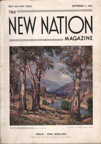
Magazine - AILEEN AND JOHN ELLISON COLLECTION: THE NEW NATION MAGAZINE
... Benetter)- The British commonwealth of Nations - Switzerland, land of lakes and mountains (by Hilary lofting) - Highways of the Syrian desert (by Francis Birtles) - Seven ages of the Australian aboriginal - The game of the empire, the approaching cricket test matches (by M. A. Noble) - Short story, the last run (by H. H. Cardinal) - "The hidden bird" (by E. M. England) - North Australia trails...Benetter)- The British commonwealth of Nations - Switzerland, land of lakes and mountains (by Hilary lofting) - Highways of the Syrian desert (by Francis Birtles) - Seven ages of the Australian aboriginal - The game of the empire, the approaching cricket test matches (by M. A. Noble) - Short story, the last run (by H. H. Cardinal) - "The hidden bird" (by E. M. England) - North Australia trails ...The New Nation Magazine Sept. Oct. Nov. Issue. September 1, 1932. On the front cover a painting "The Murrumbidgee River by J. R. Jackson. Price 1 shilling the magazine has 112 pages, the last two pages are ripped and the back cover is missing. Contents: Frontispiece "morning of the dogger bank" (by T. Benetter)- The British commonwealth of Nations - Switzerland, land of lakes and mountains (by Hilary lofting) - Highways of the Syrian desert (by Francis Birtles) - Seven ages of the Australian aboriginal - The game of the empire, the approaching cricket test matches (by M. A. Noble) - Short story, the last run (by H. H. Cardinal) - "The hidden bird" (by E. M. England) - North Australia trails ( by C. Price Conigrave) - Tales of the turf Fred Archer (by S. A. Marden) - The wide world round - Cape Horn (by J. Newman Barker) - "The home in the clearing" (by Sydney long) - Whitsunday passage (by Henry G. Lamond) - Old bridges (by J. L. Ranken) - The city of the longest drink (by A. C. Cummins) - The life of the cuckoo (by M. S.) - Radio - The world of music (by A. L. Kelly) - The world of women (by E. G. Manby Suttor) - Shopping from an easy chair - The Australian wool trade - Our verse farm - My wool clip (by H. W. Wright) - Windjammer days (by Gerald M. Moody) - Quarterly review of the stock and meat industry (by J. B. Cramsie) - New Zealand letter - At ye booksellers today - A number of things - The modern home - Portland cement - The good housewife (by E. G. Manby Suttor) - Cousin Shirley.book, magazine, the new nation -
 The Beechworth Burke Museum
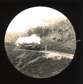
Photograph - Lantern Slide, c1900
... Burke Museum Beechworth Lantern Slide Slide Glass Slide Plate Burke Museum Collection Photograph Monochrome indigo shire north-east victoria rail trail beechworth rail trail beechworth station everton wangaratta wodonga albury rail transport cargo transport g.b. kerferd john orr murray to mountains rail trail cycling biking railway Thin translucent sheet of glass with a circular image printed on the front and framed in a black backing. ...This slide shows a train proceeding along the Beechworth rail trail in approximately 1900. The rail line to Beechworth was the subject of significant lobbying by local officials such as John Orr and G.B. Kerferd in the 1860s, as it was recognised that the poor quality of roads to Melbourne and Albury hindered trade and formed a barrier to the social development of the town. The subsequent positioning of Beechworth on a branch rather than a main line was not considered ideal to achieve these aims, but the Everton-to-Beechworth and Beechworth-to-Yackandandah components of the line cost an average of £7,277 per mile and State Government officials felt the need in the area did not justify the cost of a direct line. The Beechworth Railway Station was officially opened on the 29th of September 1876 and ran services twice daily to Melbourne, transporting nearly 12,000 passengers and around 6,500 tons of cargo in 1900. It closed in 1976 and is today used as a cycling trail used by locals and promoted as a feature of the area to tourists. Lantern slides, sometimes called 'magic lantern' slides, are glass plates on which an image has been secured for the purpose of projection. Glass slides were etched or hand-painted for this purpose from the Eighteenth Century but the process became more popular and accessible to the public with the development of photographic-emulsion slides used with a 'Magic Lantern' device in the mid-Nineteenth Century. Photographic lantern slides comprise a double-negative emulsion layer (forming a positive image) between thin glass plates that are bound together. A number of processes existed to form and bind the emulsion layer to the base plate, including the albumen, wet plate collodion, gelatine dry plate and Woodburytype techniques. Lantern slides and magic lantern technologies are seen as foundational precursors to the development of modern photography and film-making techniques.This glass slide is significant because it provides insight into Beechworth's social amenities and transport infrastructure in the late Nineteenth Century. It is also an example of an early photographic and film-making technology in use in regional Victoria in the time period.Thin translucent sheet of glass with a circular image printed on the front and framed in a black backing. It is held together by metal strips to secure the edges of the slide.burke museum, beechworth, lantern slide, slide, glass slide, plate, burke museum collection, photograph, monochrome, indigo shire, north-east victoria, rail trail, beechworth rail trail, beechworth station, everton, wangaratta, wodonga, albury, rail transport, cargo transport, g.b. kerferd, john orr, murray to mountains rail trail, cycling, biking, railway -
 The Beechworth Burke Museum
Photograph - Photograph - Reproduction, ca. 1900
... mountain mining company...spring creek...netwown falls...mining tunnels...water races...tailraces...colonial australia...australian gold rushes...mining technology...beechworth historic district...indigo gold trail...The shift from smaller scale alluvial mining to larger company dominance in the mining industry has implications for understanding wider social, economic, political and industrial changes in the region of Beechworth and within the context of the Victorian Gold Rush more broadly. burke museum beechworth museum beechworth gold fields gold rush victorian gold rush hydraulic sluicing rocky mountain mining company spring creek netwown falls mining tunnels water races tailraces colonial australia australian gold rushes mining technology beechworth historic district indigo gold trail migration indigo shire gold mining gold mining history A black and white rectangular reproduction photograph printed on photographic paper. ...This image shows the approach to Beechworth from the south-west via the Newtown Bridge. Numerous early buildings line the road as it bifurcates to become Ford and High Streets on the ridge above Spring Creek and Newtown Falls. The sloping, rocky terrain and water course along the gorge show evidence of the intense mining activity that occurred at the site. The Ovens Gold Rush at Beechworth started when gold was found at Spring Creek in February 1852, prompting an influx of miners from around the world. The population grew over 20,000 by 1857. While the earliest mining at Beechworth was similar to that in other Victorian goldfields like Ballarat and Bendigo, Beechworth is notable for its use of hydraulic sluicing as a major method of removing wash-dirt. Hydraulic sluicing employs high pressure jets of water to blast away large areas of earth and wash it down to be run through a sluice box. Gold gets caught in the sluice and the remaining slurry is washed away. This method of mining is extremely effective but causes significant environmental impacts and damage to waterways. Large water quantities were required for large-scale sluicing, and the long water races and deep tailraces that were constructed in the Beechworth area in the nineteenth century are nonetheless considered feats of engineering. The site in the photograph is associated with the Rocky Mountain Mining Company who constructed an eight hundred meter tunnel under the township between 1876-1880 to reduce water levels at Spring Creek, which had been subject to diversions since the earliest days of alluvial mining. Over four million ounces of gold (115 tones) were found at Beechworth between 1852 and 1868, and the wealth from the gold rushes built Beechworth and the nationally significant buildings that remain standing today.This image shows the early development of the Beechworth township above Spring Creek, where gold was discovered in 1852. Evidence of hydraulic sluicing, a uniquely predominant method at Beechworth, and water-works engineering are present in the landscape. By the 1870s, alluvial gold deposits were depleted and increasingly complex engineering was required so deeper shafts could reach bedrock. This image is significant for understanding changes to the landscape and the evolution of mining methods and engineering practices related to the extensive construction, manipulation and management of water networks. The shift from smaller scale alluvial mining to larger company dominance in the mining industry has implications for understanding wider social, economic, political and industrial changes in the region of Beechworth and within the context of the Victorian Gold Rush more broadly. A black and white rectangular reproduction photograph printed on photographic paper. burke museum, beechworth museum, beechworth, gold fields, gold rush, victorian gold rush, hydraulic sluicing, rocky mountain mining company, spring creek, netwown falls, mining tunnels, water races, tailraces, colonial australia, australian gold rushes, mining technology, beechworth historic district, indigo gold trail, migration, indigo shire, gold mining, gold mining history -
 Eltham District Historical Society Inc
Slide - Photograph, Unidentified location, Eltham district, c.Aug. 1990
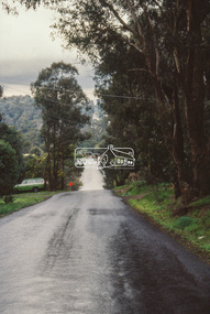
... mountain roads of Kinglake. In the byways category are views of some iof the Shire's bicycle paths including then recently completed sections of the Main Yarra Trail at Lower Plenty....mountain roads of Kinglake. In the byways category are views of some iof the Shire's bicycle paths including then recently completed sections of the Main Yarra Trail at Lower Plenty. ...Part of a presentation, "Roads and Byways of the Shire of Eltham", by Russell Yeoman to the 12 September 1990 Society meeting. Slides shown included copies of old photos and recent images ranging from the suburban streets of Eltham and Montmorency to the mountain roads of Kinglake. In the byways category are views of some iof the Shire's bicycle paths including then recently completed sections of the Main Yarra Trail at Lower Plenty.35mm colour positive transparency (1 of 37) Mount - Agfachrome Agfa CS System black 8 dotseltham, infrastructure, roads, unidentified -
 Eltham District Historical Society Inc
Slide - Photograph, Unidentified location, Eltham district, c.Aug. 1990
... mountain roads of Kinglake. In the byways category are views of some iof the Shire's bicycle paths including then recently completed sections of the Main Yarra Trail at Lower Plenty....mountain roads of Kinglake. In the byways category are views of some iof the Shire's bicycle paths including then recently completed sections of the Main Yarra Trail at Lower Plenty. ...Part of a presentation, "Roads and Byways of the Shire of Eltham", by Russell Yeoman to the 12 September 1990 Society meeting. Slides shown included copies of old photos and recent images ranging from the suburban streets of Eltham and Montmorency to the mountain roads of Kinglake. In the byways category are views of some iof the Shire's bicycle paths including then recently completed sections of the Main Yarra Trail at Lower Plenty.35mm colour positive transparency (1 of 37) Mount - Agfachrome Agfa CS System black 8 dotseltham, infrastructure, roads, unidentified -
 Eltham District Historical Society Inc
Slide - Photograph, Near the old Lower Plenty Bridge (present day Edward Willis Court), c.Aug. 1990
... mountain roads of Kinglake. In the byways category are views of some iof the Shire's bicycle paths including then recently completed sections of the Main Yarra Trail at Lower Plenty....mountain roads of Kinglake. In the byways category are views of some iof the Shire's bicycle paths including then recently completed sections of the Main Yarra Trail at Lower Plenty. ...Part of a presentation, "Roads and Byways of the Shire of Eltham", by Russell Yeoman to the 12 September 1990 Society meeting. Slides shown included copies of old photos and recent images ranging from the suburban streets of Eltham and Montmorency to the mountain roads of Kinglake. In the byways category are views of some iof the Shire's bicycle paths including then recently completed sections of the Main Yarra Trail at Lower Plenty.35mm colour positive transparency (1 of 37) Mount - Agfachrome Agfa CS System black 8 dotsinfrastructure, roads, edward willis court, lower plenty, lower plenty bridge -
 Eltham District Historical Society Inc
Slide - Photograph, Main Road, Eltham, c.1910, c.Aug. 1990
... mountain roads of Kinglake. In the byways category are views of some iof the Shire's bicycle paths including then recently completed sections of the Main Yarra Trail at Lower Plenty....mountain roads of Kinglake. In the byways category are views of some iof the Shire's bicycle paths including then recently completed sections of the Main Yarra Trail at Lower Plenty. ...Part of a presentation, "Roads and Byways of the Shire of Eltham", by Russell Yeoman to the 12 September 1990 Society meeting. Slides shown included copies of old photos and recent images ranging from the suburban streets of Eltham and Montmorency to the mountain roads of Kinglake. In the byways category are views of some iof the Shire's bicycle paths including then recently completed sections of the Main Yarra Trail at Lower Plenty.35mm colour positive transparency (1 of 37) Mount - Agfachrome Agfa CS System black 8 dotsinfrastructure, roads, main road, eltham -
 Eltham District Historical Society Inc
Slide - Photograph, Eltham-Yarra Glen Road, Kangaroo Ground c.1910, c.Aug. 1990
... mountain roads of Kinglake. In the byways category are views of some iof the Shire's bicycle paths including then recently completed sections of the Main Yarra Trail at Lower Plenty....mountain roads of Kinglake. In the byways category are views of some iof the Shire's bicycle paths including then recently completed sections of the Main Yarra Trail at Lower Plenty. ...Part of a presentation, "Roads and Byways of the Shire of Eltham", by Russell Yeoman to the 12 September 1990 Society meeting. Slides shown included copies of old photos and recent images ranging from the suburban streets of Eltham and Montmorency to the mountain roads of Kinglake. In the byways category are views of some iof the Shire's bicycle paths including then recently completed sections of the Main Yarra Trail at Lower Plenty.35mm colour positive transparency (1 of 37) Mount - Agfachrome Agfa CS System black 8 dotsinfrastructure, roads, eltham-yarra glen road, kangaroo ground -
 Eltham District Historical Society Inc
Slide - Photograph, Unidentified location, Eltham district, c.Aug. 1990
... mountain roads of Kinglake. In the byways category are views of some iof the Shire's bicycle paths including then recently completed sections of the Main Yarra Trail at Lower Plenty....mountain roads of Kinglake. In the byways category are views of some iof the Shire's bicycle paths including then recently completed sections of the Main Yarra Trail at Lower Plenty. ...Part of a presentation, "Roads and Byways of the Shire of Eltham", by Russell Yeoman to the 12 September 1990 Society meeting. Slides shown included copies of old photos and recent images ranging from the suburban streets of Eltham and Montmorency to the mountain roads of Kinglake. In the byways category are views of some iof the Shire's bicycle paths including then recently completed sections of the Main Yarra Trail at Lower Plenty.35mm colour positive transparency (1 of 37) Mount - Agfachrome Agfa CS System black 8 dotsinfrastructure, roads, houses, private street scheme, residential, unidentified -
 Eltham District Historical Society Inc
Slide - Photograph, Shalbury Avenue, Eltham, c.Aug. 1990
... mountain roads of Kinglake. In the byways category are views of some iof the Shire's bicycle paths including then recently completed sections of the Main Yarra Trail at Lower Plenty....mountain roads of Kinglake. In the byways category are views of some iof the Shire's bicycle paths including then recently completed sections of the Main Yarra Trail at Lower Plenty. ...Part of a presentation, "Roads and Byways of the Shire of Eltham", by Russell Yeoman to the 12 September 1990 Society meeting. Slides shown included copies of old photos and recent images ranging from the suburban streets of Eltham and Montmorency to the mountain roads of Kinglake. In the byways category are views of some iof the Shire's bicycle paths including then recently completed sections of the Main Yarra Trail at Lower Plenty.35mm colour positive transparency (1 of 37) Mount - Agfachrome Agfa CS System black 8 dotseltham, infrastructure, shalbury avenue -
 Eltham District Historical Society Inc
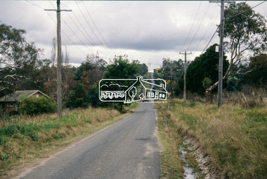
Slide - Photograph, Main Yarra Trail, Lower Plenty, c.Aug. 1990
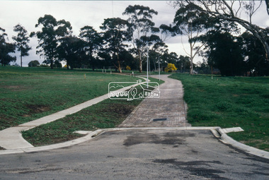
... mountain roads of Kinglake. In the byways category are views of some iof the Shire's bicycle paths including then recently completed sections of the Main Yarra Trail at Lower Plenty....mountain roads of Kinglake. In the byways category are views of some iof the Shire's bicycle paths including then recently completed sections of the Main Yarra Trail at Lower Plenty. infrastructure Bonds Road Lower Plenty Main Yarra Trail Roads Significant trees 35mm colour positive transparency (1 of 37) Mount - Agfachrome Agfa CS System black 8 dots Main Yarra Trail, Lower Plenty Slide Photograph ...Part of a presentation, "Roads and Byways of the Shire of Eltham", by Russell Yeoman to the 12 September 1990 Society meeting. Slides shown included copies of old photos and recent images ranging from the suburban streets of Eltham and Montmorency to the mountain roads of Kinglake. In the byways category are views of some iof the Shire's bicycle paths including then recently completed sections of the Main Yarra Trail at Lower Plenty.35mm colour positive transparency (1 of 37) Mount - Agfachrome Agfa CS System black 8 dotsinfrastructure, bonds road, lower plenty, main yarra trail, roads, significant trees -
 Eltham District Historical Society Inc
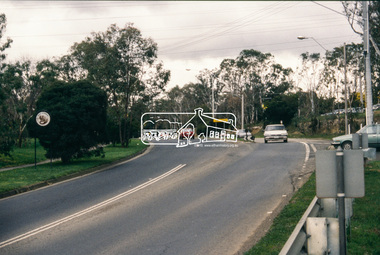
Slide - Photograph, Main Yarra Trail, Lower Plenty, c.Aug. 1990
... mountain roads of Kinglake. In the byways category are views of some iof the Shire's bicycle paths including then recently completed sections of the Main Yarra Trail at Lower Plenty....mountain roads of Kinglake. In the byways category are views of some iof the Shire's bicycle paths including then recently completed sections of the Main Yarra Trail at Lower Plenty. infrastructure bonds road lower plenty main yarra trail roads Yarra River 35mm colour positive transparency (1 of 37) Mount - Agfachrome Agfa CS System black 8 dots Main Yarra Trail, Lower Plenty Slide Photograph ...Part of a presentation, "Roads and Byways of the Shire of Eltham", by Russell Yeoman to the 12 September 1990 Society meeting. Slides shown included copies of old photos and recent images ranging from the suburban streets of Eltham and Montmorency to the mountain roads of Kinglake. In the byways category are views of some iof the Shire's bicycle paths including then recently completed sections of the Main Yarra Trail at Lower Plenty.35mm colour positive transparency (1 of 37) Mount - Agfachrome Agfa CS System black 8 dotsinfrastructure, bonds road, lower plenty, main yarra trail, roads, yarra river -
 Eltham District Historical Society Inc
Slide - Photograph, Main Yarra Trail, Lower Plenty, c.Aug. 1990
... mountain roads of Kinglake. In the byways category are views of some iof the Shire's bicycle paths including then recently completed sections of the Main Yarra Trail at Lower Plenty....mountain roads of Kinglake. In the byways category are views of some iof the Shire's bicycle paths including then recently completed sections of the Main Yarra Trail at Lower Plenty. infrastructure bonds road lower plenty main yarra trail roads yarra river 35mm colour positive transparency (1 of 37) Mount - Agfachrome Agfa CS System black 8 dots Main Yarra Trail, Lower Plenty Slide Photograph ...Part of a presentation, "Roads and Byways of the Shire of Eltham", by Russell Yeoman to the 12 September 1990 Society meeting. Slides shown included copies of old photos and recent images ranging from the suburban streets of Eltham and Montmorency to the mountain roads of Kinglake. In the byways category are views of some iof the Shire's bicycle paths including then recently completed sections of the Main Yarra Trail at Lower Plenty.35mm colour positive transparency (1 of 37) Mount - Agfachrome Agfa CS System black 8 dotsinfrastructure, bonds road, lower plenty, main yarra trail, roads, yarra river -
 Eltham District Historical Society Inc
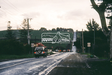
Slide - Photograph, Main Yarra Trail, Lower Plenty, c.Aug. 1990
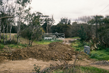
... mountain roads of Kinglake. In the byways category are views of some iof the Shire's bicycle paths including then recently completed sections of the Main Yarra Trail at Lower Plenty....mountain roads of Kinglake. In the byways category are views of some iof the Shire's bicycle paths including then recently completed sections of the Main Yarra Trail at Lower Plenty. infrastructure bonds road lower plenty roads 35mm colour positive transparency (1 of 37) Mount - Agfachrome Agfa CS System black 8 dots Main Yarra Trail, Lower Plenty Slide Photograph ...Part of a presentation, "Roads and Byways of the Shire of Eltham", by Russell Yeoman to the 12 September 1990 Society meeting. Slides shown included copies of old photos and recent images ranging from the suburban streets of Eltham and Montmorency to the mountain roads of Kinglake. In the byways category are views of some iof the Shire's bicycle paths including then recently completed sections of the Main Yarra Trail at Lower Plenty.35mm colour positive transparency (1 of 37) Mount - Agfachrome Agfa CS System black 8 dotsinfrastructure, bonds road, lower plenty, roads -
 Eltham District Historical Society Inc
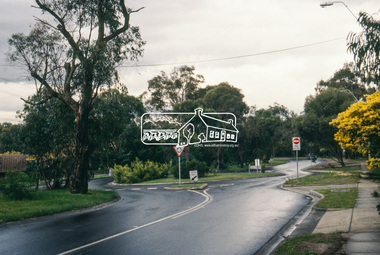
Slide - Photograph, Main Road, Lower Plenty, c.Aug. 1990
... mountain roads of Kinglake. In the byways category are views of some iof the Shire's bicycle paths including then recently completed sections of the Main Yarra Trail at Lower Plenty....mountain roads of Kinglake. In the byways category are views of some iof the Shire's bicycle paths including then recently completed sections of the Main Yarra Trail at Lower Plenty. infrastructure lower plenty roads Edward Willis Court Main Road 35mm colour positive transparency (1 of 37) Mount - Agfachrome Agfa CS System black 8 dots Main Road, Lower Plenty Slide Photograph ...Part of a presentation, "Roads and Byways of the Shire of Eltham", by Russell Yeoman to the 12 September 1990 Society meeting. Slides shown included copies of old photos and recent images ranging from the suburban streets of Eltham and Montmorency to the mountain roads of Kinglake. In the byways category are views of some iof the Shire's bicycle paths including then recently completed sections of the Main Yarra Trail at Lower Plenty.35mm colour positive transparency (1 of 37) Mount - Agfachrome Agfa CS System black 8 dotsinfrastructure, lower plenty, roads, edward willis court, main road -
 Eltham District Historical Society Inc
Slide - Photograph, Grand Boulevard, Montmorency, c.Aug. 1990
... mountain roads of Kinglake. In the byways category are views of some iof the Shire's bicycle paths including then recently completed sections of the Main Yarra Trail at Lower Plenty....mountain roads of Kinglake. In the byways category are views of some iof the Shire's bicycle paths including then recently completed sections of the Main Yarra Trail at Lower Plenty. infrastructure roads Grand Boulevard Montmorency 35mm colour positive transparency (1 of 37) Mount - Agfachrome Agfa CS System black 8 dots Grand Boulevard, Montmorency Slide Photograph ...Part of a presentation, "Roads and Byways of the Shire of Eltham", by Russell Yeoman to the 12 September 1990 Society meeting. Slides shown included copies of old photos and recent images ranging from the suburban streets of Eltham and Montmorency to the mountain roads of Kinglake. In the byways category are views of some iof the Shire's bicycle paths including then recently completed sections of the Main Yarra Trail at Lower Plenty.35mm colour positive transparency (1 of 37) Mount - Agfachrome Agfa CS System black 8 dotsinfrastructure, roads, grand boulevard, montmorency -
 Eltham District Historical Society Inc
Slide - Photograph, Kangaroo Ground Supply Store, Eltham-Yarra Glen Road, Kangaroo Ground, c.Aug. 1990
... mountain roads of Kinglake. In the byways category are views of some iof the Shire's bicycle paths including then recently completed sections of the Main Yarra Trail at Lower Plenty....mountain roads of Kinglake. In the byways category are views of some iof the Shire's bicycle paths including then recently completed sections of the Main Yarra Trail at Lower Plenty. infrastructure roads Eltham-Yarra Glen Road Kangaroo Ground Kangaroo Ground Store Kangaroo Ground Supply Store 35mm colour positive transparency (1 of 37) Mount - Agfachrome Agfa CS System black 8 dots Kangaroo Ground Supply Store, Eltham-Yarra Glen Road, Kangaroo Ground Slide Photograph ...Part of a presentation, "Roads and Byways of the Shire of Eltham", by Russell Yeoman to the 12 September 1990 Society meeting. Slides shown included copies of old photos and recent images ranging from the suburban streets of Eltham and Montmorency to the mountain roads of Kinglake. In the byways category are views of some iof the Shire's bicycle paths including then recently completed sections of the Main Yarra Trail at Lower Plenty.35mm colour positive transparency (1 of 37) Mount - Agfachrome Agfa CS System black 8 dotsinfrastructure, roads, eltham-yarra glen road, kangaroo ground, kangaroo ground store, kangaroo ground supply store -
 Eltham District Historical Society Inc
Slide - Photograph, Eltham-Yarra Glen Road, Kangaroo Ground, c.Aug. 1990
... mountain roads of Kinglake. In the byways category are views of some iof the Shire's bicycle paths including then recently completed sections of the Main Yarra Trail at Lower Plenty....mountain roads of Kinglake. In the byways category are views of some iof the Shire's bicycle paths including then recently completed sections of the Main Yarra Trail at Lower Plenty. infrastructure roads eltham-yarra glen road kangaroo ground kangaroo ground store kangaroo ground supply store 35mm colour positive transparency (1 of 37) Mount - Agfachrome Agfa CS System black 8 dots Eltham-Yarra Glen Road, Kangaroo Ground Slide Photograph ...Part of a presentation, "Roads and Byways of the Shire of Eltham", by Russell Yeoman to the 12 September 1990 Society meeting. Slides shown included copies of old photos and recent images ranging from the suburban streets of Eltham and Montmorency to the mountain roads of Kinglake. In the byways category are views of some iof the Shire's bicycle paths including then recently completed sections of the Main Yarra Trail at Lower Plenty.35mm colour positive transparency (1 of 37) Mount - Agfachrome Agfa CS System black 8 dotsinfrastructure, roads, eltham-yarra glen road, kangaroo ground, kangaroo ground store, kangaroo ground supply store