Showing 5 items matching "mt buangor"
-
 Pyrenees Shire Council
painting, Ken Burke, Mt Cole by Ken Burke, 2001
... watercolour painting of a bush track with two trees (Jimmy Smith Track, Mt Buangor State Park)...Pyrenees Shire Council 5 Lawrence Street Beaufort grampians significant as a work of art by local Pyrenees artist, locally significant to the Central Highlands Region of Victoria as a representation of local landscape and/or culture "signed: KEN BURKE (lower right) MT COLE (lower left)" watercolour painting of a bush track with two trees (Jimmy Smith Track, Mt Buangor State Park) Mt Cole by Ken Burke painting Ken Burke ...significant as a work of art by local Pyrenees artist, locally significant to the Central Highlands Region of Victoria as a representation of local landscape and/or culture watercolour painting of a bush track with two trees (Jimmy Smith Track, Mt Buangor State Park)"signed: KEN BURKE (lower right) MT COLE (lower left)" -
 Federation University Historical Collection
Booklet, Thomas Stephen Hart, The Highlands and Main Divide of Western Victoria, 1907, 12/12/1907
... ...mt buangor...Hart was a teacher at the Ballarat School of Mines, and a member of the Ballarat Field Naturalists Club thomas hart thomas s. hart ballarat school of mines ballarat field naturalists club royal society of victoria western victoria ballarat great dividing range mt william volcano volcanic plains waterways lal lal basin yarrowee creek ballarat common lava flow wendouree warrenheip ballarat plateau mt elephant grampians t.s. hart mt buangor mt beckworth mt misery mt bolton lal lal iron ored mt ararat mt wiliam mt cole burrumbeet mt warrenheip daylesford waubra ercildoun gap smythesdale lal lal falls parwan valley burrumbeet creek staffordshire reef pyranees bacchus marsh rowsley fault ben nevis avoca hill landsborough hill mt blowhard weatherboard mclean's hill Fyan's Creek thomas stephen hart lal lal Article with illustrations published by the Royal Society of Victoria by Thomas S. ...Thomas S. Hart was a teacher at the Ballarat School of Mines, and a member of the Ballarat Field Naturalists ClubArticle with illustrations published by the Royal Society of Victoria by Thomas S. Hart. The following plates are included: Fig 1. The Main Divide and some of the transverse ridges Fig 2. Hills on and near the Divide at the Ercildoun and Ascot Gaps Fig. 3. Profile of the Divide at Ascot Gap. Fig. 4. Sketch of the Hills west and north-west from Mt Buninyong - - The divide in Ascot Gap from Mt Blowhard (Serra Range, Mt William, Mt Ararat, Larne Gerin, Ben Major, Mt Cole, Mt Misery, Mt Bolton) Fig. 5. Diagram to illustrate the possible courses of the leads south of the present Divide - Burrumbeet Basin (Smythesdale, Ballarat, Lal Lal , Mt Doran, egerton, Parwan Creet, Rowsley Fault, Eastern Plateau) Fig. 6. Diagramatic cross section of the grampians, south of Hall's Gap. Profile of the Pyranees, from maiden Hill - Diagramatic Section of the Grampians south of Hall's Gap. (Mt Cole, Mt Mitchell, Ben Major, Ben More, Avoca Hill, Hall's Gap.) Fig. 7. Profile of the Pyrenees as seen from Maiden Hill near Waubra.thomas hart, thomas s. hart, ballarat school of mines, ballarat field naturalists club, royal society of victoria, western victoria, ballarat, great dividing range, mt william, volcano, volcanic plains, waterways, lal lal basin, yarrowee creek, ballarat common, lava flow, wendouree, warrenheip, ballarat plateau, mt elephant, grampians, t.s. hart, mt buangor, mt beckworth, mt misery, mt bolton, lal lal iron ored, mt ararat, mt wiliam, mt cole, burrumbeet, mt warrenheip, daylesford, waubra, ercildoun gap, smythesdale, lal lal falls, parwan valley, burrumbeet creek, staffordshire reef, pyranees, bacchus marsh, rowsley fault, ben nevis, avoca hill, landsborough hill, mt blowhard, weatherboard, mclean's hill, fyan's creek, thomas stephen hart, lal lal -
 Victorian Aboriginal Corporation for Languages
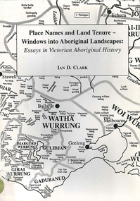
Book, Ian D Clark, Place names and land tenure : windows into Aboriginal landscapes : essays in Victorian Aboriginal history, 1998
... ...Buangor...Mt...Victorian Aboriginal Corporation for Languages 33 Saxon Street Brunswick melbourne Djab Wurrung Ngengen Wurrung Koroitgundidj Dhauwurud Wurrung Djab Wurrung Barababaraba Daung Wurrung Taungurung Dja Dja Wurrung Jardwadjali Jodajoda Yorta Yorta Nguri-illam Wurrung Waywurru Koroit Buangor Mt Eccles Mt Napier Langi Ghiran Grampians National Park massacres clan organization land tenure George Augustus Robinson Samuel Carter Aldo Massola Alfred William Howitt maps, document reproductions This work is a collection of twelve essays that are concerned with place names, clan organisation and local and regional Aboriginal history. ...This work is a collection of twelve essays that are concerned with place names, clan organisation and local and regional Aboriginal history.maps, document reproductionsdjab wurrung, ngengen wurrung, koroitgundidj, dhauwurud wurrung, djab wurrung, barababaraba, daung wurrung, taungurung, dja dja wurrung, jardwadjali, jodajoda, yorta yorta, nguri-illam wurrung, waywurru, koroit, buangor, mt eccles, mt napier, langi ghiran, grampians national park, massacres, clan organization, land tenure, george augustus robinson, samuel carter, aldo massola, alfred william howitt -
 Federation University Historical Collection
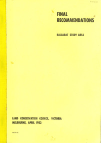
Book, Final recommendations Ballarat Study Area Land Conservation Council, Victoria, 1982, 1982
... Mt Helen Campus Federation University Australia E.J. Barker Library (top floor) Mount Helen goldfields land conservation authority ballarat endowment plantations pine plantations langi ghiran state park mount buangor state park enfield state park ballarat-creswick regional park rossbridge black lake flax mill swamp dereel lagoon lake bolac lake wongan langi ghiran reservoir gong gong reservoir pincotts reservoir beales reservoir wilsons reservoir moorabool reservoir korweinguboora korweinguborra reservoir learmonth bores sago hill illabarook reservoir ballarat water commission dunneworthy mount cole mont lonarch ben major waterloo trawalla linton ross creek canadian shepherds flat lal lal mount doran raglan chute carngham buninyong watsons hill enfield cape clear illabrook rokewood junction mount warrenheip nerrina jubilee golden stream australasian deep lead mine happy valley school piggoreet berringa bulldog ballarat common wildlife water timber flora rivers geology agriculture warrenheip biodiversity Yellow soft covered report of 95 pages . ...Yellow soft covered report of 95 pages . The contents of the report include: Parks, reference areas, wildlife reserves, water production, hardwood production, softwood production, flora Reserves and Flora and Fauna reserves, bushland reserves, historic area and reserves, rivers and streams, Roadside conservation and Highway parks, Education areas and School Plantations, Lake Reserves, geological reserves, recreation, scenic reserves, agriculture, mineral and stone production, utilities and survey, township land, Uncommitted Land, military training, other reserves and public land. Maps include: The Study area 1: 250 000 Supplementary Mapsland conservation authority, ballarat, endowment plantations, pine plantations, langi ghiran state park, mount buangor state park, enfield state park, ballarat-creswick regional park, rossbridge, black lake, flax mill swamp, dereel lagoon, lake bolac, lake wongan, langi ghiran reservoir, gong gong reservoir, pincotts reservoir, beales reservoir, wilsons reservoir, moorabool reservoir, korweinguboora, korweinguborra reservoir, learmonth bores, sago hill, illabarook reservoir, ballarat water commission, dunneworthy, mount cole, mont lonarch, ben major, waterloo, trawalla, linton, ross creek, canadian, shepherds flat, lal lal, mount doran, raglan, chute, carngham, buninyong, watsons hill, enfield, cape clear, illabrook, rokewood junction, mount warrenheip, nerrina, jubilee, golden stream, australasian deep lead mine, happy valley school, piggoreet, berringa, bulldog, ballarat common, wildlife, water, timber, flora, rivers, geology, agriculture, warrenheip, biodiversity -
 Federation University Historical Collection
Book, Dr Ian D. Clark et al, Pyrenees Shire, University of Ballarat, Tourism Planning and Development
... mt cole...redbank...mount lonarch...lake goldsmith...st arnaud...lamplough...buangor...Barker Library (top floor) Mount Helen goldfields The Themes that have been most prevalent in the Shire are: Major Mitchell's Impact Pastoral Runs in the Pyrenees Shire Aboriginal History Gold Rush Era Chinese History Wine Production nature based tourism accommodation restaurants transport attractions funding community interest production development plan trevor peek geoffrey gray djadja wurrung aboriginal clan the australian tourism commission tourism victoria avoca beaufort snake valley amphitheatre landsborough lexton elmhurst moonambel mt cole redbank mount lonarch lake goldsmith st arnaud lamplough buangor natte yallock navarre/barkly percydale Pink soft covered book of 35 pages with fifteen appendices. ...The Themes that have been most prevalent in the Shire are: Major Mitchell's Impact Pastoral Runs in the Pyrenees Shire Aboriginal History Gold Rush Era Chinese History Wine ProductionPink soft covered book of 35 pages with fifteen appendices. It includes pull out maps and plans. nature based tourism, accommodation, restaurants, transport, attractions, funding, community interest, production development plan, trevor peek, geoffrey gray, djadja wurrung aboriginal clan, the australian tourism commission, tourism victoria, avoca, beaufort, snake valley, amphitheatre, landsborough, lexton, elmhurst, moonambel, mt cole, redbank, mount lonarch, lake goldsmith, st arnaud, lamplough, buangor, natte yallock, navarre/barkly, percydale