Showing 1041 items matching "national park"
-
 Bendigo Military Museum
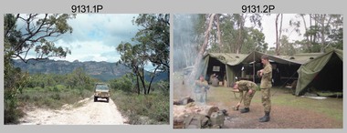
Photograph - Army Survey Regiment Adventurous Training, Grampians National Park, VIC, 1990
... Army Survey Regiment Adventurous Training, Grampians National Park, VIC...Army Survey Regiment Adventurous Training, Grampians National Park, VIC...This is a set of 22 photographs of a Army Survey Regiment adventurous training held in the Grampians National Park, VIC in October 1990. It is evident the training focussed on teamwork, leadership, abseiling, rock climbing, field craft and living off the land survival skills....A Mercedes Unimog truck traverses Grampians National Park. .2) - Photo, colour, 1990. Unidentified personnel relax at base camp. .3) - Photo, colour, 1990. ......Grampians National Park, VIC...Army Survey Regiment Adventurous Training, Grampians National Park, VIC Photograph Army Survey Regiment Adventurous Training, Grampians National Park, VIC Army Survey Regiment ...This is a set of 22 photographs of a Army Survey Regiment adventurous training held in the Grampians National Park, VIC in October 1990. It is evident the training focussed on teamwork, leadership, abseiling, rock climbing, field craft and living off the land survival skills.This is a set of 22 photographs of Army Survey Regiment personnel undergoing adventurous training held in the Grampians National Park, VIC. In October 1990. The colour photographs are on 35mm negative film and are part of the Army Survey Regiment’s Collection. The photographs were scanned at 2400 dpi. .1) - Photo, colour, 1990. A Mercedes Unimog truck traverses Grampians National Park. .2) - Photo, colour, 1990. Unidentified personnel relax at base camp. .3) - Photo, colour, 1990. A curious emu listens in to an unidentified radio operator at base camp. .4) - Photo, colour, 1990. WO2 Neil ‘Ned’ Kelly prepares to abseil. .5) to .15) - Photo, colour, 1990. Abseiling action. .16) - Photo, colour, 1990. SPR Frank Savy abseils down the cliff. .17) - Photo, colour, 1990. Personnel at cliff top in readiness to abseil. L to R: SPR Andrew Morrison-Evans, CPL Daryl South, WO2 Rhys De Laine, SSGT Peter Imeson, WO2 George Graham, SSGT Paul Leskovec, unidentified soldier in foreground. .18) - Photo, colour, 1990. Personnel at cliff top in readiness to abseil. L to R: WO2 Rhys De Laine, SGT Paul Hopes, unidentified (x2) in foreground, CPL Daryl South, unidentified SGT Chris Edwards. .19) to .22) - Photo, colour, 1990. WO2 George Graham abseils down the cliff..1P to .22P – There are no personnel identified. ‘1990 ADV TRAINING’ annotated on negatives sleeve.royal australian survey corps, rasvy, army survey regiment, army svy regt, fortuna -
 Bendigo Military Museum
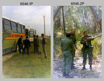
Photograph - 4th Field Survey Squadron Adventurous Training Mount Remarkable National Park, SA, 4th Field Survey Squadron Adventurous Training, Mount Remarkable National Park, SA, 1987
... 4th Field Survey Squadron Adventurous Training Mount Remarkable National Park, SA...4th Field Survey Squadron Adventurous Training, Mount Remarkable National Park, SA...This is a set of 42 photographs of 4th Field Survey Squadron undergoing adventurous training at Mount Remarkable National Park, South Australia in May 1987. It is evident the training focussed on teamwork, leadership, abseiling, rock climbing, field craft and living off the land survival skills. ...Mount Remarkable National Park terrain. .7) - Photo, colour, 1987. ...Mount Remarkable National Park, Flinders Ranges, South Australia...Mount Remarkable National Park terrain. .7) - Photo, colour, 1987. ...This is a set of 42 photographs of 4th Field Survey Squadron undergoing adventurous training at Mount Remarkable National Park, South Australia in May 1987. It is evident the training focussed on teamwork, leadership, abseiling, rock climbing, field craft and living off the land survival skills. Elements from units of the Army Reserve also participated in the training. Refer to items 6547.40P and 6548.14P for additional photographs taken during the adventurous training.This is a set of 42 photographs of 4th Field Survey Squadron undergoing adventurous training at Mount Remarkable National Park in May 1987. The colour photographs are on 35mm negative film and are part of the Army Survey Regiment’s Collection. The photographs were scanned at 96 dpi. .1) - Photo, colour, 1987. L to R: unidentified bus drivers, CAPT Danny Galbraith, unidentified, SGT Stu Symonds. .2) - Photo, colour, 1987. L to R: OC MAJ Peter Cates, SSM WO1 Bill Grigg, unidentified exchange officer. .3) - Photo, colour, 1987. Squadron briefing. .4) - Photo, colour, 1987. Endurance march L to R: unidentified (x4), LCPL Peter McCurdy, unidentified (x3), SPR Damien Killeen, unidentified. .5) - Photo, colour, 1987. Unidentified personnel taking a break during or at end Endurance march. SPR John Keely at far right. .6) - Photo, colour, 1987. Mount Remarkable National Park terrain. .7) - Photo, colour, 1987. Mount Remarkable National Park terrain. SGT Peter Imeson. .8) - Photo, colour, 1987. Mount Remarkable National Park terrain. CPL Jeff Prince. .9) - Photo, colour, 1987. Camp activities. CPL Dave Irving. .10) - Photo, colour, 1987. Camp activities. L to R: unidentified, SPR Perry Langeberg, unidentified (x2), CPL Neale ‘Tex’ Houston, SPR Steve Ellis. .11) to .13) - Photo, colour, 1987. Mount Remarkable National Park terrain. .14) - Photo, colour, 1987. Camp activities. Unidentified. .15) - Photo, colour, 1987. Camp activities. L to R: PTE P. Simpson, SPR Steve Ellis. .16) - Photo, colour, 1987. Hootchie set-up. Unidentified personnel. .17) - Photo, colour, 1987. Hootchie set-up. .18) - Photo, colour, 1987. Camp activities. Unidentified. .19) - Photo, colour, 1987. Camp activities. L to R: SPR Todd Hayley, CPL Jamie McRae. .20) - Photo, colour, 1987. Camp activities. L to R: unidentified, CPL Neale ‘Tex’ Houston, unidentified. .21) - Photo, colour, 1987. Camp activities. L to R: CPL Dave Longbottom, WO2 Brett ‘Dutchy’ Van Leeuwen. .22) - Photo, colour, 1987. Hootchie set-up. .23) - Photo, colour, 1987. Hootchie set-up. CPL Dave Irving. .24) - Photo, colour, 1987. Mount Remarkable National Park terrain. Possibly OC MAJ Peter Cates. .25) - Photo, colour, 1987. Mount Remarkable National Park terrain. .26) & .27) - Photo, colour, 1987. Hootchie set-up. .28) - Photo, colour, 1987. Camp activities. CPL Roger Graf. .29) - Photo, colour, 1987. Camp activities. Possibly water sterilisation. .30) - Photo, colour, 1987. Camp set-up. Unidentified. .31) - Photo, colour, 1987. Hootchie interior. .32) - Photo, colour, 1987. CAPT Danny Galbraith. .33) - Photo, colour, 1987. Camp activities. L to R: LCPL Peter Tuddenham, SPR Todd Hayley, CPL Dave Longbottom, CPL John Ratcliffe, CPL Dave Irving. .34) - Photo, colour, 1987. Hootchie set-up. .35) - Photo, colour, 1987. Hootchie set-up. CPL Peter Hardy. .36) - Photo, colour, 1987. Camp activities. L to R: unidentified (x2), CPL Peter Hardy, LT Greg Oaten CSC. .37) - Photo, colour, 1987. Camp activities. L to R: SPR Shaun Hynes, LT Geoff ‘GT’ Ford, SPR Bruce Graham, unidentified (x2). .38) - Photo, colour, 1987. Camp activities. L to R: SPR Shaun Hynes, LT Geoff ‘GT’ Ford, unidentified, SPR Bruce Graham, in background - CPL Dave Irving. .39) - Photo, colour, 1987. Hootchie set-up. Unidentified. .40) - Photo, colour, 1987. Camp activities. WO2 Brett ‘Dutchy’ Van Leeuwen. .41) & .42) - Photo, colour, 1987. Camp activities. Results from foraging the forest for food..1P to .42P – There are no personnel identified. ‘1987 ADV TRAINING’ annotated on negatives sleeve.royal australian survey corps, rasvy, 4 fd svy sqn -
 Bendigo Military Museum
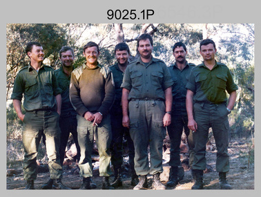
Photograph - 4th Field Survey Squadron Adventurous Training Mount Remarkable National Park, SA, 4th Field Survey Squadron Adventurous Training, Mount Remarkable National Park, SA, 1986
... 4th Field Survey Squadron Adventurous Training Mount Remarkable National Park, SA...4th Field Survey Squadron Adventurous Training, Mount Remarkable National Park, SA...This is a set of six photographs of 4th Field Survey Squadron undergoing adventurous training at Mount Remarkable National Park, part of the Flinders Ranges, SA in 1986. ...This is a set of six photographs of 4th Field Survey Squadron undergoing adventurous training at Mount Remarkable National Park, South Australia in 1986. Colour photographs .1P and .3P are printed on photographic paper and scanned at 300 dpi. ...Mount Remarkable National Park, Flinders Ranges, South Australia...This is a set of six photographs of 4th Field Survey Squadron undergoing adventurous training at Mount Remarkable National Park, part of the Flinders Ranges, SA in 1986. ...This is a set of six photographs of 4th Field Survey Squadron undergoing adventurous training at Mount Remarkable National Park, part of the Flinders Ranges, SA in 1986. These photos feature personnel during a 10-day survival exercise 'The Highlanders’.This is a set of six photographs of 4th Field Survey Squadron undergoing adventurous training at Mount Remarkable National Park, South Australia in 1986. Colour photographs .1P and .3P are printed on photographic paper and scanned at 300 dpi. Colour photographs .2P and .4P to .6P are on 35mm negative film and scanned at 2400 dpi. They are part of the Army Survey Regiment’s Collection. .1) - Photo, colour, 1986. L to R: Tony Rawcliffe, Kev Whitty, Wally Chilcott, Jamie ‘Fish’ McRae, Shaun Hynes, Geoff ‘GT’ Ford, Bruce Graham. .2) - Photo, colour, 1986. L to R: Geoff ‘GT’ Ford, Kev Whitty, Tony Rawcliffe, Jamie ‘Fish’ McRae, Wally Chilcott, Shaun Hynes. .3) - Photo, colour, 1986. L to R: Tony Rawcliffe, Wally Chilcott. .4) - Photo, colour, 1986. L to R: Bruce Graham, Kev Whitty. .5) & .6)- Photo, colour, 1986. L to R: Jamie ‘Fish’ McRae, Bruce Graham.The following annotations are written on the back of each photo: .1P – ‘1986 THE HIGHLANDERS. A 10 DAY SURVIVAL EXERCISE IN THE FLINDERS RANGES " MOUNT REMARKABLE” .3P – ‘MOUNT REMARKABLE 10 DAY SURVIVAL EXERCISE THEY DIDN'T BLINDFOLIS US ON THE WAY IN (ITS NOT A JOEY)’ royal australian survey corps, rasvy, 4 fd svy sqn -
 Bendigo Military Museum
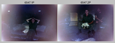
Photograph - 4th Field Survey Squadron Adventurous Training, Mount Remarkable National Park, Flinders Ranges, SA, 4th Field Survey Squadron Adventurous Training, Mount Remarkable National Park, SA, 1987
... 4th Field Survey Squadron Adventurous Training, Mount Remarkable National Park, Flinders Ranges, SA...4th Field Survey Squadron Adventurous Training, Mount Remarkable National Park, SA...This is a set of 40 photographs of 4th Field Survey Squadron undergoing adventurous training at Mount Remarkable National Park, South Australia in May 1987. It is evident the training focussed on teamwork, leadership, abseiling, rock climbing, field craft and living off the land survival skills. ...Mount Remarkable National Park terrain. .19) - Photo, colour, 1987. ...Mount Remarkable National Park, Flinders Ranges, South Australia...Mount Remarkable National Park terrain. .19) - Photo, colour, 1987. ...This is a set of 40 photographs of 4th Field Survey Squadron undergoing adventurous training at Mount Remarkable National Park, South Australia in May 1987. It is evident the training focussed on teamwork, leadership, abseiling, rock climbing, field craft and living off the land survival skills. Elements from units of the Army Reserve also participated in the training. Refer to items 6546.42P and 6548.14P for additional photographs taken during the adventurous training.This is a set of 40 photographs of 4th Field Survey Squadron undergoing adventurous training at Mount Remarkable National Park, South Australia in May 1987. The colour photographs are on 35mm negative film and are part of the Army Survey Regiment’s Collection. The photographs were scanned at 96 dpi. .1) - Photo, colour, 1987. Camp activities, unidentified soldier. .2) - Photo, colour, 1987. Camp activities, unidentified personnel. .3) & .4) - Photo, colour, 1987. Hootchie set-up. .5) - Photo, colour, 1987. Camp activities, unidentified personnel. .6) - Photo, colour, 1987. Hootchie set-up. .7) - Photo, colour, 1987. Camp activities. .8) - Photo, colour, 1987. Hootchie set-up, unidentified officer. .9) - Photo, colour, 1987. Camp activities. Results from foraging the forest for food. .10) - Photo, colour, 1987. Camp set-up. .11) - Photo, colour, 1987. Camp activities. .12) - Photo, colour, 1987. Camp activities. L to R: CPL Jeff Prince, unidentified (x3). .13) to .16) - Photo, colour, 1987. Camp activities. .17) & .18) - Photo, colour, 1987. Mount Remarkable National Park terrain. .19) - Photo, colour, 1987. Hootchie set-up. L to R: unidentified, CPL Jeff Prince, SPR Perry Langeberg, unidentified (x3). .20) - Photo, colour, 1987. Camp activities. .21) - Photo, colour, 1987. Camp activities, unidentified personnel. .22) & .23) - Photo, colour, 1987. Camp set-up. .24) - Photo, colour, 1987. Hootchie set-up. .25) - Photo, colour, 1987. Hootchie set-up, unidentified personnel. .26) - Photo, colour, 1987. Camp activities. L to R: CPL Jeff Prince, SPR Steve Ellis, SGT Peter Imeson, CPL Neale ‘Tex’ Houston, SPR Perry Langeberg, unidentified exchange officer, WO2 Russ Larsen. .27) - Photo, colour, 1987. Hootchie set-up. .28) - Photo, colour, 1987. Camp activities. L to R: SPR Bruce Graham, LT Geoff ‘GT’ Ford, CPL Jamie ‘Fish’ McRae, SGT Wally Chilcott, SPR Shaun Hynes, CPL Kevin Whitty. .29) - Photo, colour, 1987. Camp activities. L to R: unidentified, SPR Todd Hayley, unidentified, WO2 Peter Symmans, SSGT Cam Chapman, CPL Dave Irving. .30) - Photo, colour, 1987. Camp activities. L to R: unidentified (x2), LT Greg Oaten CSC, unidentified (x2), CPL Peter Hardy, unidentified. .31) - Photo, colour, 1987. Camp activities. L to R: CPL Roger Graf, WO2 Bob Rogister, SSM WO1 Bill Griggs, unidentified officer, SPR Simon Reynolds, SPR John Keely. .32) - Photo, colour, 1987. Camp activities. L to R: unidentified, SPR Steve Nokes, SGT Stu Symonds, WO2 Brett ‘Dutchy’ Van Leeuwen, unidentified (x3). .33) - Photo, colour, 1987. Camp activities. L to R: unidentified, SGT Derek Stanmore, CAPT Danny Galbraith, unidentified in foreground. .34) - Photo, colour, 1987. Camp activities. L to R: unidentified (x3), SGT Derek Stanmore, CAPT Danny Galbraith. .35) - Photo, colour, 1987. Camp activities. .36) - Photo, colour, 1987. Camp activities. OC MAJ Peter Cates. .37) - Photo, colour, 1987. Camp activities. L to R: unidentified, CPL Dave Longbottom. .38) - Photo, colour, 1987. Camp activities, unidentified personnel. .39) & .40) - Hootchie set-up..1P to .40P – There are no personnel identified. ‘1987 ADV TRAINING’ annotated on negatives sleeve.royal australian survey corps, rasvy, 4 fd svy sqn -
 Stawell Historical Society Inc
Book - Grampians National Park - Report, Grampian National Park: Inventory of Resources and Uses, 1984
... Grampians National Park - Report...Grampian National Park: Inventory of Resources and Uses...To be read with Grampians National Park Draft Management Plan...Logos of National parks Services and Australian National Parks and Wildlife Service....To be read with Grampians National Park Draft Management Plan Logos of National parks Services and Australian National Parks and Wildlife Service. ...To be read with Grampians National Park Draft Management PlanSoft Cover, Blue. Pen lined drawing - part of Grampians. Black tape over spineLogos of National parks Services and Australian National Parks and Wildlife Service. -
 Sunshine and District Historical Society Incorporated
Document - Organ Pipes National Park A Natural History, Friends Of Organ Pipes National Park Inc
... Organ Pipes National Park A Natural History...Friends Of The Organ Pipies National Park Organ Pipes National Park A Natural History...Friends Of Organ Pipes National Park Inc...Organ Pipes Keilor North Jacksons Creek Friends Of The Organ Pipies National Park Organ Pipes National Park A Natural History Soft cover report Document Organ Pipes National Park A Natural History Friends Of Organ Pipes National Park Inc Barry Kemp ...Friends Of The Organ Pipies National Park Organ Pipes National Park A Natural Historyorgan pipes, keilor north, jacksons creek -
 Eltham District Historical Society Inc
Photograph, Dedication of Everard Memorial, Mt Everard, Kinglake National Park, 22 April, 2004, 22/04/2004
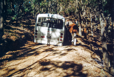
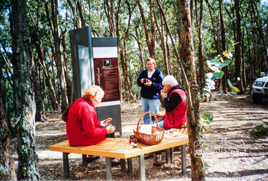
... Dedication of Everard Memorial, Mt Everard, Kinglake National Park, 22 April, 2004......kinglake national park...EVERARD CONNECTION Mt Everard in the Kinglake National Park commemorates William Hugh Everard, State Member for Evelyn and father of our member Blanche Shallard who died some eighteen months ago. ...Kinglake National Park, Victoria, Australia...EVERARD CONNECTION Mt Everard in the Kinglake National Park commemorates William Hugh Everard, State Member for Evelyn and father of our member Blanche Shallard who died some eighteen months ago. ...The Everard Memorial was officially dedicated on 22 April 2004 by Betty Lynch OAM, daughter of William Everard and sister of Blanche Shallard. Newsletter No. 156 May 2004 THE MT. EVERARD CONNECTION Mt Everard in the Kinglake National Park commemorates William Hugh Everard, State Member for Evelyn and father of our member Blanche Shallard who died some eighteen months ago. Doug and Gwen Orford represented the Society at the unveiling of an interpretive sign at Mt Everard. Doug has written this account of the event on 22nd April. We all travelled to Kinglake and met near the Fire Station where we were picked up by two buses provided by Parks Victoria to take us to the top of Mt Everard. There we enjoyed morning tea (needed to as we from·the first bus had to walk the last hill when the bus broke down) while we waited for the official party to arrive. While waiting we had a look at the open four sided interpretive feature donated by Mrs Betty Lynch OAM (sister of Blanche) in memory of their father Bill Everard who was the State Member for the area for many years and in recognition of Kinglake National Park's 75th birthday. The information display describes the Blue Ant Butterfly, the Coconut Ant and the Swamp Pea, all of which are indigenous to the area. The Chief Executive of Parks Victoria welcomed everyone on this warm windy day after which Betty explained how the blue ant butterfly cohabited with the ants and survived. The swamp pea is described as a rare indigenous plant to the area. She also spoke of her father's interest in the area. The Governor, John Landy, then spoke before he and Betty moved up to the display board and cut the red ribbon from around it.10 colour photographsbetty lynch, everard memorial, mt everard, kinglake national park, dedication, blanche shallard -
 Eltham District Historical Society Inc
Photograph, Betty Lynch (left), Russell and Marion Yeoman at the Everard Memorial, Mt Everard, Kinglake National Park, c.April, 2004, 2004
... Betty Lynch (left), Russell and Marion Yeoman at the Everard Memorial, Mt Everard, Kinglake National Park, c.April, 2004......kinglake national park...Kinglake National Park, Victoria, Australia...This lockup used to be located at the Police Station in Pryor Street and was then stored in Youth Road before being acquired for the Local History Centre betty lynch everard memorial mt everard kinglake national park blanche shallard Colour photograph Betty Lynch (left), Russell and Marion Yeoman at the Everard Memorial, Mt Everard, Kinglake National Park, c.April, 2004 Photograph Photograph ...Betty Lynch OAM, daughter of William Everard and sister of Blanche Shallard This photo appears to have been taken at a later date to the dedication ceremony of 22 April.This lockup used to be located at the Police Station in Pryor Street and was then stored in Youth Road before being acquired for the Local History Centre Colour photographbetty lynch, everard memorial, mt everard, kinglake national park, blanche shallard -
 Federation University Art Collection
Artwork - Photograph, 'Lake Mungo National Park' by Gail Trembath, 1994
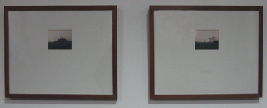
... 'Lake Mungo National Park' by Gail Trembath...lake mungo national park...Two framed photographs of Lake Mungo National Park...The Art Collection features over 1000 works and was listed as a 'Ballarat Treasure' in 2007. lake mungo national park art artwork gail trembath photography acquisition award available Two framed photographs of Lake Mungo National Park 'Lake Mungo National Park' by Gail Trembath Artwork - Photograph Gail Trembath ...This work won the Ballarat School of Mines Acquisition Award in 1994. In that year Gail Trembath was undertaking a Diploma of Visual Arts. This item is part of the Federation University Art Collection. The Art Collection features over 1000 works and was listed as a 'Ballarat Treasure' in 2007.Two framed photographs of Lake Mungo National Parklake mungo national park, art, artwork, gail trembath, photography, acquisition award, available -
 Whitehorse Historical Society Inc.
Document, The Vascular flora of Wyperfield National Park, 1/12/1962 12:00:00 AM
... The Vascular flora of Wyperfield National Park......Wyperfeld National Park...A report on the flora of Wyperfeld National Park as of December 1962. Compiled from records of collections and observations of naturalists from 1880 - 1960....Native Plants Wyperfeld National Park A report on the flora of Wyperfeld National Park as of December 1962. ...A report on the flora of Wyperfeld National Park as of December 1962.A report on the flora of Wyperfeld National Park as of December 1962. Compiled from records of collections and observations of naturalists from 1880 - 1960.A report on the flora of Wyperfeld National Park as of December 1962. native plants, wyperfeld national park -
 Ballarat Tramway Museum
Map, Ken McCarthy, Map of Proposed National Park Line - SPER, mid 1950's
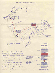
... Map of Proposed National Park Line - SPER...... National Park Line...Hand drawn plan on plain foolscap paper of proposed tram line from Loftus to View Point within National Park for South Pacific Electric Railways - with notes, proposed destination roll....Map of Proposed National Park Line - SPER Map Ken McCarthy ...Hand drawn plan on plain foolscap paper of proposed tram line from Loftus to View Point within National Park for South Pacific Electric Railways - with notes, proposed destination roll.trams, tramways, sper, national park line, loftus, destination roll -
Federation University Historical Collection
Report, Read Sturgess and Associates Consulting Economists et al, The Economic Significance of Grampians National Park, 1994 (and other reports), 1990-4
... The Economic Significance of Grampians National Park, 1994 (and other reports)......grampians national park....1) Grampians Surround Strategy, 1990 .2) Tourism and the Grampians Region: A Background Paper, 1990 .3) Grampians Surround Strategy and Discussion Paper, 1991 .4) The Economic Significance of Grampians National Park for the Department of Conservation and Natural Resources, 1994...Barker Library (top floor) Mount Helen goldfields victorian tourisim industry tourism halls gap grampians grampians national park recreation water production bee keeping arapiles dunkeld balmoral pomonal wartook population agriculture water supplies minerals hamilton ararat stawell horsham wimmera koorie heritage aboriginal heritage koorie art sites brambuk waterways wannon river wimmera river mount william creek rocklands reservoir lake lonsdale lake fyans lake toolando cherrypool mirranatwa zumstein Notes in pencil by Mary Hollick, lecturer in Tourism at the University of Ballarat. .1) Grampians Surround Strategy, 1990 .2) Tourism and the Grampians Region: A Background Paper, 1990 .3) Grampians Surround Strategy and Discussion Paper, 1991 .4) The Economic Significance of Grampians National Park for the Department of Conservation and Natural Resources, 1994 The Economic Significance of Grampians National Park, 1994 (and other reports) Report Read Sturgess and Associates Consulting Economists Trevor Budge and Associates Victorian Tourism Commission Hassell Planning Consultants ....1) Grampians Surround Strategy, 1990 .2) Tourism and the Grampians Region: A Background Paper, 1990 .3) Grampians Surround Strategy and Discussion Paper, 1991 .4) The Economic Significance of Grampians National Park for the Department of Conservation and Natural Resources, 1994Notes in pencil by Mary Hollick, lecturer in Tourism at the University of Ballarat.victorian tourisim industry, tourism, halls gap, grampians, grampians national park, recreation, water production, bee keeping, arapiles, dunkeld, balmoral, pomonal, wartook, population, agriculture, water supplies, minerals, hamilton, ararat, stawell, horsham, wimmera, koorie heritage, aboriginal heritage, koorie art sites, brambuk, waterways, wannon river, wimmera river, mount william creek, rocklands reservoir, lake lonsdale, lake fyans, lake toolando, cherrypool, mirranatwa, zumstein -
 Eltham District Historical Society Inc
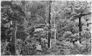
Photograph, Kinglake National Park, Tangle Creek
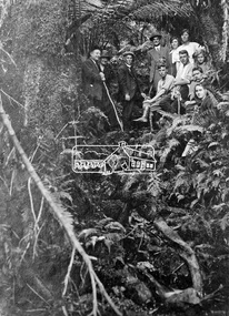
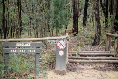
... Kinglake National Park, Tangle Creek.......kinglake national park...The Kinglake National Park was established on 11,300 acres in the Shire of Eltham in 1928....The Kinglake National Park was established on 11,300 acres in the Shire of Eltham in 1928. ...Bushwalkers and hikers pose for a photograph in the heavily forested area of Kinglake National Park near the little known Tangle Creek, circa 1925. The Kinglake National Park was established on 11,300 acres in the Shire of Eltham in 1928.This photo forms part of a collection of photographs gathered by the Shire of Eltham for their centenary project book, "Pioneers and Painters: 100 years of the Shire of Eltham" by Alan Marshall (1971). The collection of over 500 images is held in partnership between Eltham District Historical Society and Yarra Plenty Regional Library (Eltham Library) and is now formally known as 'The Shire of Eltham Pioneers Photograph Collection.' It is significant in being the first community sourced collection representing the places and people of the Shire's first one hundred years.Digital imagesepp, shire of eltham pioneers photograph collection, kinglake, kinglake national park, tangle creek, walking, hiking, bushwalk, ferns -
 Eltham District Historical Society Inc
Negative - Photograph, Kinglake National Park; view from the Mountain Trail
... Kinglake National Park; view from the Mountain Trail......kinglake national park...The Kinglake National Park was established on 11,300 acres in the Shire of Eltham in 1928....Eltham District Historical Society Inc 728 Main Rd Eltham melbourne The Kinglake National Park was established on 11,300 acres in the Shire of Eltham in 1928. ...The Kinglake National Park was established on 11,300 acres in the Shire of Eltham in 1928.This photo forms part of a collection of photographs gathered by the Shire of Eltham for their centenary project book,"Pioneers and Painters: 100 years of the Shire of Eltham" by Alan Marshall (1971). The collection of over 500 images is held in partnership between Eltham District Historical Society and Yarra Plenty Regional Library (Eltham Library) and is now formally known as 'The Shire of Eltham Pioneers Photograph Collection.' It is significant in being the first community sourced collection representing the places and people of the Shire's first one hundred years.Digital image 4 x 5 inch B&W Negsepp, shire of eltham pioneers photograph collection, kinglake, kinglake national park, mountain trail -
 Eltham District Historical Society Inc
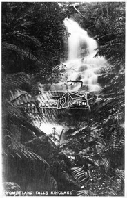
Photograph, Kinglake National Park, Wombelano Falls
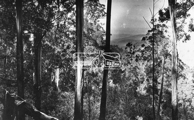
... Kinglake National Park, Wombelano Falls......kinglake national park...Wombelano Falls is framed by a eucalypt forest and lush gullies in the Kinglake National Park. This image probably produced as a postcard....Eltham District Historical Society Inc 728 Main Rd Eltham melbourne Wombelano Falls is framed by a eucalypt forest and lush gullies in the Kinglake National Park. This image probably produced as a postcard. ...Wombelano Falls is framed by a eucalypt forest and lush gullies in the Kinglake National Park. This image probably produced as a postcard.This photo forms part of a collection of photographs gathered by the Shire of Eltham for their centenary project book,"Pioneers and Painters: 100 years of the Shire of Eltham" by Alan Marshall (1971). The collection of over 500 images is held in partnership between Eltham District Historical Society and Yarra Plenty Regional Library (Eltham Library) and is now formally known as 'The Shire of Eltham Pioneers Photograph Collection.' It is significant in being the first community sourced collection representing the places and people of the Shire's first one hundred years.Digital imagesepp, shire of eltham pioneers photograph collection, kinglake, kinglake national park, wombeland falls, waterfall, postcard, forest -
 Greensborough Historical Society
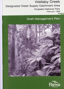
Booklet, Parks Victoria, Wallaby Creek: designated water supply catchment area. Kinglake National Park: Draft management plan 1998, 1998_02
... Wallaby Creek: designated water supply catchment area. Kinglake National Park: Draft management plan 1998...Kingllake National Park...Wallaby Creek is part of Kinglake National Park, and is a restricted access catchment area to protect quality of water supplied to Melbourne's water supply system. ...Kinglake National Park: Draft management plan 1998 Booklet Booklet Parks Victoria Parks Victoria ...Wallaby Creek is part of Kinglake National Park, and is a restricted access catchment area to protect quality of water supplied to Melbourne's water supply system. 26 p. black print on white paper, green cover, three folded mapskingllake national park, water supply, wallaby creek, parks victoria -
Glenelg Shire Council Cultural Collection
Booklet - Brochure - Mt. Richmond National Park Victoria, Jun-80
... Brochure - Mt. Richmond National Park Victoria...Tri-fold brochure for Mt. Richmond National Park. Light card, white with dark green print. ...Booklet Brochure - Mt. Richmond National Park Victoria ...Tri-fold brochure for Mt. Richmond National Park. Light card, white with dark green print. Image of bushland and logo for National Parks Service, Victoria on front cover. -
 Victorian Interpretive Projects Inc.
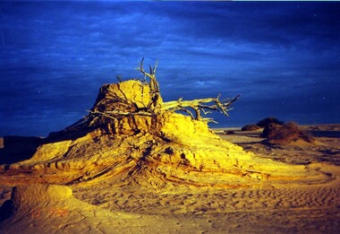
Photograph - colour, Clare Gervasoni, Mungo at Dusk, 07/09/2008
... Mungo National Park is a desert north of Mildura. It has numerous archaeological relics, and is the site of ancient Aboriginal burials known as Mungo Man and Mungo Woman. ...Colour photograph in digital format showing sand dunes and dramatic natural lighting at dusk at Mungo National Park. ...Mungo National Park...PO Box 93R, Redan, 3350 goldfields Mungo National Park is a desert north of Mildura. It has numerous archaeological relics, and is the site of ancient Aboriginal burials known as Mungo Man and Mungo Woman. ...Mungo National Park is a desert north of Mildura. It has numerous archaeological relics, and is the site of ancient Aboriginal burials known as Mungo Man and Mungo Woman. This photograph was taken during an expedition by Naga Tours in 2008.Colour photograph in digital format showing sand dunes and dramatic natural lighting at dusk at Mungo National Park. lake mungo, desert, archaeology, sand dune -
 Eltham District Historical Society Inc
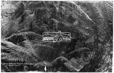
Photograph, Kinglake National Park; view from the Mountain Trail
... Kinglake National Park; view from the Mountain Trail......kinglake national park...Kinglake National Park was established in 1928 on 11,300 acres in the Shire of Eltham. ...Eltham District Historical Society Inc 728 Main Rd Eltham melbourne Kinglake National Park was established in 1928 on 11,300 acres in the Shire of Eltham. ...Kinglake National Park was established in 1928 on 11,300 acres in the Shire of Eltham. Jehosophat Valley was named by the Hotelier Frank Thomson's father, who was so struck with the grandeur of the valley in all its pristine beauty that he 'ejaculated the word Jehosophat.'This photo forms part of a collection of photographs gathered by the Shire of Eltham for their centenary project book,"Pioneers and Painters: 100 years of the Shire of Eltham" by Alan Marshall (1971). The collection of over 500 images is held in partnership between Eltham District Historical Society and Yarra Plenty Regional Library (Eltham Library) and is now formally known as 'The Shire of Eltham Pioneers Photograph Collection.' It is significant in being the first community sourced collection representing the places and people of the Shire's first one hundred years.Digital imagesepp, shire of eltham pioneers photograph collection, kinglake, kinglake national park, view, bush, ferns, jehosophat -
 Eltham District Historical Society Inc
Photograph, Kinglake National Park, fern scene, Valley of Jehosaphat
... Kinglake National Park, fern scene, Valley of Jehosaphat......kinglake national park...The Kinglake National park was established in 1928 and consisited of 11,300 acres located in the Shire of Eltham at that time. ...Eltham District Historical Society Inc 728 Main Rd Eltham melbourne The Kinglake National park was established in 1928 and consisited of 11,300 acres located in the Shire of Eltham at that time. ...The Kinglake National park was established in 1928 and consisited of 11,300 acres located in the Shire of Eltham at that time. The famous Jehosophat Valley was named by the Hotelier Frank Thomson's father, who was so struck with the grandeur of the valley in all its pristine beauty that he 'ejaculated the word Jehosophat'.This photo forms part of a collection of photographs gathered by the Shire of Eltham for their centenary project book,"Pioneers and Painters: 100 years of the Shire of Eltham" by Alan Marshall (1971). The collection of over 500 images is held in partnership between Eltham District Historical Society and Yarra Plenty Regional Library (Eltham Library) and is now formally known as 'The Shire of Eltham Pioneers Photograph Collection.' It is significant in being the first community sourced collection representing the places and people of the Shire's first one hundred years.Digital imagesepp, shire of eltham pioneers photograph collection, kinglake, kinglake national park, valley of jehosaphat., bush -
 Eltham District Historical Society Inc
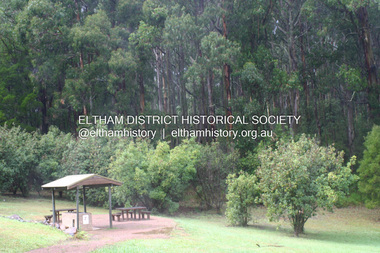
Photograph - Digital Photograph, Alan King, Kinglake National Park, 27 March 2008
... Kinglake National Park......Kinglake National Park....; p125 The magnificent Kinglake National Park, fringing Nillumbik’s north, is the largest national park close to Melbourne. ....; p125 The magnificent Kinglake National Park, fringing Nillumbik’s north, is the largest national park close to Melbourne. ...Fern gullies around Jehosaphat Gully Covered under National Estate. Published: Nillumbik Now and Then / Marguerite Marshall 2008; photographs Alan King with Marguerite Marshall.; p125 The magnificent Kinglake National Park, fringing Nillumbik’s north, is the largest national park close to Melbourne. Thanks to the vision and hard work of a band of local people, the park was created from what was rapidly becoming degraded land. Seeing a threat to Kinglake’s indigenous flora and fauna, several prominent local people campaigned for a national park, which was established in 1928.1 Since then, the park has grown through donations and acquisitions of land, from around 13,800 acres of land (5585ha) to 22,360 hectares. The Sugarloaf and Everard Blocks – of almost 8000 hectares – stand in Nillumbik and the park extends into Mitchell and Murrundindi Shires and the City of Whittlesea. Mt Everard commemorates William Hugh Everard, State member for Evelyn when the park was established. Before 1928, European settlers had degraded the Kinglake area, which was named after the celebrated English author and lawyer, Alexander William Kinglake. Remains of gold shafts and diggings in the park are reminders of Kinglake’s first settlers, who hoped to strike it rich at the gold diggings. But like other gold fields in this shire, they proved not very lucrative and soon timber cutting replaced mining in importance. However, before long, the accessible timber supply ran out, so in the 1920s agriculture took over – particularly potatoes and berry fruits – which involved large-scale clearing.2 The park’s instigator was retired Melbourne University Professor of Music, William Laver.3 As chair of the Kinglake Progress Association he began negotiations to have crown lands on the southern scarp of the Great Dividing Range reserved as a national park. Even before the park was proclaimed, from 1927, KPA members cut tracks to the major scenic points. Professor Laver was one of several people who gave land for the park, donating around 50 acres (20ha), including the Jehosaphat Gully.4 Laver chaired the park’s first Committee of Management, which raised money to employ a ranger and provide facilities, including tracks and roads for fire protection vehicles, toilets and shelters. The committee charged fees for firewood collection, some grazing of livestock, and visitor entrance, and obtained small State Government and Eltham Shire grants. In 1957 the State Government provided revenue for national parks. Then, in 1975, the State Government took over the management and the Committee of Management became an advisory committee, which disbanded in 1978. Originally, the park covered crown land in the Shires of Eltham and Whittlesea; then Wombelano Falls in Yea and other areas were added. In 1970 the park extended into the Shires of Eltham, Healesville, Whittlesea and Yea.5 Bush fires have been an ongoing problem. In 1939 hundreds of eucalypts and acacias had to be sown around the Jehosaphat Gully to rejuvenate the forest. To manage bushfires, the Committee of Management, then the State Government, worked closely with the Forestry Commission, shire councils and local fire brigades. Early national parks focussed on recreation. But by the 1980s, conservation, education and scientific research became more important, playing a vital role in preserving representative samples of the natural environment. Each year many thousands of people use the park’s extensive network of walking tracks amongst the protected plant and animal life as well as camping, cycling and horse riding. The park, along the slopes of the Great Dividing Range, has lookouts revealing magnificent views of the Melbourne skyline, Port Phillip Bay, the Yarra Valley and the You Yangs. Vegetation in the Masons Falls area includes messmate forest, Austral grass-trees, ferns and Hazel Pomaderris. In spring, orchids, lilies, everlasting daisies, correas, grevillea and heath appear. Around Jehosaphat Gully are wet and dry forest, fern gullies and banksia. Animal life includes wallabies, kangaroos, koalas, echidnas, possums, gliders and bandicoots. Male lyrebirds can be heard mimicking in the Jehosaphat Gully, particularly in the Everard Block in winter.This collection of almost 130 photos about places and people within the Shire of Nillumbik, an urban and rural municipality in Melbourne's north, contributes to an understanding of the history of the Shire. Published in 2008 immediately prior to the Black Saturday bushfires of February 7, 2009, it documents sites that were impacted, and in some cases destroyed by the fires. It includes photographs taken especially for the publication, creating a unique time capsule representing the Shire in the early 21st century. It remains the most recent comprehenesive publication devoted to the Shire's history connecting local residents to the past. nillumbik now and then (marshall-king) collection, kinglake national park, jehosaphat gully -
 Wooragee Landcare Group
Photograph
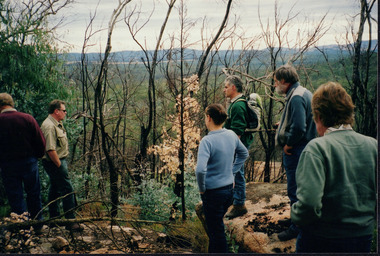
... Mount Pilot Chiltern National Park...IThis event was prompted by a desire to find out if quolls still lived in Mount Pilot-Chiltern National Park, as there had been no confirmed sightings since the 2003 bushfires. ...Mount Pilot-Chiltern National Park, Chiltern, Victoria, Australia...IThis event was prompted by a desire to find out if quolls still lived in Mount Pilot-Chiltern National Park, as there had been no confirmed sightings since the 2003 bushfires. ...This photograph was taken in April 2004, on the field day in Mount Pilot-Chiltern National Park as part of a workshop on quolls, led by Andrew Murray, then president of the South East Forests Spot-Tailed Quoll Working Group. IThis event was prompted by a desire to find out if quolls still lived in Mount Pilot-Chiltern National Park, as there had been no confirmed sightings since the 2003 bushfires. Andy Murray helped lead the efforts to find them. Currently, landcare group efforts have found evidence of a small but present spot-tailed quoll population in the park. Reasons for the decrease in population include fox populations in the area and destruction of habitat. Pictured, L-R: unknown, Andy Murray, unknown, Jerry Alexander, Geoff Galbraith, Mary Prowse The spotted-tailed quoll, also called the Tiger Quoll, is an endangered Australian animal. It is the largest carnivorous mammal in Australia, and is native to Victoria, New South Wales, Queensland, and Tasmania. Slightly larger than a cat, the animals fur is normally brown, with black marking and white spots. Currently, there are approximately 14,000 spotted-tailed quolls in the wild.This photograph is significant as an example of events used by the Wooragee Landcare Group to inform the public on local environmental issues, and for its link to the hunt for the spotted-tailed quoll.Landscape colour photgraph printed on gloss paper. Reverse (partial) WAN quoll, south east forest spotted-tailed quoll working group, spotted-tailed quoll, tiger, mt pilot, andrew murray quolls, andy murray quolls, andrew murray, mount pilot chiltern national park, foxes, endangered quoll, queries about quolls, quoll species, wooragee, wooragee landcare, wooragee landcare group, jerry alexander, geoff galbraith, mary prowse, bushfire, chiltern -
 Bendigo Historical Society Inc.
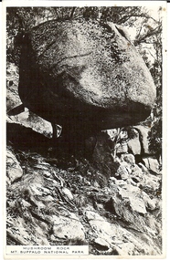
Photograph - BASIL MILLER COLLECTION: MUSHROOM ROCK MT. BUFFALO NATIONAL PARK
... BASIL MILLER COLLECTION: MUSHROOM ROCK MT. BUFFALO NATIONAL PARK...Black and white photograph of 'Mushroom Rock' at Mt. Buffalo National park. Inscriptions on reverse: Postcard, correspondence, address only, single vertical line, square formed using the name 'Kodak'....Photograph BASIL MILLER COLLECTION: MUSHROOM ROCK MT. BUFFALO NATIONAL PARK ...Black and white photograph of 'Mushroom Rock' at Mt. Buffalo National park. Inscriptions on reverse: Postcard, correspondence, address only, single vertical line, square formed using the name 'Kodak'.person, individual, basil miller -
 Bendigo Historical Society Inc.
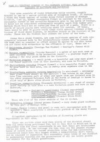
Document - PETER ELLIS COLLECTION: REMARKS ON PROPOSED NATIONAL PARK AREA
... PETER ELLIS COLLECTION: REMARKS ON PROPOSED NATIONAL PARK AREA...Some Introductory Remarks on the Proposed national Park Area in Parishes of Mandurang and Sandhurst printed on white A4 paper. ...History House 11 Mackenzie Street Bendigo goldfields BENDIGO Parks and gardens National Parks Peter Ellis Collection Wild Flowers Some Introductory Remarks on the Proposed national Park Area in Parishes of Mandurang and Sandhurst printed on white A4 paper. ...Some Introductory Remarks on the Proposed national Park Area in Parishes of Mandurang and Sandhurst printed on white A4 paper. Same as 8626.446 b with two front pages and the bottoms of some pages missing. An extra page at the end is titled POACEAE of the Bendigo Area. It lists grasses and reeds with their common names and scientific names.bendigo, parks and gardens, national parks, peter ellis collection, wild flowers -
 Bendigo Historical Society Inc.
Document - PETER ELLIS COLLECTION: REMARKS ON PROPOSED NATIONAL PARK AREA
... PETER ELLIS COLLECTION: REMARKS ON PROPOSED NATIONAL PARK AREA...Some Introductory Remarks on the Proposed National Park Area in Parishes of Mandurang and Sandhurst printed on yellow foolscap paper. ...History House 11 Mackenzie Street Bendigo goldfields BENDIGO Parks and gardens National Parks Peter Ellis Collection Wild Flowers Some Introductory Remarks on the Proposed National Park Area in Parishes of Mandurang and Sandhurst printed on yellow foolscap paper. ...Some Introductory Remarks on the Proposed National Park Area in Parishes of Mandurang and Sandhurst printed on yellow foolscap paper. Short description of the area. Common names and scientific names of many plants that grow in the area. Some descriptions and localities mentioned. 4 1/2 pages of species (249) and families (56) mentioned.bendigo, parks and gardens, national parks, peter ellis collection, wild flowers -
 Eltham District Historical Society Inc
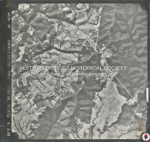
Photograph - Aerial Photograph, Smiths Gully, Christmas Hills, St Andrews, Kinglake National Park, 6 Mar. 1986
... Smiths Gully, Christmas Hills, St Andrews, Kinglake National Park......Kinglake National Park...Eltham District Historical Society Inc 728 Main Rd Eltham melbourne Small scale Red arrow indicates North shire of eltham archives Aerial Photo Christmas Hills Kinglake National Park smiths gully St Andrews Black and white proto print; Size: 235x245 mm Condition: Good Smiths Gully, Christmas Hills, St Andrews, Kinglake National Park Photograph Aerial Photograph ...Small scale Red arrow indicates Northshire of eltham archives, aerial photo, christmas hills, kinglake national park, smiths gully, st andrews -
 Eltham District Historical Society Inc
Photograph - Digital Photograph, Alan King, Kinglake National Park, 27 March 2008
... Kinglake National Park......Kinglake National Park...Nillumbik Now and Then (Marshall-King) Collection Kinglake National Park Born digital image file Kinglake National Park Photograph Digital Photograph Alan King Alan King Marguerite Marshall ...Published: Nillumbik Now and Then / Marguerite Marshall 2008; photographs Alan King with Marguerite Marshall.; p125This collection of almost 130 photos about places and people within the Shire of Nillumbik, an urban and rural municipality in Melbourne's north, contributes to an understanding of the history of the Shire. Published in 2008 immediately prior to the Black Saturday bushfires of February 7, 2009, it documents sites that were impacted, and in some cases destroyed by the fires. It includes photographs taken especially for the publication, creating a unique time capsule representing the Shire in the early 21st century. It remains the most recent comprehenesive publication devoted to the Shire's history connecting local residents to the past. nillumbik now and then (marshall-king) collection, kinglake national park -
 Eltham District Historical Society Inc
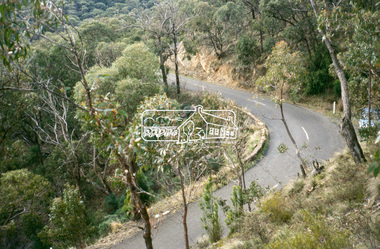
Slide - Photograph, Heidelberg-Kinglake Road, Kinglake National Park, c.June 1990
... Heidelberg-Kinglake Road, Kinglake National Park......Kinglake National Park...Eltham District Historical Society Inc 728 Main Rd Eltham melbourne roads heidelberg-kinglake road Kinglake National Park 35mm colour positive transparency (1 of 36) Mount - Agfa CS System grey 8 dots Heidelberg-Kinglake Road, Kinglake National Park Slide Photograph ...35mm colour positive transparency (1 of 36) Mount - Agfa CS System grey 8 dotsroads, heidelberg-kinglake road, kinglake national park -
 Eltham District Historical Society Inc
Slide - Photograph, Kinglake National Park, c.May 1988
... Kinglake National Park...Kinglake National Park...Eltham District Historical Society Inc 728 Main Rd Eltham melbourne Kinglake National Park Process Date MAY 88M 35mm colour positive transparency (1 of 25) Mount - Kodak Ektachrome Kinglake National Park Slide Photograph ...35mm colour positive transparency (1 of 25) Mount - Kodak EktachromeProcess Date MAY 88Mkinglake national park -
 Eltham District Historical Society Inc
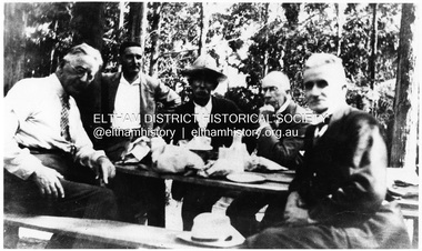
Photograph, Kinglake National Park, Committee of Management
... Kinglake National Park, Committee of Management.......kinglake national park...It is significant in being the first community sourced collection representing the places and people of the Shire's first one hundred years. sepp shire of eltham pioneers photograph collection kinglake committee of management hewitt kinglake national park prof. greenwood prof. laver ranger shelley harris Digital image Kinglake National Park, Committee of Management. ...Left to Right: Prof. Laver, Prof. Greenwood, S. Harris (Hon. Ranger), Mr. Hewitt. Source: Dr. Edith J. Hewitt and Mrs. McMinn, KinglakeThis photo forms part of a collection of photographs gathered by the Shire of Eltham for their centenary project book,"Pioneers and Painters: 100 years of the Shire of Eltham" by Alan Marshall (1971). The collection of over 500 images is held in partnership between Eltham District Historical Society and Yarra Plenty Regional Library (Eltham Library) and is now formally known as the 'The Shire of Eltham Pioneers Photograph Collection.' It is significant in being the first community sourced collection representing the places and people of the Shire's first one hundred years.Digital imagesepp, shire of eltham pioneers photograph collection, kinglake, committee of management, hewitt, kinglake national park, prof. greenwood, prof. laver, ranger, shelley harris