Showing 156 items matching "navigation instruments"
-
 Moorabbin Air Museum
Manual (Item) - Navigation Instruments - Intro & mods - RAAF
... Navigation Instruments - Intro & mods - RAAF...Navigation Instruments - Intro & mods - RAAF...Moorabbin Air Museum Moorabbin Airport 12 First Street Moorabbin melbourne Navigation Instruments - Intro & mods - RAAF Manual Navigation Instruments - Intro & mods - RAAF ... -
Moorabbin Air Museum
Manual (Item) - RAAF - Navigation Instruments Miscellaneous And Tables, Navigation Instruments Miscellaneous And Tables
... RAAF - Navigation Instruments Miscellaneous And Tables ...Navigation Instruments Miscellaneous And Tables ...Moorabbin Air Museum Moorabbin Airport 12 First Street Moorabbin melbourne Air Publication 1275B Volume 1 Section 17 Navigation Instruments Miscellaneous And Tables Manual RAAF - Navigation Instruments Miscellaneous And Tables ...Air Publication 1275B Volume 1 Section 17 -
Moorabbin Air Museum
Manual (Item) - AP 1275B Vol 1 Sec 17 Navigation Instruments Miscellaneous and Tables
... AP 1275B Vol 1 Sec 17 Navigation Instruments Miscellaneous and Tables...AP 1275B Vol 1 Sec 17 Navigation Instruments Miscellaneous and Tables...Moorabbin Air Museum Moorabbin Airport 12 First Street Moorabbin melbourne AP 1275B Vol 1 Sec 17 Navigation Instruments Miscellaneous and Tables Manual AP 1275B Vol 1 Sec 17 Navigation Instruments Miscellaneous and Tables ... -
Moorabbin Air Museum
Manual (Item) - AP 1275B Vol 1 Section 13 Navigation Instruments Astronomical Instruments
... AP 1275B Vol 1 Section 13 Navigation Instruments Astronomical Instruments ...AP 1275B Vol 1 Section 13 Navigation Instruments Astronomical Instruments ...Moorabbin Air Museum Moorabbin Airport 12 First Street Moorabbin melbourne AP 1275B Vol 1 Section 13 Navigation Instruments Astronomical Instruments Manual AP 1275B Vol 1 Section 13 Navigation Instruments Astronomical Instruments ... -
Moorabbin Air Museum
Manual (Item) - Navigation Instruments Drift Recording Instruments AP 112B.0400-1 Vol 1 Sect 12, Navigation Instruments Drift Recording Instruments
... Navigation Instruments Drift Recording Instruments AP 112B.0400-1 Vol 1 Sect 12...Navigation Instruments Drift Recording Instruments...Moorabbin Air Museum Moorabbin Airport 12 First Street Moorabbin melbourne Navigation Instruments Drift Recording Instruments Manual Navigation Instruments Drift Recording Instruments AP 112B.0400-1 Vol 1 Sect 12 ... -
Moorabbin Air Museum
Manual (Item) - Smiths Technical Data Sheets Manuals, Books 1-4, "Smiths" Technical Data Sheets for Flight, Engine and Navigation Instruments and Accessories
... "Smiths" Technical Data Sheets for Flight, Engine and Navigation Instruments and Accessories...Moorabbin Air Museum Moorabbin Airport 12 First Street Moorabbin melbourne Collection of three black and one dark blue lever-arch folders "Smiths" Technical Data Sheets for Flight, Engine and Navigation Instruments and Accessories Manual Smiths Technical Data Sheets Manuals, Books 1-4 ... -
Moorabbin Air Museum
Manual (Item) - RAF Navigation Instrument Repair Manual, Navigation Instruments: Repair and Reconditioning Instructions
... RAF Navigation Instrument Repair Manual...Navigation Instruments: Repair and Reconditioning Instructions...Any referenes to "A.P. 1275B., Vol. 2, Part 3" are also to be read as "A.P. 1275B, Vol. 6" Tan hard-cover manual Navigation Instruments: Repair and Reconditioning Instructions Manual RAF Navigation Instrument Repair Manual ...Air Publication 1275B, Volume 6. On front cover: "Note.- on all leaves issued with A.L.s I to 19, for "Vol 2 Part 3" read "Vol. 6". Any referenes to "A.P. 1275B., Vol. 2, Part 3" are also to be read as "A.P. 1275B, Vol. 6" -
Moorabbin Air Museum
Manual (item) - Navigation Instruments Compasses -Remote reading, A.P 1275B Vol1 Sect.11 A/L 43 TO 50
... Navigation Instruments Compasses -Remote reading...Moorabbin Air Museum Moorabbin Airport 12 First Street Moorabbin melbourne A.P 1275B Vol1 Sect.11 A/L 43 TO 50 Manual Navigation Instruments Compasses -Remote reading ... -
 Bendigo Military Museum
Equipment - FLYING INSTRUMENTS, AIR NAVIGATION
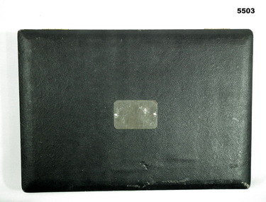
... FLYING INSTRUMENTS, AIR NAVIGATION...instruments...air navigation...Rectangular padded and sectioned wooden box containing seventeen brass, stainless steel and plastic air navigation instruments. The box is covered in black leatherette and hinged with small brass hinges. ...Equipment FLYING INSTRUMENTS, AIR NAVIGATION ...Flying instruments used by Flight Lieutenant Ian A. Lyons. Part of the Flight Lieutenant Ian A. 'Joe' Lyons MBE Collection. See Catalogue No. 5374P for his service record.Rectangular padded and sectioned wooden box containing seventeen brass, stainless steel and plastic air navigation instruments. The box is covered in black leatherette and hinged with small brass hinges. A silver coloured clasp secures the box closed. A metal plate is pinned to the middle of the lid.equipment, flying instruments, air navigation, flight lieutenant ian a. lyons -
Moorabbin Air Museum
Manual - Ansett Boeing 727 operating manuals, Boeing 727 Pilot's Course Notes Navigation and Instruments September 1985
... Boeing 727 Pilot's Course Notes Navigation and Instruments September 1985...Moorabbin Air Museum Moorabbin Airport 12 First Street Moorabbin melbourne Ansett Boeing 727 operating manuals Pitot static system Air data system Pitot static heat Mach airspeed indicators Mach/airspeed warning Altimeters Flight recorders Clocks Attitude director indicator Standby horizon indicator Compass system Horizontal situation indicator Standby magnetic compass Integrated flight system Flight director systems Proximity warning systems Performance data computer Stall warning system Overview of navigation & instruments in Boeing 727 for pilots, circa 1985 Spiral bound book type manual Boeing 727 Pilot's Course Notes Navigation and Instruments September 1985 Manual Ansett Boeing 727 operating manuals ...Overview of navigation & instruments in Boeing 727 for pilots, circa 1985Spiral bound book type manual non-fictionOverview of navigation & instruments in Boeing 727 for pilots, circa 1985pitot static system, air data system, pitot static heat, mach airspeed indicators, mach/airspeed warning, altimeters, flight recorders, clocks, attitude director indicator, standby horizon indicator, compass system, horizontal situation indicator, standby magnetic compass, integrated flight system, flight director systems, proximity warning systems, performance data computer, stall warning system -
 Dandenong/Cranbourne RSL Sub Branch
Tool - Navigational Instrument?, Memorabilia, Unknown
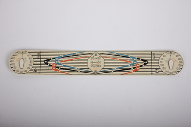
... Plastic navigational instrument?...H = 100/V =180. Plastic navigational instrument? Memorabilia Tool Navigational Instrument? ...UnknownPlastic navigational instrument?2 x circles printed on either side numbering 20 to 160 .Some Japanese writing on sides. In centre has number 20K - 30K. H = 100/V =180. -
Moorabbin Air Museum
Book - Aerial navigation, Flight - Meteorology, Aircraft Instruments and Navigation
... Flight - Meteorology, Aircraft Instruments and Navigation...instruments...Aerial navigation...Moorabbin Air Museum Moorabbin Airport 12 First Street Moorabbin melbourne Aerial navigation Atmosphere Weather map Airway weather service Aerial photogrophy Aviation radio Aircraft instruments Aerial navigation Overview of basic meteorology , aircraft instrumentation & navigation, circa 1943 Flight - Meteorology, Aircraft Instruments and Navigation Book Aerial navigation ...Overview of basic meteorology , aircraft instrumentation & navigation, circa 1943non-fictionOverview of basic meteorology , aircraft instrumentation & navigation, circa 1943atmosphere, weather map, airway weather service, aerial photogrophy, aviation radio, aircraft instruments, aerial navigation -
Moorabbin Air Museum
Manual - Ansett Douglas DC9 technical manuals, DC - 9 Airframe Course Notes
... Instrument & circuit breaker panels...Landing gear...Lights...Navigation...Ansett Douglas DC9 technical manuals Maintenance checks Dimensions & areas Lifting Levelling Towing & taxiing Parking Standard airplane practices Air conditioning AFCS/Auto throttle Electrical power Equipment/furnishings Fire protection Flight controls Fuel Hydraulics Ice & rain protection Instrument & circuit breaker panels Landing gear Lights Navigation instruments Oxygen Pneumatics Water & waste systems APU General structures Doors & airstairs Technical course notes for Douglas DC-9, circa 1966 2 clip binder DC - 9 Airframe Course Notes Manual Ansett Douglas DC9 technical manuals ...Technical course notes for Douglas DC-9, circa 19662 clip bindernon-fictionTechnical course notes for Douglas DC-9, circa 1966maintenance checks, dimensions & areas, lifting, levelling, towing & taxiing, parking, standard airplane practices, air conditioning, afcs/auto throttle, electrical power, equipment/furnishings, fire protection, flight controls, fuel, hydraulics, ice & rain protection, instrument & circuit breaker panels, landing gear, lights, navigation instruments, oxygen, pneumatics, water & waste systems, apu, general structures, doors & airstairs -
Moorabbin Air Museum
Book - Technical pilot interviews, Act The Technical Pilot Interview
... Navigation...Instruments...Moorabbin Air Museum Moorabbin Airport 12 First Street Moorabbin melbourne Technical Pilot Interviews Aerodynamics Engines Navigation Instruments And More Technical questions/answers & illustrations covering light aircraft to heavy jet operations, circa 1993 Act The Technical Pilot Interview Book Technical pilot interviews ...Technical questions/answers & illustrations covering light aircraft to heavy jet operations, circa 1993Technical questions/answers & illustrations covering light aircraft to heavy jet operations, circa 1993aerodynamics, engines, navigation, instruments, and more -
Moorabbin Air Museum
Book - Instrument Flight, I'd Rather Be Flying Instrument and Multi Engine Flying for the Weekend Pilot
... navigation...Instruments...Moorabbin Air Museum Moorabbin Airport 12 First Street Moorabbin melbourne Instrument flying Maps Aerial navigation Instruments Overview of instrument flying & change to multi engined aircraft for private pilots, circa 1962 I'd Rather Be Flying Instrument and Multi Engine Flying for the Weekend Pilot Book Instrument Flight ...Overview of instrument flying & change to multi engined aircraft for private pilots, circa 1962non-fictionOverview of instrument flying & change to multi engined aircraft for private pilots, circa 1962maps, aerial navigation, instruments -
 Flagstaff Hill Maritime Museum and Village
Instrument - Sextant, Late 20th Century
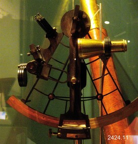
... It is a doubly reflecting navigation instrument that measures the angular distance between two visible objects. ...It is a doubly reflecting navigation instrument that measures the angular distance between two visible objects. ...In 1941, the scientific instrument manufacturing firms of Henry Hughes & Son Ltd, London, England, and Kelvin Bottomley & Baird Ltd, Glasgow, Scotland, came together to form Kelvin & Hughes Ltd. Kelvin Company History: The origins of the company lie in the highly successful and strictly informal relationship between William Thomson (1824-1907), Professor of Natural Philosophy at Glasgow University from 1846-1899 and James White, a Glasgow optical maker. James White (1824-1884) founded the firm of James White, an optical instrument maker in Glasgow in 1850 and was involved in supplying and mending apparatus for Thomson university laboratory and working with him on experimental constructions. White was declared bankrupt in August 1861 and released several months later. In 1870, White was largely responsible for equipping William Thomson laboratory in the new University premises at Gilmore hill. From 1876, he was producing accurate compasses for metal ships to Thomson design during this period and this became an important part of his business in the last years of his life. He was also involved in the production of sophisticated-sounding machinery that Thomson had designed to address problems encountered laying cables at sea, helping to make possible the first transatlantic cable connection. At the same time, he continued to make a whole range of more conventional instruments such as telescopes, microscopes and surveying equipment. White's association with Thomson continued until he died. After his death, his business continued under the same name, being administered by Matthew Edwards (until 1891 when he left to set up his own company. Thomson who became Sir William Thomson and then Baron Kelvin of Largs in 1892, continued to maintain his interest in the business after James White's death. In 1884 raising most of the capital needed to construct and equip new workshops in Cambridge Street, Glasgow. At these premises, the company continued to make the compass Thomson had designed during the 1870s and to supply it in some quantity, especially to the Admiralty. At the same time, the firm became increasingly involved in the design, production and sale of electrical apparatus. In 1899, Lord Kelvin resigned from his University chair and became, in 1900, a director in the newly formed limited liability company Kelvin & James White Ltd which had acquired the business of James White. At the same time Kelvin's nephew, James Thomson Bottomley (1845-1926), joined the firm. In 1904, a London branch office was opened which by 1915 had become known as Kelvin, White & Hutton Ltd. Kelvin & James White Ltd underwent a further change of name in 1913, becoming Kelvin Bottomley & Baird Ltd. Hughes Company History: Henry Hughes & Sons were founded in 1838 in London as a maker of chronographic and scientific instruments. The firm was incorporated as “Henry Hughes & Sons Ltd” in 1903. In 1923, the company produced its first recording echo sounder and in 1935 a controlling interest in the company was acquired by S Smith & Son Ltd resulting in the development and production of marine and aircraft instruments. Following the London office's destruction in the Blitz of 1941, a collaboration was entered into with Kelvin, Bottomley & Baird Ltd resulting in the establishing “Marine Instruments Ltd”. Following the formal amalgamation of Kelvin, Bottomley & Baird Ltd and Henry Hughes & Sons Ltd in 1947 to form Kelvin & Hughes Ltd. Marine Instruments Ltd then acted as regional agents in the UK for Kelvin & Hughes Ltd who were essentially now a part of Smith's Industries Ltd founded in 1944 and the successors of S. Smith & Son Ltd. Kelvin & Hughes Ltd went on to develop various marine radar and echo sounders supplying the Ministry of Transport, and later the Ministry of Defence. The firm was liquidated in 1966 but the name was continued as Kelvin Hughes, a division of the Smiths Group. In 2002, Kelvin Hughes continues to produce and develop marine instruments for commercial and military. G. Falconer Company History: G Falconer (Hong Kong Ltd) appear to have had a retail presence in Hong Kong since 1885, according to the company website, and currently have a shop in the Peninsula Hotel. G Falconer was the Hong Kong selling agent for several British companies. Ross Ltd of 111 New Bond St London was one and the other was Kelvins Nautical Instruments. Falconers were primarily watchmakers, jewellers and diamond merchants.They were also agents for Admiralty Charts, Ross binoculars and telescopes, and sold English Silverware and High Class English Jewellery. In 1928 the company was operating from the Union Building opposite the Hong Kong general post office. It is unclear if the item is an original Sextant made by Kelvin prior to his amalgamation with Henry Hughes & Sons in 1941 as Kelvin appears to have only made compasses up to this date. If the Sextant can be established that it was made by Kelvin then it is very significant and a rare item made for and distributed through their Hong Kong selling agents G Falconer Ltd. There are many Sextants advertised for sale stating "Kelvin & Hughes 1917 model sextant". These can be regarded as replicas as the company was not formed until 1941 and production of marine instruments was not fully under way until after the war in 1947. Further investigation needs to be undertaken to accurately determine the provenance of this item. As the writer currently has the impression that the subject object was possibly made by Kelvin and Hughes in the mid to late 20th century or is a replica made by an unknown maker in the late 1970s. Purchased as an exhibition of marine navigational instruments for the Flagstaff Hill museum. The Sextant is a brass apparatus with filters and telescope lens, and comes with a wooden felt lined storage box. It is a doubly reflecting navigation instrument that measures the angular distance between two visible objects. The primary use of a sextant is to measure the angle between an astronomical object and the horizon for the purposes of celestial navigation.G Falconer and Co. Hong Kong (retailers of nautical equipmentflagstaff hill, warrnambool, shipwrecked-coast, flagstaff-hill, flagstaff-hill-maritime-museum, maritime-museum, shipwreck-coast, flagstaff-hill-maritime-village, sextant, kelvin & hughes ltd, hong kong, navigational instrument, g falconer, mariner's quadrants -
 Flagstaff Hill Maritime Museum and Village
Instrument - Telescope, Early 18th Century
... scientific instrument...navigation...Telescope: Dollond's Telescope, Day or Night model navigational instrument. Telescope is mounted on wooden tripod stand that has folding legs. ...Its connection with one of England's 18th century pioneers in optical development makes it a significant and an important item to have within the collection. flagstaff hill warrnambool shipwrecked-coast flagstaff-hill flagstaff-hill-maritime-museum maritime-museum shipwreck-coast flagstaff-hill-maritime-village telescope dollond dollond london day & night telescope floor-standing telescope optical instrument john dollond peter dollond achromatic telescope heliometer light refraction instrument maker lens transit of venus astronomical telescope concave lens library telescope Dollond telescope Day or Night Day or Night telexcope scientific instrument navigation navigational instrument Astronomy Inscription reads "Dollond London, Day or Night" and "DOLLOND LONDON" Telescope: Dollond's Telescope, Day or Night model navigational instrument. ...This Dollond Day or Nigh telescope was designed to be used in any light conditions, as its name implies. Telescopes are optical instruments designed to make objects appear to be larger or closer. The discovery of the first telescope in 1608 can be attributed to Hans Lippershey of the Netherlands when he discovers that holding two lenses up some distance apart bring objects closer. He applies for a patent on his invention and this becomes the first documented creation of a telescope. Then in 1668, Newton produces the first successful reflecting telescope using a two-inch diameter concave spherical mirror. This opened the door to magnifying objects millions of times far beyond what could ever be obtained with a lens. It wasn’t until 1729 that Chester Moor Hall develops an achromatic lens (two pieces of glass with different indices of light refraction combined produce a lens that can focus colours to almost an exact point resulting in much sharper images but still with some distortion around the edges of the image. Then in 1729 Scottish instrument maker James Short invents the first parabolic and elliptic, distortion-less mirror ideal for reflecting telescopes. We now come to John Dollond who improves upon the achromatic objective lens by placing a concave flint glass lens between two convex crown glass lenses. This had the effect of improving the image considerably. Makers Information: John Dollond (1707-1761) London England he was a maker of optical and astronomical instruments who developed an achromatic (non-colour distorting) refracting telescope and practical heliometer. A telescope that used a divided lens to measure the Sun’s diameter and the angles between celestial bodies. The son of a Huguenot refugees Dollond learned the family trade of silk weaving. He became proficient in optics and astronomy and in 1752 his eldest son, Peter joined his father in an optical business, in 1753 he introduced the heliometer. In the same year, he also took out a patent on his new lenses. He was elected a fellow of the Royal Society in May 1761 but died suddenly in November and his share in the patent passed to his son Peter. In subsequent squabbles between Peter and the many London opticians who challenged his patent, Peter’s consistent position was that, whatever precedents there may have been to his achromatic lenses, his father had independently reached his practical technique on the basis of his theoretical command of Newtonian optics. As a result of maintaining his fathers patent, Dollond s became the leading manufacturer of optical instruments. For a time in the eighteenth and nineteenth century the word 'Dollond' was almost a generic term for telescope rather like 'Hoover; is to vacuum cleaner. Genuine Dollond telescopes were considered to be amongst the best. Peter Dollond (1731-1820) was the business brain behind the company which he founded in Vine Street, Spitalfields in 1750 and in 1752 moved the business to the Strand London. The Dollonds seem to have made both types of telescopes (reflecting and refracting), possessing the technology to produce significant numbers of lenses free of chromatic aberration for refracting telescopes. A Dollond telescope sailed with Captain Cook in 1769 on his voyage to observe the Transit of Venus. Thomas Jefferson and Admiral Lord Nelson were also customers of the Dollonds. Dollond & Co merged with Aitchison & Co in 1927 to form Dollond & Aitchison, the well-known high street chain of opticians, now fully part of Boots Opticians. They no longer manufacture but are exclusively a retail operation. John Dollond's experiments in optics and how different combinations of lenses refract light and colour gave a better understanding of the divergent properties of lenses. That went on to inform and pave the way for the improvement of our understanding of optics that is represented today. Dollond was referred to in his time as the "Father of practical optics" as a leader in his field he received many prestigious awards. The telescope in the collection is a good example of one of Dollond's early library telescopes. Its connection with one of England's 18th century pioneers in optical development makes it a significant and an important item to have within the collection.Telescope: Dollond's Telescope, Day or Night model navigational instrument. Telescope is mounted on wooden tripod stand that has folding legs. Brass telescope with leather sheath over barrel, adjustable angle fitting with brass wing nuts that join the legs to the top frame, which is then joined to the telescope pole by an adjustable screw fitting. Manufactured by Dollond, London. Inscription reads "Dollond London, Day or Night" and "DOLLOND LONDON"flagstaff hill, warrnambool, shipwrecked-coast, flagstaff-hill, flagstaff-hill-maritime-museum, maritime-museum, shipwreck-coast, flagstaff-hill-maritime-village, telescope, dollond, dollond london, day & night telescope, floor-standing telescope, optical instrument, john dollond, peter dollond, achromatic telescope, heliometer, light refraction, instrument maker, lens, transit of venus, astronomical telescope, concave lens, library telescope, dollond telescope, day or night, day or night telexcope, scientific instrument, navigation, navigational instrument, astronomy -
Moorabbin Air Museum
Manual - RAAF training manuals, Royal Australian Air Force Flying - Volume 4 Aircraft Instruments & Instrument Systems
... navigation systems...Astronomical instruments...Moorabbin Air Museum Moorabbin Airport 12 First Street Moorabbin melbourne RAAF Training Manuals Air data instruments Computing principles & circuits Inertial navigation systems Astronomical instruments Miscellaneous instruments Overview of aircraft instruments & instrument system for RAAF trainees, circa 1969 Royal Australian Air Force Flying - Volume 4 Aircraft Instruments & Instrument Systems Manual RAAF training manuals ...Overview of aircraft instruments & instrument system for RAAF trainees, circa 1969non-fictionOverview of aircraft instruments & instrument system for RAAF trainees, circa 1969air data instruments, computing principles & circuits, inertial navigation systems, astronomical instruments, miscellaneous instruments -
Moorabbin Air Museum
Book - Instrument Flying, Instrument Pilot Exam Guide
... navigation aids...Weather...Instruments...Moorabbin Air Museum Moorabbin Airport 12 First Street Moorabbin melbourne Instrument Flying Civil air regulations Radio / navigation aids Weather Instruments Sample exams Guide to exam for American FAA instrument pilot examination, circa 1964 Instrument Pilot Exam Guide Book Instrument Flying ...Guide to exam for American FAA instrument pilot examination, circa 1964non-fictionGuide to exam for American FAA instrument pilot examination, circa 1964civil air regulations, radio / navigation aids, weather, instruments, sample exams -
Moorabbin Air Museum
Manual - Ansett Boeing 767 operating manuals, Boeing 767 Operating Manual Chapter 3 Non-Normal Procedures February 1986
... ...Flight instruments & navigation...Moorabbin Air Museum Moorabbin Airport 12 First Street Moorabbin melbourne Ansett Boeing 767 operating manuals Engine failure & fires Air conditioning/pressurisation & pneumatics APU & engines Autoflight Communications Flight instruments & navigation Cargo fire Evacuation Bomb threats & unlawful seizure Forced landings & ditching Fuel Ice & rain Warning systems Abnormal flight patterns & maneuvers Overview of procedures for dealing with abnormal situations, circa 1986 Spiral bound book form manual Boeing 767 Operating Manual Chapter 3 Non-Normal Procedures February 1986 Manual Ansett Boeing 767 operating manuals ...Overview of procedures for dealing with abnormal situations, circa 1986Spiral bound book form manualnon-fictionOverview of procedures for dealing with abnormal situations, circa 1986engine failure & fires, air conditioning/pressurisation & pneumatics, apu & engines, autoflight, communications, flight instruments & navigation, cargo fire, evacuation, bomb threats & unlawful seizure, forced landings & ditching, fuel, ice & rain, warning systems, abnormal flight patterns & maneuvers -
Moorabbin Air Museum
Manual - Boeing 767 operating manuals, Boeing 767 Operating Manual Volume 1 Chapter 3 Non-Normal Procedures December 1993
... ...Flight instruments & navigation...Moorabbin Air Museum Moorabbin Airport 12 First Street Moorabbin melbourne Boeing 767 operating manuals Engine failure & fires Air conditioning/pressurisation & pneumatics APU & engines Autoflight Communications Flight instruments & navigation Bomb threats & unlawful seizure Forced landings & ditching Electrical Ice & rain protection Abnormal flight patterns & maneuvers Overview of procedures for coping with abnormal situations , circa 1993 Spiral bound book type manual Boeing 767 Operating Manual Volume 1 Chapter 3 Non-Normal Procedures December 1993 Manual Boeing 767 operating manuals ...Overview of procedures for coping with abnormal situations , circa 1993Spiral bound book type manualnon-fictionOverview of procedures for coping with abnormal situations , circa 1993engine failure & fires, air conditioning/pressurisation & pneumatics, apu & engines, autoflight, communications, flight instruments & navigation, bomb threats & unlawful seizure, forced landings & ditching, electrical, ice & rain protection, abnormal flight patterns & maneuvers -
Moorabbin Air Museum
Manual - Ansett Boeing 727 operating manuals, Boeing 727 Operating Manual Section 7 Part 2 Avionics Systems April 1986
... ...Flight instruments...Navigation...Moorabbin Air Museum Moorabbin Airport 12 First Street Moorabbin melbourne Ansett Boeing 727 operating manuals Automatic flight Communications Electrical Flight instruments Navigation Warning systems Overview of Boeing 727 avionics systems circa 1986 Spiral bound book style manual Boeing 727 Operating Manual Section 7 Part 2 Avionics Systems April 1986 Manual Ansett Boeing 727 operating manuals ...Overview of Boeing 727 avionics systems circa 1986Spiral bound book style manualnon-fictionOverview of Boeing 727 avionics systems circa 1986automatic flight, communications, electrical, flight instruments, navigation, warning systems -
Queenscliffe Maritime Museum
Instrument - Telescope
... The firm of Spencer, Browning & Rust made a variety of navigational instruments, including octants and sextants....Telescope Navigational Instruments Spencer, Browning and Co. London Day or Night Two piece brass day or night telescope Instrument Telescope ...Spencer and Browning was established by William Spencer and Samuel Browning in 1778, before they entered into partnership with Ebenezer Rust in 1784. After the death of Ebenezer Rust's son, the successor business was known as Spencer, Browning & Co. The firm of Spencer, Browning & Rust made a variety of navigational instruments, including octants and sextants.This telescope was manufactured by a London firm established in 1778. The telescope is believed to be from around 1863.Two piece brass day or night telescopeSpencer, Browning and Co. London Day or Night telescope, navigational instruments -
 Flagstaff Hill Maritime Museum and Village
Instrument - Ship Log
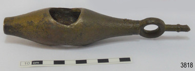
... instrument...marine technology...navigation...TAFFRAIL LOGS A taffrail log is a nautical instrument used for measuring the speed of a vessel, providing vital navigational information to be calculated, such as location and direction. ...Ship log fitting, called a fish; part of a brass navigational instrument, likely to be from a taffrail log. ...The Grange is an example of a mid-19th century vessel that carried a weapon of defence onboard. flagstaff hill warrnambool flagstaff hill maritime museum maritime museum shipwreck coast flagstaff hill maritime village great ocean road west coast trader apollo bay mid-19th century shipwreck the grange scottish barque little henty reef captain a alexander underwater explorers club of victoria vhr 5297 coastal trader wooden shipwreck john chance wooden ship taffrail log marine instrument marine technology navigation nautical instrument mechanical log nautical navigation navigation equipment scientific instrument ship log ship log register ship speed taff rail log patent log towed log taffrail log fish edward massey thomas walker Ship log fitting, called a fish; part of a brass navigational instrument, likely to be from a taffrail log. ...The ship's log part, called a fish, is likely to be from a mechanical taffrail log system. It was recovered from the wreck site of the barque, the 1840-1852 Grange. There are no marks on the fish to identify its maker or model. It is part of the John Chance Collection. This ‘fish’ is part of an early to mid-1800s ship's log. It would likely have been part of a taffrail log connected to a rotor (also called propeller, spinner) by a strong line, and the other end connected by a line to a dial mounted on the taffrail, or stern rail, at the stern of the vessel. As the propeller rotated through the water it would spin the log, which in turn would cause a number to register on the dial, showing the current speed in knots; one knot equals one nautical mile per hour. TAFFRAIL LOGS A taffrail log is a nautical instrument used for measuring the speed of a vessel, providing vital navigational information to be calculated, such as location and direction. A log has been used to measure the speed of a vessel since the 1500s. A simple piece of wood was tied to a long line and thrown into sea at the back of the vessel. The rope was knotted all along at equal distances apart. On a given signal the log line was pulled back into the vessels, the knots counted until the log came up, then the figures were calculated by a navigator In 1802 the first successful mechanical log available for general use was invented by Edward Massey. It had a rotor 'V' section connected to a recording mechanism. The water’s movement rotated the rotor, which intern sent the movement to the recorder. There are examples of this invention available to see in some of the maritime museums. Thomas Walker, nephew of Edward Massey, improved on Massey’s design, and Walker and his son took out a patent on the A1 Harpoon Log. In 1861. Both Massey and Walker continued to improve the designs of the taffrail log. New designs were still being introduced, even up to the 1950s. THE GRANGE, 1840-1858- The wooden barque ’Grange’ was a three-masted ship built in Scotland in 1840 for international and coastal trade. On March 22, 1858, the Grange set sail from Melbourne under Captain A. Alexander, carrying a cargo of ballast. The barque had left the Heads of Phillip Bay and was heading west along the Victorian coast towards Cape Otway. The ship struck Little Haley’s Reef at Apollo Bay due to a navigational error and was stuck on the rocks. The crew left the ship carrying whatever they could onto the beach. Eventually, the remains of the hull, sails and fittings were salvaged before the wreck of the Grange broke up about a month later. About 110 years later, in 1968, the wreck of the Grange was found by divers from the Underwater Explorers Club of Victoria. They were amazed to find a unique, six to nine pound carronade (type of small cannon) and a cannonball on the site. There have been no other similar carronades recorded. In that same year the anchor of the Grange was recovered by diver John Chance and Mal Brown. The ship’s log is significant historically as an example of hardware used when building wooden ships in the early to mid-19th century. The ship’s log is historically significant as an example of the work and trade of blacksmith. The ship’s log also has significant as it was recovered by John Chance, a diver from the wreck of the Grange in the 1968. Items that come from several wrecks along Victoria's coast have since been donated to the Flagstaff Hill Maritime Village’s museum collection by his family, illustrating this item’s level of historical value. The ship’s log is historically significant for its association with the 1840s wooden barque, the Grange. The Grange is an historical example of a Scottish built vessel used for international and coastal trader of both cargo and passengers in the mid-19th century. The Grange is an example of an early ship, designed with a wooden hull. It is significant as a ship still available to divers along the south coast of Victoria, for research and education purposes. The Grange is an example of a mid-19th century vessel that carried a weapon of defence onboard. Ship log fitting, called a fish; part of a brass navigational instrument, likely to be from a taffrail log. The metal is a tan colour and has rough surface with a sheen, and discolouration in places. Its basic shape is a hollow cylinder with ends tapering to a smaller size. In the centre there are opposing openings cut out, showing a rough texture inside. One end on the cylinder is closed with a ring and shank installed, fixed by an embedded screw through the end of the cylinder. There are no inscriptions.flagstaff hill, warrnambool, flagstaff hill maritime museum, maritime museum, shipwreck coast, flagstaff hill maritime village, great ocean road, west coast trader, apollo bay, mid-19th century shipwreck, the grange, scottish barque, little henty reef, captain a alexander, underwater explorers club of victoria, vhr 5297, coastal trader, wooden shipwreck, john chance, wooden ship, taffrail log, marine instrument, marine technology, navigation, nautical instrument, mechanical log, nautical navigation, navigation equipment, scientific instrument, ship log, ship log register, ship speed, taff rail log, patent log, towed log, taffrail log fish, edward massey, thomas walker -
 Frankston RSL Sub Branch
Sextant, Bubble
... This is an aviation navigation instrument used by the RAF and RAAF during the World War 2 era. ...This is an aviation navigation instrument used by the RAF and RAAF during the World War 2 era. ...Bubble Sextant model Mark 1XA type A.M. 6B/218 in protective storage box. Complete, with operation instructions. This is an aviation navigation instrument used by the RAF and RAAF during the World War 2 era. A sextant is used to measure the altitude of celestial bodies above a horizontal line of reference. A navigator can use the horizon as this line of reference, but when an aircraft is above the clouds or flying at night, the navigator can’t see the horizon. The bubble sextant solves this problem by providing an artificial horizon.The storage case has a label with the following: "A.M. 6B/218 MK IX A" and the number "10772/42 (V)" -
 Flagstaff Hill Maritime Museum and Village
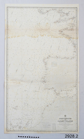
Document - Navigation Chart, Portsmouth to Canary Islands, CA. 1928
... The charts are used in conjunction with other navigational instruments and tools to calculate the vessel’s exact location and a safe route to its destination....The charts are used in conjunction with other navigational instruments and tools to calculate the vessel’s exact location and a safe route to its destination. ...Navigation charts are drawn by professional hydrographers and describe the geography of land and water, enabling a water based navigator on board vessels such as ships to safely negotiate between ports locally and around the world. They are drawn to a particular standard with common symbols noting landmarks. The charts are used in conjunction with other navigational instruments and tools to calculate the vessel’s exact location and a safe route to its destination.The set of charts and their chart are of significance as examples of equipment and documents used to navigate the oceans of the world, particularly to Australia. Migration to Australia is an important part of this country's history.British Admiralty Navigation Chart - Portsmouth to Canary Islands - printed on rectangular white paper. Published in London by the British Admiralty in 1928.warrnambool, shipwreck coast, flagstaff hill, flagstaff hill maritime museum, flagstaff hill maritime village, chart, map, navigate, navigation, location, vessel, 1928, british admiralty, hydrographer, geography, admiralty chart, portsmouth, canary islands -
 Flagstaff Hill Maritime Museum and Village
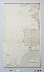
Document - Navigation Chart, Portsmouth to Canary Islands, Ca. 1928
... The charts are used in conjunction with other navigational instruments and tools to calculate the vessel’s exact location and a safe route to its destination....The charts are used in conjunction with other navigational instruments and tools to calculate the vessel’s exact location and a safe route to its destination. ...This is an Official British Admiralty Navigation Chart, one of a set of 65 charts donated together with a wooden chart case. It was published and printed in London in 1928 by the British Admiralty. Navigation charts are drawn by professional hydrographers and describe the geography of land and water, enabling a water based navigator on board vessels such as ships to safely negotiate between ports locally and around the world. They are drawn to a particular standard with common symbols noting landmarks. The charts are used in conjunction with other navigational instruments and tools to calculate the vessel’s exact location and a safe route to its destination.The set of charts and their chart are of significance as examples of equipment and documents used to navigate the oceans of the world, particularly to Australia. Migration to Australia is an important part of this country's history.British Admiralty Navigation Chart - Portsmouth to Canary Islands - printed on rectangular white paper. Published in London by the British Admiralty in 1928.warrnambool, shipwreck coast, flagstaff hill, flagstaff hill maritime museum, flagstaff hill maritime village, chart, map, navigate, navigation, location, vessel, 1928, british admiralty, hydrographer, geography, admiralty chart, portsmouth, canary islands -
 Flagstaff Hill Maritime Museum and Village
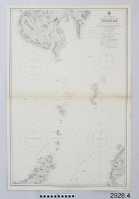
Document - Navigation Chart, Eastern Part of the Celebes Sea, Ca. 1928
... The charts are used in conjunction with other navigational instruments and tools to calculate the vessel’s exact location and a safe route to its destination....The charts are used in conjunction with other navigational instruments and tools to calculate the vessel’s exact location and a safe route to its destination. ...This is an Official British Admiralty Navigation Chart, one of a set of 65 charts donated together with a wooden chart case. It was published and printed in London in 1928 by the British Admiralty. Navigation charts are drawn by professional hydrographers and describe the geography of land and water, enabling a water based navigator on board vessels such as ships to safely negotiate between ports locally and around the world. They are drawn to a particular standard with common symbols noting landmarks. The charts are used in conjunction with other navigational instruments and tools to calculate the vessel’s exact location and a safe route to its destination.The set of charts and their chart are of significance as examples of equipment and documents used to navigate the oceans of the world, particularly to Australia. Migration to Australia is an important part of this country's history.British Admiralty Navigation Chart - Eastern Part of the Celebes Sea - printed on rectangular white paper. Published in London by the British Admiralty in 1928.warrnambool, shipwreck coast, flagstaff hill, flagstaff hill maritime museum, flagstaff hill maritime village, chart, map, navigate, navigation, location, vessel, 1928, british admiralty, hydrographer, geography, admiralty chart, celebes sea -
 Department of Energy, Environment and Climate Action
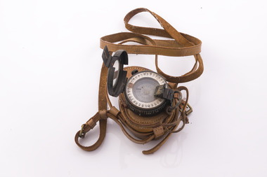
Prismatic Compass with leather case and strap, Ex Army 1940s
... A prismatic compass is a common navigation and surveying instrument which was used extensively by the Forests Commission The compass most commonly used to run a traverse line. ...Department of Energy, Environment and Climate Action 71-79 Kyle Road Altona North A prismatic compass is a common navigation and surveying instrument which was used extensively by the Forests Commission The compass most commonly used to run a traverse line. ...A prismatic compass is a common navigation and surveying instrument which was used extensively by the Forests Commission The compass most commonly used to run a traverse line. The compass calculates bearings of lines with respect to magnetic needle. A magnetic deviation correction was needed to convert the reading to a true bearing The compass could also determine angles between the traverse and waypoints (such as hilltop features). Commonly used for navigation. Largely replaced by modern GPS technology.Ex Army WW2 prismatic compass with leather case and strap. Rugged design and made of metal the internal compass plate floats on oil to help it stabilise The user lines up the direction of travel with the hair sightline in the fliptop cover and readings are taken through the viewfinder prism (hence the name).forest measurement, surveying, forests commission victoria (fcv) -
 Flagstaff Hill Maritime Museum and Village
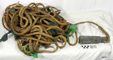
Equipment - Lead line
... ...navigation instrument...The lead line or hand lead is a simple navigational instrument used as a depth finder to measure the depth of water under the ship’s keel and to take samples of the sea bed. ...Flagstaff Hill Maritime Museum and Village 89 Merri Street Warrnambool great-ocean-road The lead line or hand lead is a simple navigational instrument used as a depth finder to measure the depth of water under the ship’s keel and to take samples of the sea bed. ...The lead line or hand lead is a simple navigational instrument used as a depth finder to measure the depth of water under the ship’s keel and to take samples of the sea bed. The long line may be marked at regular intervals with tags of different coloured and textured fabric, such as rope, leather and cloth. Each tag was a code to represent a certain depth. The leadsman’s eyes and hands could distinguish the depth easily as he drew in the lead line, day or night and in poor weather conditions. A standard set of codes for the tags was used so that the depth of the sea could be easily and quickly read. The measurement used was a Fathom, which equals 1.83 metres. The codes were: - 2 fathoms = 2 strips of leather 3 fathoms = 3 strips of leather 5 fathoms = white duck fabric 7 fathoms = red bunting fabric 10 fathoms = leather with a hole 13 fathoms = blue serge fabric 15 fathoms = white duck fabric 17 fathoms = red bunting 20 fathoms = 2 knots The lead weight could be between 7 -14 pounds (3.5 – 6.5kg) and the rope would be approximately 25 fathoms (45m). The hollowed-out end of the weight would hold a stick substance such as tallow or wax, which would pick up samples from the sea bed which would show whether the vessel was close to, or far away from, the shore. The leadsman would stand at the front of the vessel and cast the lead line into the sea. When it hit bottom he would note the tag marker nearest the surface of the water and call out his finding. Then he would haul it up again and examine the kind of matter that adhered to the end of the weight, whether it be sand, mud, gravel, or the colour of it. This information would be given to the ship’s helmsman or navigator and would help indicate the proximity to the land.This handheld lead is an example of early marine navigational equipment used by sailors to travel the seas to measure the depth of the water and sample the nature of the seabed. It helps to understand the history and progress made from the very basic to the sophisticated technology of today.Lead line, sounding line or depth finder. The long length of rope has a heavy lead weight attached to the end. Coloured fabric tags are tied onto the rope at regular intervals, representing different depths. The concave base of weight holds sticky substances such as tallow or beeswax, providing an adhesive surface to collect samples of sea bed like sand, shells or pebbles. flagstaff hill, warrnambool, shipwrecked coast, flagstaff hill maritime museum, maritime museum, shipwreck coast, flagstaff hill maritime village, lead line, depth finder, hand lead, sounding lin, leadsmane, navigation instrument, leadline, hand lead line