Showing 5 items matching "navigational textbook"
-
 Flagstaff Hill Maritime Museum and Village
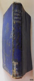
Book - Technical Reference, James Tait, Extra Master and Author et al, Tait's Home Trade Guide to the Board of Trade Examinations for Mates and Masters, 1943
... ...navigational textbook...Textbook for Mariners. Includes tables and maps, diagrams and formulas, and navigational information. ...It is an aid to understanding the navigational methods of the time and the changes and improvements in more recent history. flagstaff hill warrnambool shipwrecked coast flagstaff hill maritime museum maritime museum shipwreck coast flagstaff hill maritime village great ocean road james tait brown, son and ferguson limited torpedo open fire pt welch vessel gascoyne e-boat u-boat marine technology World War II WWII WW2 navigation exams Ship's Mate Ship's Master WWII textbook nautical textbook navigational textbook examination textbook World War II textbook 1943 nautical textbook Spint, in silver embossing "TAIT'S HOME TRADE GUIDE" Handwritten inside the back cover "R.A.D. / MOORE / PT. ...The book includes navigational information, tables and maps, diagrams and formulas. It was written for Examiners and Students studying for their nautical Mates and Masters marine qualifications— notes have been handwritten inside the front and back covers. Notes in point form: 1. I have seen the back of a torpedo EBoat or UBoat in my starboard side 2. I _ _ _ to - - - - - - - - - Port side 3. at a distance ----------- 4. Enemy surface vessel in sight __________ 5. suspicious vessel in sight 6. enemy (undecipherable) 7. I have cut a _ _ _ adrift with my _ _ 8. FI_ _ WISE _ _ _ 9. STARWISE 0. OPEN FIREThis relatively rare book provided up-to-date navigational information during World War II. It was to be used by Examiners to assess whether students qualified to be a Ship's Mate or Ship's Master. The contents of the book were based on maritime knowledge gained over centuries. It is an aid to understanding the navigational methods of the time and the changes and improvements in more recent history.Title: Tait's Home Trade Guide: to the Board of Trade Examinations for Mates and Masters Author: James Tait, Extra Master Publisher: Brown, Son and Ferguson, Ltd. Glasgow, Great Britain Date: Revised Edition 1943 Further Information: Fourteenth Edition 1941, Reprinted Edition 1943. Revised and brought up to date by Captain H. T. Jefferys, Extra Master Printed by Nautical Press, Brown, Son & Ferguson, Limited, 52-58 Darnley Street, Glasgow Hardcover, small book, royal blue cover, silver embossed text on spine. Textbook for Mariners. Includes tables and maps, diagrams and formulas, and navigational information. The inside covers of this book contain handwritten calculations, diagrams and notes that refer to navigation. Notes inside the back cover refer to an enemy vessel and OPEN FIRE.Spint, in silver embossing "TAIT'S HOME TRADE GUIDE" Handwritten inside the back cover "R.A.D. / MOORE / PT. WELCH" Included with the text inside the back cover "Gascoyne" "506" and "RCM"flagstaff hill, warrnambool, shipwrecked coast, flagstaff hill maritime museum, maritime museum, shipwreck coast, flagstaff hill maritime village, great ocean road, james tait, brown, son and ferguson limited, torpedo, open fire, pt welch, vessel gascoyne, e-boat, u-boat, marine technology, world war ii, wwii, ww2, navigation exams, ship's mate, ship's master, wwii textbook, nautical textbook, navigational textbook, examination textbook, world war ii textbook, 1943 nautical textbook -
 Flagstaff Hill Maritime Museum and Village
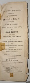
Book - Reference, navigation, J. W. Norie (author and editor), The Seaman and Merchants Complete Expeditious Measurer, 1853
... The book was published at the same address as London’s Navigation Waterhouse and Naval Academy. It is likely to be one of the textbooks used in educating seafarers, both naval and merchant. ...Flagstaff Hill Maritime Museum and Village 89 Merri Street Warrnambool great-ocean-road The book was published at the same address as London’s Navigation Waterhouse and Naval Academy. It is likely to be one of the textbooks used in educating seafarers, both naval and merchant. ...The book was published at the same address as London’s Navigation Waterhouse and Naval Academy. It is likely to be one of the textbooks used in educating seafarers, both naval and merchant. It is the twenty-fifth edition, showing that it was in great demand in the early to mid-19th century. Sea merchants could have used this as a reference for working out freight costs for their cargo. Customs Officers could have referred to it as well to calculate fees and taxes. The book’s owner had inscribed in pen and ink "Rose Anna, Schooner, Melbourne, March 25th 1857". At that time, the registered owners were Thomas Lamb & E. Keays, who were freighting cargo between Melbourne and Geelong. Schooner, ROSE ANNA: - The schooner Rose Anna was built in 1844 at Fremantle, W.A., by H. Edwards for Capt. William Heard. The 2-masted wooden vessel was carvel-built. Captain Heard registered Rose Anna at Fremantle in 1845 and in the same year, registered it at Port Adelaide. in 1852, Rose Anna was crushed and sunk at Port Adelaide by the Selma and raised. In 1852, the schooner was lengthened by William Hardy. In 1853, William Burton and W. Roberts registered Rose Anna at Melbourne. In 1855, W. Roberts registered, followed by John Balston & Thomas Ross. In 1856, it was registered by Thomas Lamb & E. Keays, in 1857 by William Howes & Charles Holland, in 1865 by Charles Holland & John Balfour, and in 1866 registered in Melbourne by mariners John Balfour & David Griffiths. In the 1940s, Rose Anna traded between Hobart, Melbourne, Adelaide, Sydney, Circular Head, Port Fairy, and Port Albert. In the 1950s and 1960s, it traded between Geelong Heads and Hobsons Bay, Melbourne, in lime, wool, general cargo and ballast. In 1857, when Rose Anna’s registered owners were Thomas Lamb & E. Keays, an advertisement was placed in The Age on March 9th, announcing that the Rose Anna was taking freight from Melbourne to Geelong. Later in the year, in October, the registered owners were William Howes & Charles Holland. They were still trading with Geelong, as on October 7th, The Age announced that Rose Anna arrived in Geelong from Melbourne on October 5th. On October 6th, 1866, Rose Anna went ashore while loading wheat at Sandridge, Port Phillip Bay, in severe gales and heavy seas and became a total wreck. The book is significant for its association with reference information to instruct sea merchant traders and naval officers. The publication is in its twenty-fifth edition, indicating the importance of such an instructional book. The book of tables and calculations shows the evolution of such reference texts, going from handwritten notes, to printed tables like these, and forward to slide rules, calculators, and to modern time computers. it demonstrates the importance of accuracy in calculating weights and measures at sea and for the purposes of fess, charges and taxes. The book is important to the history of the schooner Rose Anna, which is listed as a significant vessel on the Victorian Heritage Register, S582, as it has an inscription with the ship's name, date, and destination. Book, tall and narrow, with index tabs on the side edges of the pages. FULL Title: The Seaman and Merchants Complete Expeditious Measurer: The Seaman and Merchants Complete Expeditious Measure; containing a set of tables which show, at one view, the solid contents of all kinds of packags and casks, according to their several lengths, breadths and depths: also, rules for determining the contents of all sorts of casks in wine and beer measure, according to the Imperial Standard. Twenty-Fifth (Stereotype) Edition. Author: Mr J W Norie (John William Norie) Date: 1853 Publisher: Charles Wilson (late J.W. Norrie & Wilson), Bookseller, Publisher and Stationer, At the Navigation Waterhouse and Naval Academy, No. 157, Leadenhall Street, where may be had all the publications of Steel & Co. Late at No. 70, Cornhill. Printer: Bateman and Dennis, 95 Leadenhall Street, London, England, 1853 The book has handwritten, pen and ink inscriptions. It refers to the Schooner, Rose Anna, Melbourne, March 25th 1857.Handwritten in script with pen and ink: "Rose Anna / Schooner / Melbourne, / March 25th 1857"flagstaff hill, warrnambool, shipwrecked-coast, flagstaff-hill, flagstaff-hill-maritime-museum, maritime-museum, shipwreck-coast, flagstaff-hill-maritime-village, the seaman and merchants complete expeditious measurer, book, sea merchants, cargo, calculations, measurements, sea trade, maritime book, sea transportation, cargo rate calculations, naval academy, navy education, navigation, navigation instruction, navigation waterhouse and naval academy, twenty-fifth edition, 19th century, 1853, 1857, customs, freight, ullage, rose anna, schooner, 2-masted, march 25th 1857, melbourne, 25 march 1857, thomas lamb & e. keays, geelong, 1844, h. edwards, fremantle, carvel-built, port adelaide, selma, william hardy, william burton and w. roberts, john balston & thomas ross., charles holland & john balfour, john balfour & david griffiths, hobart, sydney, circular head, port fairy, port albert, hobsons bay, sandridge, port phillip bay -
 Flagstaff Hill Maritime Museum and Village
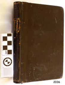
Book - Textbook, Introduction to Modern Geography
... textbooks and reference books, one of which was Introduction to Modern Geography, first published in Belfast in 1827, and revised and published in over 20 more editions. Thomson tutored two of his several children at home. His older son James Thomson (1822-1892) became an engineer and physicist. His younger son William Thomson (1824-1907) became Professor of Natural Philosophy from 1846-1899 at the University of Glasgow, and later the 1st Baron of Kelvin, famous for his designs of nautical instruments such as the navigational compass and sounding equipment used in the transatlantic installation of sea cable. ...textbooks and reference books, one of which was Introduction to Modern Geography, first published in Belfast in 1827, and revised and published in over 20 more editions. Thomson tutored two of his several children at home. His older son James Thomson (1822-1892) became an engineer and physicist. His younger son William Thomson (1824-1907) became Professor of Natural Philosophy from 1846-1899 at the University of Glasgow, and later the 1st Baron of Kelvin, famous for his designs of nautical instruments such as the navigational compass and sounding equipment used in the transatlantic installation of sea cable. ...This mid-19th century scientific reference book, Introduction to Modern Geography, explains geography and astronomy using the globe of the world as a teaching aid. The inscription connects this book to the Bobinawarrah Public Library but research to date has found no further details about the library. The rural area was settled in 1859, but in 2016 its population was only 87. It is situated about 21 kilometres south of the City of Wangaratta, in Northeast Victoria. In 2024 the local community received a grant for preservation of its almost 100-year-old Bobinawarrah Memorial Hall which displays an honour board of the Pioneers of Bobinawarrah 1859-1959. The donor of the book lived in Warrnambool. ABOUT THE AUTHOR, James Thomson (1786-1849): - James Thomson was a British Irish mathematician. He became Professor of Mathematics at the University of Glasgow. He wrote many school textbooks and reference books, one of which was Introduction to Modern Geography, first published in Belfast in 1827, and revised and published in over 20 more editions. Thomson tutored two of his several children at home. His older son James Thomson (1822-1892) became an engineer and physicist. His younger son William Thomson (1824-1907) became Professor of Natural Philosophy from 1846-1899 at the University of Glasgow, and later the 1st Baron of Kelvin, famous for his designs of nautical instruments such as the navigational compass and sounding equipment used in the transatlantic installation of sea cable. William was part of the firm that became famous as Kelvin & Hughes Ltd., suppliers of radar and echo sounders to the Ministry of Transport and the Ministry of Defence. The name continued on as Kelvin & Hughes. James Thomson (1786-1849) was a renowned British Irish mathematician and Professor of Mathematics at the University of Glasgow. He was a respected author of many important school books and textbooks that were widely used to provide understanding of arithmetic and geography. Thomson encouraged practical education and held extra classes for young ladies to learn mathematics and geography, which were a novelty at that time. Many of his works were known and used worldwide. This work was published in many editions. It is now considered as culturally significant as a basis for knowledge about our civilisation and has been made publicly available in overseas countries, and republished and reproduced in a readable format, including its diagrams and maps. Book; scientific textbook. The book has a black leather cover. The front cover is blank, but the spine has an embossed gold vertical title within a rectangular border boasting fancy corners. The fly page has a detailed title. The author is James Thomson. It is the Eighteenth edition, published in Simms & McIntyre of London and Belfast in 1845. An inscription connects it to the Bobinawarrah Public Library in Victoria.Spine within a gold border: "THOMSON'S GEOGRAPHY" Fly Page: "AN INTRODUCTION TO MODERN GEOGRAPHY, WITH AN APPENDIX, CONTAINING AN OUTLINE OF ASTRONOMY, AND THE USE OF THE GLOBES. BY JAMES THOMSON, LL.D., PROFESSOR OF MATHEMATICS IN THE UNIVERSITY OF GLASGOW." "Eighteenth Edition" "LONDON: SIMMS AND McINTYRE, ALDINE CHAMBERS, PATERSOSTER ROW; AND DONEGALL -STREET, BELFAST.""1845"flagstaff hill, flagstaff hill maritime museum and village, warrnambool, maritime museum, maritime village, great ocean road, shipwreck coast, introduction to geography, james thomson, reference book, professor thomson's introduction to modern geography, bobinawarrah public library, james thomson mathematician, james thomson engineer, 19th century irish mathematician, irish presbyterian, william thomson 1st baron of kelvin, professor of mathematics, glasgow university, william thomson professor of natural philosophy, introduction to modern geography, outline of astronomy, use of the globes, james thomson ll.d., simms and mcintyre, 1843, scientific book, school book, lord kelvin, baron kelvin of langs, nautical instruments, marine instruments, transatlantic cable, kelvin & hughes, thomson’s geography, astronomy, geography, world globe, cartography, pioneers of bobinawarrah, textbook -
 Flagstaff Hill Maritime Museum and Village
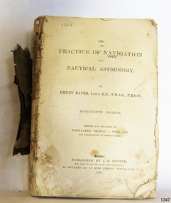
Book - Technical Reference, Henry Raper, Lieut. R.N, The Practice of Navigation and Nautical Astronomy, 1891
... textbook is the nineteenth edition of the book by Henry Raper, Lieutenant in the Royal Navy with awards that include F.R.A.S. (Fellow of the Royal Astronomical Society) and F.R.G.S. (Friend of the Royal Geographical Society). The book is dedicated in honour of Rear-Admiral Sir Francis Beaufort K.C.B., Hydrographer to the Admiralty. He was awarded the title K.C.B. (King's Commander) as a Member of the Order of Bath, an order of British Chivalry, The book was first published in 1840 and soon became a resource for navigation...navigation worldwide by seamen from many walks of life. The publisher, J D Potter of London, was at that time the sole agent for the Admiralty Charts produced by the Royal Navy. Printer Spottswoode and Co.,. was established by William Strachan in 1738. In 1819 his nephews A and R Spottswoode took over the business and bought premises in New-Street Square and Shoe Lane. In 1850 over 200 workers were employed by the firm. and five years later the business became Spottswoode & Co. Andrew Spottswoode invented the Spottswoode Press. This technical book was very popular as a textbook ...This technical textbook is the nineteenth edition of the book by Henry Raper, Lieutenant in the Royal Navy with awards that include F.R.A.S. (Fellow of the Royal Astronomical Society) and F.R.G.S. (Friend of the Royal Geographical Society). The book is dedicated in honour of Rear-Admiral Sir Francis Beaufort K.C.B., Hydrographer to the Admiralty. He was awarded the title K.C.B. (King's Commander) as a Member of the Order of Bath, an order of British Chivalry, The book was first published in 1840 and soon became a resource for navigation students. It includes topics on nautical navigation, astronomy, navigation charts, calculations and mathematical tables, time, tides, ships, longitude, and position at sea. Thomas A. Hull, who revised and expanded this edition, was a Commander in the Royal Navy and had previously been Superintendent of Admiralty Charts used for navigation worldwide by seamen from many walks of life. The publisher, J D Potter of London, was at that time the sole agent for the Admiralty Charts produced by the Royal Navy. Printer Spottswoode and Co.,. was established by William Strachan in 1738. In 1819 his nephews A and R Spottswoode took over the business and bought premises in New-Street Square and Shoe Lane. In 1850 over 200 workers were employed by the firm. and five years later the business became Spottswoode & Co. Andrew Spottswoode invented the Spottswoode Press.This technical book was very popular as a textbook for students of maritime navigation, written and updated by members of the British Royal Navy and relied upon for accurate advice and information. The first edition was published in 1840, this edition was updated, expanded and published in 1891 when ports around the world were filling with travellers, merchants and business people. Title: The Practice of Navigation and Nautical Astronomy Author: Henry Raper, Lieut, R.N., F.R.A.S., F.R.G.S. Nineteenth Edition, revised and enlarged by Commander Thomas A. Hull, R.N., Late Superintendant of Admiralty Charts Dedication: To Rear-Admiral Sir Francis Beaufort K.C.B. Publisher: J D Potter, London, sole agent for the sale of Admiralty Charts Printer: Spottswoode and Co. New-Street Square, London Date: 1891 Small leather hardcover book with gold embossed text and lines on the spine. The Dedication in the book is as follows: - "To Rear-Admiral Sir Francis Beaufort K.C.B. Hydrographer to the Admiralty. Sir, The eminent station which you occupy in the naval scientific world renders it highly gratifying to me to dedicate the following Work to you as a testimony of my regard and esteem; while the general accordance of my views on the subject with those of your more experienced judgement, gives me the greater confidence in laying my labours before the Public. I have the honour to be, Sir, Your obedient servant, HENRY RAPER"flagstaff hill maritime museum, maritime museum, shipwreck coast, flagstaff hill, warrnambool, flagstaff hill maritime village, book, navigation, nautical astronomy, hydrography, nautical charts, nautical navigation, astronomical navigation, admiralty charts, henry raper, thomas a. hull, royal navy, j d potter, royal astronomical society, royal geographical society, calculations, mathematical tables, longitude, latitude, nautical time, location at sea, position at sea, maritime, practical navigation, spottswoode and co., sir francis beaufort, k.c.b., rear-admiral sir francis beaufort, hydrographer to the admiralty, scientific book, naval science -
 Moorabbin Air Museum
Book - Private pilot manuals, Private Pilot Manual
... Meteorology Air navigation Radio navigation Aviation physiology Pre flight planning Training textbook for private pilots, circa 1991 Private Pilot Manual Book Private pilot manuals ...Training textbook for private pilots, circa 1991non-fictionTraining textbook for private pilots, circa 1991principles of flight, the flight environment, aircraft systems & performance., meteorology, air navigation, radio navigation, aviation physiology, pre flight planning