Showing 52 items matching "nerring"
-
 Bendigo Historical Society Inc.
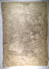
Map - NERRING, 25/08/1903 ?
... NERRING......Nerring...Map: Parish of Nerring, County of Bendigo. Parish plan Canvas backed...Parish plan Canvas backed Map NERRING ...Map: Parish of Nerring, County of Bendigo. Parish plan Canvas backedmap, bendigo, rural, nerring, county of bendigo -
 Bendigo Historical Society Inc.
Map - NERRING, August 1952
... NERRING......Nerring...Map: Nerring, County of Bendigo. Parish plan ( number 180 in Map Cupboard 1)...History House 11 Mackenzie Street Bendigo goldfields MAP Bendigo parish plan Nerring county of Bendigo Map: Nerring, County of Bendigo. ...Map: Nerring, County of Bendigo. Parish plan ( number 180 in Map Cupboard 1)map, bendigo, parish plan, nerring, county of bendigo -
Bendigo Historical Society Inc.
Map - NERRING, 15/06/1937
... NERRING......Nerring...Map: Parish of Nerring, County of Bendigo. Parish plan Canvas backed ( number 139 in Map Cupboard 1)...History House 11 Mackenzie Street Bendigo goldfields MAP Bendigo rural Nerring County of Bendigo Map: Parish of Nerring, County of Bendigo. ...Map: Parish of Nerring, County of Bendigo. Parish plan Canvas backed ( number 139 in Map Cupboard 1)map, bendigo, rural, nerring, county of bendigo -
Bendigo Historical Society Inc.
Map - NERRING SHEET 2, 21/12/1894
... ...Nerring...Map[: Nerring sheet 2 ( number 187 in Map Cupboard 1)...History House 11 Mackenzie Street Bendigo goldfields MAP Bendigo parish plan Nerring Map[: Nerring sheet 2 ( number 187 in Map Cupboard 1) Map NERRING SHEET 2 ...Map[: Nerring sheet 2 ( number 187 in Map Cupboard 1)map, bendigo, parish plan, nerring -
Bendigo Historical Society Inc.
Map - NERRING SHEET 4, Circa 1890's
... ...Nerring...Map: Nerring (part 4) . Parish plan ( number 189 in Map Cupboard 1)...History House 11 Mackenzie Street Bendigo goldfields MAP Bendigo parish plan Nerring Map: Nerring (part 4) . Parish plan ( number 189 in Map Cupboard 1) Map NERRING SHEET 4 ...Map: Nerring (part 4) . Parish plan ( number 189 in Map Cupboard 1)map, bendigo, parish plan, nerring -
Bendigo Historical Society Inc.
Map - NERRING. SHEET ?, Circa 1894
... ...Nerring...Map: Nerring, Part ( number unreadable), County of Bendigo. ...History House 11 Mackenzie Street Bendigo goldfields MAP Bendigo parish plan Nerring Map: Nerring, Part ( number unreadable), County of Bendigo. ...Map: Nerring, Part ( number unreadable), County of Bendigo. Parish plan ( number 190 in Map Cupboard 1)map, bendigo, parish plan, nerring -
Bendigo Historical Society Inc.
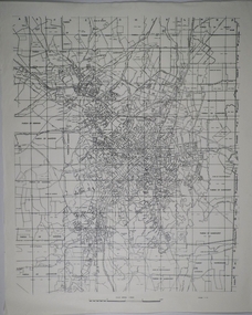
Map - NERRING : COUNTY OF BENDIGO, August 1952
... ...nerring...Map. Nerring, County Of Bendigo. Yarraberb, Neilborough, Huntly, Sandhurst, Leichardt, Marong. ...(number 0 in map cupboard 1) Map NERRING : COUNTY OF BENDIGO ...Map. Nerring, County Of Bendigo. Yarraberb, Neilborough, Huntly, Sandhurst, Leichardt, Marong. Drawn and reproduced at the Department of Lands and Survey, Melbourne,Victoria. August 1952, Price 2/-. By Appointment J.J. Gourley, Government Printer, Melbourne. (number 0 in map cupboard 1)J.J. Gourley,Government Printermap, bendigo, nerring -
Bendigo Historical Society Inc.
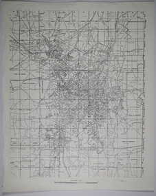
Map - NERRING : COUNTY OF BENDIGO, August 1952
... ...nerring...Map. Nerring, County of Bendigo, Yarraberb, Leichardt, Marong, Sandhurst, Huntly, Neilborough, Bendigo and Swan Hill Railway, Bendigo and Kulwin Railway, Loddon Valley Highway. ...(number 76 in map cupboard 1) Map NERRING : COUNTY OF BENDIGO. ...Map. Nerring, County of Bendigo, Yarraberb, Leichardt, Marong, Sandhurst, Huntly, Neilborough, Bendigo and Swan Hill Railway, Bendigo and Kulwin Railway, Loddon Valley Highway. By authority J.J. Gourley, Government Printer, Melbourne. Drawn and reproduced at the Department of Lands and Survey, Melbourne, Victoria. August 1952. Price $1.00. (number 76 in map cupboard 1)J.J. Gourley, Government Printer, Melbourne.map, bendigo, nerring -
Bendigo Historical Society Inc.
Map - CAMPBELL COLLECTION: BENDIGO AND DISTRICT MAPS, 15-2-29
... Map. Nerring, Parish of Nerring, scale 20 chains to 1 inch. ...History House 11 Mackenzie Street Bendigo goldfields MAP Bendigo parish plan W.J.Galbraith Map. Nerring, Parish of Nerring, scale 20 chains to 1 inch. ...Map. Nerring, Parish of Nerring, scale 20 chains to 1 inch. Prepared in W.J.B. from A and B plans by W.J. Galbraith 15-2-29. (number 356 in map cupboard 1)W.J.Galbraithmap, bendigo, parish plan -
Bendigo Historical Society Inc.
Map - CAMPBELL COLLECTION: BENDIGO AND DISTRICT MAPS, 15-2-29
... Map. Nerring, Parish of Nerring, scale 20 chains to 1 inch. ...History House 11 Mackenzie Street Bendigo goldfields MAP Bendigo agricultural lands W.J.Galbraith Map. Nerring, Parish of Nerring, scale 20 chains to 1 inch. ...Map. Nerring, Parish of Nerring, scale 20 chains to 1 inch. Prepared in W.P.B. from A. and P. Plans by W.J. Galbraith. 15-2-29. (number 379 in map cupboard 1)W.J.Galbraithmap, bendigo, agricultural lands -
Bendigo Historical Society Inc.
Map - BOROUGH OF EAGLEHAWK SHEET 1A, 30/11/1931
... Map: Borough of Eaglehawk, Parish of Nerring. Parish plan ( number 186 in Map Cupboard 1)...History House 11 Mackenzie Street Bendigo goldfields MAP Bendigo parish plan Borough of Eaglehawk Parish of Nerring Map: Borough of Eaglehawk, Parish of Nerring. ...Map: Borough of Eaglehawk, Parish of Nerring. Parish plan ( number 186 in Map Cupboard 1)map, bendigo, parish plan, borough of eaglehawk, parish of nerring -
 Bendigo Historical Society Inc.
Map - BOROUGH OF EAGLEHAWK RE-SURVEY, 6/06/1883
... Map: Re-survey, Borough of Eaglhawk, Parishes of Nerring and Sandhurst, Sheet No. 1. Parish plan...History House 11 Mackenzie Street Bendigo goldfields MAP Bendigo re-survey Borough of Eaglehawk Re-survey Map: Re-survey, Borough of Eaglhawk, Parishes of Nerring and Sandhurst, Sheet No. 1. Parish plan Map BOROUGH OF EAGLEHAWK RE-SURVEY ...Map: Re-survey, Borough of Eaglhawk, Parishes of Nerring and Sandhurst, Sheet No. 1. Parish planmap, bendigo, re-survey, borough of eaglehawk, re-survey -
Bendigo Historical Society Inc.
Map - BOROUGH OF EAGLEHAWK, 30/11/1931
... Map: Borough of Eagle hawk, Parish of Nerring. Parish plan with coloured areas ( number 185 in Map Cupboard 1)...History House 11 Mackenzie Street Bendigo goldfields MAP Bendigo parish plan Borough of Eaglehawk Parish of Nerring Map: Borough of Eagle hawk, Parish of Nerring. ...Map: Borough of Eagle hawk, Parish of Nerring. Parish plan with coloured areas ( number 185 in Map Cupboard 1)map, bendigo, parish plan, borough of eaglehawk, parish of nerring -
 Bendigo Historical Society Inc.
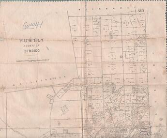
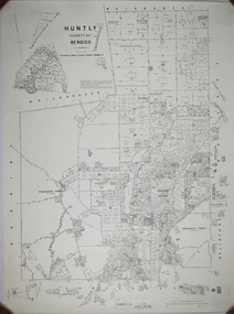
Map - MAP. HUNTLY. COUNTY OF BENDIGO, 1912
... Wellsford. Bagshot. Nerring. Wirrakee. Sandhurst. Photo-lithographed at the Department of lands and Survey. ...Wellsford. Bagshot. Nerring. Wirrakee. Sandhurst. Photo-lithographed at the Department of lands and Survey. ...Map. Huntly. County of Bendigo. Wellsford. Bagshot. Nerring. Wirrakee. Sandhurst. Photo-lithographed at the Department of lands and Survey. Melbourne byW. J. Butson -
 Bendigo Historical Society Inc.
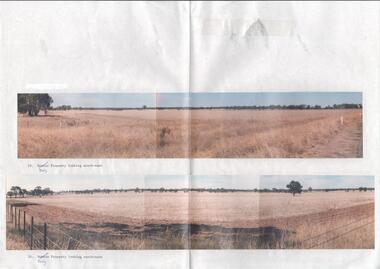
Photograph - Kangaroo Flat Gold Mine Collection: photos of Woodvale site, Daly property, pre dam construction, 1986
... Land size was 16 acres, known as Allotment 13, Section 3, Parish of Nerring. ...Land size was 16 acres, known as Allotment 13, Section 3, Parish of Nerring. Woodvale G.P. Daly Western Mining Corporation purchase Paper with two colour photographs attached, each of three photos joined to show landscape view, of the property purchased from G.P Daly by Western Mining Corporation. ...Photographs taken at the time of the purchase by Western Mining Corporation of the property owned by G.P. Daly of Raywood Road, Woodvale, in 1986. The intent of the purchase was to provide land for the Woodvale ponds. Land size was 16 acres, known as Allotment 13, Section 3, Parish of Nerring. Paper with two colour photographs attached, each of three photos joined to show landscape view, of the property purchased from G.P Daly by Western Mining Corporation. Photographs show rural land, grassy paddocks with tree line in background. Barb wire fence visible in foreground of bottom photo. Top photograph is titled 23. Daly property looking south-east. Bottom photograph is titled 24. Daly property looking north east. woodvale, g.p. daly, western mining corporation, purchase -
 Bendigo Historical Society Inc.
Map - CAMPBELL COLLECTION: BENDIGO AND DISTRICT MAPS
... Sandhurst and suburbs, Parish of Sandhurst, Parish of Huntly, Parish of Nerring, Parish of Marong, Parish of Lockwood, Parish of Wellsford, Parish of Strathfieldsaye, Parish of Mandurang...Sandhurst and suburbs, Parish of Sandhurst, Parish of Huntly, Parish of Nerring, Parish of Marong, Parish of Lockwood, Parish of Wellsford, Parish of Strathfieldsaye, Parish of Mandurang Map CAMPBELL COLLECTION: BENDIGO AND DISTRICT MAPS. ...Map. Sandhurst and suburbs, Parish of Sandhurst, Parish of Huntly, Parish of Nerring, Parish of Marong, Parish of Lockwood, Parish of Wellsford, Parish of Strathfieldsaye, Parish of Mandurangmap, bendigo, parishes -
 Bendigo Historical Society Inc.
Map - CAMPBELL COLLECTION: BENDIGO AND DISTRICT MAPS
... Parish of Sandhurst, Parish of Huntly, Parish of Nerring, Parish of Marong, Parish of Lockwood, Parish of Wellsford, Parish of Strathfieldsaye, Parish of Mandurang. ...Parish of Sandhurst, Parish of Huntly, Parish of Nerring, Parish of Marong, Parish of Lockwood, Parish of Wellsford, Parish of Strathfieldsaye, Parish of Mandurang. ...Map. Parish of Sandhurst, Parish of Huntly, Parish of Nerring, Parish of Marong, Parish of Lockwood, Parish of Wellsford, Parish of Strathfieldsaye, Parish of Mandurang. Scale approx 1:18,000.map, bendigo, parishes -
 Bendigo Historical Society Inc.
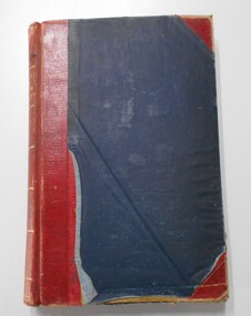
Book - LANDS OFFICE: INDEX LANDS AND SURVEY
... Sandhurst, Kangaroo Flat, Eaglehawk, White Hills, And Nerring. Land Sales, Beginning April 17, 1854. ...Sandhurst, Kangaroo Flat, Eaglehawk, White Hills, And Nerring. Land Sales, Beginning April 17, 1854. ...Index lands and Survey. Sandhurst, Kangaroo Flat, Eaglehawk, White Hills, And Nerring. Land Sales, Beginning April 17, 1854. The last entry is dated 23.9.74. markings on spine of book are at top 04 in black, in gold lettering index lands and Survey, in black Bendigo, Eaglehawk, Kangaroo Flat White Hills and Nerring, near the bottom is the letter B in black, a white sticker with the letters VV. Read in conjunction with 2239 (a to g), located in Box 77.lands office, index, survey -
 Bendigo Historical Society Inc.
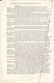
Document - PETER ELLIS COLLECTION: DRAFT OF WHIPSTICK SUBMISSION
... Locations are in the Parishes of Whirrakee, Egerton, Neilborough, Nerring, Huntly and Eaglehawk. Soil types are mentioned and also the Whipstick Scrub area. ...Locations are in the Parishes of Whirrakee, Egerton, Neilborough, Nerring, Huntly and Eaglehawk. Soil types are mentioned and also the Whipstick Scrub area. ...Appendices to Draft of Whipstick Submission to LCC, Appendix 1. Locations are in the Parishes of Whirrakee, Egerton, Neilborough, Nerring, Huntly and Eaglehawk. Soil types are mentioned and also the Whipstick Scrub area. Type of park is mentioned.bendigo, national parks, peter ellis collection, kamarooka forest, egerton forest, lightning hill recreation reserve, eaglehawk rifle range, new moon mines, d j paton, bendigo field naturalists club, land conservation council, eucalyptus oil production -
Bendigo Historical Society Inc.
Map - NERRING : COUNTY OF BENDIGO, August 1952
... Map. Nerring, County of Bendigo, Leichardt, Marong, Sandhurst, Huntly, Neilborough, Yarraberb. ...Gourley, Government Printer, Melbourne. Map. Nerring, County of Bendigo, Leichardt, Marong, Sandhurst, Huntly, Neilborough, Yarraberb. ...Map. Nerring, County of Bendigo, Leichardt, Marong, Sandhurst, Huntly, Neilborough, Yarraberb. Drawn and Reproduced at the Department of Lands and Survey, Melbourne, Victoria, August 1952, Price 2/-.( number 409 in Map Cupboard 1).J.J. Gourley, Government Printer, Melbourne.bendigo, hospital -
 Bendigo Historical Society Inc.
Map - CAMPBELL COLLECTION: BENDIGO AND DISTRICT MAPS, 1959
... Huntly, County of Bendigo, Neilborough, Bagshot, Nerring, Wellsford, Sandhurst. Township of Huntly. ...Huntly, County of Bendigo, Neilborough, Bagshot, Nerring, Wellsford, Sandhurst. Township of Huntly. ...Map. Huntly, County of Bendigo, Neilborough, Bagshot, Nerring, Wellsford, Sandhurst. Township of Huntly. By Authority A.C. Brooks, Government Printer Melbourne. Drawn and reproduced at the Department of Lands and Survey, Melbourne, 1958. Price 5/-.A.C. Brooks, Government Printermap, bendigo, allotments, huntly -
Bendigo Historical Society Inc.
Map - NERRING SHEET 3, 1/12/1894
... ...Nerring...History House 11 Mackenzie Street Bendigo goldfields MAP Bendigo parish plan Nerring Map:Neriing sheet 3. parish plan ( number 188 in Map Cupboard 1) Map NERRING SHEET 3 ...Map:Neriing sheet 3. parish plan ( number 188 in Map Cupboard 1)map, bendigo, parish plan, nerring -
Bendigo Historical Society Inc.
Map - CAMPBELL COLLECTION: BENDIGO AND DISTRICT MAPS
... Eaglehawk, Parishes of Huntly and Nerring. Scale 20 chains to 1 inch. Total area 6211 acres. ...Eaglehawk, Parishes of Huntly and Nerring. Scale 20 chains to 1 inch. Total area 6211 acres. ...Map. Eaglehawk, Parishes of Huntly and Nerring. Scale 20 chains to 1 inch. Total area 6211 acres. Eaglehawk Kerang Railway, to Epsom 2 miles. Manure Depot. (number 390 in map cupboard 1)map, bendigo, allotments -
Bendigo Historical Society Inc.
Map - NEILBOROUGH : COUNTY OF BENDIGO, 13-10-27
... Neilborough, County of Bendigo, Tandarra, Whirrakee, Huntly, Nerring, Yarraberb, Yallook, Photo-Lithographed at the Department of Lands and Survey, Melbourne by W.J. ...Neilborough, County of Bendigo, Tandarra, Whirrakee, Huntly, Nerring, Yarraberb, Yallook, Photo-Lithographed at the Department of Lands and Survey, Melbourne by W.J. ...Map. Neilborough, County of Bendigo, Tandarra, Whirrakee, Huntly, Nerring, Yarraberb, Yallook, Photo-Lithographed at the Department of Lands and Survey, Melbourne by W.J. Butson 13-10-27, Price 1/- (number 77 in map cupboard 1)W.J. Butson.map, bendigo, neilborough -
Bendigo Historical Society Inc.
Map - CAMPBELL COLLECTION: BENDIGO AND DISTRICT MAPS, 11-4-29
... Huntly, Parishes of Huntly Nerring and Neilborough. Scale 20 chains to 1 inch. ...Huntly, Parishes of Huntly Nerring and Neilborough. Scale 20 chains to 1 inch. ...Map. Huntly, Parishes of Huntly Nerring and Neilborough. Scale 20 chains to 1 inch. Total area 4738 acres. Eaglehawk. Prepared in W.J.B. from A. and C.L. Plans by W.J.Galbraith 11-4-29. (number 396 in map cupboard 1)W.J.Galbraithmap, bendigo, agricultural lands -
Bendigo Historical Society Inc.
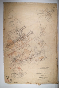
Map - YARRABERB : COUNTY OF BENDIGO, 2-3-51
... Yarraberb, County of Bendigo, Salisbury, Yallook, Neilborough, Nerring, Leichardt, Bridgewater. L5373. By authority H.J. ...Yarraberb, County of Bendigo, Salisbury, Yallook, Neilborough, Nerring, Leichardt, Bridgewater. L5373. By authority H.J. ...Map. Yarraberb, County of Bendigo, Salisbury, Yallook, Neilborough, Nerring, Leichardt, Bridgewater. L5373. By authority H.J. Green, Govt. Printer,Photo-Lithographed at the Deptartment of Lands and Survey, Melbourne. Price 2/-.2-3-51. (number 15 in map cupboard 1)H.J. Green, Govt. Printermap, bendigo, agricultural lands -
Bendigo Historical Society Inc.
Map - LEICHARDT : COUNTY OF BENDIGO, 15-6-19
... Leichardt, County of Bendigo, Bridgewater, Yarraberb, Nerring, Marong, Woodstock, Derby, Sandhurst & Inglewood Railway Line. ...Leichardt, County of Bendigo, Bridgewater, Yarraberb, Nerring, Marong, Woodstock, Derby, Sandhurst & Inglewood Railway Line. ...Map. Leichardt, County of Bendigo, Bridgewater, Yarraberb, Nerring, Marong, Woodstock, Derby, Sandhurst & Inglewood Railway Line. Photo-Lithographed at the Department of Lands and Survey, Melbourne, by T.F. McGauran, 15-6-09. Price 1/-. (number 68 in map cupboard 1)T.F. McGauranmap, bendigo, leichardt -
Bendigo Historical Society Inc.
Map - HUNTLY : COUNTY OF BENDIGO, August 1954
... Whirrakee, Bagshot, Wellsford, Nerring, Neilborough, Township of Huntly. Drawn and reproduced at the Department of Lands and Survey, Melbourne, Victoria. ...Whirrakee, Bagshot, Wellsford, Nerring, Neilborough, Township of Huntly. Drawn and reproduced at the Department of Lands and Survey, Melbourne, Victoria. ...Map. Huntly, County of Bendigo. Whirrakee, Bagshot, Wellsford, Nerring, Neilborough, Township of Huntly. Drawn and reproduced at the Department of Lands and Survey, Melbourne, Victoria. August 1954. Price 2/-. By authority W.M. Houston, Government Printer. (number 42 in map cupboard 1)W.M. Houston, Govt. Printer.map, bendigo, huntly -
 Bendigo Historical Society Inc.
Map - CAMPBELL COLLECTION: BENDIGO AND DISTRICT MAPS
... Parishes and suburbs : North of Bendigo, Parish of Huntly, Parish of Nerring, Parish of Sandhurst, Sydney Flat, Myers Flat, Borough of Eaglehawk, Sailors Gully, Jobs Gully, Harvey Town, California Gully, Maiden Gully, Long Gully, St.Just's Point, Iron Bark....Parishes and suburbs : North of Bendigo, Parish of Huntly, Parish of Nerring, Parish of Sandhurst, Sydney Flat, Myers Flat, Borough of Eaglehawk, Sailors Gully, Jobs Gully, Harvey Town, California Gully, Maiden Gully, Long Gully, St.Just's Point, Iron Bark. ...Map. Parishes and suburbs : North of Bendigo, Parish of Huntly, Parish of Nerring, Parish of Sandhurst, Sydney Flat, Myers Flat, Borough of Eaglehawk, Sailors Gully, Jobs Gully, Harvey Town, California Gully, Maiden Gully, Long Gully, St.Just's Point, Iron Bark.map, bendigo, parishes -
Bendigo Historical Society Inc.
Map - YARRABERB : COUNTY OF BENDIGO, 23-2-15
... Yarraberb, County of Bendigo, Salisbury, Yallook, Neilborough, Nerring, Leichardt, Bridgewater. L5373. Photographed at the Department of Lands and Survey, Melbourne by W.J. ...Yarraberb, County of Bendigo, Salisbury, Yallook, Neilborough, Nerring, Leichardt, Bridgewater. L5373. Photographed at the Department of Lands and Survey, Melbourne by W.J. ...Map. Yarraberb, County of Bendigo, Salisbury, Yallook, Neilborough, Nerring, Leichardt, Bridgewater. L5373. Photographed at the Department of Lands and Survey, Melbourne by W.J. Butson 23-2-15. Price 1/-.By authority: Albert J. Mullett, Government Printer, Melbourne. (number 16 in map cupboard 1)By authority Albert J. Mullett, Government Printer.map, bendigo, agricultural lands