Showing 91 items matching "new paths"
-
 University of Melbourne, Burnley Campus Archives
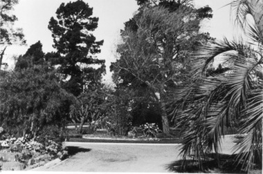
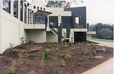
Photograph - Black and white print, E.M. Gibson, Garden View, September 1942
... ...new paths...Black and white photograph of the view from Hilda Kirkhope Rockery towards the Luffmann Ponds. New paths....New paths. Garden View Photograph Black and white print E.M. ...Black and white photograph of the view from Hilda Kirkhope Rockery towards the Luffmann Ponds. New paths.2/26hilda kirkhope rockery, lily ponds, e. m. gibson collection, luffmann ponds, garden view, new paths -
 Surrey Hills Historical Society Collection
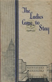
Book, The Ladies Came to Stay: study of the Education of Girls at the Presbyterian Ladies College Melbourne 1875-1960, 1960
... It records the courageous ventures of women along new paths and their achievements in new fields....It records the courageous ventures of women along new paths and their achievements in new fields. 296p. illus....It records the courageous ventures of women along new paths and their achievements in new fields. 296p. illus. ...This tells the story of Presbyterian Ladies College (PLC) which pioneered secondary education for girls in Victoria. It records the courageous ventures of women along new paths and their achievements in new fields.This tells the story of Presbyterian Ladies College (PLC) which pioneered secondary education for girls in Victoria. It records the courageous ventures of women along new paths and their achievements in new fields. 296p. illus.Title Page : M. Bedford / May 1960presbyterian ladies college, schools, (miss) dymphna lodewyckz -
 University of Melbourne, Burnley Campus Archives
Slide - Glass slide, 1891-1905
... Unidentified Stately Home with new path and garden. ...University of Melbourne, Burnley Campus Archives 500 Yarra Boulevard Richmond melbourne overseas images Unidentified Stately Home with new path and garden. Slide Glass slide ...Unidentified Stately Home with new path and garden. overseas images -
 University of Melbourne, Burnley Campus Archives
Photograph - Black and white photograph, E.M. Gibson, Garden View, September 1942
... ...path...new...Black and white photograph of the new path leading to the Orchard. Trees and lawn....University of Melbourne, Burnley Campus Archives 500 Yarra Boulevard Richmond melbourne garden view path new edges trees lawn Black and white photograph of the new path leading to the Orchard. ...garden view, path, new edges, trees, lawn -
 University of Melbourne, Burnley Campus Archives
Photograph - Black and white print, E.M. Gibson, New Path in Front of Administration Building, 1947
... New Path in Front of Administration Building...Black and white photograph of the new path around new beds in front of the Administration Building highlighting the curbing....New Path in Front of Administration Building Photograph Black and white print E.M. ...Black and white photograph of the new path around new beds in front of the Administration Building highlighting the curbing.garden beds, administration building, e. m. gibson collection, path, curbing -
 University of Melbourne, Burnley Campus Archives
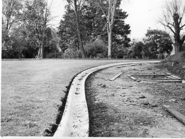
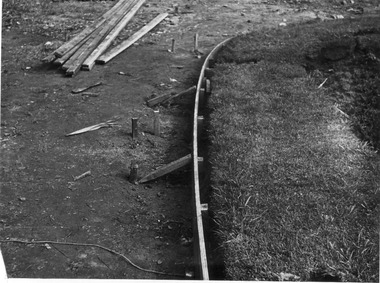
Photograph - Black and white print, E.M. Gibson, Creating New Path, 1947
... Creating New Path...Black and white photograph of detail of construction of new path in front of Administration Building. ...Creating New Path Photograph Black and white print E.M. ...Black and white photograph of detail of construction of new path in front of Administration Building. 6/30construction, administration building, e. m. gibson collection, path, path construction -
 University of Melbourne, Burnley Campus Archives
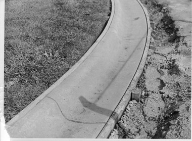
Photograph - Black and white print, E.M. Gibson, Detail of Curb Construction, 1947
... Black and white photograph of detail of curbing around new path in front of Administration Building. ...University of Melbourne, Burnley Campus Archives 500 Yarra Boulevard Richmond melbourne administration building e. m. gibson collection path curbing 6/31 Black and white photograph of detail of curbing around new path in front of Administration Building. ...Black and white photograph of detail of curbing around new path in front of Administration Building. 6/31administration building, e. m. gibson collection, path, curbing -
 University of Melbourne, Burnley Campus Archives
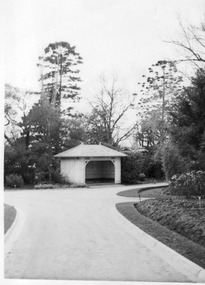
Photograph - Black and white print, E.M. Gibson, Summer House/Shelter Shed, Early September 1947
... Black and white photograph of the Summer House or Shelter Shed. New paths in the foreground, Dahlias on the right side....E M Gibson 538 11/6 Black and white photograph of the Summer House or Shelter Shed. New paths in the foreground, Dahlias on the right side. ...Black and white photograph of the Summer House or Shelter Shed. New paths in the foreground, Dahlias on the right side. "E/Sept '47." E M Gibson 538 11/6summer house, e. m. gibson collection, shelter shed, paths, dahlias -
 University of Melbourne, Burnley Campus Archives
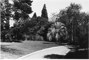
Photograph - Black and white print, E.M. Gibson, Garden View, Late 1940s
... Black and white photograph of a garden view of new paths near Lily Ponds. Hilda Kirkhope Rockery on the left Ponds in the centre background. lawns in the foreground....paths lily ponds e. m. gibson collection luffmann ponds hilda kirkhope rockery garden view X/33 Black and white photograph of a garden view of new paths near Lily Ponds. Hilda Kirkhope Rockery on the left Ponds in the centre background. lawns in the foreground. ...Black and white photograph of a garden view of new paths near Lily Ponds. Hilda Kirkhope Rockery on the left Ponds in the centre background. lawns in the foreground.X/33paths, lily ponds, e. m. gibson collection, luffmann ponds, hilda kirkhope rockery, garden view -
Friends of Ballarat Botanical Gardens History Group
Work on paper - Crown Land Reserves Improvement Program, Two Projects, C 2001
... These documents provide detailed information about improvements to the Adam Lindsay Gordon Cottage and plans for the Removal of Wishing Well and New Water Feature and Path Re-Alignment which has not been completed....Costings listed for the Removal of the Wishing Well and New Water Feature and Path Re-Alignment....Costings listed for the Removal of the Wishing Well and New Water Feature and Path Re-Alignment. Two Projects Work on paper Crown Land Reserves Improvement Program ...These documents provide detailed information about improvements to the Adam Lindsay Gordon Cottage and plans for the Removal of Wishing Well and New Water Feature and Path Re-Alignment which has not been completed.These documents give details on how improvements to the Adam Lindsay Gordon Cottage Area would enhance the site and planning for a new water feature and the major re-alignment of paths within the Gardens.3 sheets of paper. 1. entitled Crown Land Reserves Improvement Programme 2. Diagram listing the costings for the Adam Lindsay Gordon Cottage Area 3. Costings listed for the Removal of the Wishing Well and New Water Feature and Path Re-Alignment.p.1 question mark in black biro, end of 4th line. p.2 notes written in blue biro below the diagram are most relevant.john garner, doctor john garner, ballarat botanical gardens, friends of ballarat botanical gardens, crown land reserves improvement programme, adam lindsay gordon cottage area, the removal of the wishing well and installation of new water feature, costs, clips grants programme., gardens, ballarat, john garner collection -
 Heidelberg Golf Club
Photograph, Heidelberg Golf Club: Clubhouse renovations 1997-98 - New garden and path at rear of clubhouse, 1997
... Heidelberg Golf Club: Clubhouse renovations 1997-98 - New garden and path at rear of clubhouse...Heidelberg Golf Club: Clubhouse renovations 1997-98 - New garden and path at rear of clubhouse between Eaglemont Room and 4th fairway...Heidelberg Golf Club 8 Main Road Lower Plenty 3093 Heidelberg Golf Club: Clubhouse renovations 1997-98 - New garden and path at rear of clubhouse between Eaglemont Room and 4th fairway Clubhouse redevelopment 1998 HGC Clubhouse 1997 Eaglemont Room 4th fairway Colour photograph and caption, in album Heidelberg Golf Club: Clubhouse renovations 1997-98 - New garden and path at rear of clubhouse Photograph Photograph ...Heidelberg Golf Club: Clubhouse renovations 1997-98 - New garden and path at rear of clubhouse between Eaglemont Room and 4th fairwayColour photograph and caption, in albumclubhouse redevelopment 1998, hgc clubhouse 1997, eaglemont room, 4th fairway -
 Whitehorse Historical Society Inc.
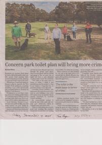
Article, Ward, Rachael, Park Toilet Plan, 19/12/2025
... Whitehorse Council endorsed a plan to upgrade the Wurundjeri Walk parklands including installing a new toilet, gravel path and potential barbecue facilities at Orchard Park Reserve....Whitehorse Council endorsed a plan to upgrade the Wurundjeri Walk parklands including installing a new toilet, gravel path and potential barbecue facilities at Orchard Park Reserve. ...Residents are worried about plans to build a $150,000 public toilet just 200 metres from existing bathrooms in Blackburn South, claiming it could encourage crime.non-fictionResidents are worried about plans to build a $150,000 public toilet just 200 metres from existing bathrooms in Blackburn South, claiming it could encourage crime.city og whitehorse, toilet block, blackburn south, crime, wurundjeri walk, ward rachael -
 Heidelberg Golf Club
Photograph, Faye Lamb, Lady members on path at new 11th tee: Heidelberg Golf Club, 1997
... Lady members on path at new 11th tee: Heidelberg Golf Club...Lady members on path at new 11th tee: Heidelberg Golf Club. Pam Whight, Phyll Moore, Betty Butterworth....Lady members on path at new 11th tee: Heidelberg Golf Club Photograph Photograph Faye Lamb ...Lady members on path at new 11th tee: Heidelberg Golf Club. Pam Whight, Phyll Moore, Betty Butterworth.Colour photograph and caption.hgc women's golf, 11th tee -
 Bendigo Historical Society Inc.
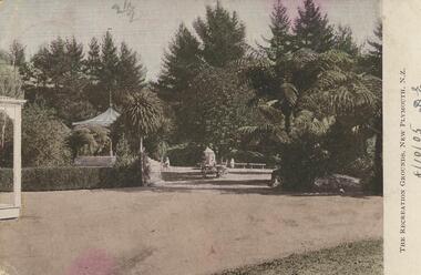
Postcard - Alice McGregor Postcard Collection, 1900 - 1920
... Colour photo of The Recreation Grounds, New Plymouth, N.Z. Gravel path in foreground. Trees and partially hidden rotunda in background ...Colour photo of The Recreation Grounds, New Plymouth, N.Z. Gravel path in foreground. Trees and partially hidden rotunda in background Postcard Alice McGregor Postcard Collection ...Alice McGREGOR Born: 1908; unknown parents. Possibly adopted by the Salter family? Electoral Roll 1936: Highland Terrace Kangaroo Flat. Alice Mary Salter and William Robert Salter living together; presumed to be sister and brother. William Robert Salter was killed in a MVA in Bendigo in 1937 aged 26. In Victoria in 1938, Alice Mary Salter married James Thomas McGregor (born Victoria 1917, died Victoria 1983, buried Fawkner Cemetery) Lived: 1968; 22 Wade Street Golden Square Alice McGregor Died: 1999 aged 91 at Anne Caudle Centre, Bendigo Buried: Kangaroo Flat Cemetery See additional research. Postcard Album of Alice McGregor contained 86 post cards.Postcard Album of Alice McGregor containing 86 post cards. See 1400. Colour photo of The Recreation Grounds, New Plymouth, N.Z. Gravel path in foreground. Trees and partially hidden rotunda in background Addressed to Miss A. Stapleton, Arcade, Bendigo, Victoria, Australia Sender - Miss D. Ellis, Hastings, Hawkes Bay, New Zealand Dated 8/10/05 postcard, collector, alice mcgregor -
 Bendigo Military Museum
Print - PRINT, FRAMED WW1, Reader's Digest (Australia) Pty Limited, 2015
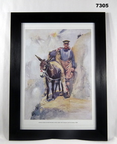
... New Zealand Expeditionary Force in 1914 and was sent to Gallipoli. Framed print. Print - colour print on paper. Copy of a watercolour on paper. Painting depicts a soldier leading a donkey carrying a wounded soldier along a cliff path. ...From information book: "Reader's Digest/ Gallipoli/ 25th April 1915 - 9th January 1916/ Centenary Commemorative Prints. Collection of 20 prints' refer Cat No. 7300.Framed print. Print - colour print on paper. Copy of a watercolour on paper. Painting depicts a soldier leading a donkey carrying a wounded soldier along a cliff path. Frame - black plastic framing with glass front and MDF board backing with adhered black paper.Details below print - in black ink; "HORACE MILLICHAMP MOORE - JONES (1868 - 1922) Simpson and his donkey 1918". Enlisted with the New Zealand Expeditionary Force in 1914 and was sent to Gallipoli.framed accessories, prints, ww1, gallipoli, centenary -
 Bendigo Military Museum
Photograph - Johnson Ground Elevation Meter (JGEM) Survey Vehicle - Army Survey Regiment, Fortuna, Bendigo, c1960s
... path. Road routes over which the JGEM operated were planned so that each started and ended as near as practicable to an existing point of known elevation (formally referred to as a level traverse bench mark). The difference in height from the bench mark and the road surface alongside the JGEM’s fifth wheel was measured with a level and staff. Along each route, mapping control photo reference points where new...path. Road routes over which the JGEM operated were planned so that each started and ended as near as practicable to an existing point of known elevation (formally referred to as a level traverse bench mark). The difference in height from the bench mark and the road surface alongside the JGEM’s fifth wheel was measured with a level and staff. Along each route, mapping control photo reference points where new ...This is a set of 16 photograph of the Royal Australian Survey Corps’ Johnson Ground Elevation Meter (JGEM) Survey Vehicle taken at the Army Survey Regiment, Fortuna, Bendigo. The JGEM vehicle was extensively used by RA Svy within Australia from the late 1960s. A limited number of Ground Elevation Meter (GEM) station wagon type vehicles were manufactured by General Motors Corporation (GMC) in the USA for the United States Geological Survey, Canada’s mapping agencies, RA Svy and National Mapping (Natmap). The GEM was a four-wheel drive, four-wheel steer vehicle. Four-wheel steering was necessary to avoid systematic errors caused by non-tracking of front and rear wheels on conventionally steered vehicles. The manufacturer substituted the rear axle with a front axle and connected them to form the four-wheel steering mechanism. The two Australian GEM vehicles, referred to as Johnson GEMs (JGEMs) were converted into right-hand drive. After delivery in 1964, acceptance Natmap and RA Svy testing and operator training was undertaken at the Army's School of Military Survey located at Balcombe, Victoria. A small fifth wheel was mounted on a cantilever arm suspension midway between the front and rear wheels on the right side of the vehicle. It was lowered to and raised from its operating position by use of a constant pressure air cylinder. A telescopic bar, suspended between the front and rear axles, provided the reference datum for the angle measurement. The wheel provided the velocity or distance signal through a pulse generator system. A sensitive pendulum mounted on this bar provided the angle measurement for each minute distance traversed. The JGEM contained electromechanical instruments used to determine relative elevations, by trigonometric principles, along a traversed path. These relative elevations were obtained through apparatus which measures the instantaneous angle of inclination of the road and the instantaneous velocity of the meter along such a path. Road routes over which the JGEM operated were planned so that each started and ended as near as practicable to an existing point of known elevation (formally referred to as a level traverse bench mark). The difference in height from the bench mark and the road surface alongside the JGEM’s fifth wheel was measured with a level and staff. Along each route, mapping control photo reference points where new elevation values were required were identified on aerial photographs. Under favourable conditions it was possible to survey as much as 160km in an ordinary working day. The first of RA Svy’s JGEM operations was undertaken in 1:250,000 scale map areas of Queensland. CPL John Hook was the JGEM’s main operator in the early 1970s undertaking operations covering 1:250,000 scale map blocks over northern Victoria and central NSW, each requiring 36 points (9 runs of photography and 4 points across. SPR Lyn Thompson and SPR Bob McDonagh teamed with CPL Hook on some of these JGEM operations. When RA Svy was integrated into the Royal Australian Engineers in 1996, the JGEM vehicle with the Survey Corps collection was donated to its museum. It is believed to be the last of the original manufactured fleet in existence. The JGEM has undergone extensive refurbishment to achieve roadworthiness and is currently housed at The Australian Army Museum of Military Engineering, Hoslworthy Barracks, NSW. It can be viewed by making an appointment with the museum’s curator.This is a set of 16 photograph of the Royal Australian Survey Corps’ Johnson Ground Elevation Meter (JGEM) Survey Vehicle taken at the Army Survey Regiment, Fortuna, Bendigo. The photographs were on 35mm slide film and were scanned at 96 dpi. They are part of the Army Survey Regiment’s Collection. .1) - Photo, colour, c1960s, Johnson Ground Elevation Meter (JGEM) Survey Vehicle .2) - Photo, colour, c1960s, JGEM instrumentation, on-board computer. .3) - Photo, colour, c1960s, JGEM instrumentation. .4) - Photo, colour, c1960s, JGEM instrumentation, on-board computer. .5) - Photo, colour, c1960s, JGEM tyre pressure controller .6) - Photo, colour, c1960s, JGEM rear doors, SGT Geoff Briggs. .7) - Photo, colour, c1960s, JGEM 5th wheel distance/angle measurement device in lowered position, SGT Geoff Briggs. .8) - Photo, colour, c1960s, JGEM 5th wheel distance/angle measurement device in lowered position. .9) & .10) - Photo, colour, c1960s, JGEM tyre pressure system, SGT Geoff Briggs. .11) - Photo, colour, c1960s, JGEM tyre pressure system. SGT Geoff Briggs. .12) - Photo, colour, c1960s, JGEM levelling scope, levelling staff, unidentified technicians. .13) & .14) - Photo, colour, c1960s, JGEM levelling scope, unidentified technician. .15) & .16) - Photo, colour, c1960s, probably survey operation adjusted height plotted on block base sheet. .1P to .16P - Some of the equipment is annotated on the frame of the 35mm slides.royal australian survey corps, rasvy, army survey regiment, army svy regt, fortuna, asr, surveying -
 Federation University Historical Collection
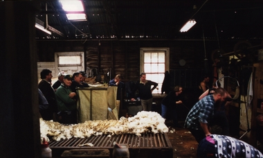
Photograph - Photograph - Colour, VIOSH: Reducing Back Injuries and Energy Costs of Shearing through the Development of Practical Modifications to Shed Layout, 1995-1997
... New South Wales and Western Australia to gather different inputs and perspectives on causes of injuries. Groups represented were shearers, doctors, farmers and shearing shed designers. Shed design was a principal factor with the emphasis on minimising body twisting associated with catching and releasing sheep, removal of floor obstructions along path between pen and release, battens oriented along direction of drag and slope in pens....New South Wales and Western Australia to gather different inputs and perspectives on causes of injuries. Groups represented were shearers, doctors, farmers and shearing shed designers. Shed design was a principal factor with the emphasis on minimising body twisting associated with catching and releasing sheep, removal of floor obstructions along path between pen and release, battens oriented along direction of drag and slope in pens. viosh victorian institute of occupational safety and health worksafe australia back injuries shearing sheds shearers school of human movement and sports science ballarat new south wales western australia doctors farmers shed designers Colour photographs - postcard and A5 - relating to reducing back injuries and Energy Costs of Shearing. ...Victorian Institute of Occupational Safety and Health (VIOSH) Australia is the Asia-Pacific centre for teaching and research in occupational health and safety (OHS) and is known as one of Australia's leaders in the field. VIOSH has a global reputation for its innovative approach within the field of OHS management. VIOSH had its first intake of students in 1979. At that time the Institution was known as the Ballarat College of Advanced Education. In 1990 it became known as Ballarat University College, then in 1994 as University of Ballarat. It was 2014 that it became Federation University. VIOSH Australia students are safety managers, senior advisors and experienced OHS professionals. They come from all over Australia and industry. Students are taught active research and enquiry; rather than textbook learning and a one-size fits all approach. VIOSH accepts people into the Graduate Diploma of Occupational Hazard Management who have no undergraduate degree - on the basis of extensive work experience and knowledge. A project titled "Reducing Back Injuries and Energy Costs of Shearing Through the Development of Practical Modifications to Shed Layout" was funded by Worksafe Australia. The budget was $101,170. VIOSH Australia collaborated with the School of Human Movement and Sports Science to look for ways to reduce muscle injuries associated with shearing. The study set up a number of focus groups in the Ballarat area, New South Wales and Western Australia to gather different inputs and perspectives on causes of injuries. Groups represented were shearers, doctors, farmers and shearing shed designers. Shed design was a principal factor with the emphasis on minimising body twisting associated with catching and releasing sheep, removal of floor obstructions along path between pen and release, battens oriented along direction of drag and slope in pens.Colour photographs - postcard and A5 - relating to reducing back injuries and Energy Costs of Shearing.viosh, victorian institute of occupational safety and health, worksafe australia, back injuries, shearing sheds, shearers, school of human movement and sports science, ballarat, new south wales, western australia, doctors, farmers, shed designers -
 Federation University Historical Collection
Photograph - Photograph - Colour, VIOSH: Shearing Shed Demonstrations - Collaboration with School of Human Movement and Sports Science; ways to reduce muscle injuries - 1994-1997
... New South Wales and Western Australia to gather different inputs and perspectives on causes of injuries. Groups represented were shearers, doctors, farmers and shearing shed designers. Shed design was a principal factor with the emphasis on minimising body twisting associated with catching and releasing sheep, removal of floor obstructions along path between pen and release, battens oriented along direction of drag and slope in pens....New South Wales and Western Australia to gather different inputs and perspectives on causes of injuries. Groups represented were shearers, doctors, farmers and shearing shed designers. Shed design was a principal factor with the emphasis on minimising body twisting associated with catching and releasing sheep, removal of floor obstructions along path between pen and release, battens oriented along direction of drag and slope in pens. viosh victorian institute of occupational safety and health 1995-1997 shearing shed layout worksafe australia school of human movement and sports science shearers doctors farmers muscle injuries university of ballarat student activity Thirty-one colour photographs on inside a shearing shed VIOSH: Shearing Shed Demonstrations - Collaboration with School of Human Movement and Sports Science; ways to reduce muscle injuries - 1994-1997. ....Victorian Institute of Occupational Safety and Health (VIOSH) Australia is the Asia-Pacific centre for teaching and research in occupational health and safety (OHS) and is known as one of Australia's leaders in the field. VIOSH has a global reputation for its innovative approach within the field of OHS management. VIOSH had its first intake of students in 1979. At that time the Institution was known as the Ballarat College of Advanced Education. In 1990 it became known as Ballarat University College, then in 1994 as University of Ballarat. It was 2014 that it became Federation University. VIOSH Australia students are safety managers, senior advisors and experienced OHS professionals. They come from all over Australia and industry. Students are taught active research and enquiry; rather than textbook learning and a one-size fits all approach. VIOSH accepts people into the Graduate Diploma of Occupational Hazard Management who have no undergraduate degree - on the basis of extensive work experience and knowledge. A project titled "Reducing Back Injuries and Energy Costs of Shearing Through the Development of Practical Modifications to Shed Layout" was funded by Worksafe Australia. The budget was $101,170. VIOSH Australia collaborated with the School of Human Movement and Sports Science to look for ways to reduce muscle injuries associated with shearing. The study set up a number of focus groups in the Ballarat area, New South Wales and Western Australia to gather different inputs and perspectives on causes of injuries. Groups represented were shearers, doctors, farmers and shearing shed designers. Shed design was a principal factor with the emphasis on minimising body twisting associated with catching and releasing sheep, removal of floor obstructions along path between pen and release, battens oriented along direction of drag and slope in pens.Thirty-one colour photographs on inside a shearing shedviosh, victorian institute of occupational safety and health, 1995-1997, shearing shed layout, worksafe australia, school of human movement and sports science, shearers, doctors, farmers, muscle injuries, university of ballarat, student activity -
Federation University Historical Collection
Booklet - Booklet - Media Clippings, University of Ballarat: Community Service Activities, 1994
... Computer and IT programmes; Uni helps kids learn about safe, active, healthy life; Uni eager to foster partnership with local community; Professor David James (Vice Chancellor) to be chair of regional consultation group reforming State's planning system; Ballarat's Martin Hughes of BU Geology Department and Queensland's Neil Phillips to present paper at Geological Society of America in Seattle; Uni to build aquatic centre to attract top swimmers; Open Days planned by Ballarat Universities; Sue Hadden, Ballarat Uni, received $75,000 grant to carry out research on Victoria's disappearing native grasses; Ballarat Uni to host major student sculpture show; Moves to develop high-tech park plan; New Research Plans assisted by Professor Tom O'Donnell; Indian experts look for answers to get more from their depleted desert forests; Uni conducts nursing survey re courses to be offered; Rabbit numbers rise - survey from farmers; Ted Lovett, VFL footballer (Fitzroy) talk on racism in sport at Ballarat Uni.; Australian beer awards at Ballarat Uni.; Study on Unhealthy Fitness - Heart Foundation suggests regular exercise at level suited to individual needs; Survey tracks path of yellow spotting; Tertiary push for hospital - Ararat; University considered for athletics facility; Top-level study on fitness for the elderly to be monitored by Human Movement and Sports Science students, University of Ballarat; Institute of Chartered Accountants will hold its annual accounting information day at the University of Ballarat's Foundation Hall. ...Computer and IT programmes; Uni helps kids learn about safe, active, healthy life; Uni eager to foster partnership with local community; Professor David James (Vice Chancellor) to be chair of regional consultation group reforming State's planning system; Ballarat's Martin Hughes of BU Geology Department and Queensland's Neil Phillips to present paper at Geological Society of America in Seattle; Uni to build aquatic centre to attract top swimmers; Open Days planned by Ballarat Universities; Sue Hadden, Ballarat Uni, received $75,000 grant to carry out research on Victoria's disappearing native grasses; Ballarat Uni to host major student sculpture show; Moves to develop high-tech park plan; New Research Plans assisted by Professor Tom O'Donnell; Indian experts look for answers to get more from their depleted desert forests; Uni conducts nursing survey re courses to be offered; Rabbit numbers rise - survey from farmers; Ted Lovett, VFL footballer (Fitzroy) talk on racism in sport at Ballarat Uni.; Australian beer awards at Ballarat Uni.; Study on Unhealthy Fitness - Heart Foundation suggests regular exercise at level suited to individual needs; Survey tracks path of yellow spotting; Tertiary push for hospital - Ararat; University considered for athletics facility; Top-level study on fitness for the elderly to be monitored by Human Movement and Sports Science students, University of Ballarat; Institute of Chartered Accountants will hold its annual accounting information day at the University of Ballarat's Foundation Hall. ...Booklet of article that appeared in the newspaper outlining events, programmes, etc. that are of community involvement. Computer and IT programmes; Uni helps kids learn about safe, active, healthy life; Uni eager to foster partnership with local community; Professor David James (Vice Chancellor) to be chair of regional consultation group reforming State's planning system; Ballarat's Martin Hughes of BU Geology Department and Queensland's Neil Phillips to present paper at Geological Society of America in Seattle; Uni to build aquatic centre to attract top swimmers; Open Days planned by Ballarat Universities; Sue Hadden, Ballarat Uni, received $75,000 grant to carry out research on Victoria's disappearing native grasses; Ballarat Uni to host major student sculpture show; Moves to develop high-tech park plan; New Research Plans assisted by Professor Tom O'Donnell; Indian experts look for answers to get more from their depleted desert forests; Uni conducts nursing survey re courses to be offered; Rabbit numbers rise - survey from farmers; Ted Lovett, VFL footballer (Fitzroy) talk on racism in sport at Ballarat Uni.; Australian beer awards at Ballarat Uni.; Study on Unhealthy Fitness - Heart Foundation suggests regular exercise at level suited to individual needs; Survey tracks path of yellow spotting; Tertiary push for hospital - Ararat; University considered for athletics facility; Top-level study on fitness for the elderly to be monitored by Human Movement and Sports Science students, University of Ballarat; Institute of Chartered Accountants will hold its annual accounting information day at the University of Ballarat's Foundation Hall. Students from other universities to attend; Prince Edward's visit - challenge of "Great Rubber Tube Raft Regatta" at Lake Wendouree; Uni, company in joint training initiative - installation on Novell's networking software in the degree course; Uni begins study into tree threat; Eureka leadership conference in Ballarat; Leadership conference an outstanding success.Buff coloured cover, black print. Pages glued and bound - black tape. Newspaper articles - photographs and print - on separate sheets in reverse order of appearance in paper; December to February.Symbol of University of Ballarat - cover.computer and it, newspaper items, health, local community involvement, david james, vice chancellor, state's planning system, martin hughes, geology department, neil phillips, queensland university, geological society of america, seattle, aquatic centre, sue hadden, research grant, $75000, native grasses, sculpture exhibitiontom o'donnell, indian experts, nursing survey, rabbit survey, ted lovett, footballer, racism in sport, australian beer awards, unhealthy fitness, heart foundation, athletics facility, fitness for the elderly, human movement and sports science, intitute of chartered accountants, networking system in degree course, eureka leadership conference -
 Federation University Historical Collection
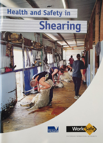
Booklet - Booklet - Safety, Worksafe Victoria, VIOSH: Victorian Workcover Authority; "Health and Safety In Shearing, 2001", 2001
... New South Wales and Western Australia to gather different inputs and perspectives on causes of injuries. Groups represented were shearers, doctors, farmers and shearing shed designers. Shed design was a principal factor with the emphasis on minimising body twisting associated with catching and releasing sheep, removal of floor obstructions along path between pen and release, battens oriented along direction of drag and slope in pens. ...New South Wales and Western Australia to gather different inputs and perspectives on causes of injuries. Groups represented were shearers, doctors, farmers and shearing shed designers. Shed design was a principal factor with the emphasis on minimising body twisting associated with catching and releasing sheep, removal of floor obstructions along path between pen and release, battens oriented along direction of drag and slope in pens. ...Victorian Institute of Occupational Safety and Health (VIOSH) Australia is the Asia-Pacific centre for teaching and research in occupational health and safety (OHS) and is known as one of Australia's leaders on the field. VIOSH has a global reputation for its innovative approach within the field of OHS management. VIOSH had its first intake of students in 1979. At that time the Institution was known as the Ballarat College of Advanced Education. In 1990 it became known as Ballarat University College, then in 1994 as University of Ballarat. It was 2014 that it became Federation University. VIOSH Australia students are safety managers, senior advisors and experienced OHS professionals. They come from all over Australia and industry. Students are taught active research and enquiry; rather than textbook learning and a one-size fits all approach. VIOSH accepts people into the Graduate Diploma of Occupational Hazard Management who have no undergraduate degree - on the basis of extensive work experience and knowledge. A project titled "Reducing Back Injuries and Energy Costs of Shearing Through the Development of Practical Modifications to Shed Layout" was funded by Worksafe Australia. The budget was $101,170. VIOSH Australia collaborated with the School of Human Movement and Sports Science to look for ways to reduce muscle injuries associated with shearing. The study set up a number of focus groups in the Ballarat area, New South Wales and Western Australia to gather different inputs and perspectives on causes of injuries. Groups represented were shearers, doctors, farmers and shearing shed designers. Shed design was a principal factor with the emphasis on minimising body twisting associated with catching and releasing sheep, removal of floor obstructions along path between pen and release, battens oriented along direction of drag and slope in pens. A full set of photographs relating to the is Item 26841.Soft covered booklet featuring the coloured image of a stand of shearers. viosh, viosh australia, occupational health & safety, shearing, workcover, shearing sheds, bob cameron, minister for workcover, 2001, back injury, item 26841, shearers, farmers, doctors, floor obstructions -
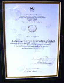 Conservation Volunteers
Award: Honour Roll, United Nations Environment Program (UNEP) - 1 June 2000 - The UNEP announced that the Australian Trust of Conservation Volunteers of Australia (ATCV), has been elected to the prestigious ranks of its Global 500 Roll of Honour for outstanding contributions to the protection of the environment, Award:United Nations Environment Program (UNEP) - 1 June 2000 - UNEP announced today that the ATCV has been elected to the prestigious ranks of its Global 500 Roll of Honour for outstanding contributions to the protection of the environment
... path that most of us hesitate to take for want of time or caring," says UNEP's Executive Director, Klaus Toepfer. "In honouring the Global 500 laureates, UNEP hopes that others will be inspired by their extraordinary deeds." CVA Conservation Volunteers Conservation Volunteers Australia Conservation Volunteers New ...THE AUSTRALIAN TRUST OF CONSERVATION VOLUNTEERS, ONE OF 14 INDIVIDUALS AND ORGANIZATIONS, TO RECEIVE UNITED NATIONS ENVIRONMENT AWARD NAIROBI, 1 June 2000 - The United Nations Environment Programme (UNEP) announced today that the Australian Trust of Conservation Volunteers of Australia (ATCV), has been elected to the prestigious ranks of its Global 500 Roll of Honour for outstanding contributions to the protection of the environment. ATCV is one of 14 individuals and organizations to receive this honour in 2000. Founded in 1982, ATCV is a national, not-for-profit community organization, whose mission is to attract and manage a force of volunteers in practical conservation projects for the betterment of the Australian environment. ATCV completes more than 4000 week-long conservation projects in urban, regional and remote areas of Australia each year. Activities range from bush regeneration, tree planting, seed collection, endangered species protection, weed control, flora and fauna surveys, walking trail construction, fencing, environmental monitoring and the protection of world heritage areas. ATCV community participation has resulted in more than 1.8 million trees being planted in 1999, and in more than 7.3 million trees planted over the past 10 years. Community involvement totalled 200,000 project days in 1999 and more than 700,000 days since 1989. To encourage the involvement of young people, ATCV developed and manages the federal government-funded programme Green Corps. Green Corps is a six-month traineeship for 17 to 20 year-olds, which incorporates conservation projects and accredited training. Since 1997, more than 4,000 trainees have completed the Green Corps programme. ATCV is a founding member of the International Conservation Alliance, which brings together organizations working in conservation volunteering, and is a member of the World Conservation Union (IUCN). " The award will be presented in Adelaide, Australia, at the World Environment Day ceremonies on 4 June 2000. World Environment Day, which is celebrated in some 120 countries around the world on 5 June, was established by the United Nations General Assembly in 1972 to focus global attention and action on environmental issues. Some 701 individuals and organizations, in both the adult and youth categories, have been honoured since UNEP launched the Global 500 award in 1987. Among prominent past winners are: French Marine explorer Jacques Cousteau; Sir David Attenborough, producer of environmental television programmes; Gro Harlem Brundtland, former Prime Minister of Norway; Anil Aggarwal, the prominent environmentalist from India; Ken Saro-Wiwa, the environmental and human rights activist from Nigeria who was executed for leading the resistance of the Ogoni People against the pollution of their Delta homeland; the World Wide Fund for Nature (WWF), Jimmy Carter, former President of the United States; Jane Goodall of the United Kingdom whose research on wild chimpanzees and olive baboons provided insight into the lives of non-human primates; and the late Chico Mendes, the Brazilian rubber tapper who was murdered during his fight to save the Amazon forest. To forge global links and to implement ideas, which can contribute to a more sustainable future, a network of all Global 500 laureates has been formed. Information about this unique network can be obtained at http://www.global500.org. The winners of UNEP's Global 500 Roll of Honour are members of a broad and growing environmental movement that is flourishing around the world. They have taken the path that most of us hesitate to take for want of time or caring," says UNEP's Executive Director, Klaus Toepfer. "In honouring the Global 500 laureates, UNEP hopes that others will be inspired by their extraordinary deeds."Certificatecva, conservation volunteers, conservation volunteers australia, conservation volunteers new zealand, colin jackson, better earth, environmental conservation, volunteers, volunteering, corporate volunteering, education – environmental, carbon footprint, climate change, ballarat, safety, training, partnerships, victoria, vic, nsw, queensland, act, australian capital territory, nt, northern territory, western australia, wa, south australia, sa, tasmania, new zealand, california conservation corps, atcv, unep, unep honour roll, united nations environment program -
 Eltham District Historical Society Inc
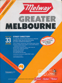
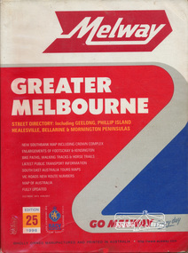
Book, Melway Publishing, Melway Greater Melbourne street directory : including Geelong, Phillip Island, Healesville, Kinglake, Gisborne, Lorne, Wallan, Bacchus Marsh Bellarine & Mornington Peninsulas; Edition 33, 2006, 2005
... Cover: Totally revised and updated with over 1380 new street listings new maps covering Mount Duneed on the Bellarine Peninsula, Pakenham South and Rythdale. Detailed public transport routes - train, tram, bus, bicycle paths & shared road routes. ...Cover: Totally revised and updated with over 1380 new street listings new maps covering Mount Duneed on the Bellarine Peninsula, Pakenham South and Rythdale. Detailed public transport routes - train, tram, bus, bicycle paths & shared road routes. ...Edition 33. 2006 Coloured detailed maps accessed by a street or location index. Cover: Totally revised and updated with over 1380 new street listings new maps covering Mount Duneed on the Bellarine Peninsula, Pakenham South and Rythdale. Detailed public transport routes - train, tram, bus, bicycle paths & shared road routes. Eastlink fully detailed new Craigieburn bypass GPS compatible WGS/MGA Grid Special feature: New Hierachy of Roads Street directory with plastic cover, coloured maps, 902 pagesstreets,roads,melbourne,map,melway -
 Eltham District Historical Society Inc
Photograph, Tess Justine (Nillumbik Shire Council), Murray's Bridge over the Diamond Creek, Eltham North, 19 Feb 2022
... new house there. Recreation reserves were established along the creek. In ca1990 Murray’s bridge was renovated with steel girders as part of a bike/pedestrian path in the reserve. ...new house there. Recreation reserves were established along the creek. In ca1990 Murray’s bridge was renovated with steel girders as part of a bike/pedestrian path in the reserve. ...Murray's Bridge over the Diamond Creek on the Diamond Creek Trail just prior to demolition and replacement with a new steel bridge. Heritage advice obtained by Nillumbik Shire Council, following a suggestion by the Eltham District Historical Society (EDHS), is that the original bridge appears to have been a simplified version of the Country Roads Board’s (CRB) standard timber bridge design of the early-to-mid 1920s. In c1990 Murray’s bridge was renovated with three recycled steel girders as part of a bike/pedestrian path in the reserve. During these alterations many parts of the bridge were removed, and some were replaced. Heritage advice indicates the condition of Murray’s bridge is poor. The remaining original parts are all in poor condition, with severe weathering, splitting and rot, especially to the stringers retained on the bridge. Heritage advice is that Murray’s Bridge does not have sufficient significance in the cultural history of the Nillumbik area to warrant inclusion in the Nillumbik Shire Heritage Overlay and also does not have sufficient significance as a rare survivor to warrant inclusion in the Nillumbik Shire Heritage Overlay. There are no indications in the historical record that this site was individually important to the cultural history of this area. EDHS is comfortable with the heritage advice provided to Council and has worked closely on this project with Council. EDHS has suggested some of the removed timbers be used in the vicinity of the bridge for landscaping and possibly seating, so as to retain these remnants close to the site of the original bridge, which is the last old timber bridge along the lower reaches of the Diamond Creek. Mary (Sweeney) Murray and John Wright Murray selected 80 acres, Lot C Section 16 and Lot 5 Section 17 Parish of Nillumbik, under an occupation license in 1866. John died in 1867 and freehold was granted to his son John in 1873. The farm was known as ‘Laurel Hill’. John Junior was an Eltham Shire councillor and sometime president from 1887 up until 1897. He added Lot A Section 16 to the farm in ca1888. John and his younger brother James arranged to rent/purchase Lot B Section 17, across Diamond Creek to the west, in ca1900. It appears that John and James farmed separately for a few years, with a new homestead built for James ad family on the high point of Lot B Section 17 in ca1910. John sold off Lot 5 Section 17 in 1912. When John died in 1912 James took over the land on both sides of the Diamond Creek. The old homestead on the west side of the Creek disappeared. A farm bridge over Diamond Creek from this period may have been located close to the northern boundary of the farm. John Langlands, owner of the farm known as ‘Ihurst’ on the west side of Diamond Creek to the south of the Murray’s land, died in 1907. In 1909 his land was then subdivided into 100 lots to become the ‘Glen Park Estate’. Other similar subdivisions of nineteenth century farms around Eltham in this period included the ‘Franktonia (or Beard’s) Estate’ to the northeast and ‘Bonsack’s Estate’ between Eltham and Greensborough. Soon after the opening of the railway extension line from Eltham to Hurstbridge in 1912, Glen Park and nearby residents including James Murray agitated for a railway station or siding to be located half-way between Eltham and Hurstbridge, so that the Glen Park residents who used the railway daily did not have to walk into the Eltham or Hurstbridge stations. Some believed Coleman’s Corner (opposite Edendale Farm) was an appropriate spot for the platform. James Murray was among those who thought the railway should be located on his land, closer to half-way between Eltham and Hurstbridge stations. The Railways Commissioners warned that the locals would have to fund these works themselves. The Glen Park Estate residents initially had difficulty accessing Eltham by road, with only an old low-level bridge over Diamond Creek at the south end of their estate. A new timber trestle bridge across the creek, now on Wattletree Road, was opened in 1915. Road access to the north was gained in 1927 when the new Murray’s Road, which crossed the Murray’s land, was built. Residents continued to agitate for a Glen Park station. By 1926 the Railways Commissioners’ preferred site was on the Murray’s land. They arranged an estimate of cost of a full-length platform. The estimate was too much for the locals, who in 1928 argued unsuccessfully for a shorter and hence cheaper platform. By 1929 Murray had agreed to donate the land, but the locals would still have to fund the works. Murray decided, unilaterally it would appear, to commence work on a timber trestle road bridge over Diamond Creek to link the new Murray Road to the proposed station. Late in 1929 he stopped work on the bridge, for reasons unknown, but started work again and completed the bridge in 1931. There is no further newspaper evidence of the campaign for the Glen Park station until 1939, when Murray and another local, Mr Maxwell, met the Railways Commissioner. The Glen Park locale now included 45 homes on the west side of the creek and 20 on the Eltham side. Most of the residents used the train every day. The Commissioner remained adamant that only a full-length platform could be built for safety reasons. It appears the campaign dissolved at this point. The increasing move to cars may have had an impact. There is no evidence of Murray’s bridge ever being connected to Murray’s Road, or of it having wide use for any purpose by locals. James Murray died in 1947 and the farm was taken over by his son James (Jim). Jim started to sell off parts of the farm in the 1980s, retaining a few acres around the ca1910 homestead and building a new house there. Recreation reserves were established along the creek. In ca1990 Murray’s bridge was renovated with steel girders as part of a bike/pedestrian path in the reserve. The old farmhouse was demolished in ca2014. * * * A theory posted on local community Facebook groups was that the bridge was built in the 1860s and was built to be more robust than was necessary for the movement of cows from one side of the creek to the other. It was suggested the robustness was necessary to support the weight of gold ore being transferred from a mine on Murray’s land to a railway siding near Murrays Bridge (presumably for transfer and processing at Diamond Creek). Perhaps this may have been one of the motivators for Murray, who really knows? Knowing when mining operations ceased on his land and how that fits the overall timeline would be useful but at the time the bridge was built, local gold production was minimal at best. The known facts are: • The railway line came to Eltham in 1902. • The extension of the railway from Eltham to Hurstbridge was constructed in 1912 so no railway line even existed through Murray's property until 1912 and the Victorian Railways maps at the time show no such siding on Murray’s property. • In 1923 a new company was formed in anticipation of the old Diamond Creek Gold Mine being re-opened. The mine had been previously closed and flooded. It was noted in the press at the time that the mine was within a mile of the railway. Nothing really came of this. • Construction of Murrays Bridge was commenced by James Murray in early 1929 in anticipation of a proposed flag station being nominated on his land, but work ceased shortly afterwards. The proposed flag station was commonly referred to as Glen Park as the residents of the Glen Park Estate wanted Option 1, located near them with the platform adjacent to Colemans corner. This was probably never going to fly as it was virtually in eyesight of Eltham station. Allandale Road was the third option, but the Commissioners' preferred option was No. 2 - on Murray's property. • The Railway Commissioners were not going to finance any such station and the works had to be funded by private landowners and residents, hence Murray investing in this himself. • Murray recommenced work two years later and finished his bridge in 1931 but unfortunately for him, the proposed flag station never eventuated. The bluestone siding you reference may well have been built by Murray as part of the proposed station platform. • Up until then, apart from the Main Road bridge, which was washed away in 1924, virtually all local crossings over the Diamond Creek were low lying bridges – Kaylocks Bridge at Brougham Street, Diamond Street bridge, Glen Park Road bridge. It is expected that Murray also had a low-lying bridge to connect his land either side of the creek. These were all washed away or severely damaged multiple times in the 1920s. Lessons were learnt, and Murrays Bridge appears to have been built in accordance with Country Road Board standards of the time. Flood damage was ongoing, and even more recently constructed raised bridges kept getting washed away, e.g., the new Wattle Tree Road bridge in 1958 just months after completion. Murray’s bridge was reinforced with steel some 30 years ago presumably to provide additional floodwater resistance, given the history of bridges disappearing in floodwaters. • In March 1932 it was reported in the Advertiser that there were still some prospectors operating around Eltham North who apart from further scarring the face of the earth over the previous two years had gained significant experience but little gold - hardly a driving factor for constructing a dedicated railway siding and bridge to transfer gold ore. It is far more probable that James Murray was hoping to have the railway station located on his property and invested his money by building the bridge to lead to it as well as a station platform. Had the station eventuated, it may well have driven up the value of his land for subdivision and new housing estates like the Glen Park Estate. That did not eventuate. Whilst the bridge was indeed old (90 years), the core structure being completed in 1931, it had been modified substantially from original and hence had no significant historic value – i.e., it was not a representative example of its type, construction, and age. Given that the bridge was not worthy of saving, the Eltham District Historical Society with Council’s support, and the Eltham Woodworkers group endeavoured to see what suitable sized timbers were salvageable to fabricate a commemorative seat. Unfortunately, the experts at the Woodworkers group were unable to salvage any suitable length/width timbers to fabricate the seat due to the presence of rot. Last remaining wooden trestle bridge on the Diamond Creek Trail just prior to demolition and replacementBorn digital image (27)diamond creek (creek), diamond creek trail, murrays bridge, ‘laurel hill’, john wright murray, mary (sweeney) murra, john murray jnr, james murray, john langlands, ‘ihurst’, ‘glen park estate’, beard's estate, franktonia, bonsack's estate, glen park estate, glen park railway station -
 Eltham District Historical Society Inc
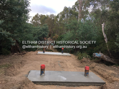
Photograph, Tess Justine (Nillumbik Shire Council), Construction work on replacement of Murray's Bridge over the Diamond Creek, Eltham North, 31 Mar 2022
... new house there. Recreation reserves were established along the creek. In ca1990 Murray’s bridge was renovated with steel girders as part of a bike/pedestrian path in the reserve. ...new house there. Recreation reserves were established along the creek. In ca1990 Murray’s bridge was renovated with steel girders as part of a bike/pedestrian path in the reserve. ...Construction work on replacement of Murray's Bridge over the Diamond Creek on the Diamond Creek Trail Mary (Sweeney) Murray and John Wright Murray selected 80 acres, Lot C Section 16 and Lot 5 Section 17 Parish of Nillumbik, under an occupation license in 1866. John died in 1867 and freehold was granted to his son John in 1873. The farm was known as ‘Laurel Hill’. John Junior was an Eltham Shire councillor and sometime president from 1887 up until 1897. He added Lot A Section 16 to the farm in ca1888. John and his younger brother James arranged to rent/purchase Lot B Section 17, across Diamond Creek to the west, in ca1900. It appears that John and James farmed separately for a few years, with a new homestead built for James ad family on the high point of Lot B Section 17 in ca1910. John sold off Lot 5 Section 17 in 1912. When John died in 1912 James took over the land on both sides of the Diamond Creek. The old homestead on the west side of the Creek disappeared. A farm bridge over Diamond Creek from this period may have been located close to the northern boundary of the farm. John Langlands, owner of the farm known as ‘Ihurst’ on the west side of Diamond Creek to the south of the Murray’s land, died in 1907. In 1909 his land was then subdivided into 100 lots to become the ‘Glen Park Estate’. Other similar subdivisions of nineteenth century farms around Eltham in this period included the ‘Franktonia (or Beard’s) Estate’ to the northeast and ‘Bonsack’s Estate’ between Eltham and Greensborough. Soon after the opening of the railway extension line from Eltham to Hurstbridge in 1912, Glen Park and nearby residents including James Murray agitated for a railway station or siding to be located half-way between Eltham and Hurstbridge, so that the Glen Park residents who used the railway daily did not have to walk into the Eltham or Hurstbridge stations. Some believed Coleman’s Corner (opposite Edendale Farm) was an appropriate spot for the platform. James Murray was among those who thought the railway should be located on his land, closer to half-way between Eltham and Hurstbridge stations. The Railways Commissioners warned that the locals would have to fund these works themselves. The Glen Park Estate residents initially had difficulty accessing Eltham by road, with only an old low-level bridge over Diamond Creek at the south end of their estate. A new timber trestle bridge across the creek, now on Wattletree Road, was opened in 1915. Road access to the north was gained in 1927 when the new Murray’s Road, which crossed the Murray’s land, was built. Residents continued to agitate for a Glen Park station. By 1926 the Railways Commissioners’ preferred site was on the Murray’s land. They arranged an estimate of cost of a full-length platform. The estimate was too much for the locals, who in 1928 argued unsuccessfully for a shorter and hence cheaper platform. By 1929 Murray had agreed to donate the land, but the locals would still have to fund the works. Murray decided, unilaterally it would appear, to commence work on a timber trestle road bridge over Diamond Creek to link the new Murray Road to the proposed station. Late in 1929 he stopped work on the bridge, for reasons unknown, but started work again and completed the bridge in 1931. There is no further newspaper evidence of the campaign for the Glen Park station until 1939, when Murray and another local, Mr Maxwell, met the Railways Commissioner. The Glen Park locale now included 45 homes on the west side of the creek and 20 on the Eltham side. Most of the residents used the train every day. The Commissioner remained adamant that only a full-length platform could be built for safety reasons. It appears the campaign dissolved at this point. The increasing move to cars may have had an impact. There is no evidence of Murray’s bridge ever being connected to Murray’s Road, or of it having wide use for any purpose by locals. James Murray died in 1947 and the farm was taken over by his son James (Jim). Jim started to sell off parts of the farm in the 1980s, retaining a few acres around the ca1910 homestead and building a new house there. Recreation reserves were established along the creek. In ca1990 Murray’s bridge was renovated with steel girders as part of a bike/pedestrian path in the reserve. The old farmhouse was demolished in ca2014. Born digital image (5)diamond creek (creek), diamond creek trail, murrays bridge, ‘laurel hill’, john wright murray, mary (sweeney) murra, john murray jnr, james murray, john langlands, ‘ihurst’, ‘glen park estate’, beard's estate, franktonia, bonsack's estate, glen park estate, glen park railway station -
 Bendigo Historical Society Inc.
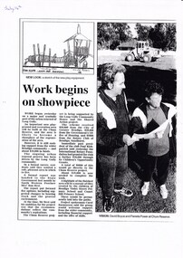
Document - LONG GULLY HISTORY GROUP COLLECTION: WORK BEGINS ON SHOWPIECE
... new playground and recreation area will be built at the Chum Reserve. It is still seeking support from the Bendigo community and more funds. Funding is discussed. A highlight of the finished area will have a mosaic of tiles created by the children of Bendigo Violet Street Primary School and Comet Hill Primary School. These would be permanently laid into the paths...new playground and recreation area will be built at the Chum Reserve. It is still seeking support from the Bendigo community and more funds. Funding is discussed. A highlight of the finished area will have a mosaic of tiles created by the children of Bendigo Violet Street Primary School and Comet Hill Primary School. These would be permanently laid into the paths ...Copy of a newspaper article titled Work begins on showpiece. A new playground and recreation area will be built at the Chum Reserve. It is still seeking support from the Bendigo community and more funds. Funding is discussed. A highlight of the finished area will have a mosaic of tiles created by the children of Bendigo Violet Street Primary School and Comet Hill Primary School. These would be permanently laid into the paths. July 14th written at the top of the page. Page has a sketch of the tree house and a photo of David Boyce and Pamela Power at Chum Reserve.bendigo, history, long gully history group, the long gully history group - work begins on showpiece, chum reserve, north western province mlc ron best, long gully community house, shared action project, city of greater bendigo, government's office of housing, rotary club of bendigo sandhurst, paul kirkpatrick, international rotary foundation, children's opportunity grants, bendigo violet street primary school, comet hill primary school, carol rasmussen, david boyce, pamela power -
 The Beechworth Burke Museum
Photograph - Stereoscopic Photograph, c1900
... At the time of being built, the Ovens District Hospital was the only hospital between Melbourne, Victoria, and Goulburn, New South Wales, treating patients from all of north-east Victoria, including Indigo Shire. Ovens Hospital Hospital garden Gardens and Parks Ovens District Hospital Reverse: 97-2292 / View up centre path of Hospital / A03177 / BMM3177 / Note: A03178 / View of the central path of the Ovens Hospital / (Church St) Beechworth Black and white stereoscopic photograph mounted on card. ...The gardens of Ovens District Hospital were laid out and planted by R H Jenkyns in 1874. Over 200 species of trees and shrubs were planted, including several large Himalayan Cedars (Cedrus deodora), a Coast Redwood (Sequoia sempervirens), rare Scots Pine (Pinus sylvestris), Pencil Cedar (Juniperus virginiana), Bunya Bunya Pines (Araucaria bidwillii), a Purple-leaved Dutch Elm (Ulmus x hollandica 'Purpurascens'), American Ash (Fraxinus americana), Pinus radiata, and numerous Populus alba trees and suckers. The gardens were considered integral to the healing process, also including orchards and kitchen gardens. In the 1880s, tourists flocked to Beechworth as the area became recognised as a health resort and picturesque beauty spot. Although the hospital closed in 1940, and parts were subsequently demolished, the gardens remain and form part of the site's listing on the Victorian Heritage Register. This photograph is part of a collection of items held by the Burke Museum relating to Ovens District Hospital. At the time of being built, the Ovens District Hospital was the only hospital between Melbourne, Victoria, and Goulburn, New South Wales, treating patients from all of north-east Victoria, including Indigo Shire.Black and white stereoscopic photograph mounted on card.Reverse: 97-2292 / View up centre path of Hospital / A03177 / BMM3177 / Note: A03178 / View of the central path of the Ovens Hospital / (Church St) Beechworthovens hospital, hospital garden, gardens and parks, ovens district hospital -
 Eltham District Historical Society Inc
Book, Melway Great Melbourne street directory including Geelong, Phillip Island Healesville, Bellarine & Mornington Peninsulas, 1998
... Cover: (Includes) New Southbank map including Crown Complex, enlargements of Footscray and Kensington, bike paths, walking tracks & horse trails, latest public transport information, South east Australia tours maps, Vic Roads new route numbers, map of Australia...Cover: (Includes) New Southbank map including Crown Complex, enlargements of Footscray and Kensington, bike paths, walking tracks & horse trails, latest public transport information, South east Australia tours maps, Vic Roads new route numbers, map of Australia streets maps roads melbourne ISSN 03113957 1 atlas (22, 772 p.) : col. maps ; Melway Great Melbourne street directory including Geelong, Phillip Island Healesville, Bellarine & Mornington Peninsulas Book ...25th edition. Coloured detailed maps accessed by a street or location index. Cover: (Includes) New Southbank map including Crown Complex, enlargements of Footscray and Kensington, bike paths, walking tracks & horse trails, latest public transport information, South east Australia tours maps, Vic Roads new route numbers, map of Australia1 atlas (22, 772 p.) : col. maps ; ISSN 03113957streets, maps, roads, melbourne -
 Eltham District Historical Society Inc
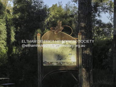
Photograph, Liz Pidgeon, Heritage Excursion; Eltham Lower Park, 1 July 2017
... path along the creek and the river provides a pleasant and scenic walk. This walk on Saturday 1st July is about 3.5 km in length and will take 2 to 2.5 hours. It will start at 2pm at the Main Road car park at the front of the park. (Melway ref 21 H 10). This sign was removed in about 2021 when works began on the building of an intersection to replace the roundabout at Fitzsimons Lane & Main Road. By May 2023 plantings in green spaces near Eltham Lower Park took place before the official opening of the new...path along the creek and the river provides a pleasant and scenic walk. This walk on Saturday 1st July is about 3.5 km in length and will take 2 to 2.5 hours. It will start at 2pm at the Main Road car park at the front of the park. (Melway ref 21 H 10). This sign was removed in about 2021 when works began on the building of an intersection to replace the roundabout at Fitzsimons Lane & Main Road. By May 2023 plantings in green spaces near Eltham Lower Park took place before the official opening of the new ...Sign at the front of the park which includes a map. Newsletter No., 234, June 2017: Heritage Excursion - Saturday 1st July - Eltham Lower Park - Walk and Talk Eltham Lower Park has played an important part in the history of our area since the early days of European settlement when it was used by local residents as an informal racecourse. Prior to that its location at the junction of the Diamond Creek and the Yarra River made it an important meeting place for the Wurundjeri people. The park combines formal elements and sporting facilities with remnant bushland that is of environmental significance. It is home to sporting and horse riding clubs, popular play spaces and the Diamond Valley Miniature Railway, which attracts large numbers of visitors. The park will be the venue for our July excursion which will comprise a walk of about 3.5 km around the park and adjacent areas. Along the way we will discuss the history and natural history of the area. The path along the creek and the river provides a pleasant and scenic walk. This walk on Saturday 1st July is about 3.5 km in length and will take 2 to 2.5 hours. It will start at 2pm at the Main Road car park at the front of the park. (Melway ref 21 H 10). This sign was removed in about 2021 when works began on the building of an intersection to replace the roundabout at Fitzsimons Lane & Main Road. By May 2023 plantings in green spaces near Eltham Lower Park took place before the official opening of the new Eltham Gateway. The sig Born Digitalelection day, heritage excursion, activities, eltham district historical society, eltham lower park, sign -
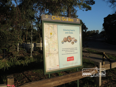 Eltham District Historical Society Inc
Photograph, Liz Pidgeon, Heritage Excursion; Eltham Lower Park, 1 July 2017
... path along the creek and the river provides a pleasant and scenic walk. This walk on Saturday 1st July is about 3.5 km in length and will take 2 to 2.5 hours. It will start at 2pm at the Main Road car park at the front of the park. (Melway ref 21 H 10). This sign was removed in about 2021 when works began on the building of an intersection to replace the roundabout at Fitzsimons Lane & Main Road. By May 2023 plantings in green spaces near Eltham Lower Park took place before the official opening of the new...path along the creek and the river provides a pleasant and scenic walk. This walk on Saturday 1st July is about 3.5 km in length and will take 2 to 2.5 hours. It will start at 2pm at the Main Road car park at the front of the park. (Melway ref 21 H 10). This sign was removed in about 2021 when works began on the building of an intersection to replace the roundabout at Fitzsimons Lane & Main Road. By May 2023 plantings in green spaces near Eltham Lower Park took place before the official opening of the new ...Civic Guide sign near the entrance of Eltham Lower Park with a map of the local area and an advertisement for Eltham College Newsletter No., 234, June 2017 Heritage Excursion - Saturday 1st July - Eltham Lower Park - Walk and Talk Eltham Lower Park has played an important part in the history of our area since the early days of European settlement when it was used by local residents as an informal racecourse. Prior to that its location at the junction of the Diamond Creek and the Yarra River made it an important meeting place for the Wurundjeri people. The park combines formal elements and sporting facilities with remnant bushland that is of environmental significance. It is home to sporting and horse riding clubs, popular play spaces and the Diamond Valley Miniature Railway, which attracts large numbers of visitors. The park will be the venue for our July excursion which will comprise a walk of about 3.5 km around the park and adjacent areas. Along the way we will discuss the history and natural history of the area. The path along the creek and the river provides a pleasant and scenic walk. This walk on Saturday 1st July is about 3.5 km in length and will take 2 to 2.5 hours. It will start at 2pm at the Main Road car park at the front of the park. (Melway ref 21 H 10). This sign was removed in about 2021 when works began on the building of an intersection to replace the roundabout at Fitzsimons Lane & Main Road. By May 2023 plantings in green spaces near Eltham Lower Park took place before the official opening of the new Eltham Gateway.Born Digitalheritage excursion, activities, eltham district historical society, eltham lower park, civic guide, eltham college, sign -
 Monbulk RSL Sub Branch
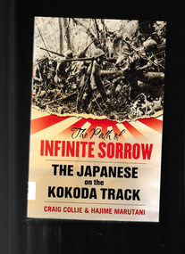
Book, Allen & Unwin, The path of infinite sorrow : the Japanese on the Kokoda Track, 2009
... New Guinea The Australian story of Kokoda has been told often and told well. Now for the first time, the full Japanese story of Kokoda is told, a poignant tale of comradeship and heart-wrenching suffering. This is a very human story of the other side, told through the eyes of Japanese who were there. Index, bib, ill, maps, p.324. The path ...The Australian story of Kokoda has been told often and told well. Now for the first time, the full Japanese story of Kokoda is told, a poignant tale of comradeship and heart-wrenching suffering. This is a very human story of the other side, told through the eyes of Japanese who were there.Index, bib, ill, maps, p.324.non-fictionThe Australian story of Kokoda has been told often and told well. Now for the first time, the full Japanese story of Kokoda is told, a poignant tale of comradeship and heart-wrenching suffering. This is a very human story of the other side, told through the eyes of Japanese who were there. kokoda track 1942, world war 1939 – 1945 – campaigns – new guinea