Showing 244 items matching "parish of sandhurst"
-
 Bendigo Historical Society Inc.
Map - RESURVEY, PARISH OF SANDHURST, 1/08/1891
... RESURVEY, PARISH OF SANDHURST......Parish of Sandhurst resurvey...Map: Resurvey , Parish of Sandhurst sheet 3. Parish plan ( number 203 in Map Cupboard 1)...History House 11 Mackenzie Street Bendigo goldfields MAP Bendigo parish plan Parish of Sandhurst resurvey Map: Resurvey , Parish of Sandhurst sheet 3. ...Map: Resurvey , Parish of Sandhurst sheet 3. Parish plan ( number 203 in Map Cupboard 1)map, bendigo, parish plan, parish of sandhurst resurvey -
Bendigo Historical Society Inc.
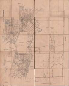
Map - PARISH OF SANDHURST SHEET 5A, 1970
... PARISH OF SANDHURST SHEET 5A......parish of Sandhurst...Map: Parish of Sandhurst Sheet 5A, County of Bendigo. Parish plan ( number 161 in Map Cupboard 1)...History House 11 Mackenzie Street Bendigo goldfields MAP Bendigo parish plan parish of Sandhurst County of Bendigo Map: Parish of Sandhurst Sheet 5A, County of Bendigo. ...Map: Parish of Sandhurst Sheet 5A, County of Bendigo. Parish plan ( number 161 in Map Cupboard 1)map, bendigo, parish plan, parish of sandhurst, county of bendigo -
Bendigo Historical Society Inc.
Map - PARISH OF SANDHURST 1961, 1961
... PARISH OF SANDHURST 1961...At Bendigo Parish of Sandhurst. Sheet 13...History House 11 Mackenzie Street Bendigo goldfields BHS Collection BENDIGO Land sales parish map Dept of Lands and Survey At Bendigo Parish of Sandhurst. Sheet 13 Map PARISH OF SANDHURST 1961 ...BHS CollectionAt Bendigo Parish of Sandhurst. Sheet 13Dept of Lands and Surveybendigo, land sales, parish map -
Bendigo Historical Society Inc.
Map - PARISH OF SANDHURST 1961, 1961
... PARISH OF SANDHURST 1961...At Bendigo Parish of Sandhurst. Sheet F....History House 11 Mackenzie Street Bendigo goldfields BHS Collection BENDIGO Land sales parish map Dept of Lands and Survey At Bendigo Parish of Sandhurst. Sheet F. Map PARISH OF SANDHURST 1961 ...BHS CollectionAt Bendigo Parish of Sandhurst. Sheet F.Dept of Lands and Surveybendigo, land sales, parish map -
Bendigo Historical Society Inc.
Map - RESURVEY PARISH OF SANDHURST, 23/07/1891
... RESURVEY PARISH OF SANDHURST......Parish of Sandhurst...Parish plan ( number 204 in Map Cupboard 1) Map RESURVEY PARISH OF SANDHURST ...Map: Resurvey, Parish of Sandhhurst sheet No. IV, Enlargement of part of sheet No. III. Parish plan ( number 204 in Map Cupboard 1)map, bendigo, parish plan, parish of sandhurst, resurvey -
Bendigo Historical Society Inc.
Map - PARISH OF HUNTLY(PART) AND SANDHURST(PART), No date visible
... PARISH OF HUNTLY(PART) AND SANDHURST(PART)...Parish of Hunlty... Parish of Sandhurst...History House 11 Mackenzie Street Bendigo goldfields MAP Bendigo city streets Parish of Hunlty Parish of Sandhurst Strathdale White Hills Huntly North bendigo Map: Part of parish plan of Bendigo, covering Strathdale, White Hills, Huntly and North Bendigo ( number 144 in Map Cupboard 1) Map PARISH OF HUNTLY(PART) AND SANDHURST(PART) ...Map: Part of parish plan of Bendigo, covering Strathdale, White Hills, Huntly and North Bendigo ( number 144 in Map Cupboard 1)map, bendigo, city streets, parish of hunlty, parish of sandhurst, strathdale, white hills, huntly, north bendigo -
 Bendigo Historical Society Inc.
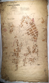
Map - PART OF THE BOROUGH OF EAGLEHAWK, 9/12/1902
... ... Parish of Sandhurst...Map: Part of the Borough of Eaglehawk, Parish of Sandhurst, County of Bendigo. Parish plan Canvas backed....History House 11 Mackenzie Street Bendigo goldfields MAP Bendigo city streets Borough of Eaglehawk Parish of Sandhurst County of Bendigo Map: Part of the Borough of Eaglehawk, Parish of Sandhurst, County of Bendigo. ...Map: Part of the Borough of Eaglehawk, Parish of Sandhurst, County of Bendigo. Parish plan Canvas backed.map, bendigo, city streets, borough of eaglehawk, parish of sandhurst, county of bendigo -
Bendigo Historical Society Inc.
Map - KANGAROO FLAT, 27/.01/1932
... ... Parish of Sandhurst...Map: Township of Kangaroo Flat, Parish of Sandhurst, County of Bendigo ( number 148 in Map Cupboard 1)...History House 11 Mackenzie Street Bendigo goldfields MAP Bendigo township Kangaroo Flat Parish of Sandhurst county of Bendigo Map: Township of Kangaroo Flat, Parish of Sandhurst, County of Bendigo ( number 148 in Map Cupboard 1) Map KANGAROO FLAT ...Map: Township of Kangaroo Flat, Parish of Sandhurst, County of Bendigo ( number 148 in Map Cupboard 1)map, bendigo, township, kangaroo flat, parish of sandhurst, county of bendigo -
Bendigo Historical Society Inc.
Map - KANGAROO FLAT SUBDIVISION, 26/11/1900
... ... Parish of Sandhurst...Map: Plan of Subdivision at Kangaroo flat, Parish of Sandhurst, County of Bendigo ( number 149 in Map Cupboard 1)...History House 11 Mackenzie Street Bendigo goldfields MAP Bendigo parish plan Kangaroo Flat Parish of Sandhurst County of Bendigo Map: Plan of Subdivision at Kangaroo flat, Parish of Sandhurst, County of Bendigo ( number 149 in Map Cupboard 1) Map KANGAROO FLAT SUBDIVISION ...Map: Plan of Subdivision at Kangaroo flat, Parish of Sandhurst, County of Bendigo ( number 149 in Map Cupboard 1)map, bendigo, parish plan, kangaroo flat, parish of sandhurst, county of bendigo -
Bendigo Historical Society Inc.
Map - BENDIGO SHEET 12, Reproduced 1961
... ... Parish of Sandhurst ...Map; Bendigo Sheet 12, Parish of Sandhurst , County of Bendigo, Parish plan, Scale 2 chains to 1 inch ( number 142 in Map Cupboard 1)...History House 11 Mackenzie Street Bendigo goldfields MAP Bendigo city streets Bendigo Sheet 12 Parish of Sandhurst county of Bendigo Map; Bendigo Sheet 12, Parish of Sandhurst , County of Bendigo, Parish plan, Scale 2 chains to 1 inch ( number 142 in Map Cupboard 1) Map BENDIGO SHEET 12 ...Map; Bendigo Sheet 12, Parish of Sandhurst , County of Bendigo, Parish plan, Scale 2 chains to 1 inch ( number 142 in Map Cupboard 1)map, bendigo, city streets, bendigo sheet 12, parish of sandhurst , county of bendigo -
Bendigo Historical Society Inc.
Map - SANDHURST, Circa 1906
... ...parish plan...Sandhurst...Map: Parish of Sandhurst, County of Bendigo. Parish plan...Parish plan Map SANDHURST ...Map: Parish of Sandhurst, County of Bendigo. Parish planmap, bendigo, parish plan, sandhurst -
 Bendigo Historical Society Inc.
Map - SANDHURST ? SHEET 5, 29/10/1879
... ...Parish of Sandhurst...History House 11 Mackenzie Street Bendigo goldfields MAP Bendigo parish plan Parish of Sandhurst Kangaroo Flat Map: Parish plan showing area Northwards from Kangaroo Flat Map SANDHURST ? ...Map: Parish plan showing area Northwards from Kangaroo Flatmap, bendigo, parish plan, parish of sandhurst, kangaroo flat -
Bendigo Historical Society Inc.
Map - PART PARISHES OF MANDURANG AND SANDHURST, No date visible
... Parish of Mandurang... Parish of Sandhurst...Map PART PARISHES OF MANDURANG AND SANDHURST ...Map: Section of Parish plan of Bendigo covering Mandurang, Diamond Hill, and Quarry Hill, ( number 147 in Map Cupboard 1).Map 11map, bendigo, city streets, parish of mandurang, parish of sandhurst, diamond hill , quarry hill -
Bendigo Historical Society Inc.
Map - PART PARISHES OF SANDHURST MARONG AND NERRING, No date visible
... ...Parish of Sandhurst...History House 11 Mackenzie Street Bendigo goldfields MAP Bendigo city streets Parish of Sandhurst Parish of Marong Parish of Nerring Ironbark Eaglehawk Myers Flat Map: Section of a Parish plan of Bendigo, covering Ironbark, Eaglehawk and Myers Flat ( number 145 in Map Cupboard 1) Map PART PARISHES OF SANDHURST MARONG AND NERRING ...Map: Section of a Parish plan of Bendigo, covering Ironbark, Eaglehawk and Myers Flat ( number 145 in Map Cupboard 1)map, bendigo, city streets, parish of sandhurst, parish of marong, parish of nerring, ironbark, eaglehawk, myers flat -
Bendigo Historical Society Inc.
Map - SANDHURST (PART), No date Visible
... ...Parish of Sandhurst...History House 11 Mackenzie Street Bendigo goldfields MAP Bendigo parish plan Parish of Sandhurst Spring Gully Map: Hand Draughted parish plan showing the area North and East of Spring Gully Reservoir ( number 206 in Map Cupboard 1) Map SANDHURST (PART) ...Map: Hand Draughted parish plan showing the area North and East of Spring Gully Reservoir ( number 206 in Map Cupboard 1)map, bendigo, parish plan, parish of sandhurst, spring gully -
 Bendigo Historical Society Inc.
Map - CAMPBELL COLLECTION: BENDIGO AND DISTRICT MAPS
... Map. Parish of Sandhurst, Shire of Strathfieldsaye, Mandurang Parish, Junortoun....MAP Bendigo city streets Map. Parish of Sandhurst, Shire of Strathfieldsaye, Mandurang Parish, Junortoun. ...Map. Parish of Sandhurst, Shire of Strathfieldsaye, Mandurang Parish, Junortoun.map, bendigo, city streets -
 Bendigo Historical Society Inc.
Map - JACK FLYNN COLLECTION: SANDHURST SHEET 6, January 1947
... ...parish plan...Sandhurst...Map: Parish of Sandhurst Sheet 6. County of Bendigo. Parish plan....Drawn and Reproduced at the Dept, of Lands and Survey, Melbourne, Victoria. Map: Parish of Sandhurst Sheet 6. County of Bendigo. Parish plan. ...Map: Parish of Sandhurst Sheet 6. County of Bendigo. Parish plan.By Authority J. J. Gourley, Government Printer, Melbourne. Drawn and Reproduced at the Dept, of Lands and Survey, Melbourne, Victoria.map, bendigo, parish plan, sandhurst sheet 6 -
 Bendigo Historical Society Inc.
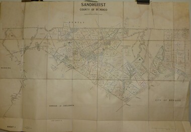
Map - JACK FLYNN COLLECTION: SANDHURST SHEET 2, January 1947
... ...parish plan...Sandhurst...Map: Parish of Sandhurst Sheet 2, County of Bendigo. Parish plan....Drawn and Reproduced at the Dept, of Lands and Survey, Melbourne, Victoria. Map: Parish of Sandhurst Sheet 2, County of Bendigo. Parish plan. ...Map: Parish of Sandhurst Sheet 2, County of Bendigo. Parish plan.By Authority J. J. Gourley, Government Printer, Melbourne. Drawn and Reproduced at the Dept, of Lands and Survey, Melbourne, Victoria.map, bendigo, parish plan, sandhurst sheet 2 -
 Bendigo Historical Society Inc.
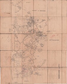
Map - JACK FLYNN COLLECTION: SANDHURST SHEET 1, January 1947
... ...parish plan...Sandhurst...Map: Parish of Sandhurst sheet 1, County of Bendigo. Parish plan....History House 11 Mackenzie Street Bendigo goldfields MAP Bendigo parish plan Sandhurst Map: Parish of Sandhurst sheet 1, County of Bendigo. ...Map: Parish of Sandhurst sheet 1, County of Bendigo. Parish plan.map, bendigo, parish plan, sandhurst -
 Bendigo Historical Society Inc.
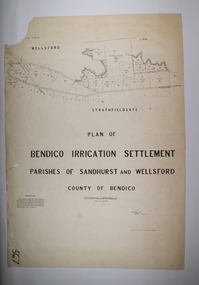
Map - BENDIGO IRRIGATION SETTLEMENT, 20/10/1908
... Map: Bendigo Irrigation Settlement, Parishes of Sandhurst and Wellsford, County of Bendigo, Parish plan...History House 11 Mackenzie Street Bendigo goldfields MAP Bendigo irrigation settlement Bendigo irrigation Settlement Map: Bendigo Irrigation Settlement, Parishes of Sandhurst and Wellsford, County of Bendigo, Parish plan Map BENDIGO IRRIGATION SETTLEMENT ...Map: Bendigo Irrigation Settlement, Parishes of Sandhurst and Wellsford, County of Bendigo, Parish planmap, bendigo, irrigation settlement, bendigo irrigation settlement -
 Bendigo Historical Society Inc.
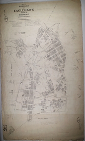
Map - BOROUGH OF EAGLEHAWK SHEET 1, 9/12/1902
... Map: Borough of Eaglehawk, sheet No. 1, Parish of Sandhurst, County of Bendigo. Parish plan...History House 11 Mackenzie Street Bendigo goldfields MAP Bendigo parish plan Borough of Eaglehawk Map: Borough of Eaglehawk, sheet No. 1, Parish of Sandhurst, County of Bendigo. Parish plan Map BOROUGH OF EAGLEHAWK SHEET 1 ...Map: Borough of Eaglehawk, sheet No. 1, Parish of Sandhurst, County of Bendigo. Parish planmap, bendigo, parish plan, borough of eaglehawk -
 Bendigo Historical Society Inc.
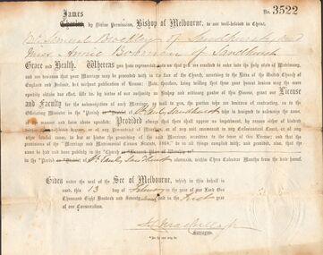
Document - BROCKLEY FAMILY DOCUMENTS: PERMISSION TO MARRY WITHOUT BANNS
... ... Parish of St Pauls Sandhurst...The permission is for Mr Samual Brockley and Miss Annie Bowman, both of Sandhurst. Dated 13 February 1877. Parish of St. Pauls Sandhurst. ...The permission is for Mr Samual Brockley and Miss Annie Bowman, both of Sandhurst. Dated 13 February 1877. Parish of St. Pauls Sandhurst. ...Certificate No. 3522 permission to marry without the publication of Banns. The permission is for Mr Samual Brockley and Miss Annie Bowman, both of Sandhurst. Dated 13 February 1877. Parish of St. Pauls Sandhurst. Document has imprint on the bottom right corner. Also a photocopy.document, certificate, marriage, permission to marry without banns, parish of st pauls sandhurst, mr samual brockley, miss annie bowman -
Bendigo Historical Society Inc.
Map - TOWNSHIP OF KANGAROO FLAT, 27/01/1932
... Map: Township of Kangaroo flat, Parish of Sandhurst , County of Bendigo. Parish plan ( number 194 in Map Cupboard 1)...History House 11 Mackenzie Street Bendigo goldfields MAP Bendigo township Kangaroo flat Map: Township of Kangaroo flat, Parish of Sandhurst , County of Bendigo. Parish plan ( number 194 in Map Cupboard 1) Map TOWNSHIP OF KANGAROO FLAT ...Map: Township of Kangaroo flat, Parish of Sandhurst , County of Bendigo. Parish plan ( number 194 in Map Cupboard 1)map, bendigo, township, kangaroo flat -
Bendigo Historical Society Inc.
Map - BENDIGO IRRIGATION SETTLEMENT, 12/02/1908
... Map: Plan of Bendigo Irrigation Settlement, Parishes of Sandhurst and Wellsford, County of Bendigo ( number 160 in Map Cupboard 1)...History House 11 Mackenzie Street Bendigo goldfields MAP Bendigo irrigation settlement Bendigo Irrigation Settlement Parishes of Sandhurst and Wellsford County of Bendigo Map: Plan of Bendigo Irrigation Settlement, Parishes of Sandhurst and Wellsford, County of Bendigo ( number 160 in Map Cupboard 1) Map BENDIGO IRRIGATION SETTLEMENT ...Map: Plan of Bendigo Irrigation Settlement, Parishes of Sandhurst and Wellsford, County of Bendigo ( number 160 in Map Cupboard 1)map, bendigo, irrigation settlement, bendigo irrigation settlement, parishes of sandhurst and wellsford, county of bendigo -
 Bendigo Historical Society Inc.
Map - CAMPBELL COLLECTION: BENDIGO AND DISTRICT MAPS
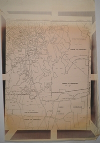
... Map. Parish of Sandhurst, Parish of Huntly, Parish of Nerring, Parish of Marong, Parish of Lockwood, Parish of Wellsford, Parish of Strathfieldsaye, Parish of Mandurang. ...MAP Bendigo parishes Map. Parish of Sandhurst, Parish of Huntly, Parish of Nerring, Parish of Marong, Parish of Lockwood, Parish of Wellsford, Parish of Strathfieldsaye, Parish of Mandurang. ...Map. Parish of Sandhurst, Parish of Huntly, Parish of Nerring, Parish of Marong, Parish of Lockwood, Parish of Wellsford, Parish of Strathfieldsaye, Parish of Mandurang. Scale approx 1:18,000.map, bendigo, parishes -
Bendigo Historical Society Inc.
Map - BENDIGO WEST IRRIGATION SETTLEMENT, 27/07/1910
... Map: bendigo West Irrigation Settlement, Parish of Sandhurst, County of Bendigo. Parish plan ( number 193 in Map Cupboard 1)...History House 11 Mackenzie Street Bendigo goldfields MAP Bendigo irrigation settlement Bendigo West Irrigation Settlement Map: bendigo West Irrigation Settlement, Parish of Sandhurst, County of Bendigo. Parish plan ( number 193 in Map Cupboard 1) Map BENDIGO WEST IRRIGATION SETTLEMENT ...Map: bendigo West Irrigation Settlement, Parish of Sandhurst, County of Bendigo. Parish plan ( number 193 in Map Cupboard 1)map, bendigo, irrigation settlement, bendigo west irrigation settlement -
Bendigo Historical Society Inc.
Map - BENDIGO WEST IRRIGATION SETTLEMENT, 13/02/1909
... Map: Bendigo West Irrigation Settlement, Parish of Sandhurst, County of Bendigo. Parish plan. ( number 191 in Map Cupboard 1)...History House 11 Mackenzie Street Bendigo goldfields MAP Bendigo irrigation settlement Bendigo West Irrigatioon Settlement Map: Bendigo West Irrigation Settlement, Parish of Sandhurst, County of Bendigo. Parish plan. ( number 191 in Map Cupboard 1) Map BENDIGO WEST IRRIGATION SETTLEMENT ...Map: Bendigo West Irrigation Settlement, Parish of Sandhurst, County of Bendigo. Parish plan. ( number 191 in Map Cupboard 1)map, bendigo, irrigation settlement, bendigo west irrigatioon settlement -
 Bendigo Historical Society Inc.
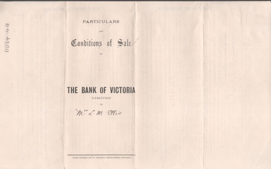
Legal record - ELLIS Edward Woodrow Tregenza - Land sale records, Watson, James & Rogers, Rogers Collection, 1907
... Bendigo and Edward Woodrow Tregenza Ellis of High St Bendigo for Crown allotments 18 and 19, Parish of Sandhurst County of bendigo..... * Plan of subdivision of crown allotments 20, 22, 23 Parish of Sandhurst, County of Bendigo * Agreement between Rupert Noyes Putnam of Williamson St. ...In the early 1980s the firm of Watson, James & Rogers merged with the partnership of Every & Every and became the iconic “Rogers & Every” as known today. The firm is still located on Bull Street. https://rogersevery.com.au/about/* Particulars, conditions of sale and contract from bank of Victoria to Louisa Mary Ellis. 1907. * Plan of subdivision of crown allotments 20, 22, 23 Parish of Sandhurst, County of Bendigo * Agreement between Rupert Noyes Putnam of Williamson St. Bendigo and Edward Woodrow Tregenza Ellis of High St Bendigo for Crown allotments 18 and 19, Parish of Sandhurst County of bendigo.Signaturesrupert noyes putnam, land sales -
 Bendigo Historical Society Inc.
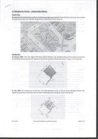
Document - History of 11 Mackenzie Street
... Six-page history of the ownership of the property at 11 MacKenzie Street, Parish of Sandhurst, Bendigo from subdivision in 1894 to sale in 2021. through five owners. ...Mackenzie Street Historical Society Six-page history of the ownership of the property at 11 MacKenzie Street, Parish of Sandhurst, Bendigo from subdivision in 1894 to sale in 2021. through five owners. ...Bendigo Historical Society moved into 11 Mackenzie Street, Bendigo in 2022. The BHS Collection has been installed in the building.Six-page history of the ownership of the property at 11 MacKenzie Street, Parish of Sandhurst, Bendigo from subdivision in 1894 to sale in 2021. through five owners. mackenzie street, historical society -
 Bendigo Historical Society Inc.
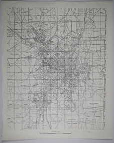
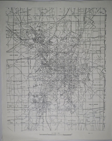
Map - CAMPBELL COLLECTION: BENDIGO AND DISTRICT MAPS
... Sandhurst and suburbs, Parish of Sandhurst, Parish of Huntly, Parish of Nerring, Parish of Marong, Parish of Lockwood, Parish of Wellsford, Parish of Strathfieldsaye, Parish of Mandurang...MAP Bendigo parishes Map. Sandhurst and suburbs, Parish of Sandhurst, Parish of Huntly, Parish of Nerring, Parish of Marong, Parish of Lockwood, Parish of Wellsford, Parish of Strathfieldsaye, Parish of Mandurang Map CAMPBELL COLLECTION: BENDIGO AND DISTRICT MAPS. ...Map. Sandhurst and suburbs, Parish of Sandhurst, Parish of Huntly, Parish of Nerring, Parish of Marong, Parish of Lockwood, Parish of Wellsford, Parish of Strathfieldsaye, Parish of Mandurangmap, bendigo, parishes