
Showing 173 items matching "picnic area"
-
 Buninyong & District Historical Society
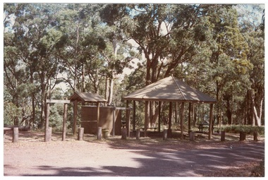
Photograph - Colour photograph, Colour photograph of Mt. Buninyong picnic area
... Colour photograph of Mt. Buninyong picnic area...Colour photograph of Mt Buninyong picnic area...Wilson Colour photograph of Mt Buninyong picnic area Colour photograph of Mt. Buninyong picnic area Photograph Colour photograph ...One of a series of photographs taken for Buninyong Shire Council 1980sMount Buninyong was reserved as a public park in 1866.Colour photograph of Mt Buninyong picnic areabuninyong shire council, mount buninyong, recreation, water tower, c.c.p. wilson -
 Department of Health and Human Services
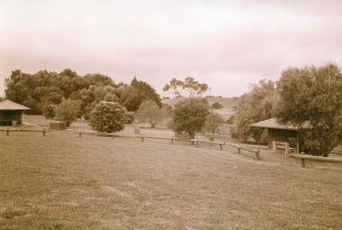
Photograph, Colanda Grounds - Barbeque picnic area
... Colanda Grounds - Barbeque picnic area...Digitised colour photograph of the Colanda Centre barbecue picnic area ...The Colac, Victoria-based Colanda Centre was one of the last Victorian institutions and offered disability accommodation from 1976, when it was established, until 2019, with its closure. colanda, colac, disability services, residential services, disability, digitised photograph Digitised colour photograph of the Colanda Centre barbecue picnic area Colanda Grounds - Barbeque picnic area Photograph ...The Colac, Victoria-based Colanda Centre was one of the last Victorian institutions and offered disability accommodation from 1976, when it was established, until 2019, with its closure.Digitised colour photograph of the Colanda Centre barbecue picnic area colanda, colac, disability services, residential services, disability, digitised photograph -
 Whitehorse Historical Society Inc.
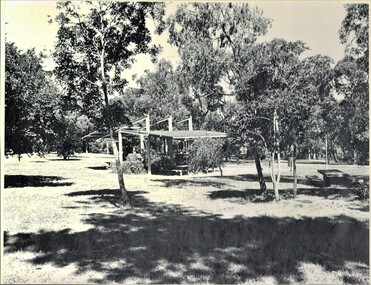
Photograph, Picnic Area at Antonio Park, 1983
... Picnic Area at Antonio Park...Laser print of black and white photo of Picnic Area at Antonio Park, corner Deep Creek Road and Whitehorse Road , Mitcham. 1977. ...(Mounted) Picnic Area at Antonio Park Photograph Photograph ...Donor developed Educational Programme for Blackburn LakeLaser print of black and white photo of Picnic Area at Antonio Park, corner Deep Creek Road and Whitehorse Road , Mitcham. 1977. (Mounted)meagher, dorothy, antonio park, mitcham, deep creek road, mitcham, whitehorse road, mitcham -
 Lakes Entrance Historical Society
Map - Lake Tyers Forest Park/Forest Drives Picnic Area, c1982
... Lake Tyers Forest Park/Forest Drives Picnic Area...Waterways Tracks Forest Tourism Copy of a tourist brochure showing Lake Tyers waterways and tracks in the forest area Map Lake Tyers Forest Park/Forest Drives Picnic Area ...Copy of a tourist brochure showing Lake Tyers waterways and tracks in the forest areawaterways, tracks, forest, tourism -
 Allan Doney Collection, Bendigo Historical Society Inc.
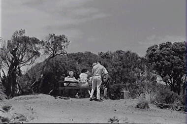
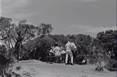
Negative - Point Lonsdale - Picnic Area - People, Allan Doney, 1950 -1970
... Point Lonsdale - Picnic Area - People...Negative Point Lonsdale - Picnic Area - People Allan Doney ...In the years of Allan Doney’s photography, landmark buildings succumbed to fire, neglect and redevelopment. He photographed the grey sand hills from Bendigo’s mining past, the streetscapes, poppet heads, miners’ cottages, gracious homes with ornate verandahs, trams and much more. Above all, his photographs show how much of the city has survived from the 19th century – and how much has not. Through two decades of great change, Allan Doney was there to capture ways people interacted with it. Although he travelled to many other places in Northern Victoria and beyond in search of subjects for his art, he seemed to always return to Bendigo for inspiration. -
 Allan Doney Collection, Bendigo Historical Society Inc.
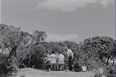
Negative - Point Lonsdale - Picnic Area - People, Allan Doney, 1950 -1970
... Point Lonsdale - Picnic Area - People...Negative Point Lonsdale - Picnic Area - People Allan Doney ...In the years of Allan Doney’s photography, landmark buildings succumbed to fire, neglect and redevelopment. He photographed the grey sand hills from Bendigo’s mining past, the streetscapes, poppet heads, miners’ cottages, gracious homes with ornate verandahs, trams and much more. Above all, his photographs show how much of the city has survived from the 19th century – and how much has not. Through two decades of great change, Allan Doney was there to capture ways people interacted with it. Although he travelled to many other places in Northern Victoria and beyond in search of subjects for his art, he seemed to always return to Bendigo for inspiration. -
 Allan Doney Collection, Bendigo Historical Society Inc.
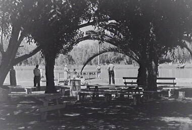
Negative - Point Lonsdale - Picnic Area - People, Allan Doney, 1950 -1970
... Point Lonsdale - Picnic Area - People...Negative Point Lonsdale - Picnic Area - People Allan Doney ...In the years of Allan Doney’s photography, landmark buildings succumbed to fire, neglect and redevelopment. He photographed the grey sand hills from Bendigo’s mining past, the streetscapes, poppet heads, miners’ cottages, gracious homes with ornate verandahs, trams and much more. Above all, his photographs show how much of the city has survived from the 19th century – and how much has not. Through two decades of great change, Allan Doney was there to capture ways people interacted with it. Although he travelled to many other places in Northern Victoria and beyond in search of subjects for his art, he seemed to always return to Bendigo for inspiration. -
 Allan Doney Collection, Bendigo Historical Society Inc.
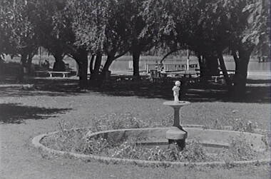
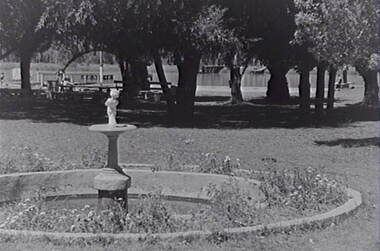
Negative - Boort - Park - Picnic Area - Lake, Allan Doney, 1950 -1970
... Boort - Park - Picnic Area - Lake...Negative Boort - Park - Picnic Area - Lake Allan Doney ...In the years of Allan Doney’s photography, landmark buildings succumbed to fire, neglect and redevelopment. He photographed the grey sand hills from Bendigo’s mining past, the streetscapes, poppet heads, miners’ cottages, gracious homes with ornate verandahs, trams and much more. Above all, his photographs show how much of the city has survived from the 19th century – and how much has not. Through two decades of great change, Allan Doney was there to capture ways people interacted with it. Although he travelled to many other places in Northern Victoria and beyond in search of subjects for his art, he seemed to always return to Bendigo for inspiration. -
 Allan Doney Collection, Bendigo Historical Society Inc.
Negative - Boort - Park - Picnic Area - Lake, Allan Doney, 1950 -1970
... Boort - Park - Picnic Area - Lake...Negative Boort - Park - Picnic Area - Lake Allan Doney ...In the years of Allan Doney’s photography, landmark buildings succumbed to fire, neglect and redevelopment. He photographed the grey sand hills from Bendigo’s mining past, the streetscapes, poppet heads, miners’ cottages, gracious homes with ornate verandahs, trams and much more. Above all, his photographs show how much of the city has survived from the 19th century – and how much has not. Through two decades of great change, Allan Doney was there to capture ways people interacted with it. Although he travelled to many other places in Northern Victoria and beyond in search of subjects for his art, he seemed to always return to Bendigo for inspiration. -
 Allan Doney Collection, Bendigo Historical Society Inc.
Negative - Boort - Park - Picnic Area - Lake, Allan Doney, 1950 -1970
... Boort - Park - Picnic Area - Lake...Negative Boort - Park - Picnic Area - Lake Allan Doney ...In the years of Allan Doney’s photography, landmark buildings succumbed to fire, neglect and redevelopment. He photographed the grey sand hills from Bendigo’s mining past, the streetscapes, poppet heads, miners’ cottages, gracious homes with ornate verandahs, trams and much more. Above all, his photographs show how much of the city has survived from the 19th century – and how much has not. Through two decades of great change, Allan Doney was there to capture ways people interacted with it. Although he travelled to many other places in Northern Victoria and beyond in search of subjects for his art, he seemed to always return to Bendigo for inspiration. -
 Marysville & District Historical Society
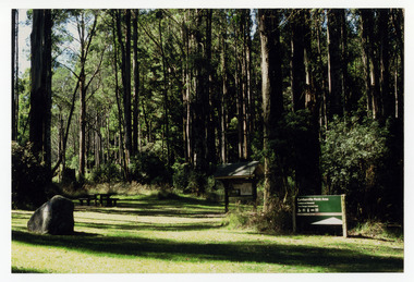
Photograph (item) - Colour photograph, Unknown
... A colour photograph of the Cambarville picnic area. Cambarville was established as a timber mill town in the 1940s. ...A colour photograph of the Cambarville picnic area....A colour photograph of the Cambarville picnic area. Cambarville was established as a timber mill town in the 1940s. ...A colour photograph of the Cambarville picnic area. Cambarville was established as a timber mill town in the 1940s. Timber mill owners A. Cameron and F.J. Barton named Cambarville. They established the mill to salvage timber from trees destroyed in the 1939 bushfires. Cambarville was impacted by the 2009 Black Saturday bushfires and any remaining structures were destroyed.A colour photograph of the Cambarville picnic area.marysville, victoria, 1939 bushfires, 2009 black saturday bushfires, cambarville, a. cameron, f.j. barton, australia, sawmill, photograph, timber mill -
 Marysville & District Historical Society
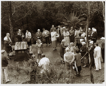
Photograph (Item) - Black and white photograph, 1993
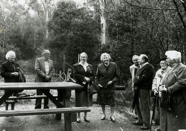
... A black and white photograph taken at the re-opening of the Wilks Creek Bridge picnic area and launch of Ann Thomas' book Wilks Creek Bridge....A black and white photograph taken at the re-opening of the Wilks Creek Bridge picnic area and launch of Ann Thomas' book Wilks Creek Bridge....A black and white photograph taken at the re-opening of the Wilks Creek Bridge picnic area and launch of Ann Thomas' book Wilks Creek Bridge. ...A black and white photograph taken at the re-opening of the Wilks Creek Bridge picnic area and launch of Ann Thomas' book Wilks Creek Bridge.A black and white photograph taken at the re-opening of the Wilks Creek Bridge picnic area and launch of Ann Thomas' book Wilks Creek Bridge. The Wilks Creek Bridge is a former timber and bluestone road bridge on the Yarra Track, and is located just off the Black Spur route, between Narbethong and Marysville, Victoria, Australia. It was built in 1870 to the design of colonial Public Works Department engineer Clement Wilks as part of the construction of a new road to the Woods Point and Jordan Goldfields. Like many bridges of the period, it had a timber superstructure employing squared beams supported by struts and straining pieces, on cut bluestone abutments. The bridge was remodelled around 1900 by engineer John Monash of the famous bridge-engineering firm of Monash and Anderson. It was last used for heavy vehicular traffic in 1980 following the realignment of Marysville Road, and was left to decay until its demolishment in 2008. All timber traces of the bridge were destroyed in the 2009 Black Saturday fires. The handcrafted bluestone masonry wingwalls and abutments, especially shaped to receive timber struts, rate among the earliest of its kind surviving intact in Victoria.wilks creek bridge, yarra track, narbethong, marysville, victoria, clement wilks, wood's point goldfields, jordan goldfields, john monash, monash and anderson, 2009 black saturday bushfires -
 Marysville & District Historical Society
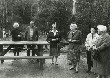
Photograph (Item) - Black and white photograph, 1993
... A black and white photograph taken at the re-opening of the Wilks Creek Bridge picnic area and launch of Ann Thomas' book Wilks Creek Bridge....A black and white photograph taken at the re-opening of the Wilks Creek Bridge picnic area and launch of Ann Thomas' book Wilks Creek Bridge....A black and white photograph taken at the re-opening of the Wilks Creek Bridge picnic area and launch of Ann Thomas' book Wilks Creek Bridge. ...A black and white photograph taken at the re-opening of the Wilks Creek Bridge picnic area and launch of Ann Thomas' book Wilks Creek Bridge.A black and white photograph taken at the re-opening of the Wilks Creek Bridge picnic area and launch of Ann Thomas' book Wilks Creek Bridge. The Wilks Creek Bridge is a former timber and bluestone road bridge on the Yarra Track, and is located just off the Black Spur route, between Narbethong and Marysville, Victoria, Australia. It was built in 1870 to the design of colonial Public Works Department engineer Clement Wilks as part of the construction of a new road to the Woods Point and Jordan Goldfields. Like many bridges of the period, it had a timber superstructure employing squared beams supported by struts and straining pieces, on cut bluestone abutments. The bridge was remodelled around 1900 by engineer John Monash of the famous bridge-engineering firm of Monash and Anderson. It was last used for heavy vehicular traffic in 1980 following the realignment of Marysville Road, and was left to decay until its demolishment in 2008. All timber traces of the bridge were destroyed in the 2009 Black Saturday fires. The handcrafted bluestone masonry wingwalls and abutments, especially shaped to receive timber struts, rate among the earliest of its kind surviving intact in Victoria.wilks creek bridge, yarra track, narbethong, marysville, victoria, clement wilks, wood's point goldfields, jordan goldfields, john monash, monash and anderson, 2009 black saturday bushfires -
 Marysville & District Historical Society
Photograph (Item) - Black and white photograph, 1993
... A black and white photograph taken at the re-opening of the Wilks Creek Bridge picnic area and launch of Ann Thomas' book Wilks Creek Bridge....A black and white photograph taken at the re-opening of the Wilks Creek Bridge picnic area and launch of Ann Thomas' book Wilks Creek Bridge....A black and white photograph taken at the re-opening of the Wilks Creek Bridge picnic area and launch of Ann Thomas' book Wilks Creek Bridge. ...A black and white photograph taken at the re-opening of the Wilks Creek Bridge picnic area and launch of Ann Thomas' book Wilks Creek Bridge.A black and white photograph taken at the re-opening of the Wilks Creek Bridge picnic area and launch of Ann Thomas' book Wilks Creek Bridge. The Wilks Creek Bridge is a former timber and bluestone road bridge on the Yarra Track, and is located just off the Black Spur route, between Narbethong and Marysville, Victoria, Australia. It was built in 1870 to the design of colonial Public Works Department engineer Clement Wilks as part of the construction of a new road to the Woods Point and Jordan Goldfields. Like many bridges of the period, it had a timber superstructure employing squared beams supported by struts and straining pieces, on cut bluestone abutments. The bridge was remodelled around 1900 by engineer John Monash of the famous bridge-engineering firm of Monash and Anderson. It was last used for heavy vehicular traffic in 1980 following the realignment of Marysville Road, and was left to decay until its demolishment in 2008. All timber traces of the bridge were destroyed in the 2009 Black Saturday fires. The handcrafted bluestone masonry wingwalls and abutments, especially shaped to receive timber struts, rate among the earliest of its kind surviving intact in Victoria.wilks creek bridge, yarra track, narbethong, marysville, victoria, clement wilks, wood's point goldfields, jordan goldfields, john monash, monash and anderson, 2009 black saturday bushfires -
 Halls Gap & Grampians Historical Society
Photograph, C 1960s (?)
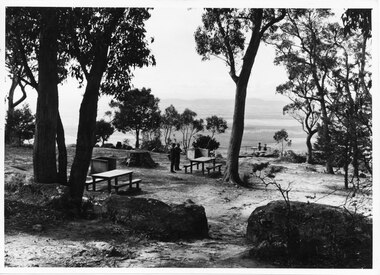
... People at the Boroka Lookout picnic area....Photo shows two men standing close to a picnic table in a picnic area near a lookout (Boroka Lookout). ...People at the Boroka Lookout picnic area. scenery lookouts Photo shows two men standing close to a picnic table in a picnic area near a lookout (Boroka Lookout). ...People at the Boroka Lookout picnic area.Photo shows two men standing close to a picnic table in a picnic area near a lookout (Boroka Lookout). Two other people are standing at the wire fence of the lookout. A valley and distant ranges can be seen in the background.scenery, lookouts -
 Halls Gap & Grampians Historical Society
Photograph - B/W, C 1960s (?)
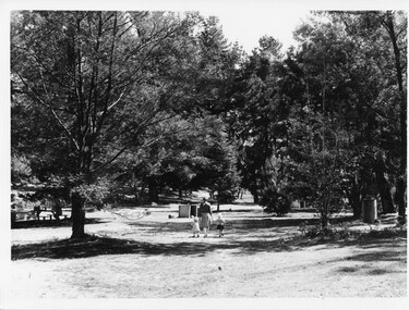
... This is a photo of Zumsteins picnic area (before the pine trees were removed)....The photo shows a woman walking in a picnic area, holding the hand of a toddler and a little girl. ...This is a photo of Zumsteins picnic area (before the pine trees were removed). ...This is a photo of Zumsteins picnic area (before the pine trees were removed).The photo shows a woman walking in a picnic area, holding the hand of a toddler and a little girl. On the far left a person is sitting at a picnic table under a tree. A Vauxhall car is parked beside the table. The area has a large number of trees, some of which are non-native pine trees.scenery, zumsteins -
Marysville & District Historical Society
Article (item) - Magazine article, Emily Friedel, The Cumberland Walk, 06-2022
... ...cambarville picnic area...Cambarville was impacted by the 2009 Black Saturday bushfires and any remaining structures were destroyed. cumberland walk cambarville picnic area big tree cora lynn falls cumberland falls cumberland falls lookout cumberland valley marysville-wood's point road a cameron fj barton cambarville 2009 black saturday bushfires A magazine article relating to The Cumberland Walk. ...A magazine article relating to The Cumberland Walk.A magazine article relating to The Cumberland Walk. The Cumberland Valley is near Cambarville which was a timber town near Marysville. Cambarville is notable for its giant mountain ash (Eucalyptus regnans) trees within the Cumberland Memorial Scenic Reserve, and relics from former sawmills and gold mining. The Big Culvert is located nearby on the Marysville - Woods Point Road, which was historically part of the Yarra Track. Cambarville was established as a timber mill town in the 1940s. Timber mill owners A Cameron and FJ Barton named Cambarville. They established the mill to salvage timber from trees destroyed in the 1939 bushfires. Cambarville was impacted by the 2009 Black Saturday bushfires and any remaining structures were destroyed.cumberland walk, cambarville picnic area, big tree, cora lynn falls, cumberland falls, cumberland falls lookout, cumberland valley, marysville-wood's point road, a cameron, fj barton, cambarville, 2009 black saturday bushfires -
 Marysville & District Historical Society
Ephemera (Item) - Visitor information pack, Four Seasons of Adventure in the Mystic Mountains, Unknown
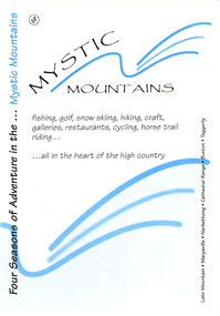
... ...taggerty river picnic area...A visitor information pack on Marysville and the surrounding district. marysville victoria australia visitor information pack lake mountain narbethong cathedral range buxton taggerty mystic mountains beauty spot walk tree fern gully walk michaeldene track keppel track woods lookout track lady talbot forest drive wishing well taggerty river picnic area taggerty river phantom falls keppel falls the beeches walking track mount sugarloaf department of conservation & environment victoria A visitor information pack on Marysville and the surrounding district. ...A visitor information pack on Marysville and the surrounding district.A visitor information pack on Marysville and the surrounding district.marysville, victoria, australia, visitor information pack, lake mountain, narbethong, cathedral range, buxton, taggerty, mystic mountains, beauty spot walk, tree fern gully walk, michaeldene track, keppel track, woods lookout track, lady talbot forest drive, wishing well, taggerty river picnic area, taggerty river, phantom falls, keppel falls, the beeches walking track, mount sugarloaf, department of conservation & environment victoria -
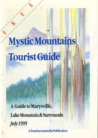 Marysville & District Historical Society
Ephemera (Item) - Tourist Guide, Graeme Haycraft, Mystic Mountains Tourist Guide July 1995, 07-1995
... ...taggerty river picnic area...A tourist guide outlining services, accommodation, activities and places of interest to visit in and around Marysville, Lake Mountain and the local district. marysville victoria australia tourist guide mystic mountains lake mountain tourism australia graeme haycraft magic creek nursery missing links miniature golf phelps bakery blackwood cottages marysville hotel motel tower motel kerami house marylands guest house lomatia lodge willowbank at taggerty barree mud brick cottages scenic motel somerled mountain retreat dalrymples guest cottages nanda binya lodge mathilde's of marysville country guest house the birches resort mystic mountains tourist information marysville caravan park the cumberland igloo roadhouse top shop pancake parlour the silver birch restaurant steavenson's restaurant olde yarra track shoppe danish coffee gardens oscars take-away country touch pottery studio & gallery cumberland memorial scenic reserve cathedral range state park lady talbot forest drive wishing well taggerty river picnic area taggerty river phantom falls keppels falls the beeches walking track mount sugarloaf maryton park holiday cottages snowviews esa camping & conference centre wirreanda festival marysville post shop hidden talent craft gallery marysville automotive repairs geoffrey pope & associates beauty spot walk tree fern gully walk michaeldene track marysville riding school gerraty's ski centre marysville holiday cottages marysville triangle taxi service fruit salad farm lake mountain alpine resort marysville ski hire lake mountain ski school cross country ski hire lake mountain ski hire marysville country club Acknowledgements/ Mystic Mountains Tourism Association, Marysville Office of the Dept. of Conser/ vation & Natural Resources, Mrs Elaine Postlethwaite, Ms Sue Henry & every/ advertiser without whose support this Guide would not have been possible. ...A tourist guide outlining services, accommodation, activities and places of interest to visit in and around Marysville, Lake Mountain and the local district.A tourist guide outlining services, accommodation, activities and places of interest to visit in and around Marysville, Lake Mountain and the local district.Acknowledgements/ Mystic Mountains Tourism Association, Marysville Office of the Dept. of Conser/ vation & Natural Resources, Mrs Elaine Postlethwaite, Ms Sue Henry & every/ advertiser without whose support this Guide would not have been possible.marysville, victoria, australia, tourist guide, mystic mountains, lake mountain, tourism australia, graeme haycraft, magic creek nursery, missing links miniature golf, phelps bakery, blackwood cottages, marysville hotel motel, tower motel, kerami house, marylands guest house, lomatia lodge, willowbank at taggerty, barree mud brick cottages, scenic motel, somerled mountain retreat, dalrymples guest cottages, nanda binya lodge, mathilde's of marysville country guest house, the birches resort, mystic mountains tourist information, marysville caravan park, the cumberland, igloo roadhouse, top shop pancake parlour, the silver birch restaurant, steavenson's restaurant, olde yarra track shoppe, danish coffee gardens, oscars take-away, country touch pottery studio & gallery, cumberland memorial scenic reserve, cathedral range state park, lady talbot forest drive, wishing well, taggerty river picnic area, taggerty river, phantom falls, keppels falls, the beeches walking track, mount sugarloaf, maryton park holiday cottages, snowviews, esa camping & conference centre, wirreanda festival, marysville post shop, hidden talent craft gallery, marysville automotive repairs, geoffrey pope & associates, beauty spot walk, tree fern gully walk, michaeldene track, marysville riding school, gerraty's ski centre, marysville holiday cottages, marysville triangle taxi service, fruit salad farm, lake mountain alpine resort, marysville ski hire, lake mountain ski school, cross country ski hire, lake mountain ski hire, marysville country club -
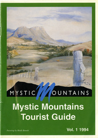 Marysville & District Historical Society
Ephemera (Item) - Tourist Guide, Michael Nash et al, Mystic Mountains Tourist Guide Vol. 1 1994, 1994
... ...taggerty river picnic area...A tourist guide outlining services, accommodation, activities and places of interest to visit in and around Marysville and the local district. marysville victoria australia tourist guide mystic mountains michael nash dudley jones marysville and district tourist and progress association department of conservation & natural resources shire of alexandra paperwork professionals pp art services harrier printing darrowby deer farm heidi boesch hidden talent craft gallery olde yarra track shoppe lady talbot forest drive mathilde's of marysville country guest house wishing well taggerty river picnic area taggery river phantom falls keppel falls the beeches walking track mount sugarloaf beauty spot walk tree fern gully walk michaeldene track keppel track woods lookout track marysville caravan park baree mud brick cottages cumberland scenic reserve nanda binya lodge cambarville the big tree barton's lookout cumberland falls our lady of the snows catholic church anglican church christ marysville christian fellowship sovereign view the big culvert st fillan steavenson's restaurant the birches resort cathedral range state park tower motel marysville post shop lake mountain wirreanda festival cross country ski hire marysville hotel motel kerami house marysville holiday cottages missing links miniature golf top shop pancake parlour marylands guest house dalrymples guest cottages crossways country inn esa camping & conference centre scenic motel the cumberland maryton park holiday cottages lomatia lodge holiday house willowbank gallery and art centre igloo roadhouse a model tours geoffrey pope & associates ACKNOWLEDGEMENTS:/ Marysville and District Tourist and Progress Association, Marysville/ Office of the Department of Conservation & Natural Resources, Shire/ of Alexandra Visitors Guide and all our advertisers whom without/ their support this publication would not have been possible. ...A tourist guide outlining services, accommodation, activities and places of interest to visit in and around Marysville and the local district.A tourist guide outlining services, accommodation, activities and places of interest to visit in and around Marysville and the local district.ACKNOWLEDGEMENTS:/ Marysville and District Tourist and Progress Association, Marysville/ Office of the Department of Conservation & Natural Resources, Shire/ of Alexandra Visitors Guide and all our advertisers whom without/ their support this publication would not have been possible.marysville, victoria, australia, tourist guide, mystic mountains, michael nash, dudley jones, marysville and district tourist and progress association, department of conservation & natural resources, shire of alexandra, paperwork professionals, pp art services, harrier printing, darrowby deer farm, heidi boesch, hidden talent craft gallery, olde yarra track shoppe, lady talbot forest drive, mathilde's of marysville country guest house, wishing well, taggerty river picnic area, taggery river, phantom falls, keppel falls, the beeches walking track, mount sugarloaf, beauty spot walk, tree fern gully walk, michaeldene track, keppel track, woods lookout track, marysville caravan park, baree mud brick cottages, cumberland scenic reserve, nanda binya lodge, cambarville, the big tree, barton's lookout, cumberland falls, our lady of the snows catholic church, anglican church christ, marysville christian fellowship, sovereign view, the big culvert, st fillan, steavenson's restaurant, the birches resort, cathedral range state park, tower motel, marysville post shop, lake mountain, wirreanda festival, cross country ski hire, marysville hotel motel, kerami house, marysville holiday cottages, missing links miniature golf, top shop pancake parlour, marylands guest house, dalrymples guest cottages, crossways country inn, esa camping & conference centre, scenic motel, the cumberland, maryton park holiday cottages, lomatia lodge holiday house, willowbank gallery and art centre, igloo roadhouse, a model tours, geoffrey pope & associates -
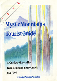 Marysville & District Historical Society
Ephemera (Item) - Tourist Guide, Graeme Haycraft, Mystic Mountains Tourist Guide July 1995, 07-1995
... ...taggerty river picnic area...A tourist guide outlining services, accommodation, activities and places of interest to visit in and around Marysville, Lake Mountain and the local district. marysville victoria australia tourist guide mystic mountains lake mountain tourism australia graeme haycraft magic creek nursery missing links miniature golf phelps bakery blackwood cottages marysville hotel motel tower motel kerami house marylands guest house lomatia lodge willowbank at taggerty barree mud brick cottages scenic motel somerled mountain retreat dalrymples guest cottages nanda binya lodge mathilde's of marysville country guest house the birches resort mystic mountains tourist information marysville caravan park the cumberland igloo roadhouse top shop pancake parlour the silver birch restaurant steavenson's restaurant olde yarra track shoppe danish coffee gardens oscars take-away country touch pottery studio & gallery cumberland memorial scenic reserve cathedral range state park lady talbot forest drive wishing well taggerty river picnic area taggerty river phantom falls keppels falls the beeches walking track mount sugarloaf maryton park holiday cottages snowviews esa camping & conference centre wirreanda festival marysville post shop hidden talent craft gallery marysville automotive repairs geoffrey pope & associates beauty spot walk tree fern gully walk michaeldene track marysville riding school gerraty's ski centre marysville holiday cottages marysville triangle taxi service fruit salad farm lake mountain alpine resort marysville ski hire lake mountain ski school cross country ski hire lake mountain ski hire marysville country club Acknowledgements/ Mystic Mountains Tourism Association, Marysville Office of the Dept. of Conser/ vation & Natural Resources, Mrs Elaine Postlethwaite, Ms Sue Henry & every/ advertiser without whose support this Guide would not have been possible. ...A tourist guide outlining services, accommodation, activities and places of interest to visit in and around Marysville, Lake Mountain and the local district.A tourist guide outlining services, accommodation, activities and places of interest to visit in and around Marysville, Lake Mountain and the local district.Acknowledgements/ Mystic Mountains Tourism Association, Marysville Office of the Dept. of Conser/ vation & Natural Resources, Mrs Elaine Postlethwaite, Ms Sue Henry & every/ advertiser without whose support this Guide would not have been possible.marysville, victoria, australia, tourist guide, mystic mountains, lake mountain, tourism australia, graeme haycraft, magic creek nursery, missing links miniature golf, phelps bakery, blackwood cottages, marysville hotel motel, tower motel, kerami house, marylands guest house, lomatia lodge, willowbank at taggerty, barree mud brick cottages, scenic motel, somerled mountain retreat, dalrymples guest cottages, nanda binya lodge, mathilde's of marysville country guest house, the birches resort, mystic mountains tourist information, marysville caravan park, the cumberland, igloo roadhouse, top shop pancake parlour, the silver birch restaurant, steavenson's restaurant, olde yarra track shoppe, danish coffee gardens, oscars take-away, country touch pottery studio & gallery, cumberland memorial scenic reserve, cathedral range state park, lady talbot forest drive, wishing well, taggerty river picnic area, taggerty river, phantom falls, keppels falls, the beeches walking track, mount sugarloaf, maryton park holiday cottages, snowviews, esa camping & conference centre, wirreanda festival, marysville post shop, hidden talent craft gallery, marysville automotive repairs, geoffrey pope & associates, beauty spot walk, tree fern gully walk, michaeldene track, marysville riding school, gerraty's ski centre, marysville holiday cottages, marysville triangle taxi service, fruit salad farm, lake mountain alpine resort, marysville ski hire, lake mountain ski school, cross country ski hire, lake mountain ski hire, marysville country club -
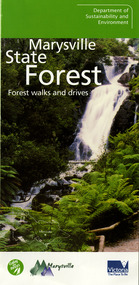 Marysville & District Historical Society
Ephemera (Item) - Information brochure, Department of Sustainability and Environment, Marysville State Forest, 2003
... ...taggerty river picnic area...An information brochure on various forest walks and drives throughout the Marysville State Forest that was published by the Victorian Department of Sustainability and Environment in 2003. marysville victoria australia information brochure marysville state forest lady talbot forest drive taggerty river picnic area the beeches coupe loop leadbeater's possum beckter lookout steavenson falls marysville visitor information centre department of sustainability & environmnet lake mountain cambarville yarra ranges national park cathedral range state park murrindindi scenic reserve gilberts gully loop beauty spot nature trail trestle track michaeldene track keppel lookout marysville tour An information brochure on various forest walks and drives throughout the Marysville State Forest that was published by the Victorian Department of Sustainability and Environment in 2003. ...An information brochure on various forest walks and drives throughout the Marysville State Forest that was published by the Victorian Department of Sustainability and Environment in 2003.An information brochure on various forest walks and drives throughout the Marysville State Forest that was published by the Victorian Department of Sustainability and Environment in 2003.marysville, victoria, australia, information brochure, marysville state forest, lady talbot forest drive, taggerty river picnic area, the beeches, coupe loop, leadbeater's possum, beckter lookout, steavenson falls, marysville visitor information centre, department of sustainability & environmnet, lake mountain, cambarville, yarra ranges national park, cathedral range state park, murrindindi scenic reserve, gilberts gully loop, beauty spot nature trail, trestle track, michaeldene track, keppel lookout, marysville tour -
 Eltham District Historical Society Inc
Photograph, Liz Pidgeon, Heritage Excursion; Eltham Lower Park Walk and Talk, 1 July 2017, 1 July 2017
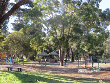
... ...picnic area...(Melway ref 21 H 10). heritage excursion activities eltham district historical society eltham lower park playground picnic area Born Digital Heritage Excursion; Eltham Lower Park Walk and Talk, 1 July 2017 Photograph Photograph Liz Pidgeon ...Newsletter No., 234, June 2017 Heritage Excursion - Saturday 1st July - Eltham Lower Park - Walk and Talk Eltham Lower Park has played an important part in the history of our area since the early days of European settlement when it was used by local residents as an informal racecourse. Prior to that its location at the junction of the Diamond Creek and the Yarra River made it an important meeting place for the Wurundjeri people. The park combines formal elements and sporting facilities with remnant bushland that is of environmental significance. It is home to sporting and horse riding clubs, popular play spaces and the Diamond Valley Miniature Railway, which attracts large numbers of visitors. The park will be the venue for our July excursion which will comprise a walk of about 3.5 km around the park and adjacent areas. Along the way we will discuss the history and natural history of the area. The path along the creek and the river provides a pleasant and scenic walk. This walk on Saturday 1st July is about 3.5 km in length and will take 2 to 2.5 hours. It will start at 2pm at the Main Road car park at the front of the park. (Melway ref 21 H 10). Born Digitalheritage excursion, activities, eltham district historical society, eltham lower park, playground, picnic area -
 Sunbury Family History and Heritage Society Inc.
Photograph, School activities day and barbecue
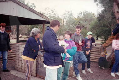
... A coloured photograph of children and adults gathered around a picnic area....Activities Days Bulla Primary School A coloured photograph of children and adults gathered around a picnic area. School activities day and barbecue. ...The photograph was taken when the Bulla Primary School was having an activities day with students, staff and parents participating in the event. It took place within the attractive restored school grounds.The former Bulla Primary School included many activities in its curriculum that involved the community. A coloured photograph of children and adults gathered around a picnic area.activities days, bulla primary school -
 Whitehorse Historical Society Inc.
Photograph, Antonio Park, 1980's
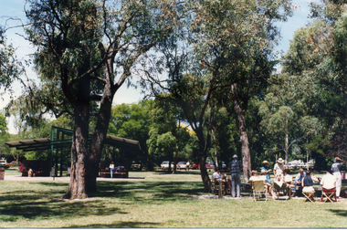
... Coloured photograph of picnic area at Antonio Park in the 1980's...antonio park mitcham Coloured photograph of picnic area at Antonio Park in the 1980's Antonio Park Photograph Photograph ...Coloured photograph of picnic area at Antonio Park in the 1980'santonio park, mitcham -
 Clunes Museum
Photograph
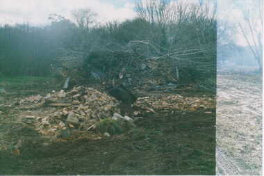
... LANDS DEPARTMENT COLOURED PHOTOGRAPH - CLEARING AREA ALONG CREEK TO MAKE PICNIC AREA...local history photography photographs clunes landscape LANDS DEPARTMENT COLOURED PHOTOGRAPH - CLEARING AREA ALONG CREEK TO MAKE PICNIC AREA Photograph PHOTOGRAPH ...LANDS DEPARTMENT COLOURED PHOTOGRAPH - CLEARING AREA ALONG CREEK TO MAKE PICNIC AREAlocal history, photography, photographs, clunes landscape -
 Whitehorse Historical Society Inc.
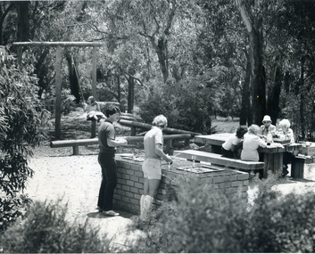
Photograph, Yarran Dheran - BBQ, c 1985
... Black and white photograph of the BBQ area and swing at the Yarran Dheran picnic area in 1985...yarran dheran barbecues Black and white photograph of the BBQ area and swing at the Yarran Dheran picnic area in 1985 Yarran Dheran - BBQ Photograph Photograph ...Black and white photograph of the BBQ area and swing at the Yarran Dheran picnic area in 1985yarran dheran, barbecues -
 Hume City Civic Collection
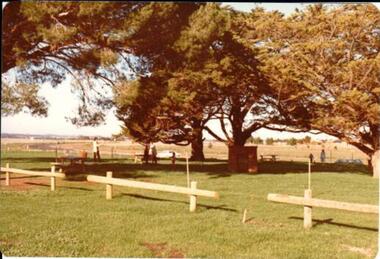
Photograph, 1/08/1980
... A coloured photograph of a barbecue and picnic area at Goonawarra. The photograph shows the Stage 3 development of the area....The golf course opened in 1980 and the housing construction continued throughout the last two decades of the twentieth century and into the twenty first century. goona warra golf club goonawarra farm goonawarra housing estate sharkey robert b. kilkenny homes craftsmen homes. australian ideas homes pty.ltd. glamor homes villa bella homes george evans collection A coloured photograph of a barbecue and picnic area at Goonawarra. The photograph shows the Stage 3 development of the area. ...On 4th August 1978 the construction of the Goonawarra Estate commenced. The estate was formerly known as the Goonawarra Farm and overlooked the Sunbury farm and the Jacksons Creek valley. Plans for the new development included a golf course, houses, community and recreational facilities. The golf course opened in 1980 and the housing construction continued throughout the last two decades of the twentieth century and into the twenty first century.A coloured photograph of a barbecue and picnic area at Goonawarra. The photograph shows the Stage 3 development of the area.goona warra golf club, goonawarra farm, goonawarra housing estate, sharkey, robert b., kilkenny homes, craftsmen homes., australian ideas homes pty.ltd., glamor homes, villa bella homes, george evans collection -
 Lakes Entrance Historical Society
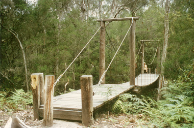
Photograph - Mississippi Creek Bridge Lakes Entrance, Victoria 1995, Fish Marie
... Colour photograph of the suspension bridge at Mississippi Creek picnic area in Colquhoun State Forest near Lakes Entrance, Victoria...Bridges Vegetation Colour photograph of the suspension bridge at Mississippi Creek picnic area in Colquhoun State Forest near Lakes Entrance, Victoria Photograph Mississippi Creek Bridge Lakes Entrance, Victoria 1995 Fish Marie ...Colour photograph of the suspension bridge at Mississippi Creek picnic area in Colquhoun State Forest near Lakes Entrance, Victoriabridges, vegetation -
 Phillip Island and District Historical Society Inc.
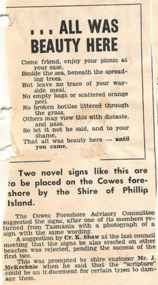
Newspaper Clipping
... Article about novel signs in the form of a poem to be placed on the Cowes foreshore by the shire of Phillip Island to encourage people to keep the picnic areas free from litter....Article from a collection of newspaper clippings from October 1968 to July 1971 phillip island cowes foreshore Article about novel signs in the form of a poem to be placed on the Cowes foreshore by the shire of Phillip Island to encourage people to keep the picnic areas free from litter. Newspaper Clipping ...Article from a collection of newspaper clippings from October 1968 to July 1971Article about novel signs in the form of a poem to be placed on the Cowes foreshore by the shire of Phillip Island to encourage people to keep the picnic areas free from litter.phillip island, cowes foreshore
