Showing 3 items matching "pitch lines bendigo"
-
 Bendigo Historical Society Inc.
Document - ALBERT RICHARDSON COLLECTION: SECRETARY FOR MINES ANNUAL REPORT 1911
... ...pitch lines bendigo...Three page typed report titled ' Notes on diagram showing pitch lines, Bendigo'. Longitudinal sections along the lines of reefs or anticlines within the 8 mile block at Bendigo are shown in a diagram' (diagram not included with notes) Mines and reef lines mentioned in the report are : New Chum line, New Chum Railway mine, Catherine United mine, Hercules and Energetic mine, Garden Gully, Hustlers and Redan, Sheepshead Reef, Sea Mine, Garden Gully, Miller's line of reef and Bendigo Development Mine. ...History House 11 Mackenzie Street Bendigo goldfields BENDIGO Mining pitch lines bendigo Three page typed report titled ' Notes on diagram showing pitch lines, Bendigo'. ...Three page typed report titled ' Notes on diagram showing pitch lines, Bendigo'. Longitudinal sections along the lines of reefs or anticlines within the 8 mile block at Bendigo are shown in a diagram' (diagram not included with notes) Mines and reef lines mentioned in the report are : New Chum line, New Chum Railway mine, Catherine United mine, Hercules and Energetic mine, Garden Gully, Hustlers and Redan, Sheepshead Reef, Sea Mine, Garden Gully, Miller's line of reef and Bendigo Development Mine. The 'old stacks' or chimneys, on Bendigo are described. 'Among the earliest of the stacks built at Bendigo in connexion with Quartz crushing plant, are the two figured in this Annual report No 1 was situate in Sailor's Gully but was demolished about three years ago. This, if not the first, must have been one of the first built, for it had a stone inserted on which chiselled the date 1854. It was built altogether of rough masonry. The other, No. 2, is still standing at the Sheepshead line and was apparently of later date, the upper portion being of brick. They are intersting landmarks of an era that is rapidly passing.' Map attached to report showing location of stacks. Stack at Sailors Gully was near the corner of Murchison Street and Lester Street. The stack at Sheepshead ( Deborah Triangle area) was near the intersection of Belle Vue Road and Adam Street.bendigo, mining, pitch lines bendigo -
 Bendigo Historical Society Inc.
Map - BENDIGO GOLDFIELD VERTICAL PROJECTIONS
... Map of Bendigo Gold Field in two sections showing 'vertical projections along several anticlinal axial planes showing pitch, stratigraphical zones, faultlines, shafts and etc.'. Bulletin No 47 written top left hand side. Lines...History House 11 Mackenzie Street Bendigo goldfields BENDIGO Gold mining reef lines Geological Survey of Victoria Map of Bendigo Gold Field in two sections showing 'vertical projections along several anticlinal axial planes showing pitch, stratigraphical zones, faultlines, shafts and etc.'. ...Map of Bendigo Gold Field in two sections showing 'vertical projections along several anticlinal axial planes showing pitch, stratigraphical zones, faultlines, shafts and etc.'. Bulletin No 47 written top left hand side. Lines of reef described: Christmas line Lancashire line Nell Gwynne line New Chum line Hustlers line Garden Gully line Sheepshead line Mines along the reef lines are listed. This map forms part of the Geological Survey of Victoria, Structure of Bendigo Goldfield report, No. 47, 1923. H.Herman, late Director of Geological Survey. On bottom of second section : Prepared in the Geological Survey Office, Bendigo, under the direction of H. Herman, late Director of Geological Survey, from surveys by H.S. Whitelaw, Field Geologist, assisted by E.S. Usher, A.J.J. Moore and R.A. Keble.Geological Survey of Victoriabendigo, gold mining, reef lines -
 Bendigo Historical Society Inc.
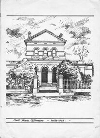
Drawing - Bendigo Advertiser Collection: Castlemaine Court House and School
... Bendigo Advertiser R. A. Johnson Castlemaine North Primary School Castlemaine Court House Two separate sketches drawn white cardboard with black ink, both appear to be signed by R.A. Johnson 1978. One is a two-story building with COURT HOUSE Written above three arches, two shrubs are on both sides of a gate supported pillars with a wrought-iron fence on each side. Below the drawing written between two double lines - Court House Castlemaine built 1862. The other drawing is a typical school building of the gold rush era in the area, a steep-pitched ...The Bendigo Advertiser was first published in 1853. The Bendigo Independent was founded in 1866. In November 1918 the papers amalgamated and continued under The Bendigo Advertiser banner. The Bendigo Advertiser currently delivers news as a printed newspaper, digital paper and on its website and social media. The paper changed from broadsheet to Tabloid in 1998.Two separate sketches drawn white cardboard with black ink, both appear to be signed by R.A. Johnson 1978. One is a two-story building with COURT HOUSE Written above three arches, two shrubs are on both sides of a gate supported pillars with a wrought-iron fence on each side. Below the drawing written between two double lines - Court House Castlemaine built 1862. The other drawing is a typical school building of the gold rush era in the area, a steep-pitched slate roof and a bell tower with steeple on top. Written below the drawing - Castlemaine North Primary School 2051the bendigo advertiser, r. a. johnson, castlemaine north primary school, castlemaine court house