Showing 320 items matching "plenty - maps"
-
 Greensborough Historical Society
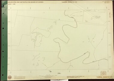
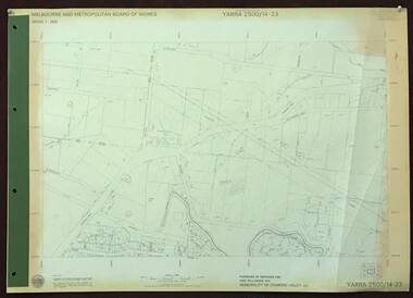
Map, Melbourne and Metropolitan Board of Works. Survey Division, MMBW, Yarra 2500 / 12.23. Janefield and Kangaroo Point, 1977_10
... ...plenty - maps...No streets marked on this map. Includes Plenty River, Kangaroo Point, Janefield Colony and Janefield Reserve....No streets marked on this map. Includes Plenty River, Kangaroo Point, Janefield Colony and Janefield Reserve. mmbw melbourne and metropolitan board of works shire of diamond valley plenty - maps MMBW Map in 1:2500 [scale] series. ...Melbourne and Metropolitan Board of Works. Yarra 2500 [base map] 12-23, Municipalities of Whittlesea 239 and Diamond Valley 257. No streets marked on this map. Includes Plenty River, Kangaroo Point, Janefield Colony and Janefield Reserve.MMBW Map in 1:2500 [scale] series. Cream parchment with green tape reinforcing on edges and punched holes on left edge.mmbw, melbourne and metropolitan board of works, shire of diamond valley, plenty - maps -
 Greensborough Historical Society
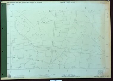
Map, Melbourne and Metropolitan Board of Works. Survey Division, MMBW, Yarra 2500 / 14.25. Plenty, Heard Road, 1978_02
... ...plenty - maps...Yarra 2500 [base map] 14.25. Plenty, Heard Road. Parishes of Greensborough 2724, Nillumbik 3310 and Morang 3183. ...MMBW, Yarra 2500 / 14.25. Plenty, Heard Road. Map Map Melbourne and Metropolitan Board of Works. ...Melbourne and Metropolitan Board of Works. Yarra 2500 [base map] 14.25. Plenty, Heard Road. Parishes of Greensborough 2724, Nillumbik 3310 and Morang 3183. Municipality of Diamond Valley 257. Prominent streets include: Heard Road, Seymour Drive and Yan Yean Road.MMBW Map in 1:2500 [scale] series. Cream parchment with green tape reinforcing on edges and punched holes on left edge.mmbw, melbourne and metropolitan board of works, shire of diamond valley, plenty - maps -
 Greensborough Historical Society
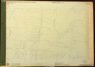
Map, Melbourne and Metropolitan Board of Works. Survey Division, MMBW, Yarra 2500 / 14.24. Plenty, 1979_05
... ...plenty - maps...Yarra 2500 [base map] 14.24. Plenty. Parishes of Nillumbik 3310 and Morang 3183. ...MMBW, Yarra 2500 / 14.24. Plenty. Map Map Melbourne and Metropolitan Board of Works. ...Melbourne and Metropolitan Board of Works. Yarra 2500 [base map] 14.24. Plenty. Parishes of Nillumbik 3310 and Morang 3183. Municipality of Diamond Valley 257. Prominent streets include: Heard Road, Hillmartin Road and Yan Yean Road. Features include Plenty Primary School and Plenty Park.MMBW Map in 1:2500 [scale] series. Cream parchment with green tape reinforcing on edges and punched holes on left edge.mmbw, melbourne and metropolitan board of works, shire of diamond valley, plenty - maps -
 Greensborough Historical Society
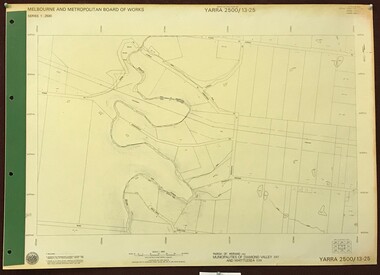
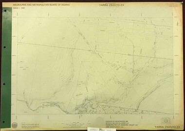
Map, Melbourne and Metropolitan Board of Works. Survey Division, MMBW, Yarra 2500 / 13.23. Plenty, Middle Gorge, 1978_04
... ...plenty - maps...Yarra 2500 [base map] 13-23. Plenty / Middle Gorge. Parish of Morang 3183. ...Features include the Plenty River and Plenty Gorge Park. mmbw melbourne and metropolitan board of works shire of diamond valley plenty - maps plenty gorge park MMBW Map in 1:2500 [scale] series. ...Melbourne and Metropolitan Board of Works. Yarra 2500 [base map] 13-23. Plenty / Middle Gorge. Parish of Morang 3183. Municipalities of Diamond Valley 257 and Whittlesea 239. Prominent streets include: Gorge Road, Kurrak Road and Browns Lane. Features include the Plenty River and Plenty Gorge Park.MMBW Map in 1:2500 [scale] series. Cream parchment with green tape reinforcing on edges and punched holes on left edge.mmbw, melbourne and metropolitan board of works, shire of diamond valley, plenty - maps, plenty gorge park -
 Greensborough Historical Society
Map, Melbourne and Metropolitan Board of Works. Survey Division, MMBW, Yarra 2500 / 14.23. Diamond Creek, Sutherland Homes, 1979_05
... ...plenty - maps...Features include the abandoned Maroondah aqueduct and Sutherland Cottages. mmbw melbourne and metropolitan board of works shire of diamond valley plenty - maps sutherland homes maroondah aqueduct MMBW Map in 1:2500 [scale] series. ...Melbourne and Metropolitan Board of Works. Yarra 2500 [base map] 14.23. Diamond Creek, Sutherland Homes. Parish of Morang 3183 and Nillumbik 3310. Municipality of Diamond Valley 257. Prominent streets Aqueduct Road, Diamond Creek Road, Yan Yean Road and McLaughlans Lane. Features include the abandoned Maroondah aqueduct and Sutherland Cottages.MMBW Map in 1:2500 [scale] series. Cream parchment with green tape reinforcing on edges and punched holes on left edge.mmbw, melbourne and metropolitan board of works, shire of diamond valley, plenty - maps, sutherland homes, maroondah aqueduct -
 Greensborough Historical Society
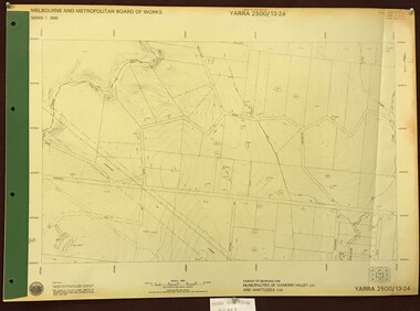
Map, Melbourne and Metropolitan Board of Works. Survey Division, MMBW, Yarra 2500 / 13.24. Plenty, Memorial Drive, 1979_03
... ...plenty - maps...Yarra 2500 [base map] 13-24. Plenty, Memorial Drive. Parish of Morang 3183. ...MMBW, Yarra 2500 / 13.24. Plenty, Memorial Drive. Map Map Melbourne and Metropolitan Board of Works. ...Melbourne and Metropolitan Board of Works. Yarra 2500 [base map] 13-24. Plenty, Memorial Drive. Parish of Morang 3183. Municipalities of Diamond Valley 257 and Whittlesea 239. Prominent streets include: Oatland Road, River Avenue and Memorial Drive. Includes Plenty River and SEC Transmission easement.MMBW Map in 1:2500 [scale] series. Cream parchment with green tape reinforcing on edges and punched holes on left edge.mmbw, melbourne and metropolitan board of works, shire of diamond valley, plenty - maps -
 Greensborough Historical Society
Map, Melbourne and Metropolitan Board of Works. Survey Division, MMBW, Yarra 2500 / 13.23. Plenty, Happy Hollow, 1979_03
... ...plenty - maps...Yarra 2500 [base map] 13-23. Plenty / Happy Hollow. Parishes of Morang 3183, Nillumbik 3310 and Keelbundora 2856. ...MMBW, Yarra 2500 / 13.23. Plenty, Happy Hollow Map Map Melbourne and Metropolitan Board of Works. ...Melbourne and Metropolitan Board of Works. Yarra 2500 [base map] 13-23. Plenty / Happy Hollow. Parishes of Morang 3183, Nillumbik 3310 and Keelbundora 2856. Municipalities of Diamond Valley 257 and Whittlesea 239. Prominent streets include: McLaughlans Lane and Happy Hollow Drive. Includes Janefield Colony Reserve.MMBW Map in 1:2500 [scale] series. Cream parchment with green tape reinforcing on edges and punched holes on left edge.mmbw, melbourne and metropolitan board of works, shire of diamond valley, plenty - maps, happy hollow -
 Greensborough Historical Society
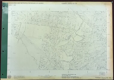
Map, Melbourne and Metropolitan Board of Works. Survey Division, MMBW, Yarra 2500 / 13.19. Lower Plenty, Montmorency, Yallambie, 1979_02
... ...lower plenty - maps...Yarra 2500 [base map] 13-19. Lower Plenty, Montmorency, Yallambie. Parishes of Keelbundora 2856 and Nillumbik 3310. ...Plenty. Includes Watsonia Army Barracks. mmbw melbourne and metropolitan board of works shire of diamond valley montmorency - maps yallambie - maps lower plenty - maps MMBW Map in 1:2500 [scale] series. ...Melbourne and Metropolitan Board of Works. Yarra 2500 [base map] 13-19. Lower Plenty, Montmorency, Yallambie. Parishes of Keelbundora 2856 and Nillumbik 3310. Municipalities of Heidelberg 228, Diamond Valley 257 and Eltham 238. Prominent streets include: Elder Street, Para Road, and Main Road Lower Plenty. Includes Watsonia Army Barracks.MMBW Map in 1:2500 [scale] series. Cream parchment with green tape reinforcing on edges and punched holes on left edge.mmbw, melbourne and metropolitan board of works, shire of diamond valley, montmorency - maps, yallambie - maps, lower plenty - maps -
 Greensborough Historical Society
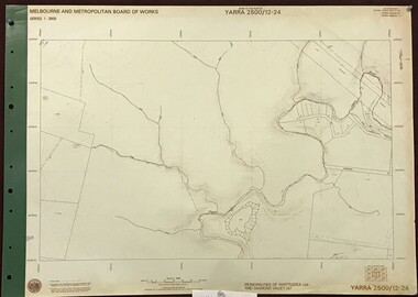
Map, Melbourne and Metropolitan Board of Works. Survey Division, MMBW, Yarra 2500 / 12.24. Plenty and Blue Lake, 1977_10
... ...plenty - maps...map]. 12-24, Municipalities of Whittlesea 239 and Diamond Valley 257. Shows street names, easement sizes, lot numbers, lodged plan numbers, names of prominent features, contour values, creek or river names. Watsonia Railway Station and environs. Prominent streets: Memorial Drive. Includes Plenty... River and Blue Lake in the Plenty Gorge. mmbw melbourne and metropolitan board of works shire of diamond valley plenty - maps blue lake MMBW Map in 1:2500 [scale] series. ...Melbourne and Metropolitan Board of Works. Yarra 2500 [base map]. 12-24, Municipalities of Whittlesea 239 and Diamond Valley 257. Shows street names, easement sizes, lot numbers, lodged plan numbers, names of prominent features, contour values, creek or river names. Watsonia Railway Station and environs. Prominent streets: Memorial Drive. Includes Plenty River and Blue Lake in the Plenty Gorge.MMBW Map in 1:2500 [scale] series. Cream parchment with green tape reinforcing on edges and punched holes on left edge.mmbw, melbourne and metropolitan board of works, shire of diamond valley, plenty - maps, blue lake -
 Greensborough Historical Society
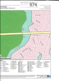
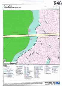
Map, Pioneer children's graves precinct, 1848-1860
... Map showing the location and surrounds of Pioneer Children's Cemetery on the Plenty River in Greensborough. ...Printed coloured copy of map of Plenty River area...Greensborough Historical Society 34A Glenauburn Road Lower Plenty Lower Plenty melbourne Map showing the location and surrounds of Pioneer Children's Cemetery on the Plenty River in Greensborough. ...Map showing the location and surrounds of Pioneer Children's Cemetery on the Plenty River in Greensborough. Children from pioneer families are buried here.Official government planning map for the Pioneer Children's Graves Precinct.Printed coloured copy of map of Plenty River areapioneer childrens cemetery, greensborough, partington, whatmough -
 Greensborough Historical Society
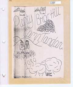
Photograph Album, Plenty/Briar Hill Camp 1989, 04/09/1989
... Photographs and maps from Plenty/Briar Hill Camp 1989. Possibly a school project, includes itinerary. ...Greensborough Historical Society 34A Glenauburn Road Lower Plenty Lower Plenty melbourne Photographs and maps from Plenty/Briar Hill Camp 1989. ...Photographs and maps from Plenty/Briar Hill Camp 1989. Possibly a school project, includes itinerary. Photographs are not named. Location: "Tandara" Halls Gap.Colour photographs and maps in albumHand drawn front cover with name of artist.plenty, briar hill -
 Kiewa Valley Historical Society
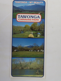
Brochure - Tawonga Caravan Park, Tawonga - Mt Beauty
... plenty to do. Tawonga Caravan park trout fishing Colored cardboard brochure with 3 small photos on the front and information printed on the back with a small map. ...Tawonga Caravan park is on the Kiewa River situated north of Mt Beauty and 30 km from Falls Creek. Tawonga Caravan park has always been popular for families and fishermen with plenty to do.Colored cardboard brochure with 3 small photos on the front and information printed on the back with a small map.tawonga caravan park, trout fishing -
 Eltham District Historical Society Inc
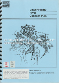
Book, Brett Cheatley et al, Lower Plenty River Concept Plan; Maroondah Pipetrack - Greensborough to Yarra/Plenty Confluence; Draft Volume B, Resource Description and Issues, February 1991
... Eltham District Historical Society Inc 728 Main Rd Eltham melbourne Concept Plan Melbourne Metropolitan Board of Works Plenty River Report Spiral bound A4, 33 pages inculding foldoiut A3 tables and maps (some coloured) 4 copies Lower Plenty River Concept Plan; Maroondah Pipetrack - Greensborough to Yarra/Plenty Confluence; Draft Volume B, Resource Description and Issues Book Book Brett Cheatley Ian Womersley Mal Warren Melbourne and Metropolitan Board of Works (Vic.). ...concept plan, melbourne metropolitan board of works, plenty river, report -
 Eltham District Historical Society Inc
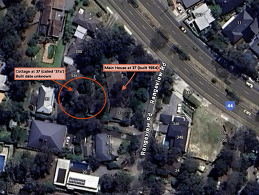
Document - Property Binder, 338 Main Road, Lower Plenty (also 37 Rangeview Road), March 2025
... ...Lower Plenty...Map...Goodison, Licensed Surveyor, and attached Surveyor's Report dated 6 June 1990 Notes: Items 1 to 6 donated electronically Items 7 to 9 sourced from LASSI - SPEAR, Department of Transport and Planning, Victoria State Government, https://maps.land.vic.gov.au/lassi/SpearUI.jsp Main Road Property Mudbrick David Newbury Phoebe Mason Collection Rate Books shire of eltham Certificate of Title Survey Plan 37 Rangeview Road 338 Main Road Application 23911 Lower Plenty Map Surveyor Field Notes Application 221805 Application 222467 Miscellaneous electrionic records, clippings, notes, photocopies, etc held on the subject property. 338 Main Road, Lower Plenty (also 37 Rangeview Road) Document Property Binder ...EDHS_03095-338 | EDHS_08635-37 338 Main Road Lower Plenty | 37 Rangeview Road, Lower Plenty Original Mudbrick cottage and studio designed and built by Eltham artist, David Alan Newbury See also EDHS_06090 David Newbury (Artist) David Newbury was married to Clare Margaret Newbury. According to the 1954 Electoral Roll they were living at 36A Murphy Street, South Yarra however around 1953 they purchased Lots 3 and 4 of Main Road Lot Plan LP 23911 in Lower Plenty. A building permit, No. 71, was issued 8 December 1953 for a 5-room house of Vertical Board construction, cost £2,840, builder L. Williams, owner D. Newbury of 36 Murphy Cl., South Yarra. The large house was in fact mostly built of mudbrick, the construction method was only just becoming recognised as an acceptable form in the late 1940s for issuance of a building permit. The house was commenced in 1954, designed by David Newbury and built by David Newbury, Horrie Judd and others. Information from Newbury family friends suggests that a second mudbrick building was constructed in the late 1950s, early 1960s for use as an artist studio by Newbury. The building was connected directly to the water mains at the time and was made suitable for living accommodation during the period Newbury was teaching at Bendigo. Apparently he and Claire rented out the main house during their time in Bendigo and would reside in the studio when visiting Melbourne. No permit for this studio was found in the Building Permit Register, Shire of Eltham, 1949-1960. The last recorded entries in the register are dated May 1960. This would suggest that the studio was constructed post May 1960. It is believed the studio was constructed during the latter period of Newbury’s teaching post in Bendigo so possibly late 1960/1961. In 1963 the Newbury’s address in the Electoral Roll has the property recorded as 220 Main Road, Lower Plenty. Between 1967 to 1980 the Electoral Rolls record the property as 338 Main Road. Today the address is 37 Rangeview Road, Lower Plenty. Contents: 1. Extract from 1942 Shire of Eltham Rate Book. Muriel Gladys Reitsma listed as owner 2. Extract from 1984-85 Shire of Eltham Rate Book for Rangeview Road. (No mention of No. 37 so was probably still listed as 338 Main Road.) 3. Certificate of Title, Vol. 5601 Fol. 1120089 - Issued to David James Graham of Lower Plenty, Builder, Heidelberg for Lot 32 Block B on Plan of Subdivision No. 7606, part of Crown Portion Two, Parish of Nillumbik, County of Evelyn, 29 October 1929 4. Certificate of Title, Vol. 8008 Fol. 076 - Issued to David Alan Newbury of 36 Murphy Street, South Yarra, School Teacher for Lot 3 on Plan of Subdivision No. 23911, part of Crown Portion Two, Parish of Nillumbik, County of Evelyn, 29 October 1953. Amended 24 June 1963 to transfer portion for road widening scheme per Country Roads Board Plan 6889 - Cancelled 24 September 1984 5. Certificate of Title, Vol. 9581 Fol. 583 - Issued to Paul Robert Biber and Althea Constance Biber of 139 Lower Heidelberg Road, Ivanhoe for Lot 3 on Plan of Subdivision No. 23911, part of Crown Portion Two, Parish of Nillumbik, County of Evelyn, 24 September 1984. Derived from Vol. 8008 Fol. 076 L276994V - Cancelled 20 Nov 1992 when subdivided from one to two lots in Vol 10092 Fol. 192 and Vol. 10092 Fol. 193; LP222467B 6. Certificate of Title, Vol. 10092 Fol. 192 - Transfer to Lawrie Mein of 20 Dewar Drive, Hurstbridge of Lot 1 on Plan of Subdivision No. 222467B, lodged 17 Feb 1993, Registered 29 March 1996. Parent Titles Vol 08008 Fol 077, Vol 09581 Fol 583 7. Survey Field Notes of Part of Crown Portion 2, Parish of Nillumbik, County of Evelyn - Portion of land bounded by New Eltham Road. Application 23911 dated 8 Sep 1952 with appended Surveyor Field notes per Application 7098; R.D. Steele, Licensed Surveyor, 18 August 1950 8. Survey Field Notes of Part of Crown Portion 2, Parish of Nillumbik, County of Evelyn - Portion of land bounded by Main Road and Rangeview Road; 2 Lot subdivisions, Vol. 9581 Fol. 583 Part Lot 3 on LP 23911 and Vol. 8008 Fol, 077 Lot 4 on LP 23911; Application 221805 dated 27 November 1989; W.J. Goodison, Licensed Surveyor, and attached Surveyor's Report dated 6 June 1990 (Withdrawn) 9. Survey Field Notes of Part of Crown Portion 2, Parish of Nillumbik, County of Evelyn - Portion of land bounded by Main Road and Rangeview Road; 2 Lot subdivisions, Vol. 9581 Fol. 583 Part Lot 3 on LP 23911 and Vol. 8008 Fol, 077 Lot 4 on LP 23911; Application 222467 dated 20 November 1992 (221805 resubmitted); W.J. Goodison, Licensed Surveyor, and attached Surveyor's Report dated 6 June 1990 Notes: Items 1 to 6 donated electronically Items 7 to 9 sourced from LASSI - SPEAR, Department of Transport and Planning, Victoria State Government, https://maps.land.vic.gov.au/lassi/SpearUI.jsp main road, property, mudbrick, david newbury, phoebe mason collection, rate books, shire of eltham, certificate of title, survey plan, 37 rangeview road, 338 main road, application 23911, lower plenty, map, surveyor field notes, application 221805, application 222467 -
 Eltham District Historical Society Inc
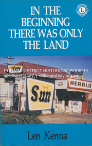
Book, Len Kenna, In the beginning there was only the land, 1988
... maps and index. Local history of the outer Melbourne suburb of Bundoora, from the original Wurundjeri people through to its development as a thriving suburb in the 1980s ; section entitled "The Aborigines" (pp.14-21) discusses the traditional way of life of the Wurundjeri people prior to European settlement. Bundoora Bundoora Hall Hospitals Jane McKimmie Janefield Janefield Church john mckimmie La Trobe University Marvellous Melbourne Mont Park Mont Park Psychiatric Hospital Plenty ...A book, published as part of the Australian Bicentenary Celebrations on the history of the suburb of Bundoora. ... Includes photographs, maps and index. Local history of the outer Melbourne suburb of Bundoora, from the original Wurundjeri people through to its development as a thriving suburb in the 1980s ; section entitled "The Aborigines" (pp.14-21) discusses the traditional way of life of the Wurundjeri people prior to European settlement.bundoora, bundoora hall, hospitals, jane mckimmie, janefield, janefield church, john mckimmie, la trobe university, marvellous melbourne, mont park, mont park psychiatric hospital, plenty river, william shillinglaw, wurundjeri, yan yean reservoir -
 Eltham District Historical Society Inc
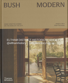
Book, Jessica Lillico, Bush Modern: Hand-crafted homes on the edge of the city, 4 Nov. 2025
... Contents: Bush modern locations (map) Grounded in simplicity by Jessica Lillico and Sean Fennessy Time and place by Morag Fraser Houses featured - Stonygrad 1940, North Warrandyte Fraser-Jackson House 1947/1977, Montmorency Busst House 1948, Eltham Burstall House 1950, Montmorency Wright House II 1960, North Warrandyte Collis House 1966, Eltham Diskin House 1967, Eltham Redfern House 1967, North Warrandyte River Bend 1968/2022, Garambi Baan, Eltham Fisher House 1969, Warrandyte Borrack House 1970, Plenty Valley Fiddlers Elbow 1970, North Warrandyte Light Well House 1972, Donvale Birrarung House 1974, Garambi Baan, Eltham High Noon 1974, North Warrandyte Monty Sibbel 1975/2022, Montmorency Provan House 1976/2021, North Warrandyte Pizzey House 1977, Eltham Pittard House 1978, Eltham Gray House 1980, Eltham Carol Ann House 1989, Bend of Islands Wattle Glen 1999, Wattle Glen Big Hill 2001, Christmas Hills ...Contents: Bush modern locations (map) Grounded in simplicity by Jessica Lillico and Sean Fennessy Time and place by Morag Fraser Houses featured - Stonygrad 1940, North Warrandyte Fraser-Jackson House 1947/1977, Montmorency Busst House 1948, Eltham Burstall House 1950, Montmorency Wright House II 1960, North Warrandyte Collis House 1966, Eltham Diskin House 1967, Eltham Redfern House 1967, North Warrandyte River Bend 1968/2022, Garambi Baan, Eltham Fisher House 1969, Warrandyte Borrack House 1970, Plenty Valley Fiddlers Elbow 1970, North Warrandyte Light Well House 1972, Donvale Birrarung House 1974, Garambi Baan, Eltham High Noon 1974, North Warrandyte Monty Sibbel 1975/2022, Montmorency Provan House 1976/2021, North Warrandyte Pizzey House 1977, Eltham Pittard House 1978, Eltham Gray House 1980, Eltham Carol Ann House 1989, Bend of Islands Wattle Glen 1999, Wattle Glen Big Hill 2001, Christmas Hills Stonygrad Fraser-Jackson House Busst House Burstall House Wright House II Collis House Diskin House Redfern House River Bend Fisher House Borrack House Fiddlers Elbow Light Well House Birrarung House High Noon Monty Sibbel Provan House Pizzey House Pittard House Gray House Carol Ann House Wattle Glen Big Hill Inside front cover in ink: "Enjoy! ...From the publisher Thames & Hudson Australia's website: "In the bushy north-eastern fringe of Melbourne, an enduring, uniquely Australian architectural aesthetic has been quietly gaining recognition. Emerging out of necessity in the post-war years, it reimagined the sleek ideals of modernism through the lens of the local landscape. Simple homes built 'of the land' from mud bricks and recycled timber captured the mood of those searching for an alternative way of life close to nature. The movement gathered momentum in the counter-cultural 1960s and culminated in near-mainstream popularity in the 1970s. After a few decades where brown lost appeal in favour of white-washed minimalism, the style in all its warm, earthy glory is once again being embraced and revived by a new generation Through evocative photography by Sean Fennessy, personal stories and architectural insights, Bush Modern explores the timeless appeal of these character-filled homes: tactile, grounded and deeply in tune with their environment." Contents: Bush modern locations (map) Grounded in simplicity by Jessica Lillico and Sean Fennessy Time and place by Morag Fraser Houses featured - Stonygrad 1940, North Warrandyte Fraser-Jackson House 1947/1977, Montmorency Busst House 1948, Eltham Burstall House 1950, Montmorency Wright House II 1960, North Warrandyte Collis House 1966, Eltham Diskin House 1967, Eltham Redfern House 1967, North Warrandyte River Bend 1968/2022, Garambi Baan, Eltham Fisher House 1969, Warrandyte Borrack House 1970, Plenty Valley Fiddlers Elbow 1970, North Warrandyte Light Well House 1972, Donvale Birrarung House 1974, Garambi Baan, Eltham High Noon 1974, North Warrandyte Monty Sibbel 1975/2022, Montmorency Provan House 1976/2021, North Warrandyte Pizzey House 1977, Eltham Pittard House 1978, Eltham Gray House 1980, Eltham Carol Ann House 1989, Bend of Islands Wattle Glen 1999, Wattle Glen Big Hill 2001, Christmas Hills Inside front cover in ink: "Enjoy! Jess & Sean"stonygrad, fraser-jackson house, busst house, burstall house, wright house ii, collis house, diskin house, redfern house, river bend, fisher house, borrack house, fiddlers elbow, light well house, birrarung house, high noon, monty sibbel, provan house, pizzey house, pittard house, gray house, carol ann house, wattle glen, big hill -
 Glen Eira Historical Society
Document - Bakewell Family
... Map, Foot Plot CCXLVI at Kooyong & Glen Eira Road. It provides a brief outline of the lives of brothers Robert and John Bakewell. The Bakewell Family Early Pioneer Families Henderson Bakewell John Port Phillip Burnewang Bakewell Robert Howitt Godfrey Dr Lord Goderich Tooradin Phoebe Friends' School Ackworth Yorkshire Nottingham Shaw John Wyberg Plenty River Businesses Goldsbrough Richard Goldsbrough Mort and Company Ltd. ...There are 3 items about this family of early European settlers in Victoria: 1/A photocopy of an extract “Early Pioneer Families of Victoria and Riverina” – Henderson Page 441-442 The Bakewell Family of Burnewang and Tooradin”. It includes a photo of John Bakewell (1807-1888). It contains two pages and describes Bakewell’s property expansion. 2/An original copy of handwritten, unsigned undated research notes on John Bakewell property holdings taken from St Kilda Rate Book (1859-1873). It describes the land allotment. 3/A typed, unsigned, undated extract from 'The Howitts in Australia by Mary Howitt' - Mary Howitt, Vic Hist Mag 1913 Vol 3 No. 1. Reference – Memoirs of a Stockman, Harry Peck, 1853 Map, Foot Plot CCXLVI at Kooyong & Glen Eira Road. It provides a brief outline of the lives of brothers Robert and John Bakewell.the bakewell family, early pioneer families, henderson, bakewell john, port phillip, burnewang, bakewell robert, howitt godfrey dr, lord goderich, tooradin, phoebe, friends' school ackworth, yorkshire, nottingham, shaw john wyberg, plenty river, businesses, goldsbrough richard, goldsbrough mort and company ltd., glaziers, squatters, burnewang, mantons, tooradin, red bluff, torbinurruck, great swamp, brenanah, westernport, numerella, snowy river, orbost, green hills b, caramut, lyall william, mickle john, buckland john, notts, england, balderton, weddings, jane emily, howitt emanuel, farnsfield, lever mary, howitt thomas, heanor, derbyshire, howitt godfrey, scales john, exeter college oxford, downing college cambridge, guerard von, wayne john, south warnborough manor, harrison robert, lord john, jamaica, mary alice, dr. miller, miller john francis compton, emmie joan, mary emily, clifton hotel welbeck street, phoebe alice, anne edith, british museum, land values, settlements, st. kilda, elsternwick, inkerman street, st. kilda east, kew, memoirs of a stockman, harry peck -
 Greensborough Historical Society
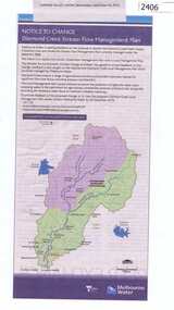
Newspaper Clipping, Diamond Creek stream flow management plan, 30/09/2015
... Greensborough Historical Society 34A Glenauburn Road Lower Plenty Lower Plenty melbourne In this Public Notice, Melbourne Water seeks feedback on the Diamond Creek Stream Flow Management Plan. diamond creek stream flow management plan melbourne water. News clipping, black text, colour map ...In this Public Notice, Melbourne Water seeks feedback on the Diamond Creek Stream Flow Management Plan.News clipping, black text, colour map.diamond creek stream flow management plan, melbourne water. -
 Greensborough Historical Society
Book, Angus & Robertson Ltd, The Australian Encyclopaedia, 1958_
... Greensborough Historical Society 34A Glenauburn Road Lower Plenty Lower Plenty melbourne Standard history of Australia to 1958 australian encyclopaedia 10 vols. illus. maps with index vol. 10 The Australian Encyclopaedia Book Angus & Robertson Ltd ...Standard history of Australia to 195810 vols. illus. maps with index vol. 10australian encyclopaedia -
 Greensborough Historical Society
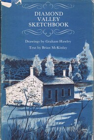
Book, Diamond Valley Sketchbook, 1973_
... Plenty melbourne Contains drawings by Graham Hawley and text by Brian McKinley. Shows landmarks around the Diamond Valley. diamond valley eltham greensborough "Happy birthday Kathryn May 1976" 63p., illus., map as endpapers, dustcover. ...Contains drawings by Graham Hawley and text by Brian McKinley. Shows landmarks around the Diamond Valley.63p., illus., map as endpapers, dustcover."Happy birthday Kathryn May 1976"diamond valley, eltham, greensborough -
 Greensborough Historical Society
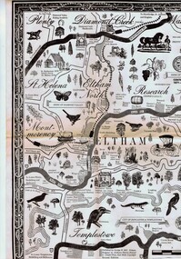
Map, George W. Bell, Eltham Warrandyte and environs: a visitor's guide map: centenary souvenir. 2nd ed, 1994c
... Greensborough Historical Society 34A Glenauburn Road Lower Plenty Lower Plenty melbourne Tourist guide to historic and other features in the Eltham Warrandyte area and environs, warrandyte eltham st helena montmorency A2, black & white, folded 3 times to A5, printed on one side Eltham Warrandyte and environs: a visitor's guide map: centenary souvenir. 2nd ed. ...Tourist guide to historic and other features in the Eltham Warrandyte area and environs, A2, black & white, folded 3 times to A5, printed on one sidewarrandyte, eltham, st helena, montmorency -
 Greensborough Historical Society
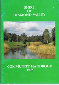
Book, Shire of Diamond Valley, Shire of Diamond Valley Community Handbook 1992, 1992_
... Plenty melbourne Guide to services provided by Shire of Diamond Valley. The Shire of Diamond Valley was a Local Government Area located about 20 kilometres northeast of Melbourne. The shire covered an area of 74.38 square kilometres and existed from 1964 until 1994. Annual guide to services in Shire of Diamond Valley shire of diamond valley 52 pages, col illus., maps ...Guide to services provided by Shire of Diamond Valley. The Shire of Diamond Valley was a Local Government Area located about 20 kilometres northeast of Melbourne. The shire covered an area of 74.38 square kilometres and existed from 1964 until 1994.Annual guide to services in Shire of Diamond Valley52 pages, col illus., maps. Cover illustration of Kalparrin Gardens Greensboroughshire of diamond valley -
 Greensborough Historical Society
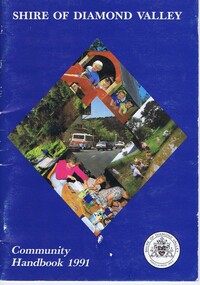
Book, Shire of Diamond Valley, Shire of Diamond Valley Community Handbook 1991, 1991_
... Plenty melbourne Guide to services provided by Shire of Diamond Valley. The Shire of Diamond Valley was a Local Government Area located about 20 kilometres northeast of Melbourne. The shire covered an area of 74.38 square kilometres and existed from 1964 until 1994. Annual guide to services in Shire of Diamond Valley shire of diamond valley 36 pages, col. illus., maps ...Guide to services provided by Shire of Diamond Valley. The Shire of Diamond Valley was a Local Government Area located about 20 kilometres northeast of Melbourne. The shire covered an area of 74.38 square kilometres and existed from 1964 until 1994.Annual guide to services in Shire of Diamond Valley36 pages, col. illus., maps. Front cover is a collage of scenes from Diamond Valley, back cover illustration of a copy of "Summer Panorama, Tabletop, NSW" by Max Dimmack, from the Shire of Diamond Valley Art Collection.shire of diamond valley -
 Greensborough Historical Society
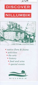
Leaflet, Nillumbik Shire Council, Discover Nillumbik, 2000c
... Greensborough Historical Society 34A Glenauburn Road Lower Plenty Lower Plenty melbourne Map and lists of attractions within the Shire of Nillumbik nillumbik Double sided, folded seven times printed in red and green Discover Nillumbik Leaflet Nillumbik Shire Council ...Map and lists of attractions within the Shire of NillumbikDouble sided, folded seven times printed in red and greennillumbik -
 Greensborough Historical Society
Map, Plenty River Children's Cemetery - location map, 1848-1860
... Plenty River Children's Cemetery - location map...Plenty River. Burials occurred between 1848 and 1860. The significance lies in the association with two of the pioneer families of the Greensborough district. Descendants of both families still live in the area. One page map ...The unmarked graves of the children of two Greensborough pioneer families lie in a private cemetery on the Plenty River. Burials occurred between 1848 and 1860.The significance lies in the association with two of the pioneer families of the Greensborough district. Descendants of both families still live in the area.One page map accompanies article item #804 -
 Greensborough Historical Society
Map, Scotprint, A Guide to World War II 'Invasion or Liberation': Western Europe Sept 1939 to March 1945, 1999_
... Greensborough Historical Society 34A Glenauburn Road Lower Plenty Lower Plenty melbourne Notes of battles, military leaders, cemeteries and other features of World War 11 Western Europe. world war ii Double sided col. maps, with notes of battles, military leaders, cemeteries and other features of World War 11 Western Europe. ...Notes of battles, military leaders, cemeteries and other features of World War 11 Western Europe.Double sided col. maps, with notes of battles, military leaders, cemeteries and other features of World War 11 Western Europe.world war ii -
 Greensborough Historical Society
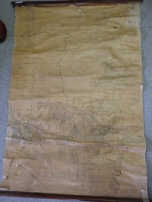
Map, Map of Greensborough - Jessop's Real Estate, 1930c
... Greensborough Historical Society 34A Glenauburn Road Lower Plenty Lower Plenty melbourne This map of Greensborough hung in the office of Cec Jessop's Real Estate office corner Main and Grimshaw Street. ...This map of Greensborough hung in the office of Cec Jessop's Real Estate office corner Main and Grimshaw Street. Includes a word document listing street name changes from the original map to today, according to Norm Colvin.This map was saved from the building when the business closed.Canvas roll-up map with timber rails top and bottom.greensborough - maps, cecil jessop, greensborough street names -
 Greensborough Historical Society
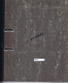
Folder, Shire of Diamond Valley, Shire of Diamond Valley forms, 1980-1994
... Greensborough Historical Society 34A Glenauburn Road Lower Plenty Lower Plenty melbourne Forms, staff telephone lists, organisation charts, maps, administrative memos, directives and bulletins used by the Shire of Diamond Valley 1980s -1994. shire of diamond valley Arch file containing forms etc. used by the Shire of Diamond Valley Shire of Diamond Valley forms Folder Shire of Diamond Valley ...Forms, staff telephone lists, organisation charts, maps, administrative memos, directives and bulletins used by the Shire of Diamond Valley 1980s -1994.Arch file containing forms etc. used by the Shire of Diamond Valleyshire of diamond valley -
![Planning Document, Plan of proposed subdivision of land in Greensborough [Map shows Scotland house], 01/04/1971](/media/collectors/4f729f5697f83e03086015b8/items/5982a68921ea6b1420e4e560/item-media/59916fb521ea681094908d7a/item-fit-380x285.jpg?cb=6) Greensborough Historical Society
Greensborough Historical SocietyPlanning Document, Plan of proposed subdivision of land in Greensborough [Map shows Scotland house], 01/04/1971
... Greensborough Historical Society 34A Glenauburn Road Lower Plenty Lower Plenty melbourne This subdivision of Greensborough shows the home of John Scotland (died 1888) and surrounding area bounded by Hailes, William, Lorimer, and Jessop Streets. john scotland hailes street greensborough william street greensborough lorimer street greensborough jessop street greensborough Part of plan (68G) of proposed subdivision of Greensborough, part of Crown Portion 18, Parish pf Keelbundora. Scale: 132 ft. to an inch Photocopy of plan, 2 pages. Plan of proposed subdivision of land in Greensborough [Map ...This subdivision of Greensborough shows the home of John Scotland (died 1888) and surrounding area bounded by Hailes, William, Lorimer, and Jessop Streets.Photocopy of plan, 2 pages.Part of plan (68G) of proposed subdivision of Greensborough, part of Crown Portion 18, Parish pf Keelbundora. Scale: 132 ft. to an inchjohn scotland, hailes street greensborough, william street greensborough, lorimer street greensborough, jessop street greensborough -
 Greensborough Historical Society
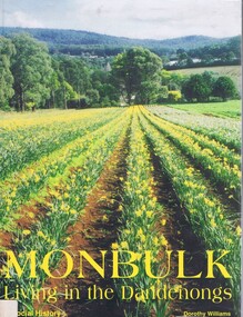
Book, Dorothy Williams, Monbulk: living in the Dandenongs, a social history, by Dorothy Williams, 1998_
... Greensborough Historical Society 34A Glenauburn Road Lower Plenty Lower Plenty melbourne History of Monbulk from early settlement in 1837 to 1997. monbulk mount dandenong Paperback, 325 p., black and white photographs, maps. ...History of Monbulk from early settlement in 1837 to 1997.Paperback, 325 p., black and white photographs, maps.monbulk, mount dandenong