Showing 24 items matching "regional planning authority"
-
 Bendigo Historical Society Inc.
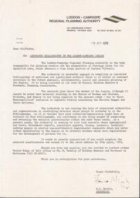
Document - LODDON - CAMPASPE REGIONAL PLANNING AUTHORITY LETTER
... LODDON - CAMPASPE REGIONAL PLANNING AUTHORITY LETTER...Two letters from the Loddon - Campaspe Regional Planning Authority the first dated 9th April, 1979 the second 12th April, 1979 both titled: annotated bibliograpghy of the Loddon-Campaspe Region. ...Two stapled pages of the Annotated Bibliography of the Loddon - Campaspe Region Document LODDON - CAMPASPE REGIONAL PLANNING AUTHORITY LETTER ...Two letters from the Loddon - Campaspe Regional Planning Authority the first dated 9th April, 1979 the second 12th April, 1979 both titled: annotated bibliograpghy of the Loddon-Campaspe Region. Also a map of the Loddon-Campaspe regional Autorithy area of study. Two stapled pages of the Annotated Bibliography of the Loddon - Campaspe Regionorganisation, government, loddon campaspe -
 Bendigo Historical Society Inc.
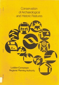
Book - CONSERVATION OF ARCHAEOLOGICAL AND HISTORIC FEATURES, 1977
... Conservation of archaeological and historic features Loddon-Campaspe Regional Planning Authority. 51 pages, with photos, and maps....Loddon Campaspe Regional Planning Authority...History House 11 Mackenzie Street Bendigo goldfields BENDIGO Buildings historic and archaeological heritage history buildings historic features heritage features Loddon Campaspe Regional Planning Authority Conservation of archaeological and historic features Loddon-Campaspe Regional Planning Authority. 51 pages, with photos, and maps. ...Conservation of archaeological and historic features Loddon-Campaspe Regional Planning Authority. 51 pages, with photos, and maps.Loddon Campaspe Regional Planning Authoritybendigo, buildings, historic and archaeological, heritage, history, buildings, historic features, heritage features -
 Phillip Island and District Historical Society Inc.
Book, SEDDON, George, Phillip Island : capability, conflict and compromise : a report to the Western Port Regional Planning Authority, 1975
... Phillip Island : capability, conflict and compromise : a report to the Western Port Regional Planning Authority...Regional planning victoria phillip island Phillip Island : capability, conflict and compromise : a report to the Western Port Regional Planning Authority Book SEDDON, George Centre for Environmental Studies, University of Melbourne ...regional planning, victoria, phillip island -
Phillip Island and District Historical Society Inc.
Book, SEDDON, George, Phillip Island : capability, conflict and compromise : a report to the Western Port Regional Planning Authority, 1975
... Phillip Island : capability, conflict and compromise : a report to the Western Port Regional Planning Authority...regional planning victoria phillip island Stamped 'Phillip Island & District Historical Society'. Phillip Island : capability, conflict and compromise : a report to the Western Port Regional Planning Authority Book SEDDON, George Centre for Environmental Studies, University of Melbourne ...Stamped 'Phillip Island & District Historical Society'.regional planning, victoria, phillip island -
Save the Dandenongs League Inc.
Archive (item), Save the Dandenongs League Incorporated, A Regional Planning Authority... - Upper Yarra Valley & Dandenong Ranges Authority
... A Regional Planning Authority... - Upper Yarra Valley & Dandenong Ranges Authority...A Regional Planning Authority... - Upper Yarra Valley & Dandenong Ranges Authority Archive Save the Dandenongs League Incorporated ... -
 Bendigo Historical Society Inc.
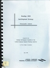
Book - BENDIGO 2020 SUB-REGIONAL STRATEGY, 1989
... .\ Prepared by Trevor Budge & Assoc for Bendigo Sub-Regional Committee of the Loddon-Campaspe Regional Planning Authority June 1989, 55 pages...Trevor Budge & Assoc for Bendigo Sub-Regional Committee of the Loddon-Campaspe Regional Planning Authority...Trevor Budge & Assoc for Bendigo Sub-Regional Committee of the Loddon-Campaspe Regional Planning Authority Bendigo 2020 Sub-Regional Strategy. ...Bendigo 2020 Sub-Regional Strategy. Demographic Analysis.\ Prepared by Trevor Budge & Assoc for Bendigo Sub-Regional Committee of the Loddon-Campaspe Regional Planning Authority June 1989, 55 pagesTrevor Budge & Assoc for Bendigo Sub-Regional Committee of the Loddon-Campaspe Regional Planning Authoritybendigo, council, future direction & strategies. -
 Bendigo Historical Society Inc.
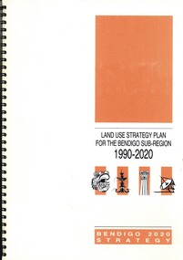
Book - LAND USE STRATEGY PLAN FOR THE BENDIGO SUV-REGION 1990-2020, 1991
... Prepared by three consulting firms for the Loddon-Campaspe Regional Planning Authority Inside front cover are: 1 Cover sheet, 3 stapled reports covering Bendigo 2020 land use strategy plan, Issues Report, Environment, also a 5 page booklet planning for the future with information and maps....Loddon-Campaspe Regional Planning Authority...Loddon-Campaspe Regional Planning Authority Land Use Strategy Plan for the Bendigo Sub-Region, 1990 - 2020. ...Land Use Strategy Plan for the Bendigo Sub-Region, 1990 - 2020. Bendigo 2020 Strategy. Prepared by three consulting firms for the Loddon-Campaspe Regional Planning Authority Inside front cover are: 1 Cover sheet, 3 stapled reports covering Bendigo 2020 land use strategy plan, Issues Report, Environment, also a 5 page booklet planning for the future with information and maps.Loddon-Campaspe Regional Planning Authoritybendigo, planning, 2020 strategy. -
 Bendigo Historical Society Inc.
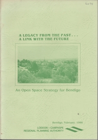
Book - A LEGACY FROM THE PAST.. A LINK WITH THE FUTURE - AN OPEN SPACE STRATEGY FOR BENDIGO, 1988
... Regional Planning Authority...An Open Space Strategy for Bendigo' Prepared for the Bendigo Sub-Regional Committee of the Loddon-Campaspe Regional Planning Authority, February 1988. Illustrated with maps, B&W photos and sketches. ...History House 11 Mackenzie Street Bendigo goldfields Regional Planning Authority Open Space Bendigo Council Evan Jones 32 page soft cover booklet 'A Legacy from the Past… a Link with the Future. ...32 page soft cover booklet 'A Legacy from the Past… a Link with the Future. An Open Space Strategy for Bendigo' Prepared for the Bendigo Sub-Regional Committee of the Loddon-Campaspe Regional Planning Authority, February 1988. Illustrated with maps, B&W photos and sketches. Main chapters 1. Open Space and Bendigo 2. An Open Space System - water courses and Bendigo Creek 3. The Provision of Public Open Space 4. Study Conclusions and Proposals.Evan Jonesregional planning authority, open space, bendigo council -
 Bendigo Historical Society Inc.
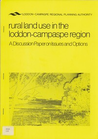
Book - RURAL LAND USE IN THE LODDON-CAMPASPE REGION, 1976
... Loddon-Campaspe regional planning authority...History House 11 Mackenzie Street Bendigo goldfields BOOK Rural land use loddon campaspe rural land use agriculture Loddon-Campaspe regional planning authority RURAL LAND USE IN THE LODDON-CAMPASPE REGION - a discussion paper on issues and options. 30 pages, with maps. ...RURAL LAND USE IN THE LODDON-CAMPASPE REGION - a discussion paper on issues and options. 30 pages, with maps.Loddon-Campaspe regional planning authoritybook, rural, land use, loddon campaspe, rural, land use, agriculture -
 Phillip Island and District Historical Society Inc.
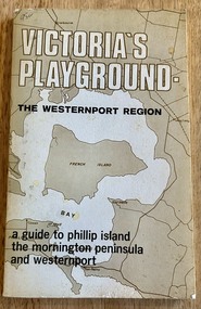
Book, Victoria's Playground The Westernport Region. A guide to Phillip Island, the Mornington Peninsula and Westernport, 1971
... Book - soft cover - 117 pages, First edition published 1971 by The Advisory Committee on Recreation and Tourism to The Westernport Regional Planning Authority...Phillip Island and District Historical Society Inc. phillip-island-and-the-bass-coast Description of Tourist Resorts on Mornington Peninsula and Westernport Bay Historical mornington peninsula westernport bay Phillip Island Book - soft cover - 117 pages, First edition published 1971 by The Advisory Committee on Recreation and Tourism to The Westernport Regional Planning Authority Victoria's Playground The Westernport Region. ...Description of Tourist Resorts on Mornington Peninsula and Westernport BayHistoricalBook - soft cover - 117 pages, First edition published 1971 by The Advisory Committee on Recreation and Tourism to The Westernport Regional Planning Authoritymornington peninsula, westernport bay, phillip island -
Port Melbourne Historical & Preservation Society
Document - Report, The Docklands Authority Bill, 1991
... Port Melbourne Historical & Preservation Society Port Melbourne Town Hall 333 Bay Street Port Melbourne melbourne town planning Report from Melbourne's Western Region Commission Inner Metropolitan Regional Association on meeting with Hon Jim Kennan MP, Minister for Major Projects, Parliament House, Melbourne 23 April 1991; bound copy of written comments on the Draft Dockland Authority Bill The Docklands Authority Bill Document Report Melbourne Western Region Commission ...Report from Melbourne's Western Region Commission Inner Metropolitan Regional Association on meeting with Hon Jim Kennan MP, Minister for Major Projects, Parliament House, Melbourne 23 April 1991; bound copy of written comments on the Draft Dockland Authority Billtown planning -
 Falls Creek Historical Society
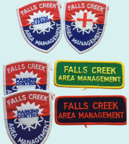
Badge - Falls Creek Area Management Cloth Badges
... Its composition changed over time but generally the Committee was composed of representatives of the State Electricity Commission, Representatives from Ski Clubs and commercial enterprises, the Country Roads Board, the Ski Tow company and a Representative of the Upper Murray Regional Committee of the Central Planning Authority. This Committee was responsibility for long term planning for the Falls Creek Tourist Area as well as the day to day running of the Village, These patches were part of the uniform of people employed by the Management Committee....Its composition changed over time but generally the Committee was composed of representatives of the State Electricity Commission, Representatives from Ski Clubs and commercial enterprises, the Country Roads Board, the Ski Tow company and a Representative of the Upper Murray Regional Committee of the Central Planning Authority. This Committee was responsibility for long term planning for the Falls Creek Tourist Area as well as the day to day running of the Village, These patches were part of the uniform of people employed by the Management Committee. ...Falls Creek was operated by the Falls Creek Area Management Committee. Its composition changed over time but generally the Committee was composed of representatives of the State Electricity Commission, Representatives from Ski Clubs and commercial enterprises, the Country Roads Board, the Ski Tow company and a Representative of the Upper Murray Regional Committee of the Central Planning Authority. This Committee was responsibility for long term planning for the Falls Creek Tourist Area as well as the day to day running of the Village, These patches were part of the uniform of people employed by the Management Committee.These cloth badges are significant because they indicated employees of the Area Management Committee and the role they played in Falls Creek.A group of cloth badges indicating the role of personnel employed by the Falls Creek Area Management. Shield shaped badges - 2 Falls Creek Area Management - PARKING CONTROL 1 Falls Creek Area Management - with red cross of SKI PATROL Rectangular - Green and yellow - FALLS CREEK AREA MANAGEMENT Red and blue - FALLS CREEK AREA MANAGEMENTfalls creek village, falls creek area management committee -
Save the Dandenongs League Inc.
Archive (item), Save the Dandenongs League Incorporated, Upper Yarra Valley and Dandenong Ranges Authority - Regional Strategy Plan - October 1982 - As Varied by Govenor-in-Council, March 1983
... Upper Yarra Valley and Dandenong Ranges Authority - Regional Strategy Plan - October 1982 - As Varied by Govenor-in-Council, March 1983...Upper Yarra Valley and Dandenong Ranges Authority - Regional Strategy Plan - October 1982 - As Varied by Govenor-in-Council, March 1983 Archive Save the Dandenongs League Incorporated ... -
Save the Dandenongs League Inc.
Archive (item), Save the Dandenongs League Incorporated, Upper Yarra Valley and Dandenong Ranges Authority - Technical Report Series - Report No. 18 - 1988 - Population and Housing in Urban, Landscape Living and Rural Residential Policy Areas of the Regional Strategy Plan at 1986 Census
... Upper Yarra Valley and Dandenong Ranges Authority - Technical Report Series - Report No. 18 - 1988 - Population and Housing in Urban, Landscape Living and Rural Residential Policy Areas of the Regional Strategy Plan at 1986 Census...Upper Yarra Valley and Dandenong Ranges Authority - Technical Report Series - Report No. 18 - 1988 - Population and Housing in Urban, Landscape Living and Rural Residential Policy Areas of the Regional Strategy Plan at 1986 Census Archive Save the Dandenongs League Incorporated ... -
Save the Dandenongs League Inc.
Archive (item), Save the Dandenongs League Incorporated, Upper Yarra Valley and Dandenong Ranges Authority - Technical Report Series - Report No. 23 - 1989 - Identification of the Extent of Implementation of Existing Policies of the Regional Strategy Plan
... Upper Yarra Valley and Dandenong Ranges Authority - Technical Report Series - Report No. 23 - 1989 - Identification of the Extent of Implementation of Existing Policies of the Regional Strategy Plan...Upper Yarra Valley and Dandenong Ranges Authority - Technical Report Series - Report No. 23 - 1989 - Identification of the Extent of Implementation of Existing Policies of the Regional Strategy Plan Archive Save the Dandenongs League Incorporated ... -
Save the Dandenongs League Inc.
Archive (item), Save the Dandenongs League Incorporated, Upper Yarra Valley and Dandenong Ranges Authority - Technical Report Series - Report No. 24 - 1989 - Report on the 'Statutory' Processes for the Review and Amendment of the Regional Strategy Plan
... Upper Yarra Valley and Dandenong Ranges Authority - Technical Report Series - Report No. 24 - 1989 - Report on the 'Statutory' Processes for the Review and Amendment of the Regional Strategy Plan...Upper Yarra Valley and Dandenong Ranges Authority - Technical Report Series - Report No. 24 - 1989 - Report on the 'Statutory' Processes for the Review and Amendment of the Regional Strategy Plan Archive Save the Dandenongs League Incorporated ... -
 Bacchus Marsh & District Historical Society
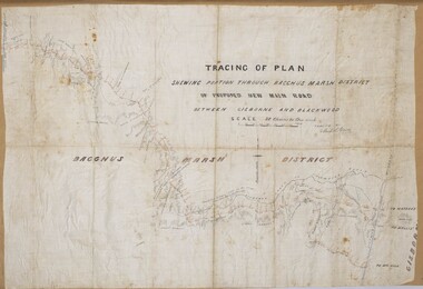
Map, Tracing of plan shewing portion through Bacchus Marsh District of proposed new Main Road between Gisborne and Blackwood
... Road construction and planning was a primary function of the early local government authorities in rural and regional Victoria. ...Bacchus Marsh & District Historical Society Lerderderg Library Main Street Bacchus Marsh Road construction and planning was a primary function of the early local government authorities in rural and regional Victoria. ...Road construction and planning was a primary function of the early local government authorities in rural and regional Victoria. This plan is indicative of the sort of documentation which generated considerable public interest and comment in rural communities. The date of this plan is not clear. Newspaper articles in the Bacchus Marsh Express around 1869 contain numerous references to the proposed new road between Gisborne and Blackwood which suggests this plan may date from the late 1860s or early 1870s.A single page paper map showing the proposed route of a main road to be constructed between Gisborne and Blackwood. The map is pasted into a bound volume containing 76 maps or plans in total. High resolution digital image stored on BMDHS computer network. roads, road plans, bacchus marsh victoria maps, gisborne to blackwood main road -
 City of Greater Bendigo - Civic Collection
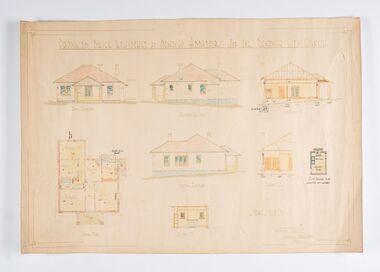
Work on paper - Architectural Drawing, City of Bendigo, Proposed Brick Residence at Bendigo Abbatoirs (sic) for the Bendigo City Council, Not dated
... regional livestock markets in Victoria. D'Ebro was critically influential in the development of industrial and in particular meat processing buildings, designing major freezing works and abattoirs throughout Victoria and Australia.(Source, National Trust Database). The Bendigo facility finally closed in 1945, when all slaughtering for local consumption passed to a joint export and local slaughtering facility at the Bendigo Inland Meat Authority. City of Greater Bendigo Commerce Charles D'Ebro Proposed Brick Residence at Bendigo Abbatoirs (sic) For The Bendigo City Council. / Front Elevation / Easter Elevation / Section A. D. / Ground Plan ...Situated at 47 Lansell Street, Bendigo, the original 1911-12 Charles D'Ebro designed brick Bendigo Municipal Abattoir, comprising twin slaughter and hanging rooms for cattle, sheep and pigs, and two smaller ancillary brick buildings. After the buildings were acquired by the Country Roads Board in 1945, a substantial but sympathetic addition was made to the south-eastern end of the old cattle abattoir. The abattoir is significant for historic, architectural and technical reasons at a state level. as a rare surviving municipal abattoir, and represents the development of hygienic slaughtering through municipal regulations, thus improving standards of public health in Victoria. It is historically significant to the City of Greater Bendigo as a key to the primary production industry that centred on this precinct from the 1860s to the mid 1990s; they are an important surviving component of one of the largest regional livestock markets in Victoria. D'Ebro was critically influential in the development of industrial and in particular meat processing buildings, designing major freezing works and abattoirs throughout Victoria and Australia.(Source, National Trust Database). The Bendigo facility finally closed in 1945, when all slaughtering for local consumption passed to a joint export and local slaughtering facility at the Bendigo Inland Meat Authority. Ink, pen, pencil and watercolour architectural drawing for the proposed brick residence at Bendigo abattoirs. Proposed Brick Residence at Bendigo Abbatoirs (sic) For The Bendigo City Council. / Front Elevation / Easter Elevation / Section A. D. / Ground Plan / Wester Elevation / Section C.D. / Section I. P. ? Existing Building to be / Converted into Laundry ? Scale 1/8" to 1 FT / Geo. Austen Architect / Commonwealth Bank Chambers / Bendigocity of greater bendigo commerce, charles d'ebro -
 Wonga Park Community Cottage History Group
Document - Appeal dated 10/9/1986, re the rebuilding and enlarging the 1957 shop on the north-east corner of Jumping Creek and Dudley roads Wonga Park
... Appeal re the rebuilding and enlarging the 1957 shop at the corner of Jumping Creek and Dudley Roads Wonga Park, shire of Lillydale in favour of granting approval but opposed by the Upper Yarra Valley and Dandenong Ranges Authority as being contrary to the Regional Strategy Plan and would create a traffic hazard. ...Wonga Park Community Cottage History Group Unit 1, 9 – 13 Old Yarra Road Wonga Park melbourne Appeal re the rebuilding and enlarging the 1957 shop at the corner of Jumping Creek and Dudley Roads Wonga Park, shire of Lillydale in favour of granting approval but opposed by the Upper Yarra Valley and Dandenong Ranges Authority as being contrary to the Regional Strategy Plan and would create a traffic hazard. ...Appeal re the rebuilding and enlarging the 1957 shop at the corner of Jumping Creek and Dudley Roads Wonga Park, shire of Lillydale in favour of granting approval but opposed by the Upper Yarra Valley and Dandenong Ranges Authority as being contrary to the Regional Strategy Plan and would create a traffic hazard. Appeal granted as question of use not a problem given 1957 permit and development is appropriate. -
Save the Dandenongs League Inc.
Archive (item), Save the Dandenongs League Incorporated, Upper Yarra Valley and Dandenong Ranges Authority - Regional Strategy Plan - October 1981 as varied by Governor-in-Council, March 1983
... Upper Yarra Valley and Dandenong Ranges Authority - Regional Strategy Plan - October 1981 as varied by Governor-in-Council, March 1983...Upper Yarra Valley and Dandenong Ranges Authority (UYVDRA) Upper Yarra Valley and Dandenong Ranges Authority - Regional Strategy Plan - October 1981 as varied by Governor-in-Council, March 1983 Archive Save the Dandenongs League Incorporated ...upper yarra valley and dandenong ranges authority (uyvdra) -
Save the Dandenongs League Inc.
Archive (item), Save the Dandenongs League Incorporated, Upper Yarra Valley and Dandenong Ranges Authority - Regional Strategy Plan - Amendment 29
... Upper Yarra Valley and Dandenong Ranges Authority - Regional Strategy Plan - Amendment 29...Upper Yarra Valley and Dandenong Ranges Authority - Regional Strategy Plan - Amendment 29 Archive Save the Dandenongs League Incorporated ... -
Save the Dandenongs League Inc.
Archive (item), Save the Dandenongs League Incorporated, Submission Re-Regional Strategy Plan, Amendment 29
... Upper Yarra Valley and Dandenong Ranges Authority (UYVDRA) Submission Re-Regional Strategy Plan, Amendment 29 Archive Save the Dandenongs League Incorporated ...upper yarra valley and dandenong ranges authority (uyvdra) -
Save the Dandenongs League Inc.
Archive (item), Save the Dandenongs League Incorporated, Regional Strategy Plan (1992) - Policies - Upper Yarra Valley and Dandenong Ranges Authority
... Regional Strategy Plan (1992) - Policies - Upper Yarra Valley and Dandenong Ranges Authority...Upper Yarra Valley and Dandenong Ranges Authority (UYVDRA) Regional Strategy Plan (1992) - Policies - Upper Yarra Valley and Dandenong Ranges Authority Archive Save the Dandenongs League Incorporated ...upper yarra valley and dandenong ranges authority (uyvdra) -
Save the Dandenongs League Inc.
Archive (item), Save the Dandenongs League Incorporated, U.Y.V. & D.R.A. Meeting - Procedures for Amendments to Approved Regional Strategy Plan
... Authority (UYVDRA) U.Y.V. & D.R.A. Meeting - Procedures for Amendments to Approved Regional Strategy Plan Archive Save the Dandenongs League Incorporated ...upper yarra valley and dandenong ranges authority (uyvdra)