Showing 276 items matching "residental development"
-
 Whitehorse Historical Society Inc.
Newspaper - Article, Heritage Buildings, 23/06/1999
... ...Residental Development...Whitehorse Historical Society Inc. 2-10 Deep Creek Road Mitcham melbourne City of Whitehorse Historic Buildings & Sites Residental Development Commercial Buildings Dulce Domum Blackburn Road Blackburn Churchill Street Mont Albert Robs Cycles & Sports Robinson George Lewis Greg Cahill Bernadette Lewis Family Building our history. 3 Whitehorse properties included in the Whitehorse Council Heritage Overlay. ...Building our history. 3 Whitehorse properties included in the Whitehorse Council Heritage Overlay. Article in the Whitehorse Gazette.city of whitehorse, historic buildings & sites, residental development, commercial buildings, dulce domum blackburn road, blackburn, churchill street mont albert, robs cycles & sports, robinson, george, lewis, greg, cahill, bernadette, lewis family -
Whitehorse Historical Society Inc.
Article, Multi-storey unit project scrapped, 2007
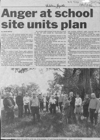
... (Photo of some of the residents opposed to the development)....Whitehorse Council has knocked back plans for a 52 unit development at 520 Mitcham Road, Mitcham. (Photo of some of the residents opposed to the development)...Whitehorse Council has knocked back plans for a 52 unit development at 520 Mitcham Road, Mitcham. (Photo of some of the residents opposed to the development) Multi-storey unit project scrapped Article Article ...Whitehorse Council has knocked back plans for a 52 unit development at 520 Mitcham Road, Mitcham.Whitehorse Council has knocked back plans for a 52 unit development at 520 Mitcham Road, Mitcham. (Photo of some of the residents opposed to the development)Whitehorse Council has knocked back plans for a 52 unit development at 520 Mitcham Road, Mitcham. mitcham road, mitcham no. 520, aubrey, chris, allan, peter, hogg, tony, residential development -
Whitehorse Historical Society Inc.
Article, Zone concern rising, 2013
... Article regarding residents concern over development in Whitehorse....Whitehorse Historical Society Inc. 2-10 Deep Creek Road Mitcham melbourne Residential development Town planning City of Whitehorse Article regarding residents concern over development in Whitehorse. ...Article regarding residents concern over development in Whitehorse.Article regarding residents concern over development in Whitehorse.Article regarding residents concern over development in Whitehorse.residential development, town planning, city of whitehorse -
 Whitehorse Historical Society Inc.
Newspaper - Article, Anger at school site plan, 23/10/1996
... Article in Whitehorse Gazette 28/10/1996 about objections by neighbouring residents to development of the Forest Hill Secondary College site....Whitehorse Historical Society Inc. 2-10 Deep Creek Road Mitcham melbourne forest hill secondary college mahoneys road forest hill canterbury road thornhill drive oscar geoff land subdivision Article in Whitehorse Gazette 28/10/1996 about objections by neighbouring residents to development of the Forest Hill Secondary College site. ...Article in Whitehorse Gazette 28/10/1996 about objections by neighbouring residents to development of the Forest Hill Secondary College site.forest hill secondary college, mahoneys road, forest hill, canterbury road, thornhill drive, oscar, geoff, land subdivision -
Whitehorse Historical Society Inc.
Article, Lobby group forms, 1999
... Article on Mitcham Residents Against Inappropriate Development (RAID) formed in response to a planned development at 445 - 447 Mitcham Road....Whitehorse Historical Society Inc. 2-10 Deep Creek Road Mitcham melbourne mitcham residents against inappropriate development mitcham road mitcham nos 445-447 Article on Mitcham Residents Against Inappropriate Development (RAID) formed in response to a planned development at 445 - 447 Mitcham Road. ...Article on Mitcham Residents Against Inappropriate Development (RAID) formed in response to a planned development at 445 - 447 Mitcham Road.Article on Mitcham Residents Against Inappropriate Development (RAID) formed in response to a planned development at 445 - 447 Mitcham Road.Article on Mitcham Residents Against Inappropriate Development (RAID) formed in response to a planned development at 445 - 447 Mitcham Road.mitcham residents against inappropriate development, mitcham road, mitcham, nos 445-447 -
Port Melbourne Historical & Preservation Society
Document - Assignment, Evolution of planning controls for the Port Melbourne foreshore, 1994-2002, Janet Bolitho, May 2002
... Assignment (completed while working on post graduate degree) arises from the author's experience of campaigning against high rise development for Port Melbourne as a member of Residents for Responsible Development, 1990s...Port Melbourne Historical & Preservation Society Port Melbourne Town Hall 333 Bay Street Port Melbourne melbourne Assignment (completed while working on post graduate degree) arises from the author's experience of campaigning against high rise development for Port Melbourne as a member of Residents for Responsible Development, 1990s town planning built environment public action campaigns residents for responsible development janet bolitho samdy nominees (bayshore) envelope factory (bayview) becton teac hmas lonsdale Assignment on the evolution of planning controls for the Port Melbourne foreshore, 1994-2002; 13pp with attachments Document Assignment, Evolution of planning controls for the Port Melbourne foreshore, 1994-2002 Janet Bolitho ...Assignment (completed while working on post graduate degree) arises from the author's experience of campaigning against high rise development for Port Melbourne as a member of Residents for Responsible Development, 1990sAssignment on the evolution of planning controls for the Port Melbourne foreshore, 1994-2002; 13pp with attachmentstown planning, built environment, public action campaigns, residents for responsible development, janet bolitho, samdy nominees (bayshore), envelope factory (bayview), becton, teac, hmas lonsdale -
 Ringwood and District Historical Society
Newspaper, Scrapbook Clipping, Library Collection, Ringwood, Victoria
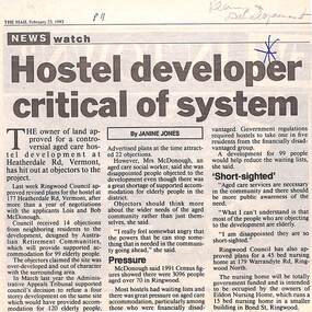
... development at Heatherdale Rd, Vermont, has hit out at objectors to the project. Ringwood Council approved revised plans for the hostel at 177 Heatherdale Rd, Vermont, after a year of negotiations with the applicants, Lois and Bob McDonough. Council received 14 objections from neighbouring residents...development at Heatherdale Rd, Vermont, has hit out at objectors to the project. Ringwood Council approved revised plans for the hostel at 177 Heatherdale Rd, Vermont, after a year of negotiations with the applicants, Lois and Bob McDonough. Council received 14 objections from neighbouring residents ...Newspaper Clipping from "The Mail", 23-2-1993. Hostel developer critical of system. Article by Janine JonesThe owner of land approved for a controversial aged care development at Heatherdale Rd, Vermont, has hit out at objectors to the project. Ringwood Council approved revised plans for the hostel at 177 Heatherdale Rd, Vermont, after a year of negotiations with the applicants, Lois and Bob McDonough. Council received 14 objections from neighbouring residents to the development. -
 Whitehorse Historical Society Inc.
Newspaper - Article, Plans raise concern, 28/04/1993
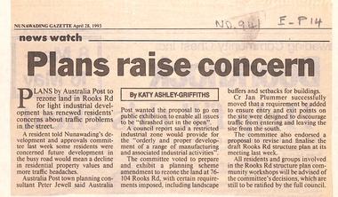
... Plans by Australia Post to rezone land in Rooks Road to light industrial development concern residents about traffic problems. ...Plans by Australia Post to rezone land in Rooks Road to light industrial development concern residents about traffic problems. Council voted to prepare and exhibit planning scheme amendment to rezone land at 76 - 104 Rooks Road. ...Article in Nunawading Gazette. Plans by Australia Post to rezone land in Rooks Road to light industrial development concern residents about traffic problems. Council voted to prepare and exhibit planning scheme amendment to rezone land at 76 - 104 Rooks Road.post offices, australia post, rooks road, mitcham, no 76 - 104, jewell, peter -
 Whitehorse Historical Society Inc.
Photograph, Australian Tesselated Tile Co - Works
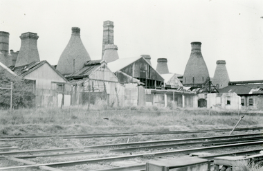
... Certainly not Mitcham's most favourable aspect but key to its early development. Residents of the time can well remember vast quantities of black smoke when the kilns were fired up on Monday morning for the week's production....Certainly not Mitcham's most favourable aspect but key to its early development. Residents of the time can well remember vast quantities of black smoke when the kilns were fired up on Monday morning for the week's production. ...Black and white photo of Australian Tesselated Tile Co. Works c1940. Situated on south side of railway line. Founded 1885- ceased operation 1965. Certainly not Mitcham's most favourable aspect but key to its early development. Residents of the time can well remember vast quantities of black smoke when the kilns were fired up on Monday morning for the week's production.australian tesselated tile co. pty ltd -
 Greensborough Historical Society
Photograph - Digital image, View of Greensborough from Delfin Crescent, 02/05/2013
... [Note: 'Medhurst Street was only listed on planning maps pre 1950 when the 'street' had no residents or development.]...[Note: 'Medhurst Street was only listed on planning maps pre 1950 when the 'street' had no residents or development.] greensborough and greenhills Digital copy of colour photograph. ...This photograph of Greensborough was taken from Delfin Crescent in 2013 to show changes over 40 years, based on Ron Reynold’s sketches in the 1973 publication “Greensborough and Greenhills” published by Cypress Books. Delphin Crescent [previously known as Medhurst Street] was created about 1970 in association with the Delfin Building Company. It was at this time also, that major works on Diamond Creek Road raised the level of the road facilitating the connection of Delfin Crescent with Diamond Creek Road. [Note: 'Medhurst Street was only listed on planning maps pre 1950 when the 'street' had no residents or development.]Digital copy of colour photograph.greensborough and greenhills -
Port Melbourne Historical & Preservation Society
Archive - Bayside Development, Resident Action Group, Pat Grainger Archive, 1987 - 1992
... Bayside Development, Resident Action Group...Pat Grainger Archive - Bayside Development, Resident Action Group - Public Action Campaigner. ...Pat Grainger Archive Archive Bayside Development, Resident Action Group ...These papers document Pat Grainger's involvement with the many facets of campaigning against the Sandridge City Development Company Bayside Project. Files & indexed by J Bolitho.Pat Grainger Archive - Bayside Development, Resident Action Group - Public Action Campaigner. Archival box containing audio tape & tape log. Individual manilla folders for the following years & subjects; 1987, Organisational submissions to ESS Sept 1987-Feb 1988, personal file retained from ESS Sept 1987 - Feb 1988. 1988, Friends of the Park 1988 - 1999. 1989 - 1994, Clarendon Street Bridge Light Raillink Advisory Committee.public action campaigns, local government - city of port melbourne, town planning - proposals shelved - bayside, melbourne harbor trust - port of melbourne authority, pat grainger -
 Greensborough Historical Society
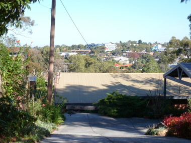
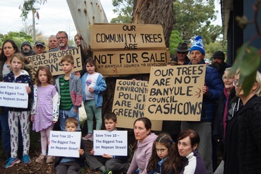
Photograph - Digital Image, Marilyn Smith, Diamond Valley Tree Protest 2019, 25/07/2019
... A VCAT decision ruled that the development be no higher than 4 storeys, and a maximum of 15 dwellings. This photograph shows local residents protesting at the development and removal of tree in July 2019....A VCAT decision ruled that the development be no higher than 4 storeys, and a maximum of 15 dwellings. This photograph shows local residents protesting at the development and removal of tree in July 2019. diamond village shopping centre diamond village nepean street watsonia Digital copy of colour photograph Diamond Valley Tree Protest 2019 Photograph Digital Image Marilyn Smith ...A redevelopment of the Diamond Village area included a multi storey apartment block which required the removal of this tree (Tree 10) on the plans. A VCAT decision ruled that the development be no higher than 4 storeys, and a maximum of 15 dwellings. This photograph shows local residents protesting at the development and removal of tree in July 2019.Digital copy of colour photographdiamond village shopping centre, diamond village, nepean street watsonia -
 Greensborough Historical Society
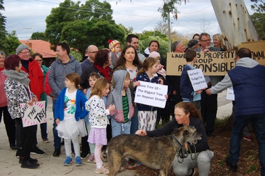
Photograph - Digital Image, Diamond Valley Tree Protest 2019 - people, 25/07/2019
... A VCAT decision ruled that the development be no higher than 4 storeys, and a maximum of 15 dwellings. This photograph shows local residents protesting at the development and removal of tree in July 2019....A VCAT decision ruled that the development be no higher than 4 storeys, and a maximum of 15 dwellings. This photograph shows local residents protesting at the development and removal of tree in July 2019. diamond village shopping centre diamond village nepean street watsonia Digital copy of colour photographs Diamond Valley Tree Protest 2019 - people Photograph - Digital Image Marilyn Smith ...A redevelopment of the Diamond Village area included a multi storey apartment block which required the removal of this tree (Tree 10) on the plans. A VCAT decision ruled that the development be no higher than 4 storeys, and a maximum of 15 dwellings. This photograph shows local residents protesting at the development and removal of tree in July 2019.Digital copy of colour photographsdiamond village shopping centre, diamond village, nepean street watsonia -
 Ballarat Tramway Museum
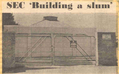
Newspaper, The Courier Ballarat, "SEC 'Building a slum' ", 20/02/1972 12:00:00 AM
... The development was considered inappropriate for the area by local residents, who requested a development of 6 lots. ...The development was considered inappropriate for the area by local residents, who requested a development of 6 lots. ...Newspaper clipping from The Courier, Ballarat, dated Monday 20/3/1972, titled "SEC 'Building a slum' ". Item with a photo about the proposals of the SEC to convert the former tram depot land to development comprising 16 houses as a built-in slum. The development was considered inappropriate for the area by local residents, who requested a development of 6 lots. Features a photo of the depot building with locked gates and a Security company sign on the gate. One of large group of newspaper cuttings from John Bainbridge, 7/4/02.depot, sale of land, wendouree parade -
 Eltham District Historical Society Inc
Document - Folder, Jim Connor et al, Eltham Gateway, 1987
... The Eltham Gateway Group (EGG) was established about 1987 by some Eltham residents concerned for the development of the Eltham Gateway, defined as that historically and environmentally sensitive region of land along Main Road, Eltham extending from the roundabout at Fitzsimons Lane to Dudley Street, Eltham. ...Eltham District Historical Society Inc 728 Main Rd Eltham melbourne The Eltham Gateway Group (EGG) was established about 1987 by some Eltham residents concerned for the development of the Eltham Gateway, defined as that historically and environmentally sensitive region of land along Main Road, Eltham extending from the roundabout at Fitzsimons Lane to Dudley Street, Eltham. ...The Eltham Gateway Group (EGG) was established about 1987 by some Eltham residents concerned for the development of the Eltham Gateway, defined as that historically and environmentally sensitive region of land along Main Road, Eltham extending from the roundabout at Fitzsimons Lane to Dudley Street, Eltham. The gateway was a unique urban area with a strong sense of character that provided a distinctive entrance to the Eltham Town Centre. The intention of this group was to support development that preserved both the natural and historic features of the gateway region. It encouraged development sympathetic to Eltham’s traditional association with the arts and natural environment. The group was initiated in response to a planning application in December 1986 to redevelop the then Mobil service station site at 729 Main Road, Eltham on the corner of Brougham Street. This group worked with and encouraged the Eltham Shire Council to consider rezoning to protect the gateway area. A detailed Eltham Gateway Study undertaken by Tract Consultants assisted with the establishment of the Eltham Gateway Zone, the Eltham Gateway Policy and the Eltham Gateway Design and Siting Guidelines. The State Government subsequently agreed to a planning amendment to rezone the land from a Residential Zone C to an Eltham Gateway Zone under the Eltham Planning Scheme. While zoning changes over the years have altered the mix of permitted uses within this area the Eltham Gateway still looks and feels like a predominately residential style precinct, even where non-residential type uses operate. EGG was followed by the establishment of the Eltham Protection Society in about 1989 to respond to community planning issues beyond the area of the Eltham Gateway and in effect took over the role from the EGG. Jim Connor President Eltham District Historical Society 4 July 2022 During 1986/87 I was a community member on the Shire of Eltham’s Community Consultative Committee involved with the Eltham Gateway Study, which led to the establishment of the original Eltham Gateway Zone, under the then Eltham Planning Scheme The Eltham Gateway Group was the pioneer community action group dedicated to protecting the character of the Eltham Gateway. It was succeeded by the Eltham Protection Society. When the Shire of Eltham Offices were demolished by the unelected Commissioners of Nillumbik Shire Council in July/August 1996, significant community upset and protest led to the establishement of the Eltham Gateway Action Group (EGAG) which in present day form has evolved into the Eltham Community Action Group (ECAG) focussing on issues throughout Eltham and not just the Eltham Gatewayeltham community action group, eltham gateway, eltham gateway action group, eltham gateway design and siting guidelines, eltham gateway group (egg), eltham gateway policy, eltham gateway study, eltham gateway zone, eltham planning scheme, eltham protection society, jim connor, michael wilson, rodger dalling, tony mcmanus -
 Warrnambool and District Historical Society Inc.
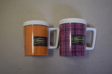
Mugs, Newlyne Mfg. Co Pty Ltd, Warrnambool Fabric Blankets, Mid 20th century
... residents moved into the new housing estate in 2009. These mugs are of interest as mementoes of the Warrnambool Woollen Mill, a key industry in the development of Warrnambool and one that operated for 90 years. ...These mugs are souvenirs of the Warrnambool Woollen Mill. They were either sold as souvenirs or given to clients of the mill. The Warrnambool Woollen Mill in South Warrnambool was opened in 1910 with the first manager being John Bennett, an Englishman who recruited skilled weavers and bought mill equipment from his home country. At the height of production the mill was employing up to 700 people. In 1958 the mill became the first in Australia to manufacture electric blankets. In 1968 the mill was sold to the Dunlop company and in the ensuing years various companies owned the plant. In the year 2000 the mill was closed and the equipment was sold. The buildings were sold to a private developer and the first residents moved into the new housing estate in 2009. These mugs are of interest as mementoes of the Warrnambool Woollen Mill, a key industry in the development of Warrnambool and one that operated for 90 years. .1 This is an insulated plastic mug with a mottled orange-coloured body and a white rim on the top opening and a white handle. On the side of the mug is a printed name with gold lettering on a brown background. The maker’s name is etched into the base of the mug. .2 This is an insulated plastic mug with a purple and black mottled body and a white rim on the top opening and a white handle. On the side of the mug is a printed name on a brown background with gold lettering. The maker’s name is etched into the base of the mug. .1 & .2 Warrnambool Fabrics Blankets Steditemp Insulated Ware Made in Australia by Newlyne MFG Co Pty Ltd Division of J. Glaser & Co Melbourne warrnambool woollen mill -
 Warrnambool and District Historical Society Inc.
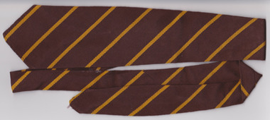
Textile - Warrnambool Primary School 1743 Tie, Circa 1950’s
... development of Primary schools at East and West Warrnambool. A large part of Warrnambool’s children have attended this school over the 140 years it has been in existence. A common item with which a large number of Warrnambool residents ...Warrnambool State School, No, 1743 was opened in 1876. The site in Jamieson St was easy to access from the surrounding areas of Belfast, Woodford, and Allansford roads. It was the main school in Warrnambool, before the development of Primary schools at East and West Warrnambool. A large part of Warrnambool’s children have attended this school over the 140 years it has been in existence.A common item with which a large number of Warrnambool residents would identify. Brown woven woollen tie with diagonal yellow stripes. White tag with black and red writing sewn into back seam.Tee- Dee, pure wool, school and college wear. warrnambool, warrnambool jamieson street primary school, no 1743, school tie, warrnambool primary school -
 Warrnambool and District Historical Society Inc.
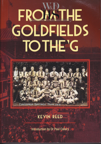
Book, Kevin Reed, From the Goldfields to the G, 2014
... This book was written by a former Warrnambool resident, Kevin Reed, a lecturer at the Warrnambool Institute of Advanced Education in the 1970s. He retired and left Warrnambool in the 1990s. Reed’s book describes the development...Warrnambool and District Historical Society Inc. 2 Gilles Street (south of Merri St) Warrnambool great-ocean-road This book was written by a former Warrnambool resident, Kevin Reed, a lecturer at the Warrnambool Institute of Advanced Education in the 1970s. He retired and left Warrnambool in the 1990s. Reed’s book describes the development ...An account of the development of Australian Rules football in both rural and suburban Victoria.This is a paper back book with a red and gold cover with a photograph of Costerfield Football Team, 1919 on the cover (335 pages) The book is signed inside by Kevin Reed non-fictionAn account of the development of Australian Rules football in both rural and suburban Victoria.warrnambool, kevin reed, dr john douglas, warrnambool cricket 1980's, warrnambool football 1970's 1980's -
 Kiewa Valley Historical Society
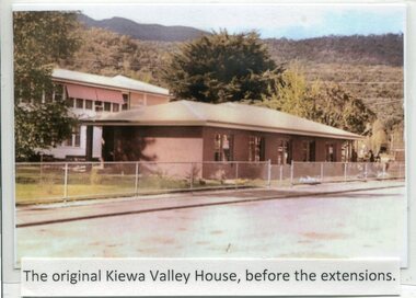
Photographs- Kiewa Valley House (before and after extensions) & Tawonga District General Hospital- Set of 6 colour photographs
... residents had to travel to Beechworth, Wangaratta or Wodonga for care. On June 6th, 1980, an appeal to finance a 12 bed nursing wing was launched at a public meeting in Mount Beauty The Hospital and Charities Commission’s development board finally approved the application for government funds to build the 12 bed nursing home in early 1981. ...residents had to travel to Beechworth, Wangaratta or Wodonga for care. On June 6th, 1980, an appeal to finance a 12 bed nursing wing was launched at a public meeting in Mount Beauty The Hospital and Charities Commission’s development board finally approved the application for government funds to build the 12 bed nursing home in early 1981. ...The establishment of Kiewa Valley House, was a significant victory for residents and senior citizens in the Kiewa Valley district. Plans were laid in the mid 1970’s and a proposal was formulated for a 12 bed unit nursing home to be attached to the Tawonga District General Hospital. The need for an aged care facility in Mount Beauty was prompted by recognition of the high ratio of senior citizens residing in the area. At the time residents had to travel to Beechworth, Wangaratta or Wodonga for care. On June 6th, 1980, an appeal to finance a 12 bed nursing wing was launched at a public meeting in Mount Beauty The Hospital and Charities Commission’s development board finally approved the application for government funds to build the 12 bed nursing home in early 1981. The official opening of the nursing home was on March 6th, 1985. Opening of the lounge extensions occurred in May, 1993 Many local residents have taken advantage of facilities at Kiewa Valley House when they became unable to manage independently in their own homes. This has meant they did not have to face the stress of leaving the area and being separated from their local family and friends. Many SEC workers and their families have been residents of Kiewa Valley House over the years.Set of 6 colour photographs of Kiewa Valley House and original Tawonga District General Hospital in Mt Beauty 1 Kiewa Valley House, before extensions, with old weatherboard hospital in background 2 & 3 Official opening of Kiewa Valley House. 4 & 5 Gardens between Kiewa Valley House and Hospital 5. Kiewa Valley lounge extension 1. The original Kiewa Valley House, before extensions 2. No markings 3. No markings 4. View of the gardens between the weatherboard hospital and Kiewa Valley House 5. Walkway between Hospital & Kiewa Valley House 6. Kiewa Valley House Lounge Room extension tawonga district hospital, kiewa valley house, mt beauty district hospital -
 Kiewa Valley Historical Society
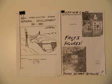
Papers - The Kiewa Hydro Electric Scheme x2, 1973 and 1993
... The first is and abbreviated history of the scheme published by the SEC, the second is similar with 'facts & figures' accessed by Bill Sutton, (Mt Beauty resident and SEC worker) whose father worked on the scheme, and who enjoyed speaking to visitors and groups about the history of the area including some of the light hearted aspects of the history. kiewa hydro electric scheme state electricity commission of victoria bill sutton The Kiewa Hydro Electric Scheme General Development 1911 - 1961 by SECV, July 1973. ...1. Chronological account of the Kiewa Hydro Electric Scheme from 1911 to 1961 2.Victorian Hydro with technical facts and figures, with Aboriginal History of the region, Settlement of the Kiewa Valley, Origin of Names Both accounts are a history of the Kiewa Hydro Electric Scheme constructed by the State Electricity Commission of Victoria. The first is and abbreviated history of the scheme published by the SEC, the second is similar with 'facts & figures' accessed by Bill Sutton, (Mt Beauty resident and SEC worker) whose father worked on the scheme, and who enjoyed speaking to visitors and groups about the history of the area including some of the light hearted aspects of the history.The Kiewa Hydro Electric Scheme General Development 1911 - 1961 by SECV, July 1973. Consists of 22 A4 pages held within a folded A3 sheet Victorian Hydro compiled by W. Sutton Nov. 1993. Office Copy / Facts & Figures. Consists of 44 A4 pages held by a metal clip.kiewa hydro electric scheme, state electricity commission of victoria, bill sutton -
Kiewa Valley Historical Society
Folder - Alex McCullough's Autobiography, Kiewa Its History From A Human Point of View By Alex McCullough
... Kiewa Valley Historical Society Mount Beauty Information Centre 31 Bogong High Plains Rd Mt Beauty high-country Alex McCullough (1916 - 2011) was a prolific writer, an historian, a family man and resident of Mt Beauty, an employee (foreman) of the SECV, served in the war and was on the committee of many clubs (27 at one stage) and associations including the Bright/Alpine Shire (1961-1981). Alex McCullough gives an insight into the development ...Alex McCullough (1916 - 2011) was a prolific writer, an historian, a family man and resident of Mt Beauty, an employee (foreman) of the SECV, served in the war and was on the committee of many clubs (27 at one stage) and associations including the Bright/Alpine Shire (1961-1981).Alex McCullough gives an insight into the development of Mt Beauty township and its community. Due to his heavy involvement at committee level of so many clubs and associations he has been able to document the town's history during his life time enabling the reader to see the changes at all levels and to compare life during that time with that of today.Typed pages on A4 paper held by metal fastener. It includes the history of some Mt Beauty Clubs and Associations and the Autobiography of Alex McCullough and the groups he belonged to.alex mccullough's autobiography, mt beauty clubs and associations -
 Kiewa Valley Historical Society
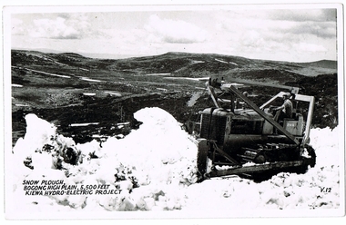
Postcard Circa 1950, Snow Plough, Bogong High Plain,5,500 Feet Kiewa Hydro-Electric Project, Circa 1950
... development of this scheme and the changing of sections of alpine landscape is covered by this and other postcards/pictures (tourists, construction workers, and established rural populations). This period in time was before the established wildlife and forest/nature groups became political activist who changed legislative acts to protect the environment. This rural region (Kiewa Valley/alpine plains) was at most only significant to a smaller group of winter sports, summer hikers/horse riders and rural farmers/graziers. The numbers of tourists and the increase in the local resident ...This postcard was produced in the 1950's for the tourist trade in the Kiewa Valley and Alpine region. It encompasses the period when the State of Victoria was pressured by the ever increasing demand by industry and its population for electricity supplies. Hydro electricity was seen as an untapped natural resource to quench this demand. The Victorian Alps and the rivers flowing into its valleys was ideal for the construction of the Kiewa Hydro Electricity Scheme. The late 1940's saw the development of this scheme and the changing of sections of alpine landscape is covered by this and other postcards/pictures (tourists, construction workers, and established rural populations). This period in time was before the established wildlife and forest/nature groups became political activist who changed legislative acts to protect the environment. This rural region (Kiewa Valley/alpine plains) was at most only significant to a smaller group of winter sports, summer hikers/horse riders and rural farmers/graziers. The numbers of tourists and the increase in the local resident population was boosted by the construction of the Hydro Electricity Scheme. This influx to the regional population resulted in a corresponding diversity in services and brought about an environment that responded to a growing level of tourists and thereby permitting this industry to grow more rapidly than it would have naturally. This postcard details an attraction to the "cleaner" method of providing electricity. This postcard was purchased in 1950 by a surveyor at Landford's Gap. This item is a black and white photograph(professional) of a panoramic view of a snow plough clearing the unsealed road in 1950.This postcard is on quality paper and the reproduction of the picture is of a high standard.For other "tourist" postcards see 0480 (A) -(F) for other photos of similar postcards. kiewa valley tourism, victorian alps, alternate energy supplies, alpine population growth, secv, snow plough -
 Kiewa Valley Historical Society
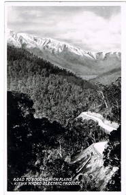
Postcard Circa 1950, Road to Bogong High Plains Kiewa Hydro Electric Project, Circa 1950's
... development of this scheme and the changing of sections of alpine landscape is covered by this and other postcards/pictures (tourists, construction workers, and established rural populations). This period in time was before the established wildlife and forest/nature groups became political activist who changed legislative acts to protect the environment. This rural region (Kiewa Valley/alpine plains) was at most only significant to a smaller group of winter sports, summer hikers/horse riders and rural farmers/graziers. The numbers of tourists and the increase in the local resident ...This postcard was produced in the 1950's for the tourist trade in the Kiewa Valley and Alpine region. It encompasses the period when the State of Victoria was pressured by the ever increasing demand by industry and its population for electricity supplies. Hydro electricity was seen as an untapped natural resource to quench this demand. The Victorian Alps and the rivers flowing into its valleys was ideal for the construction of the Kiewa Hydro Electricity Scheme. The late 1940's saw the development of this scheme and the changing of sections of alpine landscape is covered by this and other postcards/pictures (tourists, construction workers, and established rural populations). This period in time was before the established wildlife and forest/nature groups became political activist who changed legislative acts to protect the environment.This rural region (Kiewa Valley/alpine plains) was at most only significant to a smaller group of winter sports, summer hikers/horse riders and rural farmers/graziers. The numbers of tourists and the increase in the local resident population was boosted by the construction of the Hydro Electricity Scheme. This influx to the regional population resulted in a corresponding diversity in services and brought about an environment that responded to a growing level of tourists and thereby permitting this industry to grow more rapidly than it would have naturally. This postcard details an attraction to the "cleaner" method of providing electricity. This postcard was purchased in 1950 by a surveyor at Landford's Gap.This black and white photograph on a Valentine's postcard is from a V2 Argus photograph.. It is on a 200g/m paper density photo side gloss. See 0480 (A) - (G) for other photos of similar postcards.In white lettering " ROAD TO BOGONG HIGH PLAINS KIEWA HYDRO-ELECTRIC PROJECT", V3secv, road making, victorian alps -
 Kiewa Valley Historical Society
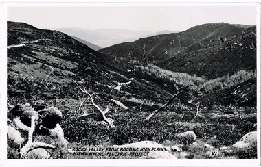
Postcard - Rocky Valley - Circa 1950, 1950
... development of this scheme and the changing of sections of alpine landscape is covered by this and other postcards/pictures (tourists, construction workers, and established rural populations). This period in time was before the established wildlife and forest/nature groups became political activist who changed legislative acts to protect the environment. This rural region (Kiewa Valley/alpine plains) was at most only significant to a smaller group of winter sports, summer hikers/horse riders and rural farmers/graziers. The numbers of tourists and the increase in the local resident ...This postcard was produced in the 1950's for the tourist trade in the Kiewa Valley and Alpine region. It encompasses the period when the State of Victoria was pressured by the ever increasing demand by industry and its population for electricity supplies. Hydro electricity was seen as an untapped natural resource to quench this demand. The Victorian Alps and the rivers flowing into its valleys was ideal for the construction of the Kiewa Hydro Electricity Scheme. The late 1940's saw the development of this scheme and the changing of sections of alpine landscape is covered by this and other postcards/pictures (tourists, construction workers, and established rural populations). This period in time was before the established wildlife and forest/nature groups became political activist who changed legislative acts to protect the environment.This rural region (Kiewa Valley/alpine plains) was at most only significant to a smaller group of winter sports, summer hikers/horse riders and rural farmers/graziers. The numbers of tourists and the increase in the local resident population was boosted by the construction of the Hydro Electricity Scheme. This influx to the regional population resulted in a corresponding diversity in services and brought about an environment that responded to a growing level of tourists and thereby permitting this industry to grow more rapidly than it would have naturally. This postcard details an attraction to the "cleaner" method of providing electricity. This postcard was purchased in 1950 by a surveyor at Landford's Gap.This black and white photograph is from a Valentine's V2 Argus postcard. It is on a 200g/m paper density one side gloss. See also KVHS 0480 (A) to (L) for similar postcards. "ROCKY VALLEY FROM BOGONG HIGH PLAINS KIEWA HYDRO-ELECTRIC PROJECT" "V1"kiewa valley tourism, victorian alps, alternate energy supplies, alpine population growth, rocky valley, secv -
 Kiewa Valley Historical Society
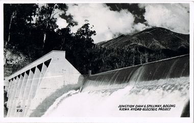
Postcard - Junction Dam - Circa 1950, Circa 1950's
... development of this scheme and the changing of sections of alpine landscape is covered by this and other postcards/pictures (tourists, construction workers, and established rural populations). This period in time was before the established wildlife and forest/nature groups became political activist who changed legislative acts to protect the environment. This rural region (Kiewa Valley/alpine plains) was at most only significant to a smaller group of winter sports, summer hikers/horse riders and rural farmers/graziers. The numbers of tourists and the increase in the local resident ...This postcard was produced in the 1950's for the tourist trade in the Kiewa Valley and Alpine region. It encompasses the period when the State of Victoria was pressured by the ever increasing demand by industry and its population for electricity supplies. Hydro electricity was seen as an untapped natural resource to quench this demand. The Victorian Alps and the rivers flowing into its valleys was ideal for the construction of the Kiewa Hydro Electricity Scheme. The late 1940's saw the development of this scheme and the changing of sections of alpine landscape is covered by this and other postcards/pictures (tourists, construction workers, and established rural populations). This period in time was before the established wildlife and forest/nature groups became political activist who changed legislative acts to protect the environment.This rural region (Kiewa Valley/alpine plains) was at most only significant to a smaller group of winter sports, summer hikers/horse riders and rural farmers/graziers. The numbers of tourists and the increase in the local resident population was boosted by the construction of the Hydro Electricity Scheme. This influx to the regional population resulted in a corresponding diversity in services and brought about an environment that responded to a growing level of tourists and thereby permitting this industry to grow more rapidly than it would have naturally. This postcard details an attraction to the "cleaner" method of providing electricity. This postcard was purchased in 1950 by a surveyor at Landford's Gap.This black and white photograph is a Valentine's postcard, from a V2 Argus photograph. It is on a 200g/m paper density with only the photo side gloss.Front "JUNCTION DAM & SPILLWAY, BOGONG KIEWA HYDRO-ELECTRIC PROJECT" on the flip side "VALENTINE'S POST CARD " "A GENUINE PHOTOGRAPH"kiewa valley tourism, victorian alps, alternate energy supplies, alpine population growth, junction dam, secv -
 Kiewa Valley Historical Society
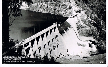
Postcard - Junction Dam - Circa 1950, Circa 1950
... development of this scheme and the changing of sections of alpine landscape is covered by this and other postcards/pictures (tourists, construction workers, and established rural populations). This period in time was before the established wildlife and forest/nature groups became political activist who changed legislative acts to protect the environment. This rural region (Kiewa Valley/alpine plains) was at most only significant to a smaller group of winter sports, summer hikers/horse riders and rural farmers/graziers. The numbers of tourists and the increase in the local resident ...This postcard was produced in the 1950's for the tourist trade in the Kiewa Valley and Alpine region. It encompasses the period when the State of Victoria was pressured by the ever increasing demand by industry and its population for electricity supplies. Hydro electricity was seen as an untapped natural resource to quench this demand. The Victorian Alps and the rivers flowing into its valleys was ideal for the construction of the Kiewa Hydro Electricity Scheme. The late 1940's saw the development of this scheme and the changing of sections of alpine landscape is covered by this and other postcards/pictures (tourists, construction workers, and established rural populations). This period in time was before the established wildlife and forest/nature groups became political activist who changed legislative acts to protect the environment.This rural region (Kiewa Valley/alpine plains) was at most only significant to a smaller group of winter sports, summer hikers/horse riders and rural farmers/graziers. The numbers of tourists and the increase in the local resident population was boosted by the construction of the Hydro Electricity Scheme. This influx to the regional population resulted in a corresponding diversity in services and brought about an environment that responded to a growing level of tourists and thereby permitting this industry to grow more rapidly than it would have naturally. This postcard details an attraction to the "cleaner" method of providing electricity. This postcard was purchased in 1950 by a surveyor at Landford's Gap.This black and white photograph on a Valentine's postcard is from a V2 Argus photograph. It is on a 200g/m paper density one side gloss only/. See 0480 (A) -(L) for other photos of similar postcards."JUNCTION DAM & SPILLWAY, LAKE GUY, BOGONG, KIEWA HYDRO-ELECTRIC PROJECT" "V5" on the flip side" VALENTINE'S POST CARD " "A GENUINE PHOTOGRAPH"kiewa valley tourism, victorian alps, alternate energy supplies, alpine population growth, junction dam, secv -
 Kiewa Valley Historical Society
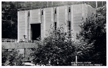
Postcard Circa 1950, No.3 Power Station Kiewa Hydro-electric Project "V.8", Circa 1950
... development of this scheme and the changing of sections of alpine landscape is covered by this and other postcards/pictures (tourists, construction workers, and established rural populations). This period in time was before the established wildlife and forest/nature groups became political activist who changed legislative acts to protect the environment. This rural region (Kiewa Valley/alpine plains) was at most only significant to a smaller group of winter sports, summer hikers/horse riders and rural farmers/graziers. The numbers of tourists and the increase in the local resident ...This postcard was produced in the 1950's for the tourist trade in the Kiewa Valley and Alpine region. It encompasses the period when the State of Victoria was pressured by the ever increasing demand by industry and its population for electricity supplies. Hydro electricity was seen as an untapped natural resource to quench this demand. The Victorian Alps and the rivers flowing into its valleys was ideal for the construction of the Kiewa Hydro Electricity Scheme. The late 1940's saw the development of this scheme and the changing of sections of alpine landscape is covered by this and other postcards/pictures (tourists, construction workers, and established rural populations). This period in time was before the established wildlife and forest/nature groups became political activist who changed legislative acts to protect the environment.This rural region (Kiewa Valley/alpine plains) was at most only significant to a smaller group of winter sports, summer hikers/horse riders and rural farmers/graziers. The numbers of tourists and the increase in the local resident population was boosted by the construction of the Hydro Electricity Scheme. This influx to the regional population resulted in a corresponding diversity in services and brought about an environment that responded to a growing level of tourists and thereby permitting this industry to grow more rapidly than it would have naturally. This postcard details an attraction to the "cleaner" method of providing electricity. This postcard was purchased in 1950 by a surveyor at Landford's Gap.This black and white photograph from a Valentine's postcard is from a V2 Argus photograph postcard. It is on a 200g/m paper density photo side gloss. See 0480 (A) - (K) for other photos of similar postcards."No.3 POWER STATION KIEWA HYDRO ELECTRIC PROJECT" "V8"kiewa valley tourism, victorian alps, alternate energy supplies, alpine population growth, secv -
 Kiewa Valley Historical Society
Box Spectacles, Circa 1960
... It was not until the Australian Government proceeded with a "regional development Centre" (for relocating some Federal Departments from Canberra) that the Wodonga/Albury townships developed into a medium city, allowing "specialist" facilities to become available and multiply. This item is very significant to the Kiewa Valley as it demonstrates that even in the 1960's early 1970's the Kiewa Valley residents still had to obtain "specialist" services from MELBOURNE. ...This eye wear transportation box was forwarded from and returned to Kiewa Valley in the 1960's. This period in time, the Kiewa Valley was still a semi remote location, and specialist eye facilities were not available in the region. It was not until the Australian Government proceeded with a "regional development Centre" (for relocating some Federal Departments from Canberra) that the Wodonga/Albury townships developed into a medium city, allowing "specialist" facilities to become available and multiply.This item is very significant to the Kiewa Valley as it demonstrates that even in the 1960's early 1970's the Kiewa Valley residents still had to obtain "specialist" services from MELBOURNE. The "isolation" of the Kiewa Valley was still in place due to unreliable transport routes, long distance travel needed to visit cities and a relatively "small" population. The slow but progress marketing of recreational areas in the region and the movement of retirees away from "city violence" and to a quieter location has been on the increase. The expansion of the existing small airfield to one that can accommodate larger aircraft will hasten the expansion of the population in the region, bringing an ever increasing "visiting specialists" covering among other fields, eye and medical practitioners.This brown coloured cardboard box was used by Coles and Garrard (Sight Testing Opticians) to transport spectacles to one of their clients. The box lid has four staples holding the four folded sides in place. The base is of similar proportions and fastened together.Printed on the top outside lid, in small print "When forwarding your spectacles for repairs, your co-operation is requested in placing name and full address inside the packet. This will obviate delay in repairing and returning spectacles", underneath and in bold print "COLES & GARRARD pty ltd", underneath "Sight Testing Optticians" underneath "We visit over 100 towns in Victoria. Local Newspapers give full details"eye specialist treatments, kiewa valley "isolation", cardboard packaging, personal eye wear -
 Kiewa Valley Historical Society
Folder - Mt Beauty, Early History of Mt Beauty, 2003
... resident of Mt Beauty for many years and wrote a book on the History of Mt Beauty. Mt Beauty was constructed by the State Electricity Commission of Victoria to house employees working on the Kiewa Hydro Electric Scheme. Mt Beauty's history is unique as it was built as a construction town in the late 1940s. The information contained in the folder is a written history of the town's development ...Alex McCullough was a resident of Mt Beauty for many years and wrote a book on the History of Mt Beauty. Mt Beauty was constructed by the State Electricity Commission of Victoria to house employees working on the Kiewa Hydro Electric Scheme.Mt Beauty's history is unique as it was built as a construction town in the late 1940s. The information contained in the folder is a written history of the town's development. Alex, 1916 - 2011, worked as a foreman on Clover Dam. He served in WWII, was involved in the community (Mt Beauty & District Progress Association & Mt Beauty Neighbourhood Centre), achieved many awards, served as Shire Councillor and Mayor, was involved with tennis and golf committees. His obituary is online ref. legacy.com White plastic folder with more than 20 clear plastic sleeves containing information on various organisations in Mt Beauty. Assembled by Alex McCullough. There is an index of the organisations in the first sleeve.Attached to the front cover: 'Early History Mount Beauty'mt beauty & district progress association, mount beauty history, alex mcculloch -
 Kiewa Valley Historical Society
Video - Fainter Falls, Fainter Falls, 2003 - 2008
... development of the Fainter Falls Trail completed in 2008. The trail was originally accessible via a fire fighting access trail. The fire in the summer of 2003 highlighted the beauty of the area and provided the residents of the Kiewa Valley with the opportunity to consider the redevelopment of the trail. ...development of the Fainter Falls Trail completed in 2008. The trail was originally accessible via a fire fighting access trail. The fire in the summer of 2003 highlighted the beauty of the area and provided the residents of the Kiewa Valley with the opportunity to consider the redevelopment of the trail. ...Visual workings and development of the Fainter Falls Trail completed in 2008. The trail was originally accessible via a fire fighting access trail. The fire in the summer of 2003 highlighted the beauty of the area and provided the residents of the Kiewa Valley with the opportunity to consider the redevelopment of the trail. Work to establish a 700 metre grade 2 walking trail with a 50 metre grade 3 extension trail to the Falls began in 2005. It also includes 3 observation decks, a bridge over a creek crossing, car parking and interpretive signage.This video recording is a visual recording of the process of the establishment of the Fainter Falls Walking Trail giving an insight into the process, the work, tools and materials used for such work from 2003 to 2008. It also shows the vegetation in the area and the amount of water flowing at the time.White cardboard cover with black plastic video labelled "Fainter Falls" on outer edge."Fainter Falls"fainter falls. bogong. walking trail. fire track. national parks of victoria