Showing 348 items matching "rural development"
-
 Moorabbin Air Museum
Document (Item) - Ansett Correspondence Relating to Commonwealth Subsidies for Rural Development, Subsidies for Developmental Services
... Ansett Correspondence Relating to Commonwealth Subsidies for Rural Development...Moorabbin Air Museum Moorabbin Airport 12 First Street Moorabbin melbourne This correspondence relates to Ansett's attempts to secure (and increase) Commonwealth subsidies to maintain services to regional areas Beige manila folder Subsidies for Developmental Services Document Ansett Correspondence Relating to Commonwealth Subsidies for Rural Development ...This correspondence relates to Ansett's attempts to secure (and increase) Commonwealth subsidies to maintain services to regional areas -
 Wheen Bee Foundation
Publication, Commonwealth Secretariat and International Bee Research Association, Beekeeping in rural development (Commonwealth Secretariat), London, 1979, 1979
... Beekeeping in rural development (Commonwealth Secretariat), London, 1979...Wheen Bee Foundation 87 Ford Street Beechworth Beekeeping in rural development (Commonwealth Secretariat), London, 1979 Publication Commonwealth Secretariat and International Bee Research Association ... -
Save the Dandenongs League Inc.
Archive (item), Save the Dandenongs League Incorporated, Upper Yarra Valley and Dandenong Ranges Authority - Technical Report Series - Report No. 20 - 1988 - Rural Residential Development Development Issues Paper
... Upper Yarra Valley and Dandenong Ranges Authority - Technical Report Series - Report No. 20 - 1988 - Rural Residential Development Development Issues Paper...Upper Yarra Valley and Dandenong Ranges Authority - Technical Report Series - Report No. 20 - 1988 - Rural Residential Development Development Issues Paper Archive Save the Dandenongs League Incorporated ... -
![Publication, Canola: pollination aware: case study 6. (Rural Industries Research and Development Corporation). Canberra, [2010], [2010]](/media/collectors/51d110e42162ef12e06aa06b/items/53603f912162ef146423bbf3/item-media/53683c5c2162ef131013299a/item-fit-380x285.jpg?cb=6) Beechworth Honey Archive
Beechworth Honey ArchivePublication, Canola: pollination aware: case study 6. (Rural Industries Research and Development Corporation). Canberra, [2010], [2010]
... (Rural Industries Research and Development Corporation). Canberra, [2010]....Canberra, Rural Industries Research and Development Corporation....(Rural Industries Research and Development Corporation). Canberra, [2010]. ...8 pages, illustrated. -
 Beechworth Honey Archive
Publication, Honeybee RD&E plan: 2012 to 2013. (Rural Industries Research and Development Corporation). Canberra, 2012, 2012
... (Rural Industries Research and Development Corporation). Canberra, 2012....Canberra, Rural Industries Research and Development Corporation....(Rural Industries Research and Development Corporation). Canberra, 2012. ...24 pages. -
 Beechworth Honey Archive
Publication, Commercial beekeeping in Australia. (Rural Industries Research and Development Corporation). Canberra, 2007, 2007
... (Rural Industries Research and Development Corporation). Canberra, 2007....Canberra, Rural Industries Research and Development Corporation....(Rural Industries Research and Development Corporation). Canberra, 2007. ... -
 Beechworth Honey Archive
Publication, Honeybee research report 2005. (Rural Industries Research and Development Corporation). Canberra, 2005, 2005
... (Rural Industries Research and Development Corporation). Canberra, 2005....Canberra, Rural Industries Research and Development Corporation....(Rural Industries Research and Development Corporation). Canberra, 2005. ... -
 Beechworth Honey Archive
Publication, Honeybee industry linkages workshop: April 2007. (Rural Industries Research and Development Corporation). Canberra, 2007, 2007
... (Rural Industries Research and Development Corporation). Canberra, 2007....Canberra, Rural Industries Research and Development Corporation...(Rural Industries Research and Development Corporation). Canberra, 2007. ...10 pages -
 Beechworth Honey Archive
Booklet - Honeybee Research and Development Council - Annual Report 1995-95, Honeybee Research and Development Council Annual Report. (Rural Industries Research and Development Corporation). Canberra, 1994-95
... Honeybee Research and Development Council Annual Report. (Rural Industries Research and Development Corporation). ...Honeybee Research and Development Council Annual Report. (Rural Industries Research and Development Corporation). ... -
 Beechworth Honey Archive
Booklet - Honeybee Research and Development Council Annual Report 1993-94, Honeybee Research and Development Council Annual Report. (Rural Industries Research and Development Corporation). Canberra, 1994-95
... Honeybee Research and Development Council Annual Report. (Rural Industries Research and Development Corporation). ...Honeybee Research and Development Council Annual Report. (Rural Industries Research and Development Corporation). ... -
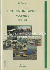 Eltham District Historical Society Inc
Book, VicRoads, Discussion Papers Volume 1, July 1989
... ...rural development...Volume One consists of the following discussion papers: road safety, rural development, conservation and the environment, future rural transport task and traffic in towns. ...VICROADS Discussion papers address key issues that have been identified by the community, through regional workshops, as having particular significance in determining the direction that should be taken in managing the rural arterial road system in Victoria to the year 2000. Volume One consists of the following discussion papers: road safety, rural development, conservation and the environment, future rural transport task and traffic in towns.non-fictionVICROADS Discussion papers address key issues that have been identified by the community, through regional workshops, as having particular significance in determining the direction that should be taken in managing the rural arterial road system in Victoria to the year 2000. Volume One consists of the following discussion papers: road safety, rural development, conservation and the environment, future rural transport task and traffic in towns.roads, vicroads, rural areas, road safety, rural development, conservation, traffic -
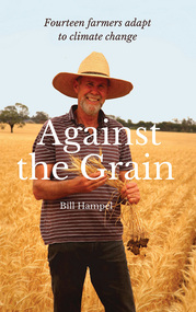 Phillip Island and District Historical Society Inc.
Book, Bill Hampel, Against the grain : fourteen farmers adapt to climate change, 2015
... ...rural development -- australia....A summary of climate change impacts - and an account of the numerous economic, political, and media barriers toward change - combine to provide a context for their work. agriculture -- environmental aspects -- australia. farmers -- australia -- economic conditions. rural development -- australia. climatic changes -- australia. ...Can we humans simply ignore the fires, the floods, and the increase in deaths brought about by climate change? In this book, Australian farmers - who bear the brunt of climate change, yet accept the science - share their experiences with the unpredictable weather events, the reduction in rainfall, and the shift to hotter months which are a challenge to farming cycles. Far from contributing to the problem with their farming practices, these farmers demonstrate how to reduce their greenhouse gases - to zero or below in some cases - while remaining profitable. They are all committed to pass on their farm in a better condition than when they first purchased or inherited it. With crops or livestock, big or small, they have worked cooperatively, mostly through land management, to plant thousands of trees, which has led to the daily presence of over 100 bird species. The farmers' inspiring and informative stories will open up a new world to most urban dwellers. A summary of climate change impacts - and an account of the numerous economic, political, and media barriers toward change - combine to provide a context for their work. 280 pages : colour illustrations, colour maps, colour portraits ; 23 cm. Includes bibliographical references and index. Also available in digital formats: ebook & epdf. ISBN 9781925078503 Dewey number 338.10994 Chapter 5 : Bob & Anne Davie Donor : Anne Davie ; Date : 14.10.2015.agriculture -- environmental aspects -- australia., farmers -- australia -- economic conditions., rural development -- australia., climatic changes -- australia. -
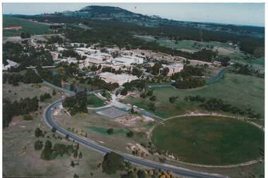 Buninyong & District Historical Society
Photograph - Colour Photograph of Mt Helen Campus, Aerial view of University of Ballarat, Mt. Helen Campus c1991
... ...Rural Development...Helen Campus Tertiary Education Mount Buninyong Rural Development Mt. Helen Campus. Aerial view to Mt. ...Mount Helen Campus in its later building stages before becoming the University of Ballarat in 1994The University of Ballarat was formed from a number of varying types of tertiary schools, the earliest being the School of Mines in 1870 and finally became a University in 1994 Aerial view Mount Helen Campus c1991Mt. Helen Campus. Aerial view to Mt. Buninyong c. 1991university of ballarat, mt. helen campus, tertiary education, mount buninyong, rural development -
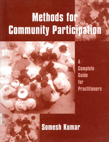 Victorian Aboriginal Corporation for Languages
Book, Somesh Kumar, Methods for community participation : a complete guide for practitioners, 2002
... ...rural development...Victorian Aboriginal Corporation for Languages 33 Saxon Street Brunswick melbourne community development rural development maps, b&w illustrations, tables, charts A manual for participatory development. ...A manual for participatory development.maps, b&w illustrations, tables, chartscommunity development, rural development -
Marysville & District Historical Society
THE TRIANGLE NEWS-VOL 40 NO 19-MAY 24 2013
... deputy premier and minister for regional & rural development...marysville victoria australia $28 million vibe hotel marsyville breaks ground deputy premier and minister for regional & rural development peter ryan what's on when in may and june buxton recreational reserve working bee intrepid triangle bushwalkers the committee of management of the gallipoli park precinct marysville community market creative triangle fire services levy now part of rates notices church notices triangle community dinner el kanah village biggest morning tea a success vale brian moore murrindindi shire council payment of rate installment position vacant mayor's chair marysville primary school mother's day raffle advertisements buxton fire brigade anna's mobile patchwork quilt shop open capital works program supports existing infrastructure villains storm home to first ever away victory staff wanted black spur inn greenlands guesthouse open by lachlan fraser building our future draft council plan released for comment emotions anonymous international buxton hotel real estate marysville golf report snowgum hillary challenge comes to marysville last quarter assault gets villains home free mulch loading triangle community dance group marysville villains sponsors and members lunch randy the puppet is back for lunch draft council plan and budget have your say melbourne international comedy festival marysville & district lions club road maintenance and construction works free information session council delivers conservative draft budget yarra valley div 1 game in marysville a success THE TRIANGLE NEWS-VOL 40 NO 19-MAY 24 2013 ...marysville, victoria, australia, $28 million vibe hotel marsyville breaks ground, deputy premier and minister for regional & rural development, peter ryan, what's on when in may and june, buxton recreational reserve, working bee, intrepid triangle bushwalkers, the committee of management of the gallipoli park precinct, marysville community market, creative triangle, fire services levy now part of rates notices, church notices, triangle community dinner, el kanah village, biggest morning tea a success, vale brian moore, murrindindi shire council, payment of rate installment, position vacant, mayor's chair, marysville primary school mother's day raffle, advertisements, buxton fire brigade, anna's mobile patchwork quilt shop open, capital works program supports existing infrastructure, villains storm home to first ever away victory, staff wanted black spur inn, greenlands guesthouse open by lachlan fraser, building our future draft council plan released for comment, emotions anonymous international, buxton hotel, real estate, marysville golf report, snowgum hillary challenge comes to marysville, last quarter assault gets villains home, free mulch loading, triangle community dance group, marysville villains sponsors and members lunch, randy the puppet is back for lunch, draft council plan and budget have your say, melbourne international comedy festival, marysville & district lions club, road maintenance and construction works free information session, council delivers conservative draft budget, yarra valley div 1 game in marysville a success -
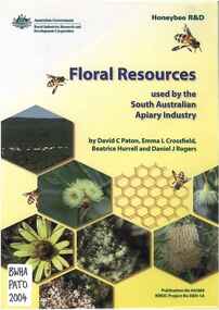 Beechworth Honey Archive
Publication, Floral resources used by the South Australian apiary industry (Paton, D. C. et al), 2004, 2004
... Canberra, Rural Industries Research & Development Corporations ... -
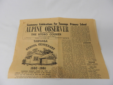 Kiewa Valley Historical Society
Newspaper Article - Tawonga School Centenary 1980 x2, Alpine Courier incorporating The Hydro Courier, 1980
... rural school development...The article also covers the changes brought about by the increased employment opportunities from SEC Kiewa Works(1935), the Sawmill(1946), the Gold mine(1949) and the Tobacco Industry (largest growing area in Australia). rural school development tawonga school centenary kiewa valley development 1880 to 1980 "Centenary Celebrations For Tawonga Primary School" below this in an enclosed heading "ALPINE OBSERVER" underneath in smaller print "WITH WHICH IS INCORPORATED" below this in larger print "THE HYDRO COURIER" and below this from left to right, "No. 719 (Vol. 3) THURSDAY, 23rd OCTOBER, 1980" next "in smaller print Recommended Price Single Copy, 20c "(cents) This item is a one page (original) article of the centenary celebrations for Tawonga Primary School came from the Alpine Observer and incorporated the Hydro Courier. ...This newspaper article was produced at a time when newspapers were the main source of local information. The period before the explosion of mobile communication technology and the cost effectiveness of communication by "texting" and internet "social connections, eg. facebook and other social media networkings" The newspapers were the main links between and within large regions. The Hydro Courier was first printed in 1950 as a YMCA community service publication by Mr. Albert Clarke YMCA Officer and Mr. Alex McCullough a State Electricity Commission employee. This paper was one very important publication that provided relevant community information to all and was the major contributer to the "Valley" cohesive fibre and unity. This article not only records the celebration (centenary) of the Tawonga School but also presents the history of the school and important events such as various relocations of classrooms and how the region was settled and developed from the 1870's onward. The yawonga school opened in 1880 on 8 acres of land. It consisted of one large wooden building (22 ft x 11 ft). It had two windows, one brick chimney, bare wooden floor and a shingle roof. This article also presents the time when Mount Beauty area was likened to an island and occasionally school children could not attend school because of a flooded Kiewa river. The article also covers the changes brought about by the increased employment opportunities from SEC Kiewa Works(1935), the Sawmill(1946), the Gold mine(1949) and the Tobacco Industry (largest growing area in Australia).This item is a one page (original) article of the centenary celebrations for Tawonga Primary School came from the Alpine Observer and incorporated the Hydro Courier. It covers the arrangements for the celebration of the 100 years of the school's existence. The printed layout is typical of the typeset in use in 1980's. There are seven distinctive type collumns separated by a printed line. Three photographs are published with one photograph of a demountable classromm ,circa 1980, and the other two of student class photos of 1899 and 1914. Teacher and student names are listed below each photograph. On the back of this page are "specials" for "Sam's Cut Price Stores", specifically the Myrtleford store. Of interest is the advertisement of "Cartons of Cigarettes at cut prices". The page was produced as part of a "run" with "telltale" holes at each corner for stabilising the page in the printing process."Centenary Celebrations For Tawonga Primary School" below this in an enclosed heading "ALPINE OBSERVER" underneath in smaller print "WITH WHICH IS INCORPORATED" below this in larger print "THE HYDRO COURIER" and below this from left to right, "No. 719 (Vol. 3) THURSDAY, 23rd OCTOBER, 1980" next "in smaller print Recommended Price Single Copy, 20c "(cents)rural school development, tawonga school centenary, kiewa valley development 1880 to 1980 -
Marysville & District Historical Society
THE TRIANGLE NEWS-VOL 39 NO 30-AUGUST 10 2012
... ...rural living development guidelines review...Marysville & District Historical Society 39 Darwin Street Marysville yarra-valley-and-the-dandenong-ranges marysville victoria australia winter warrier challenge at lake mountain marysville tourism & events marketing program tom hafey villains football advertisements rural living development guidelines review marysville & district historical society next mdhs meeting heritage rose society of victoria THE TRIANGLE NEWS-VOL 39 NO 30-AUGUST 10 2012 ...marysville, victoria, australia, winter warrier challenge at lake mountain, marysville tourism & events marketing program, tom hafey, villains football, advertisements, rural living development guidelines review, marysville & district historical society, next mdhs meeting, heritage rose society of victoria -
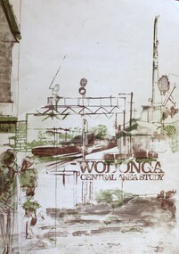 Wodonga & District Historical Society Inc
Book - Wodonga Central Area Study, Loder and Bayly, Planning & Engineering Consultants, March 1975
... Albury-Wodonga development...Rural...The report was presented to the Albury-Wodonga Development Corporation and the Rural City of Wodonga....Wodonga & District Historical Society Inc Hut 97, Bonegilla Migrant Experience, 132 Bonegilla Road Bonegilla the-murray Wodonga Town planning Albury-Wodonga development Rural City of Wodonga This report was the result of an investigation into the potential future development and town planning for the central area of Wodonga. ...This report was the result of an investigation into the potential future development and town planning for the central area of Wodonga. Chapters of the final report are:- Chapter 1: Summary: Conclusions and Recommendations, Chapter 2: Setting the scene, Chapter 3: Possible futures, Chapter 4: Objectives, Chapter 5: Growth Options, Chapter 6: Recommended approaches, Chapter 7: Plan elements and Chapter 8: Ways and Means.A report of 134 pages, including illustrations and maps. The report was presented to the Albury-Wodonga Development Corporation and the Rural City of Wodonga.This report was the result of an investigation into the potential future development and town planning for the central area of Wodonga. Chapters of the final report are:- Chapter 1: Summary: Conclusions and Recommendations, Chapter 2: Setting the scene, Chapter 3: Possible futures, Chapter 4: Objectives, Chapter 5: Growth Options, Chapter 6: Recommended approaches, Chapter 7: Plan elements and Chapter 8: Ways and Means.wodonga town planning, albury-wodonga development, rural city of wodonga -
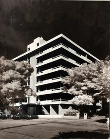 Robin Boyd Foundation
Photograph
... High rise building on one side and a possible rural development site with a few trees in the background. ...Robin Boyd Foundation 290 Walsh Street South Yarra melbourne High rise building on one side and a possible rural development site with a few trees in the background. ...High rise building on one side and a possible rural development site with a few trees in the background. Nothing is known about this, or when it was made.Black and white photograph -
Beechworth Honey Archive
Publication, Honeybee R&D News
... Published by the Australian Government- Rural Industries Research and Development Corporation. No.3 August 2009 - ...Beechworth Honey Archive 87 Ford Street Beechworth high-country Honeybee R&D News Australian Government Rural Industries Beechworth Honey Published by the Australian Government- Rural Industries Research and Development Corporation. No.3 August 2009 - Honeybee R&D News Publication ...Published by the Australian Government- Rural Industries Research and Development Corporation. No.3 August 2009 - honeybee, r&d, news, australian government, rural industries, beechworth honey -
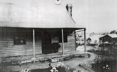 The Beechworth Burke Museum
Photograph, c1900
... This photograph is an example of rural development in the Wooragee area, showing the cottage, tents, and garden beds. ...This photograph is an example of rural development in the Wooragee area, showing the cottage, tents, and garden beds. ...This photograph shows a small timber house in Wooragee. In 1855, the Ovens district made a shift towards farming development that included the sales of land in the Wooragee Valley. This shift came because of miner's demands and concern about stabilising the area around the goldfield. Continual migration needed to be supported, unlucky diggers needed alternative employment, and there was a lack of affordable fresh produce available on the goldfields. Initially, the cost of land in areas like Wooragee was prohibitive, and miners chose to squat rather than overpay for poor land. Throughout the 1850s and 1860s, land reform was a key topic for miners and politicians, as they attempted to improve land access and protect financial interests. This photograph is an example of rural development in the Wooragee area, showing the cottage, tents, and garden beds. While the date is unknown, the image nevertheless links us to the 1850s-1860s story of rural development in Indigo Shire. Black and white rectangular photo, copy of original, printed on paper. wooragee, timber, timber cottage, corrugated iron, cottage, housing, tents, gardening, farming, farming and agriculture, construction, garden bed, flowers, verandah, squatting, tent, field -
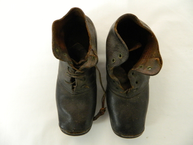 Kiewa Valley Historical Society
Boots, circa 1940s to 1950s
... In this era of rural development shoes, especially children footwear, were regarded as a longer term requirement that only required the soles and heels to be replaced. ...In this era of rural development shoes, especially children footwear, were regarded as a longer term requirement that only required the soles and heels to be replaced. ...The construction of these boots suggests that it was not purchased locally or from any large town. It may have been introduced by a wandering caravan trader in clothes and shoes. In this era of rural development shoes, especially children footwear, were regarded as a longer term requirement that only required the soles and heels to be replaced. Multiple shoe types were not common only basics that could be handed down. The policy of one main work/play shoe and one church shoe (special occasion) was the norm at this point in history.Worn by Everil Fisher (girl) at Dederang in 1880. They have 'copper toes' and are 'Hob Nail' These items although very basic were what the region required and was applicable to all levels of society at this time. Durability and no fashion infiltration from larger cities resulted in a spartan attitude to basic living requirements. The rural regions of this area were more in focus to the character of the person rather than what was worn. The personal interactions of everyone in the region were more "true blue" than that of the cities. The concept of "mate-ship' far outweighed the type of fashion being wornBrown/Black ankle high boot for child age 4 (approx). Tongue and six eyelets with broken leather laces. Hob Nail visible on soles and heel. Copper Toes. costume, children's footwear, boots, anklets -
Lakes Entrance Historical Society
Book, Tambo Shire, Shire of Tambo Planning Report 1990, 1990
... The Guide to planning and co-ordinating the development of Rural Residential and general rural subdivision through the municipality of Tambo Shire for the next five years...Local Government Township The Guide to planning and co-ordinating the development of Rural Residential and general rural subdivision through the municipality of Tambo Shire for the next five years Shire of Tambo Planning Report 1990 Book Tambo Shire ...The Guide to planning and co-ordinating the development of Rural Residential and general rural subdivision through the municipality of Tambo Shire for the next five yearslocal government, township -
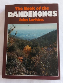 Mont De Lancey
Book, John Larkins, The Book of the Dandenongs, 1978
... The book features 192 pages with illustrations, documenting the area's forests, history of settlement, and development from rural to suburban. It highlights the "little train" Puffing Billy, timber felling, market gardens, and the transformation of the landscape. ...Mont De Lancey 71 Wellington Road Wandin North yarra-valley-and-dandenong-ranges The book features 192 pages with illustrations, documenting the area's forests, history of settlement, and development from rural to suburban. It highlights the "little train" Puffing Billy, timber felling, market gardens, and the transformation of the landscape. ...The Book of the Dandenongs by John Larkins (1978) is a detailed, illustrated history and description of Victoria's Dandenong Ranges, exploring the area's transition from early timber-getting to a tourist destination. It covers the region's unique culture, bushfires, and landmarks like Puffing Billy.A brown hardcover book with a brown and colourful dust jacket featuring an autumn photograph of the countryside from the Dandenong Ranges in Victoria. The title is printed at the top of the front cover in orange and white lettering along with the author. The front and back end papers have a photograph of a green illustration of Melbourne as seen from the Dandenongs. The front flap of the dust jacket gives an overview of the contents and the back one gives details of the author, John Larkin and his background. The title page notes the title, author and publisher information. Further titles written by this author are listed opposite the title page. Inside are Contents, Acknowledgements, Chapters on the history, photographs throughout and an Index at the back. P. 192.non-fictionThe Book of the Dandenongs by John Larkins (1978) is a detailed, illustrated history and description of Victoria's Dandenong Ranges, exploring the area's transition from early timber-getting to a tourist destination. It covers the region's unique culture, bushfires, and landmarks like Puffing Billy. history - victoria, history - the dandenongs, tourism - victoria -
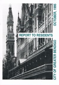 Bendigo Historical Society Inc.
Book - BOOKLET: ''REPORT TO RESIDENTS CITY OF GREATER BENDIGO, OCTOBER 1995''
... Table of Contents; Commissioners; Chief Executive Officer; Council meetings; Office location and hours; ''One Telephone Number''; Committees; Ward boundaries; Elections; Customer services; Rural services; Economic development; Bendigo Tourism Board; Bendigo Trust; Events Bendigo; Capital works 1995/96; Major projects; Discovery; Bendigo Regional Arts Centre; local laws; Fire prevention; Aged and disability services; Children and family services; Environmental health; Recreation and leisure; Parks and gardens; Planning and building; Waste management; Library services; Bendigo Leisureland; Rates; Budget for 1995/96; Index. ...Table of Contents; Commissioners; Chief Executive Officer; Council meetings; Office location and hours; ''One Telephone Number''; Committees; Ward boundaries; Elections; Customer services; Rural services; Economic development; Bendigo Tourism Board; Bendigo Trust; Events Bendigo; Capital works 1995/96; Major projects; Discovery; Bendigo Regional Arts Centre; local laws; Fire prevention; Aged and disability services; Children and family services; Environmental health; Recreation and leisure; Parks and gardens; Planning and building; Waste management; Library services; Bendigo Leisureland; Rates; Budget for 1995/96; Index. ...Front cover is a photo of The Shamrock Hotel. 52 paged booklet - ''Report to Residents - City of Greater Bendigo, October 1995''. Table of Contents; Commissioners; Chief Executive Officer; Council meetings; Office location and hours; ''One Telephone Number''; Committees; Ward boundaries; Elections; Customer services; Rural services; Economic development; Bendigo Tourism Board; Bendigo Trust; Events Bendigo; Capital works 1995/96; Major projects; Discovery; Bendigo Regional Arts Centre; local laws; Fire prevention; Aged and disability services; Children and family services; Environmental health; Recreation and leisure; Parks and gardens; Planning and building; Waste management; Library services; Bendigo Leisureland; Rates; Budget for 1995/96; Index. Contains some photographs and map of proposed 7 internal Wards for the City of Greater Bendigo.Richard Cambridge Printers Bendigo.bendigo, council, report, maxine crouch, maurie sharkey, perer ross-edwards, peter seamer, hadley sides, richard morriss, bernard smith, annie galvin child care centre, bendigo regional art centre, rosalind park, budget 1995/96. bendigo health care services. -
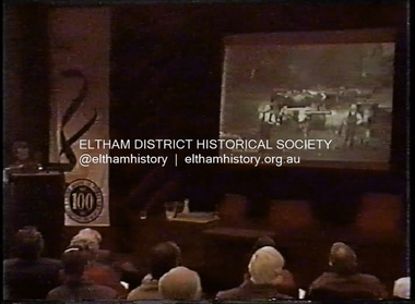 Eltham District Historical Society Inc
Film - Video (DVD), Melbourne and Metropolitan Board of Works, Yarra River Conference Proceedings; a Board of Works centenary event, 13-16 April 1991
... development of Melbourne. Conceived and presented by a group of prominent historians as a chronological 'trip down the river in time', and profusely illustrated with slides, this segment traced the various impacts that urban and rural growth, development of marine commerce, recreational uses, and environmental problems have had on the Yarra during a century and a half of European occupation. ...development of Melbourne. Conceived and presented by a group of prominent historians as a chronological 'trip down the river in time', and profusely illustrated with slides, this segment traced the various impacts that urban and rural growth, development of marine commerce, recreational uses, and environmental problems have had on the Yarra during a century and a half of European occupation. ...Yarra River Conference History Segment [Noted on VHS tape jackets "Due to unavoidable circumstances, the quality of these tapes in some setions is less than desired."] The Yarra River Conference, organised by the Board of Works as part of the Centenary Celebrations, was held in the Board's Head Office Theatrette from 13-16 April, 1991. A segment of the Conference focussed on the role that the Yarra River has played in relation to the historical development of Melbourne. Conceived and presented by a group of prominent historians as a chronological 'trip down the river in time', and profusely illustrated with slides, this segment traced the various impacts that urban and rural growth, development of marine commerce, recreational uses, and environmental problems have had on the Yarra during a century and a half of European occupation. As no formal written paper of this combined presentation is available, these two video-tapes provide a record for anyone who has an interest in tis fascinating aspect of the Yarra's history. The speakers who combined to present this segment are identified on the cover of Tape 2. Tape 1 (2 hours) 1838-1863 Deputy ?? to Utility Early navigators of the Yarra River; developing the port of Melbourne; the gold rush and its effect on the new colony; punts and bridges; water supply; pollution of the Yarra; the discovery of gold and early settlement of the Yarra valley; floods of 1839 and 1863. 1863-1891 Formation of the Harbour Trust; Coode Canal; pollution of the Yarra by industry; aborigines, gold miners, timber getters in the Upper Yarra areas; bridges; the flood of 1891. Tape 2 ( 1 1/2 hours) 1892-1934: People Begin to See Beauty and Romance to the River Henley-on-Yarra; realignment of the Yarra; MMBW is responsible for a sewerage system; new docks to cope with increased overseas trade; development of recreational parks; new reservoirs; timber production and timber tramways; bushfire; flood of 1934. 1935-1970: The River is Neglected Still, Except When it Proves Useful Bushfirs of 1939; the end of many sawmills; birth of tourism; increased interest in conservation and preservation of land for open space; further augmentation of water supply system; birth of containerisation changes the port; environmental concerns gain momentum. Speakers Dr Tony Dingle *, Department of Economic History, Monash University Dr Carolyn Rasmussen *, History Consultant Prof. Graeme Davison, History Department, Monash University Mr. Tom Griffiths, Lecturer in Public History, Monash Uiversity Mr. Patrick Miller, History Consultant Mr. Colin Jones, Author and Historian * Co-authors of the Board's history, 'Vital Connections'.video recording, yarra river, conference proceedings -
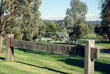 Eltham District Historical Society Inc
Slide - Photograph, Eltham Town Park, c.May 1988
... The character of the valley area has remained rural while development occurred on each side. Early photos show the area as orchard and grazing land. ...The character of the valley area has remained rural while development occurred on each side. Early photos show the area as orchard and grazing land. ...In 1981 the Shire of Eltham Historical Society was asked by the Victorian Place Names Committee to comment on a proposal by the Shire of Eltham to assign names to parklands in Eltham as follows:- "Eltham Common" - the area between the municipal offices, Main Road, the Eltham railway -line, and Panther Place and containing Shillinglaw Cottage. The Shire has advised that this name has been used locally for the site since about 1975. "Alistair Knox Park" - the area bounded by the Eltham railway -line, Panther Place, Main Road, Bridge Street, and Susan Street, and through which flows the Diamond Creek. The area has been known locally as "Eltham Town Park" The proposed name "Alistair Knox Park" had created some local controversy with a number of reversals of the Council's decision and letters to the local paper both for and against the proposal. The society was reluctant to be drawn into this controversy particularly as there were known to be members with strong views both for and against the proposed name. The society appreciated the work done by Alistair Knox both in the formulation of the park concept and in its development but because of the controversy generated by the proposed naming and also because of the wide general use of the park by the public·, the name Eltham Town Park was felt more appropriate. The society noted that there was no outstanding historical associations with the land comprising the park which would warrant naming the park after any particular person, place or event. No objection was raised to the Eltham Common proposal as set-out above. The decision was made in the knowledge that Alistair Knox had been associated with the society over many years and was a prominent figure in the recent history of Eltham. He was regarded as a key figure in the environmental building movement and in particular was renowned for his use of mud bricks as a building material. He served as a councillor of the Shire of Eltham from 1971-1975, his final year as Shire President. It was during these years that the proposals to create the park in its present form were shaped and Alistair played a leading part in the decision to make it a landscaped passive recreational park rather than a sporting area. The parklands comprise a section of the Diamond Creek valley. The creek itself flows through the centre of the area which is overlooked by steep hills on each side. The parks form part of the land purchased from the Crown in 1851 by J.M. Holloway and then subdivided into allotments and called "Little Eltham". While most of the area was subdivided into residential lots the creek valley was subdivided into lots suitable for small farms. Some further subdivision took place over the years and the whole of the parks now comprises eight separate titles. A list of some of the former owners has been compiled but exhaustive research on all owners has not been carried out. The ownership of one parcel has been traced back to when it was purchased from Holloway by John Hicks Petty in 1874, long after it was subdivided. Other families owning land within the area over the years included Lyon, Rees, Clark, Waterfall, Carrucan, Graham, Hill and Morant. The character of the valley area has remained rural while development occurred on each side. Early photos show the area as orchard and grazing land. In 1901 the railway was constructed through the area resulting in the timber trestle bridge across the Diamond Creek. which is an important feature of the park landscape. A memorial obelisk to the Eltham servicemen killed in World War 1 was erected at the south eastern corner of the park. The site is now within the intersection of Main Road and Bridge Street and the memorial was shifted in the 1950s to the Eltham R.S.L. clubrooms. Following the financial failure of the local sub-branch, the memorial obelisk was again relocated to the Eltham War Memorial building precinct in 2011. During the early 1960's the Council started purchasing the land which now comprises the parks. In the late 1960's the area to the east of the Diamond Creek was used as a garbage tip and filled above the flood plain of the creek. When this area was filled the tip was transferred to the west side of the creek. From the early 1970's the area has been progressively developed as a park for passive recreation with ornamental lakes, extensive tree planting and landscaping. The character of the valley before the days of the tip has been recreated and this has earned a Landscape classification from the National Trust, an unusual honour for a man-made landscape. The parks are not only attractive in appearance. The large number of people using them, particularly at weekends and holidays is evidence of their popularity and the foresight and careful planning of local residents, Councillors and Council Staff. 35mm colour positive transparency (1 of 23) Mount - Kodak EktachromeProcess Date MAY 88Meltham, main road, alistair knox park, eltham town park -
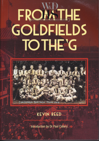 Warrnambool and District Historical Society Inc.
Book, Kevin Reed, From the Goldfields to the G, 2014
... Reed’s book describes the development of Australian Football in rural and suburban Victoria. ...Reed’s book describes the development of Australian Football in rural and suburban Victoria. ...An account of the development of Australian Rules football in both rural and suburban Victoria.This is a paper back book with a red and gold cover with a photograph of Costerfield Football Team, 1919 on the cover (335 pages) The book is signed inside by Kevin Reed non-fictionAn account of the development of Australian Rules football in both rural and suburban Victoria.warrnambool, kevin reed, dr john douglas, warrnambool cricket 1980's, warrnambool football 1970's 1980's