Showing 236 items matching "sandhurst parish"
-
 Bendigo Historical Society Inc.
Map - RESURVEY, PARISH OF SANDHURST, 1/08/1891
... RESURVEY, PARISH OF SANDHURST......Parish of Sandhurst resurvey...Map: Resurvey , Parish of Sandhurst sheet 3. Parish plan ( number 203 in Map Cupboard 1)...History House 11 Mackenzie Street Bendigo goldfields MAP Bendigo parish plan Parish of Sandhurst resurvey Map: Resurvey , Parish of Sandhurst sheet 3. ...Map: Resurvey , Parish of Sandhurst sheet 3. Parish plan ( number 203 in Map Cupboard 1)map, bendigo, parish plan, parish of sandhurst resurvey -
Bendigo Historical Society Inc.
Map - PARISH OF SANDHURST 1961, 1961
... PARISH OF SANDHURST 1961...At Bendigo Parish of Sandhurst. Sheet 13...History House 11 Mackenzie Street Bendigo goldfields BHS Collection BENDIGO Land sales parish map Dept of Lands and Survey At Bendigo Parish of Sandhurst. Sheet 13 Map PARISH OF SANDHURST 1961 ...BHS CollectionAt Bendigo Parish of Sandhurst. Sheet 13Dept of Lands and Surveybendigo, land sales, parish map -
Bendigo Historical Society Inc.
Map - PARISH OF SANDHURST 1961, 1961
... PARISH OF SANDHURST 1961...At Bendigo Parish of Sandhurst. Sheet F....History House 11 Mackenzie Street Bendigo goldfields BHS Collection BENDIGO Land sales parish map Dept of Lands and Survey At Bendigo Parish of Sandhurst. Sheet F. Map PARISH OF SANDHURST 1961 ...BHS CollectionAt Bendigo Parish of Sandhurst. Sheet F.Dept of Lands and Surveybendigo, land sales, parish map -
Bendigo Historical Society Inc.
Map - PARISH OF SANDHURST SHEET 5A, 1970
... PARISH OF SANDHURST SHEET 5A......parish of Sandhurst...Map: Parish of Sandhurst Sheet 5A, County of Bendigo. Parish plan ( number 161 in Map Cupboard 1)...History House 11 Mackenzie Street Bendigo goldfields MAP Bendigo parish plan parish of Sandhurst County of Bendigo Map: Parish of Sandhurst Sheet 5A, County of Bendigo. ...Map: Parish of Sandhurst Sheet 5A, County of Bendigo. Parish plan ( number 161 in Map Cupboard 1)map, bendigo, parish plan, parish of sandhurst, county of bendigo -
 Bendigo Historical Society Inc.
Map - CAMPBELL COLLECTION: BENDIGO AND DISTRICT MAPS
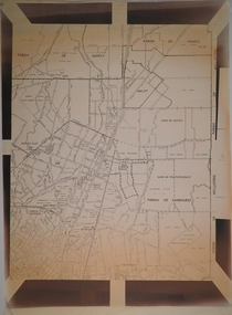
... Map. Sandhurst and suburbs, Parish of Sandhurst, Parish of Huntly, Parish of Nerring, Parish of Marong, Parish of Lockwood, Parish of Wellsford, Parish of Strathfieldsaye, Parish of Mandurang...MAP Bendigo parishes Map. Sandhurst and suburbs, Parish of Sandhurst, Parish of Huntly, Parish of Nerring, Parish of Marong, Parish of Lockwood, Parish of Wellsford, Parish of Strathfieldsaye, Parish of Mandurang Map CAMPBELL COLLECTION: BENDIGO AND DISTRICT MAPS. ...Map. Sandhurst and suburbs, Parish of Sandhurst, Parish of Huntly, Parish of Nerring, Parish of Marong, Parish of Lockwood, Parish of Wellsford, Parish of Strathfieldsaye, Parish of Mandurangmap, bendigo, parishes -
Bendigo Historical Society Inc.
Map - PART PARISHES OF SANDHURST MARONG AND NERRING, No date visible
... ...Parish of Sandhurst... Parish...History House 11 Mackenzie Street Bendigo goldfields MAP Bendigo city streets Parish of Sandhurst Parish of Marong Parish of Nerring Ironbark Eaglehawk Myers Flat Map: Section of a Parish plan of Bendigo, covering Ironbark, Eaglehawk and Myers Flat ( number 145 in Map Cupboard 1) Map PART PARISHES OF SANDHURST MARONG AND NERRING ...Map: Section of a Parish plan of Bendigo, covering Ironbark, Eaglehawk and Myers Flat ( number 145 in Map Cupboard 1)map, bendigo, city streets, parish of sandhurst, parish of marong, parish of nerring, ironbark, eaglehawk, myers flat -
 Bendigo Historical Society Inc.
Map - CAMPBELL COLLECTION: BENDIGO AND DISTRICT MAPS
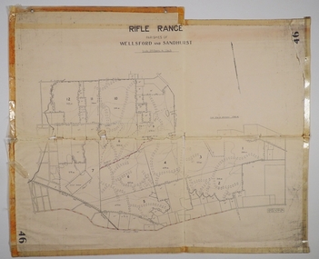
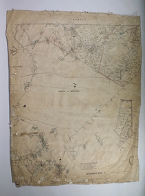
... ...Sandhurst Parish...Rifle Range, Parishes of Wellsford and Sandhurst. Scale 20 chains to 1 inch. ...MAP Bendigo allotments Bendigo Rifle Range Sandhurst Parish Wellsford Parish H.A.D.(Darby). ...Map. Rifle Range, Parishes of Wellsford and Sandhurst. Scale 20 chains to 1 inch. Total area in plan is 5916 acres. Wallan and Bendigo Railway to Axedale Township and station 8 miles, to Longlea Railway Station 2 1/2 - 3 miles. Rifle Range. Compiled in W.P.B. from Assessment and Parish Plans, by H.A.D. 8-7-29H.A.D.(Darby).map, bendigo, allotments, bendigo rifle range, sandhurst parish, wellsford parish -
Bendigo Historical Society Inc.
Map - RESURVEY PARISH OF SANDHURST, 23/07/1891
... RESURVEY PARISH OF SANDHURST......Parish of Sandhurst...History House 11 Mackenzie Street Bendigo goldfields MAP Bendigo parish plan Parish of Sandhurst Resurvey Map: Resurvey, Parish of Sandhhurst sheet No. ...Map: Resurvey, Parish of Sandhhurst sheet No. IV, Enlargement of part of sheet No. III. Parish plan ( number 204 in Map Cupboard 1)map, bendigo, parish plan, parish of sandhurst, resurvey -
 Bendigo Historical Society Inc.
Map - CAMPBELL COLLECTION: BENDIGO AND DISTRICT MAPS
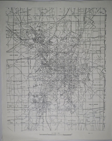
... Map. Parish of Sandhurst, Parish of Huntly, Parish of Nerring, Parish of Marong, Parish of Lockwood, Parish of Wellsford, Parish of Strathfieldsaye, Parish of Mandurang. ...MAP Bendigo parishes Map. Parish of Sandhurst, Parish of Huntly, Parish of Nerring, Parish of Marong, Parish of Lockwood, Parish of Wellsford, Parish of Strathfieldsaye, Parish of Mandurang. ...Map. Parish of Sandhurst, Parish of Huntly, Parish of Nerring, Parish of Marong, Parish of Lockwood, Parish of Wellsford, Parish of Strathfieldsaye, Parish of Mandurang. Scale approx 1:18,000.map, bendigo, parishes -
Bendigo Historical Society Inc.
Map - MANDURANG, November 6th 1854
... Map: The village of Mandurang situated about 6 miles from Sandhurst, Parish of Mandurang ( number 155 in Map Cupboard 1)...History House 11 Mackenzie Street Bendigo goldfields MAP Bendigo village Mandurang Map: The village of Mandurang situated about 6 miles from Sandhurst, Parish of Mandurang ( number 155 in Map Cupboard 1) Map MANDURANG ...Map: The village of Mandurang situated about 6 miles from Sandhurst, Parish of Mandurang ( number 155 in Map Cupboard 1)map, bendigo, village, mandurang -
Bendigo Historical Society Inc.
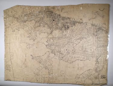
Map - SANDHURST, Circa 1906
... ...parish plan...Sandhurst...Map: Parish of Sandhurst, County of Bendigo. Parish plan...History House 11 Mackenzie Street Bendigo goldfields MAP Bendigo parish plan Sandhurst Map: Parish of Sandhurst, County of Bendigo. ...Map: Parish of Sandhurst, County of Bendigo. Parish planmap, bendigo, parish plan, sandhurst -
 Bendigo Historical Society Inc.
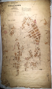
Map - BOROUGH OF EAGLEHAWK SHEET 1, 9/12/1902
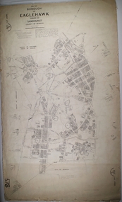
... Map: Borough of Eaglehawk, sheet No. 1, Parish of Sandhurst, County of Bendigo. Parish plan...History House 11 Mackenzie Street Bendigo goldfields MAP Bendigo parish plan Borough of Eaglehawk Map: Borough of Eaglehawk, sheet No. 1, Parish of Sandhurst, County of Bendigo. Parish plan Map BOROUGH OF EAGLEHAWK SHEET 1 ...Map: Borough of Eaglehawk, sheet No. 1, Parish of Sandhurst, County of Bendigo. Parish planmap, bendigo, parish plan, borough of eaglehawk -
 Bendigo Historical Society Inc.
Map - CAMPBELL COLLECTION: BENDIGO AND DISTRICT MAPS
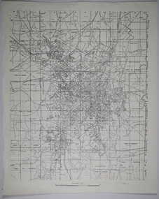
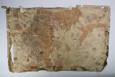
... Eastern area of Bendigo, Parish of Huntly, Ascot, Shire of Huntly, Jackass Flat, Old White Hills, White Hills, Emu Point, North Bendigo, East Bendigo, Strathdale, Parish of Strathfieldsaye, Parish of Sandhurst, Parish of Wellsford....Eastern area of Bendigo, Parish of Huntly, Ascot, Shire of Huntly, Jackass Flat, Old White Hills, White Hills, Emu Point, North Bendigo, East Bendigo, Strathdale, Parish of Strathfieldsaye, Parish of Sandhurst, Parish of Wellsford. Map CAMPBELL COLLECTION: BENDIGO AND DISTRICT MAPS. ...Map. Eastern area of Bendigo, Parish of Huntly, Ascot, Shire of Huntly, Jackass Flat, Old White Hills, White Hills, Emu Point, North Bendigo, East Bendigo, Strathdale, Parish of Strathfieldsaye, Parish of Sandhurst, Parish of Wellsford.map, bendigo, parishes -
 Bendigo Historical Society Inc.
Map - PART OF THE BOROUGH OF EAGLEHAWK, 9/12/1902
... ... Parish of Sandhurst...Map: Part of the Borough of Eaglehawk, Parish of Sandhurst, County of Bendigo. Parish plan Canvas backed....History House 11 Mackenzie Street Bendigo goldfields MAP Bendigo city streets Borough of Eaglehawk Parish of Sandhurst County of Bendigo Map: Part of the Borough of Eaglehawk, Parish of Sandhurst, County of Bendigo. ...Map: Part of the Borough of Eaglehawk, Parish of Sandhurst, County of Bendigo. Parish plan Canvas backed.map, bendigo, city streets, borough of eaglehawk, parish of sandhurst, county of bendigo -
 Bendigo Historical Society Inc.
Map - SANDHURST SHEET 4, 11/03/1925
... ...parish plan...Sandhurst...Map: Sandhurst sheet 4. Parish plan...History House 11 Mackenzie Street Bendigo goldfields MAP Bendigo parish plan Sandhurst Map: Sandhurst sheet 4. Parish plan Map SANDHURST SHEET 4 ...Map: Sandhurst sheet 4. Parish planmap, bendigo, parish plan, sandhurst -
 Bendigo Historical Society Inc.
Map - SANDHURST SHEET 4, No date visible
... ...parish plan...Sandhurst...Map: Sandhurst sheet 4. Parish plan...History House 11 Mackenzie Street Bendigo goldfields MAP Bendigo parish plan Sandhurst Map: Sandhurst sheet 4. Parish plan Map SANDHURST SHEET 4 ...Map: Sandhurst sheet 4. Parish planmap, bendigo, parish plan, sandhurst -
 Bendigo Historical Society Inc.
Map - SANDHURST SHEET 2, 14/03/1923 ?
... ...parish plan...Sandhurst...Map: Sandhurst sheet 2. Parish plan...History House 11 Mackenzie Street Bendigo goldfields MAP Bendigo parish plan Sandhurst Map: Sandhurst sheet 2. Parish plan Map SANDHURST SHEET 2 ...Map: Sandhurst sheet 2. Parish planmap, bendigo, parish plan, sandhurst -
 Bendigo Historical Society Inc.
Map - SANDHURST SHEET 2, Date unreadable
... ...parish plan...Sandhurst...Map: Sandhurst sheet 2. Parish plan...History House 11 Mackenzie Street Bendigo goldfields MAP Bendigo parish plan Sandhurst Map: Sandhurst sheet 2. Parish plan Map SANDHURST SHEET 2 ...Map: Sandhurst sheet 2. Parish planmap, bendigo, parish plan, sandhurst -
 Bendigo Historical Society Inc.
Map - SANDHURST SHEET 3, June 29th 1967
... Map: Sandhurst sheet 3. Parish plan....History House 11 Mackenzie Street Bendigo goldfields MAP Bendigo city streets Sandhurst Early Bendigo Map: Sandhurst sheet 3. Parish plan. Map SANDHURST SHEET 3 ...Map: Sandhurst sheet 3. Parish plan.map, bendigo, city streets, sandhurst, early bendigo -
 Bendigo Historical Society Inc.
Map - SANDHURST SHEET 2, March 12th 1867
... Map: Sandhurst sheet 2 . Parish plan....History House 11 Mackenzie Street Bendigo goldfields MAP Bendigo city streets Sandhurst Early bendigo Map: Sandhurst sheet 2 . Parish plan. Map SANDHURST SHEET 2 ...Map: Sandhurst sheet 2 . Parish plan.map, bendigo, city streets, sandhurst, early bendigo -
Bendigo Historical Society Inc.
Map - TOWNSHIP OF KANGAROO FLAT, 27/01/1932
... Map: Township of Kangaroo flat, Parish of Sandhurst , County of Bendigo. Parish plan ( number 194 in Map Cupboard 1)...History House 11 Mackenzie Street Bendigo goldfields MAP Bendigo township Kangaroo flat Map: Township of Kangaroo flat, Parish of Sandhurst , County of Bendigo. Parish plan ( number 194 in Map Cupboard 1) Map TOWNSHIP OF KANGAROO FLAT ...Map: Township of Kangaroo flat, Parish of Sandhurst , County of Bendigo. Parish plan ( number 194 in Map Cupboard 1)map, bendigo, township, kangaroo flat -
Bendigo Historical Society Inc.
Map - BENDIGO WEST IRRIGATION SETTLEMENT, 27/07/1910
... Map: bendigo West Irrigation Settlement, Parish of Sandhurst, County of Bendigo. Parish plan ( number 193 in Map Cupboard 1)...History House 11 Mackenzie Street Bendigo goldfields MAP Bendigo irrigation settlement Bendigo West Irrigation Settlement Map: bendigo West Irrigation Settlement, Parish of Sandhurst, County of Bendigo. Parish plan ( number 193 in Map Cupboard 1) Map BENDIGO WEST IRRIGATION SETTLEMENT ...Map: bendigo West Irrigation Settlement, Parish of Sandhurst, County of Bendigo. Parish plan ( number 193 in Map Cupboard 1)map, bendigo, irrigation settlement, bendigo west irrigation settlement -
Bendigo Historical Society Inc.
Map - BENDIGO WEST IRRIGATION SETTLEMENT, 13/02/1909
... Map: Bendigo West Irrigation Settlement, Parish of Sandhurst, County of Bendigo. Parish plan. ( number 191 in Map Cupboard 1)...History House 11 Mackenzie Street Bendigo goldfields MAP Bendigo irrigation settlement Bendigo West Irrigatioon Settlement Map: Bendigo West Irrigation Settlement, Parish of Sandhurst, County of Bendigo. Parish plan. ( number 191 in Map Cupboard 1) Map BENDIGO WEST IRRIGATION SETTLEMENT ...Map: Bendigo West Irrigation Settlement, Parish of Sandhurst, County of Bendigo. Parish plan. ( number 191 in Map Cupboard 1)map, bendigo, irrigation settlement, bendigo west irrigatioon settlement -
 Bendigo Historical Society Inc.
Map - SANDHURST,. SHEET ?, 24/04/1907 ?
... ...parish plan...Sandhurst...Map: Sandhurst (sheet No. missing). Parish plan...History House 11 Mackenzie Street Bendigo goldfields MAP Bendigo parish plan Sandhurst Map: Sandhurst (sheet No. missing). ...Map: Sandhurst (sheet No. missing). Parish planmap, bendigo, parish plan, sandhurst -
Bendigo Historical Society Inc.
Map - SANDHURST SHEET 3, 27/05/1925
... ...parish plan...Sandhurst...Map: sandhurst sheet 3. Parish plan ( number 202 in Map Cupboard 1)...History House 11 Mackenzie Street Bendigo goldfields MAP Bendigo parish plan Sandhurst Map: sandhurst sheet 3. Parish plan ( number 202 in Map Cupboard 1) Map SANDHURST SHEET 3 ...Map: sandhurst sheet 3. Parish plan ( number 202 in Map Cupboard 1)map, bendigo, parish plan, sandhurst -
Bendigo Historical Society Inc.
Map - SANDHURST SHEET 3, No date visible
... Map: Sandhurst sheet 3. Parish plan ( number 199 in Map Cupboard 1)...History House 11 Mackenzie Street Bendigo goldfields MAP Bendigo city streets Sandhurst Map: Sandhurst sheet 3. Parish plan ( number 199 in Map Cupboard 1) Map SANDHURST SHEET 3 ...Map: Sandhurst sheet 3. Parish plan ( number 199 in Map Cupboard 1)map, bendigo, city streets, sandhurst -
Bendigo Historical Society Inc.
Map - SANDHURST SHEET 4, January 1947
... Map: Sandhurst sheet 4. Parish plan ( number 198 in Map Cupboard 1)...History House 11 Mackenzie Street Bendigo goldfields MAP Bendigo city streets Sandhurst Map: Sandhurst sheet 4. Parish plan ( number 198 in Map Cupboard 1) Map SANDHURST SHEET 4 ...Map: Sandhurst sheet 4. Parish plan ( number 198 in Map Cupboard 1)map, bendigo, city streets, sandhurst -
Bendigo Historical Society Inc.
Map - SANDHURST SHEET 5, Circa 1940's
... Map: Sandhurst sheet 5. Parish plan ( number 197 in Map Cupboard 1)...History House 11 Mackenzie Street Bendigo goldfields MAP Bendigo city streets Sandhurst Map: Sandhurst sheet 5. Parish plan ( number 197 in Map Cupboard 1) Map SANDHURST SHEET 5 ...Map: Sandhurst sheet 5. Parish plan ( number 197 in Map Cupboard 1)map, bendigo, city streets, sandhurst -
Bendigo Historical Society Inc.
Map - SANDHURST SHEET 6, 1947
... Map: Sandhurst sheet 6. Parish plan ( number 196 in Map Cupboard 1)...History House 11 Mackenzie Street Bendigo goldfields MAP Bendigo city streets Sandhurst Map: Sandhurst sheet 6. Parish plan ( number 196 in Map Cupboard 1) Map SANDHURST SHEET 6 ...Map: Sandhurst sheet 6. Parish plan ( number 196 in Map Cupboard 1)map, bendigo, city streets, sandhurst -
Bendigo Historical Society Inc.
Map - BENDIGO SHEET 12, Reproduced 1961
... ... Parish of Sandhurst ...Map; Bendigo Sheet 12, Parish of Sandhurst , County of Bendigo, Parish plan, Scale 2 chains to 1 inch ( number 142 in Map Cupboard 1)...History House 11 Mackenzie Street Bendigo goldfields MAP Bendigo city streets Bendigo Sheet 12 Parish of Sandhurst county of Bendigo Map; Bendigo Sheet 12, Parish of Sandhurst , County of Bendigo, Parish plan, Scale 2 chains to 1 inch ( number 142 in Map Cupboard 1) Map BENDIGO SHEET 12 ...Map; Bendigo Sheet 12, Parish of Sandhurst , County of Bendigo, Parish plan, Scale 2 chains to 1 inch ( number 142 in Map Cupboard 1)map, bendigo, city streets, bendigo sheet 12, parish of sandhurst , county of bendigo