Showing 18 items matching "streetview"
-
 Eltham District Historical Society Inc
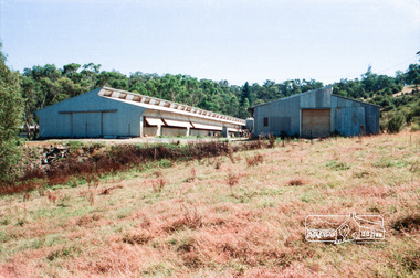
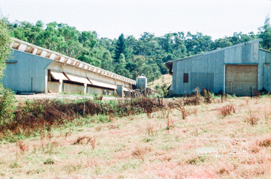
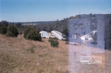
Photograph, Chook farm, 340 Henley Road, Kangaroo Ground
... Last known as Kangachicks - see Google Streetview Image of Feb 2013 ...Last known as Kangachicks - see Google Streetview Image of Feb 2013 henley road kangaroo ground chook farm Kodak CL 200 5093 Roll of 35mm colour negative film, 3 strips Chook farm, 340 Henley Road, Kangaroo Ground Photograph ...No longer running as a chook farm. Last known as Kangachicks - see Google Streetview Image of Feb 2013 Roll of 35mm colour negative film, 3 stripsKodak CL 200 5093henley road, kangaroo ground, chook farm -
 Eltham District Historical Society Inc
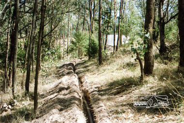
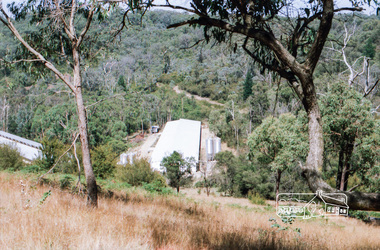
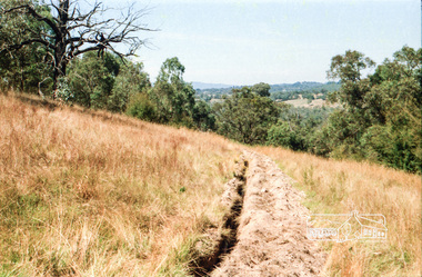
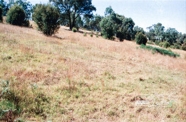
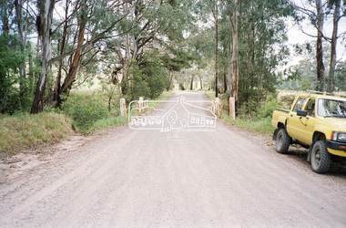
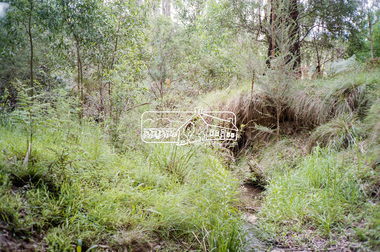
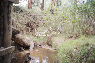
Negative - Photograph, Cottlesbridge-Strathewen Road, Strathewen, c.Nov. 1987
... A number of the trees were badly burnt or destroyed in the Black Saturday bushfire, 7 Feb. 2009 but some remained standing and identifiable as of 2014 (Google Streetview)....A number of the trees were badly burnt or destroyed in the Black Saturday bushfire, 7 Feb. 2009 but some remained standing and identifiable as of 2014 (Google Streetview). bridge chads creek chads creek road cottlesbridge-strathewen road culvert infrastructure roads school ridge road strathewen Kodak GB 200 5096 Roll of 35mm colour negative film, 4 strips Cottlesbridge-Strathewen Road, Strathewen Negative Photograph ...Photos taken during a review of road and bridge/culvert condition by Eltham Shire Council engineers. A number of the trees were badly burnt or destroyed in the Black Saturday bushfire, 7 Feb. 2009 but some remained standing and identifiable as of 2014 (Google Streetview).Roll of 35mm colour negative film, 4 stripsKodak GB 200 5096bridge, chads creek, chads creek road, cottlesbridge-strathewen road, culvert, infrastructure, roads, school ridge road, strathewen -
 Eltham District Historical Society Inc
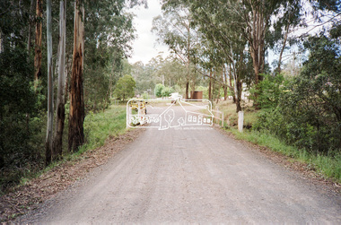
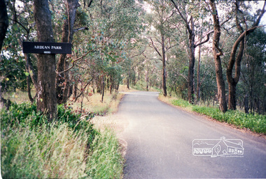
Photograph, Ardean Park, 315 Flat Rock Rd, Hurstbridge
... See https://www.realestate.com.au/sold/property-house-vic-hurstbridge-121193850 Google Streetview Feb 2014 https://www.google.com.au/maps/@-37.6455525,145.2071828,3a,49.4y,333.82h,88.64t/data=!...See https://www.realestate.com.au/sold/property-house-vic-hurstbridge-121193850 Google Streetview Feb 2014 https://www.google.com.au/maps/@-37.6455525,145.2071828,3a,49.4y,333.82h,88.64t/data=! ...Sold by Fletchers 3 Dec 2015 for $1.26m. See https://www.realestate.com.au/sold/property-house-vic-hurstbridge-121193850 Google Streetview Feb 2014 https://www.google.com.au/maps/@-37.6455525,145.2071828,3a,49.4y,333.82h,88.64t/data=!3m6!1e1!3m4!1sr2PfMo3UeXV_fqSDYToiuA!2e0!7i13312!8i6656Roll of 35mm colour negative film, 2 stripsKodak GA 100 5095shire of eltham, roads, flatrock road, hurstbridge, ardean park, cowan -
 City of Ballarat Libraries
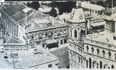
Photograph, Academy of Music and Craig's Hotel Tower, Ballarat circa 1891
... ...streetview...This view is from the Town Hall Tower looking south east. building public hotel academy of music her majesty's theatre craig's hotel streetview Academy of Music and Craig's Hotel Tower, Ballarat circa 1891. ...The Academy of Music became what is now Her Majesty's Theatre. This view is from the Town Hall Tower looking south east.building, public, hotel, academy of music, her majesty's theatre, craig's hotel, streetview -
 Eltham District Historical Society Inc
Photograph - Colour Print, Shire of Eltham, Bolton Street, Eltham, just north of Sackville Street intersection, c.1983
... Google Streetview for Jan 2008 indicates a more recent road widening and new profile kerb and channel. ...Google Streetview for Jan 2008 indicates a more recent road widening and new profile kerb and channel. ...A single rollover kerb has just been laid on western side cut into the embankment. At the crest of the hill on right in front of the Ford Laser is a fire hyrdant. This photo was processed at the same time as image EDHS_07261 of roadworks in Sackville Street about 200 m away which has been dated as c.1983 (between Sep 1982 and May 1983). The paling fence on the left has a change of angle just before the crest of the hill then flattens. More recent Google Streetviews show the same fence and shape and in more recent times a new fence but same shape. Google Streetview for Jan 2008 indicates a more recent road widening and new profile kerb and channel. The embankment was further cut away and the footpath that was adjacent to the fence lowered to road level. The fire hydrant that was on the right hand side has been relocated to the left next to the footpath. Significantly more electrical wires are now strung on the telephone poles. In 2017 Bolton Street was again upgraded. The fire hyrdrant was then relocated to another (unknown) location.1983, footpaths and gutters, road construction, road drainage, road sealing, bolton street, eltham, sackville street -
 City of Ballarat Libraries
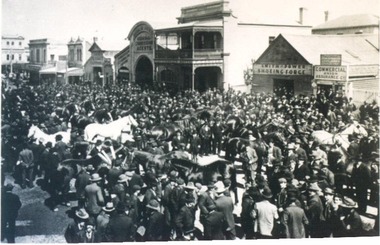
Photograph, Annual Horse Parade, Ballarat circa 1910
... ...streetview...Buildings in the background include Tattersal's Hotel and Smith & Power Shoeing Forge. building public streetview commerical hotel horses Tattersal's Hotel Smith & Power Doveton Street North Annual Horse Parade, Ballarat circa 1910. ...This horse parade was held on Doveton Street North. Buildings in the background include Tattersal's Hotel and Smith & Power Shoeing Forge.building, public, streetview, commerical, hotel, horses, tattersal's hotel, smith & power, doveton street north -
 Bendigo Historical Society Inc.
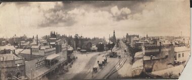
Photograph - CARWARDINE COLLECTION: STREETVIEW CHARING CROSS AND VIEW POINT, BENDIGO
... Receipt number 355/16 Photograph CARWARDINE COLLECTION: STREETVIEW CHARING CROSS AND VIEW POINT, BENDIGO ...Black and white photo. Image shows Charing Cross and View Point, looking northwards up Pall Mall (taken from City Family Hotel?) View Point businesses evident are : National and Mutual Life; A.M. Armstrong newsagents with 'The Argus popular daily ' on front; Moran and Cato, Warren's View Point Hotel, with two storey veranda ( on side: Cameo Cigarettes). Tram in foreground in View Street approaching fountain. Hustler's Royal Reserve poppet head and chimney on western side of Pall Mall, smoke rising from engine house? Post Office building with clock tower in distance. On RH side of image: written on verandah, Woodrow's Southern Cross Hotel; E.L. Holdsworth Chemist and Shamrock Hotel in distance. Four horse drawn taxis in centre of Charing Cross roadway, near fountain. Receipt number 355/16bendigo, business, carwardine soap and candle -
 St Vincent's Hospital Melbourne Archives
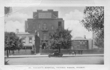
Postcard, C.W. Series, Melbourne, St Vincent's Hospital, Victoria Parade, Fitzroy, Circa 1914
... St Vincent's Hospital Melbourne Streetviews Postcards Hospital Buildings Fitzroy On the reverse is a handwritten letter in pencil from a niece to her aunt and uncle about a day trip they took into Melbourne. ...The postcard shows St Vincent's Hospital, on the northern side of Victoria Parade, Fitzroy, circa 1914. At left is the original hospital building, a converted terrace house, alongside the first purpose-built wing opened 1905 and the Cullen Wing (with facilities for medical students and residents) on the right. A group of two men and three boys stands on the footpath outside the Cullen Wing and a car is parked outside the main hospital building in the centre of the photograph. The reverse of the postcard is a letter from a niece to her uncle and aunt detailing their day trip into Melbourne, the places they saw, the people they met and the activities they took part in.This postcard is significant since it provides a rare view of the hospital from this location at this point in its history.Black and white postcard showing photograph of St Vincent's Hospital Melbourne on the front and a letter is written in pencil on the reverse.On the reverse is a handwritten letter in pencil from a niece to her aunt and uncle about a day trip they took into Melbourne. The message is dated January 27, 1914.st vincent's hospital melbourne, streetviews, postcards, hospital buildings, fitzroy