
Showing 747 items matching "warrandyte road"
-
 Eltham District Historical Society Inc
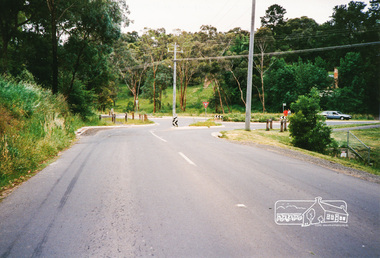
Photograph, Research-Warrandyte Road, Research
... Research-Warrandyte Road, Research......warrandyte road...Three colour photographs of Research-Warrandyte Road, Research including roundabout at Main Road...research research warrandyte road warrandyte road main road roundabouts Three colour photographs of Research-Warrandyte Road, Research including roundabout at Main Road Research-Warrandyte Road, Research Photograph ...Three colour photographs of Research-Warrandyte Road, Research including roundabout at Main Roadresearch, research warrandyte road, warrandyte road, main road, roundabouts -
 Ringwood and District Historical Society
Literary work - Biography, The story of Mrs McCann, 69 Warrandyte Road Ringwood dated December 1973, Dec-73
... The story of Mrs McCann, 69 Warrandyte Road Ringwood dated December 1973...The story of Mrs McCann, 69 Warrandyte Road Ringwood dated December 1973, 25 pages, started 8-Jan-1967 +Additional Keywords: McCann, Mrs. ...69 Warrandyte Road, Ringwood, Victoria, Australia...The story of Mrs McCann, 69 Warrandyte Road Ringwood dated December 1973 Literary work Biography ...Written by Mrs. E. McCann. House was "Castle Crag" home of the A.T. Miles family 1916.The story of Mrs McCann, 69 Warrandyte Road Ringwood dated December 1973, 25 pages, started 8-Jan-1967 +Additional Keywords: McCann, Mrs. E. -
 Ringwood and District Historical Society
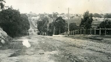
Photograph, Looking south down Warrandyte Road, Ringwood around 1920
... Looking south down Warrandyte Road, Ringwood around 1920...Black and white photograph taken just below where Mullum Mullum Road meets Warrandyte Road....The fencing was post and rail, with Warrandyte Road unmade, sealed with crushed rocks....Black and white photograph taken just below where Mullum Mullum Road meets Warrandyte Road. Looking south down Warrandyte Road, Ringwood around 1920 Photograph ...Black and white photograph taken just below where Mullum Mullum Road meets Warrandyte Road.The Mullum Mullum Bridge can be seen in the dip, with numerous houses on the ridge on Whitehorse Road (Maroondah Highway). The fencing was post and rail, with Warrandyte Road unmade, sealed with crushed rocks. -
 Eltham District Historical Society Inc
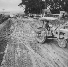
Album - Photograph, J.A. McDonald, Kangaroo Ground-Warrandyte Road, c. Sep. 1955
... Kangaroo Ground-Warrandyte Road...Kangaroo Ground-Warrandyte Road...Relocation Guthries Kangaroo Ground-Warrandyte Road September/October 1955...Kangaroo Ground-Warrandyte Road Album Photograph J.A. McDonald ...Relocation Guthries Kangaroo Ground-Warrandyte Road September/October 1955Record of various Shire of Eltham infrastructure works undertaken during the period of 1952-1962 involving bridge and road reconstruction projects, sometimes with Eltham Shire Council Project Reference numbers quoted. It was during this period that a number of significant improvements were made to roads and new bridges constructed within the shire that remain in place as of present day (2022). In many situations, the photos provide a tangible visible record of infrastructure that existed throughout the early days of the Shire. The album was put together by or under the direction of the Shire Engineer, J.A. McDonald.infrastructure, shire of eltham, bridge construction, road construction, 1955-09, bulldozer, graders, kangaroo ground-warrandyte road, l.r bassett pty ltd -
 Eltham District Historical Society Inc
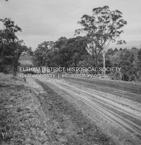
Album - Photograph, J.A. McDonald, Kangaroo Ground-Warrandyte Road, c. Sep. 1955
... Kangaroo Ground-Warrandyte Road...Kangaroo Ground-Warrandyte Road...Relocation Guthries Kangaroo Ground-Warrandyte Road September/October 1955...Kangaroo Ground-Warrandyte Road Album Photograph J.A. McDonald ...Relocation Guthries Kangaroo Ground-Warrandyte Road September/October 1955Record of various Shire of Eltham infrastructure works undertaken during the period of 1952-1962 involving bridge and road reconstruction projects, sometimes with Eltham Shire Council Project Reference numbers quoted. It was during this period that a number of significant improvements were made to roads and new bridges constructed within the shire that remain in place as of present day (2022). In many situations, the photos provide a tangible visible record of infrastructure that existed throughout the early days of the Shire. The album was put together by or under the direction of the Shire Engineer, J.A. McDonald.infrastructure, shire of eltham, bridge construction, road construction, 1955-09, kangaroo ground-warrandyte road -
 Eltham District Historical Society Inc
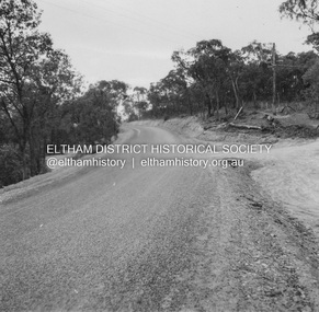
Album - Photograph, J.A. McDonald, Kangaroo Ground-Warrandyte Road, 1955
... Kangaroo Ground-Warrandyte Road...Kangaroo Ground-Warrandyte Road...Kangaroo Ground-Warrandyte Road Showing deviation old location on left...Kangaroo Ground-Warrandyte Road Album Photograph J.A. McDonald ...Kangaroo Ground-Warrandyte Road Showing deviation old location on leftRecord of various Shire of Eltham infrastructure works undertaken during the period of 1952-1962 involving bridge and road reconstruction projects, sometimes with Eltham Shire Council Project Reference numbers quoted. It was during this period that a number of significant improvements were made to roads and new bridges constructed within the shire that remain in place as of present day (2022). In many situations, the photos provide a tangible visible record of infrastructure that existed throughout the early days of the Shire. The album was put together by or under the direction of the Shire Engineer, J.A. McDonald.infrastructure, shire of eltham, bridge construction, road construction, kangaroo ground-warrandyte road, 1955 -
 Eltham District Historical Society Inc
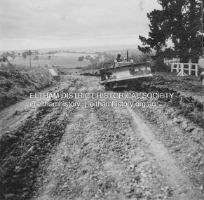
Album - Photograph, J.A. McDonald, Kangaroo Ground-Warrandyte Road, c. Sep. 1955
... Kangaroo Ground-Warrandyte Road...Kangaroo Ground-Warrandyte Road...Relocation Guthries Kangaroo Ground-Warrandyte Road September/October 1955 (Bassett)...Kangaroo Ground-Warrandyte Road Album Photograph J.A. McDonald ...Relocation Guthries Kangaroo Ground-Warrandyte Road September/October 1955 (Bassett)Record of various Shire of Eltham infrastructure works undertaken during the period of 1952-1962 involving bridge and road reconstruction projects, sometimes with Eltham Shire Council Project Reference numbers quoted. It was during this period that a number of significant improvements were made to roads and new bridges constructed within the shire that remain in place as of present day (2022). In many situations, the photos provide a tangible visible record of infrastructure that existed throughout the early days of the Shire. The album was put together by or under the direction of the Shire Engineer, J.A. McDonald.infrastructure, shire of eltham, bridge construction, road construction, 1955-09, kangaroo ground-warrandyte road, bulldozer, l.r bassett pty ltd -
 Ringwood and District Historical Society
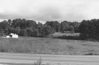
Photograph, Intersection of Warrandyte Road with Old Warrandyte Road and Tortice Dr. Nth Ringwood. 1981
... Intersection of Warrandyte Road with Old Warrandyte Road and Tortice Dr. ...Looking south-west from intersection of Warrandyte Road with Old Warrandyte Road and Tortice Dr."...Looking south-west from intersection of Warrandyte Road with Old Warrandyte Road and Tortice Dr." ...Black and white photographWritten on back of photograph: "19/6/81. Looking south-west from intersection of Warrandyte Road with Old Warrandyte Road and Tortice Dr." -
 Ringwood and District Historical Society
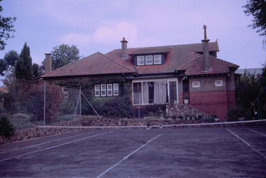
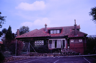
Photograph, Dr Hewitt's house and surgery, Warrandyte Road, Ringwood, circa 1960s
... Dr Hewitt's house and surgery, Warrandyte Road, Ringwood, circa 1960s...Dr Hewitt's house at 10-12 Warrandyte Road, Ringwood. Showing residence and tennis court. ...There are three bays in line to Warrandyte Road, with a central gablet attic. Its upper gable is shingles, with a latticed vent and terra-cotta finial, over a triple window. ...Dr Hewitt's house and surgery, Warrandyte Road, Ringwood, circa 1960s Photograph ...Dr Hewitt's house at 10-12 Warrandyte Road, Ringwood. Showing residence and tennis court. The surgery is on the right-hand side, facing Warrandyte Road. The surgery closed and is now used for offices. The building has Heritage Overlay, Number HO72, Maroondah City Council.Victorian Heritage Database Report Report generated 10/11/25 House 10-12 Warrandyte Rd Warranyte Rd 10-12(2).jpg Location 10-12 Warrandyte Road RINGWOOD, MAROONDAH CITY Municipality MAROONDAH CITY Level of significance Included in Heritage Overlay Heritage Overlay Numbers HO72 Heritage Listing Maroondah City Statement of Significance Last updated on - A substantial elevated brick house of the period transitional from Edwardian to early California Bungalow, built about 1915(?). It is historically significant to Maroondah as a representative embodiment of rural town family life in Ringwood immediately after the Great War. It may have been used as a medical surgery for over 80 years. It is architecturally significant as a rare representation of this transitional style locally. Heritage Study/Consultant Maroondah - Maroondah Heritage Identification Study, Richard Peterson with Peter Barrett, 1998; Hermes Number 146979 Property Number Physical Description 1 A three-bay brick house with a complex hipped roof and an attic, transitional from late Edwardian to early Californian Bungalow. Walls over dado height are roughcast. The roof is Marseilles terra-cotta tiles unglazed. Chimneys are pylons, with tall terra-cotta pots, with plate tops and corbels. There are three bays in line to Warrandyte Road, with a central gablet attic. Its upper gable is shingles, with a latticed vent and terra-cotta finial, over a triple window. Rafters are exposed. At left is a canted bay window. The entrance faces the south side, recessed at centre, between two hips. The right hip extends forward as a skillion with a chimney. At left is a small symmetrical quadruple window. Several mature evergreen trees remain. Intactness The north central bay has been replaced, an intrusive ramp installed and the entrance altered. Another intrusive addition is at the south. This place/object may be included in the Victorian Heritage Register pursuant to the Heritage Act 2017. Check the Victorian Heritage Database, selecting 'Heritage Victoria' as the place source. For further details about Heritage Overlay places, contact the relevant local council or go to Planning Schemes Online http://planningschemes.dpcd.vic.gov.au/ -
 Ringwood and District Historical Society
Photograph, Dr Hewitt's house and tennis court, Warrandyte Road, Ringwood, circa 1960s
... Dr Hewitt's house and tennis court, Warrandyte Road, Ringwood, circa 1960s...Dr Hewitt's house at 10-12 Warrandyte Road, Ringwood. Showing residence and tennis court. ...There are three bays in line to Warrandyte Road, with a central gablet attic. Its upper gable is shingles, with a latticed vent and terra-cotta finial, over a triple window. ...Dr Hewitt's house and tennis court, Warrandyte Road, Ringwood, circa 1960s Photograph ...Dr Hewitt's house at 10-12 Warrandyte Road, Ringwood. Showing residence and tennis court. The surgery is on the right-hand side, facing Warrandyte Road. The surgery closed and is now used for offices. The building has Heritage Overlay, Number HO72, Maroondah City Council. The garden was designed by Edna Walling.Victorian Heritage Database Report Report generated 10/11/25 House 10-12 Warrandyte Rd Warranyte Rd 10-12(2).jpg Location 10-12 Warrandyte Road RINGWOOD, MAROONDAH CITY Municipality MAROONDAH CITY Level of significance Included in Heritage Overlay Heritage Overlay Numbers HO72 Heritage Listing Maroondah City Statement of Significance Last updated on - A substantial elevated brick house of the period transitional from Edwardian to early California Bungalow, built about 1915(?). It is historically significant to Maroondah as a representative embodiment of rural town family life in Ringwood immediately after the Great War. It may have been used as a medical surgery for over 80 years. It is architecturally significant as a rare representation of this transitional style locally. Heritage Study/Consultant Maroondah - Maroondah Heritage Identification Study, Richard Peterson with Peter Barrett, 1998; Hermes Number 146979 Property Number Physical Description 1 A three-bay brick house with a complex hipped roof and an attic, transitional from late Edwardian to early Californian Bungalow. Walls over dado height are roughcast. The roof is Marseilles terra-cotta tiles unglazed. Chimneys are pylons, with tall terra-cotta pots, with plate tops and corbels. There are three bays in line to Warrandyte Road, with a central gablet attic. Its upper gable is shingles, with a latticed vent and terra-cotta finial, over a triple window. Rafters are exposed. At left is a canted bay window. The entrance faces the south side, recessed at centre, between two hips. The right hip extends forward as a skillion with a chimney. At left is a small symmetrical quadruple window. Several mature evergreen trees remain. Intactness The north central bay has been replaced, an intrusive ramp installed and the entrance altered. Another intrusive addition is at the south. This place/object may be included in the Victorian Heritage Register pursuant to the Heritage Act 2017. Check the Victorian Heritage Database, selecting 'Heritage Victoria' as the place source. For further details about Heritage Overlay places, contact the relevant local council or go to Planning Schemes Online http://planningschemes.dpcd.vic.gov.au/ -
 Ringwood and District Historical Society
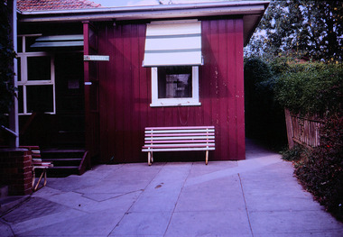
Photograph, Entrance to Dr Hewitt's Surgery, Warrandyte Road, Ringwood, circa 1960s
... Entrance to Dr Hewitt's Surgery, Warrandyte Road, Ringwood, circa 1960s...Dr Hewitt's house at 10-12 Warrandyte Road, Ringwood. Showing residence and tennis court. ...There are three bays in line to Warrandyte Road, with a central gablet attic. Its upper gable is shingles, with a latticed vent and terra-cotta finial, over a triple window. ...Entrance to Dr Hewitt's Surgery, Warrandyte Road, Ringwood, circa 1960s Photograph ...Dr Hewitt's house at 10-12 Warrandyte Road, Ringwood. Showing residence and tennis court. The surgery is on the right-hand side, facing Warrandyte Road. The surgery closed and is now used for offices. The building has Heritage Overlay, Number HO72, Maroondah City Council. The garden was designed by Edna Walling.Victorian Heritage Database Report Report generated 10/11/25 House 10-12 Warrandyte Rd Warranyte Rd 10-12(2).jpg Location 10-12 Warrandyte Road RINGWOOD, MAROONDAH CITY Municipality MAROONDAH CITY Level of significance Included in Heritage Overlay Heritage Overlay Numbers HO72 Heritage Listing Maroondah City Statement of Significance Last updated on - A substantial elevated brick house of the period transitional from Edwardian to early California Bungalow, built about 1915(?). It is historically significant to Maroondah as a representative embodiment of rural town family life in Ringwood immediately after the Great War. It may have been used as a medical surgery for over 80 years. It is architecturally significant as a rare representation of this transitional style locally. Heritage Study/Consultant Maroondah - Maroondah Heritage Identification Study, Richard Peterson with Peter Barrett, 1998; Hermes Number 146979 Property Number Physical Description 1 A three-bay brick house with a complex hipped roof and an attic, transitional from late Edwardian to early Californian Bungalow. Walls over dado height are roughcast. The roof is Marseilles terra-cotta tiles unglazed. Chimneys are pylons, with tall terra-cotta pots, with plate tops and corbels. There are three bays in line to Warrandyte Road, with a central gablet attic. Its upper gable is shingles, with a latticed vent and terra-cotta finial, over a triple window. Rafters are exposed. At left is a canted bay window. The entrance faces the south side, recessed at centre, between two hips. The right hip extends forward as a skillion with a chimney. At left is a small symmetrical quadruple window. Several mature evergreen trees remain. Intactness The north central bay has been replaced, an intrusive ramp installed and the entrance altered. Another intrusive addition is at the south. This place/object may be included in the Victorian Heritage Register pursuant to the Heritage Act 2017. Check the Victorian Heritage Database, selecting 'Heritage Victoria' as the place source. For further details about Heritage Overlay places, contact the relevant local council or go to Planning Schemes Online http://planningschemes.dpcd.vic.gov.au/ -
 Eltham District Historical Society Inc
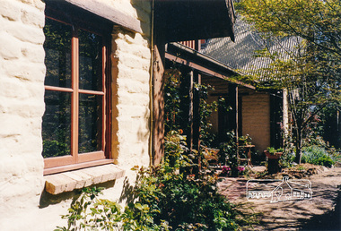
Photograph, Gayle Blackwood, Robert Marshall designed mudbrick home, off Warrandyte-Research Road, North Warrandyte
... Robert Marshall designed mudbrick home, off Warrandyte-Research Road, North Warrandyte......Warrandyte-Research Road...Warrandyte-Research Road, North Warrandyte...houses mudbrick Warrandyte-Research Road North Warrandyte Gayle Blackwood Collection Robert Marshall Ten colour prints 10 x 15 cm Robert Marshall designed mudbrick home, off Warrandyte-Research Road, North Warrandyte Photograph Gayle Blackwood ...Ten colour prints 10 x 15 cmhouses, mudbrick, warrandyte-research road, north warrandyte, gayle blackwood collection, robert marshall -
 Eltham District Historical Society Inc
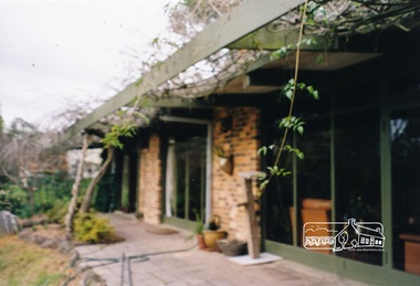
Photograph, Gayle Blackwood, Alistair Knox designed mudbrick home, off Warrandyte-Research Road, North Warrandyte
... Alistair Knox designed mudbrick home, off Warrandyte-Research Road, North Warrandyte......warrandyte-research road...Warrandyte-Research Road, North Warrandyte, Victoria...houses mudbrick warrandyte-research road north warrandyte gayle blackwood collection alistair knox Five colour prints 10 x 15 cm Alistair Knox designed mudbrick home, off Warrandyte-Research Road, North Warrandyte Photograph Gayle Blackwood ...Five colour prints 10 x 15 cmhouses, mudbrick, warrandyte-research road, north warrandyte, gayle blackwood collection, alistair knox -
 Ringwood and District Historical Society
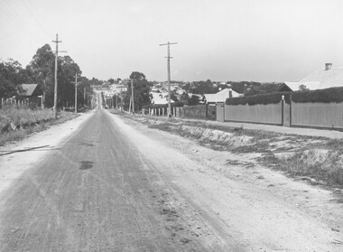
Photograph, Warrandyte Road (unmade Road). Ringwood. (undated, probably late 1960's/early 1970's)
... Warrandyte Road (unmade Road). Ringwood. (undated, probably late 1960's/early 1970's)...Written on catalogue card, "Warrandyte Road"....Written on catalogue card, "Warrandyte Road". Warrandyte Road (unmade Road). ...Written on catalogue card, "Warrandyte Road". -
 Eltham District Historical Society Inc
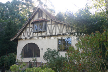
Photograph - Digital Photograph, Alan King, The Robins, 13 Kangaroo Ground-Warrandyte Road, North Warrandyte, 2 March 2008
... The Robins, 13 Kangaroo Ground-Warrandyte Road, North Warrandyte...Kangaroo Ground-Warrandyte Road...Mornington Gallery Director Andrea May said many believed Boyd ‘had never received the national acclaim that he deserved’.2 Classified by the National Trust3 and part of the Australian National Heritage,4 The Robins is set well back near the end of Kangaroo Ground – Warrandyte Road, unobserved by passers-by. Built in 1913, The Robins has some Art Nouveau influences and is a descendant of the Queen Anne style. ...Nillumbik Now and Then (Marshall-King) Collection Kangaroo Ground-Warrandyte Road North Warrandyte The Robins Born digital image file The Robins, 13 Kangaroo Ground-Warrandyte Road, North Warrandyte Photograph Digital Photograph Alan King Alan King Marguerite Marshall ...Built by noted artist Theodore Penleigh Boyd, father of architect Robin Boyd. Covered under National Estate, National Trust of Australia (Victoria) Local Significance and Heritage Overlay, Nillumbik Planning Scheme. Published: Nillumbik Now and Then / Marguerite Marshall 2008; photographs Alan King with Marguerite Marshall.; p111 The Robins at Warrandyte,* was once home to a member of a famous family and is also one of the first reinforced concrete houses in Victoria. The builder, Theodore Penleigh Boyd, born in 1890, was a talented painter1 noted for his works of the Warrandyte bush. He was the father of architect Robin Boyd, author of the Australian Ugliness and the uncle of painter, Arthur Boyd. Penleigh Boyd’s great grandfather was Sir William A’Beckett, Victoria’s first Chief Justice. Penleigh Boyd is considered by some to be an ‘unsung hero’ overshadowed by more famous members of his family. Mornington Gallery Director Andrea May said many believed Boyd ‘had never received the national acclaim that he deserved’.2 Classified by the National Trust3 and part of the Australian National Heritage,4 The Robins is set well back near the end of Kangaroo Ground – Warrandyte Road, unobserved by passers-by. Built in 1913, The Robins has some Art Nouveau influences and is a descendant of the Queen Anne style. It is covered in stucco and has a prominent attic, which Boyd used as a studio. Some parts of the house are up to 33 centimetres thick and built in part with pisé (rammed earth) and in part with reinforced concrete. Amazingly, Boyd built The Robins without an accessible driveway, and only a narrow track along which he had to cart building materials. The journey was uphill and Boyd terraced the land with Warrandyte rock5 without the aid of machinery. At only 33 years, Boyd was killed in a car accident in 1923. He was buried in Brighton near the home of his parents. Several people have since owned the house, including political journalist, Owen Webster. Boyd was born at Penleigh House, Wiltshire, and studied at Haileybury College, Melbourne and The Hutchins School, Hobart. He attended the Melbourne National Gallery School and in his final year exhibited at the Victorian Artists’ Society. He arrived in London in 1911 and his painting Springtime was hung at the Royal Academy. He painted in several studios in England and then worked in Paris.6 There he met painter Phillips Fox through whom he met artists of the French modern school and also his wife-to-be, Edith Anderson, whom he married in Paris in 1912. After touring France and Italy, the couple returned to Melbourne. In 1913 Boyd held an exhibition and won second prize in the Federal Capital site competition, then the Wynne Prize for landscape in 1914. In 1915 Boyd joined the Australian Imperial Force, and became a sergeant in the Electrical and Mechanical Mining Company. However he was severely gassed at Ypres and invalided to England. In 1918 in London Boyd published Salvage, writing the text and illustrating it with 20 black-and-white ink-sketches of army scenes. Later that year he returned to Melbourne, and, despite suffering from the effects of gas, he held several successful one-man shows, quickly selling his water-colour and oil paintings. In his short career Penleigh Boyd was recognized as one of Australia’s finest landscape painters. He loved colour, having been influenced early by Turner and McCubbin. His works are in all Australian state galleries, the National Collection in Canberra as well as in regional galleries.7 His wife Edith was also an artist having studied at the Slade School, London, and in Paris with Phillips Fox. After her marriage she continued to paint and excelled in drawing. In later years she wrote several dramas, staged by repertory companies, and radio plays for the Australian Broadcasting Commission, in which she took part. She was the model for the beautiful red-haired woman in several of Phillips Fox’s paintings and the family hold three of his portraits of her. *Possibly named after the Aboriginal words warran, meaning ‘object’ and dyte, meaning ‘thrown at’.This collection of almost 130 photos about places and people within the Shire of Nillumbik, an urban and rural municipality in Melbourne's north, contributes to an understanding of the history of the Shire. Published in 2008 immediately prior to the Black Saturday bushfires of February 7, 2009, it documents sites that were impacted, and in some cases destroyed by the fires. It includes photographs taken especially for the publication, creating a unique time capsule representing the Shire in the early 21st century. It remains the most recent comprehenesive publication devoted to the Shire's history connecting local residents to the past. nillumbik now and then (marshall-king) collection, kangaroo ground-warrandyte road, north warrandyte, the robins -
 Eltham District Historical Society Inc
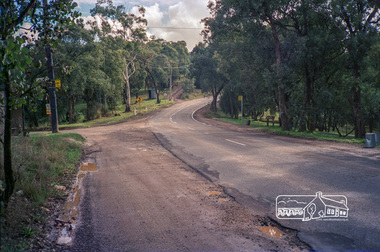
Photograph, Kangaroo Ground-Warrandyte Road, North Warrandyte, c.1988, 1988c
... Kangaroo Ground-Warrandyte Road, North Warrandyte, c.1988...kangaroo ground-warrandyte road...Looking northwest, Floods Road on left. eltham shire council infrastructure kangaroo ground-warrandyte road north warrandyte Floods Road Fuji 100 Roll of 35mm colour negative film, 7 strips Kangaroo Ground-Warrandyte Road, North Warrandyte, c.1988 Photograph ...Looking northwest, Floods Road on left.Roll of 35mm colour negative film, 7 stripsFuji 100eltham shire council, infrastructure, kangaroo ground-warrandyte road, north warrandyte, floods road -
 Ringwood and District Historical Society
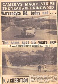
Newspaper - Photographs and Clippings, Article comparing Warrandyte Road, Ringwood, in 1912 and 1967
... Article comparing Warrandyte Road, Ringwood, in 1912 and 1967...Newspaper cutting showing a photos of Warrandyte Road, taken from Mullum Mullum Road, in 1912 and 1967....Article comparing Warrandyte Road, Ringwood, in 1912 and 1967 Newspaper Photographs and Clippings ...Newspaper cutting showing a photos of Warrandyte Road, taken from Mullum Mullum Road, in 1912 and 1967.Extract from Eastern Post Gazette 13 December 1967, page 39 -
 Ringwood and District Historical Society
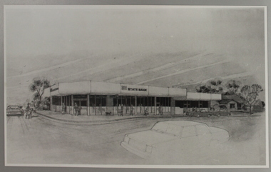
Photograph, State Bank Artist's Impression, Warrandyte Road, Ringwood North
... State Bank Artist's Impression, Warrandyte Road, Ringwood North...At the corner of Dickson's Crescent and Warrandyte Road, Ringwood North...At the corner of Dickson's Crescent and Warrandyte Road, Ringwood North Artist's Impression of the new Ringwood North State Bank premises, circa 1980 State Bank Artist's Impression, Warrandyte Road, Ringwood North Photograph ...Artist's Impression of the new Ringwood North State Bank premises, circa 1980At the corner of Dickson's Crescent and Warrandyte Road, Ringwood North -
 Ringwood and District Historical Society
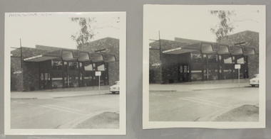
Photograph, Ringwood North State Bank , north-east corner of Dickson's Crescent and Warrandyte Road
... Ringwood North State Bank , north-east corner of Dickson's Crescent and Warrandyte Road...At the corner of Dickson's Cresent and Warrandyte Road, Ringwood North....Ringwood North State Bank , north-east corner of Dickson's Crescent and Warrandyte Road Photograph ...The new Ringwood North State Bank premises on the north-east corner of Dickson's Crescent. Exterior view. Unknown date.At the corner of Dickson's Cresent and Warrandyte Road, Ringwood North. -
 Ringwood and District Historical Society
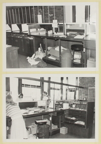
Photograph, Interior view of Ringwood North State Bank , north-east corner of Dickson's Crescent and Warrandyte Road
... Interior view of Ringwood North State Bank , north-east corner of Dickson's Crescent and Warrandyte Road...At the corner of Dickson's Crescent and Warrandyte Road, Ringwood North....At the corner of Dickson's Crescent and Warrandyte Road, Ringwood North. Interior view of the new Ringwood North State Bank premises on the north-east corner of Dickson's Crescent. ...Interior view of the new Ringwood North State Bank premises on the north-east corner of Dickson's Crescent. Exterior view. Unknown date. Opened 25 October 1971At the corner of Dickson's Crescent and Warrandyte Road, Ringwood North. -
 Ringwood and District Historical Society
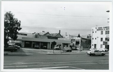
Photograph, Warrandyte Road Ringwood - 2.9.1992
... Warrandyte Road Ringwood - 2.9.1992...View of East side of Warrandyte Road approaching Maroondah Highway intersection. ...View of East side of Warrandyte Road approaching Maroondah Highway intersection. ...View of East side of Warrandyte Road approaching Maroondah Highway intersection. Rear view of Maroondah Highway businesses.Written on back of photograph: "2.9.92. Warrandyte Road.Was the Caltex garage.etheridge ford, lawfords furniture, treeby real estate, wright brothers electrics -
 Ringwood and District Historical Society
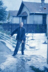
Photograph, Hail storm in Warrandyte Road, Ringwood late 1950s
... Hail storm in Warrandyte Road, Ringwood late 1950s...In the image, number 11 Warrandyte Road was Sherman's house, number 9 the Haywards, then (hidden) the Salvation Army citadel. ...Hail storm in Warrandyte Road, Ringwood late 1950s Photograph ...Clarrie Burns, father of Neville, shovelling hail stones from his driveway at 13 Warrandyte Road, Ringwood in the late 1950s. Clarrie worked for Ringwood City Council as Superintendent of Works. In the image, number 11 Warrandyte Road was Sherman's house, number 9 the Haywards, then (hidden) the Salvation Army citadel. -
 Ringwood and District Historical Society
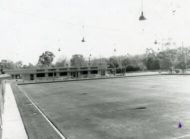
Photograph, Ringwood Bowls Club - Warrandyte Road, 1991
... Ringwood Bowls Club - Warrandyte Road, 1991..."On front of photograph" Ringwood Bowling Club Warrandyte Road, 1991..."On front of photograph" Ringwood Bowling Club Warrandyte Road, 1991 Black and white photograph Ringwood Bowls Club - Warrandyte Road, 1991 Photograph ...Black and white photograph"On front of photograph" Ringwood Bowling Club Warrandyte Road, 1991 -
 Eltham District Historical Society Inc
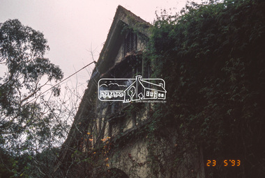
Slide - Photograph, The Robins. Kangaroo Ground-Warrandyte Road, North Warrandyte, 23 May 1993
... Kangaroo Ground-Warrandyte Road, North Warrandyte...Kangaroo Ground-Warrandyte Road...Kangaroo Ground-Warrandyte Road, North Warrandyte Slide Photograph ...The 1993 Eltham Heritage Tour was enjoyed by a busload of members of the Historical Society on a fine, calm day, Sunday May 23rd. Between 10.00 am and 4.30 pm, except for a brief lunch stop at the Eltham Living and Learning Centre, members passed about thirty places of local interest and others recommended for the Historic Buildings Register and the Register of the National Estate. A number of significant trees and buildings were also highlighted along with the opportunity to explored some of the properties.35mm colour positive transparency (1 of 24) Mount - Kodak Kodachromeactivities, kangaroo ground-warrandyte road, north warrandyte, shire of eltham historical society, the robins, heritage excursion -
 Eltham District Historical Society Inc
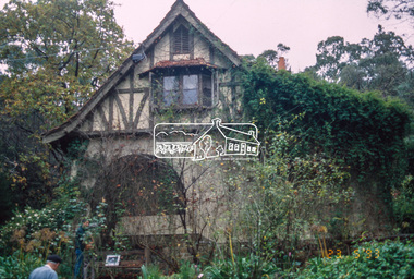
Slide - Photograph, The Robins. Kangaroo Ground-Warrandyte Road, North Warrandyte, 23 May 1993
... Kangaroo Ground-Warrandyte Road, North Warrandyte...kangaroo ground-warrandyte road...Kangaroo Ground-Warrandyte Road, North Warrandyte Slide Photograph ...The 1993 Eltham Heritage Tour was enjoyed by a busload of members of the Historical Society on a fine, calm day, Sunday May 23rd. Between 10.00 am and 4.30 pm, except for a brief lunch stop at the Eltham Living and Learning Centre, members passed about thirty places of local interest and others recommended for the Historic Buildings Register and the Register of the National Estate. A number of significant trees and buildings were also highlighted along with the opportunity to explored some of the properties.35mm colour positive transparency (1 of 24) Mount - Kodak Kodachromeactivities, kangaroo ground-warrandyte road, north warrandyte, shire of eltham historical society, the robins, heritage excursion -
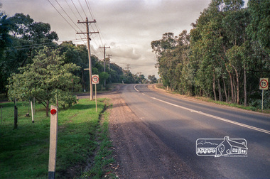 Eltham District Historical Society Inc
Photograph, Kangaroo Ground-Warrandyte Road, North Warrandyte, c.1988, 1988c
... Kangaroo Ground-Warrandyte Road, North Warrandyte, c.1988...Kangaroo Ground-Warrandyte Road...Looking southeast, Kruses Road on left. eltham shire council infrastructure Kangaroo Ground-Warrandyte Road Kruses Road North Warrandyte Fuji 100 Roll of 35mm colour negative film, 7 strips Kangaroo Ground-Warrandyte Road, North Warrandyte, c.1988 Photograph ...Looking southeast, Kruses Road on left.Roll of 35mm colour negative film, 7 stripsFuji 100eltham shire council, infrastructure, kangaroo ground-warrandyte road, kruses road, north warrandyte -
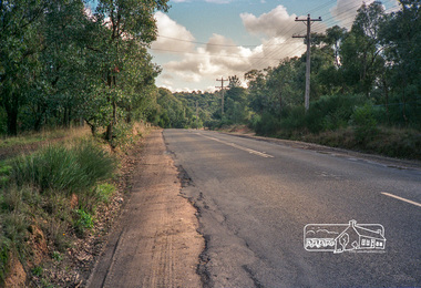 Eltham District Historical Society Inc
Photograph, Kangaroo Ground-Warrandyte Road, North Warrandyte, c.1988, 1988c
... Kangaroo Ground-Warrandyte Road, North Warrandyte, c.1988...kangaroo ground-warrandyte road...Looking northwest. eltham shire council infrastructure kangaroo ground-warrandyte road north warrandyte Fuji 100 Roll of 35mm colour negative film, 7 strips Kangaroo Ground-Warrandyte Road, North Warrandyte, c.1988 Photograph ...Looking northwest.Roll of 35mm colour negative film, 7 stripsFuji 100eltham shire council, infrastructure, kangaroo ground-warrandyte road, north warrandyte -
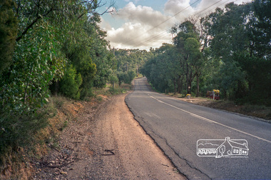 Eltham District Historical Society Inc
Photograph, Kangaroo Ground-Warrandyte Road, North Warrandyte, c.1988, 1988c
... Kangaroo Ground-Warrandyte Road, North Warrandyte, c.1988...kangaroo ground-warrandyte road...Looking northwest. eltham shire council infrastructure kangaroo ground-warrandyte road north warrandyte Fuji 100 Roll of 35mm colour negative film, 7 strips Kangaroo Ground-Warrandyte Road, North Warrandyte, c.1988 Photograph ...Looking northwest.Roll of 35mm colour negative film, 7 stripsFuji 100eltham shire council, infrastructure, kangaroo ground-warrandyte road, north warrandyte -
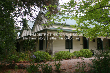 Eltham District Historical Society Inc
Photograph - Digital Photograph, Alan King, Pigeon Bank, Kangaroo Ground-Warrandyte Road, Kangaroo Ground, 6 February 2008
... Pigeon Bank, Kangaroo Ground-Warrandyte Road, Kangaroo Ground...Kangaroo Ground-Warrandyte Road....; p27 Pigeon Bank, on the Kangaroo Ground – Warrandyte Road, Kangaroo Ground, is one of the Shire’s oldest farm dwellings, and has been home to some of the district’s earliest and most distinguished families. ...Nillumbik Now and Then (Marshall-King) Collection ewen hugh cameron Francis Rogerson Kangaroo Ground Kangaroo Ground-Warrandyte Road Pigeon Bank Born digital image file Pigeon Bank, Kangaroo Ground-Warrandyte Road, Kangaroo Ground Photograph Digital Photograph Alan King Alan King Marguerite Marshall ...In 1848, Francis Rogerson form Dumfriesshire, Scotland purchased 80 acres of land at Kangaroo Ground on which he built a two-roomed bark hut. He named the property afterr the many Bronzewings and Wonga Pigeons in the area. Ewen Hugh Cameron moved to Pigeon Bank the same year he was elected to Parliament as the Member for Evelyn. At the time he moved in, Pigeon Bank had six rooms and the present water well. He made further extensive additions and lived there until his death in 1915. Covered under Heritage Overlay, Nillumbik Planning Scheme. Published: Nillumbik Now and Then / Marguerite Marshall 2008; photographs Alan King with Marguerite Marshall.; p27 Pigeon Bank, on the Kangaroo Ground – Warrandyte Road, Kangaroo Ground, is one of the Shire’s oldest farm dwellings, and has been home to some of the district’s earliest and most distinguished families. Although close to the road, the white weatherboard Victorian farmhouse is ensured privacy by the trees and hedges around it. On 4.8 hectares of farmland, Pigeon Bank is surrounded by rolling hills, farmland and bush, the peace of which is punctuated by an occasional birdcall. Pigeon Bank’s first owner was Francis Rogerson, from Dumfriesshire, Scotland, who bought 80 acres (32.4ha) of land in 1848 on which he built a two-roomed bark hut. Today this is the centre piece of the 14-room home.1 Rogerson lined the rooms with tongue-and-groove boards and roofed them with wooden shingles and sapling frames, which remain under the present green corrugated iron roof. He named Pigeon Bank after the many forest bronzewing and Wonga Pigeons in the area at the time, and the name Bank was commonly used in Scotland. Rogerson was united with one of the oldest families in the area when his sister Janet married John Bell, son of William, the original Bell settler. When Ewen Cameron moved to Pigeon Bank in 1874 it had six rooms and the present water well. He made extensive additions to the house and farm buildings and lived at Pigeon Bank until his death in 1915. Cameron, who had arrived in Melbourne from Scotland in 1853, contributed an enormous amount to the community. He worked as a builder, as a miner at Andersons Creek, a storekeeper at Queenstown2 and as the first postmaster at Warrandyte. In 1867 he married Agnes Bell, daughter of local farmer, John Bell. Cameron was a member of the Eltham Road Board (which preceded the Shire Council) and for more than 50 years, from 1863, he was an Eltham Shire Councillor, being President three times. Cameron was the Member for Evelyn for 40 years from 1874. In the 1880s he became the Government Whip, in 1902 the Minister for Mines and Water Supply, and in 1904, the Minister for Health, Cameron was also an outstanding farmer, whose farm won the Agricultural Department prize for the finest in the district, three consecutive times. Not surprisingly Pigeon Bank became the centre of district life. Every New Year’s Eve, Cameron hired a highland piper, who marched from the Kangaroo Ground school house to Pigeon Bank playing his pipes.3 Distinguished visitors included opera singer, Dame Nellie Melba, Victorian Premier, Thomas Bent, Governor, Lord Hopetoun and artist, Longstaff. Following Cameron’s death, the property changed hands several times, then returned to the family in 1919 when bought by Gordon Cameron. As the car took over from the horse, Pigeon Bank entered difficult times because the farm had produced chaff and oats and bred Clydesdales and harness ponies. In 1926 Mr Matthews bought the property and made many alterations including pulling down the kitchen, which had been separate from the main house. The property again changed hands several times. One owner was Senator James F Guthrie, who added a sunroom. In 1968 the house again returned to the Cameron family, when Vera Jackson, a grand-daughter of Ewen Cameron, and her husband, bought the property. The Bishop family, who were sixth and seventh generation Bells and also descended from the Camerons, restored the house in the 1980s. Today tongue-and-groove boards still line part of the hall (which retains two fine arches), the breakfast room, and Ewen Cameron’s former room. Five original fireplaces in the bed and living rooms are still in working order. The wide veranda with a curved iron roof and ornate iron lace work bounds three sides of the house, and nearby a windmill stands beside the water well. Sue and Ron James, who bought the property in 2001, made extensive improvements to the homestead and meticulously restored the grounds to their original state.This collection of almost 130 photos about places and people within the Shire of Nillumbik, an urban and rural municipality in Melbourne's north, contributes to an understanding of the history of the Shire. Published in 2008 immediately prior to the Black Saturday bushfires of February 7, 2009, it documents sites that were impacted, and in some cases destroyed by the fires. It includes photographs taken especially for the publication, creating a unique time capsule representing the Shire in the early 21st century. It remains the most recent comprehenesive publication devoted to the Shire's history connecting local residents to the past. nillumbik now and then (marshall-king) collection, ewen hugh cameron, francis rogerson, kangaroo ground, kangaroo ground-warrandyte road, pigeon bank -
 Ringwood and District Historical Society
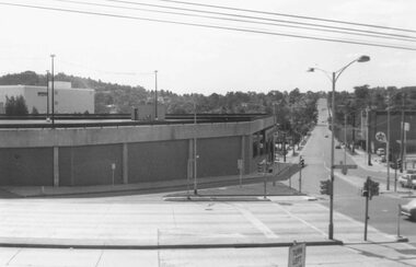
Photograph, Maroondah Highway Central, Ringwood. Carpark on corner of Highway and Warrandyte Road. 1976
... Carpark on corner of Highway and Warrandyte Road. 1976....Image shows Warrandyte Road looking north from Maroondah Highway....Image shows Warrandyte Road looking north from Maroondah Highway. ...Black and white photographImage shows Warrandyte Road looking north from Maroondah Highway.
