Showing 16 items matching "water main pipe track"
-
 Eltham District Historical Society Inc
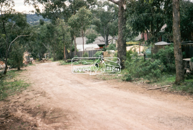
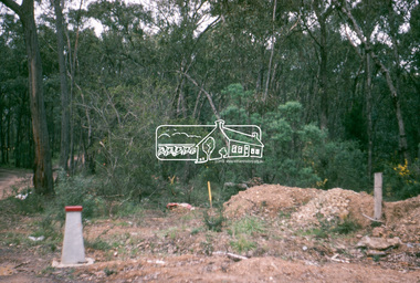
Photograph, Water Main Pipe Track (Madine Way-Bainbridge Drive), Eltham, 3 Sep 1981
... Water Main Pipe Track (Madine Way-Bainbridge Drive), Eltham......Water Main Pipe Track...water main; including views of existing damage to footpaths and gutters and general views of Beard Street. These images provide a perspective of housing estate developments and changes in housing styles and road development which began sweeping in from the mid 1970s with increasing urbanisation of what was once more outlying suburbs and regions. eltham infrastructure roads Bainbridge Drive Linear Reserve madine Way Water Main Pipe Track 35mm colour positive transparency (1 of 28) Mount - Kodak Kodachrome Card Water Main Pipe Track (Madine Way-Bainbridge Drive), Eltham Photograph Photograph ...Roll of film taken by Eltham Shire Council officers of roads and houses in the Eltham East area, 3 September 1981 prior to construction of new water main; including views of existing damage to footpaths and gutters and general views of Beard Street. These images provide a perspective of housing estate developments and changes in housing styles and road development which began sweeping in from the mid 1970s with increasing urbanisation of what was once more outlying suburbs and regions.35mm colour positive transparency (1 of 28) Mount - Kodak Kodachrome Cardeltham, infrastructure, roads, bainbridge drive linear reserve, madine way, water main pipe track -
 Eltham District Historical Society Inc
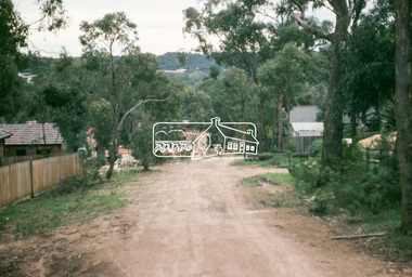
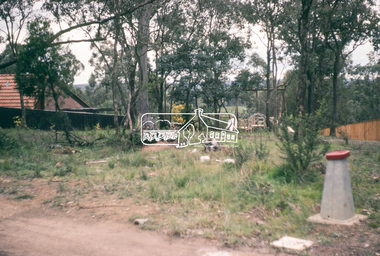
Photograph, Water Main Pipe Track (Madine Way-Bainbridge Drive), Eltham, 3 Sep 1981
... Water Main Pipe Track (Madine Way-Bainbridge Drive), Eltham......water main pipe track...water main; including views of existing damage to footpaths and gutters and general views of Beard Street. These images provide a perspective of housing estate developments and changes in housing styles and road development which began sweeping in from the mid 1970s with increasing urbanisation of what was once more outlying suburbs and regions. eltham infrastructure roads bainbridge drive linear reserve madine way water main pipe track 35mm colour positive transparency (1 of 28) Mount - Kodak Kodachrome Card Water Main Pipe Track (Madine Way-Bainbridge Drive), Eltham Photograph Photograph ...Roll of film taken by Eltham Shire Council officers of roads and houses in the Eltham East area, 3 September 1981 prior to construction of new water main; including views of existing damage to footpaths and gutters and general views of Beard Street. These images provide a perspective of housing estate developments and changes in housing styles and road development which began sweeping in from the mid 1970s with increasing urbanisation of what was once more outlying suburbs and regions.35mm colour positive transparency (1 of 28) Mount - Kodak Kodachrome Cardeltham, infrastructure, roads, bainbridge drive linear reserve, madine way, water main pipe track -
 Eltham District Historical Society Inc
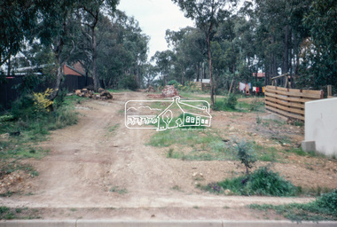
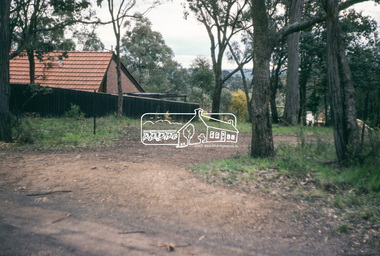
Photograph, Water Main Pipe Track (Madine Way-Bainbridge Drive), Eltham, 3 Sep 1981
... Water Main Pipe Track (Madine Way-Bainbridge Drive), Eltham......water main pipe track...water main; including views of existing damage to footpaths and gutters and general views of Beard Street. These images provide a perspective of housing estate developments and changes in housing styles and road development which began sweeping in from the mid 1970s with increasing urbanisation of what was once more outlying suburbs and regions. eltham infrastructure roads bainbridge drive linear reserve madine way water main pipe track 35mm colour positive transparency (1 of 28) Mount - Kodak Kodachrome Card Water Main Pipe Track (Madine Way-Bainbridge Drive), Eltham Photograph Photograph ...Roll of film taken by Eltham Shire Council officers of roads and houses in the Eltham East area, 3 September 1981 prior to construction of new water main; including views of existing damage to footpaths and gutters and general views of Beard Street. These images provide a perspective of housing estate developments and changes in housing styles and road development which began sweeping in from the mid 1970s with increasing urbanisation of what was once more outlying suburbs and regions.35mm colour positive transparency (1 of 28) Mount - Kodak Kodachrome Cardeltham, infrastructure, roads, bainbridge drive linear reserve, madine way, water main pipe track -
 Eltham District Historical Society Inc
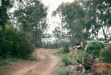
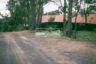
Photograph, Water Main Pipe Track (Madine Way-Eucalyptus Road), Eltham, 3 Sep 1981
... Water Main Pipe Track (Madine Way-Eucalyptus Road), Eltham......water main pipe track...water main; including views of existing damage to footpaths and gutters and general views of Beard Street. These images provide a perspective of housing estate developments and changes in housing styles and road development which began sweeping in from the mid 1970s with increasing urbanisation of what was once more outlying suburbs and regions. eltham infrastructure roads water main pipe track Madine Way Eucalyptus Road Tadema Park 35mm colour positive transparency (1 of 28) Mount - Kodak Kodachrome Card Water Main Pipe Track (Madine Way-Eucalyptus Road), Eltham Photograph Photograph ...Roll of film taken by Eltham Shire Council officers of roads and houses in the Eltham East area, 3 September 1981 prior to construction of new water main; including views of existing damage to footpaths and gutters and general views of Beard Street. These images provide a perspective of housing estate developments and changes in housing styles and road development which began sweeping in from the mid 1970s with increasing urbanisation of what was once more outlying suburbs and regions.35mm colour positive transparency (1 of 28) Mount - Kodak Kodachrome Cardeltham, infrastructure, roads, water main pipe track, madine way, eucalyptus road, tadema park -
 Eltham District Historical Society Inc
Photograph, Water Main Pipe Track (Madine Way-Eucalyptus Road), Eltham, 3 Sep 1981
... Water Main Pipe Track (Madine Way-Eucalyptus Road), Eltham......water main pipe track...water main; including views of existing damage to footpaths and gutters and general views of Beard Street. These images provide a perspective of housing estate developments and changes in housing styles and road development which began sweeping in from the mid 1970s with increasing urbanisation of what was once more outlying suburbs and regions. eltham infrastructure roads water main pipe track madine way eucalyptus road tadema park 35mm colour positive transparency (1 of 28) Mount - Kodak Kodachrome Card Water Main Pipe Track (Madine Way-Eucalyptus Road), Eltham Photograph Photograph ...Roll of film taken by Eltham Shire Council officers of roads and houses in the Eltham East area, 3 September 1981 prior to construction of new water main; including views of existing damage to footpaths and gutters and general views of Beard Street. These images provide a perspective of housing estate developments and changes in housing styles and road development which began sweeping in from the mid 1970s with increasing urbanisation of what was once more outlying suburbs and regions.35mm colour positive transparency (1 of 28) Mount - Kodak Kodachrome Cardeltham, infrastructure, roads, water main pipe track, madine way, eucalyptus road, tadema park -
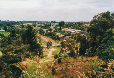 Eltham District Historical Society Inc
Photograph, Metropolitan Water pipe track east from Afton Street, Research, 19 December 1992, 19/12/1992
... Eltham District Historical Society Inc 728 Main Rd Eltham melbourne The Eltham Horse Trail: Research and Warrandyte to Kinglake: Survey of proposed route, December 1992: (4) Connecting trail to Eltham eltham horse trail (1992 survey) afton street research (vic.) Colour photograph Metropolitan Water pipe track ...The Eltham Horse Trail: Research and Warrandyte to Kinglake: Survey of proposed route, December 1992: (4) Connecting trail to ElthamColour photographeltham horse trail (1992 survey), afton street, research (vic.) -
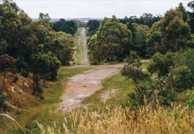 Eltham District Historical Society Inc
Photograph, Metropolitan Water pipe track west from Afton Street, Research, 19 December 1992, 19/12/1992
... Eltham District Historical Society Inc 728 Main Rd Eltham melbourne The Eltham Horse Trail: Research and Warrandyte to Kinglake: Survey of proposed route, December 1992: (4) Connecting trail to Eltham eltham horse trail (1992 survey) afton street research (vic.) Colour photograph Metropolitan Water pipe track ...The Eltham Horse Trail: Research and Warrandyte to Kinglake: Survey of proposed route, December 1992: (4) Connecting trail to ElthamColour photographeltham horse trail (1992 survey), afton street, research (vic.) -
 Eltham District Historical Society Inc
Photograph, Metropolitan Water pipe track west from Maroong Drive, Research, 19 December 1992, 19/12/1992
... Eltham District Historical Society Inc 728 Main Rd Eltham melbourne The Eltham Horse Trail: Research and Warrandyte to Kinglake: Survey of proposed route, December 1992: (4) Connecting trail to Eltham eltham horse trail (1992 survey) research (vic.) Maroong Drive Colour photograph Metropolitan Water pipe track ...The Eltham Horse Trail: Research and Warrandyte to Kinglake: Survey of proposed route, December 1992: (4) Connecting trail to ElthamColour photographeltham horse trail (1992 survey), research (vic.), maroong drive -
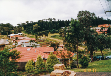
 Eltham District Historical Society Inc
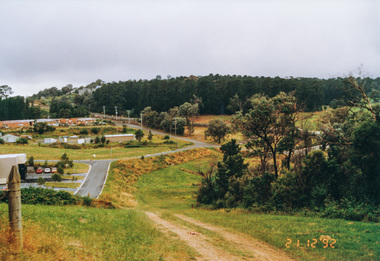
Photograph, Metropolitan Water pipe track looking west near The Esplanade, Research, 21 December 1992, 21/12/1992
... Eltham District Historical Society Inc 728 Main Rd Eltham melbourne The Eltham Horse Trail: Research and Warrandyte to Kinglake: Survey of proposed route, December 1992: (4) Connecting trail to Eltham eltham horse trail (1992 survey) research (vic.) the esplanade Colour photograph Metropolitan Water pipe track looking west near The Esplanade, Research, 21 December 1992 Photograph ...The Eltham Horse Trail: Research and Warrandyte to Kinglake: Survey of proposed route, December 1992: (4) Connecting trail to ElthamColour photographeltham horse trail (1992 survey), research (vic.), the esplanade -
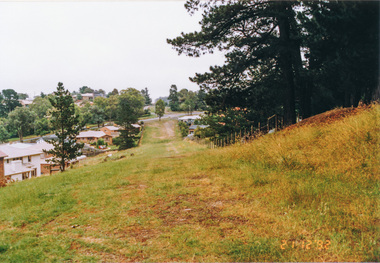
 Eltham District Historical Society Inc
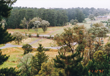
Photograph, Metropolitan Water pipe track looking east near The Esplanade, Research, 21 December 1992, 21/12/1992
... Eltham District Historical Society Inc 728 Main Rd Eltham melbourne The Eltham Horse Trail: Research and Warrandyte to Kinglake: Survey of proposed route, December 1992: (4) Connecting trail to Eltham eltham horse trail (1992 survey) research (vic.) the esplanade Colour photograph Metropolitan Water pipe track looking east near The Esplanade, Research, 21 December 1992 Photograph ...The Eltham Horse Trail: Research and Warrandyte to Kinglake: Survey of proposed route, December 1992: (4) Connecting trail to ElthamColour photographeltham horse trail (1992 survey), research (vic.), the esplanade -
 Eltham District Historical Society Inc
Photograph, Metropolitan Water pipe track south of Main Road from near The Esplanade, Research, 21 December 1992, 21/12/1992
... Metropolitan Water pipe track south of Main Road from near The Esplanade, Research, 21 December 1992...Eltham District Historical Society Inc 728 Main Rd Eltham melbourne The Eltham Horse Trail: Research and Warrandyte to Kinglake: Survey of proposed route, December 1992: (4) Connecting trail to Eltham eltham horse trail (1992 survey) research (vic.) the esplanade Main Road Colour photograph Metropolitan Water pipe track south of Main Road from near The Esplanade, Research, 21 December 1992 Photograph ...The Eltham Horse Trail: Research and Warrandyte to Kinglake: Survey of proposed route, December 1992: (4) Connecting trail to ElthamColour photographeltham horse trail (1992 survey), research (vic.), the esplanade, main road -
 Federation University Historical Collection
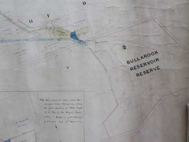
Plan, Creswick Water Supply from Bullarook to Creswick, 02/10/1869
... pipe and rack track from the Bullarook Reservoir to Albert Street, Creswick. Attached with ribbon top left are twelve pages giving bearing and lengths / descriptions of pipe and rack track. Five information boxes drawn along the bottom of plan gives extra information where pipe passes through private properties. Main heading 'Plan of Creswick Water...water supply bullurook reservoir dean bush inn hesken rivers warner taylor gillard mccormack mcdonald brown naples humbug hill sluicing co frank rivers w.r. taylor j. and m. mccormack j. mcdonald richard brown c. naples Large horizontal paper plan glued in three sections to a linen backing. Coloured plan shows pipe and rack track from the Bullarook Reservoir to Albert Street, Creswick. Attached with ribbon top left are twelve pages giving bearing and lengths / descriptions of pipe and rack track. Five information boxes drawn along the bottom of plan gives extra information where pipe passes through private properties. Main ...Probably gazetted on 12 April 1872 (pg 737)Large horizontal paper plan glued in three sections to a linen backing. Coloured plan shows pipe and rack track from the Bullarook Reservoir to Albert Street, Creswick. Attached with ribbon top left are twelve pages giving bearing and lengths / descriptions of pipe and rack track. Five information boxes drawn along the bottom of plan gives extra information where pipe passes through private properties. Main heading 'Plan of Creswick Water Supply / scale eight chains to an inch / County of Talbot / Parish of Creswick'. Calculations and hand written notes in ink and pencil also on plan. Verso 'Dean Reservoir'. Signed and dated.creswick, water supply, bullurook reservoir, dean, bush inn, hesken, rivers, warner, taylor, gillard, mccormack, mcdonald, brown, naples, humbug hill sluicing co, frank rivers, w.r. taylor, j. and m. mccormack, j. mcdonald, richard brown, c. naples