Showing 157 items matching "water supply reserve"
-
 Rutherglen Historical Society
Document - Council permit, 1877 (Exact)
... ...water supply reserve...Letter granting permission to Mr Arthur Gribbin to shoot shag on the Water Supply Reserve. Mr Gribble was senior Constable of Police stationed at Rutherglen. ...Document written in black ink on blue paper, stamped with seal of Rutherglen Municipality, granting permission to Mr Arthur Gribbin to shoot shag on the Water Supply Reserve...Rutherglen Historical Society Murray Street Rutherglen high-country Letter granting permission to Mr Arthur Gribbin to shoot shag on the Water Supply Reserve. Mr Gribble was senior Constable of Police stationed at Rutherglen. ...Letter granting permission to Mr Arthur Gribbin to shoot shag on the Water Supply Reserve. Mr Gribble was senior Constable of Police stationed at Rutherglen. Water supply came from Lake King in the park. Councillors signing were Geo. Audley / Andrew Hunter (M. Gunter?) William Meehan. [check names - Gribbin - Gribble]Document written in black ink on blue paper, stamped with seal of Rutherglen Municipality, granting permission to Mr Arthur Gribbin to shoot shag on the Water Supply Reserve"Borough of Rutherglen / Town Hall / Rutherglen / 1st October 1877" Signed by Councillors and Town Clerk Thos. Reevespermit, water supply reserve, lake king, shag, rutherglen borough -
 Stawell Historical Society Inc
Map, T.F. McGauran, William Couty of Borong 1891, 1891
... Stawell Water Supply Reserve. Grampians State Forest. Dairy Creek, Fyans Creek, Barney's Creek, Bovine Creek, Glasstree Creek, Stoney Creek. ...A2 Parish Map of Willam Inculdin Stawell Water Supply Reserve and Creeks. Marked in red...Stawell Historical Society Inc 46 Longfield St Stawell grampians Stawell Water Supply Reserve. Grampians State Forest. Dairy Creek, Fyans Creek, Barney's Creek, Bovine Creek, Glasstree Creek, Stoney Creek. ...Stawell Water Supply Reserve. Grampians State Forest. Dairy Creek, Fyans Creek, Barney's Creek, Bovine Creek, Glasstree Creek, Stoney Creek. Stawell Water Supply Aquaduct Fkuming Tunnel.A2 Parish Map of Willam Inculdin Stawell Water Supply Reserve and Creeks. Marked in redPhoto Lithographed at the Department of Lands and Survey Melbourne. By T.F. McGauran 20.07.91 water supply survey -
 Bendigo Historical Society Inc.
Document - PETER ELLIS COLLECTION: NOTES MENTIONING WHIPSTICK REGION
... Coliban/Sandhurst Water Supply Reserve...Four pages of typed notes mentioning the Whipstick Region, Mandurang Forest, Jackass Flat, Diamond Hill Area, One Tree Hill, and the Coliban/Sandhurst Water Supply Reserve. Mentioned are the Birds, Mammals, Geology, Flora, Ground Flora, Orchids,Lilies, Mistletoe, Ferns and Grasses of some of the areas....Region Bendigo Block Bendigo Field Naturalists Club Shipstick Scrub Mandurang Forest One Tree Hill Public park Redvers J Eddy Coliban/Sandhurst Water Supply Reserve Four pages of typed notes mentioning the Whipstick Region, Mandurang Forest, Jackass Flat, Diamond Hill Area, One Tree Hill, and the Coliban/Sandhurst Water Supply Reserve. ...Four pages of typed notes mentioning the Whipstick Region, Mandurang Forest, Jackass Flat, Diamond Hill Area, One Tree Hill, and the Coliban/Sandhurst Water Supply Reserve. Mentioned are the Birds, Mammals, Geology, Flora, Ground Flora, Orchids,Lilies, Mistletoe, Ferns and Grasses of some of the areas.bendigo, parks and gardens, public reserves, peter ellis collection, north/central l.c.c. region bendigo block, bendigo field naturalists club, shipstick scrub, mandurang forest, one tree hill public park, redvers j eddy, coliban/sandhurst water supply reserve -
 Bendigo Historical Society Inc.
Map - LONG GULLY HISTORY GROUP COLLECTION: MAP OF LONG GULLY AREA
... Victorian Water Supply Reserve...History House 11 Mackenzie Street Bendigo goldfields BHS Collection BENDIGO History long gully history group The Long Gully History Group - Map of Long Gully Area Victorian Water Supply Reserve Borough of Eaglehawk Two copies of a map, printed on yellow paper, of the Long Gully Area. ...BHS CollectionTwo copies of a map, printed on yellow paper, of the Long Gully Area. It shows Eaglehawk Road from Barnard Street to a little past William Street.bendigo, history, long gully history group, the long gully history group - map of long gully area, victorian water supply reserve, borough of eaglehawk -
 Federation University Historical Collection
Plan, Haddon, County of Grenville, 1932, 13/04/1932
... ...water supply reserve...haddon grenville cardigan water supply reserve nentingbook pre-emptive right a. mclachlan lake burrumbeet e.a. wynne p. russell b. hepburn benjamin hepburn nentingbool t.c. wilson j. amoy william collard smith james roach j. mitchell The Haddon Parish Plan shows crown parcels government roads, Crown Reserves, Railway. ...The Haddon Parish Plan shows crown parcels government roads, Crown Reserves, Railway. Scale 40 chains to 1" (1:31, 680) WGS 84 Centroid Lat: 37 degrees 34' 00" S Long: 148 degrees 40' 20" E N.S. 9.3km E.W.: 16.1kmhaddon, grenville, cardigan, water supply reserve, nentingbook pre-emptive right, a. mclachlan, lake burrumbeet, e.a. wynne, p. russell, b. hepburn, benjamin hepburn, nentingbool, t.c. wilson, j. amoy, william collard smith, james roach, j. mitchell -
Hand Tool Preservation Association of Australia Inc
Diagram
... Diagram reserve water supply...Hand Tool Preservation Association of Australia Inc No physical address melbourne This item is part of the Thomas Caine Tool Collection, owned by The National Trust of Australia (Victoria) and curated by the Hand Tools Preservation Association of Australia. Diagram reserve water supply Diagram ...This item is part of the Thomas Caine Tool Collection, owned by The National Trust of Australia (Victoria) and curated by the Hand Tools Preservation Association of Australia.Diagram reserve water supply -
Bendigo Historical Society Inc.
Map - HARCOURT : COUNTY OF BENDIGO, 23-3-10
... County of Bendigo, County of Talbot, Sutton Grange, Ravenswood, Walmer, Faraday, Castlemaine, Axe Creek, Barkers Creek, Melbourne to Echuca Railway, Victorian Water Supply in Connection with Barkers Creek Reservoir. Victorian Water Supply Reserve, Mt. ...County of Bendigo, County of Talbot, Sutton Grange, Ravenswood, Walmer, Faraday, Castlemaine, Axe Creek, Barkers Creek, Melbourne to Echuca Railway, Victorian Water Supply in Connection with Barkers Creek Reservoir. Victorian Water Supply Reserve, Mt. ...Map. County of Bendigo, County of Talbot, Sutton Grange, Ravenswood, Walmer, Faraday, Castlemaine, Axe Creek, Barkers Creek, Melbourne to Echuca Railway, Victorian Water Supply in Connection with Barkers Creek Reservoir. Victorian Water Supply Reserve, Mt. Alexander State Forest. Three areas reserved for Sericulture (Silkworms). Photo-Lithographed at the Dept. of Lands and Survey, Melbourne by T.F. McGauran 23-3-10. Price 1/-. (number 101 in map cupboard 1)T.F. McGauranmap, bendigo, harcourt -
 Eltham District Historical Society Inc
Photograph, Liz Pidgeon, Heritage Excursion; East of Eltham, 6 Sep 2014, 20 May 2017
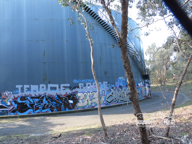
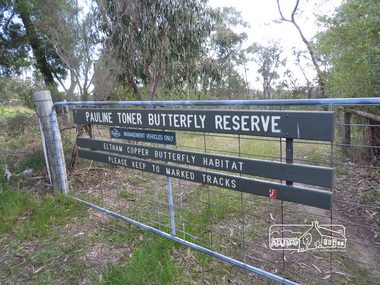
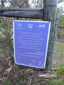
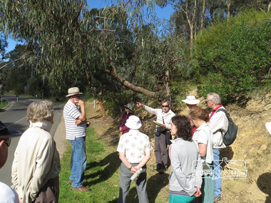
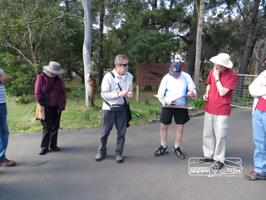
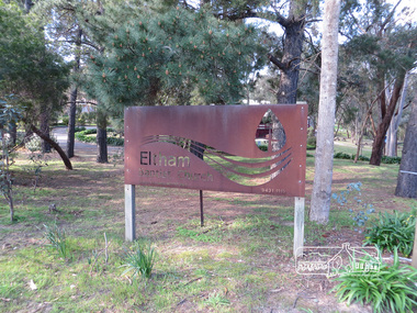
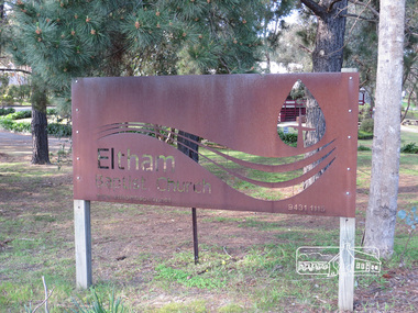
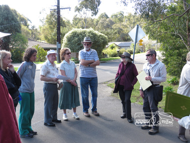
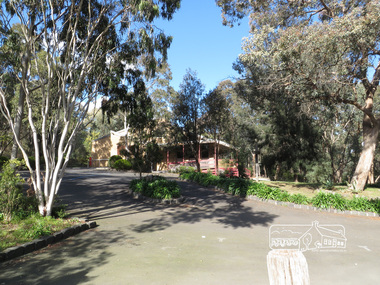
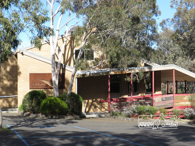
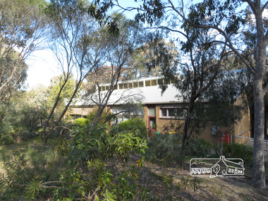
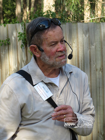
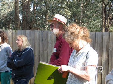
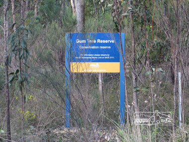
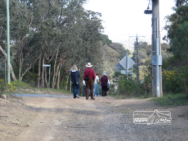
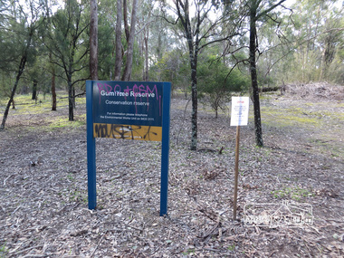
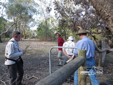
... In later years it has been subdivided for residential purposes but leaving significant areas as power line and water supply reserves and bushland reserves that are habitat for the threatened For our excursion on 6th September we intend to walk through CA 15 to a bushland reserve east of Reynolds Road. ...In later years it has been subdivided for residential purposes but leaving significant areas as power line and water supply reserves and bushland reserves that are habitat for the threatened For our excursion on 6th September we intend to walk through CA 15 to a bushland reserve east of Reynolds Road. ...Eltham Number 2 Reservoir, 386A Reynolds Road, Research. Situated at the top of Reynolds Road adjacent to the Nillumbik Bushalnd Reserve and Gumtree Reserve Newsletter No. 218, September 2014 September Excursion - East of Eltham Walk In Newsletter No. 197, March 2011, there was a brief history of Crown Allotment 15 Section 5 Parish of Nillumbik (CA 15) a parcel of land of a quarter of a square mile extending from Eucalyptus Road to Reynolds Road at the eastern extremity of Eltham. From the 1940s it was known as Stokes orchard. In later years it has been subdivided for residential purposes but leaving significant areas as power line and water supply reserves and bushland reserves that are habitat for the threatened For our excursion on 6th September we intend to walk through CA 15 to a bushland reserve east of Reynolds Road. The walk will traverse the boundary between suburban Eltham and the non-urban areas to the south and east. This is a pleasant walk through residential areas and bushland. Along the way we will discuss the early and more recent history of CA 15 as well as local natural history and geology. This walk is about 3.5 km in length and will take 2 to 2.5 hours. It will start at 2pm at the corner of Eucalyptus Road, Pitt Street and Nyora Road.Born Digitaleltham east, eltham district historical society, heritage excursion, activities, nyora road, reynolds road, gum tree road reserve, diosma road, stokes orchard, eltham no. 2 reservoir, peter & elizabeth pidgeon collection, reynolds road research -
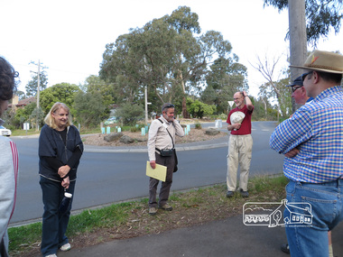 Eltham District Historical Society Inc
Photograph, Liz Pidgeon, Heritage Excursion; East of Eltham, 6 Sep 2014, 20 May 2017
... In later years it has been subdivided for residential purposes but leaving significant areas as power line and water supply reserves and bushland reserves that are habitat for the threatened For our excursion on 6th September we intend to walk through CA 15 to a bushland reserve east of Reynolds Road. ...In later years it has been subdivided for residential purposes but leaving significant areas as power line and water supply reserves and bushland reserves that are habitat for the threatened For our excursion on 6th September we intend to walk through CA 15 to a bushland reserve east of Reynolds Road. ...Newsletter No. 218, September 2014 September Excursion - East of Eltham Walk In Newsletter No. 197, March 2011, there was a brief history of Crown Allotment 15 Section 5 Parish of Nillumbik (CA 15) a parcel of land of a quarter of a square mile extending from Eucalyptus Road to Reynolds Road at the eastern extremity of Eltham. From the 1940s it was known as Stokes orchard. In later years it has been subdivided for residential purposes but leaving significant areas as power line and water supply reserves and bushland reserves that are habitat for the threatened For our excursion on 6th September we intend to walk through CA 15 to a bushland reserve east of Reynolds Road. The walk will traverse the boundary between suburban Eltham and the non-urban areas to the south and east. This is a pleasant walk through residential areas and bushland. Along the way we will discuss the early and more recent history of CA 15 as well as local natural history and geology. This walk is about 3.5 km in length and will take 2 to 2.5 hours. It will start at 2pm at the corner of Eucalyptus Road, Pitt Street and Nyora Road.Born Digitaleltham east, eltham district historical society, heritage excursion, activities, nyora road, reynolds road, gum tree road reserve, diosma road, stokes orchard, eucalyptus road -
 Eltham District Historical Society Inc
Photograph, Liz Pidgeon, Heritage Excursion; East of Eltham, 6 Sep 2014, 20 May 2017
... In later years it has been subdivided for residential purposes but leaving significant areas as power line and water supply reserves and bushland reserves that are habitat for the threatened For our excursion on 6th September we intend to walk through CA 15 to a bushland reserve east of Reynolds Road. ...In later years it has been subdivided for residential purposes but leaving significant areas as power line and water supply reserves and bushland reserves that are habitat for the threatened For our excursion on 6th September we intend to walk through CA 15 to a bushland reserve east of Reynolds Road. ...Newsletter No. 218, September 2014 September Excursion - East of Eltham Walk In Newsletter No. 197, March 2011, there was a brief history of Crown Allotment 15 Section 5 Parish of Nillumbik (CA 15) a parcel of land of a quarter of a square mile extending from Eucalyptus Road to Reynolds Road at the eastern extremity of Eltham. From the 1940s it was known as Stokes orchard. In later years it has been subdivided for residential purposes but leaving significant areas as power line and water supply reserves and bushland reserves that are habitat for the threatened For our excursion on 6th September we intend to walk through CA 15 to a bushland reserve east of Reynolds Road. The walk will traverse the boundary between suburban Eltham and the non-urban areas to the south and east. This is a pleasant walk through residential areas and bushland. Along the way we will discuss the early and more recent history of CA 15 as well as local natural history and geology. This walk is about 3.5 km in length and will take 2 to 2.5 hours. It will start at 2pm at the corner of Eucalyptus Road, Pitt Street and Nyora Road.Born Digitaleltham east, eltham district historical society, heritage excursion, activities, nyora road, reynolds road, gum tree road reserve, diosma road, stokes orchard, eucalyptus road