
Showing 18 items matching "yarrambat historical society"
-
 Eltham District Historical Society Inc
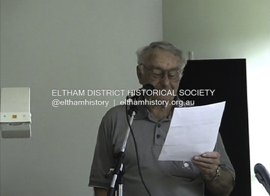
Film - Video (DVD), Yarrambat Historical Society, Tales of Old Nillumbik; Yarrambat, 22 November 2005
... ...Yarrambat Historical Society...Max Turner of Yarrambat Historical Society speaks as part of the Tales of Old Nillumbik program. ...Yarrambat Historical Society...Max Turner of Yarrambat Historical Society speaks as part of the Tales of Old Nillumbik program. ...Max Turner of Yarrambat Historical Society speaks as part of the Tales of Old Nillumbik program. A series of talks held October - December 2005 at the Eltham Living and Learning Centre which allowed Nillumbik Historical Societies to record the verbal history of the area with some of the well known residents of Nillumbik and surrounds Recorded and edited by Marie Ryan of Plenty Valley FM Community radio station. Speaker: 22 November 2005video recording, max turner, yarrambat, yarrambat heritage museum, yarrambat historical society -
 Greensborough Historical Society
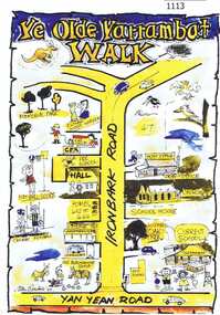
Leaflet, Yarrambat Historical Society, Ye Olde Yarrambat Walk, 2013_
... ...yarrambat historical society...Yarrambat Historical Society...Ye Olde Yarrambat Walk Leaflet Yarrambat Historical Society ...This brochure is a self-guided tour of the historical buildings remaining in Yarrambat. The walk takes in 13 sites which link ‘Olde’ Yarrambat to today including the Eltham & District Woodworkers and the original school house site. A guide is available from the Old Yarrambat General Store and Yarrambat Post Office. One page leaflet, colour images.yarrambat, yarrambat historical society -
 Greensborough Historical Society
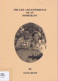
Book, The life and experience of an immigrant by Otto Rupp, 2004_
... ...yarrambat historical society...Yarrambat Historical Society...Reflects the importance of immigration to Australia otto rupp victoria immigration yarrambat historical society yarrambat "Noel with Y.H.S. thanks 9.6.2009" A4 size, 60 pages. ...Autobiography by Otto Rupp of the places and family in Victoria and South Australia. Transcribed from original handwritten 1933 manuscript. First edition 1995, second edition 1999, reprinted 2004.Reflects the importance of immigration to AustraliaA4 size, 60 pages. Black print on white paper, black and white illustrations. Light brown cover with photo of author and wife."Noel with Y.H.S. thanks 9.6.2009"otto rupp, victoria immigration, yarrambat historical society, yarrambat -
 Eltham District Historical Society Inc
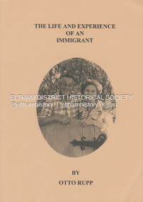
Book, Otto Rupp, The Life and Experience of an Immigrant, 1999
... ...Yarrambat Historical Society...Transcribed by the Yarrambat Historical Society from the original manuscript in 1993. ...An autobiography by Otto Rupp (1904 -1993). Transcribed by the Yarrambat Historical Society from the original manuscript in 1993. Otto Rupp was born in Switzerland in 1904. He migrated to Australia in 1927 and after working in the South Australian outback bought land in Yarramabt. He married Edna Young in 1935. This diary includes recollections of his life from 1927 to 1983. Bachelor Days, 1919-1935: Murray Bridge, Karoonda, Wirrabara, Appilia, South Australia, Central Australia, Tancks Corner (Yarrambat), Balranald, and Yarramabt. Married Life, Gold in Yarrambat, Times, People and Memories, 1943-1987.58 p. : ill., fascsims., geneal. table ; 30 cmnon-fictionAn autobiography by Otto Rupp (1904 -1993). Transcribed by the Yarrambat Historical Society from the original manuscript in 1993. Otto Rupp was born in Switzerland in 1904. He migrated to Australia in 1927 and after working in the South Australian outback bought land in Yarramabt. He married Edna Young in 1935. This diary includes recollections of his life from 1927 to 1983. Bachelor Days, 1919-1935: Murray Bridge, Karoonda, Wirrabara, Appilia, South Australia, Central Australia, Tancks Corner (Yarrambat), Balranald, and Yarramabt. Married Life, Gold in Yarrambat, Times, People and Memories, 1943-1987.otto rupp, edna young, yarrambat, tancks corner victoria, autobiography, migrant -
 Eltham District Historical Society Inc
Document - Folder, Szekfy, John
... ...Yarrambat Historical Society...John Szekfy's life and activities with Yarrambat Historical Society. ...John Szekfy's life and activities with Yarrambat Historical Society. John Szekfy James Sexton Yarrambat Primary School Yan Yean Road Victoria Our Lady Help of Christians Eltham Watsonia Technical School PMG Research Laboratories Telstra Yarrambat Historical Society Yarrambat Heritage Museum Golden King Mine Gold Battery Carol Szekfy Newspaper clippings, A4 photocopies, etc Szekfy, John Document Folder ...John Szekfy has been active in preserving the history of the Yarrambat area. Contents Newspaper article: "A champion of history", Diamond Valley Leader, 10 October 2018. John Szekfy's life and activities with Yarrambat Historical Society. Newspaper clippings, A4 photocopies, etcjohn szekfy, james sexton, yarrambat primary school, yan yean road victoria, our lady help of christians eltham, watsonia technical school, pmg research laboratories, telstra, yarrambat historical society, yarrambat heritage museum, golden king mine gold battery, carol szekfy -
 Eltham District Historical Society Inc
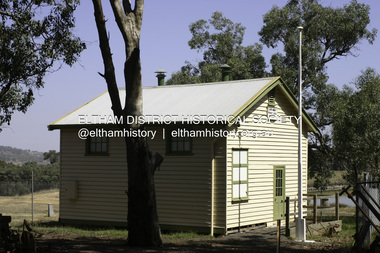
Photograph - Digital Photograph, Alan King, Yarrambat Heritage Museum, 23 January 2008
... ...Yarrambat Historical Society...The museum includes the original Yarrambat Primary School, which was moved to the site in 2000 and now serves as the Yarrambat Historical Society headquarters.The museum also includes a fully operational battery (gold-bearing ore crusher) driven by a McDonald 30HP diesel engine built in Richmond in 1938. ...Nillumbik Now and Then (Marshall-King) Collection Yarrambat Heritage Museum Yarrambat Historical Society Yarrambat Primary School Born digital image file Yarrambat Heritage Museum Photograph Digital Photograph Alan King Alan King Marguerite Marshall ...Original Yarrambat Primary School building at the Yarrambat Heritage Museum, Yarrambat Park. At the museum, visitors can gain an insight into Yarrambat’s past since non-Aboriginal settlement. The museum includes the original Yarrambat Primary School, which was moved to the site in 2000 and now serves as the Yarrambat Historical Society headquarters.The museum also includes a fully operational battery (gold-bearing ore crusher) driven by a McDonald 30HP diesel engine built in Richmond in 1938. The battery was relocated from the Golden King Mine in North Oatlands Road, Yarrambat, where it operated until 1984.1 Other exhibits include farming implements and machinery from the Yarrambat district. Published: Nillumbik Now and Then / Marguerite Marshall 2008; photographs Alan King with Marguerite Marshall.; p25This collection of almost 130 photos about places and people within the Shire of Nillumbik, an urban and rural municipality in Melbourne's north, contributes to an understanding of the history of the Shire. Published in 2008 immediately prior to the Black Saturday bushfires of February 7, 2009, it documents sites that were impacted, and in some cases destroyed by the fires. It includes photographs taken especially for the publication, creating a unique time capsule representing the Shire in the early 21st century. It remains the most recent comprehenesive publication devoted to the Shire's history connecting local residents to the past. nillumbik now and then (marshall-king) collection, yarrambat heritage museum, yarrambat historical society, yarrambat primary school -
 Greensborough Historical Society
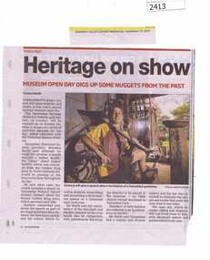
Newspaper Clipping, Heritage on show, 23/09/2015
... ...yarrambat historical society...Part of Yarrambat's gold history was on display at Yarrambat Heritage Museum's open day, yarrambat heritage museum yarrambat historical society News clipping, black text, colour image. ...Part of Yarrambat's gold history was on display at Yarrambat Heritage Museum's open day,News clipping, black text, colour image.yarrambat heritage museum, yarrambat historical society -
 Greensborough Historical Society
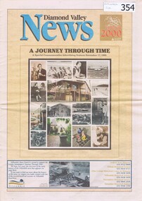
Newspaper, Diamond Valley Leader, A Journey Through Time, 17/11/1999
... historical society...eltham historical society...warrandyte historical society...yarrambat...Historical Societies in the area in 1999. A special supplement issued in the lead up to New Year's Eve 1999. nillumbik historical society eltham historical society warrandyte historical society yarrambat historical society ellis cottage historical centre andrew ross museum diamond valley news celebrate 2000 A Diamond Valley News advertising supplement issued on 17th November 1999. 12 pages, illus. ...Details the ages of local schools and the contact details of the active Historical Societies in the area in 1999.A special supplement issued in the lead up to New Year's Eve 1999.A Diamond Valley News advertising supplement issued on 17th November 1999. 12 pages, illus. (some col.). Scan of entire item available at GHS.nillumbik historical society, eltham historical society, warrandyte historical society, yarrambat historical society, ellis cottage historical centre, andrew ross museum, diamond valley news, celebrate 2000 -
Eltham District Historical Society Inc
Document - Folder, Lex de Man
... He is a member of the Yarrambat Historical Society, Yarrambat CFA and the Greensborough Hockey Club. ...He is a member of the Yarrambat Historical Society, Yarrambat CFA and the Greensborough Hockey Club. ...Lex de Man, manager of Country Fire Association region 14, became Mayor of Nillumbik in 2002, four years after he and fellow councillors were sacked by the Kennett government. In the 2009 Black Saturday fires, he led eastern metropolitan CFA volunteers and was awarded an Australian Fire Service Medal as part of the 2011 Australia Day Awards. He was a CFA volunteer for more than 30 years, a CFA employee for 15 years, and had served with Victoria Police for 18 years. He is a member of the Yarrambat Historical Society, Yarrambat CFA and the Greensborough Hockey Club. He lives at Yarrambat. Contents Newspaper article: "Voters wield axe on greens", Diamond Valley Leader, 27 March 2002, Report of Nillumbik Council election 16 March, which Diamond Creek solicitor Tony Raunic survived (beating Margaret Jennings) but all five pro-Green Wedge councillors lost. Others elected included Greg Johnson, Natalie Woodley, Belinda Clarkson, Mike Irwin, Lionel Draper, Bob Stubbings, Michael Hall and Lex de Man. Those beaten included Bill Penrose, Sigmund Jorgensen, Di Bullen and Penny Mullinar. Newspaper article: "The Man for the job", diamond Valley Leader, 3 April 2002, Report of Nillumbik Council swearing-in, details about Lex de Man, and Nillumbik Council meeting including Greg Johnson's speech. Newspaper artivle: "Blazing recovery trail", Diamond Valley Leader, 26 January 2011, Lex de Man awarded an Australian fire Service Medal in the 2011 Australia Day Awards; details of. his career and his comments on CFA volunteers.Newspaper clippings, A4 photocopies, etcmernda victoria, black saturday fires 2009, les de man, country fire authority victoria, victoria police, tony raunic, margaret jennings, green wedge nillumbik, greg johnson, natalie woodley, belinda clarkson, mike irwin, lionel draper, bob stubbings, michael hall, bill penrose, sigmuynd jorgensen, di bullen, penny mullinar -
 Greensborough Historical Society
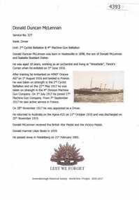
Article, Greensborough Historical Society et al, Donald Duncan McLennan, 1914-1918
... At the time of his enlistment he was living at Tanck's Corner (Yarrambat). world war 1 project donald duncan mclennan One page, text and colour images. Donald Duncan McLennan Article Greensborough Historical Society World War 1 Project ...A short article about Donald Duncan McLennan` and his service in World War 1. At the time of his enlistment he was living at Tanck's Corner (Yarrambat).One page, text and colour images.world war 1 project, donald duncan mclennan -
 Greensborough Historical Society
Book, Tanck's Corner Yarrambat; Centenary Year 1878-1978, 1878-1978
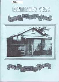
... A full history of the school including reasons for its establishment and a roll call of students from 1878 to 1978, Third reprint (1995) published with assistance of Yarrambat Historical Society yarrambat primary school tancks corner Inscribed inside front cover : "Noel, sincere thanks for your support, YHS members. 9.6.09" Addendum to 2015:item 2359. 100 pages plus addendum to 3rd reprint. ...A history of the primary school at Yarrambat, formerly called Tanck's Corner (until 1929), produced for the school centenary 1878-1978. Written and compiled by Eileen Hooper, design and technical advice from Alan White.A full history of the school including reasons for its establishment and a roll call of students from 1878 to 1978, Third reprint (1995) published with assistance of Yarrambat Historical Society100 pages plus addendum to 3rd reprint. Black and white photographs. Pale blue soft cover with photograph of original school building. 2015 copy has addendum with pupil enrolments to 2015.Inscribed inside front cover : "Noel, sincere thanks for your support, YHS members. 9.6.09" Addendum to 2015:item 2359.yarrambat primary school, tancks corner -
 Greensborough Historical Society
Book, Tanck's Corner Yarrambat; Centenary Year 1878-1978, 1978
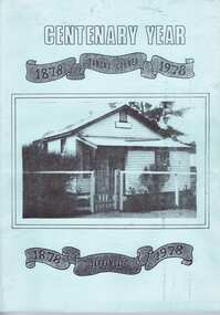
... Written and compiled by Eileen Hooper, design and technical advice from Alan White. [3rd Reprint made in 1995] A full history of the school including reasons for its establishment and a roll call of students from 1878 to 1978, Third reprint (1995) published with assistance of Yarrambat Historical Society yarrambat primary school tancks corner eileen hooper alan white yarrambat Inscribed inside front cover : "Noel, sincere thanks for your support, YHS members. 9.6.09" 100 pages plus addendum to 3rd reprint. ...A history of the primary school at Yarrambat, formerly called Tanck's Corner (until 1929), produced for the school centenary 1878-1978. Written and compiled by Eileen Hooper, design and technical advice from Alan White. [3rd Reprint made in 1995]A full history of the school including reasons for its establishment and a roll call of students from 1878 to 1978, Third reprint (1995) published with assistance of Yarrambat Historical Society100 pages plus addendum to 3rd reprint. Black and white photographs. Pale blue soft cover with photograph of original school building. Inscribed inside front cover : "Noel, sincere thanks for your support, YHS members. 9.6.09" yarrambat primary school, tancks corner, eileen hooper, alan white, yarrambat -
 Eltham District Historical Society Inc
Newsletter, Eltham District Historical Society, Newsletter, No. 242 October 2018
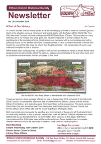
... Contents: • A Part of Our History by Jim Connor • Our Next Meeting – Wednesday 10th October 2018 • November Excursion - Along the Diamond Creek • Eltham 1950s – Childhood Reminiscences – Part 7 (6) by Ann Constable • Discord at Yarrambat by Richard Pinn • Our Christmas Function - Wednesday 12th December • Eltham's first Rate books given to Public Records Office Victoria (PROV) • Life in Eltham - Part 1 by Shirley Corneille • Eltham Justice Precinct by Jim Connor • Contacts for the Eltham District Historical Society ...Contents: • A Part of Our History by Jim Connor • Our Next Meeting – Wednesday 10th October 2018 • November Excursion - Along the Diamond Creek • Eltham 1950s – Childhood Reminiscences – Part 7 (6) by Ann Constable • Discord at Yarrambat by Richard Pinn • Our Christmas Function - Wednesday 12th December • Eltham's first Rate books given to Public Records Office Victoria (PROV) • Life in Eltham - Part 1 by Shirley Corneille • Eltham Justice Precinct by Jim Connor • Contacts for the Eltham District Historical Society The Shire of Eltham Historical Society was formed in October 1967. ...Contents: • A Part of Our History by Jim Connor • Our Next Meeting – Wednesday 10th October 2018 • November Excursion - Along the Diamond Creek • Eltham 1950s – Childhood Reminiscences – Part 7 (6) by Ann Constable • Discord at Yarrambat by Richard Pinn • Our Christmas Function - Wednesday 12th December • Eltham's first Rate books given to Public Records Office Victoria (PROV) • Life in Eltham - Part 1 by Shirley Corneille • Eltham Justice Precinct by Jim Connor • Contacts for the Eltham District Historical Society The Shire of Eltham Historical Society was formed in October 1967. The first newsletter of the Society was issued May 1978 and has been published continuously ever since on a bi-monthly basis. With the cessation of the Shire of Eltham in late 1994, the Society's name was revised to Eltham District Historical Society and this name first appeared with issue No. 103, July 1995. The collection of the Society's newsletters provides a valuable resource on the history of the Society's activities, office bearers and committee members, guest speakers and subjects of historical interest pertinent to the former Shire of Eltham and the Eltham District.A4 newsletter distributed to membersnewsletter, eltham district historical society -
 Eltham District Historical Society Inc
Journal - Newsletter, Nillumbik Shire Council, Nillumbik News, October 2000
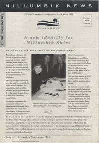
... Historical Society...Council for Aboriginal Reconciliation...Eltham North Primary School...Wattle Glen Primary School...Eltham Arts Council...Churinga Arts...Harvey World Travel (Eltham)...Eltham Little Book Shop...Do Lunch Cafe...Volumes Cafe...Grovedale Cottage...Lovegrove Winery Cottles Bridge...Yarrambat...October 2000 articles include: Safer roads for the Shire Eltham Festival program announced Commercial Place design released 2000-2003 Council Plan Released National Reconciliation Framework Living and Learning Centres More Playgrounds Susan St Pavilion completed Study to plan for BMX/skate track Wattle Glen Township Strategy Community Weed Control Program Count Koala Day Environment Centre proposed for Edendale Farm Open Space Strategy findings Neighbourhood Character Study and Residential Design Guidelines Friends groups Clean Drains – Living Creeks, National Water Week Nillumbik Shire Council Cultural Plan 2000-2005 adopted 2001 Alan Marshall Short Story Award Artists’ Open Studios program Kangaroo Ground Tower Advisory Committee Environment leaders at Eltham North primary Dollars saved by regular road maintenance Regional Road upgrades Rural roads grading program Stormwater Management Plan Locality boundary update Council Newsletters Nillumbik News Nillumbik Shire Council Council Plan 2000–2003 Municipal Road Safety Strategy Infrastructure services Stormwater Management Plan Locality boundary review Rates Sustainable agriculture rebate Capital works program road maintenance Better Roads Victorian program eltham - yarra glen road Warrandyte - Kangaroo Ground Road Rural roads grading program Commercial Place Public space public infrastructrue meals on wheels Eltham Living and Learning Centre Living and Learning Centre adult community education volunteer programs Australia Day Awards community groups environmental protection sustainability Community weed control landcare koalas Drainage works waterway protection indigenous grass environmental education Open Space public parkland playgrounds bike trail Adventure Playground community reserves Kangaroo Ground Tower reserve Cultural plan Eltham festival Artists Open Studios cultural tourism Alan Marshall Short Story Award Montsalvat community arts program garden walks Eltham Fun Run community market mudbrick tours CERES Environmental Education Centre Nillumbik Tourism Association Food and Wine trail Yarra Valley Tourism campaign road safety Adrian Cully Alan Marshall Andrew Port Anne Connor Catherine Dale Chris Wallace-Crabbe Claire Harris David Scott David Yencken Dean Stewart Deb Ganderton Debra Wilkinson Denis Ward drew gregory Daryl Taylor Fiona Austin Frank Butters Frank Nolan Gavin Jordan Glen Jameson Grace Mitchell Greg Scott Harry Gilham Helen Ash Jane Annois jane viola Jan Kelly Jenneke Korteweg Jenni Mitchell Jessica Davison Jill Forrest john hewish Jules Burns Julius Peiker kay steventon Kayte Nunn Lesley Shuttleworth leslie Avril Louise Heathcote Marg Jeffery Margaret Jennings Martin Wright Mathew Hodsnesse Maurice Stabb Megan McCarthy Mervyn Hannan Michael Jansz michael skewes Mick Woiwod nel ten wolde Nicholas Pelling Ona Henderson Peter Burn Piers Bateman reg cox Reg Evans Robert Boyle Robert Hay Robert Theobald shan shnookal Sigmund Jorgensen Stuart Menzies Steven White Vonnie Frazer Eltham District Historical Society Council for Aboriginal Reconciliation Eltham North Primary School Wattle Glen Primary School Eltham Arts Council Churinga Arts Harvey World Travel (Eltham) Eltham Little Book Shop Do Lunch Cafe Volumes Cafe Grovedale Cottage Lovegrove Winery Cottles Bridge Yarrambat Golf Club Eltham Football Club Eltham Rugby Football Club Lower Eltham Cricket Club Susan Street Oval Syd Tunn Jack Rasterhoff A4. monotone print, double stapled, 4 pages Nillumbik News Journal Newsletter Nillumbik Shire Council ...The newsletter outlines local government initiatives, community events, environmental programs, infrastructure projects, and cultural activities occurring in the Nillumbik Shire around October–November 2000. It highlights council plans, community participation opportunities, and local developments aimed at improving quality of life in the region. October 2000 articles include: Safer roads for the Shire Eltham Festival program announced Commercial Place design released 2000-2003 Council Plan Released National Reconciliation Framework Living and Learning Centres More Playgrounds Susan St Pavilion completed Study to plan for BMX/skate track Wattle Glen Township Strategy Community Weed Control Program Count Koala Day Environment Centre proposed for Edendale Farm Open Space Strategy findings Neighbourhood Character Study and Residential Design Guidelines Friends groups Clean Drains – Living Creeks, National Water Week Nillumbik Shire Council Cultural Plan 2000-2005 adopted 2001 Alan Marshall Short Story Award Artists’ Open Studios program Kangaroo Ground Tower Advisory Committee Environment leaders at Eltham North primary Dollars saved by regular road maintenance Regional Road upgrades Rural roads grading program Stormwater Management Plan Locality boundary update council newsletters, nillumbik news, nillumbik shire council, council plan 2000–2003, municipal road safety strategy, infrastructure services, stormwater management plan, locality boundary review, rates, sustainable agriculture rebate, capital works program, road maintenance, better roads victorian program, eltham - yarra glen road, warrandyte - kangaroo ground road, rural roads grading program, commercial place, public space, public infrastructrue, meals on wheels, eltham living and learning centre, living and learning centre, adult community education, volunteer programs, australia day awards, community groups, environmental protection, sustainability, community weed control, landcare, koalas, drainage works, waterway protection, indigenous grass, environmental education, open space, public parkland, playgrounds, bike trail, adventure playground, community reserves, kangaroo ground tower reserve, cultural plan, eltham festival, artists open studios, cultural tourism, alan marshall short story award, montsalvat, community arts program, garden walks, eltham fun run, community market, mudbrick tours, ceres environmental education centre, nillumbik tourism association, food and wine trail, yarra valley tourism campaign, road safety, adrian cully, alan marshall, andrew port, anne connor, catherine dale, chris wallace-crabbe, claire harris, david scott, david yencken, dean stewart, deb ganderton, debra wilkinson, denis ward, drew gregory, daryl taylor, fiona austin, frank butters, frank nolan, gavin jordan, glen jameson, grace mitchell, greg scott, harry gilham, helen ash, jane annois, jane viola, jan kelly, jenneke korteweg, jenni mitchell, jessica davison, jill forrest, john hewish, jules burns, julius peiker, kay steventon, kayte nunn, lesley shuttleworth, leslie avril, louise heathcote, marg jeffery, margaret jennings, martin wright, mathew hodsnesse, maurice stabb, megan mccarthy, mervyn hannan, michael jansz, michael skewes, mick woiwod, nel ten wolde, nicholas pelling, ona henderson, peter burn, piers bateman, reg cox, reg evans, robert boyle, robert hay, robert theobald, shan shnookal, sigmund jorgensen, stuart menzies, steven white, vonnie frazer, eltham district historical society, council for aboriginal reconciliation, eltham north primary school, wattle glen primary school, eltham arts council, churinga arts, harvey world travel (eltham), eltham little book shop, do lunch cafe, volumes cafe, grovedale cottage, lovegrove winery cottles bridge, yarrambat golf club, eltham football club, eltham rugby football club, lower eltham cricket club, susan street oval, syd tunn, jack rasterhoff -
 Eltham District Historical Society Inc
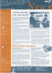
Journal - Newsletter, Nillumbik Shire Council, Nillumbik News, October 2000
... Historical Society...Council for Aboriginal Reconciliation...Eltham North Primary School...Wattle Glen Primary School...Eltham Arts Council...Churinga Arts...Harvey World Travel (Eltham)...Eltham Little Book Shop...Do Lunch Cafe...Volumes Cafe...Grovedale Cottage...Lovegrove Winery Cottles Bridge...Yarrambat...October 2000 articles include: Safer roads for the Shire Eltham Festival program announced Commercial Place design released 2000-2003 Council Plan Released National Reconciliation Framework Living and Learning Centres More Playgrounds Susan St Pavilion completed Study to plan for BMX/skate track Wattle Glen Township Strategy Community Weed Control Program Count Koala Day Environment Centre proposed for Edendale Farm Open Space Strategy findings Neighbourhood Character Study and Residential Design Guidelines Friends groups Clean Drains – Living Creeks, National Water Week Nillumbik Shire Council Cultural Plan 2000-2005 adopted 2001 Alan Marshall Short Story Award Artists’ Open Studios program Kangaroo Ground Tower Advisory Committee Environment leaders at Eltham North primary Dollars saved by regular road maintenance Regional Road upgrades Rural roads grading program Stormwater Management Plan Locality boundary update Council Newsletters Nillumbik News Nillumbik Shire Council Council Plan 2000–2003 Municipal Road Safety Strategy Infrastructure services Stormwater Management Plan Locality boundary review Rates Sustainable agriculture rebate Capital works program road maintenance Better Roads Victorian program eltham - yarra glen road Warrandyte - Kangaroo Ground Road Rural roads grading program Commercial Place Public space public infrastructrue meals on wheels Eltham Living and Learning Centre Living and Learning Centre adult community education volunteer programs Australia Day Awards community groups environmental protection sustainability Community weed control landcare koalas Drainage works waterway protection indigenous grass environmental education Open Space public parkland playgrounds bike trail Adventure Playground community reserves Kangaroo Ground Tower reserve Cultural plan Eltham festival Artists Open Studios cultural tourism Alan Marshall Short Story Award Montsalvat community arts program garden walks Eltham Fun Run community market mudbrick tours CERES Environmental Education Centre Nillumbik Tourism Association Food and Wine trail Yarra Valley Tourism campaign road safety Adrian Cully Alan Marshall Andrew Port Anne Connor Catherine Dale Chris Wallace-Crabbe Claire Harris David Scott David Yencken Dean Stewart Deb Ganderton Debra Wilkinson Denis Ward drew gregory Daryl Taylor Fiona Austin Frank Butters Frank Nolan Gavin Jordan Glen Jameson Grace Mitchell Greg Scott Harry Gilham Helen Ash Jane Annois jane viola Jan Kelly Jenneke Korteweg Jenni Mitchell Jessica Davison Jill Forrest john hewish Jules Burns Julius Peiker kay steventon Kayte Nunn Lesley Shuttleworth leslie Avril Louise Heathcote Marg Jeffery Margaret Jennings Martin Wright Mathew Hodsnesse Maurice Stabb Megan McCarthy Mervyn Hannan Michael Jansz michael skewes Mick Woiwod nel ten wolde Nicholas Pelling Ona Henderson Peter Burn Piers Bateman reg cox Reg Evans Robert Boyle Robert Hay Robert Theobald shan shnookal Sigmund Jorgensen Stuart Menzies Steven White Vonnie Frazer Eltham District Historical Society Council for Aboriginal Reconciliation Eltham North Primary School Wattle Glen Primary School Eltham Arts Council Churinga Arts Harvey World Travel (Eltham) Eltham Little Book Shop Do Lunch Cafe Volumes Cafe Grovedale Cottage Lovegrove Winery Cottles Bridge Yarrambat Golf Club Eltham Football Club Eltham Rugby Football Club Lower Eltham Cricket Club Susan Street Oval Syd Tunn Jack Rasterhoff A4. two colour print (orange/blue), double stapled, 16 pages Nillumbik News Journal Newsletter Nillumbik Shire Council ...The newsletter outlines local government initiatives, community events, environmental programs, infrastructure projects, and cultural activities occurring in the Nillumbik Shire around October–November 2000. It highlights council plans, community participation opportunities, and local developments aimed at improving quality of life in the region. October 2000 articles include: Safer roads for the Shire Eltham Festival program announced Commercial Place design released 2000-2003 Council Plan Released National Reconciliation Framework Living and Learning Centres More Playgrounds Susan St Pavilion completed Study to plan for BMX/skate track Wattle Glen Township Strategy Community Weed Control Program Count Koala Day Environment Centre proposed for Edendale Farm Open Space Strategy findings Neighbourhood Character Study and Residential Design Guidelines Friends groups Clean Drains – Living Creeks, National Water Week Nillumbik Shire Council Cultural Plan 2000-2005 adopted 2001 Alan Marshall Short Story Award Artists’ Open Studios program Kangaroo Ground Tower Advisory Committee Environment leaders at Eltham North primary Dollars saved by regular road maintenance Regional Road upgrades Rural roads grading program Stormwater Management Plan Locality boundary update council newsletters, nillumbik news, nillumbik shire council, council plan 2000–2003, municipal road safety strategy, infrastructure services, stormwater management plan, locality boundary review, rates, sustainable agriculture rebate, capital works program, road maintenance, better roads victorian program, eltham - yarra glen road, warrandyte - kangaroo ground road, rural roads grading program, commercial place, public space, public infrastructrue, meals on wheels, eltham living and learning centre, living and learning centre, adult community education, volunteer programs, australia day awards, community groups, environmental protection, sustainability, community weed control, landcare, koalas, drainage works, waterway protection, indigenous grass, environmental education, open space, public parkland, playgrounds, bike trail, adventure playground, community reserves, kangaroo ground tower reserve, cultural plan, eltham festival, artists open studios, cultural tourism, alan marshall short story award, montsalvat, community arts program, garden walks, eltham fun run, community market, mudbrick tours, ceres environmental education centre, nillumbik tourism association, food and wine trail, yarra valley tourism campaign, road safety, adrian cully, alan marshall, andrew port, anne connor, catherine dale, chris wallace-crabbe, claire harris, david scott, david yencken, dean stewart, deb ganderton, debra wilkinson, denis ward, drew gregory, daryl taylor, fiona austin, frank butters, frank nolan, gavin jordan, glen jameson, grace mitchell, greg scott, harry gilham, helen ash, jane annois, jane viola, jan kelly, jenneke korteweg, jenni mitchell, jessica davison, jill forrest, john hewish, jules burns, julius peiker, kay steventon, kayte nunn, lesley shuttleworth, leslie avril, louise heathcote, marg jeffery, margaret jennings, martin wright, mathew hodsnesse, maurice stabb, megan mccarthy, mervyn hannan, michael jansz, michael skewes, mick woiwod, nel ten wolde, nicholas pelling, ona henderson, peter burn, piers bateman, reg cox, reg evans, robert boyle, robert hay, robert theobald, shan shnookal, sigmund jorgensen, stuart menzies, steven white, vonnie frazer, eltham district historical society, council for aboriginal reconciliation, eltham north primary school, wattle glen primary school, eltham arts council, churinga arts, harvey world travel (eltham), eltham little book shop, do lunch cafe, volumes cafe, grovedale cottage, lovegrove winery cottles bridge, yarrambat golf club, eltham football club, eltham rugby football club, lower eltham cricket club, susan street oval, syd tunn, jack rasterhoff -
 Eltham District Historical Society Inc
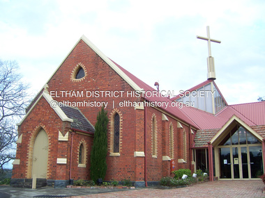
Photograph - Digital Photograph, Marguerite Marshall, St John's Anglican Church, Diamond Creek, 7 September 2008
... Yarrambat. As parishioner numbers outgrew the building, extensions were added in 1989 and then in 1993, blending in well with the original building. Church members have made a huge contribution to the local community. John Ryan was a Heidelberg Shire Councillor for 25 years from 1931, Mayor in 1939 and headed several local sporting and other organisations. His son Jock became a clergyman and a local historian heading the Nillumbik Historical Society...Yarrambat. As parishioner numbers outgrew the building, extensions were added in 1989 and then in 1993, blending in well with the original building. Church members have made a huge contribution to the local community. John Ryan was a Heidelberg Shire Councillor for 25 years from 1931, Mayor in 1939 and headed several local sporting and other organisations. His son Jock became a clergyman and a local historian heading the Nillumbik Historical Society ...The building was designed by Charles Maplestone of Heidelberg, son-in-law to Anthony Beale of St Helena. Maplestone was a prominent architect who came out to Australia with his family in 1852. The foundation stone was laid by Mrs Isabella Maplestone on 11th November 1867. The bricklayers for the church were George Stebbing, H Limmer, H Spicer and a Mr Timm while Thomas Day was the stonemason. Another three years were to pass before sufficient money could be raised for its completion. It was opened by Bishop Perry on 1st November, 1870. The church bell which hung under a tree for 50 years until it was incorporated in the parish hall was brought out from England and presented by Charles Orme. In 1916, the estate of George Martin Pizzey left sufficient money to build the red brick hall, which still stands today (2023) though in January 1969 the hall and bell tower were badly damaged by bushfire. Coincidentally the former home of benefactor, George Pizzey was destroyed in the same fire. Of particular significance are the interior and exterior of the church, the Sunday school and hall with emphasis on pre-World War I fabric (excluding the 1990s additions) and the three coloured glass windows currently suspended in the 1990s entry foyer. In 2011 further alterations were made to the front of the Church. The church is historically significant because it was the oldest public building in the former Diamond Valley Shire, is amongst the oldest buildings in the Shire of Nillumbik and is associated with the early settlement of the Diamond Creek district. The church is historically, socially and spiritually significant because it has been a place of worship for over 150 years and continues to be, an important meeting place in the Shire. The church is aesthetically significant for the three stained glass windows executed by the noted stained glass manufacturers, Ferguson & Urie, as well as the supporting coloured glass windows in the church. The Sunday school & parish hall is architecturally significant because the hall is a well executed and preserved example of the work of noted church architects, North & Williams. It is historically significant because it is connected with local parishioner and Melbourne industrialist, George Pizzey, who bequeathed funds for its construction. Covered under Heritage Overlay, Nillumbik Planning Scheme. National Estate Ntionl Trust of Australia (Victoria) Local significance Published: Nillumbik Now and Then / Marguerite Marshall 2008; photographs Alan King with Marguerite Marshall.; p85 St John’s Anglican Church stands like a beacon on the hill on Main Street, Diamond Creek. Today the church has a large congregation, but its early years were marked by a small congregation struggling to find enough money to survive. It was gold in Diamond Creek that resulted in the building of this National Trust registered property.1 This church is far removed from William Wilson’s humble barn (later the Bowling Green) where the first Anglican church services were conducted – probably the first in the district.2 In the mid 19th century services were infrequent as the Rev Francis Hales, travelling on horseback, also conducted services elsewhere, including at Heidelberg, Coburg, Kinglake, Arthurs Creek, St Andrews and Kangaroo Ground. In 1860 Diamond Creek came under the jurisdiction of the Eltham Parish. Until the mid 1860s the Diamond Creek settlement included only about 20 families who were struggling farmers. But this changed when gold was found in 1862. Then the township grew to 200 families, including miners, civil administration workers and shopkeepers. The resulting growth of Church of England adherents prompted them to petition the Government in 1866 for land to build a church. The area chosen, on which the original building still stands, was at the centre of the proposed township. Today church leaders believe that this conspicuous location is one of the reasons for its exceptional growth. Prominent architect Charles Maplestone designed the building as he did the Presbyterian Church at Kangaroo Ground. St John’s, which is still intact, was built in the Gothic Revival style with the traditional rectangular plan of a central nave and sanctuary at the end. It is typical of small churches built in Victoria at that time, with polychromatic hand-made bricks, a porch, diagonal buttresses and a slate roof.3 The church was officially opened by Lord Bishop Perry on November 1, 1870. But during the next 40 years, due to the varying fortunes of gold mining, the church struggled to remain viable. In 1909 it separated from the Eltham Parish to form a parish with Greensborough. Life became more difficult with the privations of World War One. Then disaster struck in 1915 when fire destroyed the Diamond Creek Gold Mine, wiping out the major livelihood of most parishioners. However the church’s morale was lifted in 1916, when it received a bequest to build the red brick hall, from late parishioner and prominent leather manufacturer, George Pizzey. As prosperity grew, in 1924 the congregation separated from Greensborough, but they rejoined in the 1930s Depression. In the 1950s the wider population soared, impacting on St John’s, and it became a separate parish, becoming responsible for six churches at St Andrews, Hazel Glen, Hurstbridge, St Helena and Yarrambat. As parishioner numbers outgrew the building, extensions were added in 1989 and then in 1993, blending in well with the original building. Church members have made a huge contribution to the local community. John Ryan was a Heidelberg Shire Councillor for 25 years from 1931, Mayor in 1939 and headed several local sporting and other organisations. His son Jock became a clergyman and a local historian heading the Nillumbik Historical Society. Another parishioner, Dr Ted Cordner, came to Diamond Creek in 1920. One of his sons Donald, who was a local doctor, won the Brownlow Medal, was President of the Melbourne Cricket Club and President of the Melbourne Grammar School Council. Roy ‘Monty’ Vale was a state Liberal MP and was related to May Vale, a member of the Heidelberg School of Artists.4 In the early 21st century St John’s Anglican Church is one of the fastest growing congregations in Melbourne. References: St Johns Anglican Church complex, Sunday School and Parish Hall 61 Main Street DIAMOND CREEK, NILLUMBIK SHIRE. (2023, June 7). Retrieved from https://vhd.heritagecouncil.vic.gov.au/places/64023 Diamond Creek, VIC. – St John’s Anglican (2023, June 7). Retrieved from https://www.churchhistories.net.au/church-catalog/diamond-creek-vic-st-johns-anglican This collection of almost 130 photos about places and people within the Shire of Nillumbik, an urban and rural municipality in Melbourne's north, contributes to an understanding of the history of the Shire. Published in 2008 immediately prior to the Black Saturday bushfires of February 7, 2009, it documents sites that were impacted, and in some cases destroyed by the fires. It includes photographs taken especially for the publication, creating a unique time capsule representing the Shire in the early 21st century. It remains the most recent comprehenesive publication devoted to the Shire's history connecting local residents to the past. nillumbik now and then (marshall-king) collection, st john's anglican church, diamond creek -
 Eltham District Historical Society Inc
Photograph - Digital Photograph, Alan King, Monash Bridge, Hurstbridge, 23 January 2008
... Yarrambat and Arthurs Creek. Monash Bridge, also called Hurst’s Bridge, was built in 1917, by the Reinforced Concrete and Monier Pipe Construction Company Pty Ltd, for the Shires of Heidelberg, Eltham and Whittlesea. Although Monash was probably in action overseas during World War One when the bridge was designed and constructed, he evolved the basic design in the 1900s and it was a standard design for the firm. However J A Laing, a designer at the firm, was probably the designer, as his initials are on bridge drawings held by the Eltham District Historical Society...Yarrambat and Arthurs Creek. Monash Bridge, also called Hurst’s Bridge, was built in 1917, by the Reinforced Concrete and Monier Pipe Construction Company Pty Ltd, for the Shires of Heidelberg, Eltham and Whittlesea. Although Monash was probably in action overseas during World War One when the bridge was designed and constructed, he evolved the basic design in the 1900s and it was a standard design for the firm. However J A Laing, a designer at the firm, was probably the designer, as his initials are on bridge drawings held by the Eltham District Historical Society ...Monash Bridge spans the Diamond Creek at Hurstbridge. It was built in 1917 for the Shires of Heidelberg, Eltham and Whittlesea. It is considered Nillumbik Shire's finest engineered bridge and was construced by the engineering company of Sir John Monash. Covered under Heritage Overlay, Nillumbik Planning Scheme. Published: Nillumbik Now and Then / Marguerite Marshall 2008; photographs Alan King with Marguerite Marshall.; p117 Monash Bridge is considered the Shire’s finest engineered bridge and was constructed by the engineering company of that great Australian, Sir John Monash.1 The bridge spans Diamond Creek on the Hurstbridge-Arthurs Creek Road, linking Hurstbridge with Yarrambat and Arthurs Creek. Monash Bridge, also called Hurst’s Bridge, was built in 1917, by the Reinforced Concrete and Monier Pipe Construction Company Pty Ltd, for the Shires of Heidelberg, Eltham and Whittlesea. Although Monash was probably in action overseas during World War One when the bridge was designed and constructed, he evolved the basic design in the 1900s and it was a standard design for the firm. However J A Laing, a designer at the firm, was probably the designer, as his initials are on bridge drawings held by the Eltham District Historical Society.2 The bridge is an excellent early Australian example of an open spandrel reinforced concrete arch bridge and has a single span of 29 metres. It is unusual in Victoria, but similar to many reinforced concrete arch bridges in Europe and America, built from the late 19th century. In Victoria, Monash pioneered the use of reinforced concrete – then a revolutionary construction material. His company, Monash & Anderson, had the exclusive licence for the Monier patent for the system of reinforced concrete construction for Victoria and New South Wales. A well-known example of the Monier arch bridge is the Morell Bridge in South Yarra. The sweeping arch of the Monash Bridge combines grace and utility and blends with the surrounding rural landscape. Its design and construction have allowed it to carry increasing volumes of heavy traffic, but in modern times the one lane is considered by some to prevent easy passage through Hurstbridge. However others consider this an asset to deter too much more traffic, which would diminish Hurstbridge’s charming rural character.3 This is the third bridge across the Diamond Creek at this site. The original bridge was a log bridge upstream, constructed in the 1850s by early settler, Henry Hurst, after whom Hurstbridge was named. The bridge spanned the creek, where it divided his family’s property. In the 1880s a timber bridge replaced it, known as Hurst’s Bridge. However a more permanent bridge was considered necessary when the new railway arrived in 1912, bringing with it expectations of growth in the town and the surrounding fruit-growing district. Monash Bridge’s official opening on November 3, 1917 was a gala occasion, which took place before about 1000 spectators. Two who attended the opening had a particularly sound knowledge of the locality. One was Fred Hurst, Henry’s brother, who used to ford the creek at or near the bridge’s site more than 50 years before. The other was John McDonald of Arthurs Creek, who had built the old wooden bridge over the creek about 40 years earlier.4 Although John Monash was a fine engineer, his fame came from his brilliant war career, rather than from his engineering or his many other achievements. Monash was Corps Commander of the Australian Forces. His brilliance was recognised with his awards: Knight Grand Cross of the Order of St. Michael and St. George, and Knight Commander of the Bath. Monash was also decorated by the French, Belgian, and American Governments.5 After the war, Monash worked in many prominent civilian positions, the most notable as head of the Victorian State Electricity Commission. He was a leading and loved public figure, involved in many public and private organisations. He was president of the Australian Zionist Federation and involved in the Boy Scouts. Monash University is named after him. By the 1920s Monash was probably regarded as the greatest living Australian.6 Despite most of his life working as an administrator and leader, rather than a fighting soldier, he became integral to the ANZAC legend. Monash died in 1931.This collection of almost 130 photos about places and people within the Shire of Nillumbik, an urban and rural municipality in Melbourne's north, contributes to an understanding of the history of the Shire. Published in 2008 immediately prior to the Black Saturday bushfires of February 7, 2009, it documents sites that were impacted, and in some cases destroyed by the fires. It includes photographs taken especially for the publication, creating a unique time capsule representing the Shire in the early 21st century. It remains the most recent comprehenesive publication devoted to the Shire's history connecting local residents to the past. nillumbik now and then (marshall-king) collection, hurstbridge, monash bridge -
 Greensborough Historical Society
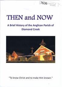
Booklet, Nillumbik Historical Society, Then and now: a brief history of the Anglican Parish of Diamond Creek, 22/10/2019
... yarrambat Booklet, 8 pages, text and colour illus. Then and now: a brief history of the Anglican Parish of Diamond Creek Booklet Booklet Yarra Plenty Regional Library Nillumbik Historical Society Yarra Plenty Regional Library ...A history of the Anglican Parish of Diamond Creek, prepared for the Yarra Plenty Regional Library's "Diamond Valley History Tour 2019". The Diamond Creek parish includes St John's Diamond Creek, St Michael's Yarrambat and St Katherine's St Helena.Booklet, 8 pages, text and colour illus.diamond valley, yarra plenty regional library, anglican parish of diamond creek, st john's diamond creek, st katherine's st helena, st michael's yarrambat
