Showing 48 items matching " conservation of natural resources"
-
 Eltham District Historical Society Inc
Book, Land Conservation Council, Report on the Melbourne Study Area, December 1973
This report is one of a series describings the physical nature of the land and its environment, examines the likely forms of land use, and assesses the hazards associated with these uses. It is divided into four main sections: Introduction, Characteristics of environment, main forms of land use and description of 24 specific blocks in the study area which include Torquay, Brisbane Ranges, Werribee, Wombat, Loddon, Romsey, Puckapunyal, Strathbogie, Eildon, Disappointment, Break O'Day, Black Range, Cerberean, Upper Goulburn, Kinglake, Donna Buang, Upper Yarra, Thomson, Dandenongs, Bunyip-Latrobe, Shady Creek, Tyers, Westernport and Strzelecki. The Land Conservation Act 1970 established the Land Conservation Council whose functions is to "carry out investigations and make recommendations to the Minister with respect to the use of public land in order to provide for the balanced use of land in Victoria. This report sets out to describe and assess the natural resources of the public lands in the Melbourne area and provides a factual basis on which members of the community may base submissions to the [Land Conservation] Council of Victoria.444 pagesnon-fictionThis report is one of a series describings the physical nature of the land and its environment, examines the likely forms of land use, and assesses the hazards associated with these uses. It is divided into four main sections: Introduction, Characteristics of environment, main forms of land use and description of 24 specific blocks in the study area which include Torquay, Brisbane Ranges, Werribee, Wombat, Loddon, Romsey, Puckapunyal, Strathbogie, Eildon, Disappointment, Break O'Day, Black Range, Cerberean, Upper Goulburn, Kinglake, Donna Buang, Upper Yarra, Thomson, Dandenongs, Bunyip-Latrobe, Shady Creek, Tyers, Westernport and Strzelecki. The Land Conservation Act 1970 established the Land Conservation Council whose functions is to "carry out investigations and make recommendations to the Minister with respect to the use of public land in order to provide for the balanced use of land in Victoria. This report sets out to describe and assess the natural resources of the public lands in the Melbourne area and provides a factual basis on which members of the community may base submissions to the [Land Conservation] Council of Victoria.land use, kinglake, thomson valley, conservation, public lands -
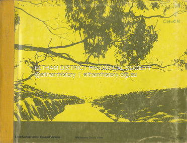
![Book - Map, Land Conservation Council, Melbourne Study Area Report, [December 1973]](/media/collectors/4f729f7b97f83e03086018a5/items/6469bc241d76dd4b008a829f/item-media/646b0013d841f8920fa4323c/item-fit-380x285.jpg) Eltham District Historical Society Inc
Eltham District Historical Society IncBook - Map, Land Conservation Council, Melbourne Study Area Report, [December 1973]
The Melbourne Study Report is a series of volumes describing the physical nature of the land and its environment, examines the likely forms of land use, and assesses the hazards associated with these uses. This is Volume 2 (coloured maps). The first page featues a black and white map described as "Shire of Diamond Valley" with public land marked in yellow. Followed by eight large fold out maps. Melbourne Study Area Public land and descriptive blocks, Population description, Geology, Physiography, topography and rainfall, vegetation and water supply. The Land Conservation Act 1970 established the Land Conservation Council whose functions is to "carry out investigations and make recommendations to the Minister with respect to the use of public land in order to provide for the balanced use of land in Victoria. This report sets out to describe and assess the natural resources of the public lands in the Melbourne area and provides a factual basis on which members of the community may base submissions to the [Land Conservation] Council of Victoria.A collection of eight large fold out coloured maps published in a bound book formnon-fictionThe Melbourne Study Report is a series of volumes describing the physical nature of the land and its environment, examines the likely forms of land use, and assesses the hazards associated with these uses. This is Volume 2 (coloured maps). The first page featues a black and white map described as "Shire of Diamond Valley" with public land marked in yellow. Followed by eight large fold out maps. Melbourne Study Area Public land and descriptive blocks, Population description, Geology, Physiography, topography and rainfall, vegetation and water supply. The Land Conservation Act 1970 established the Land Conservation Council whose functions is to "carry out investigations and make recommendations to the Minister with respect to the use of public land in order to provide for the balanced use of land in Victoria. This report sets out to describe and assess the natural resources of the public lands in the Melbourne area and provides a factual basis on which members of the community may base submissions to the [Land Conservation] Council of Victoria. maps, shire of diamond valley, population, geology, topography, rainfall, vegetation, water supply, land use, public lands -
 Glen Eira Historical Society
Article - Boyd Park
This file contains two items. Two original photographs of Boyd Park, date unknown. An article from the CAULFIELD/ PORT PHILLIP LEADER on a massive swamp gum tree that was felled by heavy winds in Boyd Park, Murrumbeena, dated 03/08/2012.glen eira, glen eira environment group, smith colin, caine paul, boyd park, murrumbeena, parks, conservation of natural land and energy economics, reserves, bushland, gardens, resources, trees, plants -
![Book, CUTTRISS, Linda et al, Five hundred [500] million years on Phillip Island, 1995](/media/collectors/4f729f5b97f83e0308601629/items/59addb1990751a2a14cd6a5a/item-media/65fa31f1da165d21f3449f68/item-fit-380x285.jpg) Phillip Island and District Historical Society Inc.
Phillip Island and District Historical Society Inc.Book, CUTTRISS, Linda et al, Five hundred [500] million years on Phillip Island, 1995
... geology nature effect of human beings conservation natural ...Signed copy; Donated by C. McFee.natural history, victoria, phillip island, geology, nature, effect of human beings, conservation, natural resources -
 Phillip Island and District Historical Society Inc.
Book, Ministry for Conservation (Victoria), Westernportrait : an explanation of the Westernport Bay environmental study, 1975
... -island-and-the-bass-coast conservation natural resources victoria ...Stamped 'Phillip Island & District Historical Society'.conservation, natural resources, victoria, western port region, reports, surveys -
Tatura Irrigation & Wartime Camps Museum
Folder, Department Conservation and Natural Resources et al, Rushworth Waranga, 2003
... Department Conservation and Natural Resources.... Rushworth Waranga Folder Department Conservation and Natural ...Report on mines, including Balaclava, extracts from Waranga News. Early happening settlement life.Black with metal clips. Labels on spine.rushworth, waranga, balaclava mines -
 Victorian Aboriginal Corporation for Languages
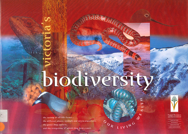
Book, Department of Natural Resources and Environment, Victoria's biodiversity : our living wealth, 1997
Lush colour photographs of the particular environments, including flora, fauna, birds etc and maps locating area.Colour illustrations, colour photographsconservation, sustainability, biodiversity, victorian alps, mallee -
 Victorian Aboriginal Corporation for Languages
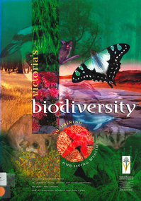
Book, Department of Natural Resources and Environment, Victoria's biodiversity : sustaining our living wealth, 1997
Investigates ways of sustaining Victoria's biodiversity.Colour illustrations, colour photographsbiodiversity, sustainability, conservation -
 Victorian Aboriginal Corporation for Languages
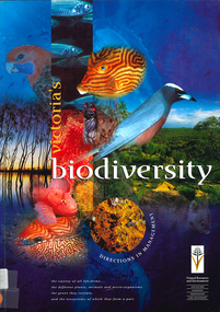
Book, Department of Natural Resources and Environment, Victoria's biodiversity : directions in management, 1997
Looking at Victoria in each region and examining the biodiversity of the environment, for management purposes.Maps (including two large maps) charts, graphs, colour photographs,biodiversity, sustainability, conservation -
 Whitehorse Historical Society Inc.
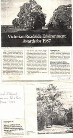
Article, Victorian Roadside Environment Awards for 1987, 1/06/1988 12:00:00 AM
Article from 'Trees and Natural Resources' v.30 No2 (June 1988) on Jeffrey Street, Blackburn, winner of Roadsides Conservation Committee's Victorian Roadside Environment Award for 1987.jeffery street, blackburn, roads and streets -
 Otway Districts Historical Society
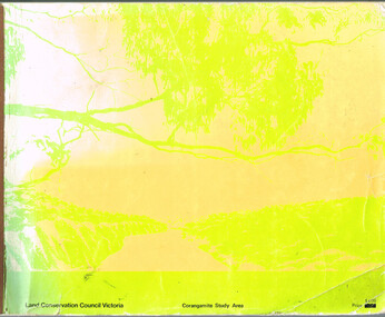
Book, Land Conservation Council, Report on the Corangamite Study Area, May 1976
The Report describes and assesses the natural resources of public land in the Corangamite study area, and provides a factual basis on which members of the community may base their submissions to the Council.Report on the Corangamite study area. Land Conservation Council. Melbourne; Land Conservation Council; May 1976. x, 310 p.; illus, maps (separate). Soft cover.land conservation council; corangamite; geology; physiography; climate; water resources; soils; vegetation; fauna; -
 Otway Districts Historical Society
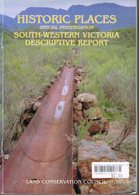
Book, Land Conservation Council, Historic places: Special investigation: South-Western Victoria: Descriptive report, January 1996
The south-west of Victoria, possessing a rich heritage of the signs of past human activity, is fertile ground for an investigation of historic places on public land. This report includes an initial inventory of almost 2000 places. The report outlines the history and the related heritage of the area, describes in some detail its biophysical attributes and introduces the natural resources and present land use. This information provides a context for understanding the origins of the historical features that are observes today.Historic places: Special investigation: South-Western Victoria: Descriptive report. Land Conservation Council. Land Conservation Council; Melbourne (Vic); January 1966. viii, 180 p.; illus.; maps. Soft cover. ISBN 0 7241 9288 3Maps in plastic sleeve.land conservation council; conservation; south-western victoria; historic places; -
University of Melbourne, Burnley Campus Archives
Nursery catalogues, Nursery Catalogues: booklets & foolscap sheets
... Lodge Nursery; Cowley Nurseries; Natural Resources Conservation... Nurseries; Natural Resources Conservation League Victoria; Forests ...nurseries, plant nomenclaturenurseries, plant nomenclature -
Lakes Entrance Historical Society
Book, Land Conservation Council Victoria East Gippsland Study Area, 1974
Report describing the nature of environmental features, together with the character and distribution of various natural resources of the East Gippsland, Victoria, study area, comprising land in the old Shire of Orbost. History, vegetation, flora, fauna,vegetation, natural history, vegetation -
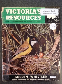 Stawell Historical Society Inc
Book, Natural Resources Conservation, Victoria's Resources - Vol 3 No 4, 1962
... Natural Resources Conservation... No 4 Book Natural Resources Conservation ...Departments, Regions, Municipalities and Organisations which are members of the Conservation League. These books were provided free of charge to residents.Paper cover: 3/4 Green strip with white & black print. Black section containing map of Victoria below a colour picture of a nesting mother bird with chicks below black strip with white printVictori's Resources Vol 3. No. 4. December 1961 February 1962. Published Quarterly Price 1'6 Golden Whistler Beautiful Insectivorous bird widespread thoughout Australiatourism -
Lakes Entrance Historical Society
Book, Land Conservation Council, Victoria, Final Recommendations East Gippsland Study Area 1977, 1977
A summary of the final recommendation for the adequate management and protection of public land in East Gippsland.natural resources, recreation, agriculture -
Lakes Entrance Historical Society
Book, Land Conservation Council Victoria South Gippsland Area District 2, 1980
Report describing and assessing the natural resources of the public land in the South Gippsland (Victoria) Study Area 2, comprising the Latrobe Valley, Strzelecki Range, South Gippsland coastal plains and all of Wilson's Promontory. History, Geology, floRuth Clarkgippsland, topography, natural history, vegetation -
Lakes Entrance Historical Society
Book, Land Conservation Council Victoria, The Gippsland Lakes Land Use Strategy Plan 1978, 1985
A review of public land use in the East Gippsland area, including natural resources, flora and fauna, recreation. Contains photographs, maps statistics.conservation, aboriginals, primary industry