Showing 486 items
matching kilometres
-
 Greensborough Historical Society
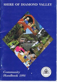
Book, Shire of Diamond Valley, Shire of Diamond Valley Community Handbook 1991, 1991_
Guide to services provided by Shire of Diamond Valley. The Shire of Diamond Valley was a Local Government Area located about 20 kilometres northeast of Melbourne. The shire covered an area of 74.38 square kilometres and existed from 1964 until 1994.Annual guide to services in Shire of Diamond Valley36 pages, col. illus., maps. Front cover is a collage of scenes from Diamond Valley, back cover illustration of a copy of "Summer Panorama, Tabletop, NSW" by Max Dimmack, from the Shire of Diamond Valley Art Collection.shire of diamond valley -
 Kew Historical Society Inc
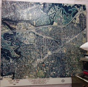
Photograph - Aerial Photograph, Division of Survey and Mapping, Department of Property and Services, City of Kew, Scale 1 : 3,000, 1989, 1989
The City of Kew was a local government area about 4 kilometres east of Melbourne, the state capital of Victoria, Australia, on the southeast bank of the Yarra River. The city covered an area of 14.56 square kilometres, and existed from 1860 until 1994.Very large aerial photograph of “City of Kew” Scale 1 : 3,000. 1989. “City of Kew” Scale 1 : 3,000. 1989. Photomosaic compiled by Division of Survey and Mapping, Department of Property and Services. © Crown (State of Victoria) Copyright 1990.city of kew, kew (vic.), aerial photography -
 Greensborough Historical Society
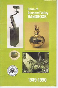
Booklet, Shire of Diamond Valley Handbook 1989-1990, 1989_
Guide to services provided by Shire of Diamond Valley. The Shire of Diamond Valley was a Local Government Area located about 20 kilometres northeast of Melbourne. The shire covered an area of 74.38 square kilometres and existed from 1964 until 1994.Annual guide to services in Shire of Diamond Valley32 pages, col illus., maps. Cover illustration of items from the Diamond Valley Shire Art Collection. 2 copiesshire of diamond valley, greensborough, handbooks -
 Bendigo Historical Society Inc.
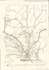
Document - JOAN O'SHEA COLLECTION: DUNNOLLY MAPS, 1980
Joan O'Shea Collection. Goldfield Maps Dunolly 3 Sheets 1980. Page 1: Mines in Dunolly, Whistling Flat, Painswick and Surrounds. Page 2: Mines in Goldsborough, McKinnons Gap, Bealiba Range, Stewarts Flat and Surrounds. Page 3: Mines in Dunolly, Emu Creek, Bet Bet, Bromley & Surrounds. Scale in Chains and Kilometres.GoldField Maps 1980 based on Dunolly 7624 by Division of National Mappinggold, goldfields, goldfield maps dunolly & surrounds -
 Melbourne Tram Museum
Newspaper, The Age, “Push to scrap rego and myki”, 25/03/2020 12:00:00 AM
Newspaper clippings titled: “Push to scrap rego and myki” by Timna Jacks Newspaper clipping from the Age 25/03/2020 Infrastructure Victoria wants to replace car insurance, registration and myki with a pay as you go system. Proposal for tram users to pay 74c per kilometre. Has a photo of a tram being cleaned.trams, tramways, public transport, melbourne, ticket, myki -
 Uniting Church Archives - Synod of Victoria
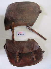
Saddlebag
This small saddle bag was carried on the off-side (right hand side) of the saddle. Nyah West is a town in Victoria, near the Murray River. It is near the Murray Valley Highway, 371 kilometres north-west of Melbourne and 27 kilometres north-west of Swan Hill.Dark brown leather single small saddlebag. The bag is secured with two buckles. -
 Greensborough Historical Society
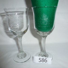
Glasses, Shire of Diamond Valley Commemorative glasses, 1994_
These glasses were distributed to commemorate the 30th anniversary of the proclamation of the Shire of Diamond Valley. The Shire of Diamond Valley was a Local Government Area located about 20 kilometres northeast of Melbourne. The shire covered an area of 74.38 square kilometres and existed from 1964 until 1994. A limited edition glass presented to community volunteers and others associated with the Shire of Diamond Valley.Pair of clear glass, stemmed wine glasses. Stem has spiral pattern.Etched into bowl "Shire of Diamond Valley 1964-1994" and shire coat of arms.shire of diamond valley, greensborough, commemorative glasses -
 Warrnambool and District Historical Society Inc.
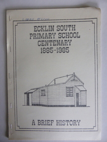
Booklet, Ecklin South Primary School 1885-1985, 1985
This is a short history of the Ecklin South Primary School from 1885 to 1985. Ecklin South is 37 kilometres from Warrnambool and 25 kilometres from Port Campbell. The school was established on a five acre site in 1885 with the first teacher, Andrew Harkness. A new building was erected in 1937.This booklet is of interest because it gives the history of a school in Ecklin South, a district not far from Warrnambool. It will be useful for research. This is a soft cover booklet of 28 pages produced in-house by Ecklin South Primary School Centenary Committee members.. The cover is a buff colour with a black, grey and white sketch of the school on the front. The history of the school is type-written and there are several black and white photographs reproduced by photocopying. The booklet includes a poem, ‘Ecklin School’ by Iris Wormald and a list of the teachers from 1885 to 1985. The booklet has been stapled. Some of the pages are difficult to read. Front cover: ‘Ecklin South Primary School Centenary 1885-1985 A Brief History’ecklin south, ecklin south primary school, warrnambool -
 Greensborough Historical Society
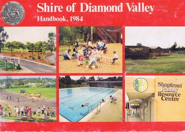
Booklet, Shire of Diamond Valley Handbook 1984, 1984_
Guide to services provided by Shire of Diamond Valley. The Shire of Diamond Valley was a Local Government Area located about 20 kilometres northeast of Melbourne. The shire covered an area of 74.38 square kilometres and existed from 1964 until 1994. Cover illustration of recreation facilities in Diamond Valley.Annual guide to services in Shire of Diamond Valley32 pages, col illus., maps. 2 copies.shire of diamond valley, greensborough, handbooks -
 Greensborough Historical Society
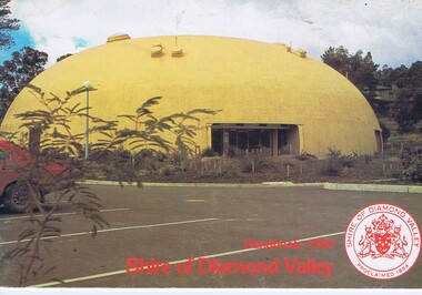
Booklet, The Shire of Diamond Valley Handbook 1981, 1981_
Guide to services provided by Shire of Diamond Valley. The Shire of Diamond Valley was a Local Government Area located about 20 kilometres northeast of Melbourne. The shire covered an area of 74.38 square kilometres and existed from 1964 until 1994. Cover illustration of "Diamond Creek Bini-shell".Annual guide to services in Shire of Diamond Valley28 pages, col illus., maps. (3 copies)shire of diamond valley, greensborough, handbooks -
 Archive of Vietnamese Boat People
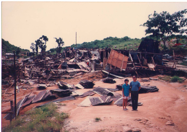
Demolishment of Bidong refugee camp in 1991
Bidong refugee camp located in Bidong Island, Terengganu state, Malaysia, was established in Oct 1978 and closed down in Nov 1991. In 13 years it provided accomodatation to a number of nearly 250,000 Vietnamese boat people, with the topmost crowded period of time in 1980 it housed over 40,000 boat people at one time in a small area of one square kilometre.Demolishment of Bidong refugee camp in 1991 -
 Wodonga & District Historical Society Inc
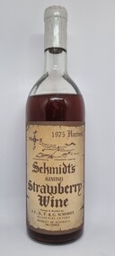
Functional object - Bottle - Schmidt's Strawberry Wine 1976
Schmidt’s Strawberry Farm is set on acres of lush strawberry fields in Allans Flat, approximately 5 kilometres from Yackandandah and 24 kilometres from Wodonga. Schmidt's is the oldest strawberry winery in Australia, owned and operated by brothers Martin and Michael Schmidt who are third generation strawberry growers/winemakers.This item originates from the oldest strawberry winery in AustraliaA bottle of Schmidt's Strawberry Wine from their 1975 harvest. The bottle bears a beige label with brown text. Their is also a sticker on the back of the bottle containing information about the wine.Front Label below a district map: 1975 Harvest/ Schmidt's /(GENUINE)/ Strawberry/ Wine/ Grown & Bottled by / J.F., D. F. & G. SCHMIDT/ ALLANS FLAT, VICTORIA/ PRODUCT OF AUSTRALIA/ .740 LITRES" On sticker across back: "Fermented from fresh strawberries with no artificial flavour or/ preservatives. This strawberry wine has been the house specialty/ of the Schmidt family for many generations - with the advent of/ improved growing techniques, this dessert wine is now introduced/ to the wine lovers of Australia."strawberry wine, schmidt’s strawberry farm, martin and michael schmidt -
 Ballarat Heritage Services
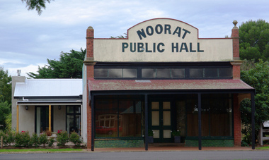
digital photographs, Lisa Gervasoni, Noorat Public Hall, c2015, c2010-2017
Noorat is six kilometres North of Terang. It is thought that Noorat was the name of an Aboriginal tribal leader.Colour photograph of the Noorat Hall. Noorat is situated beside an extinct volcano.building, noorat, heritage, hall, public hall -
 Greensborough Historical Society
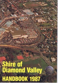
Booklet, Shire of Diamond Valley Handbook 1987, 1987_
Guide to services provided by Shire of Diamond Valley. The Shire of Diamond Valley was a Local Government Area located about 20 kilometres northeast of Melbourne. The shire covered an area of 74.38 square kilometres and existed from 1964 until 1994. Cover illustration of aerial view of Greensborough shopping area and environs.Annual guide to services in Shire of Diamond Valley32 pages, col illus., maps. 2 copies.shire of diamond valley, greensborough, handbooks -
 Greensborough Historical Society
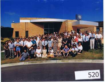
Photograph (Framed), Shire of Diamond Valley, Shire of Diamond Valley Staff. Last day 1992, 1992_12
Photograph of "indoor" staff, Shire of Diamond Valley, on their last day at work for the Shire.The Shire of Diamond Valley was a Local Government Area located about 20 kilometres northeast of Melbourne. The shire covered an area of 74.38 square kilometres and existed from 30/09/1964 until 14/12/1994.Large colour photograph in timber frame.shire of diamond valley -
 Halls Gap & Grampians Historical Society
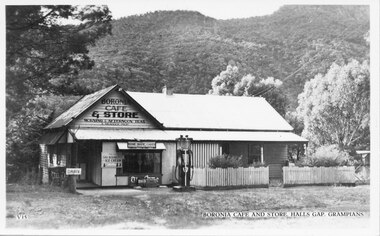
Postcard - B/W, C 1930s
The picture is of Boronia Cafe and Store, which was situated one kilometre south of Halls Gap township.The postcard shows a building with a sign reading "Boronia Cafe & Store". The building has a picket fence at the front and a canvas awning on part of its verandah. There is a petrol pump at the front of the building and wooded hills behind.buildings, shops -
 Greensborough Historical Society
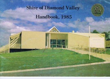
Booklet, Shire of Diamond Valley Handbook 1985, 1985_
Guide to services provided by Shire of Diamond Valley. The Shire of Diamond Valley was a Local Government Area located about 20 kilometres northeast of Melbourne. The shire covered an area of 74.38 square kilometres and existed from 1964 until 1994. Cover illustration of Library/Arts facility at Civic Centre Greensborough, opened 1985.Annual guide to services in Shire of Diamond Valley32 pages, col illus., maps. 2 copies.shire of diamond valley, greensborough, handbooks -
 Warrnambool and District Historical Society Inc.
Medallions, Borough of Koroit, 1985
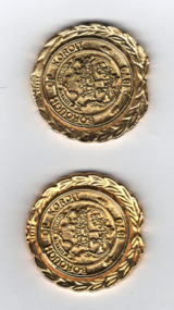
These medals were produced in 1985 to denote the closing of the Koroit Borough. Koroit is 18 kilometres north west of Warrnambool and the Borough of Koroit, established in 1870, covered 23.07 square kilometres. In 1985 the Borough of Koroit was incorporated into the Shire of Warrnambool as the Koroit Riding. In 1994 the Shire of Warrnambool ceased to exist and Koroit became part of the Shire of Moyne.These medals are interesting mementoes of the Borough of Koroit, a municipal authority that no longer exists.These identical gold coloured metal, almost circular, medallions feature a coat of arms with indistinguishable text and emblems , a second text and a wreath of laurel around the rim. The edge is notched and indented at the base.. The reverse side has text on a circular centre with the back of the laurel wreath surrounding it. Obverse BOROUGH OF KOROIT1870 Reverse 1870 1985koroit borough, warrnambool history -
 Greensborough Historical Society
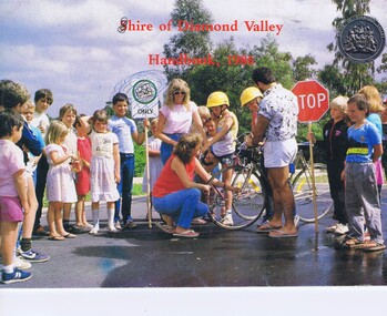
Booklet, Shire of Diamond Valley Handbook 1986, 1986_
Guide to services provided by Shire of Diamond Valley. The Shire of Diamond Valley was a Local Government Area located about 20 kilometres northeast of Melbourne. The shire covered an area of 74.38 square kilometres and existed from 1964 until 1994. . Cover illustration of Bike Education program sponsored by Shire of Diamond Valley in local schools.Annual guide to services in Shire of Diamond Valley32 pages, col illus., maps. (3 copies)shire of diamond valley, greensborough, handbooks -
 Greensborough Historical Society
Booklet, The Shire of Diamond Valley Handbook 1982, 1982_
Guide to services provided by Shire of Diamond Valley. The Shire of Diamond Valley was a Local Government Area located about 20 kilometres northeast of Melbourne. The shire covered an area of 74.38 square kilometres and existed from 1964 until 1994. Cover illustration of aqueduct and bridge over Plenty River near Apollo Parkways estste.Annual guide to services in Shire of Diamond Valley32 pages, col illus., maps. 2 copiesshire of diamond valley, greensborough, handbooks -
Warrnambool and District Historical Society Inc.
Book, Star Printing Terang Victoria. 978-0-9751360-1-0 et al, The Road to Laurel-Dale, Nov 2014
Early Bennett, Buck & Guinea families in Laang & South West VictoriaThis is a soft cover book of 340 pages. It has a grey cover with a black and white sketch of a house on the front and a black and white photograph of a house on the back. There is black printing on the front and the back and the spine of the cover. The book has an introduction, acknowledgements and contents pages, information on the Bennett, Buck and Guinea families, a bibliography and an index. There are many maps, black and white photographs and illustrations and family trees. There are several blank pages at the back of the book for the inclusion of family records and information. non-fictionEarly Bennett, Buck & Guinea families in Laang & South West Victorialaang, guinea families of south west victoria, bennett families of south west victoria, buck families of south west victoria, history of warrnambool -
 Bendigo Historical Society Inc.
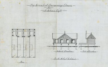
Plan - Architectural drawings for Burnewang Homestead, Elmore, No date visible
Burnewang was built in 1903 for the Holmes Family. It is situated on the banks of the Campaspe river a few kilometres east of Elmore.Set of five Architect drawings of the Burnewang, Elmore Homestead showing, Elevations, Floor plans, Garden Layout, Details of the Fencing and the Dog Kennel. The plans were prepared for H Holmes.H. Holmes Esq.buildings, house, architect drawing, burnewang, elmore, holmes -
 Greensborough Historical Society
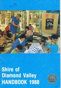
Booklet, Shire of Diamond Valley Handbook 1988, 1988_
Guide to services provided by Shire of Diamond Valley. The Shire of Diamond Valley was a Local Government Area located about 20 kilometres northeast of Melbourne. The shire covered an area of 74.38 square kilometres and existed from 1964 until 1994. Cover illustration of activity following pre-school story time for 3-5 year olds at the libraryAnnual guide to services in Shire of Diamond Valley32 pages, col illus., maps. . (3 copies)shire of diamond valley, greensborough, handbooks -
Greensborough Historical Society
Booklet - Calendar, Shire of Diamond Valley, Shire of Diamond Valley 1993 Calendar, 1993_
Copies of this calendar were distributed to households in the Shire of Diamond Valley. This 1993 Calendar features images of the Shire. Includes a Guide to services provided by Shire of Diamond Valley. The Shire of Diamond Valley was a Local Government Area located about 20 kilometres northeast of Melbourne. The Shire covered an area of 74.38 square kilometres and existed from 1964 until 1994.The annual calendar is a record of the activities and services in the former Shire of Diamond Valley.28 page calendar illustrated with photographs of the Shire, with 16 page liftout "Shire of Diamond Valley Resource Guide". shire of diamond valley, shire of diamond valley calendar -
 Orbost & District Historical Society
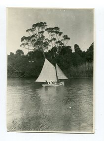
black and white photograph, 1899
Marlo, fifteen kilometres from Orbost, has always been a popular fishing and boating destination for Orbost locals. This is a pictorial record of a popular recreational activity in the late 19th century in Marlo.A black / white photograph of a sailing boat with five people on board.on back, handwritten in pen - "SAILING BOAT BREAM POINT EASTER< 1899"marlo-sailing bream-point-marlo recreation -
 Greensborough Historical Society
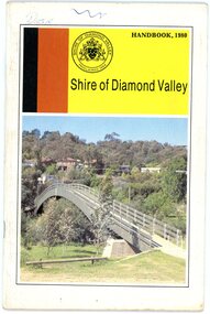
Book, Shire of Diamond Valley, Shire of Diamond Valley Handbook 1980, 1980_
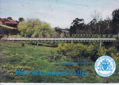
Guide to services provided by Shire of Diamond Valley. The Shire of Diamond Valley was a Local Government Area located about 20 kilometres northeast of Melbourne. The shire covered an area of 74.38 square kilometres and existed from 1964 until 1994. Cover illustration of footbridge over the Plenty River at Flintoff Street. The span is 50 metres and cost $56,100 to build in 1978.Annual guide to services in Shire of Diamond Valley32 pages, col illus., maps. shire of diamond valley, greensborough, handbooks -
 Greensborough Historical Society
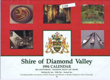
Booklet - Calendar, Shire of Diamond Valley, Shire of Diamond Valley 1994 Calendar: 20th anniversary - Diamond Valley Art Award, 1994_
Copies of this calendar were distributed to households in the Shire of Diamond Valley. This 1994 Calendar features images of artwork acquired by the Shire. Includes a Guide to services provided by Shire of Diamond Valley. The Shire of Diamond Valley was a Local Government Area located about 20 kilometres northeast of Melbourne. The Shire covered an area of 74.38 square kilometres and existed from 1964 until 1994.The annual calendar is a record of the activities and services in the former Shire of Diamond Valley.28 page calendar illustrated with images of art work, with 16 page liftout "Shire of Diamond Valley Resource Guide". 2 copiesshire of diamond valley, shire of diamond valley calendar, diamond valley art awards -
 Greensborough Historical Society
Photograph - Digital image, Marilyn Smith, Melbourne City skyline from Greensborough, 16/08/2015
Greensborough is approximately 23 kilometres from the Melbourne Central Business District. This photo of the Melbourne skyline was taken from Greensborough.Digital copy of colour photographgreensborough, melbourne -
 Ballarat Heritage Services
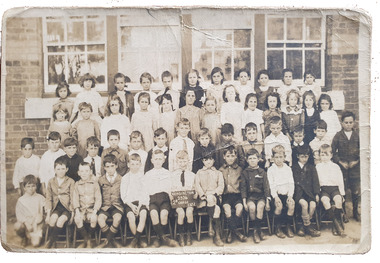
Photograph, Kensington Primary School 2374 2B Grade, 1922, c1920
Kensington Primary School opened in 1881 and is located four kilometres from the centre of Melbourne, is one of the oldest schools in Victoria. A class of Grade 2 students at Kensington Primary School.em22, kensington, kensington primary school -
 Greensborough Historical Society
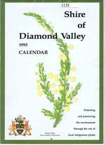
Calendar, Shire of Diamond Valley, Shire of Diamond Valley 1995 Calendar, 1995_
Copies of this calendar were distributed to households in the Shire of Diamond Valley. This 1994 Calendar features images of indigenous plants painted by Jan Lowe. Includes a Guide to services provided by Shire of Diamond Valley. The Shire of Diamond Valley was a Local Government Area located about 20 kilometres northeast of Melbourne. The shire covered an area of 74.38 square kilometres and existed from 1964 until 1994.The annual calendar is a record of the activities and services in the former Shire of Diamond Valley.28 page calendar illustrated with images of local flora, with 16 page liftout "Shire of Diamond Valley Resource Guide"shire of diamond valley, shire of diamond valley calendar, jan lowe