Showing 64 items
matching agricultural surveying
-
 University of Melbourne, Burnley Campus Archives
Document, Department of Agriculture (TAFE courses) forms, and 1977 Statistical Survey (CAE courses) forms, 1977
Tables. 2tafe, courses, department of agriculture -
University of Melbourne, Burnley Campus Archives
Document, Department of Agriculture, Victoria. 1977 Statistical Survey, 1977
... Department of Agriculture, Victoria. 1977 Statistical... Boulevard Richmond melbourne tafe courses department of agriculture ...TAFE and CAE course forms. 2tafe, courses, department of agriculture -
University of Melbourne, Burnley Campus Archives
Document, Department of Agriculture 1978 Statistical Survey (TAFE courses), 1979
... Department of Agriculture 1978 Statistical Survey (TAFE... Department of Agriculture 1978 Statistical Survey (TAFE courses ...tafe, courses, department of agriculture -
University of Melbourne, Burnley Campus Archives
Document, Department of Agriculture Victoria 1979 Statistical Survey T.A.F.E courses, 1979
... Department of Agriculture Victoria 1979 Statistical Survey... Department of Agriculture Victoria 1979 Statistical Survey T.A.F.E ...tafe, courses, department of agriculture -
University of Melbourne, Burnley Campus Archives
Document, Department of Agriculture Victoria 1982-84 Statistical Survey (TAFE courses), 1980
tafe, courses, department of agriculture -
University of Melbourne, Burnley Campus Archives
Document, Department of Agriculture Victoria 1980 Statistical Survey, 1980
... Department of Agriculture Victoria 1980 Statistical Survey... of Agriculture Victoria 1980 Statistical Survey Document ...Forms for TAFE and Advanced Education coursestafe, courses, department of agriculture -
 University of Melbourne, Burnley Campus Archives
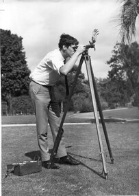
Photograph - Black and white print, Information Branch, Victorian Department of Agriculture, Student Using Dumpy Level, 1967
Note by T.H. Kneen 18 December 1991, "Student using dumpy level is Adrian Wells (1968)."2 copies black and white photograph. Student using surveying equipment in Burnley grounds.On reverse stamp, "Photograph by Information Branch Victorian Department Of Agriculture Ref. No. D.1100.F."students, adrian wells, 1968, surveying, students working outside, dumpy level, publicity -
Koorie Heritage Trust
Book, Broome, Richard, Aboriginal Australians. Black Responses to white Dominance 1788-1994. (Second Edition), 1994
Surveys traditional life and values, confrontations with the British; violent conflicts with settlers, native police throughout the country; attacks on Aboriginal initiative at Coranderrk, Cumeroogunja and other settlements; racial legislation, missionary attitudes; cattle industry, mining; discrimination; growth of Aboriginal rights movement, Aboriginal organizations, land rights.4-275 P.; plates; ill,; appendices; notes; bib.; index; 22 cm.Surveys traditional life and values, confrontations with the British; violent conflicts with settlers, native police throughout the country; attacks on Aboriginal initiative at Coranderrk, Cumeroogunja and other settlements; racial legislation, missionary attitudes; cattle industry, mining; discrimination; growth of Aboriginal rights movement, Aboriginal organizations, land rights.aboriginal australians -- social conditions. | race discrimination -- australia. | australia -- race relations. | economic sectors - agriculture and horticulture - pastoral industry - beef cattle | religions - christianity - missions | settlement and contacts - 20th century | enterprises - pastoral industry | government policy - assimilation | government policy - initial period and protectionism | government policy - integration | government policy - state and territory - new south wales | government policy - state and territory - victoria | law - land | land rights - mining industry | land rights - pastoral industry | socioeconomic conditions - living conditions | occupations - pastoral industry workers | law enforcement - police - native police | law enforcement - police conduct and attitudes | politics and government - political action - land rights | race relations - violent - massacres, murders, poisonings etc. - to 1900 | race relations - racism - stereotyping | -
National Wool Museum
Book, Reconnaissance survey of the sheep industry, No.8: the counties of Tatchera and Gunbower, Victoria, 1952
... -and-the-bellarine-peninsula "Reconnaissance survey of the sheep industry ..."Reconnaissance survey of the sheep industry, No.8: the counties of Tatchera and Gunbower, Victoria, 1952" Bureau of Agricultural Economicsagriculture wool growing, c. of a. - bureau of agricultural economics, agriculture, wool growing -
 Ballarat Heritage Services
Photograph - Colour, Bessibelle Drystone Sheep Wash, 2016, 24/04/2016
The Bessiebelle Sheepwashes and Yards complex is located on the former 14,000 acre Ardonachie Run, established in 1848 by pastoralist Samuel Gorrie, then carrying 6,000 sheep. In 1864 this run was subdivided into smaller runs, and the sheep washes were located within Mount Eccles and Lake Gorrie Run. The date of construction of the washes and walls is not known, although they were probably constructed within the period 1848-1864. The Bessiebelle Sheepwashes and Yards are probably the largest and most sophisticated surviving example of a traditional pastoral property sheepwash in Victoria. They clearly demonstrate the large network of races, yards and folds necessary for washing thousands of sheep over a short period of time. The Bessiebelle sheep washes apparently predate later technological changes and the necessity for hot water washing. The Bessiebelle sheepwashes and yards are of landscape significance as a cultural landscape which has been both modified by, and cleverly adapted to, an annual process that was of critical importance within the pastoral calendar. The drystone walls and races appear to evolve from the rocky terrain, and have a strong organic affinity with the prevailing harsh landscape. The drystone walls demonstrate a high level of craftsmanship and skill in their construction, and reflect the extensive scale of pastoral operations across the landscape. The Bessiebelle sheepwashes and yards are of archaeological significance to the State of Victoria. The site has not been fully surveyed but its complexity strongly suggests a potential to reveal more about the washing processes and associated pastoral occupation and activity in the area.(Heritage Victoria)drystone, bessibell, sheep race, sheep wash, agriculture -
Bendigo Historical Society Inc.
Document - Golden City Implements Foundry, Ironbark, Bendigo, 1960-1980s
This foundry had been a landmark in Mt Korong Road for many years. It began with an Osborne and Mitchell. After 1914 when mining declined, it became the Golden City Implement boundary and the name can still be seen painted on on the façade which faces the intersection of Marong Road (Calder highway) and Eaglehawk Road. The interior is a mass of used and un-used machinery scattered amongst modern lathes and more modern apparatus. The yard was a fascinating graveyard of past times, with old mining and agricultural scrap everywhere mixed up with coke and slag from the smelting sheds at the rear. A feature of the foundry was the manufacturer of cast iron lace. National Trust Survey Data Sheet and article from the Bendigo Advertiser November 4th 1981. Osbornes Ironbark Foundryhistory, national trust bendigo collection, bendigo, foundary, iron bark bendigo -
![Publication, The world market for honey: market survey #01. (USAID. CIAFS [Capacity to Improve Agriculture and Food Security]. Washington, DC, 2012, 2012](/media/collectors/51d110e42162ef12e06aa06b/items/5366e1b32162ef1514e08c81/item-media/536881af2162ef13101a0185/item-fit-380x285.jpg) Beechworth Honey Archive
Beechworth Honey ArchivePublication, The world market for honey: market survey #01. (USAID. CIAFS [Capacity to Improve Agriculture and Food Security]. Washington, DC, 2012, 2012
14 pages, illustrated. -
 Beechworth Honey Archive
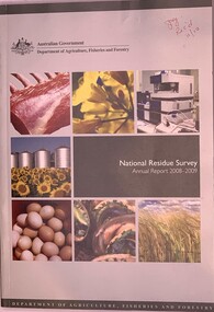
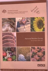
Publication, National Residue Survey Annual Report 2008-2009, 2009
Soft Cover Book - 277 pages, slighlty larger than A5. Light grey colour with pictures on the front of meat, flowers, machine, silos, eggs, oysters? & wheat Publication by Dept of Agriculture, Fisheries & Forestry 2 copies of -
 Beechworth Honey Archive
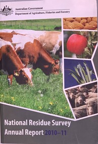
Publication, National Residue Survey Annual Report 2011 - Dept of Agriculture, Fisheries & Forestry, 2011
Soft Cover Book slightly larger than A% with pictures on the front of cattle, almonds, an apple, crop & sheep 291 pages -
 Beechworth Honey Archive
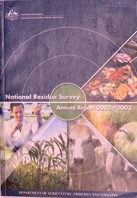
Publication, National Residue Survey Annual Report 2002-2003 (Dept of Agriculture, Fisheries and Forestry), 2003
Soft cover book partly teal cover with photos of seafood, fruit, cattle, wheat & laboratory assistant. Slightly larger than A5 size 159 pages 2 copies of this edition -
 Beechworth Honey Archive
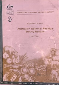
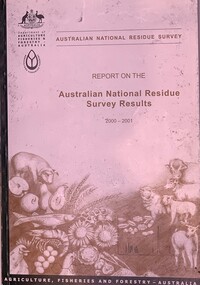
Publication, Australian National Residue Survey - Report on the Australian National Residue Survey Results 2001-2002 (Dep of Agriculture Fisheries & Forestry), 2002
Soft cover book slightly larger than A5 siz, green spine with an off white cover with pencil drawings of cattle sheep, pig. seafood, chicken, eggs, sunflowers & wheat 93 pages -
 Beechworth Honey Archive
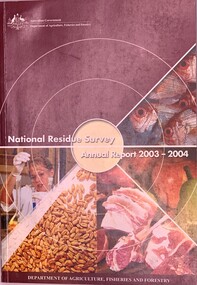
Publication, National Residue Survey Annual Report 2003-2004 (Dept of Agriculture, Fisheries and Forestry)
Soft cover book, slightly larger than A5, crimson cover with photos of laboratory assistant, grain, meat, fruit & fish 164 pages -
 Beechworth Honey Archive
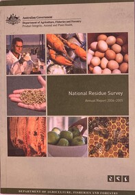
Publication, National Residue Survey Annual Report 2004-2005 (Dept of Agriculture, Fisheries and Forestry), 2005
Soft Cover book with a pale and olive green cover with photos of a laboratory assistant, seafood, eggs, grain, meat, apples & bees 182 pages -
 Beechworth Honey Archive
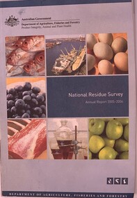
Publication, National Residue Survey Annual Report 2005-2006 Department of Agriculture, Fisheries and Forestry), 2006
Soft cover book with pale blue & teal cover with photos of fish, ship, eggs, blueberries, meat, lab equipment & apples 186 pages -
 Beechworth Honey Archive
Publication, National Residue Survey Annual Report 2006-2007 (Dept of Agriculture, Fisheries and Forestry), 2007
Soft cover book slightly larger than A5 size, fawn & brown cover with photos of fish, lab worker, bees on sunflower, meat, fruit, grain & chicken meat 218 pages -
 Beechworth Honey Archive
Publication, Australian National Residue Survey - Report on the Australian National Residue Survey Results 2000-2001 ( Dept of Agriculture, Fisheries and Forestry - Australia), 2001
Soft Cover book slightly larger than A5 size, Dark Green spine with an off white cover & pencil drawings of a pig, fruit, seafood, chickens, eggs,sunflower grain, cattle, sheep 74 pages -
 Beechworth Honey Archive
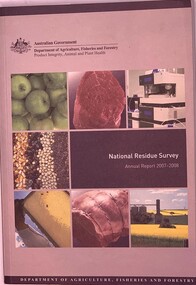
Publication, National Residue Survey Annual Report 2007-2008 (Dept of Agriculture, Fisheries and Forestry), 2008
Soft cover book slightly larger than A5 size, Fawn and brown cover with photos of apples, meat, lab equipment, grain, honeycomb frame and canola crop 239 pages -
 Surrey Hills Historical Society Collection
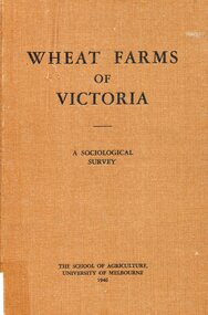
Book, Wheat farms of Victoria: a sociological survey, 1946
... . wheat social surveys agriculture (mr) alan holt farming Alan J ...The owner, Alan Judge Holt lived locally and was Secretary of the Lands Department. Donated by Max Holt who was one of his sons. This book goes into considerable detail on all facets of wheat farm life, providing the basis for a real understanding of the problems of the man who grows wheat.Cloth-covered hardback book of 179p. Alan J. Holtwheat, social surveys, agriculture, (mr) alan holt, farming -
 Port Fairy Historical Society Museum and Archives
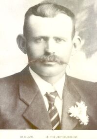
Photograph, Cr D Lane 1911-12,17-18, 29-30
Councillor Lane carried on agricultural farming activities at Killarney on part of the Special Survey. His last term as president was during the Great Depression of the late 1920’s when there was a considerable amount of unemployment in the district Black and white portraitCr D Lane 1911-12,17-18, 29-30government, belfast, president, portrait, shire, council, municipal, local-government, d.lane -
 Linton and District Historical Society Inc
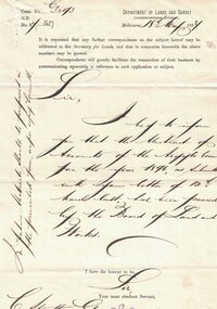
Letter, Paper manufactured by T. Edmonds 1890 (watermark), Department of Lands and Survey, Argyle Common, Linton, 1897, 18.05.1897
Letter written on behalf of Tho. MacGibbon, Secretary for Lands, to C. Stratton, Secretary, Argyle Common, Linton. Acknowledging receipt of Argyle Common accounts for 1896, and informing of their passing by the Board of Land and Parks. Also requesting that in future the accounts should be prepared on the prescribed form, a copy of which was enclosed. Found in the home of Miss Margaret Gorman after her death. See form sent with letter - Registration No. 1617Handwritten letter on grey paper headed Department of Lands and Survey, dated 18th May 1897. Addressee C. Stratton Esq.-Secretary-Argyle Common-Linton.argyle common linton, animal grazing, agricultural activity -
 Federation University Historical Collection
Book, Final recommendations Ballarat Study Area Land Conservation Council, Victoria, 1982, 1982
Yellow soft covered report of 95 pages . The contents of the report include: Parks, reference areas, wildlife reserves, water production, harwood production, softwood production, flora Reserves and Flora and Fauna reserves, bushland reserves, historic area and reserves, rivers and streams, Roadside conservation and Highway parks, Education areas and School Plantations, Lake Reserves, geological reserves, recreation, scenic reserves, agriculture, mineral and stone production, utilities and survey, township land, Uncommitted Land, military training, other reserves and public land. Maps include: The Study area 1: 250 000 Supplementary Mapsland conservation authority, ballarat, endowment plantations, pine plantations, langi ghiran state park, mount buangor state park, enfield state park, ballarat-creswick regional park, rossbridge, black lake, flax mill swamp, dereel lagoon, lake bolac, lake wongan, langi ghiran reservoir, gong gong reservoir, pincotts reservoir, beales reservoir, wilsons reservoir, moorabool reservoir, korweinguboora, korweinguborra reservoir, learmonth bores, sago hill, illabarook reservoir, ballarat water commission, dunneworthy, mount cole, mont lonarch, ben major, waterloo, trawalla, linton, ross creek, canadian, shepherds flat, lal lal, mount doran, raglan, chute, carngham, buninyong, watsons hill, enfield, cape clear, illabrook, rokewood junction, mount warrenheip, nerrina, jubilee, golden stream, australasian deep lead mine, happy valley school, piggoreet, berringa, bulldog, ballarat common, wildlife, water, timber, flora, rivers, geology, agriculture, warrenheip, biodiversity -
University of Melbourne, Burnley Campus Archives
Plan (Item), Plan of Burnley Gardens, City of Richmond, Parish of Jika Jika, County of Bourke, 1948
(On original) : Notes by W(?) Anderson 28/2/45. Date stamp of School of Primary Horticulture and Agriculture Burnley E1burnley gardens, richmond, department of lands & survey, orchard -
 Federation University Historical Collection
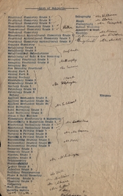
Document, List of Subjects
School of Mines Ballarat is predecessor of Federation University Foolscap sized list of Subjects from Ballarat School of Mines with handwritten names.8S3S in large writng on the back school of mines ballarat, practical chemistry, mr. walker, theoretical chemistry, theoretical agricultural chemistry, practical agricultural chemistry, technical chemistry, metallurgy, alfred mica smith, metallurgical calculations, metallurgy of gold and ore dressing, assaying practical, assaying dry, mr. murphy, ore dressing practical, mining, mining geology, mineralogy, geology, petrology, botany, applied mechanics, mr hart, mine surveying, land surveying, steam and gas engines, mr gilchrist, elementry electricity & magnetism, electrical technology, mr sutherland, turning and fitting, mr connon, engineering drawing, mr kerr, geometry, algebra, trigonometry, physics, conics, calculus, mr whitington, building construction, plane and solid geometry, plumbing grade, mr hall, mr mullins, carpentry, wool classing, materia medica, mr gutheil, technical arithmatic, mr hutchison, telegraphy, mr williams, sloyd, mr slater, photography, mr campbell, manual training, cyanide, mr deane, mr brittain, mr martell, english, astronomy, list of subjects -
 University of Melbourne, Burnley Campus Archives
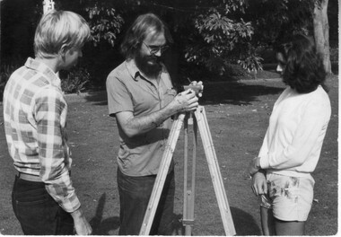
Photograph - Black and white print, Information Branch Victorian Department of Agriculture, Surveying Detail, Unknown
Black and white photograph. Staff member demonstrating surveying equipment to 2 students in the Ornamental Garden.On reverse, "Photography Information Branch Victorian Dept of Agriculture Ref. No. 1981 (914-17)." "Return to James Pleasance." "Victorian College of Agriculture & Horticulture-Burnley gardens Swan Street, Richmond, Vic 3121."staff, demonstration, equipment, students, james pleasance, victorian college of agriculture & horticulture, burnley gardens, swan street, richmond, surveying, student outside classroom -
 Federation University Historical Collection
Map, Ballaarat Gold Field, 1861, 21/10/1861
... reserve allied armies flour mill agricultural reserve marsh survey ...A party of surveyors camped by Yuille's Swamp (later Lake Wendouree) and surveyed the countryside for a map to be produced by the Geological Survey of Victoria. In November 2004 the Central Highlands Regional Library presented a special edition of 200 copies of the 1861 map reproduced from a copy in their collection. Original geological map of Ballarat showing property, waterways, mines, churches, schools, water races, and garden reserves. It was compiled and drawn from the surveys of Mining Surveyors Davidson, Fitzpatrick and Cowan.Compiled & Drawn from the Survey of Mining Surveyors Davidson, Fitzpatrick and Cowan & the Plans in the Surveyor General's Office by J. Brahe, 21st October 1861. R. Brough Smyth, Secretary for Mines. The Honourable J.B. Humffray, M.L.A. Commr of Mines.ballarat, map, davidson, robert brough-smyth, fitzpatrick, cowan, yuille's swamp, public garden reserve, manure depot, black hill, ballarat east, old post office hill, pennyweight hill, claytons hill, golden point, mining, railway, cricket ground, swamp creek, cemetery, sludge reserve, bakery hill, gaelic church, juvenile reformatory, orphanage, specimen hill, eureka lead, cattle yard hill, dalton's flat, chinese village, poverty hill, railway reserve, little bendigo diggings, pound reserve, allied armies, flour mill, agricultural reserve, marsh, survey reserve, survey corps, white flat, yarrowee, yarrowee creek, brache, j. brache, survey, ballaarat gold field 1861