


Historical information
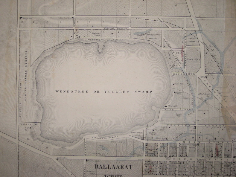
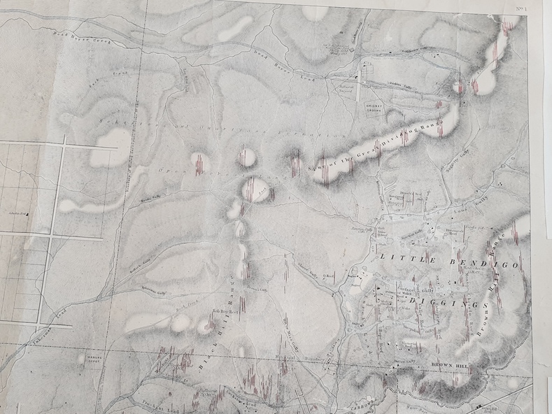
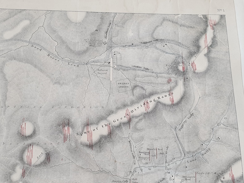
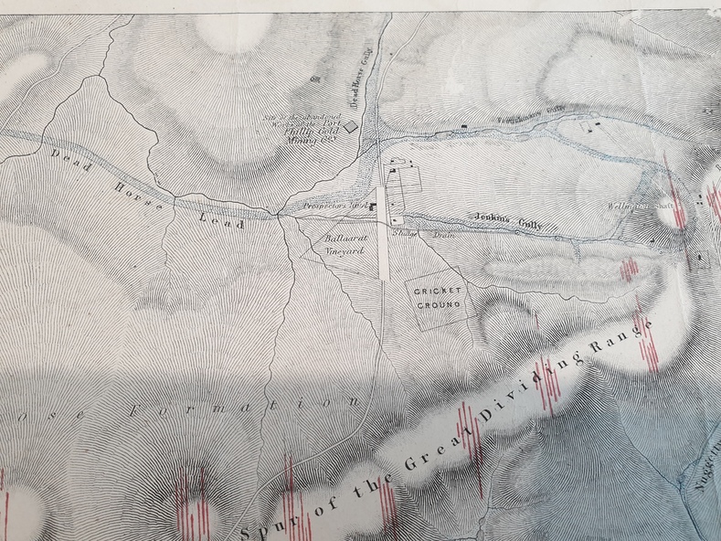
A party of surveyors camped by Yuille's Swamp (later Lake Wendouree) and surveyed the countryside for a map to be produced by the Geological Survey of Victoria.
In November 2004 the Central Highlands Regional Library presented a special edition of 200 copies of the 1861 map reproduced from a copy in their collection.
Physical description
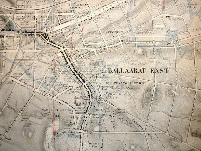
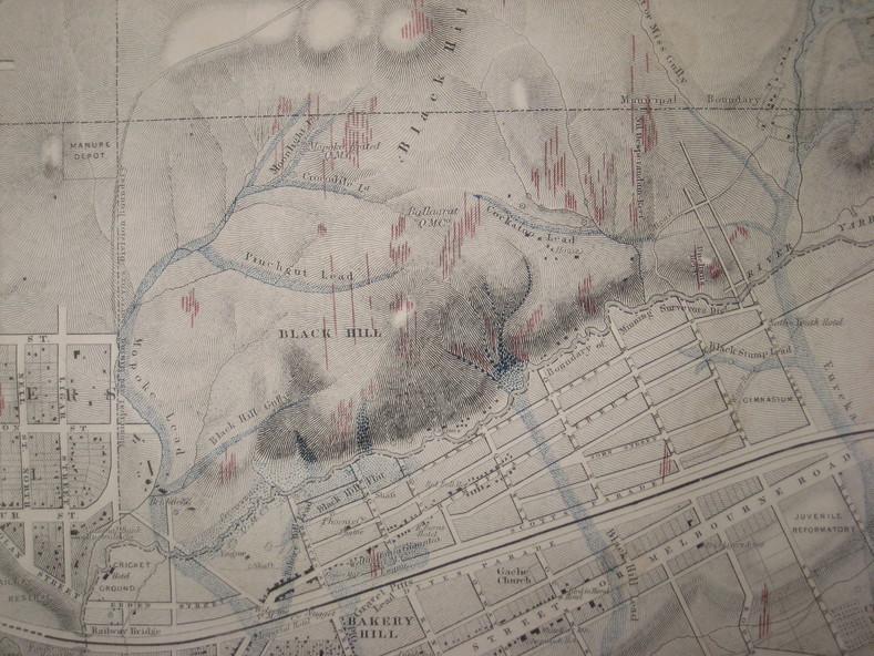
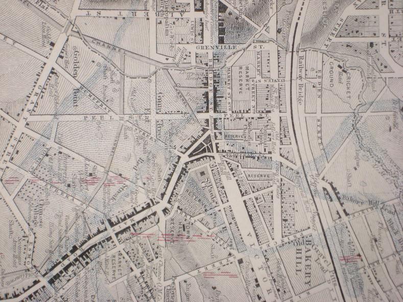
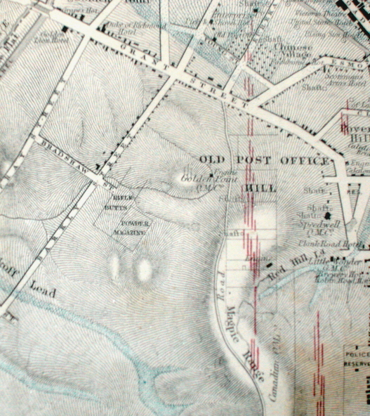
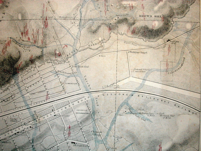
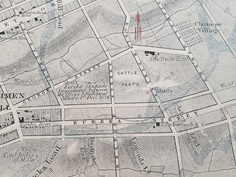
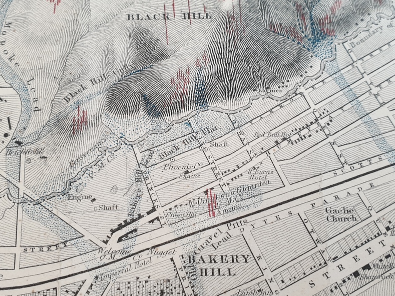
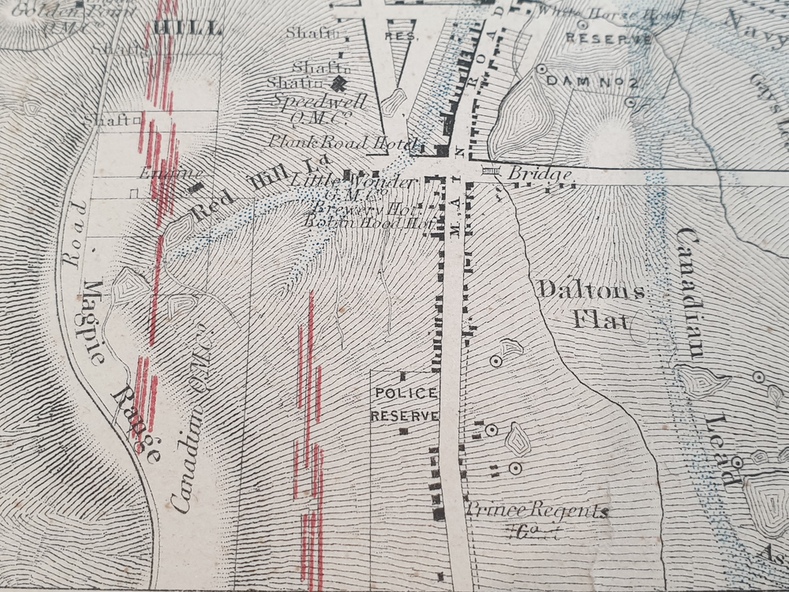
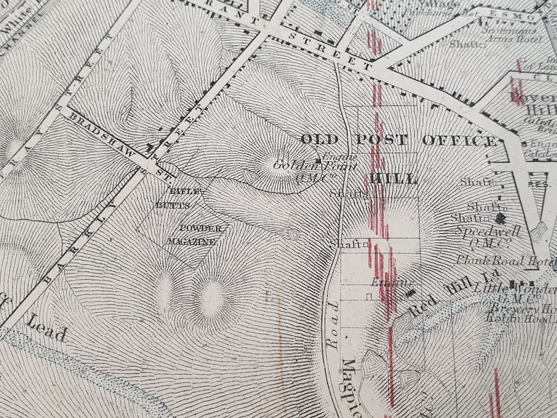
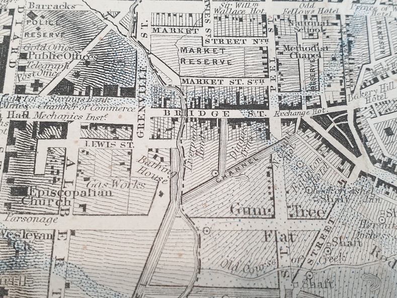
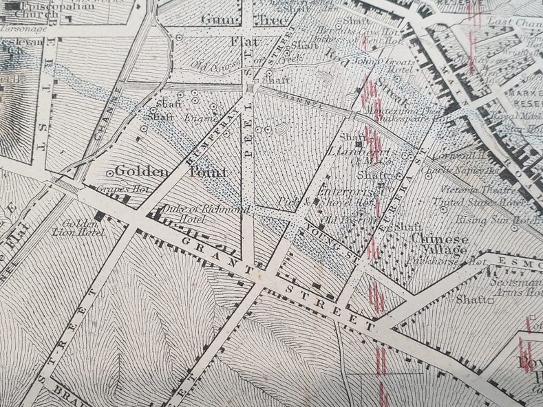
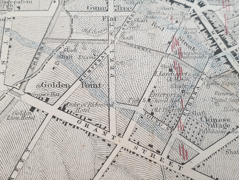
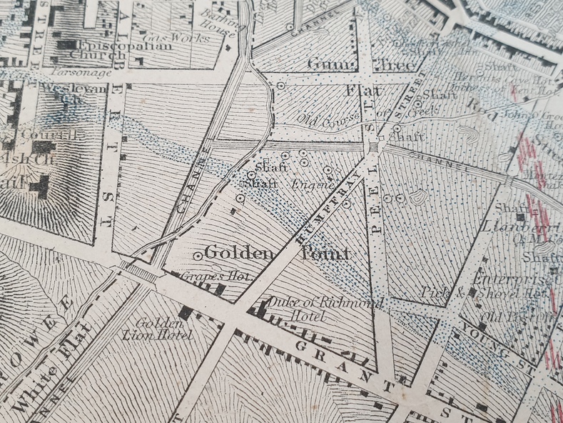
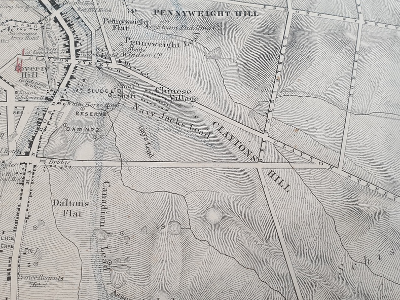
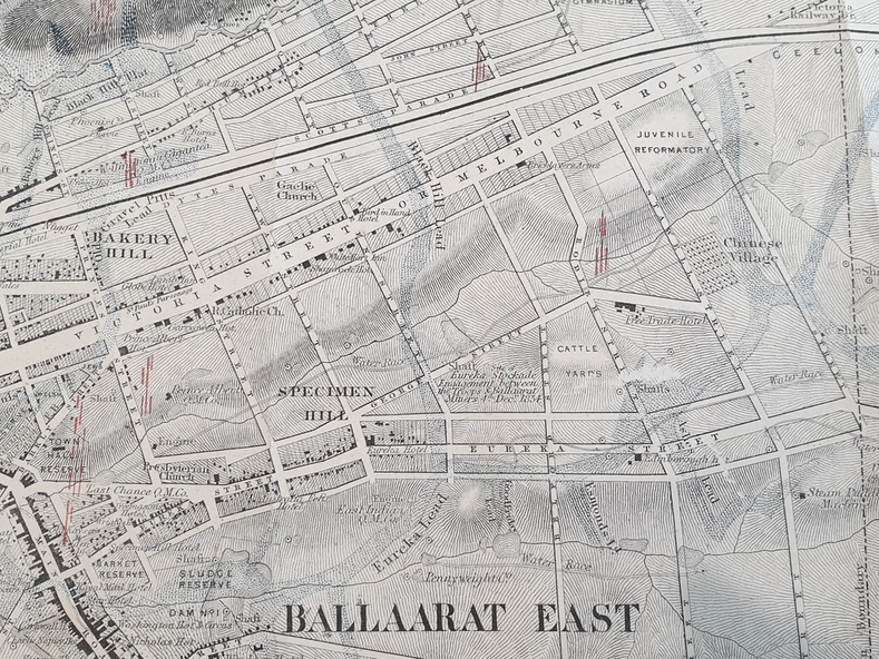
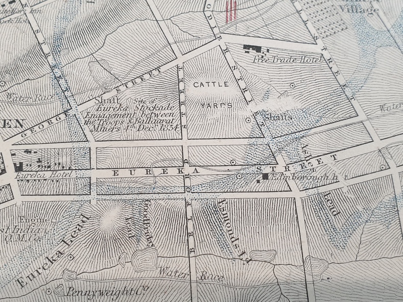
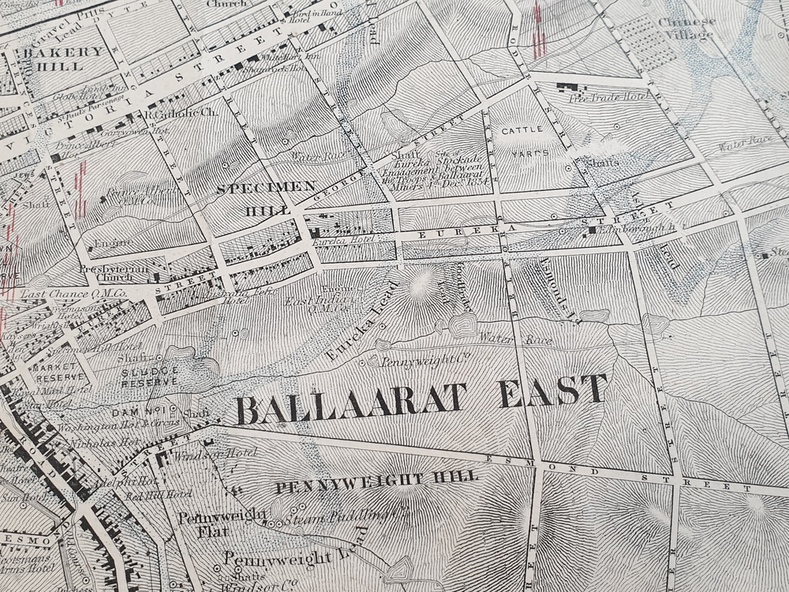
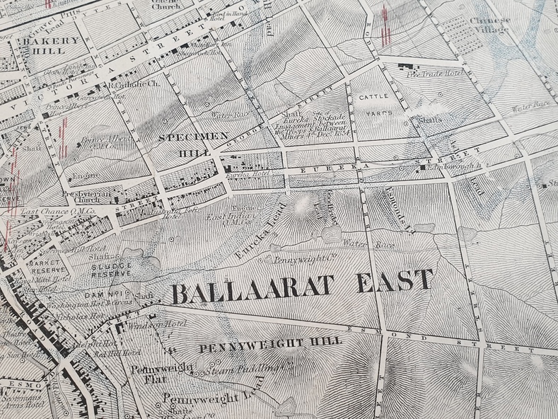
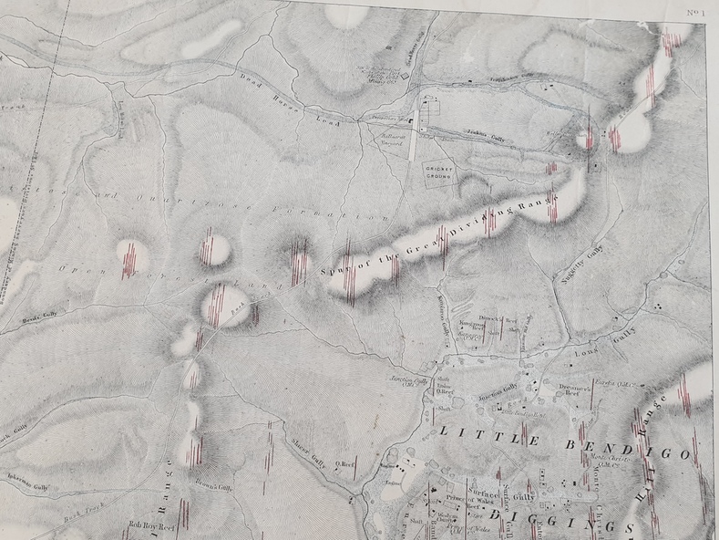
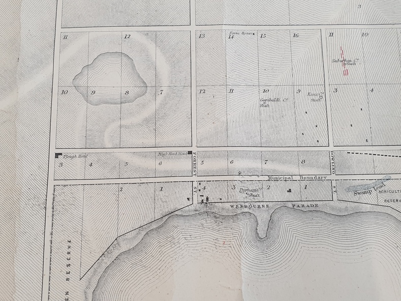
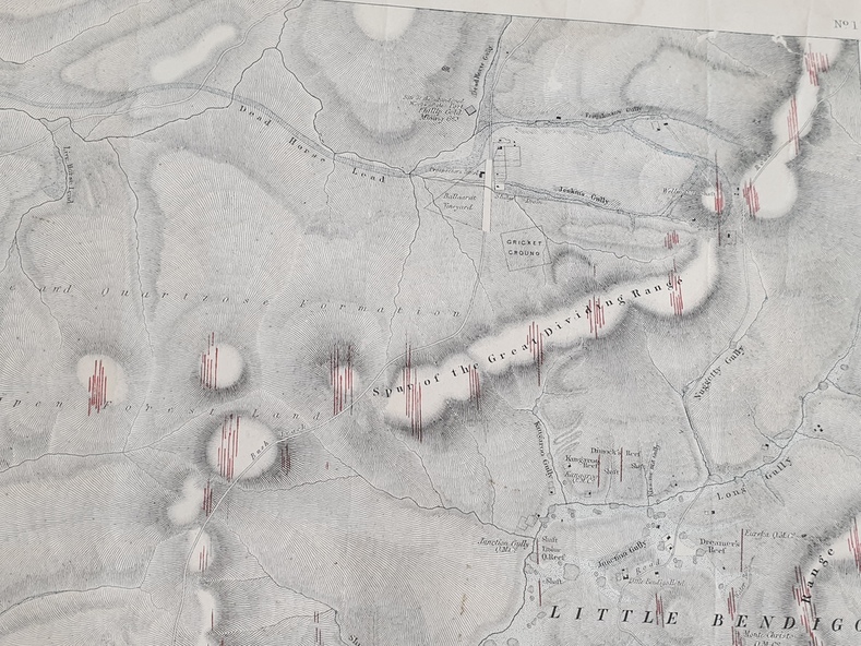
Original geological map of Ballarat showing property, waterways, mines, churches, schools, water races, and garden reserves. It was compiled and drawn from the surveys of Mining Surveyors Davidson, Fitzpatrick and Cowan.
Inscriptions & markings
Compiled & Drawn from the Survey of Mining Surveyors Davidson, Fitzpatrick and Cowan & the Plans in the Surveyor General's Office by J. Brahe, 21st October 1861. R. Brough Smyth, Secretary for Mines. The Honourable J.B. Humffray, M.L.A. Commr of Mines.
Subjects
- ballarat,
- map,
- davidson,
- robert brough-smyth,
- fitzpatrick,
- cowan,
- yuille's swamp,
- public garden reserve,
- manure depot,
- black hill,
- ballarat east,
- old post office hill,
- pennyweight hill,
- claytons hill,
- golden point,
- mining,
- railway,
- cricket ground,
- swamp creek,
- cemetery,
- sludge reserve,
- bakery hill,
- gaelic church,
- juvenile reformatory,
- orphanage,
- specimen hill,
- eureka lead,
- cattle yard hill,
- dalton's flat,
- chinese village,
- poverty hill,
- railway reserve,
- little bendigo diggings,
- pound reserve,
- allied armies,
- flour mill,
- agricultural reserve,
- marsh,
- survey reserve,
- survey corps,
- white flat,
- yarrowee,
- yarrowee creek,
- brache,
- j. brache,
- survey,
- ballaarat gold field 1861