Showing 85 items
matching lot 15
-
 Eltham District Historical Society Inc
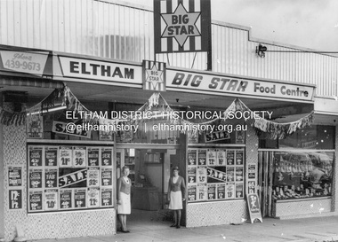
Photograph, Eltham Big Star Food Centre, Main Road, Eltham, c.1966
In February 1965, Staffs Railway Store, the oldest business premises in the Eltham shopping district was demolished. Formerly a self-service grocery, restaurant and electrical repair shop, the building for many years housed Eltham’s only ‘family’ grocer and feed store. Earlier it had appeared to have been the town’s bakery. The building had been purchased in late March 1939 by Mr Eric N. Staff. At the time of E.N. Staff’s purchase there were huge bakers’ ovens located at the rear and the building also had a well and four toilets for employees. When the ‘pictures’ came to Eltham with the opening of the Eltham Public Hall across the road in 1941, Mr E.N. Staff extended the business and opened a milk bar and sweet shop. Further extensions re-established the tea rooms of days gone by. Mr E.N. Staff conducted business for about 15 years before handing over the reins to his son, Ray Staff. When his son Ray took over, the milk bar and tea rooms were closed for several years but the milk bar and was later re-opened and subsequently became a greengrocers and later again, a restaurant. The tea rooms section was converted to an electrical repair shop about 1955. Electoral Roll records for 1967 record Raymond Charles Staff at 929 Main Road, Eltham, grocer, and in 1968 at Lot 4, Hillcrest Avenue, Eltham, taxi truck operator. So it would appear that Ray continued to run the business for approximately two years after the original store was demolished and a new supermarket was built. Today, 929 Main Road is the Nongkhai Thai Restaurant and is precisely where the original Staffs store stood. Even though the facade has been modified at eye level with new larger windows, the upper facade is identical to that of the new Eltham Big Star Food Centre of 1965/66. But how did the original building, the oldest premises in the 1965 era shopping centre come about? On August 12th, 1902 at the Eltham Courthouse, appearing before T. Smallman, Esq,. Police Magistrate, and Messrs. W. Duncan and W.J. Taylor, Justices of the Peace is Luther Haley, baker. Wilfred Henry Johnston, by his agent Stanley Ernest Elder had applied for a warrant of ejectment under the Landlord and Tenant Act 1890 against Luther Haley from the bakery premises at the corner of Main Road and York Street. From the evidence presented we learn that Mrs Burgoyne of Eltham had purchased the property some months earlier from Mr Johnston, which consisted of a store and bakery establishment at Eltham occupied by Mr. Luther Haley, and whose lease expired some little time back, and up to the present time, Mr. Haley was not prepared to leave. He informed the court that he is unable to secure at Eltham a suitable house in which to carry on his business, but was building a place near the railway station which he expected to be done in about three weeks time, and he is then prepared to give up possession of the premises he now occupies. Mr Smallman informed the defendant, Luther Haley, that he will have to quit the premises in three weeks from the present date, and that a warrant of ejectment would be issued. However he also informed Mr Haley that he would order the warrant to lie in the office for three weeks from that date. The premises under construction referred to by Luther Haley in court were situated on the western side of Main Road, near the railway station slightly opposite present-day Arthur Street. It was opened around September 1902 as a General Store, Bakery and Tea Rooms. This was the original building in the present-day shopping precinct. At the time the only thing nearby was the railway station. Luther Haley’s business appeared to prosper and he would have catered to not only the locals abut also day visitors by train on Sundays coming up from Melbourne, offering fresh baked produce, tea rooms and summer drinks. The fields across Main Road running between present day Arthur Street and Luck Street were known as Haley’s Paddock and at times were used for community festivities and picnics. A newspaper report on the annual State schools picnic held at Haley’s Paddock on March 11, 1904 described it as “quite close to the railway station, and is quite capable of holding comfortably 10,000 people. With its ample shade and hilly surroundings, it is an ideal place for any gathering.” Luther Haley successfully ran his general store, bakery and tea rooms until 1917 when he and his family departed the district and moved to Westgarth Street in Northcote where he changed careers and became a publisher. It was then taken over by Hannah Lloyd and became known as Lloyd’s Railway General Store from 1917 to 1920. From then it had a succession of owners, one as short as two months until March 31, 1939 when the Grocery Business formerly carried on by Mr. T.K. White of Eltham for the previous eight years was purchased by Mr Eric N. Staff of Research and became known as E.N. Staff’s Railway Store. The ownership timeline for the store is as follows: Luther Haley Sep 1902-1917 Hannah Lloyd 1917-c.Feb 1920 Messrs J.R. & N.E. Lee 1920-Sep 1922 A. & E. Copeland Sep 1922-Sep 1925 Mr Price Sep 1925-Nov 1925 Mr Warren Nov 1925?-Nov 1926 A.W.J. Edwards Nov 1926-1931 T.K. White 1931-Mar 1939 Eric Staff Apr 1939-c.1954 Ray Staff c.1954-Feb 1965 then demolished Ray Staff Eltham Big Star Food Centre c.1965-1967 Research and copy: Peter Pidgeon (EDHS) Digital file only from scan of copy on loan to EDHSa. copeland, a.w.j. edwards, big star food centre, e. copeland, eltham, eric staff, general store, hannah lloyd, j.r. lee, lloyd's general store, luther haley, main road, n.e. lee, price, ray staff, staffs general store, supermarket, t.k. white -
 Eltham District Historical Society Inc
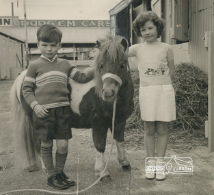
Work on paper (item) - Photograph, Little Models, 1961
Florence Ada Zull, known as Ada was an illustrator for the 'New Idea for Women" magazine. In 1961 she lived in Brunswick. From 1963 she and her husband Robert built a Alistair Knox designed house at 2 (lot 8) Metery Road, Eltham. In this issue Ada's son and daughter Susan model jumpers that were knitting competition prize winners at the Royal Agricultural Society of Victoria's Royal Show including Mrs L.M. Fullerton. (page 15) The opposite page features a photograph of film star Virginia Mayo and a beauty column. Original photo cut in half donated along with the issue of the magazine the photo was published in. royal agricultural society of victoria, royal melbourne show, l.m. fullerton, 1961, susan zull, susan bennett, zull family, knitting, pony, jumpers, virgninia mayo -
 Eltham District Historical Society Inc
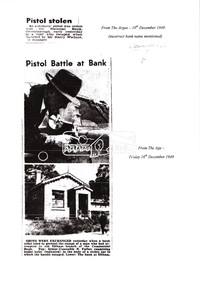
Folder, Commercial Bank of Australia Eltham Branch Hold-Up, 15 December 1949
Thursday, December 15, 1949, the quiet little bank was embroiled in an infamous wild shoot-out between a daring thief and two bank officers. Today, the building still carries the scars ; a bullet hole remains visible in a cedar bench testifying to the events that played out that day. 3.30 a.m., Friday, December 9. The manager of the Commercial Bank branch at Greensborough, Mr Harry Wallace and his wife are asleep in their bedroom of the little house behind the branch. Harry is awakened by a noise and sees an intruder in a corner of the bedroom. He calls out but the intruder who has switched off the power in anticipation flees through a side door and scarpers down Main Street. Harry summons the police but a search by First Constable Thomas of the Greensborough Police assisted by a wireless patrol car is unsuccessful. A report is filed noting the theft of a .25 calibre pistol from the wardrobe. Thursday, December 15th. It is 1pm and the Commercial Bank has just opened. The branch is only open Mondays and Thursdays from 1-3pm. The morning started off a little cool with some scattered showers but it has fined up and the temperature is now around 61 degrees (16 C). A new grey Singer sports car with soft-top pulls up on the opposite side of the road and a young man, neatly dressed in a dark blue suit, wearing a grey hat and carrying a brief case exits the vehicle. He looks around then crosses the road and walks up the steps and through the door into the bank. There are three people inside; Mr. Jack Burgoyne whose grocery store is situated just 50 yards up the road, Mr. Lindsay A. Spears, the Eltham Agency Receiving Officer and by chance, Mr Harry Wallace, manager of the Greensborough branch. Jack Burgoyne takes note of the young stranger; thinking to himself he appears nervous. The man approaches the counter and introduces himself as John Henderson of Greensborough and explains that he wishes to open a new account. He places his hat and £3 on the counter. Mr Spears attends to the paperwork. He asks the young man to sign two forms, which he does but then he withdraws from the counter and starts walking towards the door. Suddenly he spins around pulling an automatic pistol from his right-hand pocket. He exclaims forcefully; “The game’s on! I’ll take the lot!” Spears appears to comply by pretending to open a drawer. The man shouts loudly, “Keep your hand away from that drawer.” Spears instead reaches for a pistol in his pocket and challenges the man, “Here it is. Come and get it!” At the same time, Harry Wallace pulls a pistol from his pocket as well. The bandit fires a shot but misses, the bullet striking the counter. Both Spears and Wallace open fire and Jack Burgoyne ducks for cover. As the bandit turns and runs for the door leaving his £3 behind, he fires another shot, which strikes the ceiling. Spears fires back, and thinks he may have hit him in the foot. The bandit flees the bank and heads for the grey Singer car, registration NO-106, parked opposite. Wallace and Spears pursue him to the door and open fire again, striking the car three times around the driver’s door. Spears lets off eight shots and Wallace, seven before his gun jams. The getaway car initially heads slowly down Main Road towards Bridge Street. About 100 yards down the road, Dave Adams, a PMG employee, who has heard the shots, throws a steel manhole step at the driver. It hits the roof of the car nine inches above the driver’s head and tears the hood. Another witness claims to have seen the door blow open and the driver raise his hand. The car gathers speed and swings left into Bridge Street racing along at about 60 miles an hour careering recklessly past council employee, Mr. Percy Williams, who is driving a dray along Smarts Road [believed to be Bridge Street]. At the end of the road the Singer fails to get round the sharp turn and crashes into an embankment skidding to a stop outside the home of Mr John Clifford. One side of the car is wrecked. Mr Clifford, an aircraft engineer hears the fast travelling car bump heavily into the road bank at about 1.25 p.m. Hearing the whine of an engine he goes outside to find the grey Singer parked at the side of the road. Jack George also lives at the corner and hears the car crash. “The bandit opened the car door, ran 50 yards, and suddenly turned back,” exclaims Jack. “He took something from the car. It might have been a gun.” In his haste, the bandit drops his grey felt hat, size 6 7/8, on the road and dashes up Sherbourne Road for about 200 yards then disappears into the scrub carrying a brief case and a bundle in which a sailor’s cap can be seen. About 3 p.m., Mr H.D. Pettie of Mountain View Road, Montmorency is looking through his field glasses and notices a young man walking through thick scrub on private property some distance from his house. The man is wearing a sailor’s cap and disappears along the railway track toward Montmorency. As the day progresses, ten police cars, one motor cycle, and about 40 police led by Det. Sgt. McMennemin of Malvern CIB are searching for him. They believe he is hiding in thick scrub along the bank of the creek about half-a-mile outside Eltham township. Wireless patrol cars, four mobile traffic cars and the CIB area cars from Malvern and Kew are taking part. Police check the thief’s car and discover it was stolen from Helen Baxter, of Doncaster Road, North Balwyn from outside Victoria Barracks. Harry Wallace informs the police that he believes he recognised the bandit as the man who took his pistol from his bedroom the previous Friday morning. As night falls, armed police are posted at strategic points in the Eltham-Greensborough district. Police in cars are watching the roads. Others are searching the bush and checking passengers on trains. Little do they realise the young man has already slipped out of the net. SEQUEL YOUTH OF 19 CHARGED WITH ATTEMPTED ARMED ROBBERY OF BANK AT ELTHAM Weekly Times, Wednesday 15 February 1950, page 6 Detectives who raided a house in Bell St., Coburg, Melbourne, charged a 19-year-old youth, of South Yarra, with attempted armed robbery at the Commercial Bank’s Eltham (Vic.) receiving depot on Dec. 15. Police say they recovered a loaded automatic pistol, diamond and signet rings worth more than £200, a complete set of house-breaking instruments, a sailor’s uniform, and chloroform gauze in the raid. The youth was charged that while armed with an offensive weapon, he attempted to rob Lindsay George Spears of a sum of money. He was further charged on six counts of breaking, entering and stealing. Police allege that the person who tried to hold up Mr Spears in the Commercial Bank receiving depot at Eltham on December 15. escaped in a stolen car, after Mr Spears and Mr Henry Wallace, manager of the bank’s Greensborough branch, had fired at him. After the car crashed, he escaped into thick scrub and is alleged to have changed into a sailor’s uniform. On December 9 an automatic pistol was stolen from Mr Wallace’s bedroom at the Greensborough bank. The chloroform pad recovered is alleged to have been stolen from the Dental Supply Company, Plenty Road, Preston. The rings are alleged to have been taken in a £513 burglary from the shop of James Paton. Sydney Road, Coburg. Det. Sgt. H. McMennemin conducted the investigations with Senior Dets. R. Newton and M Downie, Detectives l. Dent, R. Rayner, P. Pedersen and M. Handley and First Constable A. Thomas. The youth will appear at Eltham Court on February 22. Manager’s Gun Used in Holdup at Bank The Age, Thursday 23 February 1950, page 4 It was stated in Eltham court yesterday that a youth who robbed a bank manager of his pistol, later used it in an attempt to hold-up the bank. Kay Arthur Morgan, 19, draftsman, of Castle-street, South Yarra, was committed for trial on charges of breaking and entering, and stealing a pistol and attempted robbery while armed with an offensive weapon. He pleaded guilty. The manager of Eltham branch of the Commercial Bank of Australia Ltd., Henry Clifton Cabot Wallace, said he disturbed someone in the bedroom, in which he and his wife were sleeping, at 3 a.m. on December. 9, 1949. Later he found that his automatic- pistol was missing. On December 15 a youth, who said his name was John Henderson, entered the bank and opened a new account. As the youth was leaving the bank he turned round with a pistol in his hand and said: — “I want the lot.” Spear indicated a drawer under the counter; and said.— “Here it is. Come and get it.” The youth said:— “Keep your hand away from that drawer.” Witness said Spear then drew his pistol from his hip pocket. The youth fired at them, and Spear returned the fire. “I pulled my pistol and fired, too” said witness. The youth fired again, ran out to a car and drove off. Witness and Spear fired several shots at the car. The youth was the accused Morgan, sitting in court, witness said. Evidence was given that one bullet was found in the celling and the other in the bank. Morgan was allowed £100 bail on each charge. Morgan ended up serving three years for the failed armed robbery and became a notorious criminal. He had twin sons, Peter and Doug and even though only ten years old, Morgan would get his sons to act as lookouts whilst he committed burglaries. The lads became building contractors but when the industry suffered a downturn in 1977 and they were short on cash, they returned to the family business. Over the following 23 months they undertook 24 raids on country and outer-suburban TABs and banks. Whilst robbing one country bank for the third time, just like their father, it all went wrong ending up with a police officer shot. They were nick-named the “After-dark” bandits and are considered to be Australia’s last bushrangers. They were convicted and served 17 years in prison.5 x A4 photocopied pagesbank hold-up, cba bank, det sgt mcmennemin, eltham, h.d. pettie, harry wallace, jack burgoyne, kay arthur morgan, lindsay a. spears, main road -
 Flagstaff Hill Maritime Museum and Village
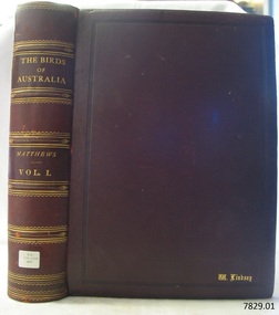
Book - Reference, The Birds of Australia Vol 1
The Birds of Australia is a 12 volume work, in a total of 14 books. The books were used as an ornithological handbook. They contain scientific text as well as over 600 hand-coloured lithographed plates by J.G. Keulemans, H. Grönvold, Roland Green, H. Goodchild and G.E. Lodge. The work was written, sponsored and organised by Gregory M. Matthews, F.R.S.C. Erc. who were a wealthy Australian and an amateur ornithologist? His titles included – -Fellow of the Linnean and Zoological Societies of London -Member of the British Ornithologists’ Union -Corresponding Fellow of the American Ornithologists’ Union The volumes in our collection were originally donated to the Warrnambool Mechanics’ Institute and Free Library by William Lindsay. THE LINDSAYS (quoted from the book Of Many Things – A History of Warrnambool Shire by C.E. Sayers) The Lindsays were amongst the most prominent families in the Shire of Warrnambool, as pastoralists, sportsmen, municipal councillors, community leaders. The first of the family William arrived in Melbourne in 1841 and started a business as a livestock agent. The gold rushes sent him to the central Victoria diggings dealing in cattle. This was a business that boomed in the early 1850s, and he prospered. In 1859 he took over the Quamby run near Woolsthrope from Paul de Castella, the Yarra Valley Swiss vigneron who had brought the leasehold and improvements in 1853 from George You, who had pioneered the run. Quamby was originally 25,000 acres. It was heavily timbered, rough country, much of it swampy, a characteristic of the district. Lindsay used it to fatten cattle which gave large returns with the booming gold diggings towns paying high prices for beef. In 1862 purchases at auction made Quamby a freehold. In the next six years, a further 20,000 acres of Crown land were brought at auction to make the run one of the largest in the south-west district. The great profits from his cattle trading enabled Lindsay to make improvements to the holding, and to Union which was added in 1864. Much of the thick timber was cleared and the worst of the swamps drained. Union was 15,000 acres of freehold land when Kennedy sold it to Lindsay. It was heavily timbered, mostly blackwood, with large belts of wattle and honeysuckle. Much of the heavy native was ringbarked and cleared; much more was swept away by bushfire. It was expensive work, but Lindsay’s bank passbook was heavy with credit, and he did not spare money to make both Quamby and Union heavily developed stock runs. He was as lavish in social living; the bluestone Quamby homestead was one of the most hospitable in the district when William Lindsay was host there; its paddocks carried high-quality thoroughbreds: its stables housed steeplechasers and flat racers which won many races on Warrnambool and other courses; its coach houses were filled with carriages which took his guests to the great racing carnivals of the district. After William Lindsay died in 1897, in his eighty-fifth year, his two sons, William and James, managed Union and Quamby as a joint venture. This partnership ended in 1906 when William took over Union and James kept Quamby. The following year 10,000 acres of Union was subdivided and sold in lots of 100 acres to 700 acres for dairying and general farming. It was well-improved country, much of it alluvial flats. By then many of the paddocks were sheltered with blue gum belts, and they carried good pastures. The three Lindsays, father and two sons, gave many years of service to the Shire, and to many charitable, sporting, social and community organisations in the Warrnambool district. William Lindsay senior, was a Shire councillor for 15 years, and President several times. James Lindsay followed his father as a north riding councillor. He served nineteen years, from 1887 until his death in March 1908. He was President four times. Jimmy Lindsay was one of the most popular men in the south-west of Victoria. He was a fine sportsman: horse breeder, owner and a dashing amateur rider. He lived lavishly and played hard. For many years he guarded a herd of kangaroos, as many as 100 head, at Quamby. Descendants of the Lindsay kangaroos are still in the district. James Lindsay’s wife, Margaret Esther was a daughter of Samuel Shaw Parker, the first engineer of the Shire. Nell Lindsay, a daughter, lives in the Bluestone Quamby homestead. Only a little more than 60 acres of the original run still belongs to the property. William Lindsay junior succeeded his brother as a Shire councillor. He served for 25 years from 1908 until his death in 1934. So, the Lindsays, father and two sons, served as Shite councillors for an unbroken period of sixth-five years. William Lindsay junior had a life-long interest in horse racing, as breeder, owner and enthusiastic amateur steeplechase rider. He was elected a member of the Warrnambool racing club in 1901 and was president of the club for thirty-two years. He raced and rode horses for the love of the sport. He won the Villiers and Heytesbury Hunt Cup in the 1870s on his own horse, Ventura. In the year he died his horse Flavedo won the Warrnambool Grand Annual steeplechase. It was a sensational race. All of the contestants fell or lost their riders. When Flavedo baulked at a jump, its jockey R. Sweetman, remounted and completed the course to win the race. All of the Lindsays were passionately fond of the thoroughbred horse. Nell Lindsay talking to the author in the drawing-room of Quamby homestead - with many memories for her of its lavish years – said of a brother that he was put on a horse when he was two years old and never got off. William Lindsay junior made Union into a fine, high-producing property, breeding cattle and horses. He added to the bluestone house that David Kennedy started, established plantations of pines and gums, and made an attractive garden. WARRNAMBOOL MECHANICS’ INSTITUTE Warrnambool's Mechanics' Institute (or Institution as it was sometimes called) was one of the earliest in Victoria. On 17th October 1853, a meeting was held where it was resolved to request the Lieutenant Governor of the Colony to grant land for the erection of a Mechanics' Institutes building. A committee was formed at the meeting and Richard Osburne chaired the first meeting of this committee. The land on the North West corner of Banyan and Merri Streets was granted but there were no funds to erect the building. The Formal Rights of the Warrnambool Mechanics' Institute's encompassed its aims and these were officially adopted in1859; "This Institution has for its object the diffusion of literary, scientific, and other useful knowledge amongst its members, excluding all controversial subjects, religious or political. These objects are sought to be obtained by means of a circulating library, a reading room, the establishment of classes, debates, and the occasional delivery of lectures on natural and experimental philosophy, mechanics, astronomy, chemistry, natural history, literature, and the useful and ornamental arts, particularly those which have a more immediate reference to the colony." The Warrnambool Mechanics' Institute opened its first meeting room in November 1854 in the National School building at the corner of Banyan and Timor Streets. The Institute was funded by member subscription, payable on a quarterly, half-yearly or yearly basis. Samuel Hannaford, the Manager of the Warrnambool Bank of Australasia, was the first Honorary Secretary of the Mechanics' Institutes, and an early President and Vice-President. He also gave several of the early lectures in the Reading Room. Another early Secretary, Librarian and lecturer was Marmaduke Fisher, the teacher at the National School. Lecture topics included The Poets and Poetry of Ireland', 'The Birth and Development of the Earth', 'The Vertebrae - with Remarks on the pleasures resulting from the study of Natural History' and 'Architecture'. In 1856 the Reading Room was moved to James Hider's shop in Timor Street, and by 1864 it was located in the bookshop of Davies and Read. In the 1860's the Mechanics' Institute struggled as membership waned but in 1866, after a series of fund raising efforts, the committee was able to purchase land in Liebig Street, on a site then called Market Square, between the weighbridge and the fire station. A Mechanics' Institute building was opened at this site in August 1871. The following year four more rooms were added to the main Reading Room and in 1873 the Artisan School of Design was incorporated into the Institute. The same year Joseph Archibald established a Museum; however, it deteriorated when he was transferred to Bendigo in 1877. In 1880, with Archibald's return to Warrnambool, the Museum was re-established, and in 1885 a new building was built at the back of the Institute to accommodate the re-created School of Design, the Art Gallery and the Museum. In 1887 the Museum section was moved to the former court house in Timor Street (for some time the walls of the building formed part of the TAFE cafeteria but all is now demolished)). In 1911 the Museum was transferred back to the original building and the management of the Mechanics' Institute was handed over to the Warrnambool City Council. The Museum and Art Gallery became one and housed many fine works of art, and the Library continued to grow. The building was well patronised, with records showing that at the beginning of the 20th century there were between 500 and 800 visitors. During World War One the monthly figures were in the thousands, with 3,400 people visiting in January 1915. The Museum was a much-loved Institution in Warrnambool until the contents of the Museum and Art Gallery were removed to make room for the Warrnambool City Council Engineers' Department. The contents were stored but many of the items were scattered or lost. When the original building was demolished the site became occupied by the Civic Centre, which included the new City Library. (The library was temporarily located in the old Palais building in Koroit Street.) In the process of reorganisation the Collection was distributed amongst the community groups: -The new City Library took some of the historic books and some important documents, historic photographs and newspapers. -The Art Gallery kept the 19th Century art collection and some of the artefacts from the museum. -The Historic Society has some items -The State Museum has some items -Some items were destroyed -Flagstaff Hill Maritime Village has old newspapers, Government Gazettes, most of the Mechanics' Institute Library, ledgers and documents connected to the Mechanics' Institute Library, some framed and unframed artworks and some photographs. The Warrnambool Mechanics' Institute Library book collection is deemed to be of great importance because it is one of the few collections in an almost intact state, and many of the books are now very rare and of great value. THE PATTISON COLLECTION This book is also part of the ‘Pattison Collection’, a collection of books and records that was originally owned by the Warrnambool Mechanics’ Institute, which was founded in Warrnambool in 1853. In 1935 Ralph Pattison was appointed as City Librarian to establish and organise the Warrnambool Library, as the Warrnambool Mechanics’ Institute was then called. When the Warrnambool Mechanics’ Institute building was pulled down in 1963 a new civic building was erected on the site and the new Warrnambool Library, on behalf of the City Council, took over all the holdings of the Warrnambool Mechanics’ Institute. At this time some of the items were separated and identified as the ‘Pattison Collection’, named after Ralph Pattison. Eventually, the components of the Warrnambool Mechanics’ Institute were distributed from the Warrnambool Library to various places, including the Art Gallery, Historical Society and Flagstaff Hill. Later some were even distributed to other regional branches of Corangamite Regional Library and passed to and fro. It is difficult now to trace just where all of the items have ended up. The books at Flagstaff Hill Maritime Village generally display stamps and markings from Pattison as well as a variety of other institutions including the Mechanics’ Institute itself. RALPH ERIC PATTISON Ralph Eric Pattison was born in Rockhampton, Queensland, in 1891. He married Maude Swan from Warrnambool in 1920 and they set up home in Warrnambool. In 1935 Pattison accepted a position as City Librarian for the Warrnambool City Council. His huge challenge was to make a functional library within two rooms of the Mechanics’ Institute. He tirelessly cleaned, cleared and sorted a disarrayed collection of old books, jars of preserved specimens and other items reserved for exhibition in the city’s museum. He developed and updated the library with a wide variety of books for all tastes, including reference books for students; a difficult task to fulfil during the years following the Depression. He converted all of the lower areas of the building into a library, reference room and reading room for members and the public. The books were sorted and stored using a cataloguing and card index system that he had developed himself. He also prepared the upper floor of the building and established the Art Gallery and later the Museum, a place to exhibit the many old relics that had been stored for years for this purpose. One of the treasures he found was a beautiful ancient clock, which he repaired, restored and enjoyed using in his office during the years of his service there. Ralph Pattison was described as “a meticulous gentleman whose punctuality, floorless courtesy and distinctive neat dress were hallmarks of his character, and ‘his’ clock controlled his daily routine and his opening and closing of the library’s large heavy doors to the minute.” Pattison took leave from 1942 to 1945 to serve in the Royal Australian Navy, Volunteer Reserve as Lieutenant. A few years later he converted one of the Museum’s rooms into a Children’s Library, stocking it with suitable books for the younger generation. This was an instant success. In the 1950’s he had the honour of being appointed to the Victorian Library Board and received more inspiration from the monthly conferences in Melbourne. He was sadly retired in 1959 after over 23 years of service, due to the fact that he had gone over the working age of council officers. However, he continued to take a very keen interest in the continual development of the Library until his death in 1969. The Birds of Australia by Gregory M. Matthews is now considered a rare and valuable scientific and historic work on its own. These 12 volumes were donated in 1934 to The Warrnambool Mechanics’ Institute and were included as part of the Pattison Collection. The Warrnambool Mechanics’ Institute Collection is primarily significant in its totality, rather than for the individual objects it contains. Its contents are highly representative of the development of Mechanics' Institute libraries across Australia, particularly Victoria. A diversity of publications and themes has been amassed, and these provide clues to our understanding of the nature of and changes in the reading habits of Victorians from the 1850s to the middle of the 20th century. The collection also highlights the Warrnambool community’s commitment to the Mechanics’ Institute, reading, literacy and learning in the regions, and proves that access to knowledge was not impeded by distance. These items help to provide a more complete picture of our community’s ideals and aspirations. The Warrnambool Mechanics Institute book collection has historical and social significance for its strong association with the Mechanics Institute movement and the important role it played in the intellectual, cultural and social development of people throughout the latter part of the nineteenth century and the early twentieth century. The collection of books is a rare example of an early lending library and its significance is enhanced by the survival of an original collection of many volumes. The Warrnambool Mechanics' Institute’s publication collection is of both local and state significance. The Birds of Australia Vol 1 Author: Gregory M Mathews Publisher: Witherby & Co, 326 HIGH HOLBORN LONDON Date: 1910-1911 Tan, leather bound illustrated workLabel on spine cover with typed text RA 598.2994 MAT Pastedown front endpaper has sticker from Warrnambool Mechanics Institute that reads Presented by W Lindsay Esq, “Union”, Woolsthorpe. Accession Number 15232 Date Received: 3-34 “W. Lindsay” embossed in gold on front cover, bottom right of bookflagstaff hill, warrnambool, shipwrecked coast, flagstaff hill maritime museum, maritime museum, shipwreck coast, flagstaff hill maritime village, great ocean road, the birds of australia, gregory m. matthews, witherby & co., h.f. & g. witherby, w lindsay, william lindsay, pattison collection, the birds of australia vol 1, union station, woolsthrope, quamby station, warrnambool mechanics’ institute and free library -
 Flagstaff Hill Maritime Museum and Village
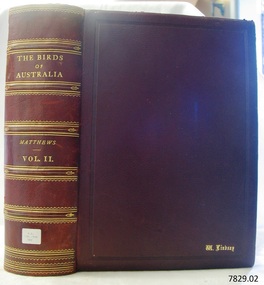
Book - Reference, The Birds of Australia Vol 2
The Birds of Australia is a 12 volume work, in a total of 14 books. The books were used as an ornithological handbook. They contain scientific text as well as over 600 hand-coloured lithographed plates by J.G. Keulemans, H. Grönvold, Roland Green, H. Goodchild and G.E. Lodge. The work was written, sponsored and organised by Gregory M. Matthews, F.R.S.C. Erc. who was a wealthy Australian and an amateur ornithologist. His titles included – -Fellow of the Linnean and Zoological Societies of London -Member of the British Ornithologists’ Union -Corresponding Fellow of the American Ornithologists’ Union The volumes in our collection were originally donated to the Warrnambool Mechanics’ Institute and Free Library by William Lindsay. THE LINDSAYS (quoted from the book Of Many Things – A History of Warrnambool Shire by C.E. Sayers) The Lindsays were amongst the most prominent families in the Shire of Warrnambool, as pastoralists, sportsmen, municipal councillors, community leaders. The first of the family William arrived in Melbourne in 1841 and started business as a livestock agent. The gold rushes sent him to the central Victoria diggings dealing in cattle. This was a business that boomed in the early 1850s, and he prospered. In 1859 he took over the Quamby run near Woolsthrope from Paul de Castella, the Yarra Valley Swiss vigneron who had brought the leasehold and improvements in 1853 from George Youl, who had pioneered the run. Quamby was originally 25,000 acres. It was heavily timbered, rough country, much of it swampy, a characteristic of the district. Lindsay used it to fatten cattle which gave large returns with the booming gold diggings towns paying high prices for beef. In 1862 purchases at auction made Quamby a freehold. In the next six years a further 20,000 acres of Crown land were brought at auction to make the run one of the largest in the south-west district. The great profits from his cattle trading enabled Lindsay to make improvements to the holding, and to Union which was added in 1864. Much of the thick timber was cleared and the worst of the swamps drained. Union was 15,000 acres of freehold when Kennedy sold it to Lindsay. It was heavily timbered, mostly blackwood, with large belts of wattle and honeysuckle. Much of the heavy native was ringbarked and cleared; much more was swept away by bushfire. It was expensive work, but Lindsay’s bank passbook was heavy with credit, and he did not spare money to make both Quamby and Union heavily developed stock runs. He was as lavish in social living; the bluestone Quamby homestead was one of the most hospitable in the district when William Lindsay was host there; its paddocks carried high quality thoroughbreds: its stables housed steeplechasers and flat racers which won many races on Warrnambool and other courses; its coach houses were filled with carriages which took his guests to the great racing carnivals of the district. After William Lindsay died in 1897, in his eighty-fifth year, his two sons, William and James, managed Union and Quamby as a joint venture. This partnership ended in 1906 when William took over Union and James kept Quamby. The following year 10,000 acres of Union were subdivided and sold in lots of 100 acres to 700 acres for dairying and general farming. It was well improved country, much of it alluvial flats. By then many of the paddocks were sheltered with blue gum belts, and they carried good pastures. The three Lindsays, father and two sons, gave many years of service to the Shire, and to many charitable, sporting, social and community organisations in the Warrnambool district. William Lindsay senior, was a Shire councillor for 15 years, and President several times. James Lindsay followed his father as a north riding councillor. He served nineteen years, from 1887 until his death in March 1908. He was President four times. Jimmy Lindsay was one of the most popular men in the south-west of Victoria. He was a fine sportsman: horse breeder, owner and a dashing amateur rider. He lived lavishly and played hard. For many years he guarded a herd of kangaroos, as many as 100 head, at Quamby. Descendants of the Lindsay kangaroos are still in the district. James Lindsay’s wife, Margaret Esther was a daughter of Samuel Shaw Parker, the first engineer of the Shire. Nell Lindsay, a daughter, lives in the Bluestone Quamby homestead. Only a little more than 60 acres of the original run still belongs to the property. William Lindsay junior succeeded his brother as a Shire councillor. He served for 25 years from 1908 until his death in 1934. So, the Lindsays, father and two sons, served as Shite councillors for an unbroken period of sixth-five years. William Lindsay junior had a life-long interest in horse racing, as breeder, owner and enthusiastic amateur steeplechase rider. He was elected a member of the Warrnambool racing club in 1901 and was president of the club for thirty-two years. He raced and rode horses for the love of the sport. He won the Villiers and Heytesbury Hunt Cup in the 1870s on his own horse, Ventura. In the year he died his horse Flavedo won the Warrnambool Grand Annual steeplechase. It was a sensational race. All of the contestants fell, or lost their riders. When Flavedo baulked at a jump, its jockey R. Sweetman, remounted and completed the course to win the race. All of the Lindsays were passionately fond of the thoroughbred horse. Nell Lindsay talking to the author in the drawing room of Quamby homestead - with many memories for her of its lavish years – said of a brother that he was put on a horse when he was two years old and never got off. William Lindsay junior made Union into a fine, high-producing property, breeding cattle and horses. He added to the bluestone house that David Kennedy started, established plantations of pines and gums, and made an attractive garden. WARRNAMBOOL MECHANICS’ INSTITUTE Warrnambool's Mechanics' Institute (or Institution as it was sometimes called) was one of the earliest in Victoria. On 17th October 1853 a meeting was held where it was resolved to request the Lieutenant Governor of the Colony to grant land for the erection of a Mechanics' Institutes building. A committee was formed at the meeting and Richard Osburne chaired the first meeting of this committee. The land on the North West corner of Banyan and Merri Streets was granted but there were no funds to erect the building. The Formal Rights of the Warrnambool Mechanics' Institute's encompassed its aims and these were officially adopted in1859; "This Institution has for its object the diffusion of literary, scientific, and other useful knowledge amongst its members, excluding all controversial subjects, religious or political. These objects are sought to be obtained by means of a circulating library, a reading room, the establishment of classes, debates, and the occasional delivery of lectures on natural and experimental philosophy, mechanics, astronomy, chemistry, natural history, literature, and the useful and ornamental arts, particularly those which have a more immediate reference to the colony." The Warrnambool Mechanics' Institute opened its first meeting room in November1854 in the National School building at the corner of Banyan and Timor Streets. The Institute was funded by member subscription, payable on a quarterly, half yearly or yearly basis. Samuel Hannaford, the Manager of the Warrnambool Bank of Australasia, was the first Honorary Secretary of the Mechanics' Institutes, and an early President and Vice-President. He also gave several of the early lectures in the Reading Room. Another early Secretary, Librarian and lecturer was Marmaduke Fisher, the teacher at the National School. Lecture topics included The Poets and Poetry of Ireland', 'The Birth and Development of the Earth', 'The Vertebrae - with Remarks on the pleasures resulting from the study of Natural History' and 'Architecture'. In 1856 the Reading Room was moved to James Hider's shop in Timor Street, and by 1864 it was located in the bookshop of Davies and Read. In the 1860's the Mechanics' Institute struggled as membership waned but in 1866, after a series of fund raising efforts, the committee was able to purchase land in Liebig Street, on a site then called Market Square, between the weighbridge and the fire station. A Mechanics' Institute building was opened at this site in August 1871. The following year four more rooms were added to the main Reading Room and in 1873 the Artisan School of Design was incorporated into the Institute. The same year Joseph Archibald established a Museum; however it deteriorated when he was transferred to Bendigo in 1877. In 1880, with Archibald's return to Warrnambool, the Museum was re-established, and in 1885 a new building was built at the back of the Institute to accommodate the re-created School of Design, the Art Gallery and the Museum. In 1887 the Museum section was moved to the former court house in Timor Street (for some time the walls of the building formed part of the TAFE cafeteria but all is now demolished)). In 1911 the Museum was transferred back to the original building and the management of the Mechanics' Institute was handed over to the Warrnambool City Council. The Museum and Art Gallery became one and housed many fine works of art, and the Library continued to grow. The building was well patronised, with records showing that at the beginning of the 20th century there were between 500 and 800 visitors. During World War One the monthly figures were in the thousands, with 3,400 people visiting in January 1915. The Museum was a much loved Institution in Warrnambool until the contents of the Museum and Art Gallery were removed to make room for the Warrnambool City Council Engineers' Department. The contents were stored but many of the items were scattered or lost. When the original building was demolished the site became occupied by the Civic Centre, which included the new City Library. (The library was temporarily located in the old Palais building in Koroit Street.) In the process of reorganisation the Collection was distributed amongst the community groups: -The new City Library took some of the historic books and some important documents, historic photographs and newspapers. -The Art Gallery kept the 19th Century art collection and some of the artefacts from the museum. -The Historic Society has some items -The State Museum has some items -Some items were destroyed -Flagstaff Hill Maritime Village has old newspapers, Government Gazettes, most of the Mechanics' Institute Library, ledgers and documents connected to the Mechanics' Institute Library, some framed and unframed art works and some photographs. The Warrnambool Mechanics' Institute Library book collection is deemed to be of great importance because it is one of the few collections in an almost intact state, and many of the books are now very rare and of great value. THE PATTISON COLLECTION This book is also part of the ‘Pattison Collection’, a collection of books and records that was originally owned by the Warrnambool Mechanics’ Institute, which was founded in Warrnambool in 1853. In 1935 Ralph Pattison was appointed as City Librarian to establish and organise the Warrnambool Library, as the Warrnambool Mechanics’ Institute was then called. When the Warrnambool Mechanics’ Institute building was pulled down in 1963 a new civic building was erected on the site and the new Warrnambool Library, on behalf of the City Council, took over all the holdings of the Warrnambool Mechanics’ Institute. At this time some of the items were separated and identified as the ‘Pattison Collection’, named after Ralph Pattison. Eventually the components of the Warrnambool Mechanics’ Institute were distributed from the Warrnambool Library to various places, including the Art Gallery, Historical Society and Flagstaff Hill. Later some were even distributed to other regional branches of Corangamite Regional Library and passed to and fro. It is difficult now to trace just where all of the items have ended up. The books at Flagstaff Hill Maritime Village generally display stamps and markings from Pattison as well as a variety of other institutions including the Mechanics’ Institute itself. RALPH ERIC PATTISON Ralph Eric Pattison was born in Rockhampton, Queensland, in 1891. He married Maude Swan from Warrnambool in 1920 and they set up home in Warrnambool. In 1935 Pattison accepted a position as City Librarian for the Warrnambool City Council. His huge challenge was to make a functional library within two rooms of the Mechanics’ Institute. He tirelessly cleaned, cleared and sorted a disarrayed collection of old books, jars of preserved specimens and other items reserved for exhibition in the city’s museum. He developed and updated the library with a wide variety of books for all tastes, including reference books for students; a difficult task to fulfil during the years following the Depression. He converted all of the lower area of the building into a library, reference room and reading room for members and the public. The books were sorted and stored using a cataloguing and card index system that he had developed himself. He also prepared the upper floor of the building and established the Art Gallery and later the Museum, a place to exhibit the many old relics that had been stored for years for this purpose. One of the treasures he found was a beautiful ancient clock, which he repaired, restored and enjoyed using in his office during the years of his service there. Ralph Pattison was described as “a meticulous gentleman whose punctuality, floorless courtesy and distinctive neat dress were hallmarks of his character, and ‘his’ clock controlled his daily routine, and his opening and closing of the library’s large heavy doors to the minute.” Pattison took leave during 1942 to 1945 to serve in the Royal Australian Navy, Volunteer Reserve as Lieutenant. A few years later he converted one of the Museum’s rooms into a Children’s Library, stocking it with suitable books for the younger generation. This was an instant success. In the 1950’s he had the honour of being appointed to the Victorian Library Board and received more inspiration from the monthly conferences in Melbourne. He was sadly retired in 1959 after over 23 years of service, due to the fact that he had gone over the working age of council officers. However he continued to take a very keen interest in the continual development of the Library until his death in 1969.The Birds of Australia by Gregory M. Matthews is now considered a rare and valuable scientific and historic work on its own. These 12 volumes were donated in 1934 to The Warrnambool Mechanics’ Institute and were included as part of the Pattison Collection. The Warrnambool Mechanics’ Institute Collection is primarily significant in its totality, rather than for the individual objects it contains. Its contents are highly representative of the development of Mechanics' Institute libraries across Australia, particularly Victoria. A diversity of publications and themes has been amassed, and these provide clues to our understanding of the nature of and changes in the reading habits of Victorians from the 1850s to the middle of the 20th century. The collection also highlights the Warrnambool community’s commitment to the Mechanics’ Institute, reading, literacy and learning in the regions, and proves that access to knowledge was not impeded by distance. These items help to provide a more complete picture of our community’s ideals and aspirations. The Warrnambool Mechanics Institute book collection has historical and social significance for its strong association with the Mechanics Institute movement and the important role it played in the intellectual, cultural and social development of people throughout the latter part of the nineteenth century and the early twentieth century. The collection of books is a rare example of an early lending library and its significance is enhanced by the survival of an original collection of many volumes. The Warrnambool Mechanics' Institute’s publication collection is of both local and state significance. The Birds of Australia Vol 2 Author: Gregory M Mathews Publisher: Witherby & Co 326 HIGH HOLBORN LONDON Date: 1912-1913 Tan leather bound illustrated work. Label on spine cover with typed text RA 598.2994 MAT Pastedown front endpaper has sticker from Warrnambool Mechanics Institute and Free Library that reads “Presented by W. Lindsay Esq. ‘Union’ Woolsthrope” Accession Number: 15233 Date Received: 3-34 “W. Lindsay” embossed in gold on front cover, bottom right of book flagstaff hill, warrnambool, shipwrecked coast, flagstaff hill maritime museum, maritime museum, shipwreck coast, flagstaff hill maritime village, great ocean road, the birds of australia, gregory m. matthews, witherby & co., h.f. & g. witherby, w lindsay, william lindsay, quamby woolsthorpe, union woolsthorpe, pattison collection, warrnambool library, warrnambool art gallery, joseph archibald, warrnambool mechanics’ institute and free library, ralph eric pattison, warrnambool city librarian, mechanics’ institute library, victorian library board, warrnambool books and records, warrnambool children’s library, the birds of australia vol 2, quamby station, union station, woolsthrope -
 Flagstaff Hill Maritime Museum and Village
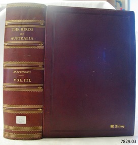
Book - Reference, The Birds of Australia Vol 3
The Birds of Australia is a 12 volume work, in a total of 14 books. The books were used as an ornithological handbook. They contain scientific text as well as over 600 hand-coloured lithographed plates by J.G. Keulemans, H. Grönvold, Roland Green, H. Goodchild and G.E. Lodge. The work was written, sponsored and organised by Gregory M. Matthews, F.R.S.C. Erc. who was a wealthy Australian and an amateur ornithologist. His titles included – -Fellow of the Linnean and Zoological Societies of London -Member of the British Ornithologists’ Union -Corresponding Fellow of the American Ornithologists’ Union The volumes in our collection were originally donated to the Warrnambool Mechanics’ Institute and Free Library by William Lindsay. THE LINDSAYS (quoted from the book Of Many Things – A History of Warrnambool Shire by C.E. Sayers) The Lindsays were amongst the most prominent families in the Shire of Warrnambool, as pastoralists, sportsmen, municipal councillors, community leaders. The first of the family William arrived in Melbourne in 1841 and started business as a livestock agent. The gold rushes sent him to the central Victoria diggings dealing in cattle. This was a business that boomed in the early 1850s, and he prospered. In 1859 he took over the Quamby run near Woolsthrope from Paul de Castella, the Yarra Valley Swiss vigneron who had brought the leasehold and improvements in 1853 from George Youl, who had pioneered the run. Quamby was originally 25,000 acres. It was heavily timbered, rough country, much of it swampy, a characteristic of the district. Lindsay used it to fatten cattle which gave large returns with the booming gold diggings towns paying high prices for beef. In 1862 purchases at auction made Quamby a freehold. In the next six years a further 20,000 acres of Crown land were brought at auction to make the run one of the largest in the south-west district. The great profits from his cattle trading enabled Lindsay to make improvements to the holding, and to Union which was added in 1864. Much of the thick timber was cleared and the worst of the swamps drained. Union was 15,000 acres of freehold when Kennedy sold it to Lindsay. It was heavily timbered, mostly blackwood, with large belts of wattle and honeysuckle. Much of the heavy native was ringbarked and cleared; much more was swept away by bushfire. It was expensive work, but Lindsay’s bank passbook was heavy with credit, and he did not spare money to make both Quamby and Union heavily developed stock runs. He was as lavish in social living; the bluestone Quamby homestead was one of the most hospitable in the district when William Lindsay was host there; its paddocks carried high quality thoroughbreds: its stables housed steeplechasers and flat racers which won many races on Warrnambool and other courses; its coach houses were filled with carriages which took his guests to the great racing carnivals of the district. After William Lindsay died in 1897, in his eighty-fifth year, his two sons, William and James, managed Union and Quamby as a joint venture. This partnership ended in 1906 when William took over Union and James kept Quamby. The following year 10,000 acres of Union were subdivided and sold in lots of 100 acres to 700 acres for dairying and general farming. It was well improved country, much of it alluvial flats. By then many of the paddocks were sheltered with blue gum belts, and they carried good pastures. The three Lindsays, father and two sons, gave many years of service to the Shire, and to many charitable, sporting, social and community organisations in the Warrnambool district. William Lindsay senior, was a Shire councillor for 15 years, and President several times. James Lindsay followed his father as a north riding councillor. He served nineteen years, from 1887 until his death in March 1908. He was President four times. Jimmy Lindsay was one of the most popular men in the south-west of Victoria. He was a fine sportsman: horse breeder, owner and a dashing amateur rider. He lived lavishly and played hard. For many years he guarded a herd of kangaroos, as many as 100 head, at Quamby. Descendants of the Lindsay kangaroos are still in the district. James Lindsay’s wife, Margaret Esther was a daughter of Samuel Shaw Parker, the first engineer of the Shire. Nell Lindsay, a daughter, lives in the Bluestone Quamby homestead. Only a little more than 60 acres of the original run still belongs to the property. William Lindsay junior succeeded his brother as a Shire councillor. He served for 25 years from 1908 until his death in 1934. So, the Lindsays, father and two sons, served as Shite councillors for an unbroken period of sixth-five years. William Lindsay junior had a life-long interest in horse racing, as breeder, owner and enthusiastic amateur steeplechase rider. He was elected a member of the Warrnambool racing club in 1901 and was president of the club for thirty-two years. He raced and rode horses for the love of the sport. He won the Villiers and Heytesbury Hunt Cup in the 1870s on his own horse, Ventura. In the year he died his horse Flavedo won the Warrnambool Grand Annual steeplechase. It was a sensational race. All of the contestants fell, or lost their riders. When Flavedo baulked at a jump, its jockey R. Sweetman, remounted and completed the course to win the race. All of the Lindsays were passionately fond of the thoroughbred horse. Nell Lindsay talking to the author in the drawing room of Quamby homestead - with many memories for her of its lavish years – said of a brother that he was put on a horse when he was two years old and never got off. William Lindsay junior made Union into a fine, high-producing property, breeding cattle and horses. He added to the bluestone house that David Kennedy started, established plantations of pines and gums, and made an attractive garden. WARRNAMBOOL MECHANICS’ INSTITUTE Warrnambool's Mechanics' Institute (or Institution as it was sometimes called) was one of the earliest in Victoria. On 17th October 1853 a meeting was held where it was resolved to request the Lieutenant Governor of the Colony to grant land for the erection of a Mechanics' Institutes building. A committee was formed at the meeting and Richard Osburne chaired the first meeting of this committee. The land on the North West corner of Banyan and Merri Streets was granted but there were no funds to erect the building. The Formal Rights of the Warrnambool Mechanics' Institute's encompassed its aims and these were officially adopted in1859; "This Institution has for its object the diffusion of literary, scientific, and other useful knowledge amongst its members, excluding all controversial subjects, religious or political. These objects are sought to be obtained by means of a circulating library, a reading room, the establishment of classes, debates, and the occasional delivery of lectures on natural and experimental philosophy, mechanics, astronomy, chemistry, natural history, literature, and the useful and ornamental arts, particularly those which have a more immediate reference to the colony." The Warrnambool Mechanics' Institute opened its first meeting room in November1854 in the National School building at the corner of Banyan and Timor Streets. The Institute was funded by member subscription, payable on a quarterly, half yearly or yearly basis. Samuel Hannaford, the Manager of the Warrnambool Bank of Australasia, was the first Honorary Secretary of the Mechanics' Institutes, and an early President and Vice-President. He also gave several of the early lectures in the Reading Room. Another early Secretary, Librarian and lecturer was Marmaduke Fisher, the teacher at the National School. Lecture topics included The Poets and Poetry of Ireland', 'The Birth and Development of the Earth', 'The Vertebrae - with Remarks on the pleasures resulting from the study of Natural History' and 'Architecture'. In 1856 the Reading Room was moved to James Hider's shop in Timor Street, and by 1864 it was located in the bookshop of Davies and Read. In the 1860's the Mechanics' Institute struggled as membership waned but in 1866, after a series of fund raising efforts, the committee was able to purchase land in Liebig Street, on a site then called Market Square, between the weighbridge and the fire station. A Mechanics' Institute building was opened at this site in August 1871. The following year four more rooms were added to the main Reading Room and in 1873 the Artisan School of Design was incorporated into the Institute. The same year Joseph Archibald established a Museum; however it deteriorated when he was transferred to Bendigo in 1877. In 1880, with Archibald's return to Warrnambool, the Museum was re-established, and in 1885 a new building was built at the back of the Institute to accommodate the re-created School of Design, the Art Gallery and the Museum. In 1887 the Museum section was moved to the former court house in Timor Street (for some time the walls of the building formed part of the TAFE cafeteria but all is now demolished)). In 1911 the Museum was transferred back to the original building and the management of the Mechanics' Institute was handed over to the Warrnambool City Council. The Museum and Art Gallery became one and housed many fine works of art, and the Library continued to grow. The building was well patronised, with records showing that at the beginning of the 20th century there were between 500 and 800 visitors. During World War One the monthly figures were in the thousands, with 3,400 people visiting in January 1915. The Museum was a much loved Institution in Warrnambool until the contents of the Museum and Art Gallery were removed to make room for the Warrnambool City Council Engineers' Department. The contents were stored but many of the items were scattered or lost. When the original building was demolished the site became occupied by the Civic Centre, which included the new City Library. (The library was temporarily located in the old Palais building in Koroit Street.) In the process of reorganisation the Collection was distributed amongst the community groups: -The new City Library took some of the historic books and some important documents, historic photographs and newspapers. -The Art Gallery kept the 19th Century art collection and some of the artefacts from the museum. -The Historic Society has some items -The State Museum has some items -Some items were destroyed -Flagstaff Hill Maritime Village has old newspapers, Government Gazettes, most of the Mechanics' Institute Library, ledgers and documents connected to the Mechanics' Institute Library, some framed and unframed art works and some photographs. The Warrnambool Mechanics' Institute Library book collection is deemed to be of great importance because it is one of the few collections in an almost intact state, and many of the books are now very rare and of great value. THE PATTISON COLLECTION This book is also part of the ‘Pattison Collection’, a collection of books and records that was originally owned by the Warrnambool Mechanics’ Institute, which was founded in Warrnambool in 1853. In 1935 Ralph Pattison was appointed as City Librarian to establish and organise the Warrnambool Library, as the Warrnambool Mechanics’ Institute was then called. When the Warrnambool Mechanics’ Institute building was pulled down in 1963 a new civic building was erected on the site and the new Warrnambool Library, on behalf of the City Council, took over all the holdings of the Warrnambool Mechanics’ Institute. At this time some of the items were separated and identified as the ‘Pattison Collection’, named after Ralph Pattison. Eventually the components of the Warrnambool Mechanics’ Institute were distributed from the Warrnambool Library to various places, including the Art Gallery, Historical Society and Flagstaff Hill. Later some were even distributed to other regional branches of Corangamite Regional Library and passed to and fro. It is difficult now to trace just where all of the items have ended up. The books at Flagstaff Hill Maritime Village generally display stamps and markings from Pattison as well as a variety of other institutions including the Mechanics’ Institute itself. RALPH ERIC PATTISON Ralph Eric Pattison was born in Rockhampton, Queensland, in 1891. He married Maude Swan from Warrnambool in 1920 and they set up home in Warrnambool. In 1935 Pattison accepted a position as City Librarian for the Warrnambool City Council. His huge challenge was to make a functional library within two rooms of the Mechanics’ Institute. He tirelessly cleaned, cleared and sorted a disarrayed collection of old books, jars of preserved specimens and other items reserved for exhibition in the city’s museum. He developed and updated the library with a wide variety of books for all tastes, including reference books for students; a difficult task to fulfil during the years following the Depression. He converted all of the lower area of the building into a library, reference room and reading room for members and the public. The books were sorted and stored using a cataloguing and card index system that he had developed himself. He also prepared the upper floor of the building and established the Art Gallery and later the Museum, a place to exhibit the many old relics that had been stored for years for this purpose. One of the treasures he found was a beautiful ancient clock, which he repaired, restored and enjoyed using in his office during the years of his service there. Ralph Pattison was described as “a meticulous gentleman whose punctuality, floorless courtesy and distinctive neat dress were hallmarks of his character, and ‘his’ clock controlled his daily routine, and his opening and closing of the library’s large heavy doors to the minute.” Pattison took leave during 1942 to 1945 to serve in the Royal Australian Navy, Volunteer Reserve as Lieutenant. A few years later he converted one of the Museum’s rooms into a Children’s Library, stocking it with suitable books for the younger generation. This was an instant success. In the 1950’s he had the honour of being appointed to the Victorian Library Board and received more inspiration from the monthly conferences in Melbourne. He was sadly retired in 1959 after over 23 years of service, due to the fact that he had gone over the working age of council officers. However he continued to take a very keen interest in the continual development of the Library until his death in 1969. The Birds of Australia by Gregory M. Matthews is now considered a rare and valuable scientific and historic work on its own. These 12 volumes were donated in 1934 to The Warrnambool Mechanics’ Institute and were included as part of the Pattison Collection. The Warrnambool Mechanics’ Institute Collection is primarily significant in its totality, rather than for the individual objects it contains. Its contents are highly representative of the development of Mechanics' Institute libraries across Australia, particularly Victoria. A diversity of publications and themes has been amassed, and these provide clues to our understanding of the nature of and changes in the reading habits of Victorians from the 1850s to the middle of the 20th century. The collection also highlights the Warrnambool community’s commitment to the Mechanics’ Institute, reading, literacy and learning in the regions, and proves that access to knowledge was not impeded by distance. These items help to provide a more complete picture of our community’s ideals and aspirations. The Warrnambool Mechanics Institute book collection has historical and social significance for its strong association with the Mechanics Institute movement and the important role it played in the intellectual, cultural and social development of people throughout the latter part of the nineteenth century and the early twentieth century. The collection of books is a rare example of an early lending library and its significance is enhanced by the survival of an original collection of many volumes. The Warrnambool Mechanics' Institute’s publication collection is of both local and state significance. The Birds of Australia Vol 3 Author: Gregory M Mathews Publisher: Witherby & Co 326 HIGH HOLBORN LONDON Date: 1913-1914 Label on spine cover with typed text RA 598.2994 MAT Pastedown front endpaper has sticker from Warrnambool Mechanics Institute and Free Library that reads “Presented by W. Lindsay Esq. ‘Union’ Woolsthrope” Accession Number: 15234 Date Received: 3-34 “W. Lindsay” embossed in gold on front cover, bottom right of book flagstaff hill, warrnambool, shipwrecked coast, flagstaff hill maritime museum, maritime museum, shipwreck coast, flagstaff hill maritime village, great ocean road, the birds of australia, gregory m. matthews, witherby & co., h.f. & g. witherby, w lindsay, william lindsay, quamby woolsthorpe, union woolsthorpe, pattison collection, warrnambool library, warrnambool art gallery, joseph archibald, warrnambool mechanics’ institute and free library, ralph eric pattison, warrnambool city librarian, mechanics’ institute library, victorian library board, warrnambool books and records, warrnambool children’s library, the birds of australia vol 3, quamby station, union station, woolsthrope -
 Flagstaff Hill Maritime Museum and Village
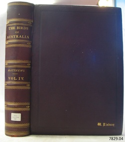
Book - Reference, The Birds of Australia Vol 4
The Birds of Australia is a 12 volume work, in a total of 14 books. The books were used as an ornithological handbook. They contain scientific text as well as over 600 hand-coloured lithographed plates by J.G. Keulemans, H. Grönvold, Roland Green, H. Goodchild and G.E. Lodge. The work was written, sponsored and organised by Gregory M. Matthews, F.R.S.C. Erc. who was a wealthy Australian and an amateur ornithologist. His titles included – -Fellow of the Linnean and Zoological Societies of London -Member of the British Ornithologists’ Union -Corresponding Fellow of the American Ornithologists’ Union The volumes in our collection were originally donated to the Warrnambool Mechanics’ Institute and Free Library by William Lindsay. THE LINDSAYS (quoted from the book Of Many Things – A History of Warrnambool Shire by C.E. Sayers) The Lindsays were amongst the most prominent families in the Shire of Warrnambool, as pastoralists, sportsmen, municipal councillors, community leaders. The first of the family William arrived in Melbourne in 1841 and started business as a livestock agent. The gold rushes sent him to the central Victoria diggings dealing in cattle. This was a business that boomed in the early 1850s, and he prospered. In 1859 he took over the Quamby run near Woolsthrope from Paul de Castella, the Yarra Valley Swiss vigneron who had brought the leasehold and improvements in 1853 from George Youl, who had pioneered the run. Quamby was originally 25,000 acres. It was heavily timbered, rough country, much of it swampy, a characteristic of the district. Lindsay used it to fatten cattle which gave large returns with the booming gold diggings towns paying high prices for beef. In 1862 purchases at auction made Quamby a freehold. In the next six years a further 20,000 acres of Crown land were brought at auction to make the run one of the largest in the south-west district. The great profits from his cattle trading enabled Lindsay to make improvements to the holding, and to Union which was added in 1864. Much of the thick timber was cleared and the worst of the swamps drained. Union was 15,000 acres of freehold when Kennedy sold it to Lindsay. It was heavily timbered, mostly blackwood, with large belts of wattle and honeysuckle. Much of the heavy native was ringbarked and cleared; much more was swept away by bushfire. It was expensive work, but Lindsay’s bank passbook was heavy with credit, and he did not spare money to make both Quamby and Union heavily developed stock runs. He was as lavish in social living; the bluestone Quamby homestead was one of the most hospitable in the district when William Lindsay was host there; its paddocks carried high quality thoroughbreds: its stables housed steeplechasers and flat racers which won many races on Warrnambool and other courses; its coach houses were filled with carriages which took his guests to the great racing carnivals of the district. After William Lindsay died in 1897, in his eighty-fifth year, his two sons, William and James, managed Union and Quamby as a joint venture. This partnership ended in 1906 when William took over Union and James kept Quamby. The following year 10,000 acres of Union were subdivided and sold in lots of 100 acres to 700 acres for dairying and general farming. It was well improved country, much of it alluvial flats. By then many of the paddocks were sheltered with blue gum belts, and they carried good pastures. The three Lindsays, father and two sons, gave many years of service to the Shire, and to many charitable, sporting, social and community organisations in the Warrnambool district. William Lindsay senior, was a Shire councillor for 15 years, and President several times. James Lindsay followed his father as a north riding councillor. He served nineteen years, from 1887 until his death in March 1908. He was President four times. Jimmy Lindsay was one of the most popular men in the south-west of Victoria. He was a fine sportsman: horse breeder, owner and a dashing amateur rider. He lived lavishly and played hard. For many years he guarded a herd of kangaroos, as many as 100 head, at Quamby. Descendants of the Lindsay kangaroos are still in the district. James Lindsay’s wife, Margaret Esther was a daughter of Samuel Shaw Parker, the first engineer of the Shire. Nell Lindsay, a daughter, lives in the Bluestone Quamby homestead. Only a little more than 60 acres of the original run still belongs to the property. William Lindsay junior succeeded his brother as a Shire councillor. He served for 25 years from 1908 until his death in 1934. So, the Lindsays, father and two sons, served as Shite councillors for an unbroken period of sixth-five years. William Lindsay junior had a life-long interest in horse racing, as breeder, owner and enthusiastic amateur steeplechase rider. He was elected a member of the Warrnambool racing club in 1901 and was president of the club for thirty-two years. He raced and rode horses for the love of the sport. He won the Villiers and Heytesbury Hunt Cup in the 1870s on his own horse, Ventura. In the year he died his horse Flavedo won the Warrnambool Grand Annual steeplechase. It was a sensational race. All of the contestants fell, or lost their riders. When Flavedo baulked at a jump, its jockey R. Sweetman, remounted and completed the course to win the race. All of the Lindsays were passionately fond of the thoroughbred horse. Nell Lindsay talking to the author in the drawing room of Quamby homestead - with many memories for her of its lavish years – said of a brother that he was put on a horse when he was two years old and never got off. William Lindsay junior made Union into a fine, high-producing property, breeding cattle and horses. He added to the bluestone house that David Kennedy started, established plantations of pines and gums, and made an attractive garden. WARRNAMBOOL MECHANICS’ INSTITUTE Warrnambool's Mechanics' Institute (or Institution as it was sometimes called) was one of the earliest in Victoria. On 17th October 1853 a meeting was held where it was resolved to request the Lieutenant Governor of the Colony to grant land for the erection of a Mechanics' Institutes building. A committee was formed at the meeting and Richard Osburne chaired the first meeting of this committee. The land on the North West corner of Banyan and Merri Streets was granted but there were no funds to erect the building. The Formal Rights of the Warrnambool Mechanics' Institute's encompassed its aims and these were officially adopted in1859; "This Institution has for its object the diffusion of literary, scientific, and other useful knowledge amongst its members, excluding all controversial subjects, religious or political. These objects are sought to be obtained by means of a circulating library, a reading room, the establishment of classes, debates, and the occasional delivery of lectures on natural and experimental philosophy, mechanics, astronomy, chemistry, natural history, literature, and the useful and ornamental arts, particularly those which have a more immediate reference to the colony." The Warrnambool Mechanics' Institute opened its first meeting room in November1854 in the National School building at the corner of Banyan and Timor Streets. The Institute was funded by member subscription, payable on a quarterly, half yearly or yearly basis. Samuel Hannaford, the Manager of the Warrnambool Bank of Australasia, was the first Honorary Secretary of the Mechanics' Institutes, and an early President and Vice-President. He also gave several of the early lectures in the Reading Room. Another early Secretary, Librarian and lecturer was Marmaduke Fisher, the teacher at the National School. Lecture topics included The Poets and Poetry of Ireland', 'The Birth and Development of the Earth', 'The Vertebrae - with Remarks on the pleasures resulting from the study of Natural History' and 'Architecture'. In 1856 the Reading Room was moved to James Hider's shop in Timor Street, and by 1864 it was located in the bookshop of Davies and Read. In the 1860's the Mechanics' Institute struggled as membership waned but in 1866, after a series of fund raising efforts, the committee was able to purchase land in Liebig Street, on a site then called Market Square, between the weighbridge and the fire station. A Mechanics' Institute building was opened at this site in August 1871. The following year four more rooms were added to the main Reading Room and in 1873 the Artisan School of Design was incorporated into the Institute. The same year Joseph Archibald established a Museum; however it deteriorated when he was transferred to Bendigo in 1877. In 1880, with Archibald's return to Warrnambool, the Museum was re-established, and in 1885 a new building was built at the back of the Institute to accommodate the re-created School of Design, the Art Gallery and the Museum. In 1887 the Museum section was moved to the former court house in Timor Street (for some time the walls of the building formed part of the TAFE cafeteria but all is now demolished)). In 1911 the Museum was transferred back to the original building and the management of the Mechanics' Institute was handed over to the Warrnambool City Council. The Museum and Art Gallery became one and housed many fine works of art, and the Library continued to grow. The building was well patronised, with records showing that at the beginning of the 20th century there were between 500 and 800 visitors. During World War One the monthly figures were in the thousands, with 3,400 people visiting in January 1915. The Museum was a much loved Institution in Warrnambool until the contents of the Museum and Art Gallery were removed to make room for the Warrnambool City Council Engineers' Department. The contents were stored but many of the items were scattered or lost. When the original building was demolished the site became occupied by the Civic Centre, which included the new City Library. (The library was temporarily located in the old Palais building in Koroit Street.) In the process of reorganisation the Collection was distributed amongst the community groups: -The new City Library took some of the historic books and some important documents, historic photographs and newspapers. -The Art Gallery kept the 19th Century art collection and some of the artefacts from the museum. -The Historic Society has some items -The State Museum has some items -Some items were destroyed -Flagstaff Hill Maritime Village has old newspapers, Government Gazettes, most of the Mechanics' Institute Library, ledgers and documents connected to the Mechanics' Institute Library, some framed and unframed art works and some photographs. The Warrnambool Mechanics' Institute Library book collection is deemed to be of great importance because it is one of the few collections in an almost intact state, and many of the books are now very rare and of great value. THE PATTISON COLLECTION This book is also part of the ‘Pattison Collection’, a collection of books and records that was originally owned by the Warrnambool Mechanics’ Institute, which was founded in Warrnambool in 1853. In 1935 Ralph Pattison was appointed as City Librarian to establish and organise the Warrnambool Library, as the Warrnambool Mechanics’ Institute was then called. When the Warrnambool Mechanics’ Institute building was pulled down in 1963 a new civic building was erected on the site and the new Warrnambool Library, on behalf of the City Council, took over all the holdings of the Warrnambool Mechanics’ Institute. At this time some of the items were separated and identified as the ‘Pattison Collection’, named after Ralph Pattison. Eventually the components of the Warrnambool Mechanics’ Institute were distributed from the Warrnambool Library to various places, including the Art Gallery, Historical Society and Flagstaff Hill. Later some were even distributed to other regional branches of Corangamite Regional Library and passed to and fro. It is difficult now to trace just where all of the items have ended up. The books at Flagstaff Hill Maritime Village generally display stamps and markings from Pattison as well as a variety of other institutions including the Mechanics’ Institute itself. RALPH ERIC PATTISON Ralph Eric Pattison was born in Rockhampton, Queensland, in 1891. He married Maude Swan from Warrnambool in 1920 and they set up home in Warrnambool. In 1935 Pattison accepted a position as City Librarian for the Warrnambool City Council. His huge challenge was to make a functional library within two rooms of the Mechanics’ Institute. He tirelessly cleaned, cleared and sorted a disarrayed collection of old books, jars of preserved specimens and other items reserved for exhibition in the city’s museum. He developed and updated the library with a wide variety of books for all tastes, including reference books for students; a difficult task to fulfil during the years following the Depression. He converted all of the lower area of the building into a library, reference room and reading room for members and the public. The books were sorted and stored using a cataloguing and card index system that he had developed himself. He also prepared the upper floor of the building and established the Art Gallery and later the Museum, a place to exhibit the many old relics that had been stored for years for this purpose. One of the treasures he found was a beautiful ancient clock, which he repaired, restored and enjoyed using in his office during the years of his service there. Ralph Pattison was described as “a meticulous gentleman whose punctuality, floorless courtesy and distinctive neat dress were hallmarks of his character, and ‘his’ clock controlled his daily routine, and his opening and closing of the library’s large heavy doors to the minute.” Pattison took leave during 1942 to 1945 to serve in the Royal Australian Navy, Volunteer Reserve as Lieutenant. A few years later he converted one of the Museum’s rooms into a Children’s Library, stocking it with suitable books for the younger generation. This was an instant success. In the 1950’s he had the honour of being appointed to the Victorian Library Board and received more inspiration from the monthly conferences in Melbourne. He was sadly retired in 1959 after over 23 years of service, due to the fact that he had gone over the working age of council officers. However he continued to take a very keen interest in the continual development of the Library until his death in 1969. The Birds of Australia by Gregory M. Matthews is now considered a rare and valuable scientific and historic work on its own. These 12 volumes were donated in 1934 to The Warrnambool Mechanics’ Institute and were included as part of the Pattison Collection. The Warrnambool Mechanics’ Institute Collection is primarily significant in its totality, rather than for the individual objects it contains. Its contents are highly representative of the development of Mechanics' Institute libraries across Australia, particularly Victoria. A diversity of publications and themes has been amassed, and these provide clues to our understanding of the nature of and changes in the reading habits of Victorians from the 1850s to the middle of the 20th century. The collection also highlights the Warrnambool community’s commitment to the Mechanics’ Institute, reading, literacy and learning in the regions, and proves that access to knowledge was not impeded by distance. These items help to provide a more complete picture of our community’s ideals and aspirations. The Warrnambool Mechanics Institute book collection has historical and social significance for its strong association with the Mechanics Institute movement and the important role it played in the intellectual, cultural and social development of people throughout the latter part of the nineteenth century and the early twentieth century. The collection of books is a rare example of an early lending library and its significance is enhanced by the survival of an original collection of many volumes. The Warrnambool Mechanics' Institute’s publication collection is of both local and state significance. The Birds of Australia Vol 4 Author: Gregory M Mathews Publisher: Witherby & Co 326 HIGH HOLBORN LONDON Date: 1914-1915 Tan leather bound illustrated work.Label on spine cover with typed text RA 598.2994 MAT Pastedown front endpaper has sticker from Warrnambool Mechanics Institute and Free Library that reads “Presented by W. Lindsay Esq. ‘Union’ Woolsthrope” Accession Number: 15235 Date Received: 3-34 “W. Lindsay” embossed in gold on front cover, bottom right of book flagstaff hill, warrnambool, shipwrecked coast, flagstaff hill maritime museum, maritime museum, shipwreck coast, flagstaff hill maritime village, great ocean road, the birds of australia, gregory m. matthews, witherby & co., h.f. & g. witherby, w lindsay, william lindsay, quamby woolsthorpe, union woolsthorpe, pattison collection, warrnambool library, warrnambool art gallery, joseph archibald, warrnambool mechanics’ institute and free library, ralph eric pattison, warrnambool city librarian, mechanics’ institute library, victorian library board, warrnambool books and records, warrnambool children’s library, the birds of australia vol 4, quamby station, union station, woolsthrope -
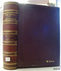 Flagstaff Hill Maritime Museum and Village
Book - Reference, The Birds of Australia Vol 5
The Birds of Australia is a 12 volume work, in a total of 14 books. The books were used as an ornithological handbook. They contain scientific text as well as over 600 hand-coloured lithographed plates by J.G. Keulemans, H. Grönvold, Roland Green, H. Goodchild and G.E. Lodge. The work was written, sponsored and organised by Gregory M. Matthews, F.R.S.C. Erc. who was a wealthy Australian and an amateur ornithologist. His titles included – -Fellow of the Linnean and Zoological Societies of London -Member of the British Ornithologists’ Union -Corresponding Fellow of the American Ornithologists’ Union The volumes in our collection were originally donated to the Warrnambool Mechanics’ Institute and Free Library by William Lindsay. THE LINDSAYS (quoted from the book Of Many Things – A History of Warrnambool Shire by C.E. Sayers) The Lindsays were amongst the most prominent families in the Shire of Warrnambool, as pastoralists, sportsmen, municipal councillors, community leaders. The first of the family William arrived in Melbourne in 1841 and started business as a livestock agent. The gold rushes sent him to the central Victoria diggings dealing in cattle. This was a business that boomed in the early 1850s, and he prospered. In 1859 he took over the Quamby run near Woolsthrope from Paul de Castella, the Yarra Valley Swiss vigneron who had brought the leasehold and improvements in 1853 from George Youl, who had pioneered the run. Quamby was originally 25,000 acres. It was heavily timbered, rough country, much of it swampy, a characteristic of the district. Lindsay used it to fatten cattle which gave large returns with the booming gold diggings towns paying high prices for beef. In 1862 purchases at auction made Quamby a freehold. In the next six years a further 20,000 acres of Crown land were brought at auction to make the run one of the largest in the south-west district. The great profits from his cattle trading enabled Lindsay to make improvements to the holding, and to Union which was added in 1864. Much of the thick timber was cleared and the worst of the swamps drained. Union was 15,000 acres of freehold when Kennedy sold it to Lindsay. It was heavily timbered, mostly blackwood, with large belts of wattle and honeysuckle. Much of the heavy native was ringbarked and cleared; much more was swept away by bushfire. It was expensive work, but Lindsay’s bank passbook was heavy with credit, and he did not spare money to make both Quamby and Union heavily developed stock runs. He was as lavish in social living; the bluestone Quamby homestead was one of the most hospitable in the district when William Lindsay was host there; its paddocks carried high quality thoroughbreds: its stables housed steeplechasers and flat racers which won many races on Warrnambool and other courses; its coach houses were filled with carriages which took his guests to the great racing carnivals of the district. After William Lindsay died in 1897, in his eighty-fifth year, his two sons, William and James, managed Union and Quamby as a joint venture. This partnership ended in 1906 when William took over Union and James kept Quamby. The following year 10,000 acres of Union were subdivided and sold in lots of 100 acres to 700 acres for dairying and general farming. It was well improved country, much of it alluvial flats. By then many of the paddocks were sheltered with blue gum belts, and they carried good pastures. The three Lindsays, father and two sons, gave many years of service to the Shire, and to many charitable, sporting, social and community organisations in the Warrnambool district. William Lindsay senior, was a Shire councillor for 15 years, and President several times. James Lindsay followed his father as a north riding councillor. He served nineteen years, from 1887 until his death in March 1908. He was President four times. Jimmy Lindsay was one of the most popular men in the south-west of Victoria. He was a fine sportsman: horse breeder, owner and a dashing amateur rider. He lived lavishly and played hard. For many years he guarded a herd of kangaroos, as many as 100 head, at Quamby. Descendants of the Lindsay kangaroos are still in the district. James Lindsay’s wife, Margaret Esther was a daughter of Samuel Shaw Parker, the first engineer of the Shire. Nell Lindsay, a daughter, lives in the Bluestone Quamby homestead. Only a little more than 60 acres of the original run still belongs to the property. William Lindsay junior succeeded his brother as a Shire councillor. He served for 25 years from 1908 until his death in 1934. So, the Lindsays, father and two sons, served as Shite councillors for an unbroken period of sixth-five years. William Lindsay junior had a life-long interest in horse racing, as breeder, owner and enthusiastic amateur steeplechase rider. He was elected a member of the Warrnambool racing club in 1901 and was president of the club for thirty-two years. He raced and rode horses for the love of the sport. He won the Villiers and Heytesbury Hunt Cup in the 1870s on his own horse, Ventura. In the year he died his horse Flavedo won the Warrnambool Grand Annual steeplechase. It was a sensational race. All of the contestants fell, or lost their riders. When Flavedo baulked at a jump, its jockey R. Sweetman, remounted and completed the course to win the race. All of the Lindsays were passionately fond of the thoroughbred horse. Nell Lindsay talking to the author in the drawing room of Quamby homestead - with many memories for her of its lavish years – said of a brother that he was put on a horse when he was two years old and never got off. William Lindsay junior made Union into a fine, high-producing property, breeding cattle and horses. He added to the bluestone house that David Kennedy started, established plantations of pines and gums, and made an attractive garden. WARRNAMBOOL MECHANICS’ INSTITUTE Warrnambool's Mechanics' Institute (or Institution as it was sometimes called) was one of the earliest in Victoria. On 17th October 1853 a meeting was held where it was resolved to request the Lieutenant Governor of the Colony to grant land for the erection of a Mechanics' Institutes building. A committee was formed at the meeting and Richard Osburne chaired the first meeting of this committee. The land on the North West corner of Banyan and Merri Streets was granted but there were no funds to erect the building. The Formal Rights of the Warrnambool Mechanics' Institute's encompassed its aims and these were officially adopted in1859; "This Institution has for its object the diffusion of literary, scientific, and other useful knowledge amongst its members, excluding all controversial subjects, religious or political. These objects are sought to be obtained by means of a circulating library, a reading room, the establishment of classes, debates, and the occasional delivery of lectures on natural and experimental philosophy, mechanics, astronomy, chemistry, natural history, literature, and the useful and ornamental arts, particularly those which have a more immediate reference to the colony." The Warrnambool Mechanics' Institute opened its first meeting room in November1854 in the National School building at the corner of Banyan and Timor Streets. The Institute was funded by member subscription, payable on a quarterly, half yearly or yearly basis. Samuel Hannaford, the Manager of the Warrnambool Bank of Australasia, was the first Honorary Secretary of the Mechanics' Institutes, and an early President and Vice-President. He also gave several of the early lectures in the Reading Room. Another early Secretary, Librarian and lecturer was Marmaduke Fisher, the teacher at the National School. Lecture topics included The Poets and Poetry of Ireland', 'The Birth and Development of the Earth', 'The Vertebrae - with Remarks on the pleasures resulting from the study of Natural History' and 'Architecture'. In 1856 the Reading Room was moved to James Hider's shop in Timor Street, and by 1864 it was located in the bookshop of Davies and Read. In the 1860's the Mechanics' Institute struggled as membership waned but in 1866, after a series of fund raising efforts, the committee was able to purchase land in Liebig Street, on a site then called Market Square, between the weighbridge and the fire station. A Mechanics' Institute building was opened at this site in August 1871. The following year four more rooms were added to the main Reading Room and in 1873 the Artisan School of Design was incorporated into the Institute. The same year Joseph Archibald established a Museum; however it deteriorated when he was transferred to Bendigo in 1877. In 1880, with Archibald's return to Warrnambool, the Museum was re-established, and in 1885 a new building was built at the back of the Institute to accommodate the re-created School of Design, the Art Gallery and the Museum. In 1887 the Museum section was moved to the former court house in Timor Street (for some time the walls of the building formed part of the TAFE cafeteria but all is now demolished)). In 1911 the Museum was transferred back to the original building and the management of the Mechanics' Institute was handed over to the Warrnambool City Council. The Museum and Art Gallery became one and housed many fine works of art, and the Library continued to grow. The building was well patronised, with records showing that at the beginning of the 20th century there were between 500 and 800 visitors. During World War One the monthly figures were in the thousands, with 3,400 people visiting in January 1915. The Museum was a much loved Institution in Warrnambool until the contents of the Museum and Art Gallery were removed to make room for the Warrnambool City Council Engineers' Department. The contents were stored but many of the items were scattered or lost. When the original building was demolished the site became occupied by the Civic Centre, which included the new City Library. (The library was temporarily located in the old Palais building in Koroit Street.) In the process of reorganisation the Collection was distributed amongst the community groups: -The new City Library took some of the historic books and some important documents, historic photographs and newspapers. -The Art Gallery kept the 19th Century art collection and some of the artefacts from the museum. -The Historic Society has some items -The State Museum has some items -Some items were destroyed -Flagstaff Hill Maritime Village has old newspapers, Government Gazettes, most of the Mechanics' Institute Library, ledgers and documents connected to the Mechanics' Institute Library, some framed and unframed art works and some photographs. The Warrnambool Mechanics' Institute Library book collection is deemed to be of great importance because it is one of the few collections in an almost intact state, and many of the books are now very rare and of great value. THE PATTISON COLLECTION This book is also part of the ‘Pattison Collection’, a collection of books and records that was originally owned by the Warrnambool Mechanics’ Institute, which was founded in Warrnambool in 1853. In 1935 Ralph Pattison was appointed as City Librarian to establish and organise the Warrnambool Library, as the Warrnambool Mechanics’ Institute was then called. When the Warrnambool Mechanics’ Institute building was pulled down in 1963 a new civic building was erected on the site and the new Warrnambool Library, on behalf of the City Council, took over all the holdings of the Warrnambool Mechanics’ Institute. At this time some of the items were separated and identified as the ‘Pattison Collection’, named after Ralph Pattison. Eventually the components of the Warrnambool Mechanics’ Institute were distributed from the Warrnambool Library to various places, including the Art Gallery, Historical Society and Flagstaff Hill. Later some were even distributed to other regional branches of Corangamite Regional Library and passed to and fro. It is difficult now to trace just where all of the items have ended up. The books at Flagstaff Hill Maritime Village generally display stamps and markings from Pattison as well as a variety of other institutions including the Mechanics’ Institute itself. RALPH ERIC PATTISON Ralph Eric Pattison was born in Rockhampton, Queensland, in 1891. He married Maude Swan from Warrnambool in 1920 and they set up home in Warrnambool. In 1935 Pattison accepted a position as City Librarian for the Warrnambool City Council. His huge challenge was to make a functional library within two rooms of the Mechanics’ Institute. He tirelessly cleaned, cleared and sorted a disarrayed collection of old books, jars of preserved specimens and other items reserved for exhibition in the city’s museum. He developed and updated the library with a wide variety of books for all tastes, including reference books for students; a difficult task to fulfil during the years following the Depression. He converted all of the lower area of the building into a library, reference room and reading room for members and the public. The books were sorted and stored using a cataloguing and card index system that he had developed himself. He also prepared the upper floor of the building and established the Art Gallery and later the Museum, a place to exhibit the many old relics that had been stored for years for this purpose. One of the treasures he found was a beautiful ancient clock, which he repaired, restored and enjoyed using in his office during the years of his service there. Ralph Pattison was described as “a meticulous gentleman whose punctuality, floorless courtesy and distinctive neat dress were hallmarks of his character, and ‘his’ clock controlled his daily routine, and his opening and closing of the library’s large heavy doors to the minute.” Pattison took leave during 1942 to 1945 to serve in the Royal Australian Navy, Volunteer Reserve as Lieutenant. A few years later he converted one of the Museum’s rooms into a Children’s Library, stocking it with suitable books for the younger generation. This was an instant success. In the 1950’s he had the honour of being appointed to the Victorian Library Board and received more inspiration from the monthly conferences in Melbourne. He was sadly retired in 1959 after over 23 years of service, due to the fact that he had gone over the working age of council officers. However he continued to take a very keen interest in the continual development of the Library until his death in 1969. The Birds of Australia by Gregory M. Matthews is now considered a rare and valuable scientific and historic work on its own. These 12 volumes were donated in 1934 to The Warrnambool Mechanics’ Institute and were included as part of the Pattison Collection. The Warrnambool Mechanics’ Institute Collection is primarily significant in its totality, rather than for the individual objects it contains. Its contents are highly representative of the development of Mechanics' Institute libraries across Australia, particularly Victoria. A diversity of publications and themes has been amassed, and these provide clues to our understanding of the nature of and changes in the reading habits of Victorians from the 1850s to the middle of the 20th century. The collection also highlights the Warrnambool community’s commitment to the Mechanics’ Institute, reading, literacy and learning in the regions, and proves that access to knowledge was not impeded by distance. These items help to provide a more complete picture of our community’s ideals and aspirations. The Warrnambool Mechanics Institute book collection has historical and social significance for its strong association with the Mechanics Institute movement and the important role it played in the intellectual, cultural and social development of people throughout the latter part of the nineteenth century and the early twentieth century. The collection of books is a rare example of an early lending library and its significance is enhanced by the survival of an original collection of many volumes. The Warrnambool Mechanics' Institute’s publication collection is of both local and state significance. The Birds of Australia Vol 5 Author: Gregory M Mathews Publisher: Witherby & Co 326 HIGH HOLBORN LONDON Date: 1915-1916 Tan leather bound illustrated workLabel on spine cover with typed text RA 598.2994 MAT Pastedown front endpaper has sticker from Warrnambool Mechanics Institute and Free Library that reads “Presented by W. Lindsay Esq. ‘Union’ Woolsthrope” Accession Number: 15236 Date Received: 3-34 “W. Lindsay” embossed in gold on front cover, bottom right of book flagstaff hill, warrnambool, shipwrecked coast, flagstaff hill maritime museum, maritime museum, shipwreck coast, flagstaff hill maritime village, great ocean road, the birds of australia, gregory m. matthews, witherby & co., h.f. & g. witherby, w lindsay, william lindsay, quamby woolsthorpe, union woolsthorpe, pattison collection, warrnambool library, warrnambool art gallery, joseph archibald, warrnambool mechanics’ institute and free library, ralph eric pattison, warrnambool city librarian, mechanics’ institute library, victorian library board, warrnambool books and records, warrnambool children’s library, the birds of australia vol 5, quamby station, union station, woolsthrope -
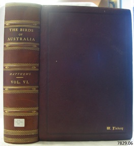 Flagstaff Hill Maritime Museum and Village
Book - Reference, The Birds of Australia Vol 6
The Birds of Australia is a 12 volume work, in a total of 14 books. The books were used as an ornithological handbook. They contain scientific text as well as over 600 hand-coloured lithographed plates by J.G. Keulemans, H. Grönvold, Roland Green, H. Goodchild and G.E. Lodge. The work was written, sponsored and organised by Gregory M. Matthews, F.R.S.C. Erc. who was a wealthy Australian and an amateur ornithologist. His titles included – -Fellow of the Linnean and Zoological Societies of London -Member of the British Ornithologists’ Union -Corresponding Fellow of the American Ornithologists’ Union The volumes in our collection were originally donated to the Warrnambool Mechanics’ Institute and Free Library by William Lindsay. THE LINDSAYS (quoted from the book Of Many Things – A History of Warrnambool Shire by C.E. Sayers) The Lindsays were amongst the most prominent families in the Shire of Warrnambool, as pastoralists, sportsmen, municipal councillors, community leaders. The first of the family William arrived in Melbourne in 1841 and started business as a livestock agent. The gold rushes sent him to the central Victoria diggings dealing in cattle. This was a business that boomed in the early 1850s, and he prospered. In 1859 he took over the Quamby run near Woolsthrope from Paul de Castella, the Yarra Valley Swiss vigneron who had brought the leasehold and improvements in 1853 from George Youl, who had pioneered the run. Quamby was originally 25,000 acres. It was heavily timbered, rough country, much of it swampy, a characteristic of the district. Lindsay used it to fatten cattle which gave large returns with the booming gold diggings towns paying high prices for beef. In 1862 purchases at auction made Quamby a freehold. In the next six years a further 20,000 acres of Crown land were brought at auction to make the run one of the largest in the south-west district. The great profits from his cattle trading enabled Lindsay to make improvements to the holding, and to Union which was added in 1864. Much of the thick timber was cleared and the worst of the swamps drained. Union was 15,000 acres of freehold when Kennedy sold it to Lindsay. It was heavily timbered, mostly blackwood, with large belts of wattle and honeysuckle. Much of the heavy native was ringbarked and cleared; much more was swept away by bushfire. It was expensive work, but Lindsay’s bank passbook was heavy with credit, and he did not spare money to make both Quamby and Union heavily developed stock runs. He was as lavish in social living; the bluestone Quamby homestead was one of the most hospitable in the district when William Lindsay was host there; its paddocks carried high quality thoroughbreds: its stables housed steeplechasers and flat racers which won many races on Warrnambool and other courses; its coach houses were filled with carriages which took his guests to the great racing carnivals of the district. After William Lindsay died in 1897, in his eighty-fifth year, his two sons, William and James, managed Union and Quamby as a joint venture. This partnership ended in 1906 when William took over Union and James kept Quamby. The following year 10,000 acres of Union were subdivided and sold in lots of 100 acres to 700 acres for dairying and general farming. It was well improved country, much of it alluvial flats. By then many of the paddocks were sheltered with blue gum belts, and they carried good pastures. The three Lindsays, father and two sons, gave many years of service to the Shire, and to many charitable, sporting, social and community organisations in the Warrnambool district. William Lindsay senior, was a Shire councillor for 15 years, and President several times. James Lindsay followed his father as a north riding councillor. He served nineteen years, from 1887 until his death in March 1908. He was President four times. Jimmy Lindsay was one of the most popular men in the south-west of Victoria. He was a fine sportsman: horse breeder, owner and a dashing amateur rider. He lived lavishly and played hard. For many years he guarded a herd of kangaroos, as many as 100 head, at Quamby. Descendants of the Lindsay kangaroos are still in the district. James Lindsay’s wife, Margaret Esther was a daughter of Samuel Shaw Parker, the first engineer of the Shire. Nell Lindsay, a daughter, lives in the Bluestone Quamby homestead. Only a little more than 60 acres of the original run still belongs to the property. William Lindsay junior succeeded his brother as a Shire councillor. He served for 25 years from 1908 until his death in 1934. So, the Lindsays, father and two sons, served as Shite councillors for an unbroken period of sixth-five years. William Lindsay junior had a life-long interest in horse racing, as breeder, owner and enthusiastic amateur steeplechase rider. He was elected a member of the Warrnambool racing club in 1901 and was president of the club for thirty-two years. He raced and rode horses for the love of the sport. He won the Villiers and Heytesbury Hunt Cup in the 1870s on his own horse, Ventura. In the year he died his horse Flavedo won the Warrnambool Grand Annual steeplechase. It was a sensational race. All of the contestants fell, or lost their riders. When Flavedo baulked at a jump, its jockey R. Sweetman, remounted and completed the course to win the race. All of the Lindsays were passionately fond of the thoroughbred horse. Nell Lindsay talking to the author in the drawing room of Quamby homestead - with many memories for her of its lavish years – said of a brother that he was put on a horse when he was two years old and never got off. William Lindsay junior made Union into a fine, high-producing property, breeding cattle and horses. He added to the bluestone house that David Kennedy started, established plantations of pines and gums, and made an attractive garden. WARRNAMBOOL MECHANICS’ INSTITUTE Warrnambool's Mechanics' Institute (or Institution as it was sometimes called) was one of the earliest in Victoria. On 17th October 1853 a meeting was held where it was resolved to request the Lieutenant Governor of the Colony to grant land for the erection of a Mechanics' Institutes building. A committee was formed at the meeting and Richard Osburne chaired the first meeting of this committee. The land on the North West corner of Banyan and Merri Streets was granted but there were no funds to erect the building. The Formal Rights of the Warrnambool Mechanics' Institute's encompassed its aims and these were officially adopted in1859; "This Institution has for its object the diffusion of literary, scientific, and other useful knowledge amongst its members, excluding all controversial subjects, religious or political. These objects are sought to be obtained by means of a circulating library, a reading room, the establishment of classes, debates, and the occasional delivery of lectures on natural and experimental philosophy, mechanics, astronomy, chemistry, natural history, literature, and the useful and ornamental arts, particularly those which have a more immediate reference to the colony." The Warrnambool Mechanics' Institute opened its first meeting room in November1854 in the National School building at the corner of Banyan and Timor Streets. The Institute was funded by member subscription, payable on a quarterly, half yearly or yearly basis. Samuel Hannaford, the Manager of the Warrnambool Bank of Australasia, was the first Honorary Secretary of the Mechanics' Institutes, and an early President and Vice-President. He also gave several of the early lectures in the Reading Room. Another early Secretary, Librarian and lecturer was Marmaduke Fisher, the teacher at the National School. Lecture topics included The Poets and Poetry of Ireland', 'The Birth and Development of the Earth', 'The Vertebrae - with Remarks on the pleasures resulting from the study of Natural History' and 'Architecture'. In 1856 the Reading Room was moved to James Hider's shop in Timor Street, and by 1864 it was located in the bookshop of Davies and Read. In the 1860's the Mechanics' Institute struggled as membership waned but in 1866, after a series of fund raising efforts, the committee was able to purchase land in Liebig Street, on a site then called Market Square, between the weighbridge and the fire station. A Mechanics' Institute building was opened at this site in August 1871. The following year four more rooms were added to the main Reading Room and in 1873 the Artisan School of Design was incorporated into the Institute. The same year Joseph Archibald established a Museum; however it deteriorated when he was transferred to Bendigo in 1877. In 1880, with Archibald's return to Warrnambool, the Museum was re-established, and in 1885 a new building was built at the back of the Institute to accommodate the re-created School of Design, the Art Gallery and the Museum. In 1887 the Museum section was moved to the former court house in Timor Street (for some time the walls of the building formed part of the TAFE cafeteria but all is now demolished)). In 1911 the Museum was transferred back to the original building and the management of the Mechanics' Institute was handed over to the Warrnambool City Council. The Museum and Art Gallery became one and housed many fine works of art, and the Library continued to grow. The building was well patronised, with records showing that at the beginning of the 20th century there were between 500 and 800 visitors. During World War One the monthly figures were in the thousands, with 3,400 people visiting in January 1915. The Museum was a much loved Institution in Warrnambool until the contents of the Museum and Art Gallery were removed to make room for the Warrnambool City Council Engineers' Department. The contents were stored but many of the items were scattered or lost. When the original building was demolished the site became occupied by the Civic Centre, which included the new City Library. (The library was temporarily located in the old Palais building in Koroit Street.) In the process of reorganisation the Collection was distributed amongst the community groups: -The new City Library took some of the historic books and some important documents, historic photographs and newspapers. -The Art Gallery kept the 19th Century art collection and some of the artefacts from the museum. -The Historic Society has some items -The State Museum has some items -Some items were destroyed -Flagstaff Hill Maritime Village has old newspapers, Government Gazettes, most of the Mechanics' Institute Library, ledgers and documents connected to the Mechanics' Institute Library, some framed and unframed art works and some photographs. The Warrnambool Mechanics' Institute Library book collection is deemed to be of great importance because it is one of the few collections in an almost intact state, and many of the books are now very rare and of great value. THE PATTISON COLLECTION This book is also part of the ‘Pattison Collection’, a collection of books and records that was originally owned by the Warrnambool Mechanics’ Institute, which was founded in Warrnambool in 1853. In 1935 Ralph Pattison was appointed as City Librarian to establish and organise the Warrnambool Library, as the Warrnambool Mechanics’ Institute was then called. When the Warrnambool Mechanics’ Institute building was pulled down in 1963 a new civic building was erected on the site and the new Warrnambool Library, on behalf of the City Council, took over all the holdings of the Warrnambool Mechanics’ Institute. At this time some of the items were separated and identified as the ‘Pattison Collection’, named after Ralph Pattison. Eventually the components of the Warrnambool Mechanics’ Institute were distributed from the Warrnambool Library to various places, including the Art Gallery, Historical Society and Flagstaff Hill. Later some were even distributed to other regional branches of Corangamite Regional Library and passed to and fro. It is difficult now to trace just where all of the items have ended up. The books at Flagstaff Hill Maritime Village generally display stamps and markings from Pattison as well as a variety of other institutions including the Mechanics’ Institute itself. RALPH ERIC PATTISON Ralph Eric Pattison was born in Rockhampton, Queensland, in 1891. He married Maude Swan from Warrnambool in 1920 and they set up home in Warrnambool. In 1935 Pattison accepted a position as City Librarian for the Warrnambool City Council. His huge challenge was to make a functional library within two rooms of the Mechanics’ Institute. He tirelessly cleaned, cleared and sorted a disarrayed collection of old books, jars of preserved specimens and other items reserved for exhibition in the city’s museum. He developed and updated the library with a wide variety of books for all tastes, including reference books for students; a difficult task to fulfil during the years following the Depression. He converted all of the lower area of the building into a library, reference room and reading room for members and the public. The books were sorted and stored using a cataloguing and card index system that he had developed himself. He also prepared the upper floor of the building and established the Art Gallery and later the Museum, a place to exhibit the many old relics that had been stored for years for this purpose. One of the treasures he found was a beautiful ancient clock, which he repaired, restored and enjoyed using in his office during the years of his service there. Ralph Pattison was described as “a meticulous gentleman whose punctuality, floorless courtesy and distinctive neat dress were hallmarks of his character, and ‘his’ clock controlled his daily routine, and his opening and closing of the library’s large heavy doors to the minute.” Pattison took leave during 1942 to 1945 to serve in the Royal Australian Navy, Volunteer Reserve as Lieutenant. A few years later he converted one of the Museum’s rooms into a Children’s Library, stocking it with suitable books for the younger generation. This was an instant success. In the 1950’s he had the honour of being appointed to the Victorian Library Board and received more inspiration from the monthly conferences in Melbourne. He was sadly retired in 1959 after over 23 years of service, due to the fact that he had gone over the working age of council officers. However he continued to take a very keen interest in the continual development of the Library until his death in 1969. The Birds of Australia by Gregory M. Matthews is now considered a rare and valuable scientific and historic work on its own. These 12 volumes were donated in 1934 to The Warrnambool Mechanics’ Institute and were included as part of the Pattison Collection. The Warrnambool Mechanics’ Institute Collection is primarily significant in its totality, rather than for the individual objects it contains. Its contents are highly representative of the development of Mechanics' Institute libraries across Australia, particularly Victoria. A diversity of publications and themes has been amassed, and these provide clues to our understanding of the nature of and changes in the reading habits of Victorians from the 1850s to the middle of the 20th century. The collection also highlights the Warrnambool community’s commitment to the Mechanics’ Institute, reading, literacy and learning in the regions, and proves that access to knowledge was not impeded by distance. These items help to provide a more complete picture of our community’s ideals and aspirations. The Warrnambool Mechanics Institute book collection has historical and social significance for its strong association with the Mechanics Institute movement and the important role it played in the intellectual, cultural and social development of people throughout the latter part of the nineteenth century and the early twentieth century. The collection of books is a rare example of an early lending library and its significance is enhanced by the survival of an original collection of many volumes. The Warrnambool Mechanics' Institute’s publication collection is of both local and state significance. The Birds of Australia Vol 6 Author: Gregory M Mathews Publisher: Witherby & Co 326 HIGH HOLBORN LONDON Date: 1916-1917 Tan leather bound illustrated work.Label on spine cover with typed text RA 598.2994 MAT Pastedown front endpaper has sticker from Warrnambool Mechanics Institute and Free Library that reads “Presented by W. Lindsay Esq. ‘Union’ Woolsthrope” Accession Number: 15237 Date Received: 3-34 “W. Lindsay” embossed in gold on front cover, bottom right of book flagstaff hill, warrnambool, shipwrecked coast, flagstaff hill maritime museum, maritime museum, shipwreck coast, flagstaff hill maritime village, great ocean road, the birds of australia, gregory m. matthews, witherby & co., h.f. & g. witherby, w lindsay, william lindsay, quamby woolsthorpe, union woolsthorpe, pattison collection, warrnambool library, warrnambool art gallery, joseph archibald, warrnambool mechanics’ institute and free library, ralph eric pattison, warrnambool city librarian, mechanics’ institute library, victorian library board, warrnambool books and records, warrnambool children’s library, the birds of australia vol 6, quamby station, union station, woolsthorpe -
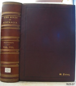 Flagstaff Hill Maritime Museum and Village
Book - Reference, The Birds of Australia Vol 7
The Birds of Australia is a 12 volume work, in a total of 14 books. The books were used as an ornithological handbook. They contain scientific text as well as over 600 hand-coloured lithographed plates by J.G. Keulemans, H. Grönvold, Roland Green, H. Goodchild and G.E. Lodge. The work was written, sponsored and organised by Gregory M. Matthews, F.R.S.C. Erc. who was a wealthy Australian and an amateur ornithologist. His titles included – -Fellow of the Linnean and Zoological Societies of London -Member of the British Ornithologists’ Union -Corresponding Fellow of the American Ornithologists’ Union The volumes in our collection were originally donated to the Warrnambool Mechanics’ Institute and Free Library by William Lindsay. THE LINDSAYS (quoted from the book Of Many Things – A History of Warrnambool Shire by C.E. Sayers) The Lindsays were amongst the most prominent families in the Shire of Warrnambool, as pastoralists, sportsmen, municipal councillors, community leaders. The first of the family William arrived in Melbourne in 1841 and started business as a livestock agent. The gold rushes sent him to the central Victoria diggings dealing in cattle. This was a business that boomed in the early 1850s, and he prospered. In 1859 he took over the Quamby run near Woolsthrope from Paul de Castella, the Yarra Valley Swiss vigneron who had brought the leasehold and improvements in 1853 from George Youl, who had pioneered the run. Quamby was originally 25,000 acres. It was heavily timbered, rough country, much of it swampy, a characteristic of the district. Lindsay used it to fatten cattle which gave large returns with the booming gold diggings towns paying high prices for beef. In 1862 purchases at auction made Quamby a freehold. In the next six years a further 20,000 acres of Crown land were brought at auction to make the run one of the largest in the south-west district. The great profits from his cattle trading enabled Lindsay to make improvements to the holding, and to Union which was added in 1864. Much of the thick timber was cleared and the worst of the swamps drained. Union was 15,000 acres of freehold when Kennedy sold it to Lindsay. It was heavily timbered, mostly blackwood, with large belts of wattle and honeysuckle. Much of the heavy native was ringbarked and cleared; much more was swept away by bushfire. It was expensive work, but Lindsay’s bank passbook was heavy with credit, and he did not spare money to make both Quamby and Union heavily developed stock runs. He was as lavish in social living; the bluestone Quamby homestead was one of the most hospitable in the district when William Lindsay was host there; its paddocks carried high quality thoroughbreds: its stables housed steeplechasers and flat racers which won many races on Warrnambool and other courses; its coach houses were filled with carriages which took his guests to the great racing carnivals of the district. After William Lindsay died in 1897, in his eighty-fifth year, his two sons, William and James, managed Union and Quamby as a joint venture. This partnership ended in 1906 when William took over Union and James kept Quamby. The following year 10,000 acres of Union were subdivided and sold in lots of 100 acres to 700 acres for dairying and general farming. It was well improved country, much of it alluvial flats. By then many of the paddocks were sheltered with blue gum belts, and they carried good pastures. The three Lindsays, father and two sons, gave many years of service to the Shire, and to many charitable, sporting, social and community organisations in the Warrnambool district. William Lindsay senior, was a Shire councillor for 15 years, and President several times. James Lindsay followed his father as a north riding councillor. He served nineteen years, from 1887 until his death in March 1908. He was President four times. Jimmy Lindsay was one of the most popular men in the south-west of Victoria. He was a fine sportsman: horse breeder, owner and a dashing amateur rider. He lived lavishly and played hard. For many years he guarded a herd of kangaroos, as many as 100 head, at Quamby. Descendants of the Lindsay kangaroos are still in the district. James Lindsay’s wife, Margaret Esther was a daughter of Samuel Shaw Parker, the first engineer of the Shire. Nell Lindsay, a daughter, lives in the Bluestone Quamby homestead. Only a little more than 60 acres of the original run still belongs to the property. William Lindsay junior succeeded his brother as a Shire councillor. He served for 25 years from 1908 until his death in 1934. So, the Lindsays, father and two sons, served as Shite councillors for an unbroken period of sixth-five years. William Lindsay junior had a life-long interest in horse racing, as breeder, owner and enthusiastic amateur steeplechase rider. He was elected a member of the Warrnambool racing club in 1901 and was president of the club for thirty-two years. He raced and rode horses for the love of the sport. He won the Villiers and Heytesbury Hunt Cup in the 1870s on his own horse, Ventura. In the year he died his horse Flavedo won the Warrnambool Grand Annual steeplechase. It was a sensational race. All of the contestants fell, or lost their riders. When Flavedo baulked at a jump, its jockey R. Sweetman, remounted and completed the course to win the race. All of the Lindsays were passionately fond of the thoroughbred horse. Nell Lindsay talking to the author in the drawing room of Quamby homestead - with many memories for her of its lavish years – said of a brother that he was put on a horse when he was two years old and never got off. William Lindsay junior made Union into a fine, high-producing property, breeding cattle and horses. He added to the bluestone house that David Kennedy started, established plantations of pines and gums, and made an attractive garden. WARRNAMBOOL MECHANICS’ INSTITUTE Warrnambool's Mechanics' Institute (or Institution as it was sometimes called) was one of the earliest in Victoria. On 17th October 1853 a meeting was held where it was resolved to request the Lieutenant Governor of the Colony to grant land for the erection of a Mechanics' Institutes building. A committee was formed at the meeting and Richard Osburne chaired the first meeting of this committee. The land on the North West corner of Banyan and Merri Streets was granted but there were no funds to erect the building. The Formal Rights of the Warrnambool Mechanics' Institute's encompassed its aims and these were officially adopted in1859; "This Institution has for its object the diffusion of literary, scientific, and other useful knowledge amongst its members, excluding all controversial subjects, religious or political. These objects are sought to be obtained by means of a circulating library, a reading room, the establishment of classes, debates, and the occasional delivery of lectures on natural and experimental philosophy, mechanics, astronomy, chemistry, natural history, literature, and the useful and ornamental arts, particularly those which have a more immediate reference to the colony." The Warrnambool Mechanics' Institute opened its first meeting room in November1854 in the National School building at the corner of Banyan and Timor Streets. The Institute was funded by member subscription, payable on a quarterly, half yearly or yearly basis. Samuel Hannaford, the Manager of the Warrnambool Bank of Australasia, was the first Honorary Secretary of the Mechanics' Institutes, and an early President and Vice-President. He also gave several of the early lectures in the Reading Room. Another early Secretary, Librarian and lecturer was Marmaduke Fisher, the teacher at the National School. Lecture topics included The Poets and Poetry of Ireland', 'The Birth and Development of the Earth', 'The Vertebrae - with Remarks on the pleasures resulting from the study of Natural History' and 'Architecture'. In 1856 the Reading Room was moved to James Hider's shop in Timor Street, and by 1864 it was located in the bookshop of Davies and Read. In the 1860's the Mechanics' Institute struggled as membership waned but in 1866, after a series of fund raising efforts, the committee was able to purchase land in Liebig Street, on a site then called Market Square, between the weighbridge and the fire station. A Mechanics' Institute building was opened at this site in August 1871. The following year four more rooms were added to the main Reading Room and in 1873 the Artisan School of Design was incorporated into the Institute. The same year Joseph Archibald established a Museum; however it deteriorated when he was transferred to Bendigo in 1877. In 1880, with Archibald's return to Warrnambool, the Museum was re-established, and in 1885 a new building was built at the back of the Institute to accommodate the re-created School of Design, the Art Gallery and the Museum. In 1887 the Museum section was moved to the former court house in Timor Street (for some time the walls of the building formed part of the TAFE cafeteria but all is now demolished)). In 1911 the Museum was transferred back to the original building and the management of the Mechanics' Institute was handed over to the Warrnambool City Council. The Museum and Art Gallery became one and housed many fine works of art, and the Library continued to grow. The building was well patronised, with records showing that at the beginning of the 20th century there were between 500 and 800 visitors. During World War One the monthly figures were in the thousands, with 3,400 people visiting in January 1915. The Museum was a much loved Institution in Warrnambool until the contents of the Museum and Art Gallery were removed to make room for the Warrnambool City Council Engineers' Department. The contents were stored but many of the items were scattered or lost. When the original building was demolished the site became occupied by the Civic Centre, which included the new City Library. (The library was temporarily located in the old Palais building in Koroit Street.) In the process of reorganisation the Collection was distributed amongst the community groups: -The new City Library took some of the historic books and some important documents, historic photographs and newspapers. -The Art Gallery kept the 19th Century art collection and some of the artefacts from the museum. -The Historic Society has some items -The State Museum has some items -Some items were destroyed -Flagstaff Hill Maritime Village has old newspapers, Government Gazettes, most of the Mechanics' Institute Library, ledgers and documents connected to the Mechanics' Institute Library, some framed and unframed art works and some photographs. The Warrnambool Mechanics' Institute Library book collection is deemed to be of great importance because it is one of the few collections in an almost intact state, and many of the books are now very rare and of great value. THE PATTISON COLLECTION This book is also part of the ‘Pattison Collection’, a collection of books and records that was originally owned by the Warrnambool Mechanics’ Institute, which was founded in Warrnambool in 1853. In 1935 Ralph Pattison was appointed as City Librarian to establish and organise the Warrnambool Library, as the Warrnambool Mechanics’ Institute was then called. When the Warrnambool Mechanics’ Institute building was pulled down in 1963 a new civic building was erected on the site and the new Warrnambool Library, on behalf of the City Council, took over all the holdings of the Warrnambool Mechanics’ Institute. At this time some of the items were separated and identified as the ‘Pattison Collection’, named after Ralph Pattison. Eventually the components of the Warrnambool Mechanics’ Institute were distributed from the Warrnambool Library to various places, including the Art Gallery, Historical Society and Flagstaff Hill. Later some were even distributed to other regional branches of Corangamite Regional Library and passed to and fro. It is difficult now to trace just where all of the items have ended up. The books at Flagstaff Hill Maritime Village generally display stamps and markings from Pattison as well as a variety of other institutions including the Mechanics’ Institute itself. RALPH ERIC PATTISON Ralph Eric Pattison was born in Rockhampton, Queensland, in 1891. He married Maude Swan from Warrnambool in 1920 and they set up home in Warrnambool. In 1935 Pattison accepted a position as City Librarian for the Warrnambool City Council. His huge challenge was to make a functional library within two rooms of the Mechanics’ Institute. He tirelessly cleaned, cleared and sorted a disarrayed collection of old books, jars of preserved specimens and other items reserved for exhibition in the city’s museum. He developed and updated the library with a wide variety of books for all tastes, including reference books for students; a difficult task to fulfil during the years following the Depression. He converted all of the lower area of the building into a library, reference room and reading room for members and the public. The books were sorted and stored using a cataloguing and card index system that he had developed himself. He also prepared the upper floor of the building and established the Art Gallery and later the Museum, a place to exhibit the many old relics that had been stored for years for this purpose. One of the treasures he found was a beautiful ancient clock, which he repaired, restored and enjoyed using in his office during the years of his service there. Ralph Pattison was described as “a meticulous gentleman whose punctuality, floorless courtesy and distinctive neat dress were hallmarks of his character, and ‘his’ clock controlled his daily routine, and his opening and closing of the library’s large heavy doors to the minute.” Pattison took leave during 1942 to 1945 to serve in the Royal Australian Navy, Volunteer Reserve as Lieutenant. A few years later he converted one of the Museum’s rooms into a Children’s Library, stocking it with suitable books for the younger generation. This was an instant success. In the 1950’s he had the honour of being appointed to the Victorian Library Board and received more inspiration from the monthly conferences in Melbourne. He was sadly retired in 1959 after over 23 years of service, due to the fact that he had gone over the working age of council officers. However he continued to take a very keen interest in the continual development of the Library until his death in 1969. The Birds of Australia by Gregory M. Matthews is now considered a rare and valuable scientific and historic work on its own. These 12 volumes were donated in 1934 to The Warrnambool Mechanics’ Institute and were included as part of the Pattison Collection. The Warrnambool Mechanics’ Institute Collection is primarily significant in its totality, rather than for the individual objects it contains. Its contents are highly representative of the development of Mechanics' Institute libraries across Australia, particularly Victoria. A diversity of publications and themes has been amassed, and these provide clues to our understanding of the nature of and changes in the reading habits of Victorians from the 1850s to the middle of the 20th century. The collection also highlights the Warrnambool community’s commitment to the Mechanics’ Institute, reading, literacy and learning in the regions, and proves that access to knowledge was not impeded by distance. These items help to provide a more complete picture of our community’s ideals and aspirations. The Warrnambool Mechanics Institute book collection has historical and social significance for its strong association with the Mechanics Institute movement and the important role it played in the intellectual, cultural and social development of people throughout the latter part of the nineteenth century and the early twentieth century. The collection of books is a rare example of an early lending library and its significance is enhanced by the survival of an original collection of many volumes. The Warrnambool Mechanics' Institute’s publication collection is of both local and state significance. The Birds of Australia Vol 7 Author: Gregory M Mathews Publisher: Witherby & Co Date: 1918-1919 Tan leather bound illustrated work.Label on spine cover with typed text RA 598.2994 MAT Pastedown front endpaper has sticker from Warrnambool Mechanics Institute and Free Library that reads “Presented by W. Lindsay Esq. ‘Union’ Woolsthrope” Accession Number: 15238 Date Received: 3-34 “W. Lindsay” embossed in gold on front cover, bottom right of book flagstaff hill, warrnambool, shipwrecked coast, flagstaff hill maritime museum, maritime museum, shipwreck coast, flagstaff hill maritime village, great ocean road, the birds of australia, gregory m. matthews, witherby & co., h.f. & g. witherby, w lindsay, william lindsay, quamby woolsthorpe, union woolsthorpe, pattison collection, warrnambool library, warrnambool art gallery, joseph archibald, warrnambool mechanics’ institute and free library, ralph eric pattison, warrnambool city librarian, mechanics’ institute library, victorian library board, warrnambool books and records, warrnambool children’s library, the birds of australia vol 7, quamby station, union station, woolsthrope -
 Flagstaff Hill Maritime Museum and Village
Book - Reference, The Birds of Australia Vol 8 Part 1 Supplmemt 1
The Birds of Australia is a 12 volume work, in a total of 14 books. The books were used as an ornithological handbook. They contain scientific text as well as over 600 hand-coloured lithographed plates by J.G. Keulemans, H. Grönvold, Roland Green, H. Goodchild and G.E. Lodge. The work was written, sponsored and organised by Gregory M. Matthews, F.R.S.C. Erc. who was a wealthy Australian and an amateur ornithologist. His titles included – -Fellow of the Linnean and Zoological Societies of London -Member of the British Ornithologists’ Union -Corresponding Fellow of the American Ornithologists’ Union The volumes in our collection were originally donated to the Warrnambool Mechanics’ Institute and Free Library by William Lindsay. THE LINDSAYS (quoted from the book Of Many Things – A History of Warrnambool Shire by C.E. Sayers) The Lindsays were amongst the most prominent families in the Shire of Warrnambool, as pastoralists, sportsmen, municipal councillors, community leaders. The first of the family William arrived in Melbourne in 1841 and started business as a livestock agent. The gold rushes sent him to the central Victoria diggings dealing in cattle. This was a business that boomed in the early 1850s, and he prospered. In 1859 he took over the Quamby run near Woolsthrope from Paul de Castella, the Yarra Valley Swiss vigneron who had brought the leasehold and improvements in 1853 from George Youl, who had pioneered the run. Quamby was originally 25,000 acres. It was heavily timbered, rough country, much of it swampy, a characteristic of the district. Lindsay used it to fatten cattle which gave large returns with the booming gold diggings towns paying high prices for beef. In 1862 purchases at auction made Quamby a freehold. In the next six years a further 20,000 acres of Crown land were brought at auction to make the run one of the largest in the south-west district. The great profits from his cattle trading enabled Lindsay to make improvements to the holding, and to Union which was added in 1864. Much of the thick timber was cleared and the worst of the swamps drained. Union was 15,000 acres of freehold when Kennedy sold it to Lindsay. It was heavily timbered, mostly blackwood, with large belts of wattle and honeysuckle. Much of the heavy native was ringbarked and cleared; much more was swept away by bushfire. It was expensive work, but Lindsay’s bank passbook was heavy with credit, and he did not spare money to make both Quamby and Union heavily developed stock runs. He was as lavish in social living; the bluestone Quamby homestead was one of the most hospitable in the district when William Lindsay was host there; its paddocks carried high quality thoroughbreds: its stables housed steeplechasers and flat racers which won many races on Warrnambool and other courses; its coach houses were filled with carriages which took his guests to the great racing carnivals of the district. After William Lindsay died in 1897, in his eighty-fifth year, his two sons, William and James, managed Union and Quamby as a joint venture. This partnership ended in 1906 when William took over Union and James kept Quamby. The following year 10,000 acres of Union were subdivided and sold in lots of 100 acres to 700 acres for dairying and general farming. It was well improved country, much of it alluvial flats. By then many of the paddocks were sheltered with blue gum belts, and they carried good pastures. The three Lindsays, father and two sons, gave many years of service to the Shire, and to many charitable, sporting, social and community organisations in the Warrnambool district. William Lindsay senior, was a Shire councillor for 15 years, and President several times. James Lindsay followed his father as a north riding councillor. He served nineteen years, from 1887 until his death in March 1908. He was President four times. Jimmy Lindsay was one of the most popular men in the south-west of Victoria. He was a fine sportsman: horse breeder, owner and a dashing amateur rider. He lived lavishly and played hard. For many years he guarded a herd of kangaroos, as many as 100 head, at Quamby. Descendants of the Lindsay kangaroos are still in the district. James Lindsay’s wife, Margaret Esther was a daughter of Samuel Shaw Parker, the first engineer of the Shire. Nell Lindsay, a daughter, lives in the Bluestone Quamby homestead. Only a little more than 60 acres of the original run still belongs to the property. William Lindsay junior succeeded his brother as a Shire councillor. He served for 25 years from 1908 until his death in 1934. So, the Lindsays, father and two sons, served as Shite councillors for an unbroken period of sixth-five years. William Lindsay junior had a life-long interest in horse racing, as breeder, owner and enthusiastic amateur steeplechase rider. He was elected a member of the Warrnambool racing club in 1901 and was president of the club for thirty-two years. He raced and rode horses for the love of the sport. He won the Villiers and Heytesbury Hunt Cup in the 1870s on his own horse, Ventura. In the year he died his horse Flavedo won the Warrnambool Grand Annual steeplechase. It was a sensational race. All of the contestants fell, or lost their riders. When Flavedo baulked at a jump, its jockey R. Sweetman, remounted and completed the course to win the race. All of the Lindsays were passionately fond of the thoroughbred horse. Nell Lindsay talking to the author in the drawing room of Quamby homestead - with many memories for her of its lavish years – said of a brother that he was put on a horse when he was two years old and never got off. William Lindsay junior made Union into a fine, high-producing property, breeding cattle and horses. He added to the bluestone house that David Kennedy started, established plantations of pines and gums, and made an attractive garden. WARRNAMBOOL MECHANICS’ INSTITUTE Warrnambool's Mechanics' Institute (or Institution as it was sometimes called) was one of the earliest in Victoria. On 17th October 1853 a meeting was held where it was resolved to request the Lieutenant Governor of the Colony to grant land for the erection of a Mechanics' Institutes building. A committee was formed at the meeting and Richard Osburne chaired the first meeting of this committee. The land on the North West corner of Banyan and Merri Streets was granted but there were no funds to erect the building. The Formal Rights of the Warrnambool Mechanics' Institute's encompassed its aims and these were officially adopted in1859; "This Institution has for its object the diffusion of literary, scientific, and other useful knowledge amongst its members, excluding all controversial subjects, religious or political. These objects are sought to be obtained by means of a circulating library, a reading room, the establishment of classes, debates, and the occasional delivery of lectures on natural and experimental philosophy, mechanics, astronomy, chemistry, natural history, literature, and the useful and ornamental arts, particularly those which have a more immediate reference to the colony." The Warrnambool Mechanics' Institute opened its first meeting room in November1854 in the National School building at the corner of Banyan and Timor Streets. The Institute was funded by member subscription, payable on a quarterly, half yearly or yearly basis. Samuel Hannaford, the Manager of the Warrnambool Bank of Australasia, was the first Honorary Secretary of the Mechanics' Institutes, and an early President and Vice-President. He also gave several of the early lectures in the Reading Room. Another early Secretary, Librarian and lecturer was Marmaduke Fisher, the teacher at the National School. Lecture topics included The Poets and Poetry of Ireland', 'The Birth and Development of the Earth', 'The Vertebrae - with Remarks on the pleasures resulting from the study of Natural History' and 'Architecture'. In 1856 the Reading Room was moved to James Hider's shop in Timor Street, and by 1864 it was located in the bookshop of Davies and Read. In the 1860's the Mechanics' Institute struggled as membership waned but in 1866, after a series of fund raising efforts, the committee was able to purchase land in Liebig Street, on a site then called Market Square, between the weighbridge and the fire station. A Mechanics' Institute building was opened at this site in August 1871. The following year four more rooms were added to the main Reading Room and in 1873 the Artisan School of Design was incorporated into the Institute. The same year Joseph Archibald established a Museum; however it deteriorated when he was transferred to Bendigo in 1877. In 1880, with Archibald's return to Warrnambool, the Museum was re-established, and in 1885 a new building was built at the back of the Institute to accommodate the re-created School of Design, the Art Gallery and the Museum. In 1887 the Museum section was moved to the former court house in Timor Street (for some time the walls of the building formed part of the TAFE cafeteria but all is now demolished)). In 1911 the Museum was transferred back to the original building and the management of the Mechanics' Institute was handed over to the Warrnambool City Council. The Museum and Art Gallery became one and housed many fine works of art, and the Library continued to grow. The building was well patronised, with records showing that at the beginning of the 20th century there were between 500 and 800 visitors. During World War One the monthly figures were in the thousands, with 3,400 people visiting in January 1915. The Museum was a much loved Institution in Warrnambool until the contents of the Museum and Art Gallery were removed to make room for the Warrnambool City Council Engineers' Department. The contents were stored but many of the items were scattered or lost. When the original building was demolished the site became occupied by the Civic Centre, which included the new City Library. (The library was temporarily located in the old Palais building in Koroit Street.) In the process of reorganisation the Collection was distributed amongst the community groups: -The new City Library took some of the historic books and some important documents, historic photographs and newspapers. -The Art Gallery kept the 19th Century art collection and some of the artefacts from the museum. -The Historic Society has some items -The State Museum has some items -Some items were destroyed -Flagstaff Hill Maritime Village has old newspapers, Government Gazettes, most of the Mechanics' Institute Library, ledgers and documents connected to the Mechanics' Institute Library, some framed and unframed art works and some photographs. The Warrnambool Mechanics' Institute Library book collection is deemed to be of great importance because it is one of the few collections in an almost intact state, and many of the books are now very rare and of great value. THE PATTISON COLLECTION This book is also part of the ‘Pattison Collection’, a collection of books and records that was originally owned by the Warrnambool Mechanics’ Institute, which was founded in Warrnambool in 1853. In 1935 Ralph Pattison was appointed as City Librarian to establish and organise the Warrnambool Library, as the Warrnambool Mechanics’ Institute was then called. When the Warrnambool Mechanics’ Institute building was pulled down in 1963 a new civic building was erected on the site and the new Warrnambool Library, on behalf of the City Council, took over all the holdings of the Warrnambool Mechanics’ Institute. At this time some of the items were separated and identified as the ‘Pattison Collection’, named after Ralph Pattison. Eventually the components of the Warrnambool Mechanics’ Institute were distributed from the Warrnambool Library to various places, including the Art Gallery, Historical Society and Flagstaff Hill. Later some were even distributed to other regional branches of Corangamite Regional Library and passed to and fro. It is difficult now to trace just where all of the items have ended up. The books at Flagstaff Hill Maritime Village generally display stamps and markings from Pattison as well as a variety of other institutions including the Mechanics’ Institute itself. RALPH ERIC PATTISON Ralph Eric Pattison was born in Rockhampton, Queensland, in 1891. He married Maude Swan from Warrnambool in 1920 and they set up home in Warrnambool. In 1935 Pattison accepted a position as City Librarian for the Warrnambool City Council. His huge challenge was to make a functional library within two rooms of the Mechanics’ Institute. He tirelessly cleaned, cleared and sorted a disarrayed collection of old books, jars of preserved specimens and other items reserved for exhibition in the city’s museum. He developed and updated the library with a wide variety of books for all tastes, including reference books for students; a difficult task to fulfil during the years following the Depression. He converted all of the lower area of the building into a library, reference room and reading room for members and the public. The books were sorted and stored using a cataloguing and card index system that he had developed himself. He also prepared the upper floor of the building and established the Art Gallery and later the Museum, a place to exhibit the many old relics that had been stored for years for this purpose. One of the treasures he found was a beautiful ancient clock, which he repaired, restored and enjoyed using in his office during the years of his service there. Ralph Pattison was described as “a meticulous gentleman whose punctuality, floorless courtesy and distinctive neat dress were hallmarks of his character, and ‘his’ clock controlled his daily routine, and his opening and closing of the library’s large heavy doors to the minute.” Pattison took leave during 1942 to 1945 to serve in the Royal Australian Navy, Volunteer Reserve as Lieutenant. A few years later he converted one of the Museum’s rooms into a Children’s Library, stocking it with suitable books for the younger generation. This was an instant success. In the 1950’s he had the honour of being appointed to the Victorian Library Board and received more inspiration from the monthly conferences in Melbourne. He was sadly retired in 1959 after over 23 years of service, due to the fact that he had gone over the working age of council officers. However he continued to take a very keen interest in the continual development of the Library until his death in 1969. The Birds of Australia by Gregory M. Matthews is now considered a rare and valuable scientific and historic work on its own. These 12 volumes were donated in 1934 to The Warrnambool Mechanics’ Institute and were included as part of the Pattison Collection. The Warrnambool Mechanics’ Institute Collection is primarily significant in its totality, rather than for the individual objects it contains. Its contents are highly representative of the development of Mechanics' Institute libraries across Australia, particularly Victoria. A diversity of publications and themes has been amassed, and these provide clues to our understanding of the nature of and changes in the reading habits of Victorians from the 1850s to the middle of the 20th century. The collection also highlights the Warrnambool community’s commitment to the Mechanics’ Institute, reading, literacy and learning in the regions, and proves that access to knowledge was not impeded by distance. These items help to provide a more complete picture of our community’s ideals and aspirations. The Warrnambool Mechanics Institute book collection has historical and social significance for its strong association with the Mechanics Institute movement and the important role it played in the intellectual, cultural and social development of people throughout the latter part of the nineteenth century and the early twentieth century. The collection of books is a rare example of an early lending library and its significance is enhanced by the survival of an original collection of many volumes. The Warrnambool Mechanics' Institute’s publication collection is of both local and state significance. The Birds of Australia Vol 8 Part 1 Supplmemt 1 Author: Gregory M Mathews Publisher: Witherby & Co Date: 1920 Tan leather bound illustrated work.Label on spine cover with typed text RA 598.2994 MAT Pastedown front endpaper has sticker from Warrnambool Mechanics Institute and Free Library that reads “Presented by W. Lindsay Esq. ‘Union’ Woolsthrope” Accession Number: 15239 Date Received: 3-34 “W. Lindsay” embossed in gold on front cover, bottom right of book flagstaff hill, warrnambool, shipwrecked coast, flagstaff hill maritime museum, maritime museum, shipwreck coast, flagstaff hill maritime village, great ocean road, the birds of australia, gregory m. matthews, witherby & co., h.f. & g. witherby, w lindsay, william lindsay, quamby woolsthorpe, union woolsthorpe, pattison collection, warrnambool library, warrnambool art gallery, joseph archibald, warrnambool mechanics’ institute and free library, ralph eric pattison, warrnambool city librarian, mechanics’ institute library, victorian library board, warrnambool books and records, warrnambool children’s library, the birds of australia vol 8 part 1 supplmemt 1, quamby station, union station, woolsthrope -
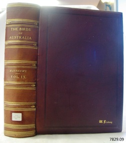 Flagstaff Hill Maritime Museum and Village
Book - Reference, The Birds of Australia Vol 9
The Birds of Australia is a 12 volume work, in a total of 14 books. The books were used as an ornithological handbook. They contain scientific text as well as over 600 hand-coloured lithographed plates by J.G. Keulemans, H. Grönvold, Roland Green, H. Goodchild and G.E. Lodge. The work was written, sponsored and organised by Gregory M. Matthews, F.R.S.C. Erc. who was a wealthy Australian and an amateur ornithologist. His titles included – -Fellow of the Linnean and Zoological Societies of London -Member of the British Ornithologists’ Union -Corresponding Fellow of the American Ornithologists’ Union The volumes in our collection were originally donated to the Warrnambool Mechanics’ Institute and Free Library by William Lindsay. THE LINDSAYS (quoted from the book Of Many Things – A History of Warrnambool Shire by C.E. Sayers) The Lindsays were amongst the most prominent families in the Shire of Warrnambool, as pastoralists, sportsmen, municipal councillors, community leaders. The first of the family William arrived in Melbourne in 1841 and started business as a livestock agent. The gold rushes sent him to the central Victoria diggings dealing in cattle. This was a business that boomed in the early 1850s, and he prospered. In 1859 he took over the Quamby run near Woolsthrope from Paul de Castella, the Yarra Valley Swiss vigneron who had brought the leasehold and improvements in 1853 from George Youl, who had pioneered the run. Quamby was originally 25,000 acres. It was heavily timbered, rough country, much of it swampy, a characteristic of the district. Lindsay used it to fatten cattle which gave large returns with the booming gold diggings towns paying high prices for beef. In 1862 purchases at auction made Quamby a freehold. In the next six years a further 20,000 acres of Crown land were brought at auction to make the run one of the largest in the south-west district. The great profits from his cattle trading enabled Lindsay to make improvements to the holding, and to Union which was added in 1864. Much of the thick timber was cleared and the worst of the swamps drained. Union was 15,000 acres of freehold when Kennedy sold it to Lindsay. It was heavily timbered, mostly blackwood, with large belts of wattle and honeysuckle. Much of the heavy native was ringbarked and cleared; much more was swept away by bushfire. It was expensive work, but Lindsay’s bank passbook was heavy with credit, and he did not spare money to make both Quamby and Union heavily developed stock runs. He was as lavish in social living; the bluestone Quamby homestead was one of the most hospitable in the district when William Lindsay was host there; its paddocks carried high quality thoroughbreds: its stables housed steeplechasers and flat racers which won many races on Warrnambool and other courses; its coach houses were filled with carriages which took his guests to the great racing carnivals of the district. After William Lindsay died in 1897, in his eighty-fifth year, his two sons, William and James, managed Union and Quamby as a joint venture. This partnership ended in 1906 when William took over Union and James kept Quamby. The following year 10,000 acres of Union were subdivided and sold in lots of 100 acres to 700 acres for dairying and general farming. It was well improved country, much of it alluvial flats. By then many of the paddocks were sheltered with blue gum belts, and they carried good pastures. The three Lindsays, father and two sons, gave many years of service to the Shire, and to many charitable, sporting, social and community organisations in the Warrnambool district. William Lindsay senior, was a Shire councillor for 15 years, and President several times. James Lindsay followed his father as a north riding councillor. He served nineteen years, from 1887 until his death in March 1908. He was President four times. Jimmy Lindsay was one of the most popular men in the south-west of Victoria. He was a fine sportsman: horse breeder, owner and a dashing amateur rider. He lived lavishly and played hard. For many years he guarded a herd of kangaroos, as many as 100 head, at Quamby. Descendants of the Lindsay kangaroos are still in the district. James Lindsay’s wife, Margaret Esther was a daughter of Samuel Shaw Parker, the first engineer of the Shire. Nell Lindsay, a daughter, lives in the Bluestone Quamby homestead. Only a little more than 60 acres of the original run still belongs to the property. William Lindsay junior succeeded his brother as a Shire councillor. He served for 25 years from 1908 until his death in 1934. So, the Lindsays, father and two sons, served as Shite councillors for an unbroken period of sixth-five years. William Lindsay junior had a life-long interest in horse racing, as breeder, owner and enthusiastic amateur steeplechase rider. He was elected a member of the Warrnambool racing club in 1901 and was president of the club for thirty-two years. He raced and rode horses for the love of the sport. He won the Villiers and Heytesbury Hunt Cup in the 1870s on his own horse, Ventura. In the year he died his horse Flavedo won the Warrnambool Grand Annual steeplechase. It was a sensational race. All of the contestants fell, or lost their riders. When Flavedo baulked at a jump, its jockey R. Sweetman, remounted and completed the course to win the race. All of the Lindsays were passionately fond of the thoroughbred horse. Nell Lindsay talking to the author in the drawing room of Quamby homestead - with many memories for her of its lavish years – said of a brother that he was put on a horse when he was two years old and never got off. William Lindsay junior made Union into a fine, high-producing property, breeding cattle and horses. He added to the bluestone house that David Kennedy started, established plantations of pines and gums, and made an attractive garden. WARRNAMBOOL MECHANICS’ INSTITUTE Warrnambool's Mechanics' Institute (or Institution as it was sometimes called) was one of the earliest in Victoria. On 17th October 1853 a meeting was held where it was resolved to request the Lieutenant Governor of the Colony to grant land for the erection of a Mechanics' Institutes building. A committee was formed at the meeting and Richard Osburne chaired the first meeting of this committee. The land on the North West corner of Banyan and Merri Streets was granted but there were no funds to erect the building. The Formal Rights of the Warrnambool Mechanics' Institute's encompassed its aims and these were officially adopted in1859; "This Institution has for its object the diffusion of literary, scientific, and other useful knowledge amongst its members, excluding all controversial subjects, religious or political. These objects are sought to be obtained by means of a circulating library, a reading room, the establishment of classes, debates, and the occasional delivery of lectures on natural and experimental philosophy, mechanics, astronomy, chemistry, natural history, literature, and the useful and ornamental arts, particularly those which have a more immediate reference to the colony." The Warrnambool Mechanics' Institute opened its first meeting room in November1854 in the National School building at the corner of Banyan and Timor Streets. The Institute was funded by member subscription, payable on a quarterly, half yearly or yearly basis. Samuel Hannaford, the Manager of the Warrnambool Bank of Australasia, was the first Honorary Secretary of the Mechanics' Institutes, and an early President and Vice-President. He also gave several of the early lectures in the Reading Room. Another early Secretary, Librarian and lecturer was Marmaduke Fisher, the teacher at the National School. Lecture topics included The Poets and Poetry of Ireland', 'The Birth and Development of the Earth', 'The Vertebrae - with Remarks on the pleasures resulting from the study of Natural History' and 'Architecture'. In 1856 the Reading Room was moved to James Hider's shop in Timor Street, and by 1864 it was located in the bookshop of Davies and Read. In the 1860's the Mechanics' Institute struggled as membership waned but in 1866, after a series of fund raising efforts, the committee was able to purchase land in Liebig Street, on a site then called Market Square, between the weighbridge and the fire station. A Mechanics' Institute building was opened at this site in August 1871. The following year four more rooms were added to the main Reading Room and in 1873 the Artisan School of Design was incorporated into the Institute. The same year Joseph Archibald established a Museum; however it deteriorated when he was transferred to Bendigo in 1877. In 1880, with Archibald's return to Warrnambool, the Museum was re-established, and in 1885 a new building was built at the back of the Institute to accommodate the re-created School of Design, the Art Gallery and the Museum. In 1887 the Museum section was moved to the former court house in Timor Street (for some time the walls of the building formed part of the TAFE cafeteria but all is now demolished)). In 1911 the Museum was transferred back to the original building and the management of the Mechanics' Institute was handed over to the Warrnambool City Council. The Museum and Art Gallery became one and housed many fine works of art, and the Library continued to grow. The building was well patronised, with records showing that at the beginning of the 20th century there were between 500 and 800 visitors. During World War One the monthly figures were in the thousands, with 3,400 people visiting in January 1915. The Museum was a much loved Institution in Warrnambool until the contents of the Museum and Art Gallery were removed to make room for the Warrnambool City Council Engineers' Department. The contents were stored but many of the items were scattered or lost. When the original building was demolished the site became occupied by the Civic Centre, which included the new City Library. (The library was temporarily located in the old Palais building in Koroit Street.) In the process of reorganisation the Collection was distributed amongst the community groups: -The new City Library took some of the historic books and some important documents, historic photographs and newspapers. -The Art Gallery kept the 19th Century art collection and some of the artefacts from the museum. -The Historic Society has some items -The State Museum has some items -Some items were destroyed -Flagstaff Hill Maritime Village has old newspapers, Government Gazettes, most of the Mechanics' Institute Library, ledgers and documents connected to the Mechanics' Institute Library, some framed and unframed art works and some photographs. The Warrnambool Mechanics' Institute Library book collection is deemed to be of great importance because it is one of the few collections in an almost intact state, and many of the books are now very rare and of great value. THE PATTISON COLLECTION This book is also part of the ‘Pattison Collection’, a collection of books and records that was originally owned by the Warrnambool Mechanics’ Institute, which was founded in Warrnambool in 1853. In 1935 Ralph Pattison was appointed as City Librarian to establish and organise the Warrnambool Library, as the Warrnambool Mechanics’ Institute was then called. When the Warrnambool Mechanics’ Institute building was pulled down in 1963 a new civic building was erected on the site and the new Warrnambool Library, on behalf of the City Council, took over all the holdings of the Warrnambool Mechanics’ Institute. At this time some of the items were separated and identified as the ‘Pattison Collection’, named after Ralph Pattison. Eventually the components of the Warrnambool Mechanics’ Institute were distributed from the Warrnambool Library to various places, including the Art Gallery, Historical Society and Flagstaff Hill. Later some were even distributed to other regional branches of Corangamite Regional Library and passed to and fro. It is difficult now to trace just where all of the items have ended up. The books at Flagstaff Hill Maritime Village generally display stamps and markings from Pattison as well as a variety of other institutions including the Mechanics’ Institute itself. RALPH ERIC PATTISON Ralph Eric Pattison was born in Rockhampton, Queensland, in 1891. He married Maude Swan from Warrnambool in 1920 and they set up home in Warrnambool. In 1935 Pattison accepted a position as City Librarian for the Warrnambool City Council. His huge challenge was to make a functional library within two rooms of the Mechanics’ Institute. He tirelessly cleaned, cleared and sorted a disarrayed collection of old books, jars of preserved specimens and other items reserved for exhibition in the city’s museum. He developed and updated the library with a wide variety of books for all tastes, including reference books for students; a difficult task to fulfil during the years following the Depression. He converted all of the lower area of the building into a library, reference room and reading room for members and the public. The books were sorted and stored using a cataloguing and card index system that he had developed himself. He also prepared the upper floor of the building and established the Art Gallery and later the Museum, a place to exhibit the many old relics that had been stored for years for this purpose. One of the treasures he found was a beautiful ancient clock, which he repaired, restored and enjoyed using in his office during the years of his service there. Ralph Pattison was described as “a meticulous gentleman whose punctuality, floorless courtesy and distinctive neat dress were hallmarks of his character, and ‘his’ clock controlled his daily routine, and his opening and closing of the library’s large heavy doors to the minute.” Pattison took leave during 1942 to 1945 to serve in the Royal Australian Navy, Volunteer Reserve as Lieutenant. A few years later he converted one of the Museum’s rooms into a Children’s Library, stocking it with suitable books for the younger generation. This was an instant success. In the 1950’s he had the honour of being appointed to the Victorian Library Board and received more inspiration from the monthly conferences in Melbourne. He was sadly retired in 1959 after over 23 years of service, due to the fact that he had gone over the working age of council officers. However he continued to take a very keen interest in the continual development of the Library until his death in 1969. The Birds of Australia by Gregory M. Matthews is now considered a rare and valuable scientific and historic work on its own. These 12 volumes were donated in 1934 to The Warrnambool Mechanics’ Institute and were included as part of the Pattison Collection. The Warrnambool Mechanics’ Institute Collection is primarily significant in its totality, rather than for the individual objects it contains. Its contents are highly representative of the development of Mechanics' Institute libraries across Australia, particularly Victoria. A diversity of publications and themes has been amassed, and these provide clues to our understanding of the nature of and changes in the reading habits of Victorians from the 1850s to the middle of the 20th century. The collection also highlights the Warrnambool community’s commitment to the Mechanics’ Institute, reading, literacy and learning in the regions, and proves that access to knowledge was not impeded by distance. These items help to provide a more complete picture of our community’s ideals and aspirations. The Warrnambool Mechanics Institute book collection has historical and social significance for its strong association with the Mechanics Institute movement and the important role it played in the intellectual, cultural and social development of people throughout the latter part of the nineteenth century and the early twentieth century. The collection of books is a rare example of an early lending library and its significance is enhanced by the survival of an original collection of many volumes. The Warrnambool Mechanics' Institute’s publication collection is of both local and state significance. The Birds of Australia Vol 9 Author: Gregory M Mathews Publisher: H F & G Witherby Date: 1921-1922 Tan leather bound illustrated work.Label on spine cover with typed text RA 598.2994 MAT Pastedown front endpaper has sticker from Warrnambool Mechanics Institute and Free Library that reads “Presented by W. Lindsay Esq. ‘Union’ Woolsthrope” Accession Number: 15240 Date Received: 3-34 “W. Lindsay” embossed in gold on front cover, bottom right of book flagstaff hill, warrnambool, shipwrecked coast, flagstaff hill maritime museum, maritime museum, shipwreck coast, flagstaff hill maritime village, great ocean road, the birds of australia, gregory m. matthews, witherby & co., h.f. & g. witherby, w lindsay, william lindsay, quamby woolsthorpe, union woolsthorpe, pattison collection, warrnambool library, warrnambool art gallery, joseph archibald, warrnambool mechanics’ institute and free library, ralph eric pattison, warrnambool city librarian, mechanics’ institute library, victorian library board, warrnambool books and records, warrnambool children’s library, the birds of australia vol 9, quamby station, union station, woolsthrope -
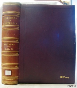 Flagstaff Hill Maritime Museum and Village
Book - Reference, The Birds of Australia Vol 10
The Birds of Australia is a 12 volume work, in a total of 14 books. The books were used as an ornithological handbook. They contain scientific text as well as over 600 hand-coloured lithographed plates by J.G. Keulemans, H. Grönvold, Roland Green, H. Goodchild and G.E. Lodge. The work was written, sponsored and organised by Gregory M. Matthews, F.R.S.C. Erc. who was a wealthy Australian and an amateur ornithologist. His titles included – -Fellow of the Linnean and Zoological Societies of London -Member of the British Ornithologists’ Union -Corresponding Fellow of the American Ornithologists’ Union The volumes in our collection were originally donated to the Warrnambool Mechanics’ Institute and Free Library by William Lindsay. THE LINDSAYS (quoted from the book Of Many Things – A History of Warrnambool Shire by C.E. Sayers) The Lindsays were amongst the most prominent families in the Shire of Warrnambool, as pastoralists, sportsmen, municipal councillors, community leaders. The first of the family William arrived in Melbourne in 1841 and started business as a livestock agent. The gold rushes sent him to the central Victoria diggings dealing in cattle. This was a business that boomed in the early 1850s, and he prospered. In 1859 he took over the Quamby run near Woolsthrope from Paul de Castella, the Yarra Valley Swiss vigneron who had brought the leasehold and improvements in 1853 from George Youl, who had pioneered the run. Quamby was originally 25,000 acres. It was heavily timbered, rough country, much of it swampy, a characteristic of the district. Lindsay used it to fatten cattle which gave large returns with the booming gold diggings towns paying high prices for beef. In 1862 purchases at auction made Quamby a freehold. In the next six years a further 20,000 acres of Crown land were brought at auction to make the run one of the largest in the south-west district. The great profits from his cattle trading enabled Lindsay to make improvements to the holding, and to Union which was added in 1864. Much of the thick timber was cleared and the worst of the swamps drained. Union was 15,000 acres of freehold when Kennedy sold it to Lindsay. It was heavily timbered, mostly blackwood, with large belts of wattle and honeysuckle. Much of the heavy native was ringbarked and cleared; much more was swept away by bushfire. It was expensive work, but Lindsay’s bank passbook was heavy with credit, and he did not spare money to make both Quamby and Union heavily developed stock runs. He was as lavish in social living; the bluestone Quamby homestead was one of the most hospitable in the district when William Lindsay was host there; its paddocks carried high quality thoroughbreds: its stables housed steeplechasers and flat racers which won many races on Warrnambool and other courses; its coach houses were filled with carriages which took his guests to the great racing carnivals of the district. After William Lindsay died in 1897, in his eighty-fifth year, his two sons, William and James, managed Union and Quamby as a joint venture. This partnership ended in 1906 when William took over Union and James kept Quamby. The following year 10,000 acres of Union were subdivided and sold in lots of 100 acres to 700 acres for dairying and general farming. It was well improved country, much of it alluvial flats. By then many of the paddocks were sheltered with blue gum belts, and they carried good pastures. The three Lindsays, father and two sons, gave many years of service to the Shire, and to many charitable, sporting, social and community organisations in the Warrnambool district. William Lindsay senior, was a Shire councillor for 15 years, and President several times. James Lindsay followed his father as a north riding councillor. He served nineteen years, from 1887 until his death in March 1908. He was President four times. Jimmy Lindsay was one of the most popular men in the south-west of Victoria. He was a fine sportsman: horse breeder, owner and a dashing amateur rider. He lived lavishly and played hard. For many years he guarded a herd of kangaroos, as many as 100 head, at Quamby. Descendants of the Lindsay kangaroos are still in the district. James Lindsay’s wife, Margaret Esther was a daughter of Samuel Shaw Parker, the first engineer of the Shire. Nell Lindsay, a daughter, lives in the Bluestone Quamby homestead. Only a little more than 60 acres of the original run still belongs to the property. William Lindsay junior succeeded his brother as a Shire councillor. He served for 25 years from 1908 until his death in 1934. So, the Lindsays, father and two sons, served as Shite councillors for an unbroken period of sixth-five years. William Lindsay junior had a life-long interest in horse racing, as breeder, owner and enthusiastic amateur steeplechase rider. He was elected a member of the Warrnambool racing club in 1901 and was president of the club for thirty-two years. He raced and rode horses for the love of the sport. He won the Villiers and Heytesbury Hunt Cup in the 1870s on his own horse, Ventura. In the year he died his horse Flavedo won the Warrnambool Grand Annual steeplechase. It was a sensational race. All of the contestants fell, or lost their riders. When Flavedo baulked at a jump, its jockey R. Sweetman, remounted and completed the course to win the race. All of the Lindsays were passionately fond of the thoroughbred horse. Nell Lindsay talking to the author in the drawing room of Quamby homestead - with many memories for her of its lavish years – said of a brother that he was put on a horse when he was two years old and never got off. William Lindsay junior made Union into a fine, high-producing property, breeding cattle and horses. He added to the bluestone house that David Kennedy started, established plantations of pines and gums, and made an attractive garden. WARRNAMBOOL MECHANICS’ INSTITUTE Warrnambool's Mechanics' Institute (or Institution as it was sometimes called) was one of the earliest in Victoria. On 17th October 1853 a meeting was held where it was resolved to request the Lieutenant Governor of the Colony to grant land for the erection of a Mechanics' Institutes building. A committee was formed at the meeting and Richard Osburne chaired the first meeting of this committee. The land on the North West corner of Banyan and Merri Streets was granted but there were no funds to erect the building. The Formal Rights of the Warrnambool Mechanics' Institute's encompassed its aims and these were officially adopted in1859; "This Institution has for its object the diffusion of literary, scientific, and other useful knowledge amongst its members, excluding all controversial subjects, religious or political. These objects are sought to be obtained by means of a circulating library, a reading room, the establishment of classes, debates, and the occasional delivery of lectures on natural and experimental philosophy, mechanics, astronomy, chemistry, natural history, literature, and the useful and ornamental arts, particularly those which have a more immediate reference to the colony." The Warrnambool Mechanics' Institute opened its first meeting room in November1854 in the National School building at the corner of Banyan and Timor Streets. The Institute was funded by member subscription, payable on a quarterly, half yearly or yearly basis. Samuel Hannaford, the Manager of the Warrnambool Bank of Australasia, was the first Honorary Secretary of the Mechanics' Institutes, and an early President and Vice-President. He also gave several of the early lectures in the Reading Room. Another early Secretary, Librarian and lecturer was Marmaduke Fisher, the teacher at the National School. Lecture topics included The Poets and Poetry of Ireland', 'The Birth and Development of the Earth', 'The Vertebrae - with Remarks on the pleasures resulting from the study of Natural History' and 'Architecture'. In 1856 the Reading Room was moved to James Hider's shop in Timor Street, and by 1864 it was located in the bookshop of Davies and Read. In the 1860's the Mechanics' Institute struggled as membership waned but in 1866, after a series of fund raising efforts, the committee was able to purchase land in Liebig Street, on a site then called Market Square, between the weighbridge and the fire station. A Mechanics' Institute building was opened at this site in August 1871. The following year four more rooms were added to the main Reading Room and in 1873 the Artisan School of Design was incorporated into the Institute. The same year Joseph Archibald established a Museum; however it deteriorated when he was transferred to Bendigo in 1877. In 1880, with Archibald's return to Warrnambool, the Museum was re-established, and in 1885 a new building was built at the back of the Institute to accommodate the re-created School of Design, the Art Gallery and the Museum. In 1887 the Museum section was moved to the former court house in Timor Street (for some time the walls of the building formed part of the TAFE cafeteria but all is now demolished)). In 1911 the Museum was transferred back to the original building and the management of the Mechanics' Institute was handed over to the Warrnambool City Council. The Museum and Art Gallery became one and housed many fine works of art, and the Library continued to grow. The building was well patronised, with records showing that at the beginning of the 20th century there were between 500 and 800 visitors. During World War One the monthly figures were in the thousands, with 3,400 people visiting in January 1915. The Museum was a much loved Institution in Warrnambool until the contents of the Museum and Art Gallery were removed to make room for the Warrnambool City Council Engineers' Department. The contents were stored but many of the items were scattered or lost. When the original building was demolished the site became occupied by the Civic Centre, which included the new City Library. (The library was temporarily located in the old Palais building in Koroit Street.) In the process of reorganisation the Collection was distributed amongst the community groups: -The new City Library took some of the historic books and some important documents, historic photographs and newspapers. -The Art Gallery kept the 19th Century art collection and some of the artefacts from the museum. -The Historic Society has some items -The State Museum has some items -Some items were destroyed -Flagstaff Hill Maritime Village has old newspapers, Government Gazettes, most of the Mechanics' Institute Library, ledgers and documents connected to the Mechanics' Institute Library, some framed and unframed art works and some photographs. The Warrnambool Mechanics' Institute Library book collection is deemed to be of great importance because it is one of the few collections in an almost intact state, and many of the books are now very rare and of great value. THE PATTISON COLLECTION This book is also part of the ‘Pattison Collection’, a collection of books and records that was originally owned by the Warrnambool Mechanics’ Institute, which was founded in Warrnambool in 1853. In 1935 Ralph Pattison was appointed as City Librarian to establish and organise the Warrnambool Library, as the Warrnambool Mechanics’ Institute was then called. When the Warrnambool Mechanics’ Institute building was pulled down in 1963 a new civic building was erected on the site and the new Warrnambool Library, on behalf of the City Council, took over all the holdings of the Warrnambool Mechanics’ Institute. At this time some of the items were separated and identified as the ‘Pattison Collection’, named after Ralph Pattison. Eventually the components of the Warrnambool Mechanics’ Institute were distributed from the Warrnambool Library to various places, including the Art Gallery, Historical Society and Flagstaff Hill. Later some were even distributed to other regional branches of Corangamite Regional Library and passed to and fro. It is difficult now to trace just where all of the items have ended up. The books at Flagstaff Hill Maritime Village generally display stamps and markings from Pattison as well as a variety of other institutions including the Mechanics’ Institute itself. RALPH ERIC PATTISON Ralph Eric Pattison was born in Rockhampton, Queensland, in 1891. He married Maude Swan from Warrnambool in 1920 and they set up home in Warrnambool. In 1935 Pattison accepted a position as City Librarian for the Warrnambool City Council. His huge challenge was to make a functional library within two rooms of the Mechanics’ Institute. He tirelessly cleaned, cleared and sorted a disarrayed collection of old books, jars of preserved specimens and other items reserved for exhibition in the city’s museum. He developed and updated the library with a wide variety of books for all tastes, including reference books for students; a difficult task to fulfil during the years following the Depression. He converted all of the lower area of the building into a library, reference room and reading room for members and the public. The books were sorted and stored using a cataloguing and card index system that he had developed himself. He also prepared the upper floor of the building and established the Art Gallery and later the Museum, a place to exhibit the many old relics that had been stored for years for this purpose. One of the treasures he found was a beautiful ancient clock, which he repaired, restored and enjoyed using in his office during the years of his service there. Ralph Pattison was described as “a meticulous gentleman whose punctuality, floorless courtesy and distinctive neat dress were hallmarks of his character, and ‘his’ clock controlled his daily routine, and his opening and closing of the library’s large heavy doors to the minute.” Pattison took leave during 1942 to 1945 to serve in the Royal Australian Navy, Volunteer Reserve as Lieutenant. A few years later he converted one of the Museum’s rooms into a Children’s Library, stocking it with suitable books for the younger generation. This was an instant success. In the 1950’s he had the honour of being appointed to the Victorian Library Board and received more inspiration from the monthly conferences in Melbourne. He was sadly retired in 1959 after over 23 years of service, due to the fact that he had gone over the working age of council officers. However he continued to take a very keen interest in the continual development of the Library until his death in 1969. The Birds of Australia by Gregory M. Matthews is now considered a rare and valuable scientific and historic work on its own. These 12 volumes were donated in 1934 to The Warrnambool Mechanics’ Institute and were included as part of the Pattison Collection. The Warrnambool Mechanics’ Institute Collection is primarily significant in its totality, rather than for the individual objects it contains. Its contents are highly representative of the development of Mechanics' Institute libraries across Australia, particularly Victoria. A diversity of publications and themes has been amassed, and these provide clues to our understanding of the nature of and changes in the reading habits of Victorians from the 1850s to the middle of the 20th century. The collection also highlights the Warrnambool community’s commitment to the Mechanics’ Institute, reading, literacy and learning in the regions, and proves that access to knowledge was not impeded by distance. These items help to provide a more complete picture of our community’s ideals and aspirations. The Warrnambool Mechanics Institute book collection has historical and social significance for its strong association with the Mechanics Institute movement and the important role it played in the intellectual, cultural and social development of people throughout the latter part of the nineteenth century and the early twentieth century. The collection of books is a rare example of an early lending library and its significance is enhanced by the survival of an original collection of many volumes. The Warrnambool Mechanics' Institute’s publication collection is of both local and state significance. The Birds of Australia Vol 10 Author: Gregory M Mathews Publisher: H F & G Witherby 326 HIGH HOLBORN LONDON Date: 1922-1923 Tan leather bound illustrated work.Label on spine cover with typed text RA 598.2994 MAT Pastedown front endpaper has sticker from Warrnambool Mechanics Institute and Free Library that reads “Presented by W. Lindsay Esq. ‘Union’ Woolsthrope” Accession Number: 15241 Date Received: 3-34 “W. Lindsay” embossed in gold on front cover, bottom right of book flagstaff hill, warrnambool, shipwrecked coast, flagstaff hill maritime museum, maritime museum, shipwreck coast, flagstaff hill maritime village, great ocean road, the birds of australia, gregory m. matthews, witherby & co., h.f. & g. witherby, w lindsay, william lindsay, quamby woolsthorpe, union woolsthorpe, pattison collection, warrnambool library, warrnambool art gallery, joseph archibald, warrnambool mechanics’ institute and free library, ralph eric pattison, warrnambool city librarian, mechanics’ institute library, victorian library board, warrnambool books and records, warrnambool children’s library, the birds of australia vol 10, quamby station, union station, woolsthrope -
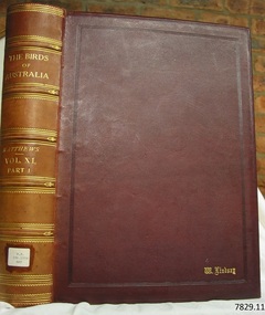 Flagstaff Hill Maritime Museum and Village
Book - Reference, The Birds of Australia Vol 11 Part 1 Supplment 2
The Birds of Australia is a 12 volume work, in a total of 14 books. The books were used as an ornithological handbook. They contain scientific text as well as over 600 hand-coloured lithographed plates by J.G. Keulemans, H. Grönvold, Roland Green, H. Goodchild and G.E. Lodge. The work was written, sponsored and organised by Gregory M. Matthews, F.R.S.C. Erc. who was a wealthy Australian and an amateur ornithologist. His titles included – -Fellow of the Linnean and Zoological Societies of London -Member of the British Ornithologists’ Union -Corresponding Fellow of the American Ornithologists’ Union The volumes in our collection were originally donated to the Warrnambool Mechanics’ Institute and Free Library by William Lindsay. THE LINDSAYS (quoted from the book Of Many Things – A History of Warrnambool Shire by C.E. Sayers) The Lindsays were amongst the most prominent families in the Shire of Warrnambool, as pastoralists, sportsmen, municipal councillors, community leaders. The first of the family William arrived in Melbourne in 1841 and started business as a livestock agent. The gold rushes sent him to the central Victoria diggings dealing in cattle. This was a business that boomed in the early 1850s, and he prospered. In 1859 he took over the Quamby run near Woolsthrope from Paul de Castella, the Yarra Valley Swiss vigneron who had brought the leasehold and improvements in 1853 from George Youl, who had pioneered the run. Quamby was originally 25,000 acres. It was heavily timbered, rough country, much of it swampy, a characteristic of the district. Lindsay used it to fatten cattle which gave large returns with the booming gold diggings towns paying high prices for beef. In 1862 purchases at auction made Quamby a freehold. In the next six years a further 20,000 acres of Crown land were brought at auction to make the run one of the largest in the south-west district. The great profits from his cattle trading enabled Lindsay to make improvements to the holding, and to Union which was added in 1864. Much of the thick timber was cleared and the worst of the swamps drained. Union was 15,000 acres of freehold when Kennedy sold it to Lindsay. It was heavily timbered, mostly blackwood, with large belts of wattle and honeysuckle. Much of the heavy native was ringbarked and cleared; much more was swept away by bushfire. It was expensive work, but Lindsay’s bank passbook was heavy with credit, and he did not spare money to make both Quamby and Union heavily developed stock runs. He was as lavish in social living; the bluestone Quamby homestead was one of the most hospitable in the district when William Lindsay was host there; its paddocks carried high quality thoroughbreds: its stables housed steeplechasers and flat racers which won many races on Warrnambool and other courses; its coach houses were filled with carriages which took his guests to the great racing carnivals of the district. After William Lindsay died in 1897, in his eighty-fifth year, his two sons, William and James, managed Union and Quamby as a joint venture. This partnership ended in 1906 when William took over Union and James kept Quamby. The following year 10,000 acres of Union were subdivided and sold in lots of 100 acres to 700 acres for dairying and general farming. It was well improved country, much of it alluvial flats. By then many of the paddocks were sheltered with blue gum belts, and they carried good pastures. The three Lindsays, father and two sons, gave many years of service to the Shire, and to many charitable, sporting, social and community organisations in the Warrnambool district. William Lindsay senior, was a Shire councillor for 15 years, and President several times. James Lindsay followed his father as a north riding councillor. He served nineteen years, from 1887 until his death in March 1908. He was President four times. Jimmy Lindsay was one of the most popular men in the south-west of Victoria. He was a fine sportsman: horse breeder, owner and a dashing amateur rider. He lived lavishly and played hard. For many years he guarded a herd of kangaroos, as many as 100 head, at Quamby. Descendants of the Lindsay kangaroos are still in the district. James Lindsay’s wife, Margaret Esther was a daughter of Samuel Shaw Parker, the first engineer of the Shire. Nell Lindsay, a daughter, lives in the Bluestone Quamby homestead. Only a little more than 60 acres of the original run still belongs to the property. William Lindsay junior succeeded his brother as a Shire councillor. He served for 25 years from 1908 until his death in 1934. So, the Lindsays, father and two sons, served as Shite councillors for an unbroken period of sixth-five years. William Lindsay junior had a life-long interest in horse racing, as breeder, owner and enthusiastic amateur steeplechase rider. He was elected a member of the Warrnambool racing club in 1901 and was president of the club for thirty-two years. He raced and rode horses for the love of the sport. He won the Villiers and Heytesbury Hunt Cup in the 1870s on his own horse, Ventura. In the year he died his horse Flavedo won the Warrnambool Grand Annual steeplechase. It was a sensational race. All of the contestants fell, or lost their riders. When Flavedo baulked at a jump, its jockey R. Sweetman, remounted and completed the course to win the race. All of the Lindsays were passionately fond of the thoroughbred horse. Nell Lindsay talking to the author in the drawing room of Quamby homestead - with many memories for her of its lavish years – said of a brother that he was put on a horse when he was two years old and never got off. William Lindsay junior made Union into a fine, high-producing property, breeding cattle and horses. He added to the bluestone house that David Kennedy started, established plantations of pines and gums, and made an attractive garden. WARRNAMBOOL MECHANICS’ INSTITUTE Warrnambool's Mechanics' Institute (or Institution as it was sometimes called) was one of the earliest in Victoria. On 17th October 1853 a meeting was held where it was resolved to request the Lieutenant Governor of the Colony to grant land for the erection of a Mechanics' Institutes building. A committee was formed at the meeting and Richard Osburne chaired the first meeting of this committee. The land on the North West corner of Banyan and Merri Streets was granted but there were no funds to erect the building. The Formal Rights of the Warrnambool Mechanics' Institute's encompassed its aims and these were officially adopted in1859; "This Institution has for its object the diffusion of literary, scientific, and other useful knowledge amongst its members, excluding all controversial subjects, religious or political. These objects are sought to be obtained by means of a circulating library, a reading room, the establishment of classes, debates, and the occasional delivery of lectures on natural and experimental philosophy, mechanics, astronomy, chemistry, natural history, literature, and the useful and ornamental arts, particularly those which have a more immediate reference to the colony." The Warrnambool Mechanics' Institute opened its first meeting room in November1854 in the National School building at the corner of Banyan and Timor Streets. The Institute was funded by member subscription, payable on a quarterly, half yearly or yearly basis. Samuel Hannaford, the Manager of the Warrnambool Bank of Australasia, was the first Honorary Secretary of the Mechanics' Institutes, and an early President and Vice-President. He also gave several of the early lectures in the Reading Room. Another early Secretary, Librarian and lecturer was Marmaduke Fisher, the teacher at the National School. Lecture topics included The Poets and Poetry of Ireland', 'The Birth and Development of the Earth', 'The Vertebrae - with Remarks on the pleasures resulting from the study of Natural History' and 'Architecture'. In 1856 the Reading Room was moved to James Hider's shop in Timor Street, and by 1864 it was located in the bookshop of Davies and Read. In the 1860's the Mechanics' Institute struggled as membership waned but in 1866, after a series of fund raising efforts, the committee was able to purchase land in Liebig Street, on a site then called Market Square, between the weighbridge and the fire station. A Mechanics' Institute building was opened at this site in August 1871. The following year four more rooms were added to the main Reading Room and in 1873 the Artisan School of Design was incorporated into the Institute. The same year Joseph Archibald established a Museum; however it deteriorated when he was transferred to Bendigo in 1877. In 1880, with Archibald's return to Warrnambool, the Museum was re-established, and in 1885 a new building was built at the back of the Institute to accommodate the re-created School of Design, the Art Gallery and the Museum. In 1887 the Museum section was moved to the former court house in Timor Street (for some time the walls of the building formed part of the TAFE cafeteria but all is now demolished)). In 1911 the Museum was transferred back to the original building and the management of the Mechanics' Institute was handed over to the Warrnambool City Council. The Museum and Art Gallery became one and housed many fine works of art, and the Library continued to grow. The building was well patronised, with records showing that at the beginning of the 20th century there were between 500 and 800 visitors. During World War One the monthly figures were in the thousands, with 3,400 people visiting in January 1915. The Museum was a much loved Institution in Warrnambool until the contents of the Museum and Art Gallery were removed to make room for the Warrnambool City Council Engineers' Department. The contents were stored but many of the items were scattered or lost. When the original building was demolished the site became occupied by the Civic Centre, which included the new City Library. (The library was temporarily located in the old Palais building in Koroit Street.) In the process of reorganisation the Collection was distributed amongst the community groups: -The new City Library took some of the historic books and some important documents, historic photographs and newspapers. -The Art Gallery kept the 19th Century art collection and some of the artefacts from the museum. -The Historic Society has some items -The State Museum has some items -Some items were destroyed -Flagstaff Hill Maritime Village has old newspapers, Government Gazettes, most of the Mechanics' Institute Library, ledgers and documents connected to the Mechanics' Institute Library, some framed and unframed art works and some photographs. The Warrnambool Mechanics' Institute Library book collection is deemed to be of great importance because it is one of the few collections in an almost intact state, and many of the books are now very rare and of great value. THE PATTISON COLLECTION This book is also part of the ‘Pattison Collection’, a collection of books and records that was originally owned by the Warrnambool Mechanics’ Institute, which was founded in Warrnambool in 1853. In 1935 Ralph Pattison was appointed as City Librarian to establish and organise the Warrnambool Library, as the Warrnambool Mechanics’ Institute was then called. When the Warrnambool Mechanics’ Institute building was pulled down in 1963 a new civic building was erected on the site and the new Warrnambool Library, on behalf of the City Council, took over all the holdings of the Warrnambool Mechanics’ Institute. At this time some of the items were separated and identified as the ‘Pattison Collection’, named after Ralph Pattison. Eventually the components of the Warrnambool Mechanics’ Institute were distributed from the Warrnambool Library to various places, including the Art Gallery, Historical Society and Flagstaff Hill. Later some were even distributed to other regional branches of Corangamite Regional Library and passed to and fro. It is difficult now to trace just where all of the items have ended up. The books at Flagstaff Hill Maritime Village generally display stamps and markings from Pattison as well as a variety of other institutions including the Mechanics’ Institute itself. RALPH ERIC PATTISON Ralph Eric Pattison was born in Rockhampton, Queensland, in 1891. He married Maude Swan from Warrnambool in 1920 and they set up home in Warrnambool. In 1935 Pattison accepted a position as City Librarian for the Warrnambool City Council. His huge challenge was to make a functional library within two rooms of the Mechanics’ Institute. He tirelessly cleaned, cleared and sorted a disarrayed collection of old books, jars of preserved specimens and other items reserved for exhibition in the city’s museum. He developed and updated the library with a wide variety of books for all tastes, including reference books for students; a difficult task to fulfil during the years following the Depression. He converted all of the lower area of the building into a library, reference room and reading room for members and the public. The books were sorted and stored using a cataloguing and card index system that he had developed himself. He also prepared the upper floor of the building and established the Art Gallery and later the Museum, a place to exhibit the many old relics that had been stored for years for this purpose. One of the treasures he found was a beautiful ancient clock, which he repaired, restored and enjoyed using in his office during the years of his service there. Ralph Pattison was described as “a meticulous gentleman whose punctuality, floorless courtesy and distinctive neat dress were hallmarks of his character, and ‘his’ clock controlled his daily routine, and his opening and closing of the library’s large heavy doors to the minute.” Pattison took leave during 1942 to 1945 to serve in the Royal Australian Navy, Volunteer Reserve as Lieutenant. A few years later he converted one of the Museum’s rooms into a Children’s Library, stocking it with suitable books for the younger generation. This was an instant success. In the 1950’s he had the honour of being appointed to the Victorian Library Board and received more inspiration from the monthly conferences in Melbourne. He was sadly retired in 1959 after over 23 years of service, due to the fact that he had gone over the working age of council officers. However he continued to take a very keen interest in the continual development of the Library until his death in 1969. The Birds of Australia by Gregory M. Matthews is now considered a rare and valuable scientific and historic work on its own. These 12 volumes were donated in 1934 to The Warrnambool Mechanics’ Institute and were included as part of the Pattison Collection. The Warrnambool Mechanics’ Institute Collection is primarily significant in its totality, rather than for the individual objects it contains. Its contents are highly representative of the development of Mechanics' Institute libraries across Australia, particularly Victoria. A diversity of publications and themes has been amassed, and these provide clues to our understanding of the nature of and changes in the reading habits of Victorians from the 1850s to the middle of the 20th century. The collection also highlights the Warrnambool community’s commitment to the Mechanics’ Institute, reading, literacy and learning in the regions, and proves that access to knowledge was not impeded by distance. These items help to provide a more complete picture of our community’s ideals and aspirations. The Warrnambool Mechanics Institute book collection has historical and social significance for its strong association with the Mechanics Institute movement and the important role it played in the intellectual, cultural and social development of people throughout the latter part of the nineteenth century and the early twentieth century. The collection of books is a rare example of an early lending library and its significance is enhanced by the survival of an original collection of many volumes. The Warrnambool Mechanics' Institute’s publication collection is of both local and state significance. The Birds of Australia Vol 11 Part 1 Supplment 2 Author: Gregory M Mathews Publisher: H F & G Witherby 326 HIGH HOLBORN LONDON Date: 1924 Tan leather bound illustrated work.Label on spine cover with typed text RA 598.2994 MAT Pastedown front endpaper has sticker from Warrnambool Mechanics Institute and Free Library that reads “Presented by W. Lindsay Esq. ‘Union’ Woolsthrope” Accession Number: 15242 Date Received: 3-34 “W. Lindsay” embossed in gold on front cover, bottom right of book flagstaff hill, warrnambool, shipwrecked coast, flagstaff hill maritime museum, maritime museum, shipwreck coast, flagstaff hill maritime village, great ocean road, the birds of australia, gregory m. matthews, witherby & co., h.f. & g. witherby, w lindsay, william lindsay, quamby woolsthorpe, union woolsthorpe, pattison collection, warrnambool library, warrnambool art gallery, joseph archibald, warrnambool mechanics’ institute and free library, ralph eric pattison, warrnambool city librarian, mechanics’ institute library, victorian library board, warrnambool books and records, warrnambool children’s library, the birds of australia vol 11 part 1 supplment 2, quamby station, union station, woolsthrope -
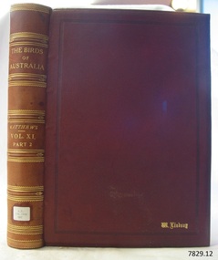 Flagstaff Hill Maritime Museum and Village
Book - Reference, The Birds of Australia Vol 11 Part 2 Supplment 3
The Birds of Australia is a 12 volume work, in a total of 14 books. The books were used as an ornithological handbook. They contain scientific text as well as over 600 hand-coloured lithographed plates by J.G. Keulemans, H. Grönvold, Roland Green, H. Goodchild and G.E. Lodge. The work was written, sponsored and organised by Gregory M. Matthews, F.R.S.C. Erc. who was a wealthy Australian and an amateur ornithologist. His titles included – -Fellow of the Linnean and Zoological Societies of London -Member of the British Ornithologists’ Union -Corresponding Fellow of the American Ornithologists’ Union The volumes in our collection were originally donated to the Warrnambool Mechanics’ Institute and Free Library by William Lindsay. THE LINDSAYS (quoted from the book Of Many Things – A History of Warrnambool Shire by C.E. Sayers) The Lindsays were amongst the most prominent families in the Shire of Warrnambool, as pastoralists, sportsmen, municipal councillors, community leaders. The first of the family William arrived in Melbourne in 1841 and started business as a livestock agent. The gold rushes sent him to the central Victoria diggings dealing in cattle. This was a business that boomed in the early 1850s, and he prospered. In 1859 he took over the Quamby run near Woolsthrope from Paul de Castella, the Yarra Valley Swiss vigneron who had brought the leasehold and improvements in 1853 from George Youl, who had pioneered the run. Quamby was originally 25,000 acres. It was heavily timbered, rough country, much of it swampy, a characteristic of the district. Lindsay used it to fatten cattle which gave large returns with the booming gold diggings towns paying high prices for beef. In 1862 purchases at auction made Quamby a freehold. In the next six years a further 20,000 acres of Crown land were brought at auction to make the run one of the largest in the south-west district. The great profits from his cattle trading enabled Lindsay to make improvements to the holding, and to Union which was added in 1864. Much of the thick timber was cleared and the worst of the swamps drained. Union was 15,000 acres of freehold when Kennedy sold it to Lindsay. It was heavily timbered, mostly blackwood, with large belts of wattle and honeysuckle. Much of the heavy native was ringbarked and cleared; much more was swept away by bushfire. It was expensive work, but Lindsay’s bank passbook was heavy with credit, and he did not spare money to make both Quamby and Union heavily developed stock runs. He was as lavish in social living; the bluestone Quamby homestead was one of the most hospitable in the district when William Lindsay was host there; its paddocks carried high quality thoroughbreds: its stables housed steeplechasers and flat racers which won many races on Warrnambool and other courses; its coach houses were filled with carriages which took his guests to the great racing carnivals of the district. After William Lindsay died in 1897, in his eighty-fifth year, his two sons, William and James, managed Union and Quamby as a joint venture. This partnership ended in 1906 when William took over Union and James kept Quamby. The following year 10,000 acres of Union were subdivided and sold in lots of 100 acres to 700 acres for dairying and general farming. It was well improved country, much of it alluvial flats. By then many of the paddocks were sheltered with blue gum belts, and they carried good pastures. The three Lindsays, father and two sons, gave many years of service to the Shire, and to many charitable, sporting, social and community organisations in the Warrnambool district. William Lindsay senior, was a Shire councillor for 15 years, and President several times. James Lindsay followed his father as a north riding councillor. He served nineteen years, from 1887 until his death in March 1908. He was President four times. Jimmy Lindsay was one of the most popular men in the south-west of Victoria. He was a fine sportsman: horse breeder, owner and a dashing amateur rider. He lived lavishly and played hard. For many years he guarded a herd of kangaroos, as many as 100 head, at Quamby. Descendants of the Lindsay kangaroos are still in the district. James Lindsay’s wife, Margaret Esther was a daughter of Samuel Shaw Parker, the first engineer of the Shire. Nell Lindsay, a daughter, lives in the Bluestone Quamby homestead. Only a little more than 60 acres of the original run still belongs to the property. William Lindsay junior succeeded his brother as a Shire councillor. He served for 25 years from 1908 until his death in 1934. So, the Lindsays, father and two sons, served as Shite councillors for an unbroken period of sixth-five years. William Lindsay junior had a life-long interest in horse racing, as breeder, owner and enthusiastic amateur steeplechase rider. He was elected a member of the Warrnambool racing club in 1901 and was president of the club for thirty-two years. He raced and rode horses for the love of the sport. He won the Villiers and Heytesbury Hunt Cup in the 1870s on his own horse, Ventura. In the year he died his horse Flavedo won the Warrnambool Grand Annual steeplechase. It was a sensational race. All of the contestants fell, or lost their riders. When Flavedo baulked at a jump, its jockey R. Sweetman, remounted and completed the course to win the race. All of the Lindsays were passionately fond of the thoroughbred horse. Nell Lindsay talking to the author in the drawing room of Quamby homestead - with many memories for her of its lavish years – said of a brother that he was put on a horse when he was two years old and never got off. William Lindsay junior made Union into a fine, high-producing property, breeding cattle and horses. He added to the bluestone house that David Kennedy started, established plantations of pines and gums, and made an attractive garden. WARRNAMBOOL MECHANICS’ INSTITUTE Warrnambool's Mechanics' Institute (or Institution as it was sometimes called) was one of the earliest in Victoria. On 17th October 1853 a meeting was held where it was resolved to request the Lieutenant Governor of the Colony to grant land for the erection of a Mechanics' Institutes building. A committee was formed at the meeting and Richard Osburne chaired the first meeting of this committee. The land on the North West corner of Banyan and Merri Streets was granted but there were no funds to erect the building. The Formal Rights of the Warrnambool Mechanics' Institute's encompassed its aims and these were officially adopted in1859 "This Institution has for its object the diffusion of literary, scientific, and other useful knowledge amongst its members, excluding all controversial subjects, religious or political. These objects are sought to be obtained by means of a circulating library, a reading room, the establishment of classes, debates, and the occasional delivery of lectures on natural and experimental philosophy, mechanics, astronomy, chemistry, natural history, literature, and the useful and ornamental arts, particularly those which have a more immediate reference to the colony." The Warrnambool Mechanics' Institute opened its first meeting room in November1854 in the National School building at the corner of Banyan and Timor Streets. The Institute was funded by member subscription, payable on a quarterly, half yearly or yearly basis. Samuel Hannaford, the Manager of the Warrnambool Bank of Australasia, was the first Honorary Secretary of the Mechanics' Institutes, and an early President and Vice-President. He also gave several of the early lectures in the Reading Room. Another early Secretary, Librarian and lecturer was Marmaduke Fisher, the teacher at the National School. Lecture topics included The Poets and Poetry of Ireland', 'The Birth and Development of the Earth', 'The Vertebrae - with Remarks on the pleasures resulting from the study of Natural History' and 'Architecture'. In 1856 the Reading Room was moved to James Hider's shop in Timor Street, and by 1864 it was located in the bookshop of Davies and Read. In the 1860's the Mechanics' Institute struggled as membership waned but in 1866, after a series of fund raising efforts, the committee was able to purchase land in Liebig Street, on a site then called Market Square, between the weighbridge and the fire station. A Mechanics' Institute building was opened at this site in August 1871. The following year four more rooms were added to the main Reading Room and in 1873 the Artisan School of Design was incorporated into the Institute. The same year Joseph Archibald established a Museum; however it deteriorated when he was transferred to Bendigo in 1877. In 1880, with Archibald's return to Warrnambool, the Museum was re-established, and in 1885 a new building was built at the back of the Institute to accommodate the re-created School of Design, the Art Gallery and the Museum. In 1887 the Museum section was moved to the former court house in Timor Street (for some time the walls of the building formed part of the TAFE cafeteria but all is now demolished)). In 1911 the Museum was transferred back to the original building and the management of the Mechanics' Institute was handed over to the Warrnambool City Council. The Museum and Art Gallery became one and housed many fine works of art, and the Library continued to grow. The building was well patronised, with records showing that at the beginning of the 20th century there were between 500 and 800 visitors. During World War One the monthly figures were in the thousands, with 3,400 people visiting in January 1915. The Museum was a much loved Institution in Warrnambool until the contents of the Museum and Art Gallery were removed to make room for the Warrnambool City Council Engineers' Department. The contents were stored but many of the items were scattered or lost. When the original building was demolished the site became occupied by the Civic Centre, which included the new City Library. (The library was temporarily located in the old Palais building in Koroit Street.) In the process of reorganisation the Collection was distributed amongst the community groups: -The new City Library took some of the historic books and some important documents, historic photographs and newspapers. -The Art Gallery kept the 19th Century art collection and some of the artefacts from the museum. -The Historic Society has some items -The State Museum has some items -Some items were destroyed -Flagstaff Hill Maritime Village has old newspapers, Government Gazettes, most of the Mechanics' Institute Library, ledgers and documents connected to the Mechanics' Institute Library, some framed and unframed art works and some photographs. The Warrnambool Mechanics' Institute Library book collection is deemed to be of great importance because it is one of the few collections in an almost intact state, and many of the books are now very rare and of great value. THE PATTISON COLLECTION This book is also part of the ‘Pattison Collection’, a collection of books and records that was originally owned by the Warrnambool Mechanics’ Institute, which was founded in Warrnambool in 1853. In 1935 Ralph Pattison was appointed as City Librarian to establish and organise the Warrnambool Library, as the Warrnambool Mechanics’ Institute was then called. When the Warrnambool Mechanics’ Institute building was pulled down in 1963 a new civic building was erected on the site and the new Warrnambool Library, on behalf of the City Council, took over all the holdings of the Warrnambool Mechanics’ Institute. At this time some of the items were separated and identified as the ‘Pattison Collection’, named after Ralph Pattison. Eventually the components of the Warrnambool Mechanics’ Institute were distributed from the Warrnambool Library to various places, including the Art Gallery, Historical Society and Flagstaff Hill. Later some were even distributed to other regional branches of Corangamite Regional Library and passed to and fro. It is difficult now to trace just where all of the items have ended up. The books at Flagstaff Hill Maritime Village generally display stamps and markings from Pattison as well as a variety of other institutions including the Mechanics’ Institute itself. RALPH ERIC PATTISON Ralph Eric Pattison was born in Rockhampton, Queensland, in 1891. He married Maude Swan from Warrnambool in 1920 and they set up home in Warrnambool. In 1935 Pattison accepted a position as City Librarian for the Warrnambool City Council. His huge challenge was to make a functional library within two rooms of the Mechanics’ Institute. He tirelessly cleaned, cleared and sorted a disarrayed collection of old books, jars of preserved specimens and other items reserved for exhibition in the city’s museum. He developed and updated the library with a wide variety of books for all tastes, including reference books for students; a difficult task to fulfil during the years following the Depression. He converted all of the lower area of the building into a library, reference room and reading room for members and the public. The books were sorted and stored using a cataloguing and card index system that he had developed himself. He also prepared the upper floor of the building and established the Art Gallery and later the Museum, a place to exhibit the many old relics that had been stored for years for this purpose. One of the treasures he found was a beautiful ancient clock, which he repaired, restored and enjoyed using in his office during the years of his service there. Ralph Pattison was described as “a meticulous gentleman whose punctuality, floorless courtesy and distinctive neat dress were hallmarks of his character, and ‘his’ clock controlled his daily routine, and his opening and closing of the library’s large heavy doors to the minute.” Pattison took leave during 1942 to 1945 to serve in the Royal Australian Navy, Volunteer Reserve as Lieutenant. A few years later he converted one of the Museum’s rooms into a Children’s Library, stocking it with suitable books for the younger generation. This was an instant success. In the 1950’s he had the honour of being appointed to the Victorian Library Board and received more inspiration from the monthly conferences in Melbourne. He was sadly retired in 1959 after over 23 years of service, due to the fact that he had gone over the working age of council officers. However he continued to take a very keen interest in the continual development of the Library until his death in 1969. The Birds of Australia by Gregory M. Matthews is now considered a rare and valuable scientific and historic work on its own. These 12 volumes were donated in 1934 to The Warrnambool Mechanics’ Institute and were included as part of the Pattison Collection. The Warrnambool Mechanics’ Institute Collection is primarily significant in its totality, rather than for the individual objects it contains. Its contents are highly representative of the development of Mechanics' Institute libraries across Australia, particularly Victoria. A diversity of publications and themes has been amassed, and these provide clues to our understanding of the nature of and changes in the reading habits of Victorians from the 1850s to the middle of the 20th century. The collection also highlights the Warrnambool community’s commitment to the Mechanics’ Institute, reading, literacy and learning in the regions, and proves that access to knowledge was not impeded by distance. These items help to provide a more complete picture of our community’s ideals and aspirations. The Warrnambool Mechanics Institute book collection has historical and social significance for its strong association with the Mechanics Institute movement and the important role it played in the intellectual, cultural and social development of people throughout the latter part of the nineteenth century and the early twentieth century. The collection of books is a rare example of an early lending library and its significance is enhanced by the survival of an original collection of many volumes. The Warrnambool Mechanics' Institute’s publication collection is of both local and state significance The Birds of Australia Vol 11 Part 2 Supplment 3 Author: Gregory M Mathews Publisher: H F & G Witherby Date: 1924 Tan leather bound illustrated work.Label on spine cover with typed text RA 598.2994 MAT Pastedown front endpaper has sticker from Warrnambool Mechanics Institute and Free Library that reads “Presented by W. Lindsay Esq. ‘Union’ Woolsthrope” Accession Number: 15243 Date Received: 3-34 “W. Lindsay” embossed in gold on front cover, bottom right of book flagstaff hill, warrnambool, shipwrecked coast, flagstaff hill maritime museum, maritime museum, shipwreck coast, flagstaff hill maritime village, great ocean road, the birds of australia, gregory m. matthews, witherby & co., h.f. & g. witherby, w lindsay, william lindsay, quamby woolsthorpe, union woolsthorpe, pattison collection, warrnambool library, warrnambool art gallery, joseph archibald, warrnambool mechanics’ institute and free library, ralph eric pattison, warrnambool city librarian, mechanics’ institute library, victorian library board, warrnambool books and records, warrnambool children’s library, the birds of australia vol 11 part 2 supplment 3, quamby station, union station, woolsthrope -
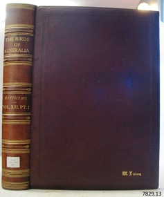 Flagstaff Hill Maritime Museum and Village
Book - Reference, The Birds of Australia Vol 12 Part 1
The Birds of Australia is a 12 volume work, in a total of 14 books. The books were used as an ornithological handbook. They contain scientific text as well as over 600 hand-coloured lithographed plates by J.G. Keulemans, H. Grönvold, Roland Green, H. Goodchild and G.E. Lodge. The work was written, sponsored and organised by Gregory M. Matthews, F.R.S.C. Erc. who was a wealthy Australian and an amateur ornithologist. His titles included – -Fellow of the Linnean and Zoological Societies of London -Member of the British Ornithologists’ Union -Corresponding Fellow of the American Ornithologists’ Union The volumes in our collection were originally donated to the Warrnambool Mechanics’ Institute and Free Library by William Lindsay. THE LINDSAYS (quoted from the book Of Many Things – A History of Warrnambool Shire by C.E. Sayers) The Lindsays were amongst the most prominent families in the Shire of Warrnambool, as pastoralists, sportsmen, municipal councillors, community leaders. The first of the family William arrived in Melbourne in 1841 and started business as a livestock agent. The gold rushes sent him to the central Victoria diggings dealing in cattle. This was a business that boomed in the early 1850s, and he prospered. In 1859 he took over the Quamby run near Woolsthrope from Paul de Castella, the Yarra Valley Swiss vigneron who had brought the leasehold and improvements in 1853 from George Youl, who had pioneered the run. Quamby was originally 25,000 acres. It was heavily timbered, rough country, much of it swampy, a characteristic of the district. Lindsay used it to fatten cattle which gave large returns with the booming gold diggings towns paying high prices for beef. In 1862 purchases at auction made Quamby a freehold. In the next six years a further 20,000 acres of Crown land were brought at auction to make the run one of the largest in the south-west district. The great profits from his cattle trading enabled Lindsay to make improvements to the holding, and to Union which was added in 1864. Much of the thick timber was cleared and the worst of the swamps drained. Union was 15,000 acres of freehold when Kennedy sold it to Lindsay. It was heavily timbered, mostly blackwood, with large belts of wattle and honeysuckle. Much of the heavy native was ringbarked and cleared; much more was swept away by bushfire. It was expensive work, but Lindsay’s bank passbook was heavy with credit, and he did not spare money to make both Quamby and Union heavily developed stock runs. He was as lavish in social living; the bluestone Quamby homestead was one of the most hospitable in the district when William Lindsay was host there; its paddocks carried high quality thoroughbreds: its stables housed steeplechasers and flat racers which won many races on Warrnambool and other courses; its coach houses were filled with carriages which took his guests to the great racing carnivals of the district. After William Lindsay died in 1897, in his eighty-fifth year, his two sons, William and James, managed Union and Quamby as a joint venture. This partnership ended in 1906 when William took over Union and James kept Quamby. The following year 10,000 acres of Union were subdivided and sold in lots of 100 acres to 700 acres for dairying and general farming. It was well improved country, much of it alluvial flats. By then many of the paddocks were sheltered with blue gum belts, and they carried good pastures. The three Lindsays, father and two sons, gave many years of service to the Shire, and to many charitable, sporting, social and community organisations in the Warrnambool district. William Lindsay senior, was a Shire councillor for 15 years, and President several times. James Lindsay followed his father as a north riding councillor. He served nineteen years, from 1887 until his death in March 1908. He was President four times. Jimmy Lindsay was one of the most popular men in the south-west of Victoria. He was a fine sportsman: horse breeder, owner and a dashing amateur rider. He lived lavishly and played hard. For many years he guarded a herd of kangaroos, as many as 100 head, at Quamby. Descendants of the Lindsay kangaroos are still in the district. James Lindsay’s wife, Margaret Esther was a daughter of Samuel Shaw Parker, the first engineer of the Shire. Nell Lindsay, a daughter, lives in the Bluestone Quamby homestead. Only a little more than 60 acres of the original run still belongs to the property. William Lindsay junior succeeded his brother as a Shire councillor. He served for 25 years from 1908 until his death in 1934. So, the Lindsays, father and two sons, served as Shite councillors for an unbroken period of sixth-five years. William Lindsay junior had a life-long interest in horse racing, as breeder, owner and enthusiastic amateur steeplechase rider. He was elected a member of the Warrnambool racing club in 1901 and was president of the club for thirty-two years. He raced and rode horses for the love of the sport. He won the Villiers and Heytesbury Hunt Cup in the 1870s on his own horse, Ventura. In the year he died his horse Flavedo won the Warrnambool Grand Annual steeplechase. It was a sensational race. All of the contestants fell, or lost their riders. When Flavedo baulked at a jump, its jockey R. Sweetman, remounted and completed the course to win the race. All of the Lindsays were passionately fond of the thoroughbred horse. Nell Lindsay talking to the author in the drawing room of Quamby homestead - with many memories for her of its lavish years – said of a brother that he was put on a horse when he was two years old and never got off. William Lindsay junior made Union into a fine, high-producing property, breeding cattle and horses. He added to the bluestone house that David Kennedy started, established plantations of pines and gums, and made an attractive garden. WARRNAMBOOL MECHANICS’ INSTITUTE Warrnambool's Mechanics' Institute (or Institution as it was sometimes called) was one of the earliest in Victoria. On 17th October 1853 a meeting was held where it was resolved to request the Lieutenant Governor of the Colony to grant land for the erection of a Mechanics' Institutes building. A committee was formed at the meeting and Richard Osburne chaired the first meeting of this committee. The land on the North West corner of Banyan and Merri Streets was granted but there were no funds to erect the building. The Formal Rights of the Warrnambool Mechanics' Institute's encompassed its aims and these were officially adopted in1859; "This Institution has for its object the diffusion of literary, scientific, and other useful knowledge amongst its members, excluding all controversial subjects, religious or political. These objects are sought to be obtained by means of a circulating library, a reading room, the establishment of classes, debates, and the occasional delivery of lectures on natural and experimental philosophy, mechanics, astronomy, chemistry, natural history, literature, and the useful and ornamental arts, particularly those which have a more immediate reference to the colony." The Warrnambool Mechanics' Institute opened its first meeting room in November1854 in the National School building at the corner of Banyan and Timor Streets. The Institute was funded by member subscription, payable on a quarterly, half yearly or yearly basis. Samuel Hannaford, the Manager of the Warrnambool Bank of Australasia, was the first Honorary Secretary of the Mechanics' Institutes, and an early President and Vice-President. He also gave several of the early lectures in the Reading Room. Another early Secretary, Librarian and lecturer was Marmaduke Fisher, the teacher at the National School. Lecture topics included The Poets and Poetry of Ireland', 'The Birth and Development of the Earth', 'The Vertebrae - with Remarks on the pleasures resulting from the study of Natural History' and 'Architecture'. In 1856 the Reading Room was moved to James Hider's shop in Timor Street, and by 1864 it was located in the bookshop of Davies and Read. In the 1860's the Mechanics' Institute struggled as membership waned but in 1866, after a series of fund raising efforts, the committee was able to purchase land in Liebig Street, on a site then called Market Square, between the weighbridge and the fire station. A Mechanics' Institute building was opened at this site in August 1871. The following year four more rooms were added to the main Reading Room and in 1873 the Artisan School of Design was incorporated into the Institute. The same year Joseph Archibald established a Museum; however it deteriorated when he was transferred to Bendigo in 1877. In 1880, with Archibald's return to Warrnambool, the Museum was re-established, and in 1885 a new building was built at the back of the Institute to accommodate the re-created School of Design, the Art Gallery and the Museum. In 1887 the Museum section was moved to the former court house in Timor Street (for some time the walls of the building formed part of the TAFE cafeteria but all is now demolished)). In 1911 the Museum was transferred back to the original building and the management of the Mechanics' Institute was handed over to the Warrnambool City Council. The Museum and Art Gallery became one and housed many fine works of art, and the Library continued to grow. The building was well patronised, with records showing that at the beginning of the 20th century there were between 500 and 800 visitors. During World War One the monthly figures were in the thousands, with 3,400 people visiting in January 1915. The Museum was a much loved Institution in Warrnambool until the contents of the Museum and Art Gallery were removed to make room for the Warrnambool City Council Engineers' Department. The contents were stored but many of the items were scattered or lost. When the original building was demolished the site became occupied by the Civic Centre, which included the new City Library. (The library was temporarily located in the old Palais building in Koroit Street.) In the process of reorganisation the Collection was distributed amongst the community groups: -The new City Library took some of the historic books and some important documents, historic photographs and newspapers. -The Art Gallery kept the 19th Century art collection and some of the artefacts from the museum. -The Historic Society has some items -The State Museum has some items -Some items were destroyed -Flagstaff Hill Maritime Village has old newspapers, Government Gazettes, most of the Mechanics' Institute Library, ledgers and documents connected to the Mechanics' Institute Library, some framed and unframed art works and some photographs. The Warrnambool Mechanics' Institute Library book collection is deemed to be of great importance because it is one of the few collections in an almost intact state, and many of the books are now very rare and of great value. THE PATTISON COLLECTION This book is also part of the ‘Pattison Collection’, a collection of books and records that was originally owned by the Warrnambool Mechanics’ Institute, which was founded in Warrnambool in 1853. In 1935 Ralph Pattison was appointed as City Librarian to establish and organise the Warrnambool Library, as the Warrnambool Mechanics’ Institute was then called. When the Warrnambool Mechanics’ Institute building was pulled down in 1963 a new civic building was erected on the site and the new Warrnambool Library, on behalf of the City Council, took over all the holdings of the Warrnambool Mechanics’ Institute. At this time some of the items were separated and identified as the ‘Pattison Collection’, named after Ralph Pattison. Eventually the components of the Warrnambool Mechanics’ Institute were distributed from the Warrnambool Library to various places, including the Art Gallery, Historical Society and Flagstaff Hill. Later some were even distributed to other regional branches of Corangamite Regional Library and passed to and fro. It is difficult now to trace just where all of the items have ended up. The books at Flagstaff Hill Maritime Village generally display stamps and markings from Pattison as well as a variety of other institutions including the Mechanics’ Institute itself. RALPH ERIC PATTISON Ralph Eric Pattison was born in Rockhampton, Queensland, in 1891. He married Maude Swan from Warrnambool in 1920 and they set up home in Warrnambool. In 1935 Pattison accepted a position as City Librarian for the Warrnambool City Council. His huge challenge was to make a functional library within two rooms of the Mechanics’ Institute. He tirelessly cleaned, cleared and sorted a disarrayed collection of old books, jars of preserved specimens and other items reserved for exhibition in the city’s museum. He developed and updated the library with a wide variety of books for all tastes, including reference books for students; a difficult task to fulfil during the years following the Depression. He converted all of the lower area of the building into a library, reference room and reading room for members and the public. The books were sorted and stored using a cataloguing and card index system that he had developed himself. He also prepared the upper floor of the building and established the Art Gallery and later the Museum, a place to exhibit the many old relics that had been stored for years for this purpose. One of the treasures he found was a beautiful ancient clock, which he repaired, restored and enjoyed using in his office during the years of his service there. Ralph Pattison was described as “a meticulous gentleman whose punctuality, floorless courtesy and distinctive neat dress were hallmarks of his character, and ‘his’ clock controlled his daily routine, and his opening and closing of the library’s large heavy doors to the minute.” Pattison took leave during 1942 to 1945 to serve in the Royal Australian Navy, Volunteer Reserve as Lieutenant. A few years later he converted one of the Museum’s rooms into a Children’s Library, stocking it with suitable books for the younger generation. This was an instant success. In the 1950’s he had the honour of being appointed to the Victorian Library Board and received more inspiration from the monthly conferences in Melbourne. He was sadly retired in 1959 after over 23 years of service, due to the fact that he had gone over the working age of council officers. However he continued to take a very keen interest in the continual development of the Library until his death in 1969. The Birds of Australia by Gregory M. Matthews is now considered a rare and valuable scientific and historic work on its own. These 12 volumes were donated in 1934 to The Warrnambool Mechanics’ Institute and were included as part of the Pattison Collection. The Warrnambool Mechanics’ Institute Collection is primarily significant in its totality, rather than for the individual objects it contains. Its contents are highly representative of the development of Mechanics' Institute libraries across Australia, particularly Victoria. A diversity of publications and themes has been amassed, and these provide clues to our understanding of the nature of and changes in the reading habits of Victorians from the 1850s to the middle of the 20th century. The collection also highlights the Warrnambool community’s commitment to the Mechanics’ Institute, reading, literacy and learning in the regions, and proves that access to knowledge was not impeded by distance. These items help to provide a more complete picture of our community’s ideals and aspirations. The Warrnambool Mechanics Institute book collection has historical and social significance for its strong association with the Mechanics Institute movement and the important role it played in the intellectual, cultural and social development of people throughout the latter part of the nineteenth century and the early twentieth century. The collection of books is a rare example of an early lending library and its significance is enhanced by the survival of an original collection of many volumes. The Warrnambool Mechanics' Institute’s publication collection is of both local and state significance. The Birds of Australia Vol 12 Part 1 Author: Gregory M Mathews Publisher: H. F. & G. Witherby 326 HIGH HOLBORN LONDON Date: 1925-1927 Tan leather bound illustrated work.Label on spine cover with typed text RA 598.2994 MAT Pastedown front endpaper has sticker from Warrnambool Mechanics Institute and Free Library that reads “Presented by W. Lindsay Esq. ‘Union’ Woolsthrope” Accession Number: 15244 Date Received: 3-34 “W. Lindsay” embossed in gold on front cover, bottom right of book flagstaff hill, warrnambool, shipwrecked coast, flagstaff hill maritime museum, maritime museum, shipwreck coast, flagstaff hill maritime village, great ocean road, the birds of australia, gregory m. matthews, witherby & co., h.f. & g. witherby, w lindsay, william lindsay, quamby woolsthorpe, union woolsthorpe, pattison collection, warrnambool library, warrnambool art gallery, joseph archibald, warrnambool mechanics’ institute and free library, ralph eric pattison, warrnambool city librarian, mechanics’ institute library, victorian library board, warrnambool books and records, warrnambool children’s library, the birds of australia vol 12 part 1, quamby station, union station, woolsthrope -
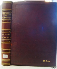 Flagstaff Hill Maritime Museum and Village
Book - Reference, The Birds of Australia Vol 12 Part 2
The Birds of Australia is a 12 volume work, in a total of 14 books. The books were used as an ornithological handbook. They contain scientific text as well as over 600 hand-coloured lithographed plates by J.G. Keulemans, H. Grönvold, Roland Green, H. Goodchild and G.E. Lodge. The work was written, sponsored and organised by Gregory M. Matthews, F.R.S.C. Erc. who was a wealthy Australian and an amateur ornithologist. His titles included – -Fellow of the Linnean and Zoological Societies of London -Member of the British Ornithologists’ Union -Corresponding Fellow of the American Ornithologists’ Union The volumes in our collection were originally donated to the Warrnambool Mechanics’ Institute and Free Library by William Lindsay. THE LINDSAYS (quoted from the book Of Many Things – A History of Warrnambool Shire by C.E. Sayers) The Lindsays were amongst the most prominent families in the Shire of Warrnambool, as pastoralists, sportsmen, municipal councillors, community leaders. The first of the family William arrived in Melbourne in 1841 and started business as a livestock agent. The gold rushes sent him to the central Victoria diggings dealing in cattle. This was a business that boomed in the early 1850s, and he prospered. In 1859 he took over the Quamby run near Woolsthrope from Paul de Castella, the Yarra Valley Swiss vigneron who had brought the leasehold and improvements in 1853 from George Youl, who had pioneered the run. Quamby was originally 25,000 acres. It was heavily timbered, rough country, much of it swampy, a characteristic of the district. Lindsay used it to fatten cattle which gave large returns with the booming gold diggings towns paying high prices for beef. In 1862 purchases at auction made Quamby a freehold. In the next six years a further 20,000 acres of Crown land were brought at auction to make the run one of the largest in the south-west district. The great profits from his cattle trading enabled Lindsay to make improvements to the holding, and to Union which was added in 1864. Much of the thick timber was cleared and the worst of the swamps drained. Union was 15,000 acres of freehold when Kennedy sold it to Lindsay. It was heavily timbered, mostly blackwood, with large belts of wattle and honeysuckle. Much of the heavy native was ringbarked and cleared; much more was swept away by bushfire. It was expensive work, but Lindsay’s bank passbook was heavy with credit, and he did not spare money to make both Quamby and Union heavily developed stock runs. He was as lavish in social living; the bluestone Quamby homestead was one of the most hospitable in the district when William Lindsay was host there; its paddocks carried high quality thoroughbreds: its stables housed steeplechasers and flat racers which won many races on Warrnambool and other courses; its coach houses were filled with carriages which took his guests to the great racing carnivals of the district. After William Lindsay died in 1897, in his eighty-fifth year, his two sons, William and James, managed Union and Quamby as a joint venture. This partnership ended in 1906 when William took over Union and James kept Quamby. The following year 10,000 acres of Union were subdivided and sold in lots of 100 acres to 700 acres for dairying and general farming. It was well improved country, much of it alluvial flats. By then many of the paddocks were sheltered with blue gum belts, and they carried good pastures. The three Lindsays, father and two sons, gave many years of service to the Shire, and to many charitable, sporting, social and community organisations in the Warrnambool district. William Lindsay senior, was a Shire councillor for 15 years, and President several times. James Lindsay followed his father as a north riding councillor. He served nineteen years, from 1887 until his death in March 1908. He was President four times. Jimmy Lindsay was one of the most popular men in the south-west of Victoria. He was a fine sportsman: horse breeder, owner and a dashing amateur rider. He lived lavishly and played hard. For many years he guarded a herd of kangaroos, as many as 100 head, at Quamby. Descendants of the Lindsay kangaroos are still in the district. James Lindsay’s wife, Margaret Esther was a daughter of Samuel Shaw Parker, the first engineer of the Shire. Nell Lindsay, a daughter, lives in the Bluestone Quamby homestead. Only a little more than 60 acres of the original run still belongs to the property. William Lindsay junior succeeded his brother as a Shire councillor. He served for 25 years from 1908 until his death in 1934. So, the Lindsays, father and two sons, served as Shite councillors for an unbroken period of sixth-five years. William Lindsay junior had a life-long interest in horse racing, as breeder, owner and enthusiastic amateur steeplechase rider. He was elected a member of the Warrnambool racing club in 1901 and was president of the club for thirty-two years. He raced and rode horses for the love of the sport. He won the Villiers and Heytesbury Hunt Cup in the 1870s on his own horse, Ventura. In the year he died his horse Flavedo won the Warrnambool Grand Annual steeplechase. It was a sensational race. All of the contestants fell, or lost their riders. When Flavedo baulked at a jump, its jockey R. Sweetman, remounted and completed the course to win the race. All of the Lindsays were passionately fond of the thoroughbred horse. Nell Lindsay talking to the author in the drawing room of Quamby homestead - with many memories for her of its lavish years – said of a brother that he was put on a horse when he was two years old and never got off. William Lindsay junior made Union into a fine, high-producing property, breeding cattle and horses. He added to the bluestone house that David Kennedy started, established plantations of pines and gums, and made an attractive garden. WARRNAMBOOL MECHANICS’ INSTITUTE Warrnambool's Mechanics' Institute (or Institution as it was sometimes called) was one of the earliest in Victoria. On 17th October 1853 a meeting was held where it was resolved to request the Lieutenant Governor of the Colony to grant land for the erection of a Mechanics' Institutes building. A committee was formed at the meeting and Richard Osburne chaired the first meeting of this committee. The land on the North West corner of Banyan and Merri Streets was granted but there were no funds to erect the building. The Formal Rights of the Warrnambool Mechanics' Institute's encompassed its aims and these were officially adopted in1859; "This Institution has for its object the diffusion of literary, scientific, and other useful knowledge amongst its members, excluding all controversial subjects, religious or political. These objects are sought to be obtained by means of a circulating library, a reading room, the establishment of classes, debates, and the occasional delivery of lectures on natural and experimental philosophy, mechanics, astronomy, chemistry, natural history, literature, and the useful and ornamental arts, particularly those which have a more immediate reference to the colony." The Warrnambool Mechanics' Institute opened its first meeting room in November1854 in the National School building at the corner of Banyan and Timor Streets. The Institute was funded by member subscription, payable on a quarterly, half yearly or yearly basis. Samuel Hannaford, the Manager of the Warrnambool Bank of Australasia, was the first Honorary Secretary of the Mechanics' Institutes, and an early President and Vice-President. He also gave several of the early lectures in the Reading Room. Another early Secretary, Librarian and lecturer was Marmaduke Fisher, the teacher at the National School. Lecture topics included The Poets and Poetry of Ireland', 'The Birth and Development of the Earth', 'The Vertebrae - with Remarks on the pleasures resulting from the study of Natural History' and 'Architecture'. In 1856 the Reading Room was moved to James Hider's shop in Timor Street, and by 1864 it was located in the bookshop of Davies and Read. In the 1860's the Mechanics' Institute struggled as membership waned but in 1866, after a series of fund raising efforts, the committee was able to purchase land in Liebig Street, on a site then called Market Square, between the weighbridge and the fire station. A Mechanics' Institute building was opened at this site in August 1871. The following year four more rooms were added to the main Reading Room and in 1873 the Artisan School of Design was incorporated into the Institute. The same year Joseph Archibald established a Museum; however it deteriorated when he was transferred to Bendigo in 1877. In 1880, with Archibald's return to Warrnambool, the Museum was re-established, and in 1885 a new building was built at the back of the Institute to accommodate the re-created School of Design, the Art Gallery and the Museum. In 1887 the Museum section was moved to the former court house in Timor Street (for some time the walls of the building formed part of the TAFE cafeteria but all is now demolished)). In 1911 the Museum was transferred back to the original building and the management of the Mechanics' Institute was handed over to the Warrnambool City Council. The Museum and Art Gallery became one and housed many fine works of art, and the Library continued to grow. The building was well patronised, with records showing that at the beginning of the 20th century there were between 500 and 800 visitors. During World War One the monthly figures were in the thousands, with 3,400 people visiting in January 1915. The Museum was a much loved Institution in Warrnambool until the contents of the Museum and Art Gallery were removed to make room for the Warrnambool City Council Engineers' Department. The contents were stored but many of the items were scattered or lost. When the original building was demolished the site became occupied by the Civic Centre, which included the new City Library. (The library was temporarily located in the old Palais building in Koroit Street.) In the process of reorganisation the Collection was distributed amongst the community groups: -The new City Library took some of the historic books and some important documents, historic photographs and newspapers. -The Art Gallery kept the 19th Century art collection and some of the artefacts from the museum. -The Historic Society has some items -The State Museum has some items -Some items were destroyed -Flagstaff Hill Maritime Village has old newspapers, Government Gazettes, most of the Mechanics' Institute Library, ledgers and documents connected to the Mechanics' Institute Library, some framed and unframed art works and some photographs. The Warrnambool Mechanics' Institute Library book collection is deemed to be of great importance because it is one of the few collections in an almost intact state, and many of the books are now very rare and of great value. THE PATTISON COLLECTION This book is also part of the ‘Pattison Collection’, a collection of books and records that was originally owned by the Warrnambool Mechanics’ Institute, which was founded in Warrnambool in 1853. In 1935 Ralph Pattison was appointed as City Librarian to establish and organise the Warrnambool Library, as the Warrnambool Mechanics’ Institute was then called. When the Warrnambool Mechanics’ Institute building was pulled down in 1963 a new civic building was erected on the site and the new Warrnambool Library, on behalf of the City Council, took over all the holdings of the Warrnambool Mechanics’ Institute. At this time some of the items were separated and identified as the ‘Pattison Collection’, named after Ralph Pattison. Eventually the components of the Warrnambool Mechanics’ Institute were distributed from the Warrnambool Library to various places, including the Art Gallery, Historical Society and Flagstaff Hill. Later some were even distributed to other regional branches of Corangamite Regional Library and passed to and fro. It is difficult now to trace just where all of the items have ended up. The books at Flagstaff Hill Maritime Village generally display stamps and markings from Pattison as well as a variety of other institutions including the Mechanics’ Institute itself. RALPH ERIC PATTISON Ralph Eric Pattison was born in Rockhampton, Queensland, in 1891. He married Maude Swan from Warrnambool in 1920 and they set up home in Warrnambool. In 1935 Pattison accepted a position as City Librarian for the Warrnambool City Council. His huge challenge was to make a functional library within two rooms of the Mechanics’ Institute. He tirelessly cleaned, cleared and sorted a disarrayed collection of old books, jars of preserved specimens and other items reserved for exhibition in the city’s museum. He developed and updated the library with a wide variety of books for all tastes, including reference books for students; a difficult task to fulfil during the years following the Depression. He converted all of the lower area of the building into a library, reference room and reading room for members and the public. The books were sorted and stored using a cataloguing and card index system that he had developed himself. He also prepared the upper floor of the building and established the Art Gallery and later the Museum, a place to exhibit the many old relics that had been stored for years for this purpose. One of the treasures he found was a beautiful ancient clock, which he repaired, restored and enjoyed using in his office during the years of his service there. Ralph Pattison was described as “a meticulous gentleman whose punctuality, floorless courtesy and distinctive neat dress were hallmarks of his character, and ‘his’ clock controlled his daily routine, and his opening and closing of the library’s large heavy doors to the minute.” Pattison took leave during 1942 to 1945 to serve in the Royal Australian Navy, Volunteer Reserve as Lieutenant. A few years later he converted one of the Museum’s rooms into a Children’s Library, stocking it with suitable books for the younger generation. This was an instant success. In the 1950’s he had the honour of being appointed to the Victorian Library Board and received more inspiration from the monthly conferences in Melbourne. He was sadly retired in 1959 after over 23 years of service, due to the fact that he had gone over the working age of council officers. However he continued to take a very keen interest in the continual development of the Library until his death in 1969. The Birds of Australia by Gregory M. Matthews is now considered a rare and valuable scientific and historic work on its own. These 12 volumes were donated in 1934 to The Warrnambool Mechanics’ Institute and were included as part of the Pattison Collection. The Warrnambool Mechanics’ Institute Collection is primarily significant in its totality, rather than for the individual objects it contains. Its contents are highly representative of the development of Mechanics' Institute libraries across Australia, particularly Victoria. A diversity of publications and themes has been amassed, and these provide clues to our understanding of the nature of and changes in the reading habits of Victorians from the 1850s to the middle of the 20th century. The collection also highlights the Warrnambool community’s commitment to the Mechanics’ Institute, reading, literacy and learning in the regions, and proves that access to knowledge was not impeded by distance. These items help to provide a more complete picture of our community’s ideals and aspirations. The Warrnambool Mechanics Institute book collection has historical and social significance for its strong association with the Mechanics Institute movement and the important role it played in the intellectual, cultural and social development of people throughout the latter part of the nineteenth century and the early twentieth century. The collection of books is a rare example of an early lending library and its significance is enhanced by the survival of an original collection of many volumes. The Warrnambool Mechanics' Institute’s publication collection is of both local and state significance. The Birds of Australia Vol 12 Part 2 Author: Gregory M Mathews Publisher: H. F. & G. Witherby 326 HIGH HOLBORN LONDON Date: 1925-1927 Tan leather bound illustrated work.Label on spine cover with typed text RA 598.2994 MAT Pastedown front endpaper has sticker from Warrnambool Mechanics Institute and Free Library that reads “Presented by W. Lindsay Esq. ‘Union’ Woolsthrope” Accession Number: 15245 Date Received: 3-34 “W. Lindsay” embossed in gold on front cover, bottom right of book flagstaff hill, warrnambool, shipwrecked coast, flagstaff hill maritime museum, maritime museum, shipwreck coast, flagstaff hill maritime village, great ocean road, the birds of australia, gregory m. matthews, witherby & co., h.f. & g. witherby, w lindsay, william lindsay, quamby woolsthorpe, union woolsthorpe, pattison collection, warrnambool library, warrnambool art gallery, joseph archibald, warrnambool mechanics’ institute and free library, ralph eric pattison, warrnambool city librarian, mechanics’ institute library, victorian library board, warrnambool books and records, warrnambool children’s library, the birds of australia vol 12 part 2, quamby station, union station, woolsthrope -
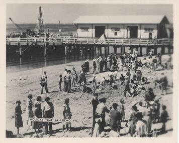 Phillip Island and District Historical Society Inc.
Photograph, Unknown
One of a collection of 15 photographs donated by Lois MullinsBlack & White photograph of the San Remo Pier with large shed. Lots of holiday makers enjoying the beach."Holiday time, San Remo, Vic."san remo pier, san remo jetty, san remo beach, lois mullins -
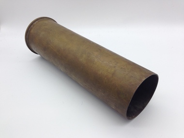 Montmorency/Eltham RSL Sub Branch
Weapon - 6-Pounder Shell Case, E.C.C, 1942
The Ordnance QF 6-pounder (57mm) 7 cwt was a British anti-tank gun used by both British and Commonwealth forces during World War II. Different versions of the gun were used on tanks, armoured cars and naval vessels. One version - the Molins Gun - was even used on an aircraft. Designed to replace the QF 2-pounder (40mm) it was first used by Australian troops during the El Alamein battles in 1942. The guns were also made in Australia by General Motors Holden who produced 615 of them, delivering the first gun in July 1942. The United States Army also adopted it and called it the 57mm Gun M1. Ammunition was primarily armour-piercing but in March 1944 a high-explosive round was introduced. The shell case shown here would have contained a 2.86kg (6lb 5oz) armour-piercing projectile. Brass Shell CaseOn Base of Cartridge: 6PR 7CWT LOT E.C.C. 236 On central firing disc: No. 15 II 11C 41 115 TH 1- -42 7 1942 F. T -
 Kiewa Valley Historical Society
Collection of Papers and Books re - Mt Beauty Heritage Centre
In the early 1990s the KVHS applied for a grant to create the Mt Beauty Heritage Centre / Discovery Centre. This involved employing consultants and further research.This collection includes a lot of detail of the Kiewa Valley area.1. Bogong - The Alpine Discovery Centre 2. Heritage Centre - black folder 3. Heritage Centre - manila folder 4. High Country Heritage Centre - 1991 - green spiral folder 5. Six Heritage Centre - Matt Viney & Associates - white spiral folders 6. Landscape Consultants - Susan Campbell & son - red spiral folder 7. Plant List - Upper Kiewa Valley Water Supply Catchment 8. Geological Survey of Vic., Plates, Bulletin No. 44 - in battered paper 'bag' with front cover list of contents - 15 plates 9. Geological Survey - A3 photo copies of pages 106-117 10. Geological Survey of Vic. - Report of Progress No VII 1884 - bound book 11. Geological Survey of Vic. Bulletin 56 - includes nth east Vic. 1958 - bound book with green cloth spine 12. Department of Mines Report Vic. 1906 - booklet held with two staples 13. Royal Society of Vic book - The Geology of the Kiewa Area 1961 14. Miscellaneous papers - Geological Survey, Reports of Fossil Specimens and maps of local area 15. Gold - Appendix K and Appendix 111, Part C - photocopied pages from Vic Mining Registrars Report 1888 - manila foldermt beauty heritage centre, mt beauty discovery centre, geological surveys -
 Eltham District Historical Society Inc
Negative - Photograph, The Bridge, Hurstbridge, Vic, c.1925
Copied from brochure "Wattle Valley Estate" 7 minutes from the bridge. The new bridge designed by Sir John Monash over the Diamond Creek near Hurst's home of 'Mia Mia' at Hurstbridge. The Wattle Valley Estate was first advertised in August 1925 as weekend building allotments by the Greater Melbourne Land and Development Company. Advertised from £28.10.0 or £60 per block. In August 1926, 30 picked allotments of 60x150 feet were put up for auction Saturday August 14, 1926 with frontages to Valley View Road and Fawkner Crescent advertised in the “Heart of the Glorious Wattle Country” and “Within 15 Minutes of the Newly Electrified Railway Station”. The Advertiser on August 13, 1926 in an article promoting the auction stated “the estate is regarded as one of the best in the district, and will be sold practically without reserve.” It is noted that an advertisement running in The Argus February 22, 1951 offered the remaining 16 blocks for sale at £12.10.0 or £200 the lot. By March 7, the remaining blocks were advertised at £17.10.0 The Wattle Valley Estate took over 20 years to sell and then people could not build on them This image was also used in a brochure advertising the "Wattle Valley Estate", which forms part of the Shire of Eltham Pioneers Photograph Collection (Cross Reference Photo No.(s): 1056, 1057)This photo forms part of a collection of photographs gathered by the Shire of Eltham for their centenary project book,"Pioneers and Painters: 100 years of the Shire of Eltham" by Alan Marshall (1971). The collection of over 500 images is held in partnership between Eltham District Historical Society and Yarra Plenty Regional Library (Eltham Library) and is now formally known as the 'The Shire of Eltham Pioneers Photograph Collection.' It is significant in being the first community sourced collection representing the places and people of the Shire's first one hundred years.Digital image 4 x 5 inch B&W Negshire of eltham pioneers photograph collection, hurstbridge, bridge, diamond creek (creek), monash bridge, wattle valley estate -
 Eltham District Historical Society Inc
Negative - Photograph, Rose Stereograph Company, The Bridge, Hurstbridge, Vic, c.1925
Copied from brochure "Wattle Valley Estate". The new bridge designed by Sir John Monash over the Diamond Creek near Hurst's original home "Mia Mia" seen in the distance. Reprinted from brochure advertising "Wattle Valley Estate" 7 minutes from bridge. The Wattle Valley Estate was first advertised in August 1925 as weekend building allotments by the Greater Melbourne Land and Development Company. Advertised from £28.10.0 or £60 per block. In August 1926, 30 picked allotments of 60x150 feet were put up for auction Saturday August 14, 1926 with frontages to Valley View Road and Fawkner Crescent advertised in the “Heart of the Glorious Wattle Country” and “Within 15 Minutes of the Newly Electrified Railway Station”. The Advertiser on August 13, 1926 in an article promoting the auction stated “the estate is regarded as one of the best in the district, and will be sold practically without reserve.” It is noted that an advertisement running in The Argus February 22, 1951 offered the remaining 16 blocks for sale at £12.10.0 or £200 the lot. By March 7, the remaining blocks were advertised at £17.10.0 The Wattle Valley Estate took over 20 years to sell and then people could not build on them This image was also used in a brochure advertising the "Wattle Valley Estate", which forms part of the Shire of Eltham Pioneers Photograph Collection (Cross Reference Photo No.(s): 1056, 1057). Also cross reference SEPP_1028 / 29 for other views of Mia Mia. Part of a slide show presentation "Bridges & Waterways of the Shire" by Russell Yeoman to the 13 September 1989 Society meeting. The presentation included slides of historic photos from the Shire of Eltham Pioneers collections as well as several recent views. This photo forms part of a collection of photographs gathered by the Shire of Eltham for their centenary project book,"Pioneers and Painters: 100 years of the Shire of Eltham" by Alan Marshall (1971). The collection of over 500 images is held in partnership between Eltham District Historical Society and Yarra Plenty Regional Library (Eltham Library) and is now formally known as the 'The Shire of Eltham Pioneers Photograph Collection.' It is significant in being the first community sourced collection representing the places and people of the Shire's first one hundred years.Digital image 4 x 5 inch B&W Negshire of eltham pioneers photograph collection, hurstbridge, mia mia, bridge, diamond creek (creek), monash bridge, wattle valley estate -
 Eltham District Historical Society Inc
Negative - Photograph, Popular Picnicing at Hurstbridge, c.1925
Picnickers enjoying a Sunday outing near the Wattle Valley Estate at Hurstbridge. Copied from brochure "Wattle Valley Estate". It is believed the picture is taken at the northwest corner of the intersection of Wattletree Road and Hurstbridge-Arthurs Creek Road looking southeast towards the township (most likely where the house is located on the property of what is today No. 2 Wattletree Road)- https://goo.gl/maps/VDorwCe1rJJUapjE6 According to a comment by Jean Verso (via @nillumbikcouncil FB page 3 Jan 2020) - "This view is from Wattle Tree Road with Haleys Gully Road to the right and across the creek to William Gray's nursery at Allwood. The building to the far left looks like Dorset House. The building on the left in the middle distance is still there today and has been used for storage and as a stable/tack room for a number of years." The Wattle Valley Estate was first advertised in August 1925 as weekend building allotments by the Greater Melbourne Land and Development Company. Advertised from £28.10.0 or £60 per block. In August 1926, 30 picked allotments of 60x150 feet were put up for auction Saturday August 14, 1926 with frontages to Valley View Road and Fawkner Crescent advertised in the “Heart of the Glorious Wattle Country” and “Within 15 Minutes of the Newly Electrified Railway Station”. The Advertiser on August 13, 1926 in an article promoting the auction stated “the estate is regarded as one of the best in the district, and will be sold practically without reserve.” It is noted that an advertisement running in The Argus February 22, 1951 offered the remaining 16 blocks for sale at £12.10.0 or £200 the lot. By March 7, the remaining blocks were advertised at £17.10.0 The Wattle Valley Estate took over 20 years to sell and then people could not build on them Cross Ref EDHS_02665 Rose Series Postcard P. 4341, "View at Hurstbridge, Vic." Also, other images from sales brochure SEPP_1055 / 1056This photo forms part of a collection of photographs gathered by the Shire of Eltham for their centenary project book,"Pioneers and Painters: 100 years of the Shire of Eltham" by Alan Marshall (1971). The collection of over 500 images is held in partnership between Eltham District Historical Society and Yarra Plenty Regional Library (Eltham Library) and is now formally known as the 'The Shire of Eltham Pioneers Photograph Collection.' It is significant in being the first community sourced collection representing the places and people of the Shire's first one hundred years.Digital image 4 x 5 inch B&W Neg1925, dorset house, fawkner crescent, haleys gully road, hurstbridge, hurstbridge-arthurs creek road, picnic, postcards, shire of eltham pioneers photograph collection, valley view road, wattle valley estate, wattletree road, exhibition yprl 2019-12 -
 Eltham District Historical Society Inc
Photograph - Postcard, Rose Stereograph Company, View at Hurstbridge, Vic, c.1925
Rose Series Postcard P. 4341 “View at Hurstbridge, Vic.” Picnickers enjoying a Sunday outing near the Wattle Valley Estate at Hurstbridge. Copied from brochure "Wattle Valley Estate". It is believed the picture is taken at the northwest corner of the intersection of Wattletree Road and Hurstbridge-Arthurs Creek Road looking southeast towards the township (most likely where the house is located on the property of what is today No. 2 Wattletree Road)- https://goo.gl/maps/VDorwCe1rJJUapjE6 According to a comment by Jean Verso (via @nillumbikcouncil FB page 3 Jan 2020) - "This view is from Wattle Tree Road with Haleys Gully Road to the right and across the creek to William Gray's nursery at Allwood. The building to the far left looks like Dorset House. The building on the left in the middle distance is still there today and has been used for storage and as a stable/tack room for a number of years." The Wattle Valley Estate was first advertised in August 1925 as weekend building allotments by the Greater Melbourne Land and Development Company. Advertised from £28.10.0 or £60 per block. In August 1926, 30 picked allotments of 60x150 feet were put up for auction Saturday August 14, 1926 with frontages to Valley View Road and Fawkner Crescent advertised in the “Heart of the Glorious Wattle Country” and “Within 15 Minutes of the Newly Electrified Railway Station”. The Advertiser on August 13, 1926 in an article promoting the auction stated “the estate is regarded as one of the best in the district, and will be sold practically without reserve.” It is noted that an advertisement running in The Argus February 22, 1951 offered the remaining 16 blocks for sale at £12.10.0 or £200 the lot. By March 7, the remaining blocks were advertised at £17.10.0 The Wattle Valley Estate took over 20 years to sell and then people could not build on them Cross Ref SEPP_1057, “Popular Picnicing at Hurstbridge” rcopied from Wattle Valley estate sales brochure.Digital file only Postcards scanned from the collection of Michael Aitken on loan to EDHS, 13 Feb 20181925, dorset house, exhibition yprl 2019-12, fawkner crescent, haleys gully road, hurstbridge, hurstbridge-arthurs creek road, michael aitken collection, picnic, postcards, rose stereograph company, shire of eltham pioneers photograph collection, valley view road, wattle valley estate, wattletree road -
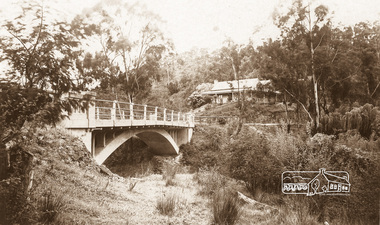 Eltham District Historical Society Inc
Photograph - Postcard, The Bridge, Hurstbridge, Vic
Arched Bridge (Monash Bridge) The Rose Series P. 4036 Reproduced in a brochure advertising the "Wattle Valley Estate" 7 minutes from the bridge. The new bridge designed by Sir John Monash over the Diamond Creek near Hurst's original home "Mia Mia" seen in the distance. The Wattle Valley Estate was first advertised in August 1925 as weekend building allotments by the Greater Melbourne Land and Development Company. Advertised from £28.10.0 or £60 per block. In August 1926, 30 picked allotments of 60x150 feet were put up for auction Saturday August 14, 1926 with frontages to Valley View Road and Fawkner Crescent advertised in the “Heart of the Glorious Wattle Country” and “Within 15 Minutes of the Newly Electrified Railway Station”. The Advertiser on August 13, 1926 in an article promoting the auction stated “the estate is regarded as one of the best in the district, and will be sold practically without reserve.” It is noted that an advertisement running in The Argus February 22, 1951 offered the remaining 16 blocks for sale at £12.10.0 or £200 the lot. By March 7, the remaining blocks were advertised at £17.10.0 The Wattle Valley Estate took over 20 years to sell and then people could not build on them.Digital file only Postcards scanned from the collection of Michael Aitken on loan to EDHS, 13 Feb 2018michael aitken collection, postcards, hurstbridge, monash bridge, bridge, diamond creek (creek), mia mia, shire of eltham pioneers photograph collection, wattle valley estate -
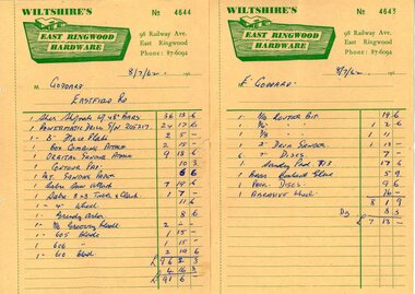 Ringwood and District Historical Society
Document - Manila Folder, Collection of personal documents for Mr Emil Goddard, 15 Eastfield Road, Ringwood East, Victoria, 1947-1953
Correspondence between Mr Goddard and Repatriation Department regarding War Pension entitlements. Specifications of work to be done and materials to be used in the erection of a timber residence at 15 Eastfield Road, Ringwood East, for E.K. Goddard. Contract of Sale of Land at Lots 55 & 56 on P/S No.10492, part of Crown allotments 27 and 28,B, Parish of Ringwood, County of Mornington. Miscellaneous receipts from 1947-1953 including Hire Purchase Agreement for Hillman Minx car. Also includes letter from Presbyterian Ladies' College referring to 1953 term 1 fee of £18.0.3 for Margaret Goddard Receipts from Wiltshire's East Ringwood Hardware, 98 Railway Avenue, East Ringwood, Phone 87-6092, 8/7/1962. -
 Ringwood and District Historical Society
Letter, Property for sale - Ringwood Shop and Dwelling Estate, Ringwood, Victoria - circa 1925
ID 5225 note: Further information relating to allotments marked on the hand-drawn plan are included in ID 5224 - Ringwood Station Estate.Typewritten letter from A.V. Greenwood with hand drawn plan of Ringwood Shop and Dwelling Estate, detailed description of property for sale, and top and side elevation views of house. (7 pages)(Transcript of first page - to unknown recipient) Phone 988 Central, 331 Canty Greenwood Pty. Ltd. 5 Flinders Street Melbourne. Dear Sir, 1. Attached please find drawings of my house at Ringwood. 2. It is for sale at £4,865 or to let at £5 per week to an approved tenant. 3. I sold it to Mr. De Garis and vacated it, but it is now back on my hands. 4. I leased another place instead of living in my own. I may be able to cancel same; in the meantime, however, I propose to sell or let my own. The painters are now going through the place; re-varnishing, re-oiling and re-polishing so that in about five days it will look "spick and span". 5. The house was specially built under my own supervision. 6. It is very suitable for a high class Guest House, Doctor's residence, Hospital or Convalescent Home. If you know of anyone whom it might suit, please communicate with them. DESCRIPTION 7. It stands on 305 feet of land facing Greenwood Avenue. It is cement, roughcast and hardwood, well oiled, and is now being redone so that the house is as good as new; red tile roof; verandahs three sides; two sleep-outs; five bedrooms; large dining room; very large music room with nooks, upstairs lounge, study; sewing room; built-in wardrobes and cupboards throughout; handsome kitchen with handsome pantry cupboard with drawers and glass front; one bath room; one shower room; wash house with patent copper and laundry. Every modern convenience, hot water system (through copper pipes with large copper cylinder) electric lights everywhere, outside and in, Yan Yean water laid on everwhere throughout house and gardens. Floors throughout are the very best, close set, stained and polished; dainty lead light windows etc. 8. There is a big garage, with tiled roof and two rooms with all conveniences for a married couple. Property is well drained with a system of its own. The house stands upon the top of a hill close to Railway Station, say 500 feet from the Footbridge. 9. The garden has expansive shrubs; sheds; fernery; tennis court. 10. A handsome piece of furniture goes with the house; a combination pantry and storeroom for groceries, milk, bread etc., consisting of drawers, glass and wire doors, as mentioned above. 11. It is within easy distance of Melbourne as it is only two minutes from Ringwood Station, which is a frequent electric train service bringing it within 39 minutes of the City. It is thought better by some to go further out into the country atmosphere and walk a short distance at the end than to go by train 20 minutes then walk 15 to 20 minutes. 12. The price quoted of £4,865 is made up as follows - 305 feet of land @ £5 ... £1,515 Garage and dwelling ... £300 House hot water system, American cupboard ... £2,600 Water, fencing, sheds & drain ... £250 For the lot ... £4,865 Should you require copies of the enclosed drawings I shall be pleased to supply same. 13. Mr. J.B. McAlpin is the local agent, Phone Ring. 7 (after hours Ring. 44) or you may phone me Central 988. 14. The house is south of the line, facing Greenwood Avenue and immediately at the back of Ringwood House, which is also my property. Yours sincerely, A.V. Greenwood (illegible) ..... (Transcript of second page) RINGWOOD SHOP AND DWELLING ESTATE See these letters on plan attached (H.) Ringwood House and Shops on 100 by 150 feet of land fronting Bedford Road 100 feet @ £10 per foot - £1,000 House and shops - £2,400 ... £3,400 Ringwood House consists of Boarding House, (Phone 101) and two shops, mainly brick; 9 inch walls. Will carry another story. Has music room, dining room, entrance halls, 10 bedrooms, large verandahs, all conveniences, hot and cold water, and stands on what will become a most valuable business corner. (F.)(G.) Mr. Greenwood's house, garage and sheds, stands on 307 feet of land fronting Greenwood Avenue. See detailed description attached ... £4,865 (J.) Cottage on Block 81 in William Street ... £750 (K.) Cottage in Pitt Street ... £650 (Total) £9,665 ..... (Description of third page - Subdivision Plan) Drawn by Edyth Greenwood, phone 988 Central. Subdivision includes Station Street, Pitt Street, Bedford Road, Wantirna Road, James Street, William Street (later Kendall Street), Greenwood Avenue, Ellison Street, and Haig Street. Circles denote blocks for sale. Squares denote house properties for sale. Other features marked include location of businesses along Main Street (Maroondah Highway), cool store, railway station, shop and police station on Bedford Road, church on Station Street, site of schoolmaster's residence and State School, and location of proposed public baths -
 Federation University Historical Collection
Unknown - Object, Allan Mine Cage Safety Brake, c1873, c1873
A mining safety cage was used in a mine lift. It was fitted with mechanisms to prevent the cage from dropping if the lifting rope broke. In the 1870s in Victoria, deaths and injuries from falling cages in vertical shafts of gold mines were a major problem. The inventor of this safety cage was Robert Allan, a machinery maker of Creswick Rd, Ballarat. He said his cage featured a ‘dissolving’ fulcrum. Others called it an eccentric (off centre) system. Note the pair of clutch levers designed to grab the side guides if tension ceases in the suspending rope from the poppet head pulley. Also, the hinged ‘lids’; designed to protect miners trapped in a braked cage from falling rope, and to enable rescue of the miners. This model was presented to The Ballarat School of Mines Council in November 1876. This model was shown at the Smeaton Show in November 1874, Ballarat School of Mines Museum from 1876, and examined by the 1879 Victorian Board of Inquiry (Pg 15 of FedUni Catalogue 3437) From the Argus of 13 November 1874: At Smeaton Show, Robert Allan of Ballarat won 1st prize for a Model of a Mining Cage, a Butter working machine, a Cheese press and a Curd Mill. By 1878 an Allan Safety-Cage was in operation in the Number 6 shaft of the Band and Albion Consols mine in Ballarat. This cage was judged the best inspected by the Victorian Board of Inquiry by 1879, p. 39.Mining was a big industry in Ballarat in the late 1800s and a lot of deaths were recorded because of mining accidents, the development of the mining safety cage brake limited the deaths and injuries from falling cages in vertical shafts. The model also has links to the Ballarat School of Mines, being presented to the council in 1876. Ballarat School of Mines is the oldest Technical School in Australia and is a predecessor of Federation University. The model is significant to Ballarat's mining history.Model of a mine safety cafe. A grey painted wooden frame with metal model of cage and safety brake system. When tension ceases in rope a pair of crutch levers grab strongly onto the wooden guide strips which run down the sides of a vertical shaft. This safety cage was discussed in "Safety Mining Cages. Report of the Board of Enquiry on Safety Cages 1878-9; together with proceedings of the Board and Appendices".safety cage, mine cage safety brake, robert allan, model, safety cage model, machine maker, millwright, mining, gold mining, tools, equipment, victorian board of inquiry -
 Red Cliffs Military Museum
Letter
Letter written from (unknown) POW imprisioned by the Japanese on Morotai Island from 1942 - 1945 to (unknown) friend. Descriptive of life and treatment in POW camp. The island was captured by the Japanese in early 1942. Morotai's southern plain was taken by American forces in September 1944 during the Battle of Morotai, and used as a staging point for the Allied invasion of the Philippines in early 1945, and of Borneo in May and June of that year. Japanese soldier Teruo Nakamura was discovered in the Morotai jungle in 1974, as one of the WWII Japanese soldiers who held out subsequent to the Japanese military's surrender.Photocopy of letter, 4 pages, originally written in ink on (unofficial) Australian Red Cross form.Added to head of letter at a later date is inscription ' First letter written home for 3 1/2 years'.Top left hand- FOR SAFETY/ IN YOUR LETTERS DO NOT REFER TO:-/ The name of your ship or other ships in the convoy, or its escorts./The date of sailing, ports of call, or probable destination./ The description of troops, their loca-/tion or any other information/ which, if intercepted, would be of/ value to the enemy. In your Top right hand- Australian Red Cross Society/ (UNOFFICIAL)/ 25-8-45/ (added at later date 'Morotri Island')/ Alex, Have witten this especially/ as i don't wish our women folk to know the tougher side of life./Well Alex for the first/ 2 1/2 years as POWs we lived reasonably/ well, but the last 15 months was like /hell. Heres the worst lot of b-s/ you could find on earth, they worked /us from 7AM till 6 PM, & fed/ us on muck you wouldn't feed to/ Pigs. I'm nothing at all they would 2, pow, morotri island, morotai island, world war, prisoner of war, australian red cross society -
 Bendigo Historical Society Inc.
Document - BENDIGO SALEYARDS COLLECTION: CATTLE REWEIGHS
Twenty four pages titled Reweighs. Date ranges are 2/7/91, 15/1/91, 25/9/90, Jan 90, 5/9/89, 7/2/89,4/10/88, 2/8/88, 26/4/88, 20/10/88, 20/11/90, 4/12/90, 27/11/90. Pages are divided into columns with the agents names, Total No. Weigh, Columns titled Lots and TW are repeated across the page. Agents are: Dalgety, Elders, Hill, McGregor, M & T, McKean, Nevins, Nuttall, Rodwell, Vains, V.P.C., Webster & Co, Reweighs are for Cattle,bendigo, council, cattle markets, bendigo saleyards collection - cattle reweighs, dalgety, elders, hill, mcgregor, m & t, mckean, nevins, nuttall, rodwell, vains, v.p.c., webster & co