Showing 36 items matching "map of whittlesea"
-
 City of Whittlesea
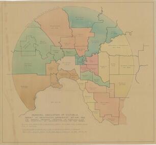
Map - Maps, Municipal Association Of Victoria groupings of councils for representation, 1936
Map was produced as part of Municipal Association of Victoria report on Metropolitan Government, 18 May 1936. Map shows proprosed groupings of municipalities for election of representation to the MAV Board. Map includes net annual value of rateable property within each municipality. The net rateable value for metropolitan area of the Shire of Whittlesea in 1936 was £20,102. Maps, paper. Produced as part of Municipal Association of Victoria report on Metropolitan Government, 18 May 1936. Map shows proprosed groupings of municipalities for election of representation to the MAV Board. council, municipal association of victoria -
 City of Whittlesea
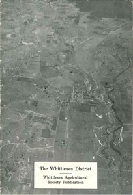
Booklet (item), The Whittlesea District
The Whittlesea district / Whittlesea Agricultural Society publication, 16 pages, black and white photographs, maps, graphs. Booklet provides a brief history and analysis of farming in the Whittlesea district up to the late 1940s. Publication c.1950sbooklet -
 Victorian Railway History Library
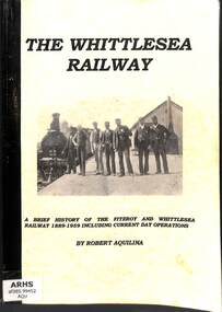
Book, Aquilina, Robert, The Whittlesea Railway, 1999
... , maps. p.168. The Whittlesea Railway Book Aquilina, Robert ...A brief history of the Fitzroy and Whittlesea Railway 1889-1959 including current day operations.ill, maps. p.168.non-fictionA brief history of the Fitzroy and Whittlesea Railway 1889-1959 including current day operations.railroad construction - victoria - history, whittlesea railway - victoria - history -
 Greensborough Historical Society
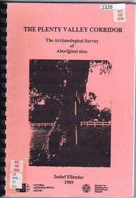
Book, Victoria Archaeological Survey, The Plenty Valley Corridor: the archaeological survey of Aboriginal sites / by Isabel Ellender 1989, 1989_
This archaeological survey of th Plenty Valley was conducted by Isabel Ellender in 1989 for the Ministry of Planning and Environment. The area studied is north of Greensborough to Whittlesea. A number of Aboriginal sites were identified and recommendations made for the future.103 p., illus., maps. Plastic spiral binding.plenty river, aboriginal heritage sites -
 University of Melbourne, Burnley Campus Archives
Map, Yarra 2500, 1983-1988
Photocopies of set of maps, Melbourne and Metropolitan Board of Works. Scale 1:2500. (1) Municipalities of Brunswick 213 Coburg 217 Northcote 218 Broadmeadows 237 Whittlesea 239 and Preston225. Yarra 2500/07.16-07.22. (2) Municipalities of Fitzroy 205 Collingwood 206 Kew 215 Northcote 218 Brunswick 213 Coburg 217 Preston 225. Yarra 2500/08.12-08.17. (3) Municipalities of Collingwood 206 Kew 215 Northcote 218 Yarra 2500/09.12-09.13. (4) Municipalities of Eltham 238 Yarra 2500/18.21. Plus some extra copies. Used when planning Native Garden Woodland Section. 25 sheetscoburg, northcote, broadmeadows, melbourne and metropolitan board of works, collingwood, eltham, kew, whittlesea, brunswick, preston -
 Greensborough Historical Society
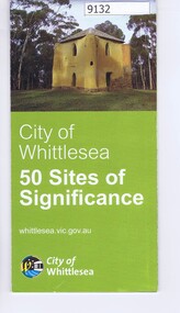
Pamphlet - Map, City of Whittlesea, City of Whittlesea, 50 Sites of Significance
... Pamphlet of historical places in Whittlesea with map...Pamphlet of historical places in Whittlesea with map ...Pamphlet of historical places in Whittlesea with map and imagesColour pamphlet with text, fold out map and coloured imageswhittlesea, historic sites whittlesea