Showing 216 items
matching military manuals
-
 4th/19th Prince of Wales's Light Horse Regiment Unit History Room
Booklet, Maj W J Pendlebury, The King's Regulations and Manual of Military Law, 1940's
... The King's Regulations and Manual of Military Law... and Manual of Military Law written for Officers by Maj W J Pendlebury... Regulations and Manual of Military Law written for Officers by Maj W J ...Soft covered booklet - a precis of King's Regulations and Manual of Military Law written for Officers by Maj W J Pendlebury late RFA (T) and Staff Captain, Kantara EEFSixth Edition revised in accordance with KR 1940, 1941military law -
 Bendigo Military Museum
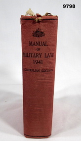
Manual - MILITARY LAW WW2, Command of the Military Board, Army Headquarters/ Melbourne, 1941
... From Title Page; "AUSTRALIAN EDITION/ OF/ MANUAL... Manual Military Law Front end paper - purple ink stamp. "Major ...From Title Page; "AUSTRALIAN EDITION/ OF/ MANUAL OF/ MILITARY LAW/ 1941/ Including Army Act and Rules of Procedure as/ modified and adapted by the Defence Act 1903 - 1939 and the Australian Military Regulations". Part of the William (Bill) THOMASON Collection. Refer Cat. No. 4136P for more items.Hardcover book Cover - cardboard, red colour buckram, embossed lettering on front, black colour ink print on spine. 850 pages - cut, plain, off white colour . No illustrations. Amendments have been added to many pages - paper slips glued to designated pages. Amendments noted on Page iii - handwritten red and black ink pen dated "30/11/41", 31/9/42", "31/12/42", 30/6/43". Front end paper - three purple and one black ink stamps and handwritten signatures and information in black and blue ink pen. Front end paper - purple ink stamp. "Major/ Brigade Major B.P. & G. Force" date "1942", illegible signature. "Major/ G.S. Victoria Garrison Brigade - date "1942", illegible signature. "Major/ Adm.Comd. Vic Garrison Bde with illegible signature - date "42/43" - black ink print. "Lt.Col/ A.A. & G.M.G., Vic covering Force " - with illegible signature - handwritten information, black ink pen "Private Property", blue ink pen. Return to/ Room 10 Block B/ Southern Command.publication, book, ww2, manual, military law -
 Bendigo Military Museum
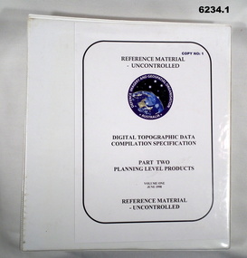
Manual - Digital Topographic Data Compilation Specification - Part 2 Planning Level Products, June 1998
The purpose of this document is to provide digital Topographic data compilation specifications for the Australian Defence Force (ADF) which are applicable to all areas of the Area of Direct Military Interest (ADMI) for the collection of features and attributes to populate the ADF topographic database.6234.1 A four ringed Folder containing A4 Paper, White, Metal Bindings, Chapters 1 to 8 6234.2 A four ringed Folder containing A4 Paper, White, Metal Bindings, Chapters 8 to 13 and Annexesroyal australian survey corps, rasvy, fortuna, army survey regiment, army svy regt, asr, director of survey - army -
 Bendigo Military Museum
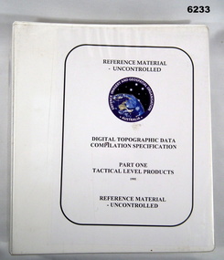
Manual - Digital Topographic Data Compilation Specification - Part 1 Tactical Level Products, February 1995
These specifications enable the compilation of digital topographic data for the Australian Defence Force (ADF) to support the production of topographic information across a multiple product range covering Australia and its Area of Direct Military Interest (ADMI)A plastic covered four ring folder containing A4 paper, white, ten chapters, metal clip ringsroyal australian survey corps, rasvy, fortuna, army survey regiment, army svy regt, asr, director of survey-army -
 Bendigo Military Museum
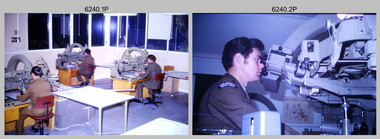
Photograph - Photogrammetric Equipment – Army Survey Regiment, Bendigo and School of Military Survey Bonegilla, c1960s to c1980s
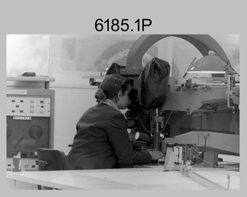
This is a set of 14 photographs of RA Svy technicians operating photogrammetric equipment in Air Survey Squadron, Army Survey Regiment, Fortuna, Bendigo; and the School of Military Survey Bonegilla c1960s to c1980s. The Wild B9 stereo plotter were introduced in 1962 and the Wild B8 stereo plotter was introduced in 1966. The Wild B9 and B8 stereo plotters were used for plotting topographic detail and contours. These analogue machines were manually controlled by adjusting the control knobs for the orientation of the 3D image. The B9s used a four and a half square, and the B8s used a nine-inch square photo image on a film or glass diapositive which allowed highly accurate extraction of map features. At first, plotting with B8 and B9 stereo plotters was undertaken at the aerial photography scale of 1:80,000 in pencil onto a controlled plotting sheet. Sheets were then inked up and reduced photographically to the 1: 100,000 publication scale for scribe impression production. In the early days topographic detail and contours were plotted with a pencil or ink pen mounted at the far end of the pantograph arm. The plotting procedure was upgraded to direct plotting in ink with photographic reduction to publication scale. In 1975 four B8s were upgraded with tri-axis locaters as part of the Input Sub-system to enable digital extraction to AUTOMAP 1’s topographic database. When AUTOMAP 2 was introduced in 1982 these B8s were upgraded, and additional machines added to expand the Army Survey Regiment’s digital capture capability. There are several more photos catalogued in the Victorian Collections database of RA Svy personnel operating Wild B9 and B8 stereo plotters.Photogrammetric Equipment – Army Survey Regiment, Fortuna, Bendigo c.1981. . .7) – Unidentified technician operating Wild B8 stereo plotter in AUTOMAP 1 at ASR. .8) - Wild B8 stereo plotter in AUTOMAP 1 at ASR. Photogrammetric Equipment – Army Survey Regiment, Fortuna, Bendigo. c1981. .9) – ASR’s CPL Dave Cook in AUTOMAP 1 operating a Wild B8 stereo plotter. This is a set of 14 photographs of RA Svy technicians operating photogrammetric equipment at the Army Survey Regiment (ASR), Bendigo and the School of Military Survey (SMS) Bonegilla. c1960s to c1980s. The photographs are on 35mm colour slides and were scanned at 96 dpi. .1) - Photo, colour, c1964. Unidentified ASR technicians operating analogue Wild B9 stereo plotters. .2) - Photo, colour, c1974. ASR’s SPR Mick Minchin operating an analogue Wild B8 stereo plotter. .3) to .6) - Photo, colour, c1980. Photogrammetry Instructor SGT Neil ‘Ned’ Kelly at the SMS operating an analogue Wild B8 stereo plotter. .7) - Photo, colour, c1981. Unidentified technician operating Wild B8 stereo plotter in AUTOMAP 1 at ASR. .8) - Photo, colour, c1981. Wild B8 stereo plotter in AUTOMAP 1 at ASR. .9) to .14) - Photo, colour, c1981. ASR’s CPL Dave Cook in AUTOMAP 1 operating a Wild B8 stereo plotter..1P to .14P - Some of the equipment is annotated on the frame of the 35mm slides.royal australian survey corps, rasvy, army survey regiment, army svy regt, fortuna, asr, photogrammetry -
 Bendigo Military Museum
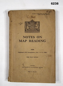
Manual - Notes on Map Reading 1929 - The War Office, 30.06.1939
Instruction in Map reading. The object of map - reading is to tender possible the clear and accurate visualization of the ground from a map productBrown Cardboard book, A5 Size, Several insets. Reprinted with Amendments 1-4 1939, 95 pages.royal australian survey corps, rasvy, fortuna, army survey regiment, army svy regt, asr -
 Bendigo Military Museum
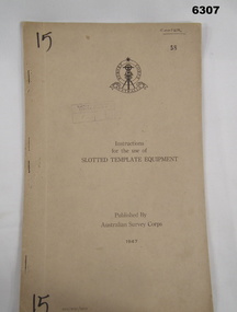
Manual - Australian Survey Corps 1947 - Instructions for the use of Slotted Template Equipment, Australian Survey Corps, 1947
This is an instruction manual describing in detail the construction of the templates used for producing map compilation sheets from aerial photographs, and how the system works.Foolscap size, soft carboard covers, 9 x numbered pages, 3 x fold out pages containing two photos on each. Australian Survey Corps Badge on cover. Stapled and re-stapled on Left hand edge.Front Cover, "15" Top Left and Bottom Left corner, "COOPER" and stamped "58" in Top Right, "AHQ/Misc/0015" Bottom Left Corner, Stamped "Eastern Command Survey Service copy 5"royal australian survey corps, rasvy, fortuna, army survey regiment, army svy regt, asr -
 Bendigo Military Museum
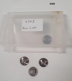
Equipment - Tri punched Film Registration System - stainless steel (studs), Ordinance Factory Bendigo, Circa 1960
These studs (pins) were used in the manual production of mapping to accurately register a number of sheets of film reproduction material together. A set of three studs were required. This simple but effective system allowed the reproduction material layers (repromat) to expand and contract with changes in temperature whilst maintaining the registration between sheets.Precision engineered stainless steel studs (pins) Set of three required for operation, includes a spare stud all stored in a plastic container. These studs were also produced as a low profile version for use in large format photographic vacuum contact frames so that they would not break the glass.royal australian survey corps, rasvy, fortuna, army survey regiment, army svy regt, asr -
 Bendigo Military Museum
Photograph - Photogrammetric Equipment – Army Survey Regiment, Fortuna, Bendigo, c1960s to c1980s
This is a set of eight photographs of technicians operating photogrammetric equipment in Air Survey Squadron, Army Survey Regiment, Fortuna, Bendigo. c1960s to c1980s. The Wild A9 Stereocomparator and Wild B9 stereo plotter were introduced in 1962. The Wild B8 stereo plotter was introduced in 1966. Technicians used the Wild A9 Stereocomparator to accurately measure between pass, tie, and survey control points on aerial photographs. The Wild B9 and B8s were used for plotting topographic detail and contours. These analogue machines were manually controlled by adjusting the control knobs for the orientation of the 3D image. The B9s used a four and a half square, and the B8s used a nine-inch square photo image on a film or glass diapositive which allowed highly accurate extraction of map features. At first, plotting with B8 and B9 stereo plotters was undertaken at the aerial photography scale of 1:80,000 in pencil onto a controlled plotting sheet. Sheets were then inked up and reduced photographically to the 1: 100,000 publication scale for scribe impression production. In the early days topographic detail and contours were plotted with a pencil or ink pen mounted at the far end of the pantograph arm. The plotting procedure was upgraded to direct plotting in ink with photographic reduction to publication scale. In 1975 four B8s were upgraded with tri-axis locaters as part of the Input Sub-system to enable digital extraction to AUTOMAP 1’s topographic database. When AUTOMAP 2 was introduced in 1982 these B8s were upgraded, and additional machines added to expand the Army Survey Regiment’s digital capture capability. This is a set of eight photographs of technicians operating photogrammetric equipment in Air Survey Squadron, Army Survey Regiment, Fortuna, Bendigo. c1960s to c1980s. Black and white and colour photos are on photographic paper and scanned at 300 dpi. .1) - Photo, black & white, c1965. Unidentified technician operating a Wild A9 Stereocomparator. .2) - Photo, black & white, c1965. Unidentified technician operating a Wild B9 stereo plotter. .3) - Photo, black & white, c1967. L to R: Unidentified technician, SPR Ken Jeffery operating a Wild B9 stereo plotter. .4) - Photo, colour, c1974. Unidentified technician, operating a Wild B8 stereo plotter. .5) - Photo, black & white, c1974. Unidentified technician operating a Wild B8 stereo plotter. .6) to .7) - Photo, black & white, c1979. Unidentified technicians operating a Wild B8 stereo plotter. .8) - Photo, black & white, c1985. Unidentified technician in AUTOMAP 2 operating a Wild B8 stereo plotter..1P, .2P, .4P, .5P, .7P – no annotations. .3P – annotated ‘Standing - , Seated SPR Ken Jefferies (sic). .6P – annotated with date ‘1979’ .8P – annotated ‘AUTOMAP 2’royal australian survey corps, rasvy, army survey regiment, army svy regt, fortuna, asr, air survey, photogrammetry -
 Bendigo Military Museum
Photograph - Co-ordinatorgraph Map Grid Production, Army Survey Regiment, Fortuna Bendigo, c1960s to 1970s
This is a set of seven photographs of map grid production using co-ordinatorgraphs at the Army Survey Regiment, Fortuna Bendigo. c1960s to 1970s. The Aristo Co-ordinatorgraph introduced in 1962 was a large heavy steel framed light table with a scribing head that moved in a XY direction using a vernier calibrated measuring scale to 0.001 of an inch. Whilst hand operated it was much quicker and accurate than manual grid and graticule calculation, plotting and scribing. Mapping PNG presented the Regiment with many challenges. WO1 Farrington and CPL John Dean developed computer software for the digitally controlled co-ordinatorgraph, the Calcomp 718 Flatbed Plotter. Much time was saved by automatically plotted cartographic grids and graticules, and automatically draw base compilation sheets complete with aerial triangulated stereo model control. This could be used for a number of maps and was the first step towards map automation. The history of co-ordinatorgraphs is covered in more detail with additional historic photographs, in pages 50 to 51 and page 88 of Valerie Lovejoy’s book 'Mapmakers of Fortuna – A history of the Army Survey Regiment’ ISBN: 0-646-42120-4. SGT Bill Boyd appearing in photo .1P reach the rank of WO1 and for 11 years was the technical warrant officer at the Detachment Army Survey Regiment located at Bonegilla, Victoria. He was awarded the OAM, the Order of Australia Medal for the development of the Flexiflow quality control system. This system comprised a series of job plans and charts linked to a task allocation to resource magnetic planning board. Using critical path analysis and task prioritisation, complex job planning was efficiently scheduled, and re-prioritisations readily made. Reproduction requirements were effectively coordinated by way of weekly courier to the Army Survey Regiment. Supervisors and technicians fully embraced the system as they could understand their role, others around them and the positive production achievements. Bendigo. See page 178 of Valerie Lovejoy’s book for more information on WO1 Boyd’s contribution to RA Svy.This is a set of seven photographs of map grid production using co-ordinatorgraphs at the Army Survey Regiment, Fortuna Bendigo. c1960s to 1970s. The photographs were printed on photographic paper and are part of the Army Survey Regiment’s Collection. The photographs were scanned at 300 dpi. .1) - Photo, black & white, c1960s, L to R: SGT Bill Boyd demonstrating Aristo Co-ordinatorgraph equipment to unidentified technicians (x3) .2) - Photo, black & white, c1960s, Aristo Co-ordinatorgraph equipment. .3) - Photo, black & white, c1960s, unidentified technician operating Aristo Co-ordinatorgraph equipment. .4) - Photo, black & white, c1960s, L to R: PTE Desi Asaris and CPL Kalen Sargent operating Aristo Co-ordinatorgraph equipment. .5) - Photo, black & white, Photo, black & white, c1970s, John Bloor operating Calcomp co-ordinatorgraph equipment. .6) - Photo, black & white, Photo, black & white, c1970s, unidentified technician operating Calcomp co-ordinatorgraph equipment. .7) - Photo, black & white, Photo, black & white, c1970s, L to R: SGT Andy Covington and SGT John Waight operating Calcomp co-ordinatorgraph equipment..7P annotated on back ‘Covington & Waight’.royal australian survey corps, rasvy, army survey regiment, army svy regt, fortuna, asr, carto, air survey -
 Bendigo Military Museum
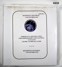
Manual - Portrayal Specification for Topographic Line Mapping at Scales1:50,000, 1:25,000 and 1:10,000, 16.07.1998
These specifications enabled the hard copy representation of digital topographic data for the Australian Defence Force (ADF) covering Australia and nearer regions.Plastic covered white four ring binder, 14 Chapters, 4 Annexesroyal australian survey corps, rasvy, fortuna, army survey regiment, army svy regt, asr, director of strategic military geographic information, dsmgi -
 Bendigo Military Museum
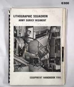
Manual - Lithographic Squadron Army Survey Regiment - Equipment Handbook 1991, Lithographic Squadron, Army Survey Regiment, Circa 1991
The Equipment Handbook was produced by Lihographic Squadron Army Survey Regiment to record the characteristics and capabilities of the equipment used. It was also used to assist in the forecasting of equipment replacement.A4 booklet, plastic ring binding, collage of Lithographic equipment on front cover, text, photographs and diagrams"CPL WITHERS" annotated on front cover in pencilroyal australian survey corps, rasvy, fortuna, army survey regiment, army svy regt, asr -
 Warrnambool and District Historical Society Inc.
Book, Manual of Military Law, 1929
... Manual of Military Law.... There is evidence of mould on the back cover. Manual of Military Law Book ...This book belonged to Captain Charles Rogers of the Australian Army. He was part of the Guard of Honour during the visit of the Duke of Gloucester in 1934. The visit was part of Victoria’s Centenary celebrations. Rogers was a well-known Warrnambool identity in the 1930s, 40s and 50s as a horseman and an army man. He was a long-serving Warrnambool Agricultural Show official as a judge of equine events. He died in 1961. The book is of interest as it belonged to a well-known resident of Warrnambool in the 1930s, 40s and 50s. This is a hard cover book of 1068 pages. It has a red cover with black printing on the spine. The book has an Introduction, textual material on military law in three Sections and an Index. It also has several pages of advertisements printed on pink paper at the front of the book. The cover at the top part of the spine is torn away, there is evidence of silverfish damage in several places and the text has been annotated in many places, in handwriting in red ink. There is a signature of the owner in pencil on the one of the first pages and blue stamps of the Warrnambool & District Historical Society on the same page and on a back page. There is evidence of mould on the back cover.‘C.A.Rogers’ captain charles rogers, military law, history of warrnambool -
 Bendigo Military Museum
Photograph - Capturing Topographic Features with a Wild B8 – Army Survey Regiment, Fortuna, Bendigo, c1980
These four photographs of SPR Santina (Argetto) Straube capturing topographic features – plotting with a Wild B8 stereo plotter were most likely taken in c1980. Introduced in 1966, the Wild B8 stereo plotter was used for plotting topographic detail and contours. These analogue machines were manually controlled by adjusting the control knobs for the orientation of the 3D image. The B8s used a nine-inch square photo image on a film or glass diapositive which allowed highly accurate extraction of map features. At first, plotting by B8 and B9 equipment was undertaken at the aerial photography scale of 1:80,000 in pencil onto a controlled plotting sheet. Sheets were then inked up and reduced photographically to the 1: 100,000 publication scale for scribe impression production. In these photos SPR Santina (Argetto) Straube was plotting with a pencil or ink pen mounted at the far end of the pantograph arm. The plotting procedure was upgraded to direct plotting in ink with photographic reduction to publication scale. In 1975 four B8s were upgraded with tri-axis locaters as part of the Input Sub-system to enable digital extraction to AUTOMAP 1’s topographic database. When AUTOMAP 2 was introduced in 1982 these B8s were upgraded, and additional machines added to expand the Army Survey Regiment’s digital capture capability. This is a set of four photographs of a technician capturing topographic Features with a Wild B8 stereo plotter in Air Survey Squadron – Army Survey Regiment, Fortuna, Bendigo. 1980. The photographs were on 35mm negative film and were scanned at 96 dpi. They are part of the Army Survey Regiment’s Collection. .1) to .4) Photo, black & white, c1980. SPR Santina (Argetto) Straube operating a Wild B8 stereo plotter..1P to .4P – no annotations.royal australian survey corps, rasvy, army survey regiment, army svy regt, fortuna, asr, air survey, photogrammetry -
 Bendigo Military Museum
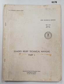
Manual - Shaded Relief Technical Manual - United States Air Force, Department of the Air Force, USA, May 1958
This manual describes how to hand create "Shaded Relief" or the appearance of hills. This manual was produced by the Aeronautical Chart Information Centre, United States Air Force, St Louis 18, Missouri. Shaded relief was produced by hand at the Army Survey Regiment in the 50's, 60's and 70's so that it could be shown on small scale topographical maps and RAAF Aeronauical Charts. Shaded relief continued to be produced by hand until the mid 1980's when it was replaced by digital production methods.Grey covered Manual, gloss paper, stapled together.royal australian survey corps, rasvy, fortuna, army survey regiment, army svy regt, asr -
 Bendigo Military Museum
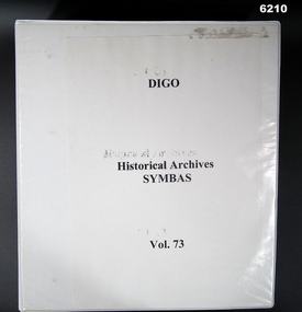
Manual - DIGO Historical Archive - SYMBAS 88 Master Symbols, 1988
Original Positive Masters of all SYMBAS 88 symbols used on RASvy Mapping. This standardized the process of adding symbols to maps. These fil positive masters were used to create "Copy Proof" adhesive copies that allowed symbols to be affixed to film positive type sheets.Large 4 Ring Binder - White Cardboard Plastic covered, Contains an index of All Symbas Symbol positives. Back half of folder contains "Copy Proof" adhesive copies of symbols.royal australian survey corps, rasvy, fortuna, army survey regiment, army svy regt, asr -
 Bendigo Military Museum
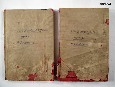
Manual - Trigonometry Part 1 and Part 2, Cambridge University Press, 1948
Manuals of Trigonometry as used by the Royal Australian Survey CorpsHardcovered, Red Book, Brown Paper covered, textroyal australian survey corps, rasvy, fortuna, army survey regiment, army svy regt, asr -
 Bendigo Military Museum
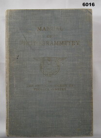
Manual - Manual of Photogrammetry, (Preliminary Edition), 1934 American Society of Photogrammetry, Circa 1934
This book belonged to Brigadier FD Buckland OBE Director of Survey Land HeadquarterHardcover, light blue, 819 pages, text, diagrams, photographsroyal australian survey corps, rasvy, fortuna, army survey regiment, army svy regt, asr, photogrammetry -
 Bendigo Military Museum
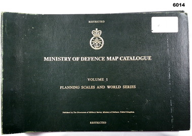
Manual - Ministry of Defence Map Catalogue, Volume 1 Planning Scales and World Series
Map Catalogue, Ministry of Defence, Planning Scales and World Series, The Directorate of Military Survey, Ministry of Defence United KingdomLarge Book, dark green, hard cover, gold text, metal binding, elastic strap keeper, text, diagrams.royal australian survey corps, rasvy, fortuna, army survey regiment, army svy regt, asr -
 Bendigo Military Museum
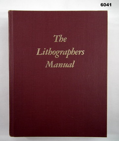
Manual - The Lithographers Manual Fifth Edition, Graphic arts Technical Foundation, Produced by the Graphic Arts Technical Foundation, 1977
The Graphic Arts Technical Foundation Lithographers ManualHard Cover, Red, 20 Chapters, Text, Diagrams, Photographs, ISBN 0-88362-005-7Inside Front Cover - "B. McLachlan"royal australian survey corps, rasvy, fortuna, army survey regiment, army svy regt, asr -
 Bendigo Military Museum
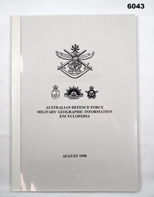
Manual - Australian Defence Force - Military Geographic Information Encyclopedia, Information Strategic Concepts Branch of the Australian Defence Force Strategic Command Division, Directorate of Strategic Military Geographic Information, 27 Aug 1998
... - Military Geographic Information Encyclopedia Manual Australian ...Military Geographic Information Encyclopedia in 3 Parts- Acronyms, Definitions, Web sitesSoft Film Cover, 3 Parts (Chapters), 77 Pagesroyal australian survey corps, rasvy, fortuna, army survey regiment, army svy regt, asr -
 Bendigo Military Museum
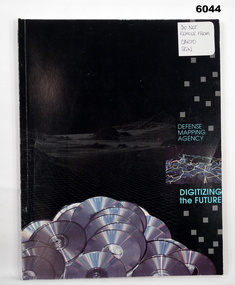
Manual - Defense Mapping Agency (US) - Digitizing the Future Third Edition, c1990
Digitizing the Future Third Edition, An information booklet describing the types of new digital geographic products produced by the US Defense Mapping Agency. The Australian Army Survey Regiment went on to also produce many of these digital productsSoft Cover Book, Paper Pages, 3 parts with Numerous Sections in each Part, Text, Diagrams and Photographs, Data Information Sheets, DMA Stock No: DDIPDIGITALPACFront Cover, "DO NOT REMOVE FROM CARTO SQN"royal australian survey corps, rasvy, fortuna, army survey regiment, army svy regt, asr -
 Bendigo Military Museum
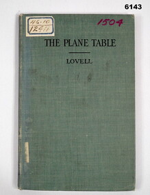
Manual - The Plane Table - Its Use in Surveying, McGraw Publishing Company, New York, USA, 1908
The plane table instrument was a simple but very effective early method of producing maps. Some very early editions were produced by the Australian Survey Corps after its formation in 1915 using this method. This manual details how to use the "Plane Table" for Surveying purposes.Hard Cloth covered Covers front and back, paper pages. title page has rubber stamp impressions (see below). Contents page, symbols page, pages 1-47 and index page.Adhesive label on front "46.10 and 12411", "1504" in purple also on front cover, Numbers inside front cover - "Acc. No. 000076" and crossed out. "scm - B0 - 86-72" written underneath. stamps- Australian Intelligence Corps, Headquarters library No 150 (difficult to read) on first page and stamped "CANCELLED" , Stamp School of Military Survey Library Call No 526 - 9825 LOV. Another stamp on title page - Department of Defence Library 46.10 and 12411. Second stamp 2/D. M.O.S. 2012 with CANCELLED. royal australian survey corps, rasvy, army survey regiment, army svy regt, asr, fortuna -
 Bendigo Military Museum
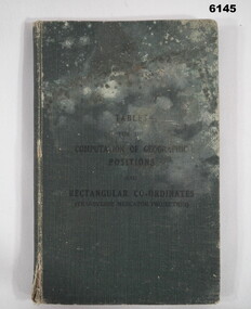
Manual - Mathematical Tables for the Computation of Geographic positions and Rectangular Coordinates, 1942
Numerous mathematical tables for the computation of Geographical Positions and rectangular coordinatesHard covered Book, cloth covered, A5 in size, 169 pages, Title Page, contents Page, 5 x blank pages at front, 15 x blank pages at rear."? Slattery" , "Sgt RC Andrews. School Tac? Adm. Seymour" all crossed out, on 1st page inside cover. "Please Return to: Survey Directorate AHQ Victoria Barracks Melbourne" Front and rear pages.royal australian survey corps, rasvy, fortuna, army survey regiment, army svy regt, asr -
 Bendigo Military Museum
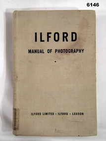
Manual - Ilford Manual of Photography, Ilford Limited, Henry Greenwood &Co. Ltd. & Percy Lund, Humphries & Co. Ltd, First Published in October 1942
Manual describing all facets of photography using Ilford Cameras and includes developing and printing of photographs. The map making production at the Army Survey Regiment, Bendigo, made extensive use of photographic processes.A5 sized book, Hard Covers front and back. 470 numbered glossy pages.Inside front cover - "L33", stamp - "EXPENDABLE STORES" (twice), "Unreadable signature - QM 30/7/82", Stamp- "AHQ Survey Regiment, Royal Australian Survey Corps" Handwritten - Accession No 167 (and then crossed out), Stamp "29" First Page "15/-", Stamp "2 Topo Svy Coy, Powlett Street Training Depot (partly crossed out), Stamp Technical Book and Magazine Co, 295 -299 Swanston St. Opp Old Melbourne Hospital cert 2041, Melbourne. Title Page - "Accession No16, stamp 2 Topo Svy Coy Powlett Street Training Depot, East Melbourne" Stamp - "AHQ Survey Regiment, Royal Australian Survey Corps" - Accession No 167 (faded). Back Cover - Stamp - "AHQ Survey Regiment, Royal Australian Survey Corps"royal australian survey corps, rasvy, fortuna, army survey regiment, army svy regt, asr -
 Bendigo Military Museum
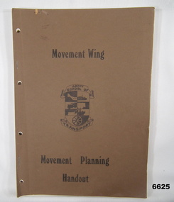
Manual - MOVEMENT PLANNING HANDOUT, Australian Army
This is a book made by Army School of Transport. The cover is a thin cardboard, coloured brown. Printing is in black ink. In the centre is a form of shield. On top is a banner with words "Army School of. At the bottom is the word "Transport". It has approx 44 pages of black and white photos and specifications of equipment. i.e. Aircraft, Trucks, APC road rovers, Trailers, Tractors, Graders, Water Craft etc.passchendaele barracks trust, transport, planning, equipment specs -
 Bendigo Military Museum
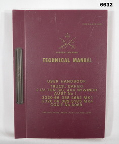
Manual - TECHNICAL MANUAL FOR CARGO TRUCK, Jan 1976
This is a hard cover book. The cover is a marron plastic. The writing is embossed with gold ink. At the top is the Army Crest - Kangaroo and crossed swords. The book is for Truck Cargo, 2 1/2 ton GS. 4 x W/winch. It has 198 pages. Aust No.1 2320 66 058 4682 MK3. 2320 66 089 5185. Code No. 6069 Army Part No. 7810 66 090 7083.passchendaele barracks trust collection, mk3, army truck -
 Bendigo Military Museum
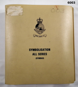
Manual - Symbolisation All Series (Symbas), Specification for maps produced by the Royal Australian Survey Corps, C 1988
Symbas provides the specification (rules) for the collection and compilation of topographic data; the basic instructions for colour preparation and reproduction of topographical detail on maps produced by RASvyPlastic cover, book, beige, 7 chapters, metal clip bindingroyal australian survey corps, rasvy, fortuna, army survey regiment, army svy regt, asr, symbas, specification -
 Bendigo Military Museum
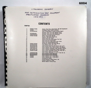
Manual - Map Reproduction and Equipment Specification Handbook, Circa 1975
Manual used by Lithographic Technicians as a register of Map reproduction equipment. Possible uses include to identify and quantify available equipment as part of the stocktaking process.90 page technical manual/ handbook. Does not have a front cover. Contents page and pages within the document have black and white stock descriptions followed by photos of equipment. The manual is printed on photographic paper and is bounded by a black plastic spiral spline.royal australian survey corps, rasvy, fortuna, army survey regiment, army svy regt, asr -
 Bendigo Military Museum
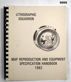
Manual - Map Reproduction and Equipment Specification Handbook, 1982
This handbook provided comprehensive technical information principally to the lithographic technician and to other Royal Australian Survey Corps technical trades. Part 1 comprised technical descriptions and photos of lithographic equipment used in military map production. Part 2 provided various tables such as printing sizes conversion tables. Part 3 provided technical guidance on the stipples and screens utilised in the map reproduction process. Part 4 detailed the Pantone Matching System printing colours for map and chart products. Part 5 was a Glossary of Lithographic Technical Terms.Army Survey Regiment Manual/handbook with a manilla cover comprising approximately 100 pages. The pages in the document are in black and white paper providing technical information and photograph identifying lithographic equipment and other information to lithographic technicians. Printed on standard paper bound by a by a black plastic spiral spline.royal australian survey corps, rasvy, fortuna, army svy regt, asr, army survey regiment