


Historical information
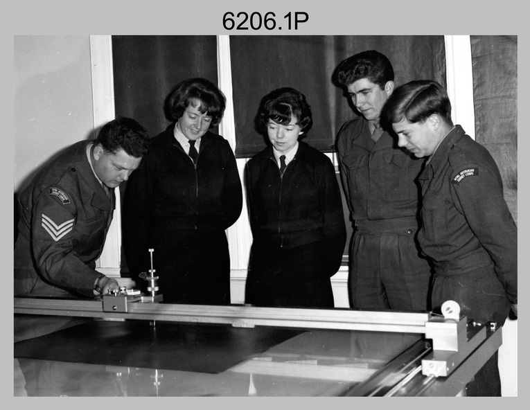
This is a set of seven photographs of map grid production using co-ordinatorgraphs at the Army Survey Regiment, Fortuna Bendigo. c1960s to 1970s. The Aristo Co-ordinatorgraph introduced in 1962 was a large heavy steel framed light table with a scribing head that moved in a XY direction using a vernier calibrated measuring scale to 0.001 of an inch. Whilst hand operated it was much quicker and accurate than manual grid and graticule calculation, plotting and scribing. Mapping PNG presented the Regiment with many challenges. WO1 Farrington and CPL John Dean developed computer software for the digitally controlled co-ordinatorgraph, the Calcomp 718 Flatbed Plotter. Much time was saved by automatically plotted cartographic grids and graticules, and automatically draw base compilation sheets complete with aerial triangulated stereo model control. This could be used for a number of maps and was the first step towards map automation. The history of co-ordinatorgraphs is covered in more detail with additional historic photographs, in pages 50 to 51 and page 88 of Valerie Lovejoy’s book 'Mapmakers of Fortuna – A history of the Army Survey Regiment’ ISBN: 0-646-42120-4. SGT Bill Boyd appearing in photo .1P reach the rank of WO1 and for 11 years was the technical warrant officer at the Detachment Army Survey Regiment located at Bonegilla, Victoria. He was awarded the OAM, the Order of Australia Medal for the development of the Flexiflow quality control system. This system comprised a series of job plans and charts linked to a task allocation to resource magnetic planning board. Using critical path analysis and task prioritisation, complex job planning was efficiently scheduled, and re-prioritisations readily made. Reproduction requirements were effectively coordinated by way of weekly courier to the Army Survey Regiment. Supervisors and technicians fully embraced the system as they could understand their role, others around them and the positive production achievements. Bendigo. See page 178 of Valerie Lovejoy’s book for more information on WO1 Boyd’s contribution to RA Svy.
Physical description
This is a set of seven photographs of map grid production using co-ordinatorgraphs at the Army Survey Regiment, Fortuna Bendigo. c1960s to 1970s. The photographs were printed on photographic paper and are part of the Army Survey Regiment’s Collection. The photographs were scanned at 300 dpi.
.1) - Photo, black & white, c1960s, L to R: SGT Bill Boyd demonstrating Aristo Co-ordinatorgraph equipment to unidentified technicians (x3)
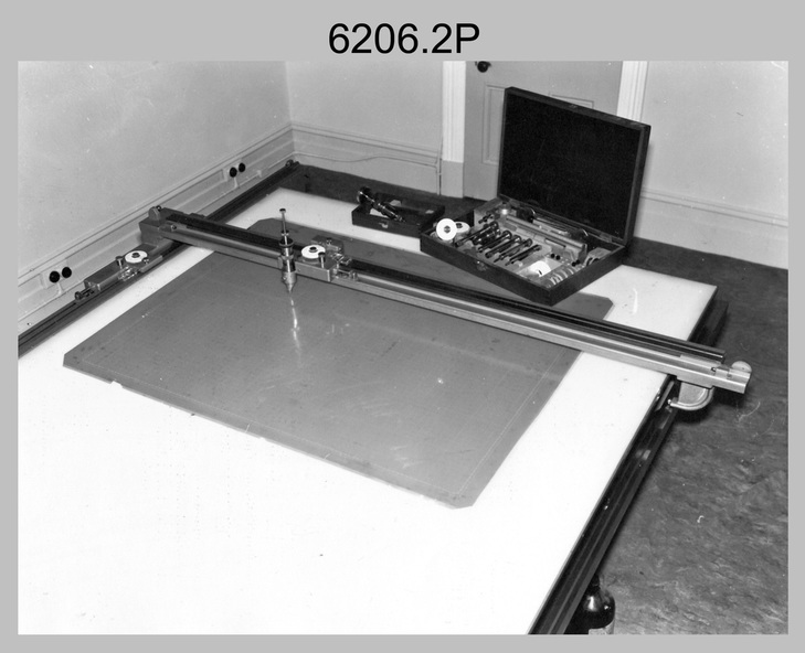
.2) - Photo, black & white, c1960s, Aristo Co-ordinatorgraph equipment.
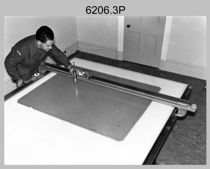
.3) - Photo, black & white, c1960s, unidentified technician operating Aristo Co-ordinatorgraph equipment.
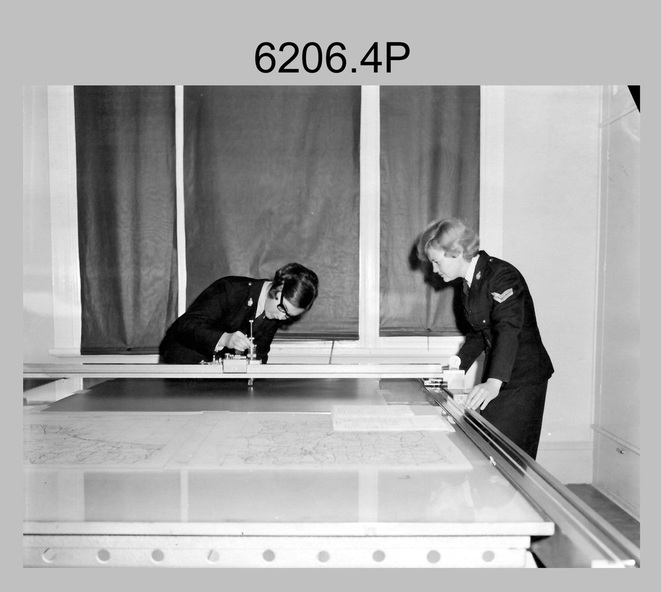
.4) - Photo, black & white, c1960s, L to R: PTE Desi Asaris and CPL Kalen Sargent operating Aristo Co-ordinatorgraph equipment.
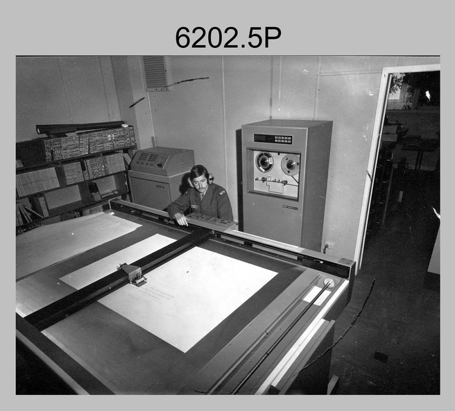
.5) - Photo, black & white, Photo, black & white, c1970s, John Bloor operating Calcomp co-ordinatorgraph equipment.
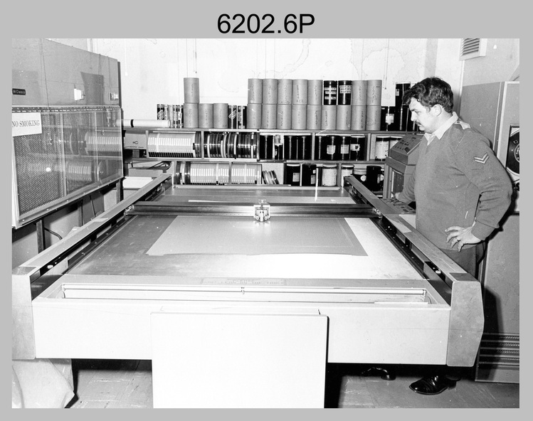
.6) - Photo, black & white, Photo, black & white, c1970s, unidentified technician operating Calcomp co-ordinatorgraph equipment.
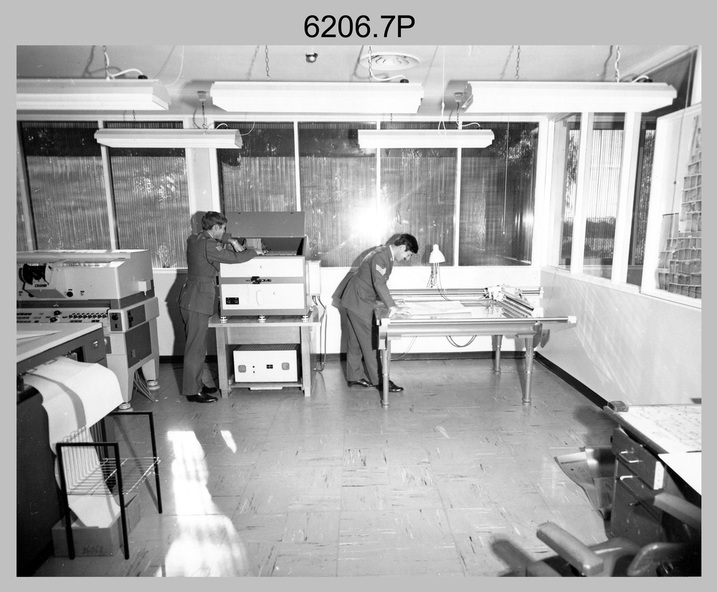
.7) - Photo, black & white, Photo, black & white, c1970s, L to R: SGT Andy Covington and SGT John Waight operating Calcomp co-ordinatorgraph equipment.
Inscriptions & markings
.7P annotated on back ‘Covington & Waight’.